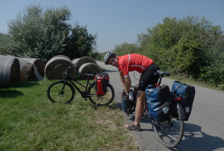
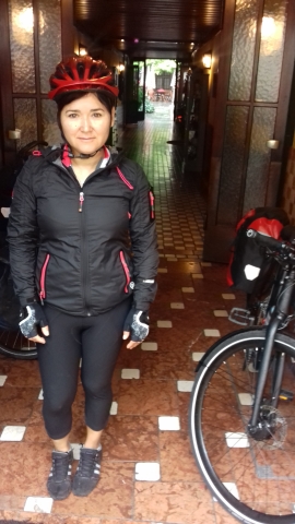
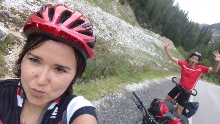
After four years it is finally going to happen. For the first time Margarita and I go
will embark on biciycle journey together. It will be the first time for Margarita
that she will do a bike trip of more than one day and it will be the first time that
she will cycle on a fully loaded bicycle. In order to be as lightweight as possible,
we will travel without a tent and without sleeping bag and mat, and also without
cooking utensils. That means that we will sleep in hotels and that we will often eat
in restaurants rather than cook our own stew. A bike trip for VIPs.
By train we travel to Vienna, the starting point of the trip. In Amersfoort
we have to change for the train to Hannover, where we have almost three hours connecting
time for the train to Vienna. But the train does not arrive in Amersfoort. The minutes
are stringing together into hours. There is no information available about what is the
matter. Eventually, after many hours, a train arrives which takes us to Hannover.
It turns out that the connecting train to Vienna has not waited. We are in the middle
of the night by now. We get a voucher for a hotel and the next day we will have to
go to Vienna by a string of local trains. After another long day on local trains
we arrive in Vienna the next evening, sixteen hours later than planned.
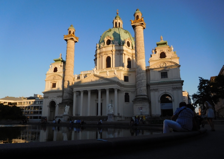
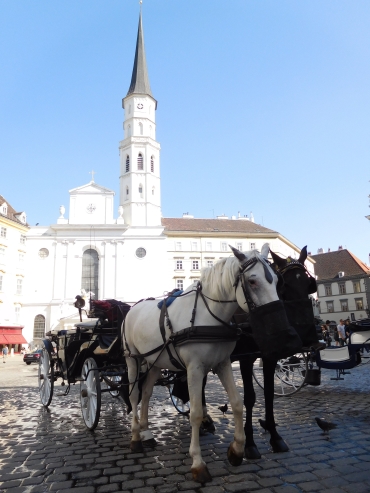
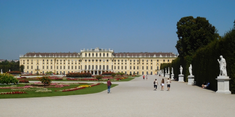
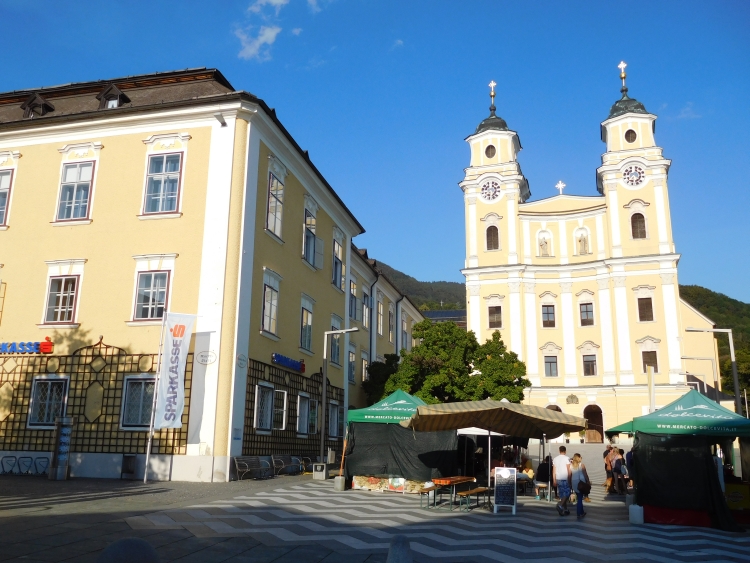
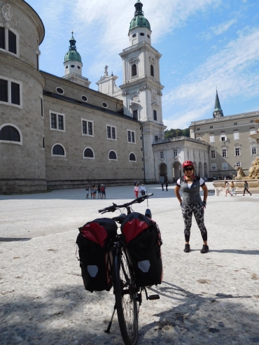
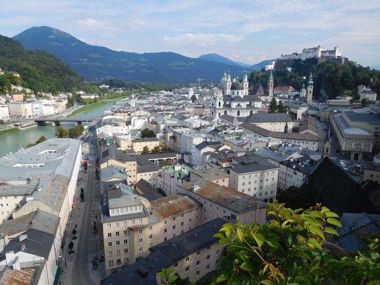
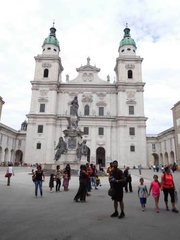
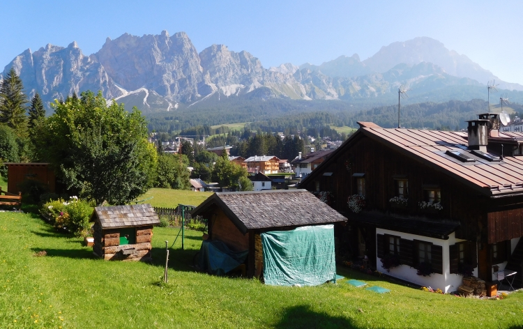
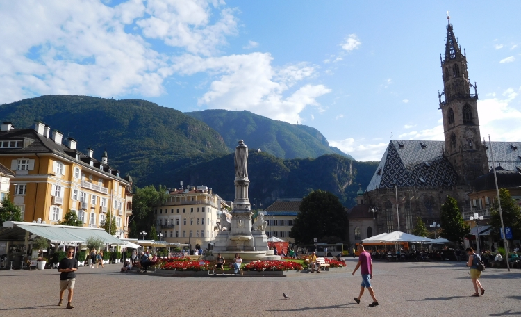
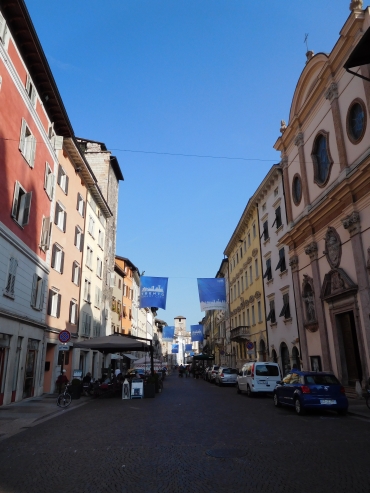
We remain in Vienna one day. We explore the center,visit the famous Schönbrunn
Palace and we go to the opera. Tomorrow we will start the bike trip.
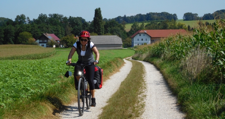
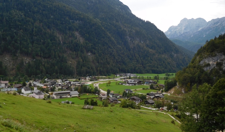
Day 1: Vienna - Klosterneuburg - Tulln - Krems a.d. Donau 86 km
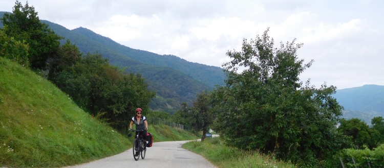
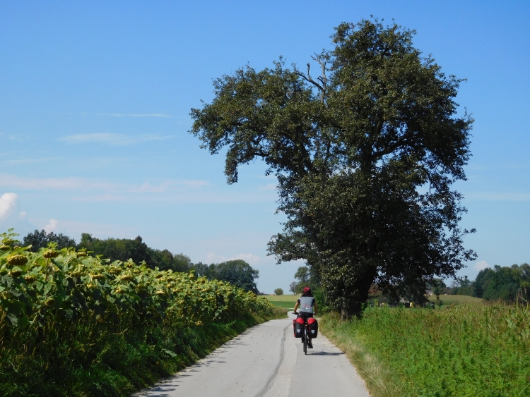
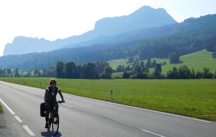
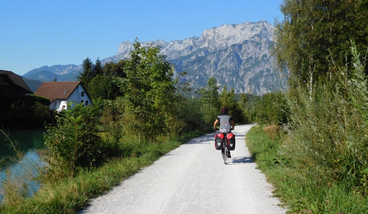
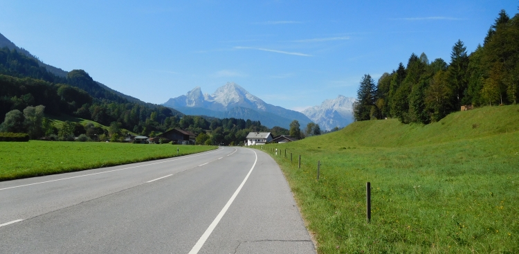
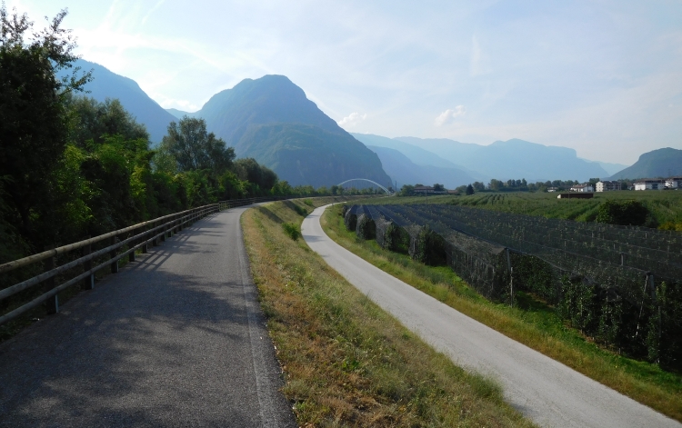
And then we finally hit the road. Our idea is to cycle along the Danube. That means
that we will not have major climbs. We will be able to see how much Margarita likes
bike traveling and we can quietly see what are her physical capabilities. If cycling
along the Danube will go easy, we can slowly extend the trip to hillside sceneries and
maybe we can even do some true mountain passes. Otherwise we can just stick to follow
the Danube to Germany.
We get up early in the morning to avoid the midday heat. Yesterday it was over thirty
degrees and that will presumably be the case again today. It is Sunday today and there
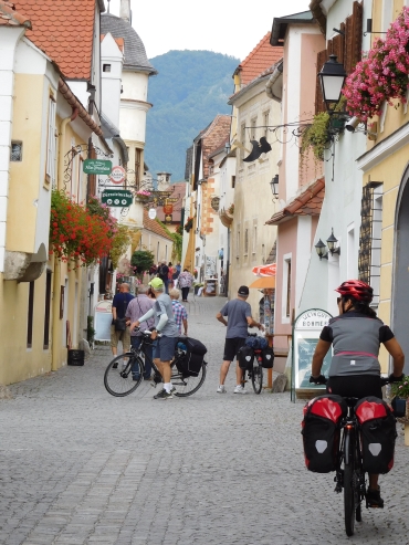
are few people on the road. We cycle through the center of Vienna to the Danube. On
both banks of the Danube are cycling paths. We take the western bike path and cycle
upstream, heading north. After an hour we are out of the suburbs and we find ourselves
in natural environments.
Although we have left the city, the cycle path is busier than central Vienna. The
Donauradweg is one of the most popular cycling routes in the world and that holds
especially true for the Austrian section. The cause of the popularity is logical.
Along the Danube the cycling is easy. There are no mountain passes or other climbs
to be overcome. The banks of the Danube are dotted with cultural highlights. Besides
Vienna, the Austrian section has many beautiful small towns and villages as well as
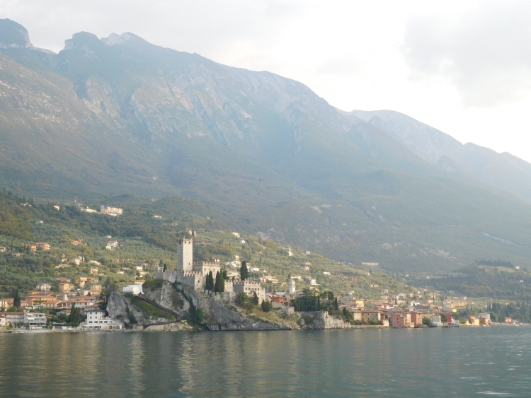
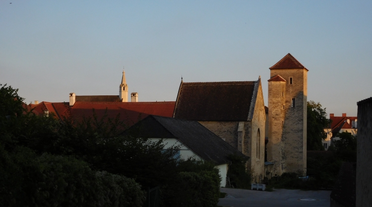
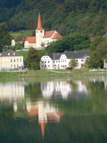
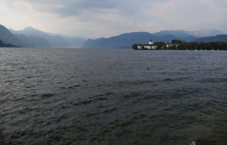
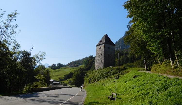
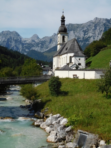
a fair share of monasteries, churches and castles. So we take in an incredible view
of a rocky outcrop along the river with a towering spinal church tower on top. Apart
from the cultural highlights of the Danube Cycling Trail also passes through beautiful
landscapes such as the hills of Wachau.
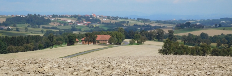
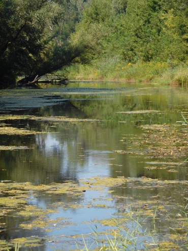
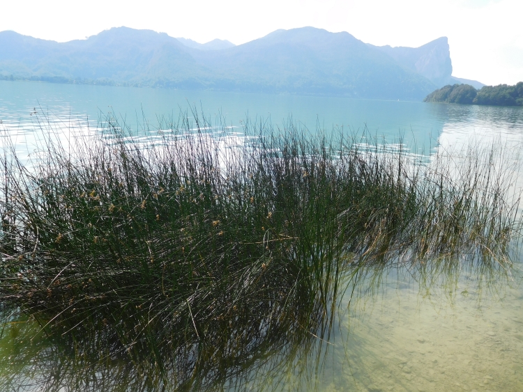
At this moment however, the landscape to the north is becoming flatter. Eventually
we cycle through smooth, flat countryside. We see the hills slowly disappear from sight.
We are doing well. Margarita appears to be fine and relaxed on the easy terrain
of the Donauradweg. Because Margarita usually likes action and diversity and with
her rather unpatient character, I had my doubts whether she would not find cycling
monotonous or dull. So far those fears lack all substance. In fact, I am the one who
experiences cycling along the Danube as monotonous. We have reached the northernmost
point now. We turn west along the Danube, a section with hardly any cities and villages.
We are cycling largely through a forest on the banks of the Danube. For a long time there
are hardly any landscape changes. When we make a mistake and cycle a few kilometers
in the wrong direction and have to cycle all the way back, I have to conclude that this is a
very boring experience. Fortunately we leave the banks after a long while and we
cycle through open fields with small, sleepy villages.
It turns out that Margarita is not a person for many or long breaks. She does not even
want to stop for a lunch. Moving on is the motto. We are not at the final destination yet,
are we? I object that we can stop in every village if we want. There is plenty of
accommodation. But no, she wants to go on. For me that is not a problem either. We do
not cycle that fast so I do not get tired at all and I can persevere quite a long time
without food. Despite the complete lack of hills, the going is getting a bit less easy
now. That has everything to do with the heat. The air feels heavy because of the clammy
heat and our speed begins to drop. We want to stay in Krems an der Donau today but that
village seems further than it appeared initially because of the winding course of the
section between Tulln and Krems. It is already late in the afternoon now and in the end
we still have to eat because our energy is low after hours of cycling. After that we
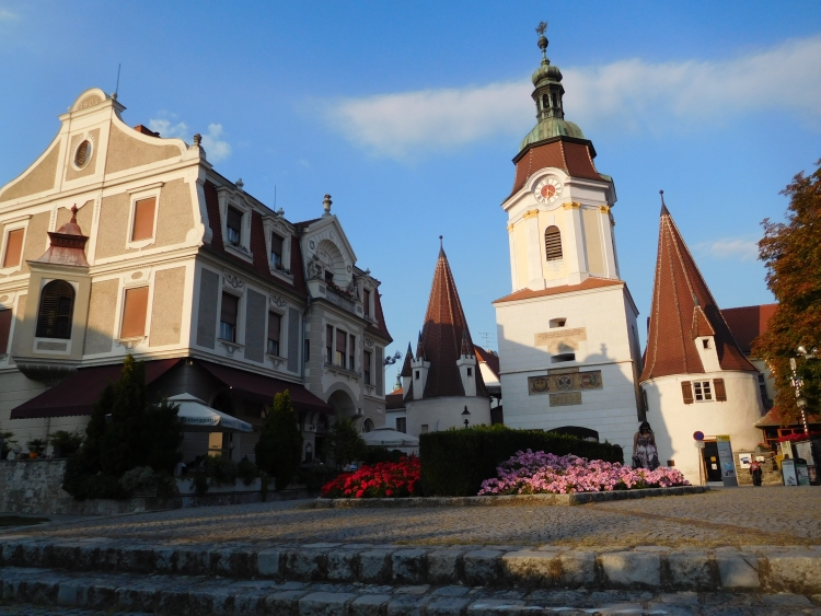
can continue again and soon we reach the quirky little town of Krems. Here we have a
small incident. When looking for a hotel I stop to get off to maneuver some small
stairs but Margarita does not expect this and tries to get along. She has not seen
the small steps and falls. Fortunately it does not really hurt and she does not
have any injuries.
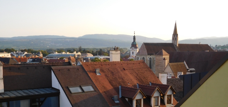
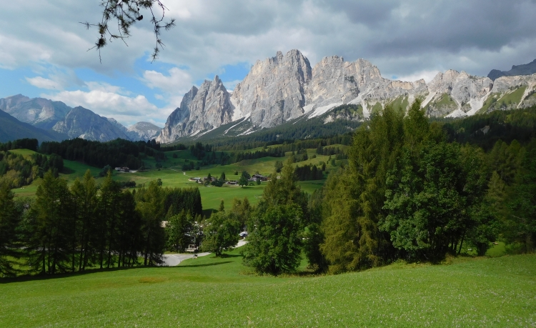
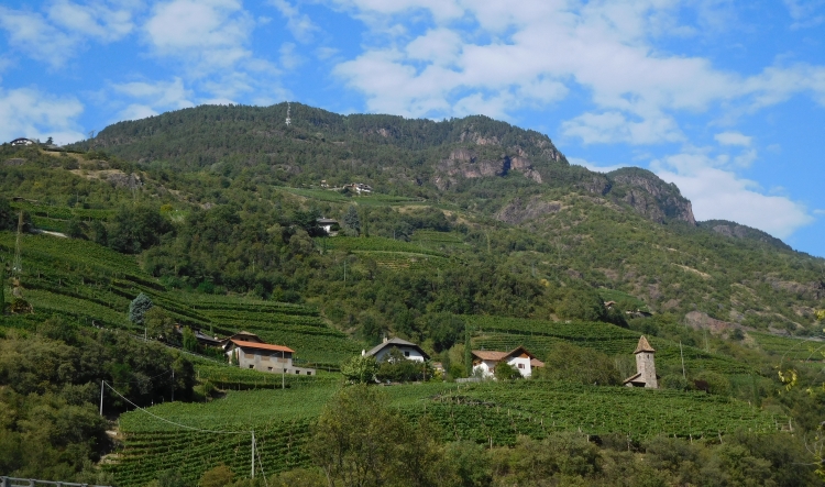
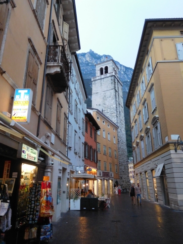
Krems appears to be a lovely town. It is the gateway to Wachau, the hill area that
is bisected by the Danube. The town itself is partially built against the slopes of
the first hills. Further upstream in Wachau the hills are significantly higher.
We find a characteristic little hotel that is stuffed with old-fashioned dolls. No
ordinary ones, but beautiful, vintage dolls. Usually it would not be my taste, but
the fun of a trip like this is that it takes you to places that are different from
what you are used to. In the beautiful courtyard we can dine and that is what we are
doing now. Margarita is not immediately impressed by the Austrian cuisine. I am afraid
that this will not change in the near future, because it will not get much better
than here. Fortunately in the end everything is good, as they come up with the apple
strudel.
Day 2: Krems a.d. Donau - Dürnstein - Weißenkirchen - Spitz - Melk -Pöchlarn - Ybbs a.d. Donau 68 km
The nice weather is over. During breakfast the sky is already gray, but nearby we see
a pitch-black sky, which is moving in our direction. Half an hour later we are ready to go
and right at the moment that we want to leave, a thunder strikes nearby. What to do?
Margarita wants to go, but that does not seem like a good idea with the thunderstorm right
over our heads. When the storm is gone, we leave immediately, while the rain is still
pouring. It is not cold though, so the fiery rain is not a real problem. The more so
because the weather is improving rapidly. After the short but violent storm it is mostly
cloudy, but once in a while the sun is breaking through the clouds. We are cycling through
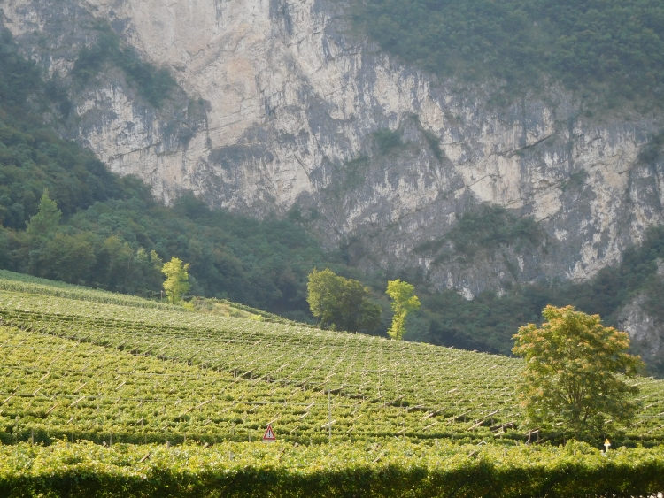
a scenery that is incredibly beautiful. In mighty arches the river Danube is winding
its way through the high, dark green hills of Wachau. On the plains between the river
and the hills are pstures and vineyards and some stunningly beautiful villages.
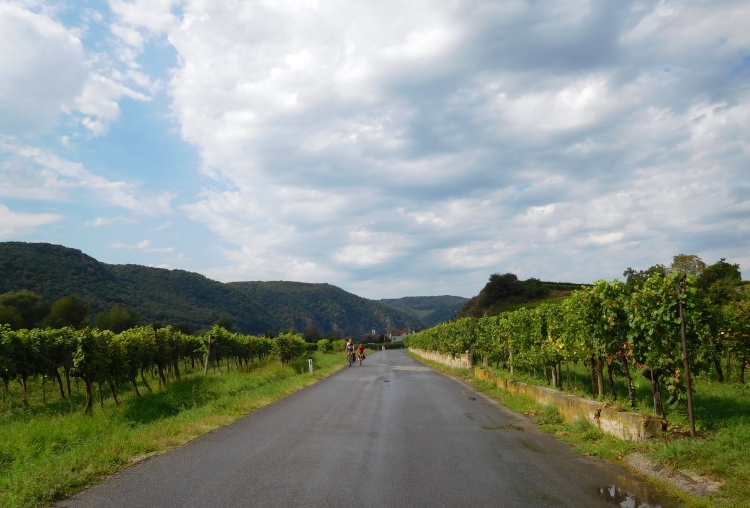
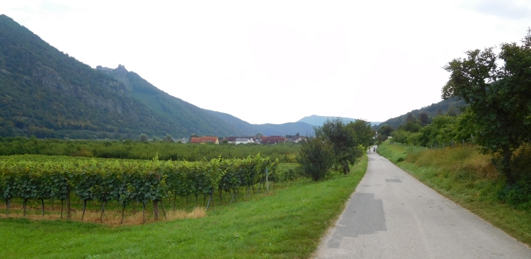
After several kilometers we reach Stein, the first of the pretty villages today, almost
as charming as Krems. After Stein the landscape becomes really nice. For the first time
we have to climb. The climbs in Wachau are short but there might be some steep sections.
These do never last longer than a minute though. Margarita does not have any problems
at all and so we can enjoy the beautiful, romantic landscapes. Margarita looks happy
and she is making even more pictures than I do. After passing some very small villages,
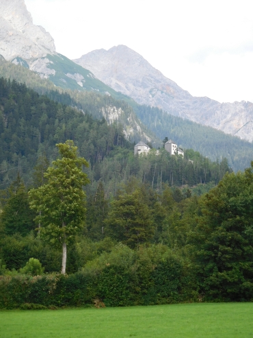
we climb to the first large village in the Wachau. Dürnstein is located on a sort
of terrace above the river. The church and the remains of a small castle are towering
above the village. We cycle through the gate inside the old village center. We have to
wind through the many tourists and fellow cyclists. We are certainly not the only ones
who have set ourselves to cycle here.
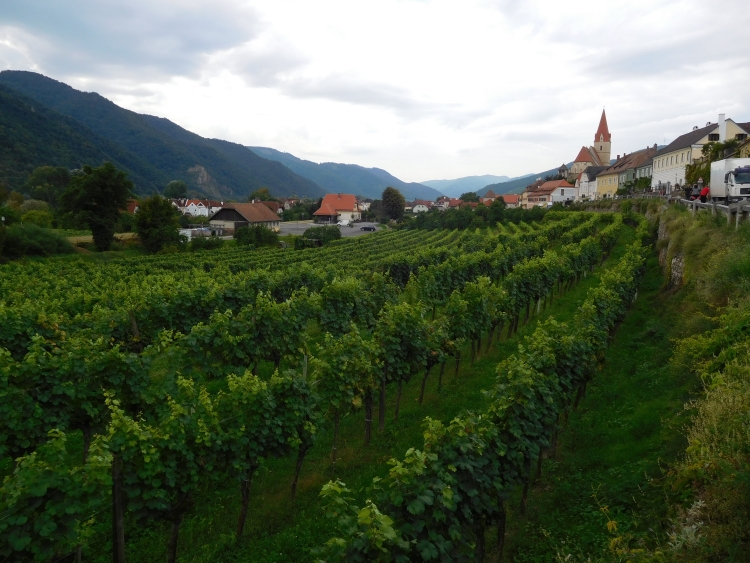
After Dürnstein we cycle towards Weißenkirchen, another gem in
Wachau, beautifully situated between the vineyards. From Weißenkirchen we cycle
among the highest hills in the area to Spitz, where we have lunch in an organic
eatery.
After Spitz we have left the highest hills of the Wachau region slowly behind us,
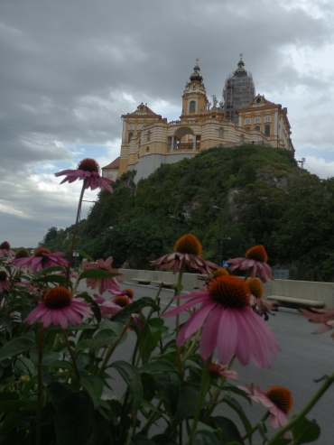
but the landscape is still hilly. We are approaching Melk now, a historic town with a
monastery that is so large that it almost withdraws a complete hill from
sight. We climb up the hill to reach the monastery. In the end we do not go inside
because the entance appears to be on the other side of the hill. We descend to the
town of Melk town. At the time we reach the center, a heavy storm erupts. We run
into a pub where we make the best of the situation by ordering two gigantic Kuchen.
At the time that we have eaten the Kuchen drank the tea, it is dry again and we can
continue. We cycle over twenty kilometers more to the small town of Pöchlarn,
our target overnight stay. One way or another we both do not like the atmosphere.
The town is actually quite nice, although not like the other towns and villages
that we have passed today. We decide to cycle twenty kilometers further to Ybbs an der
Donau. We are struggling to find a hotel but eventually we find a real cyclists
hostel. End good, all good.
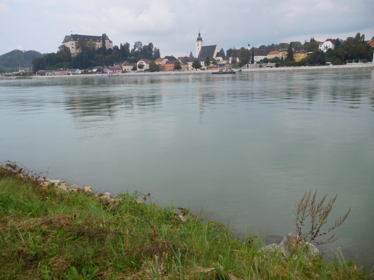
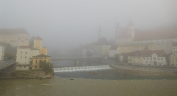
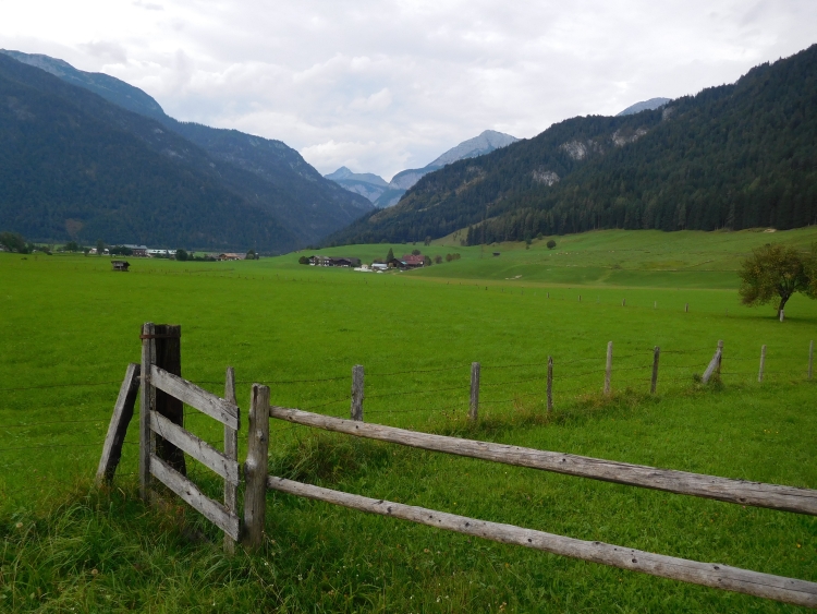
Day 3: Ybbs a.d. Donau - Grein - Wallsee - Haag - Steyr 74 km
We are early on the way today. It is reasonably good weather, with clouds covering
half of the sky. We will continue to follow the Danube for a while and later on we will
go into the hills. It would be nice if we would reach Steyr today. The route between
Ybbs and Grein is surprisingly nice. The Danube meanders between the hills again and
because there is hardly any wind, there are beautiful reflections of the churches and
settlements in the river. Although we are far from Vienna now, there are still many
cyclists in this sparsely populated area. We pass a German-Italian couple that we also
met in a restaurant yesterday. We cycle together occasionally, until one of us makes
a picture and they are out of sight again. Another time they stop for a little snack
and we catch up again. In the end we cycle together large parts of the way to Grein
and Wallsee. Eventually our roads split in Wallsee. They continue to follow the Danube
to Linz. We leave the Danube to go in the direction of Steyr.
I had seen a nice little road on my GPS, that goes into the hills just beyond Wallsee.
In reality it turns out to be a very small road, which goes up by a mere 20% gradient.
So far Margarita could easily manage the different circumstances, but going up more
than 20% up with luggage, that is a bit too much.
> Are the climbs always so steep?
>>> Well no, you do not see climbs as steep as this very often.
> Are you sure ??
>>> Yes, believe me. That's really rare.
After having cycled up, I walk back to go up with Margarita's bike. We find ourselves
on a small ridge now, but I see that there are a lot of much higher ridges in the area.
There we will have to go up against. After a few kilometers the road goes down and we lose
all our altimeters. That means we have to climb even further to the top of the next ridge.
And again there is a steep climb, again around 20% steep. The only difference is that there
are no warning signs now. Even before we are completely on top of the hill, the road
descends into the valley that we have just climbed out.
> What is this? Why did you choose this crazy route. I think it's bad enough
cycling in these hills, but this climb does not make any sense! We are back in
the same valley. Haven't you seen??
>>> Yeah sorry, this kind of detail I can not see my GPS.
> Well, I guess that this is the last climb?
>>> I'm afraid ...
> I hope for you tha this is the last one!
After another useless climb, followed by a descent right into the very same valley,
we are finally on our way up to the highest hill ridge. Overall the climb is not too
difficult, but there are sections that are really steep with gradients of up to 20%.
The last few hundred meters of the climb are around 20% steep again. Margarita does
not want anymore is sitting down on a bank along the road. I think that we are only
hundred meter away from the top, but I am not a hundred percent sure. we sit down more
than an hour, an hour where I have asked myself a few existential questions. Margarita
has also gone through some existental questions. The choice between continuing and sitting
down here for the rest of her life has eventually been made. She goedon her bike again and
a minute later we are on top of the hill.
The descent does not bring enlightenment either. Pretty soon we reach a busy road without
shoulders or cycling paths. After a few kilometers we can finally leave the road.
We find ourselves on medium big reads now. A few more asscents follow, but luckily
those are not so steep any more. Eventually we are on the long descent to Steyr.
We find a beautiful hotel, where we can recover from the first hills.
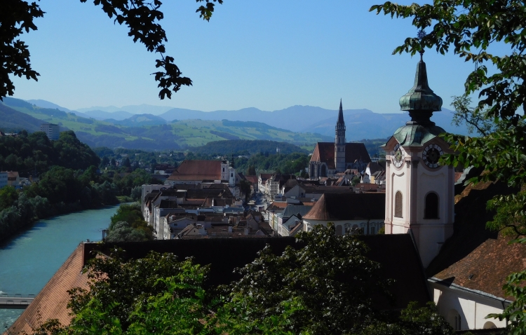
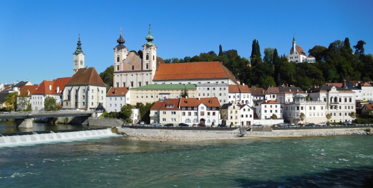
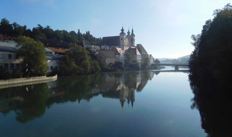
Day 4: Steyr 0 km
It was not an option to continue cycling today. And there was no reason to actually.
Steyr is a beautiful little town, located on the place where the rivers Enns and
Steyr converge. A part of the city is built against a steep hill. At the top is
a small chapel, from where there are beautiful views over the city and the rivers
and in the background we can see the Alps, which we are approaching slowly.
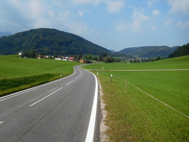
Day 5: Steyr - Sierning - Kremsmünster - Ried im Trankreis - Gmünden 72 km
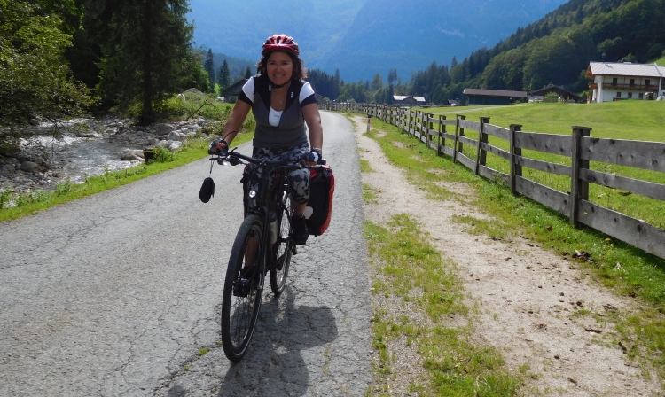
After the rest day Margarita has found the lust for cycling again. Today the route will
be hilly again, but she looks forward to the day with confidence.
The first kilometers are easy. We can continue to follow the river. In this case
this means that we still have to climb however. At one point we are even climbing
to the top of a ridge in order to avoid a steep passage right along the river.
Immediately after the passage the road goes down again and immediately up again against
the hill on the other side up. Again the question pops up, whether my mental faculties
are sufficient to find a route on the GPS. All in all the cycling is fine though. The
roads are sometimes slightly steeper than I am used to in France for example, but the
roads are not nearly as steep as the day before. The weather is also nice and slowly
Margarita's confidence is growing that she can handle the terrain.
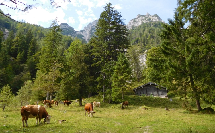
We cycle through sparsely populated, untouristy areas. After passing the Monastery
of Kremsmünster, we know that there we will not find any sleeping facilities
up to no Gmünden forty kilometer further. The day is going well though. The climbs
are not too steep and we are getting along nicely. We end up in Gmünden along
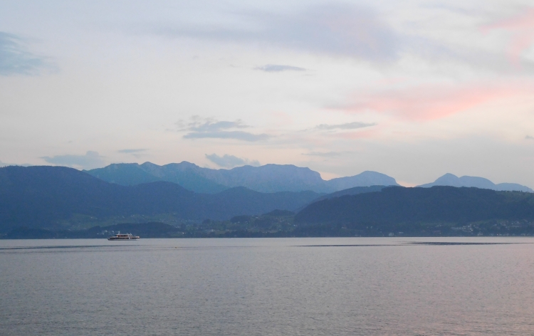
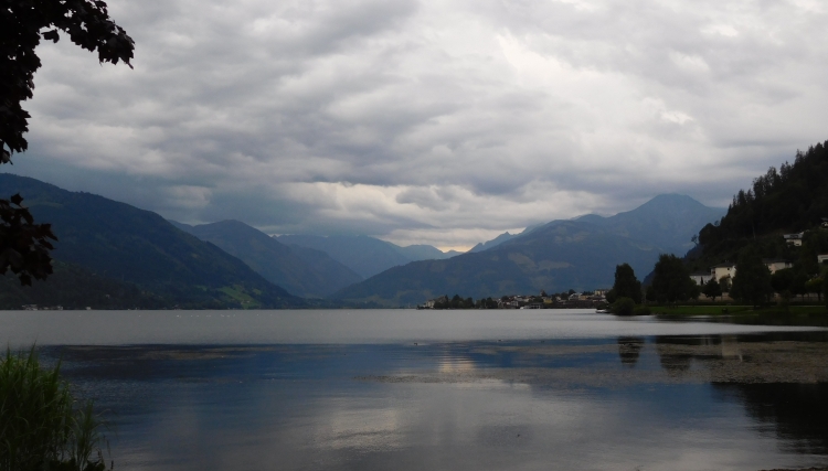
the Traunsee early in the afternoon. The Traunsee is the first of the great lakes
of the Salzkammergut, at the foot of the Alps.
Gmünden is no budget destination. There are fewer hotels than expected and we find
out that all the hotels are a combination of expensive, crowded, closed or substandard.
The first hotel is expensive and full, the second one is closed and substandard, the
third is expensive and closed, the fourth expensive and full. We are looking more and
more away from the center and we are searching on the hillside now. There we find a
hotel that is closed and below average and the last hotel we find is expensive and
substandard and furthermore sleazy, smelly, but the most repellent is the downright
rude owner. Slowly we come ot the conclusion that it not going to be easy to find something
here. Then we meet a passer-by who sees us cycling around for more than an hour now.
He says that further along the lake towards Traunstein are a few cheaper hotels. And this comes
true. We find an affordable hotel with simple but excellent rooms, which is open and that
has an extremely affable owner. He has only one room, but he does not go up with the
price. I do not have to think twice: give us the room please!
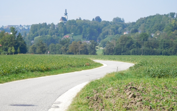
Day 6: Gmünden - Altmünster - Neukirchen - Steinbach am Attersee - Wiesenau - Mondsee 52 km
In the evening and night there was another fiery rain shower, but the storm is over now.
The clouds are beaten apart and the sun occasionally finds a crack in the clouds.
The wind is still blowing hard. The lake surface is filled with millions of small
but steep waves, an eerily strange sight. We sre cycling along the lake surface
in the direction of Altmünster. Along the way we pass the striking white church
that seems to float on the lake surface. The church is not really floating above the
lake of course, but is built on a tiny island off the coast.
The Traunsee is one of the great glacial lakes of the Salzkammergut, which are formed
by glaciers that have been withdrawn long ago. The glaciers came from the Alps, whose
foothills we are approaching rapidly now. In Altmünster we can start our first
small alpine climb. We are taking the small road to Neukirchen. In this way we can
reach the Attersee, the large lake on the other side of theridge. The climb is
relatively small for the Alps, but there are still 500 altimeters to be overcome.
It will be the biggest climb so far on this journey and is a good test, which
should prove whether we should or should not commit ourselves to the larger alpine
climbs.
Right from the start in Altmünster the road goes up firmly. Margarita is afraid
that she might not make it. After a kilomter we have to rest. In the one kilometer we
have already climbed a hundred meters, those we have in the pocket. After a long
rest we continue. Soon the climb flattens and one kilometer further we cycle through
a flat valley, a hanging valley at a level of one hundred and fifty meters above
the still nearby Traunsee.
After Neukirchen we are climbing again. The valley is a lot narrower here than on
the section towards Neukirchen. We are cycling through Alpine meadows, which are
surrounded by dense forests. Above the meadows and the forests the first modest but
nonethess highly impressive cliffs are towering above us. We find ourselves on an
extraordinarily beautiful road and Margarita is enjoying as much as I do. She loves
flowers and she is taking a lot of pictures, coming very close with her camera and
fully zooming in, in order to get 'inside' the secret world of the flowers. It is
a work which takes time and concentration.
The road gets steeper. At times Margarita must stop to walk a bit with the bike.
We have all the time because we do not have to go far. If we get across the pass,
we only have to descend to get back to civilization. And because Margarita does not
like to take breaks and I do not need a break either, we are actually carrying on
in a surprisingly fast pace through the countryside. We have reached the Taferlklaussee
now, a tiny idyllic mountain lake in front of the pass. We do take a break now to
enjoy the beautiful scenery.
After the lake we have to climb a hundred meters more. These are quite steep, but
Margarita feels that she has nearly made it and without problems we reach the pass.
We are preparing for the first long descent. We have to go down five hundred meters
to the Attersee. It appears that the descent is much steeper than the climb that
we have done. I thin to myself that it is good that we are cycling in this direction
and not the other way around. We are racing down. Margarita turns to descend very well
and we are naturally going doen with the same pace. In the descent is hidden a small,
but steep climb. After that we descend again and finally we reach the Attersee.
On the lake front of the Attersee we are among the people again and, unfortunately,
between the cars. The lake road is narrow and because there is a lot of traffic, cars
are continuously rushing by right beside us. After a few kilometers there is
a bike path along the lake and we can finally get off the road. We can enjoy the
beautiful mountains of Alps again. The weather has improved further and it has
ultimately become a hot and sunny day. Ideal for cooling off in the glacial lake.
With our bike clothes we dive into the cold water and we are having a lunch of the
sandwiches that we bought at a supermarket nearby.
After the break we continue in the direction of the Mondsee, another glacial lake.
This time we only have to climb a very modest ridge to get across to the lake. In
ten minutes we are up and in five more minutes we are down at the other side. The
Mondsee is the smallest and the most beautiful of the three major lakes that we
have followed today. We can mostly cycle on a bike path that remains close to the lake.
Sometimes the cycle along the lakeside and sometimes we must climb to get over a
steep rock wall that plummets into the lake.
The further north we get, the more the landscape is becoming flatter and gentler. At
the end of the day we reach the village of Mondsee, which is the very definition of
loveliness. The village is famous for its church, which has been used for the wedding scene
in The Sound of Music. Mondsee is a romantic place and it is also an exclusive place.
The hotel prices speak for themselves. After some searching and haggling we eventually
succeed to arrange an overnight stay within our budget and we can enjoy the kitschy, but
still beautiful village with its high romantic atmosphere.
Day 7: Mondsee - Thalgau - Hallwang - Salzburg 36 km
The weather is great when we get up. There is not a single cloud in the sky and it
is already warm now. We want to cycle to Salzburg today. That is not so far away
from Mondsee. The terrain is not too difficult either. After a short climb we arrive
in an open landscape, that is almost flat. After Thalgau we begin the actual climb to
the pass, but the climb is short and easy.
We descend. The last part follows a special bike trail, where hundreds of cyclists
are active. The bike trail is clearly not the fastest way to move from A to B as it zigzags
and turns in all directions. The route goes through the most beautiful and peaceful areas.
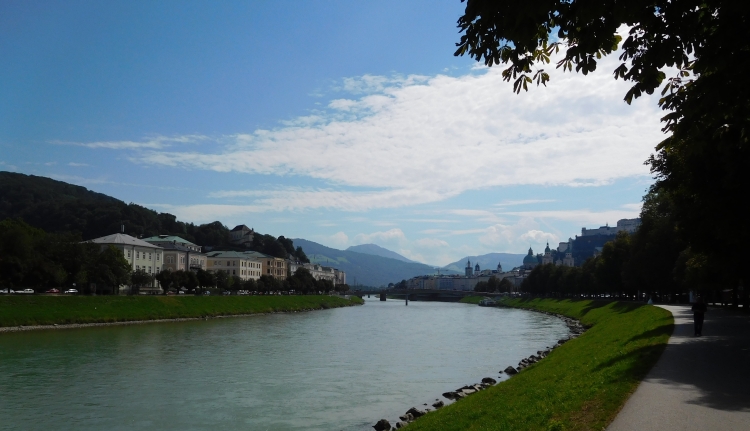
The last stretch follows a cycle path along the Salzach, the river that bisects the city.
In this way we cycle right into the historic center of Salburg exclusively on bike
paths.
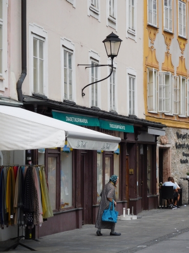
As straightforward the day was for us so far, so difficult it gets when we are looking
for an affordable hotel. There are oddly few hotels in the historic center and all
of them are more than twice as expensive as what I would like to spend. Nevertheless,
the center is filled with loads of foreign tourists. Well, they must sleep somewhere?
Finally the thought comes up to me that these people do not seem to sleep in the
historic center and so they apparently stay on the other side of the river. And
indeed there are a lot of hotels on the other side, which are a lot more affordable
too. Fortunately, we still have a lot of hours left, in we can explore the splendor
of the birthplace of Mozart.
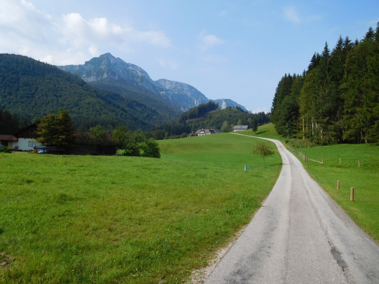
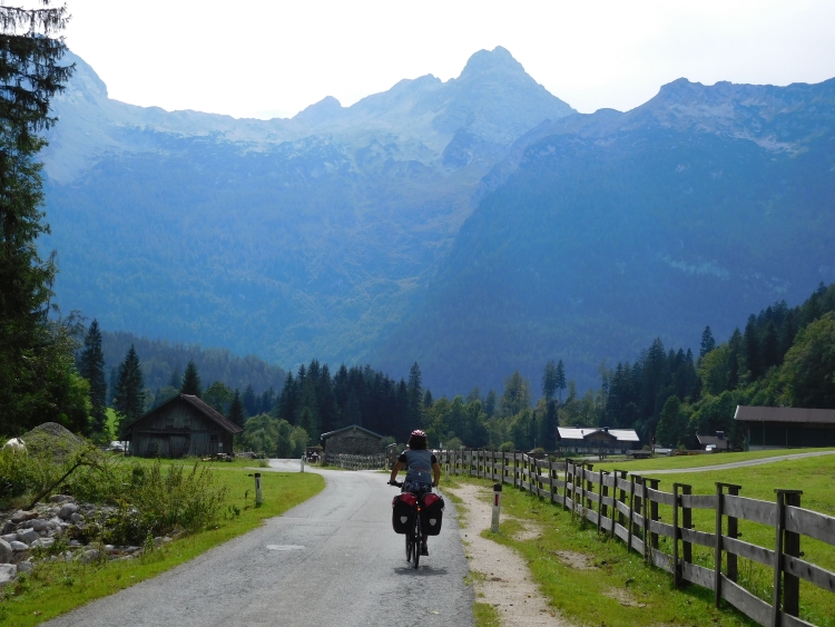
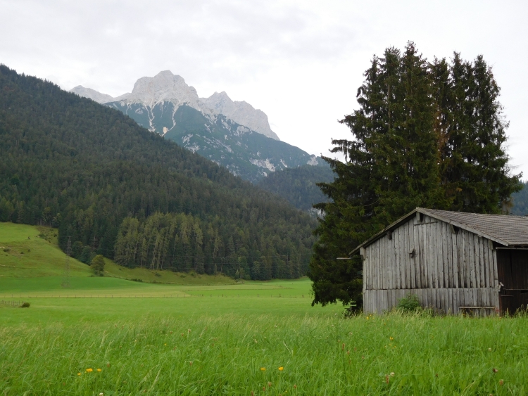
Day 8: Salzburg - Berchtesgaden (Germany) - Ramsau - Hirschbichl (Austria) - Saalfelden - Zell am See 91 km
We are early today. We want to cycle to the far south of Germany, Berchtesgaden, and
from there back to Austria. On the second border is a pass of nearly 1,200 meters. So for
the first time this journey we will have to do a truly big climb. The road to the
pass appears to have passages of uo to 23% steep according to sources on internet,
so it will not only be a long climb, but it will also be a difficult climb. I do
not have clue at all how we will ever be able to overcome this.
It is radiantly beautiful weather as we cycle along the Salzach towards the German border.
The forecasts are dramatically bad, though. A frontal system will come very soon and
it will rain more than two consecutive days in succession. It should be great therefore,
if we could be at the pass in time.
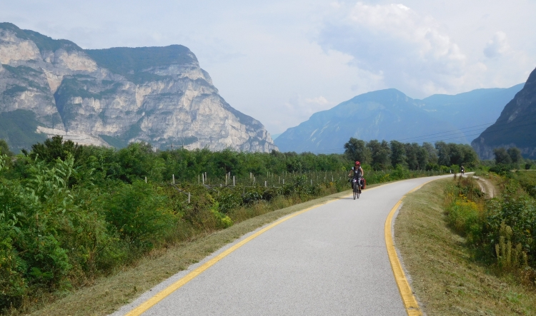
For now, however, we have beautiful weather and we do not have to climb yet. On a dirt bike path
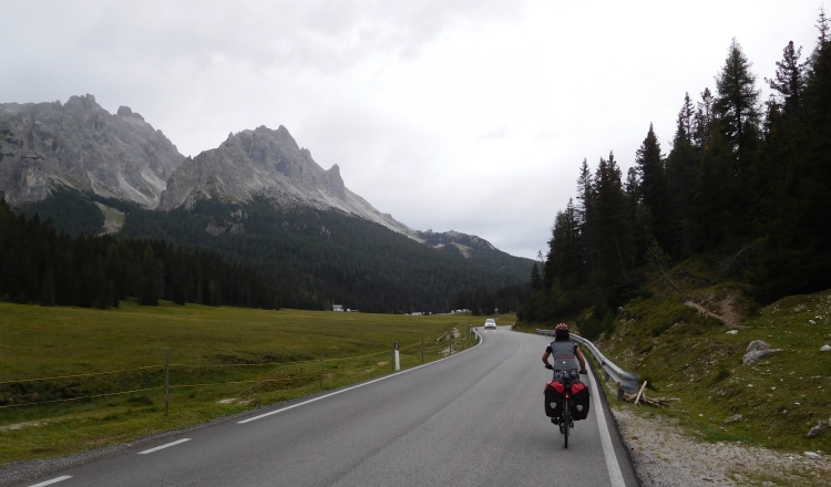
along the river we are riding toawards the Alps. Giant limestone formations loom up before us.
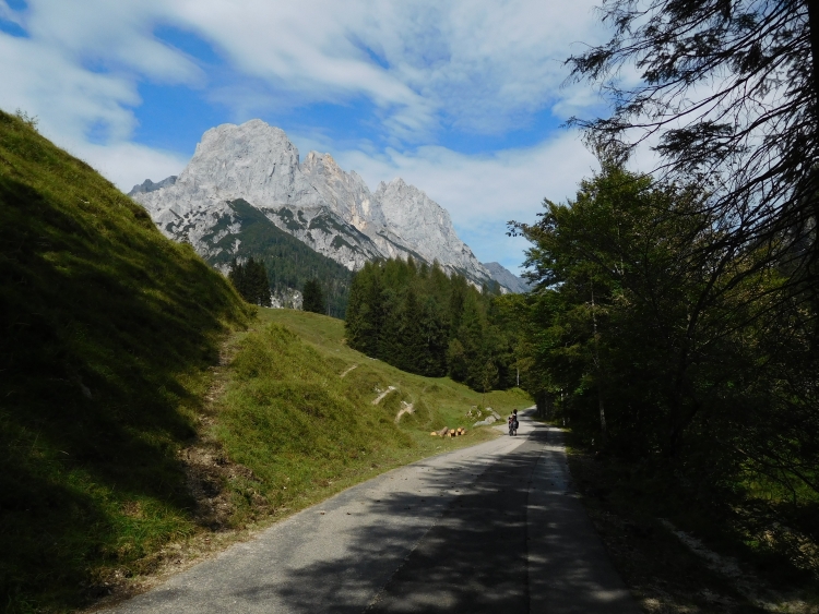
Right across the German border the bike path stops and we have to continue our route on the
narrow shoulder of a main road. We pass the German border and a little later we have glorious
views of the Watzmann, perhaps the most beautiful mountain of Germany. We are cycling through
a rolling landscape of expansive alpine meadows with continuous panoramas of the Watzmann and
other limestone mountains.
We pass the town of Berchtesgaden, the main town of this area. From there we continue
towards Ramsau im Berchtesgaden, a village of an extraordinarily beautiful church.
This might be one of the most beautifully situated churches in Europe. The narrow church
sits lonely in an idyllic valley with a cobbling mountain stream, surrounded by the
beautiful limestone mountains that characterize the region. Ramsau is the starting
point of the climb to Hirschbichl, the pass which forms the border with Austria. We
can also take the main road to Austria. It will be much easier because that road will
not be high and will not be steep either. We decide not to opt for the practical way but
we go for the most beautiful route and so we go up to Hirschbichl. Meanwhile the first
high clouds are chasing over far above us. No beautiful, neatly delineated cloud formations,
but a kind of dirty gray soup, which does not abode good times.
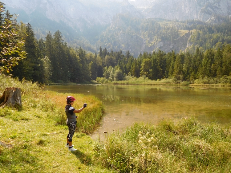
The road to Hirschbichl follows the idyllic valley, flanked on either side by the towering
limestone cliffs far above us. We are climbing to a mountain lake, where Margarita
goes swimming in the ice cold water. The water will not be warmer than a degree or
five. I am nearly freezing to death by just paddling up to my ankles. There are a few
other groups of people who are picknicking or paddling as well. At the moment that
Margarita dives down with her head, she gets a heartfelt applause. I must confirm
that after the Dutch ice man phenomenon we also have an ice woman in our midst. And
that without special mental preparation!
After the mountain lake follows another small lake and then the road becomes even
narrower than it was. It is forbidden for cars here. Only cyclists and buses are allowed.
We are approaching the pass quickly without having to climb too hard. It is too good to
be true that we could reach the pass so easy. Apparently the climb is concentrated
on the last kilometers. And so it would be. Suddenly the road goes up with a murderous rate.
In a range of 500 horizontal meters the road climbs more than one hundred meters vertically.
I find myself just able to keep pedaling with my luggage, but logically this is too hard
for Margaita. I run back to ride up with her bike while she is walking. After the short
passage the road levels off again. The next two kilomters are not too difficult, but the
last kilometer is a constant grueling 23% up. With some cycling up and running down I manage
to get both bicycles and myself up, while Margarita is walking up. We reach the pass and so
the Austrian border too.
The climb had some steep passages, but the descent is continuously steep. Fortunately Margarita
manages to descend extremely well. Furthermore, I am very glad it is not raining yet,
because this steep descent would be quite dangerous under wet conditions.
In Weißbach bei Lofer we reach the valley floor. We can simply continue to ride
through the valley, a deceptively flat section. We are cycling fast now, haunted by the
idea that in a very short term hell can break loose. The skies are a deep and dark gray
now, but it is still not raining yet. The wind is accelerating heavily now, though.
We reach Saalfelden, the first really big village. There is not too much going on here.
No one is out on the streets and it turns out that there is only one hotel. We conclude
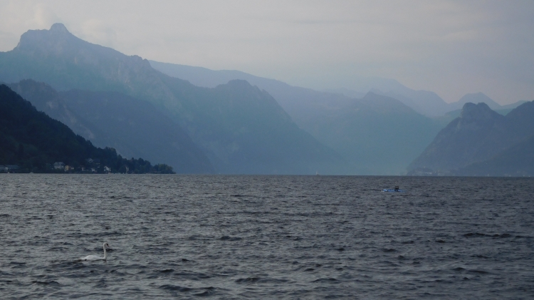
that we can better continue to Zell am See. This is a very boring place to wait two days
for good weather. Cycling in the rain would not make any sense at all, as the only
logical route from here leads along the Grossglockner over a 2,600 meter high pass
with two thousand meters of climbing. That would not be a good idea to do with bad
weather. And so we are heading on. This means that we still have an unexpected climb
to overcome. After the long day, this is a bit too much for Margarita, but she manages
to get herself through this very well.
The wind makes the last twenty kilometers extremely tough, especially since we have
to climb much more than we have to descend. The ever accelerating headwinds are a real
pain in the ass also. Still e are lucky, as I see rain showers all around, but we are
still dry. We reach the lake and we can already see Zell am See. A few minutes later
we reach the exclusive mountain town. We are lucky as the first hotel appears to be
affordable and also very luxurious, with an extensive spa. All to the joy of Margarita.
At the moment that we push our bikes inside, all hell breaks loose. The torrential
rains fall down and the first thundercracks can be heard in the distance.
Day 9: Zell am See 0 km
As predicted, it rains throughout the day. It is really not a day to do some high
mountain cycling today. We remain in Zell am See therefore. And we have made a decision.
Because it will rain again all day tomorrow, we are not going up at the Grossglockner
tomorrow, but instead we will go under the mountains by train. On the southern side
of the Alps the weather will improve sooner and there we should be able to cycle again
the day after tomorrow.
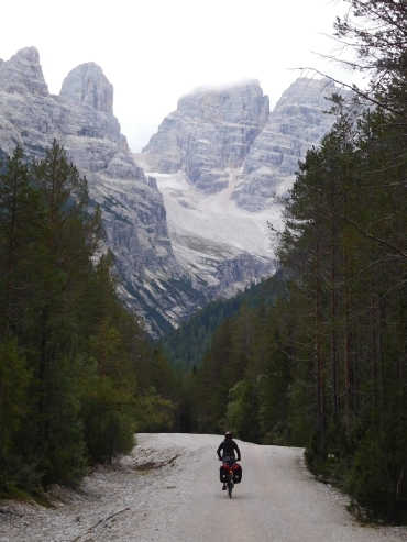
Day 10: Dobbiaco (Italy) - Col S. Angelo (1.756 m) - Misurina 23 km
We went by train under the high Alps and reached Lienz, from where we took a follow-up train
to Dobbiaco, the first town in Italy, not far from the Dolomites. Because the trains
do not connect too well, it took us quite some hours to reach Dobbiaco. In the meantime, the
weather slowly improved, so when we finally reach Dobbiaco at 3 o'clock, it is
still cloudy but it does not rain anymore. I have been looking on my GPS for a place
to sleep, as Margarita asks why we are not going to cycle. That is a good question. Because
it would rain all day, I did not take into account the possibility that the weather could
improve and that we could cycle today. Although it is late, we could still make it
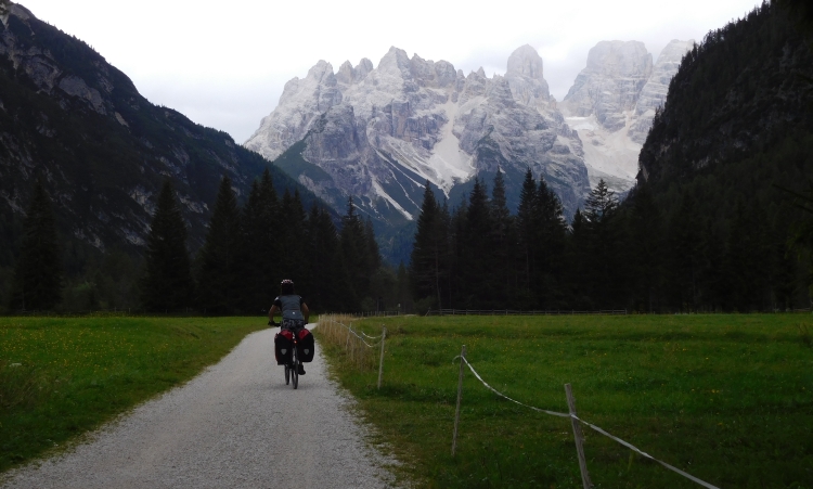
to Misurina. And so unexpected we are actually cycling now. We follow a large road
up through a valley, but fortunately there is a bike path that runs parallel to the
road. We will have to climb today. Misurina lies just over the Col San Angelo. So far
the climb is still easy. We are riding up through the valley, where we slowly gain
altitude. Soon the first Dolomite peaks come in sight. Hundreds of meters the cliffs
rise up from the valley. The overcast weather gives a mysterious atmosphere over the
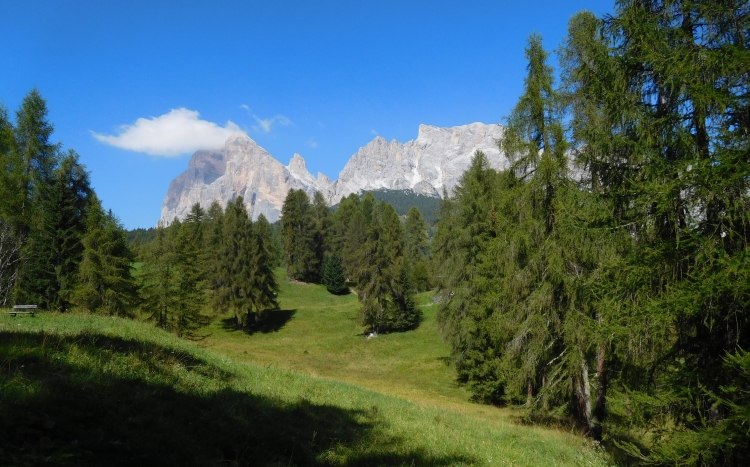
dark woods and the gray rocks. Thankfully I experience the beauty of the landscape.
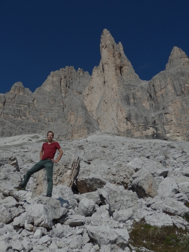
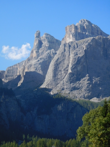
We cycle straight to one of the spectacular Dolomites walls. The Monte Cristallo
is more than 3,200 meters high and even has a small glacier. The bike path runs
through Alpine meadows full of blooming flowers. Margarita is filled with joy.
Did you know that the flowers are calling me?
Yes, I know.
No, I mean they really call me by my name.
Yes I know. I wanted you to listen to me when I call...
After all the talks with flowers it has become late. The real climb still has not
started yet, and so we continue to avoid arriving in the dark. We reach the end of
the valley. The bike path ends here and we have to continue on the main road again.
Now it has really begun to climb. The road is medium steep, exactly what I would
normally expect in the Alps. It is just manageable for Margarita with an occasional
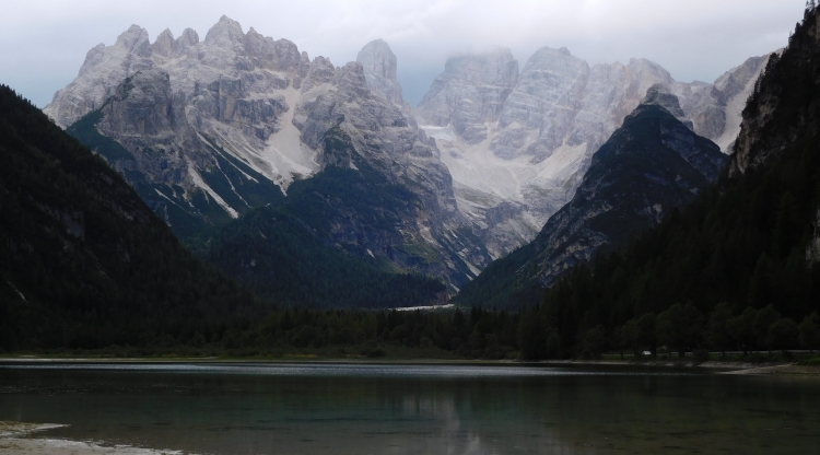
rest. Without problems we reach the pass and descend to Misurina.
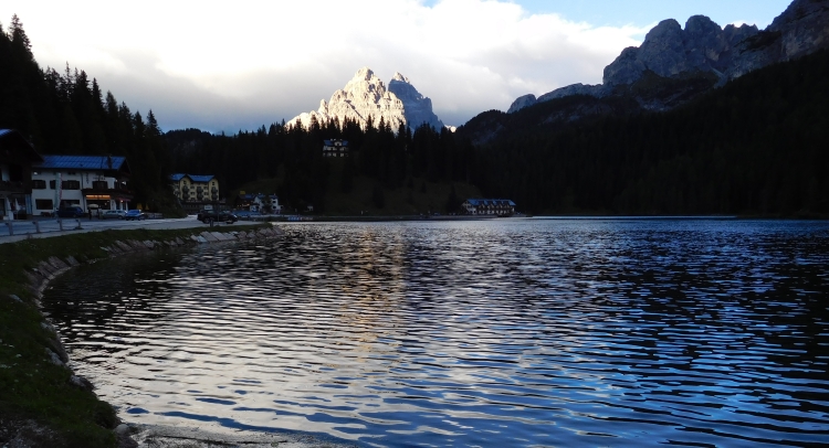
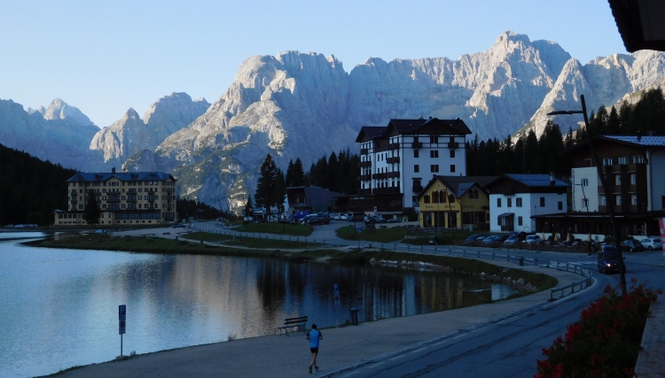
Misurina is a wonderfully located tourist village on the banks of the lake. It is one of
the nicer places in the Alps and that holds true for tonight in particular. When
the sun goes down, there are holes in the clouds, creating beautiful breaking lights
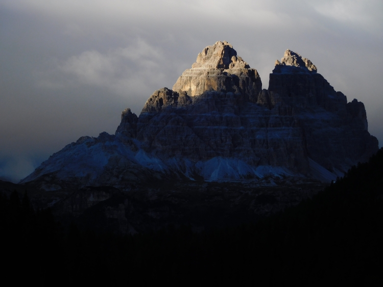
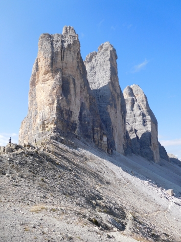
that cast the Dolomite peaks in a surreal, otherwotldly light. We enjoy the breathtaking
spectacle, one of the finest I have ever seen in the Alps.
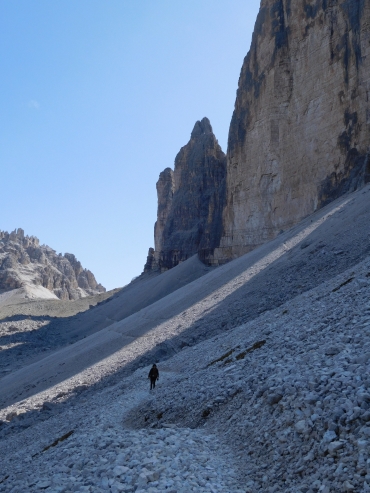
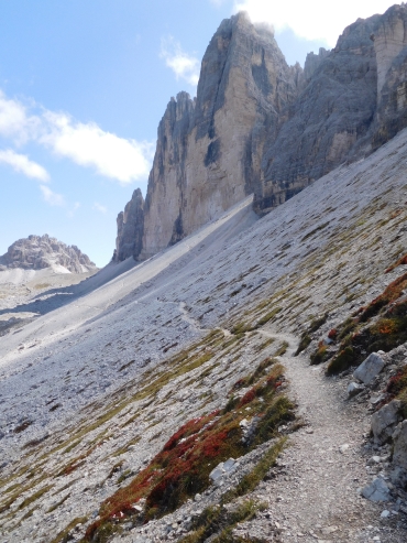
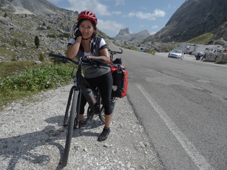
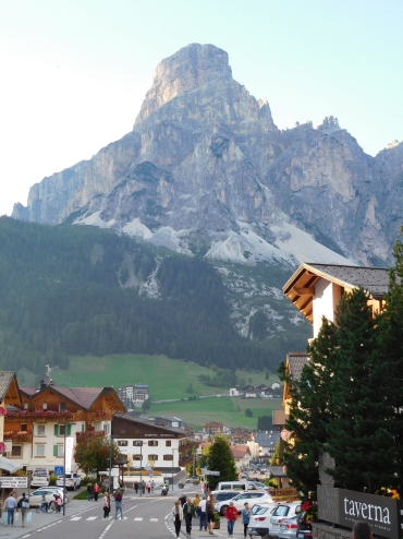
Day 11: Misurina - Passo Tre Croci (1.809 m) - Cortina d'Ampezzo 15 km
The bad weather is definitely over now. We wake up under a bright morning sun.
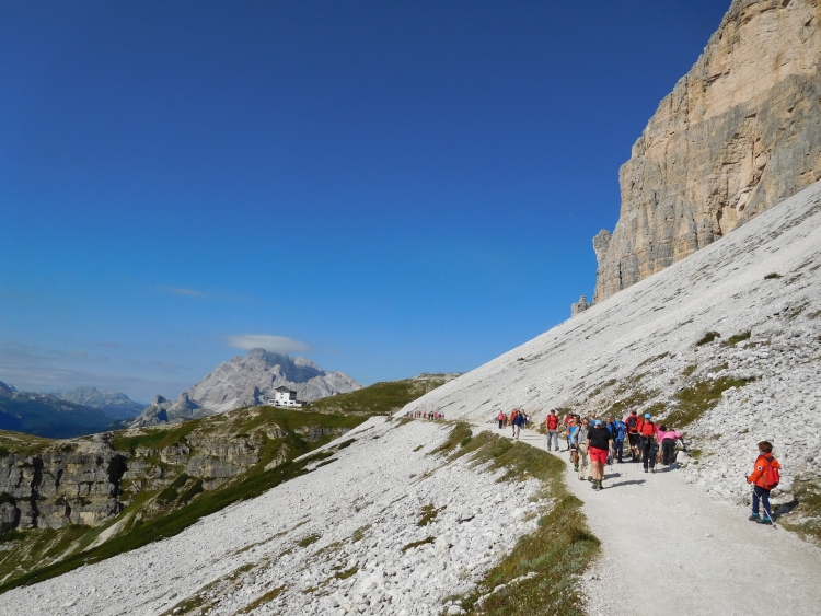
I suggest the idea to take the bus to the Rifugio Auronzo, a mountain refuge right
under the peaks of the Drei Zinnen or in Italian the Tre Cime di Lavaredo. From the
refuge it is possible to walk around around the enigmatic Dolomite peaks. That may take
a few hours to complete. If we are tired after the walk, we will stay in our hotel in
Misurina one more rnight, but if we have time and energy left, we can still get
on our bikes after the hike and cycle to Cortina d'Ampezzo.
We do not seem to be the only ones who had the idea to go to the Rifugio by bus.
From Dobbiaco, from Cortina, from Misurina, from every little corner seem to sprout
buses which travel to the refuge. After arriving, we immediately start to walk. A
long snake of colorfully dressed walkers and some climbers are walking on the wide
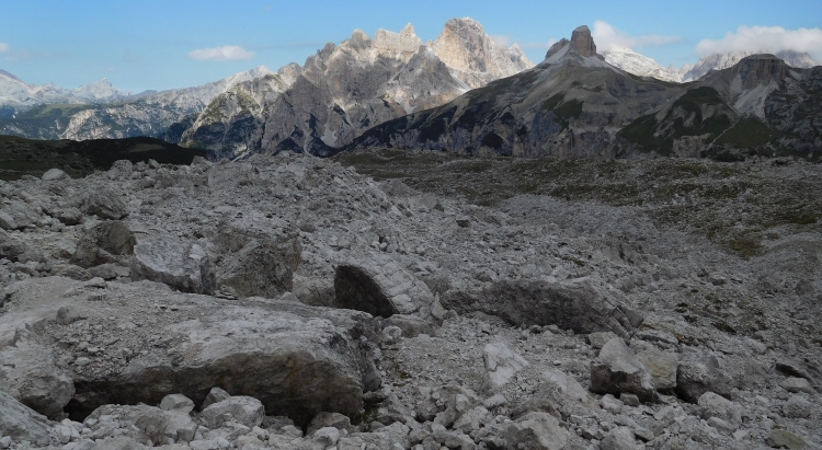
path before us. The trail leads below the dolomite cliffs and scree slopes. Far below
the dolomite peaks, but at the same time high above the tree line and even further
above the valleys. The views are spectacular. And this is just the 'back' of the
Drei Zinnen. The other side is actually the famous one that adorns many a screensaver
or jigsaw-puzzle.
The walk on the comfortable trail is very easy and before we realize it, we are on
the pass. The Drei Zinnen are right before us, it looks like we can grasp them. Just
like many villages and mountains in the region, the Drei Zinnen have both German and
Italian names. At the beginning of the last century a fierce war was raging in the
region between Austria and Italy. The whole area that is called Sudtirol now, fell
in Italian hands. Nowadays the atmosphere is still more Austrian than Italian. Most
people still speak German and the kitchen is often mixed. The menu is adorned with the
Spaghetti carbonara brotherly next to the Wiener Schnitzel.
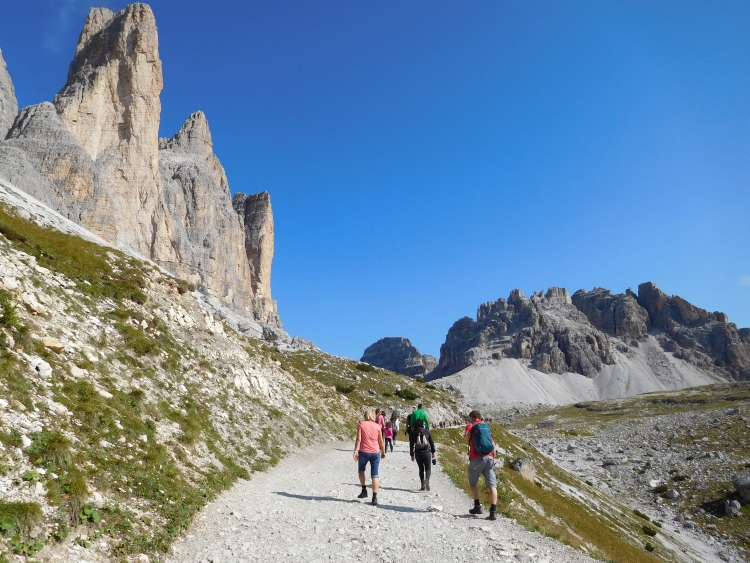
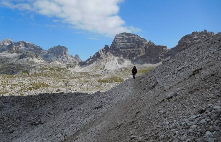
We enjoy the breathtaking views and then we start the journey back. We do not take
the easiest route. Directly below the walls of the Drei Zinnen are extensive scree slopes,
filled with large stacks of boulders. The slopes are pretty steep and the blocks are
loose. From a distance the route appeared to be a normal path, but it appears that
the trails are used by the climbers in order to reach the rock walls. So we have
to find our own way over and sometimes between the towering boulders. Other parts
of the route, however, are a lot easier and in these moments we seem to follow a 'real'
foot path.
All in all the route occupies a lot of attention, especially since we are walking
on our bike shoes. As smoothly as we walked to the pass, as slowly we find our way
over the endless scree. The route is incredibly beautiful and apparently Margarita gets
along well on the rugged terrain. But hey, she comes from one of the most mountainous
countries of our planet. Chile is jampacked with extraordinarily beautiful mountain
scenery, but still the Dolomites are unique for Margarita. After a long detour on
the scree we reach the mountain refuge, from where we take the bus back to Misurina.
After some hours of walking we are hungry. In our small hotel in Misurina we can finally
do something about it. We order some snacks. That should be enough to achieve Cortina
d'Ampezzo. There is a pass between Misurina and Cortina d'Ampezzo, but because Misurina
is already high, we only have some two hundred meters to climb to reach the Passo
Tre Croci. It is just a small climb that is not so steep, but neither is it very easy.
Margarita is not doing too well on the climb. She appears to be tired from yesterday
or from today or both. Fortunately the climb is short and so we forget about it quickly
as we whiz down. We reach Cortina d'Ampezzo, the largest town of the Dolomites, a chic,
cosmopolitan city with style. This was the place of the Olympics of 1954 and James Bond
had been caught up in a spectacular action scene on the bobsleigh track. It is the
type of city that excites Margarita. Bewitched she gazes to the beautiful, elegant
clothes with the exorbitant prices. I myself stare in amazement to the clothes shops
and I feel myself excited to be able to get off here tomorrow to the mountains.
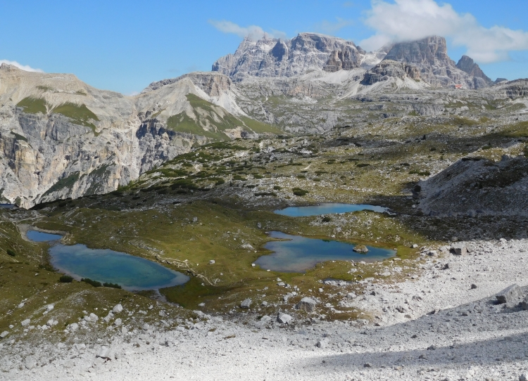
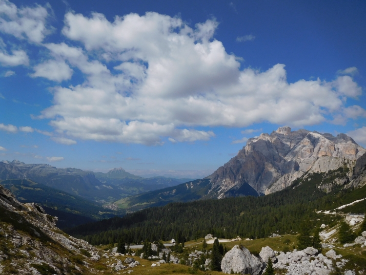
Day 12: Cortina d'Ampezzo - Passo di Valparola (2.192 m) - La Villa - Corvara 38 km
It is beautiful weather again. That is good, because today we will climb a thousand
meters to the almost 2,200 meters high double pass of Passo di Falzarego and Passo
Valparola, the latter the highest pas of our little journey.
Margarita is not climbing well today. Or maybe: she does not want to anymore.
Actually she was already tired yesterday, but because the climb was so short,
we forgot about the laborious process. I explain the various options, including
descending back to Cortina and then go north via a short climb back to Dobbiaco or
an option where we permanently descend to the south via untouristy and unfamiliar
territory. All options would be fine for me, but Margarita dislikes all of them. And
so we finally continue to go up.
Things do no run smoothly, but at least much of the climb to the Passo di Falzarego
is not steep. And so we still manage to cover large portions relatively easy. On the steeper
sections I ride up twice, first with my own bike, then running down, and then with the
bike of Margarita. Many hours we are working our way up like this, but eventually we
reach the pass. But we are not finished yet. We must go on a bit more to the next pass,
the Passo di Valparola, which is a hundred meters higher. The way up to the second pass
is actually much steeper, but Margarita seems to have recharged herself. The steeper
passage she actually manages to cycle up herself, in one single go.
The Passo di Valparola has more of a small plateau than an Alpine pass. More than
a kilometer the road continues on pass elevation, withou going up or down. A straight
road without curves, ultimately leading to the start of the descent. The road winds
down over a steep slope. An obscure descent that is running in all directions. After
arriving down, we find out that it is hot. Unfortunately we must climb again, not steep
at all, but we are slowed down a lot. The last hour up to Corvara is mentally and physically
quite strenuous for both of us, but eventually we reach Corvara, beautifully situated
at the foot of the Sella massif. Tomorrow or the day after tomorrow we will climb over
the Passo di Gardena and after that we do not need to do any large or steep climbs anymore.
It will be a huge relief for Margarita. But for now the climb over the Passo di Gardena
hangs like a sword of Damocles over our heads.
Day 13: Corvara - Passo di Gardena (2.121 m) - Ortisei - Bolzano 67 km
Again, the weather is beautiful when we leave for our last climb in the Dolomites. We
are going up to the Passo di Gardena, a climb that I had already done a few years ago.
The climb is certainly shorter than the climb of yesterday, but it is also considerably
steeper. Not an extremely steep climb, but neither one of the easiest. I have calculated
the scenario that she could not cycle up at all. Even then we would have anough time
to make it up and all the long way down to Bolzano. But it would of course be much nicer
if it would go more smoothly than that.
It looks like Margarita has got a lot more spirit than yesterday. Without complaining
she goes up with a gritty determination. She does not need many breaks. We are zigzagging
up on a slope of Alpine meadows, flanked on both sides by steep rock towers. It is one
of the very beautiful climbs in the Alps. Now Margarita is going so well, I am unexpectedly
able to just enjoy the climb without worrying. The last kilometers are the steepest. The
road goes up with short zigzags now. That is psychologically beneficial, because as such
we can see ourselves move quickly above the scenery where we were a few moments ago.
Surprisingly soon we reach the pass, several hours earlier than I expected. I ask Margarita
how she could be so much better today than yesterday. Today was whatsoever harder than
yesterday. Margarita says that she prayed the whole way like crazy. Again and again she
askes for force to a tragically perished television presenter from Chile. And that apparently
helped.
We stand before and especially above one of the longest descents in Europe. We still
have nearly sixty kilometer to go to Bolzano, but all those kilometers are going down.
Also in terms of altitude the descent is impressive. The downhill is almost two thousand
altimeters. We descend into the Gardena Valley, where the road leads past a series of
wintersport resorts. The descent is therefore not extraordinarily beautiful compared
with the last days and some moments the route is even ugly, at the moments where we
have to go down over a broad thoroughfare. After the resorts of the valley the road
runs down steeply and we fly with sixty kilometers per hour over the broad road.
The steep descent ends abruptly when we reach the valley of the Eisack. We cycle along
the main route of the Brenner Pass in the direction of Verona and the rest of Italy.
The Eisack Valley is relatively narrow at this section. The cycling path therefore
regularly crosses the river to find a flat piece of land. At the beginning of the trip,
we cycled along the Danube on one of the most popular cycling routes in the world,
but so is the route of Innsbruck over the Brenner Pass to Lake Garda and Verona.
The Brenner Pass must be one of the easiest mountain passes of the entire Alps and
it is also by far the lowest pass of the main ridge of the Alps. We do not go up
to the Brenner Pass however, but we go deeper down into Italy.
It was not cold on top of the Gardena but two thousand meters lower in the valley of the Eisack
it is downright hot, even if it is almost autumn. After many days of alpine meadows we cycle
between vineyards now. Not only the valley and the small hills, but also the steeper mountainsides
are covered with vines. The sweet smell permeates everything. For the first time I have the
feeling that we are really in Italy.
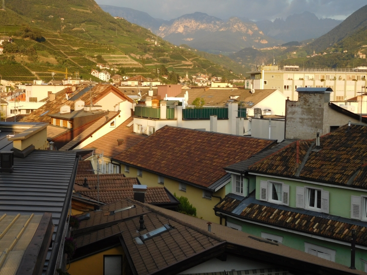
We reach Bolzano, the biggest city in the region, located in a wide plain where the rivers
Eisack and the Adige merge. We find a small room in a hotel in the city center, so that
we can enjoy all the pleasures that the Italian kitchen has to offer and we raise a glass
to the successful crossing of the Dolomites. Margarita has made it anyway on her first
bicycle travel. That is a great achievement. And so the suffering of the long distance
cyclist is easily exchanged for the mediterranean good life.
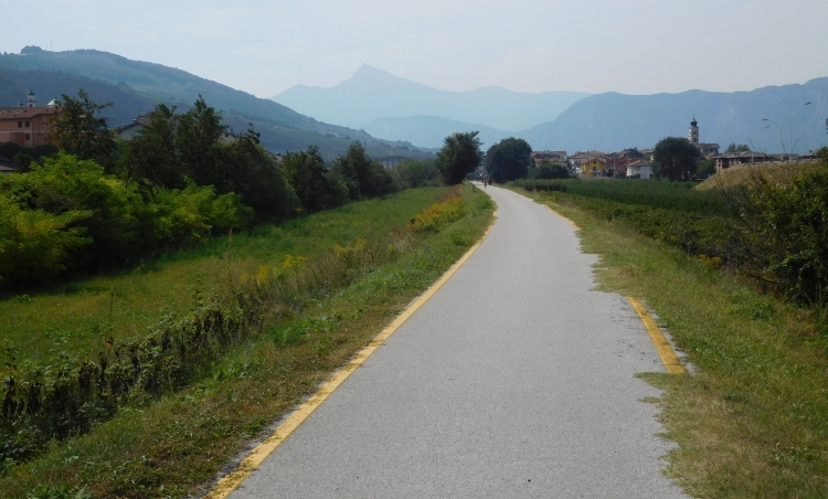
Day 14: Bolzano - Trento 67 km
And so we have left behind the mountains for good. Better stated, we do not need to climb
over them. On both sides of the Adige the mountains still rise up far above us, but
we can easily continue cycling along the banks of the river. The route is easy and popular
with cyclists. Thousands of people are cycling along the Adige annually. The route
is not as beautiful as the Donauradweg, the other popular cycling route with
real highlights, but it is not unpleasant to ride here. And it is also nice not having
to worry whether the cycling is going to be hard.
We reach the city of Trento right after the lunch break. Trento is a nice, medium-sized city
in the foothills of the Alps, amidst the hills and mountains of Trentino, one of the
most surprising and underrated bike regions of Europe. We will not venture in this mountain
scenery after our recent Dolomites Adventure. I myself have cycled in Trentino before,
but the capital of Trento I did not know yet. It appears to be a truly Italian town,
unlike Bolzano thta has also clear Austrian influences. In the afternoon we have enough
time to explore the small medieval town, even if a lot of time is lost as we have to
take shelter for a totally unexpected thunderstorm which discharges above our heads.
Day 15: Trento - Rovereto - Riva del Garda 51 km
We continue to follow the course of the Adige river to the south. There little to no
changes in the landscape: a wide valley flanked by high hill ridges. The landscape
is not outstanding beautiful nor is it ugly. It is still busy with cyclists. The busy
bike traffic even leads to minor accident just before Rovereto. A child of around four
or five years old is swinging unpredictably from left to right and back before me. I
must slow down, because there is oncoming traffic. Once I see a possibility to pass,
I am directing to the far left to take over, but right at the most unfortunate moment
the child swings sharply to the left. I can only prevent a clash by turning sharply
to the right, but at that time the child is doing the same. I squeeze the brakes and
cannot pass. At that time Margarita is coming to take us both over with full speed.
At that time, however, the child takes another swing back to the left, leaving Margarita
nowhere to go. She cannot get along to the left and neither can she move to the right
as I am still there. She makes an emergency brake, ans she falls. Luckily she is
not injured physically, but mentally she is in a state of minor shock.
After the unsavory incident the father of the child gives a firm reprimand to the
child, although I think we should not blame the small child, but we must rather
take the blame on ourselves. Anyway we reach Rovereto, where we leave the valley of
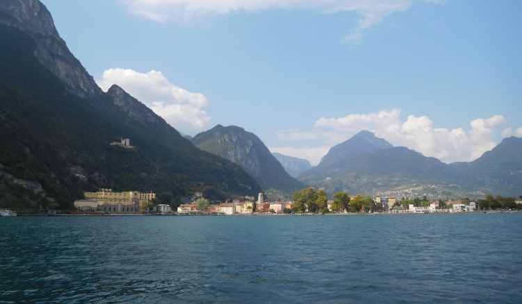
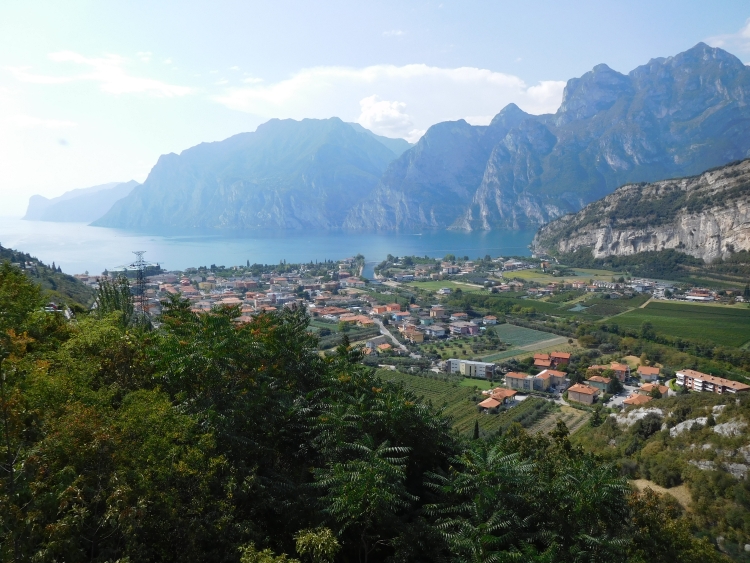
the Adige. We are climbing to a small ridge from where we can descend to Lake Garda.
I have been here several times before. A few small roads are inimitably connected,
but if you follow the signs, all will be well. After that a clear bicycle path leads
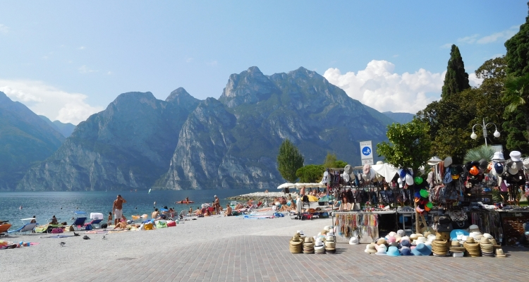
over the pass, and finally steeply down to Lake Garda. Despite the high season should
be over, it is incredibly busy around Lake Garda. On the descent we are passing a kilometers
long traffic jam and once at the lakeside the bike path is jampacked and we can hardly
get through. I am afraid that we will not be able to find a place to sleep. An extremely
friendly hotel owner is offering us a fantastic service. She has no room herself but she
is checking out a booking site for us to see whether there are rooms available. She knows
which ones are the best value for money and she notices that there is only one room
available. Meanwhile a thunderstorm is discharging overhead. Like firemen we race to
the hotel, where the storm erupts at the moment when we check in.
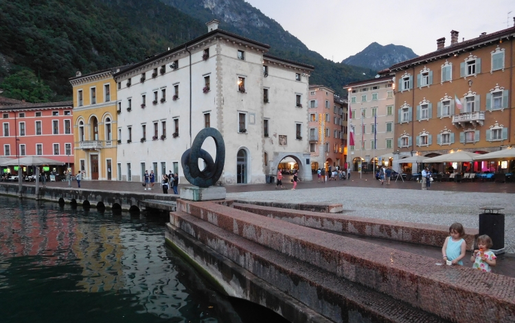
Day 16: Riva del Garda - Garda 5 km
Unfortunately we were able to stay only one night in the hotel. Therefore we opt to
take the boat today to cross over to the town of Garda, on the southeast side of
Lake Garda. The roads on both sides of the lake are not very suitable for cycling,
partly because of the heavy traffic and partly because of the many long tunnels that
have been hewn out of the mountain rock.
We do not have much luck today. The boat has considerable delay. When we are finally
on our way, the motor breaks down after half an hour. After being adrift for half an
hour, the engine is functioning again, but we go back to Riva. After an additional two
to three hours of waiting we finally are able to leave Riva on an overcrowded boat.
So we finally reach Garda at half past eight. It is already dark and we still have
to find a hotel. That is not easy. Everything appears full. We try one hotel after
another, all for nothing. Only the lower quality hotels in the higher hills have
a few rooms available. At least we have a place to stay. After a day with so much
bad luck, we have to count our blessings.
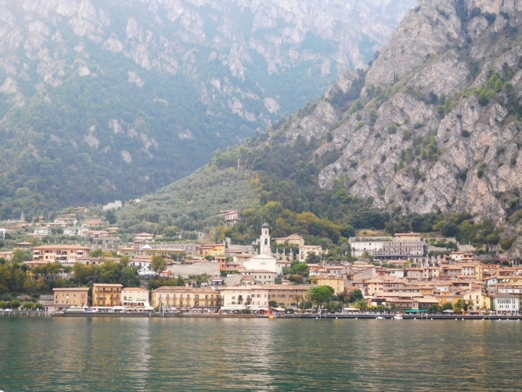
Day 17: Garda - Bussolengo - Verona 38 km
From Garda it is only forty kilometers to Verona, the intended final destination of our
journey. We follow the lake for a few kilometers. In Bardolino we leave the lake.
We are in a hilly area with plenty of vineyards. The famous Bardolino wines come from
this region. The terrain is quite hilly, a welcome change after quite a few almost
flat days. The terrain is not really difficult. Margarita is perfectly fine here.
We are heading east through all-Italian hillside scenery. We descend to the Adige
river again, the river that we have followed a few days ago. After those last flat
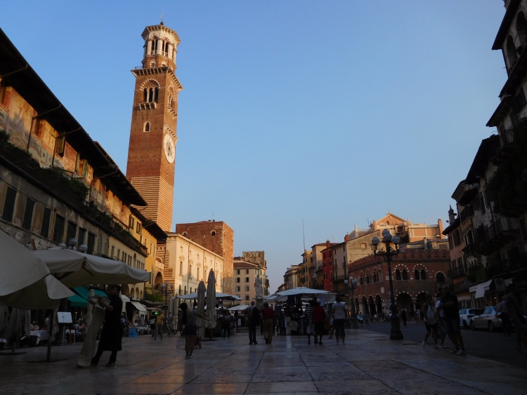
kilometers along the river, we reach the city of Verona. We cycle to the ancient
city walls and pass through an old gateway and we find ourselves right into the
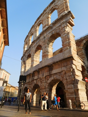
historic center. We stand before the Piazza Bra, one of the main squares of Verona,
with the great Roman amphitheater. We made it. We will celebrate two days of vacation
before we will return back home by train.
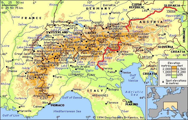
Map of the route
Statistics
Facts and Figures
Facts and Figures
# Days
# days on the bike
Distance
Distance / Day
Biggest distance on a day
Biggest altitude difference on a day: climbing
Highest point
Statistieken
17
13
786 km
60 km
93 km
1.300 m
2.192 m
Day by Day
Day
1
2
3
5
6
7
8
10
11
12
13
14
15
16
17
Route
Vienna - Krems a.d. Donau
Krems a.d. Donau - Melk - Ybbs a.d. Donau
Ybbs a.d. Donau - Grein - Wallsee - Haag - Steyr
Steyr - Kremsmünster - Gmünden
Gmünden - Steinbach am Attersee - Mondsee
Mondsee - Thalgau - Hallwang - Salzburg
Salzburg - Berchtesgaden - Zell am See
Dobbiaco - Col S. Angelo - Misurina
Misurina - Passo Tre Croci - Cortina d'Ampezzo
Cortina d'Ampezzo - Passo di Valparola - Corvara
Corvara - Passo di Gardena - Ortisei - Bolzano
Bolzano - Trento
Trento - Rovereto - Riva del Garda
Riva del Garda - Garda
Garda - Bussolengo - Verona
Km
86
68
74
72
52
36
91
23
15
38
67
67
51
5
38
Opmerkingen
.
Wachau is beautuful and the terrain is easy.
There are lots of steep roads between Wallsee and Steyr.
.
The road between Altmünster and Steinbach is recommended.
.
The route over Hirschbichl is beautiful but very steep.

 It turns out that Margarita is not a person for many or long breaks. She does not even
want to stop for a lunch. Moving on is the motto. We are not at the final destination yet,
are we? I object that we can stop in every village if we want. There is plenty of
accommodation. But no, she wants to go on. For me that is not a problem either. We do
not cycle that fast so I do not get tired at all and I can persevere quite a long time
without food. Despite the complete lack of hills, the going is getting a bit less easy
now. That has everything to do with the heat. The air feels heavy because of the clammy
heat and our speed begins to drop. We want to stay in Krems an der Donau today but that
village seems further than it appeared initially because of the winding course of the
section between Tulln and Krems. It is already late in the afternoon now and in the end
we still have to eat because our energy is low after hours of cycling. After that we
can continue again and soon we reach the quirky little town of Krems. Here we have a
small incident. When looking for a hotel I stop to get off to maneuver some small
stairs but Margarita does not expect this and tries to get along. She has not seen
the small steps and falls. Fortunately it does not really hurt and she does not
have any injuries.
It turns out that Margarita is not a person for many or long breaks. She does not even
want to stop for a lunch. Moving on is the motto. We are not at the final destination yet,
are we? I object that we can stop in every village if we want. There is plenty of
accommodation. But no, she wants to go on. For me that is not a problem either. We do
not cycle that fast so I do not get tired at all and I can persevere quite a long time
without food. Despite the complete lack of hills, the going is getting a bit less easy
now. That has everything to do with the heat. The air feels heavy because of the clammy
heat and our speed begins to drop. We want to stay in Krems an der Donau today but that
village seems further than it appeared initially because of the winding course of the
section between Tulln and Krems. It is already late in the afternoon now and in the end
we still have to eat because our energy is low after hours of cycling. After that we
can continue again and soon we reach the quirky little town of Krems. Here we have a
small incident. When looking for a hotel I stop to get off to maneuver some small
stairs but Margarita does not expect this and tries to get along. She has not seen
the small steps and falls. Fortunately it does not really hurt and she does not
have any injuries.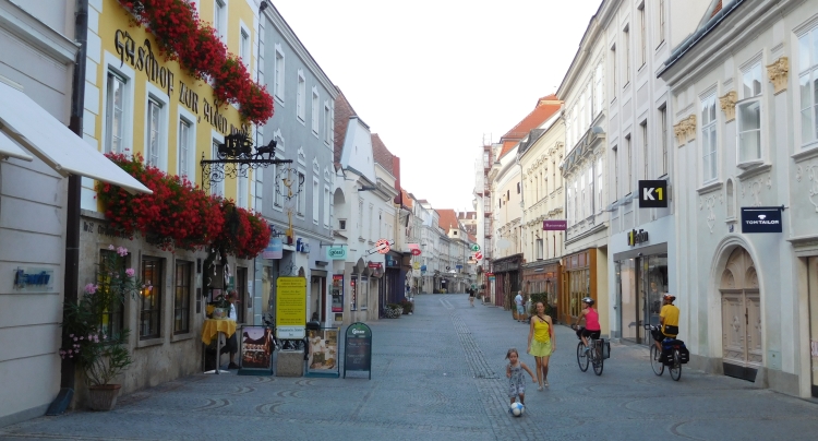
 The nice weather is over. During breakfast the sky is already gray, but nearby we see
a pitch-black sky, which is moving in our direction. Half an hour later we are ready to go
and right at the moment that we want to leave, a thunder strikes nearby. What to do?
Margarita wants to go, but that does not seem like a good idea with the thunderstorm right
over our heads. When the storm is gone, we leave immediately, while the rain is still
pouring. It is not cold though, so the fiery rain is not a real problem. The more so
because the weather is improving rapidly. After the short but violent storm it is mostly
cloudy, but once in a while the sun is breaking through the clouds. We are cycling through
a scenery that is incredibly beautiful. In mighty arches the river Danube is winding
its way through the high, dark green hills of Wachau. On the plains between the river
and the hills are pstures and vineyards and some stunningly beautiful villages.
The nice weather is over. During breakfast the sky is already gray, but nearby we see
a pitch-black sky, which is moving in our direction. Half an hour later we are ready to go
and right at the moment that we want to leave, a thunder strikes nearby. What to do?
Margarita wants to go, but that does not seem like a good idea with the thunderstorm right
over our heads. When the storm is gone, we leave immediately, while the rain is still
pouring. It is not cold though, so the fiery rain is not a real problem. The more so
because the weather is improving rapidly. After the short but violent storm it is mostly
cloudy, but once in a while the sun is breaking through the clouds. We are cycling through
a scenery that is incredibly beautiful. In mighty arches the river Danube is winding
its way through the high, dark green hills of Wachau. On the plains between the river
and the hills are pstures and vineyards and some stunningly beautiful villages.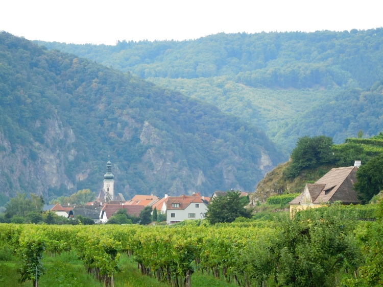
 After several kilometers we reach Stein, the first of the pretty villages today, almost
as charming as Krems. After Stein the landscape becomes really nice. For the first time
we have to climb. The climbs in Wachau are short but there might be some steep sections.
These do never last longer than a minute though. Margarita does not have any problems
at all and so we can enjoy the beautiful, romantic landscapes. Margarita looks happy
and she is making even more pictures than I do. After passing some very small villages,
we climb to the first large village in the Wachau. Dürnstein is located on a sort
of terrace above the river. The church and the remains of a small castle are towering
above the village. We cycle through the gate inside the old village center. We have to
wind through the many tourists and fellow cyclists. We are certainly not the only ones
who have set ourselves to cycle here.
After several kilometers we reach Stein, the first of the pretty villages today, almost
as charming as Krems. After Stein the landscape becomes really nice. For the first time
we have to climb. The climbs in Wachau are short but there might be some steep sections.
These do never last longer than a minute though. Margarita does not have any problems
at all and so we can enjoy the beautiful, romantic landscapes. Margarita looks happy
and she is making even more pictures than I do. After passing some very small villages,
we climb to the first large village in the Wachau. Dürnstein is located on a sort
of terrace above the river. The church and the remains of a small castle are towering
above the village. We cycle through the gate inside the old village center. We have to
wind through the many tourists and fellow cyclists. We are certainly not the only ones
who have set ourselves to cycle here.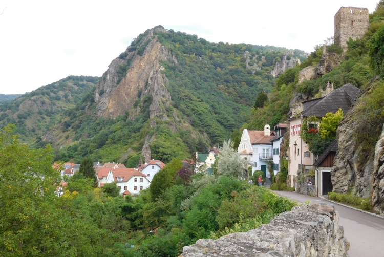
 After Spitz we have left the highest hills of the Wachau region slowly behind us,
but the landscape is still hilly. We are approaching Melk now, a historic town with a
monastery that is so large that it almost withdraws a complete hill from
sight. We climb up the hill to reach the monastery. In the end we do not go inside
because the entance appears to be on the other side of the hill. We descend to the
town of Melk town. At the time we reach the center, a heavy storm erupts. We run
into a pub where we make the best of the situation by ordering two gigantic Kuchen.
At the time that we have eaten the Kuchen drank the tea, it is dry again and we can
continue. We cycle over twenty kilometers more to the small town of Pöchlarn,
our target overnight stay. One way or another we both do not like the atmosphere.
The town is actually quite nice, although not like the other towns and villages
that we have passed today. We decide to cycle twenty kilometers further to Ybbs an der
Donau. We are struggling to find a hotel but eventually we find a real cyclists
hostel. End good, all good.
After Spitz we have left the highest hills of the Wachau region slowly behind us,
but the landscape is still hilly. We are approaching Melk now, a historic town with a
monastery that is so large that it almost withdraws a complete hill from
sight. We climb up the hill to reach the monastery. In the end we do not go inside
because the entance appears to be on the other side of the hill. We descend to the
town of Melk town. At the time we reach the center, a heavy storm erupts. We run
into a pub where we make the best of the situation by ordering two gigantic Kuchen.
At the time that we have eaten the Kuchen drank the tea, it is dry again and we can
continue. We cycle over twenty kilometers more to the small town of Pöchlarn,
our target overnight stay. One way or another we both do not like the atmosphere.
The town is actually quite nice, although not like the other towns and villages
that we have passed today. We decide to cycle twenty kilometers further to Ybbs an der
Donau. We are struggling to find a hotel but eventually we find a real cyclists
hostel. End good, all good.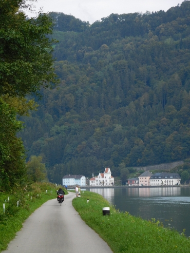 We are early on the way today. It is reasonably good weather, with clouds covering
half of the sky. We will continue to follow the Danube for a while and later on we will
go into the hills. It would be nice if we would reach Steyr today. The route between
Ybbs and Grein is surprisingly nice. The Danube meanders between the hills again and
because there is hardly any wind, there are beautiful reflections of the churches and
settlements in the river. Although we are far from Vienna now, there are still many
cyclists in this sparsely populated area. We pass a German-Italian couple that we also
met in a restaurant yesterday. We cycle together occasionally, until one of us makes
a picture and they are out of sight again. Another time they stop for a little snack
and we catch up again. In the end we cycle together large parts of the way to Grein
and Wallsee. Eventually our roads split in Wallsee. They continue to follow the Danube
to Linz. We leave the Danube to go in the direction of Steyr.
We are early on the way today. It is reasonably good weather, with clouds covering
half of the sky. We will continue to follow the Danube for a while and later on we will
go into the hills. It would be nice if we would reach Steyr today. The route between
Ybbs and Grein is surprisingly nice. The Danube meanders between the hills again and
because there is hardly any wind, there are beautiful reflections of the churches and
settlements in the river. Although we are far from Vienna now, there are still many
cyclists in this sparsely populated area. We pass a German-Italian couple that we also
met in a restaurant yesterday. We cycle together occasionally, until one of us makes
a picture and they are out of sight again. Another time they stop for a little snack
and we catch up again. In the end we cycle together large parts of the way to Grein
and Wallsee. Eventually our roads split in Wallsee. They continue to follow the Danube
to Linz. We leave the Danube to go in the direction of Steyr.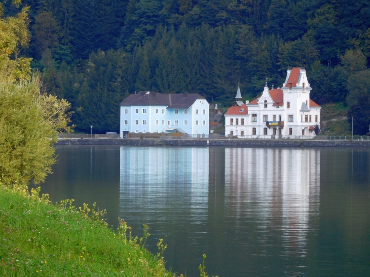
 After the lake we have to climb a hundred meters more. These are quite steep, but
Margarita feels that she has nearly made it and without problems we reach the pass.
After the lake we have to climb a hundred meters more. These are quite steep, but
Margarita feels that she has nearly made it and without problems we reach the pass.
 On the lake front of the Attersee we are among the people again and, unfortunately,
between the cars. The lake road is narrow and because there is a lot of traffic, cars
are continuously rushing by right beside us. After a few kilometers there is
a bike path along the lake and we can finally get off the road. We can enjoy the
beautiful mountains of Alps again. The weather has improved further and it has
ultimately become a hot and sunny day. Ideal for cooling off in the glacial lake.
With our bike clothes we dive into the cold water and we are having a lunch of the
sandwiches that we bought at a supermarket nearby.
On the lake front of the Attersee we are among the people again and, unfortunately,
between the cars. The lake road is narrow and because there is a lot of traffic, cars
are continuously rushing by right beside us. After a few kilometers there is
a bike path along the lake and we can finally get off the road. We can enjoy the
beautiful mountains of Alps again. The weather has improved further and it has
ultimately become a hot and sunny day. Ideal for cooling off in the glacial lake.
With our bike clothes we dive into the cold water and we are having a lunch of the
sandwiches that we bought at a supermarket nearby.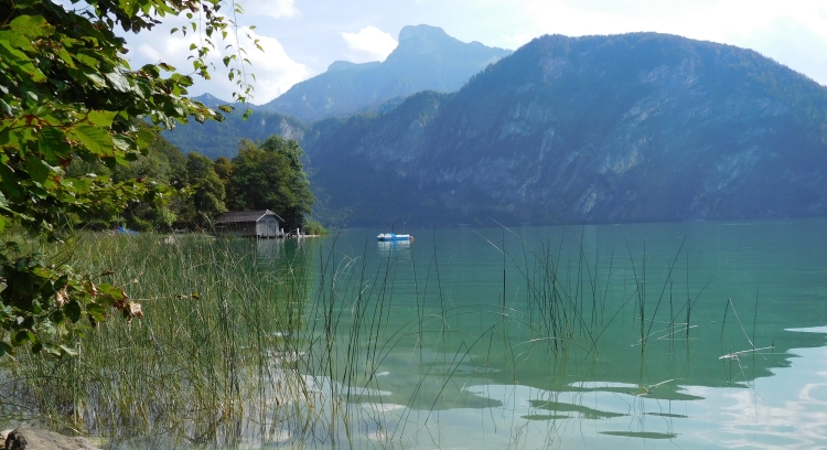
 We pass the town of Berchtesgaden, the main town of this area. From there we continue
towards Ramsau im Berchtesgaden, a village of an extraordinarily beautiful church.
This might be one of the most beautifully situated churches in Europe. The narrow church
sits lonely in an idyllic valley with a cobbling mountain stream, surrounded by the
beautiful limestone mountains that characterize the region. Ramsau is the starting
point of the climb to Hirschbichl, the pass which forms the border with Austria. We
can also take the main road to Austria. It will be much easier because that road will
not be high and will not be steep either. We decide not to opt for the practical way but
we go for the most beautiful route and so we go up to Hirschbichl. Meanwhile the first
high clouds are chasing over far above us. No beautiful, neatly delineated cloud formations,
but a kind of dirty gray soup, which does not abode good times.
We pass the town of Berchtesgaden, the main town of this area. From there we continue
towards Ramsau im Berchtesgaden, a village of an extraordinarily beautiful church.
This might be one of the most beautifully situated churches in Europe. The narrow church
sits lonely in an idyllic valley with a cobbling mountain stream, surrounded by the
beautiful limestone mountains that characterize the region. Ramsau is the starting
point of the climb to Hirschbichl, the pass which forms the border with Austria. We
can also take the main road to Austria. It will be much easier because that road will
not be high and will not be steep either. We decide not to opt for the practical way but
we go for the most beautiful route and so we go up to Hirschbichl. Meanwhile the first
high clouds are chasing over far above us. No beautiful, neatly delineated cloud formations,
but a kind of dirty gray soup, which does not abode good times.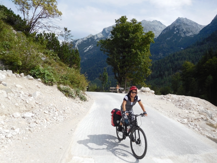
 We reach Saalfelden, the first really big village. There is not too much going on here.
No one is out on the streets and it turns out that there is only one hotel. We conclude
that we can better continue to Zell am See. This is a very boring place to wait two days
for good weather. Cycling in the rain would not make any sense at all, as the only
logical route from here leads along the Grossglockner over a 2,600 meter high pass
with two thousand meters of climbing. That would not be a good idea to do with bad
weather. And so we are heading on. This means that we still have an unexpected climb
to overcome. After the long day, this is a bit too much for Margarita, but she manages
to get herself through this very well.
We reach Saalfelden, the first really big village. There is not too much going on here.
No one is out on the streets and it turns out that there is only one hotel. We conclude
that we can better continue to Zell am See. This is a very boring place to wait two days
for good weather. Cycling in the rain would not make any sense at all, as the only
logical route from here leads along the Grossglockner over a 2,600 meter high pass
with two thousand meters of climbing. That would not be a good idea to do with bad
weather. And so we are heading on. This means that we still have an unexpected climb
to overcome. After the long day, this is a bit too much for Margarita, but she manages
to get herself through this very well.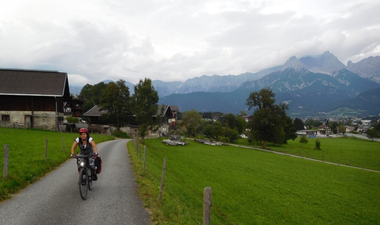
 We cycle straight to one of the spectacular Dolomites walls. The Monte Cristallo
is more than 3,200 meters high and even has a small glacier. The bike path runs
through Alpine meadows full of blooming flowers. Margarita is filled with joy.
We cycle straight to one of the spectacular Dolomites walls. The Monte Cristallo
is more than 3,200 meters high and even has a small glacier. The bike path runs
through Alpine meadows full of blooming flowers. Margarita is filled with joy.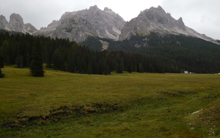
 The Passo di Valparola has more of a small plateau than an Alpine pass. More than
a kilometer the road continues on pass elevation, withou going up or down. A straight
road without curves, ultimately leading to the start of the descent. The road winds
down over a steep slope. An obscure descent that is running in all directions. After
arriving down, we find out that it is hot. Unfortunately we must climb again, not steep
at all, but we are slowed down a lot. The last hour up to Corvara is mentally and physically
quite strenuous for both of us, but eventually we reach Corvara, beautifully situated
at the foot of the Sella massif. Tomorrow or the day after tomorrow we will climb over
the Passo di Gardena and after that we do not need to do any large or steep climbs anymore.
It will be a huge relief for Margarita. But for now the climb over the Passo di Gardena
hangs like a sword of Damocles over our heads.
The Passo di Valparola has more of a small plateau than an Alpine pass. More than
a kilometer the road continues on pass elevation, withou going up or down. A straight
road without curves, ultimately leading to the start of the descent. The road winds
down over a steep slope. An obscure descent that is running in all directions. After
arriving down, we find out that it is hot. Unfortunately we must climb again, not steep
at all, but we are slowed down a lot. The last hour up to Corvara is mentally and physically
quite strenuous for both of us, but eventually we reach Corvara, beautifully situated
at the foot of the Sella massif. Tomorrow or the day after tomorrow we will climb over
the Passo di Gardena and after that we do not need to do any large or steep climbs anymore.
It will be a huge relief for Margarita. But for now the climb over the Passo di Gardena
hangs like a sword of Damocles over our heads.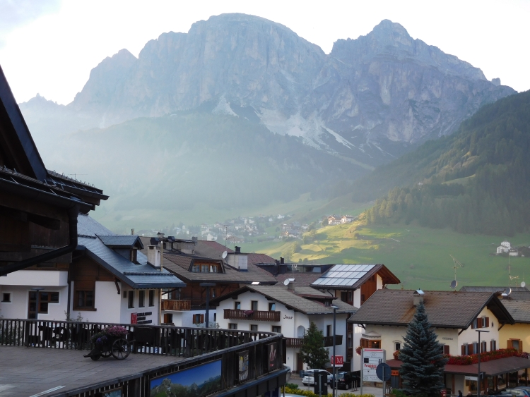

 It looks like Margarita has got a lot more spirit than yesterday. Without complaining
she goes up with a gritty determination. She does not need many breaks. We are zigzagging
up on a slope of Alpine meadows, flanked on both sides by steep rock towers. It is one
of the very beautiful climbs in the Alps. Now Margarita is going so well, I am unexpectedly
able to just enjoy the climb without worrying. The last kilometers are the steepest. The
road goes up with short zigzags now. That is psychologically beneficial, because as such
we can see ourselves move quickly above the scenery where we were a few moments ago.
It looks like Margarita has got a lot more spirit than yesterday. Without complaining
she goes up with a gritty determination. She does not need many breaks. We are zigzagging
up on a slope of Alpine meadows, flanked on both sides by steep rock towers. It is one
of the very beautiful climbs in the Alps. Now Margarita is going so well, I am unexpectedly
able to just enjoy the climb without worrying. The last kilometers are the steepest. The
road goes up with short zigzags now. That is psychologically beneficial, because as such
we can see ourselves move quickly above the scenery where we were a few moments ago.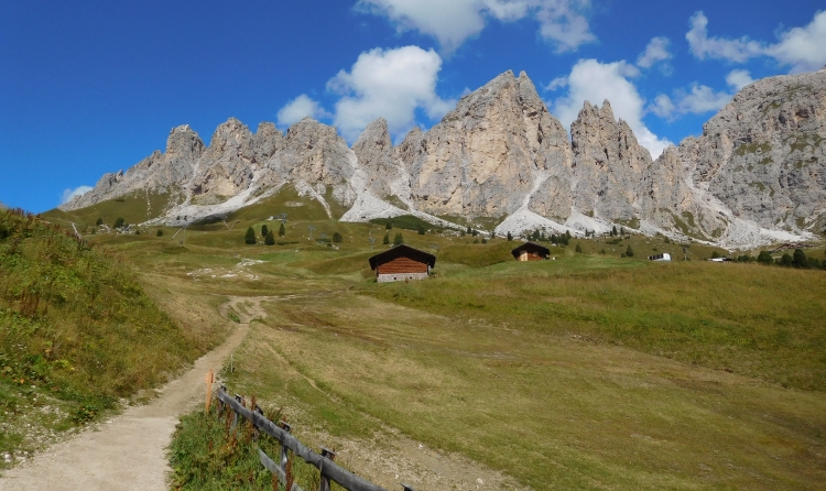
 We reach the city of Trento right after the lunch break. Trento is a nice, medium-sized city
in the foothills of the Alps, amidst the hills and mountains of Trentino, one of the
most surprising and underrated bike regions of Europe. We will not venture in this mountain
scenery after our recent Dolomites Adventure. I myself have cycled in Trentino before,
but the capital of Trento I did not know yet. It appears to be a truly Italian town,
unlike Bolzano thta has also clear Austrian influences. In the afternoon we have enough
time to explore the small medieval town, even if a lot of time is lost as we have to
take shelter for a totally unexpected thunderstorm which discharges above our heads.
We reach the city of Trento right after the lunch break. Trento is a nice, medium-sized city
in the foothills of the Alps, amidst the hills and mountains of Trentino, one of the
most surprising and underrated bike regions of Europe. We will not venture in this mountain
scenery after our recent Dolomites Adventure. I myself have cycled in Trentino before,
but the capital of Trento I did not know yet. It appears to be a truly Italian town,
unlike Bolzano thta has also clear Austrian influences. In the afternoon we have enough
time to explore the small medieval town, even if a lot of time is lost as we have to
take shelter for a totally unexpected thunderstorm which discharges above our heads.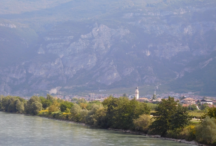
 After the unsavory incident the father of the child gives a firm reprimand to the
child, although I think we should not blame the small child, but we must rather
take the blame on ourselves. Anyway we reach Rovereto, where we leave the valley of
the Adige. We are climbing to a small ridge from where we can descend to Lake Garda.
I have been here several times before. A few small roads are inimitably connected,
but if you follow the signs, all will be well. After that a clear bicycle path leads
over the pass, and finally steeply down to Lake Garda. Despite the high season should
be over, it is incredibly busy around Lake Garda. On the descent we are passing a kilometers
long traffic jam and once at the lakeside the bike path is jampacked and we can hardly
get through. I am afraid that we will not be able to find a place to sleep. An extremely
friendly hotel owner is offering us a fantastic service. She has no room herself but she
is checking out a booking site for us to see whether there are rooms available. She knows
which ones are the best value for money and she notices that there is only one room
available. Meanwhile a thunderstorm is discharging overhead. Like firemen we race to
the hotel, where the storm erupts at the moment when we check in.
After the unsavory incident the father of the child gives a firm reprimand to the
child, although I think we should not blame the small child, but we must rather
take the blame on ourselves. Anyway we reach Rovereto, where we leave the valley of
the Adige. We are climbing to a small ridge from where we can descend to Lake Garda.
I have been here several times before. A few small roads are inimitably connected,
but if you follow the signs, all will be well. After that a clear bicycle path leads
over the pass, and finally steeply down to Lake Garda. Despite the high season should
be over, it is incredibly busy around Lake Garda. On the descent we are passing a kilometers
long traffic jam and once at the lakeside the bike path is jampacked and we can hardly
get through. I am afraid that we will not be able to find a place to sleep. An extremely
friendly hotel owner is offering us a fantastic service. She has no room herself but she
is checking out a booking site for us to see whether there are rooms available. She knows
which ones are the best value for money and she notices that there is only one room
available. Meanwhile a thunderstorm is discharging overhead. Like firemen we race to
the hotel, where the storm erupts at the moment when we check in.