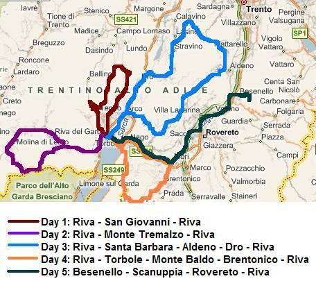
Day 1: Riva del Garda - Arco - San Giovanni - Canale di Tenno - Lago di Tenno - Riva del Garda 40 km
Riva del Garda at Lake Garda, Italy. We are with four. Willem Hoffmans, Marco Duiker,
Ron van Dijk and me. The idea is simple. Making day trips on our mountain bikes.
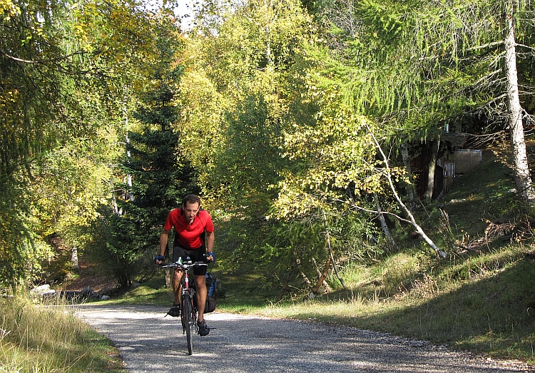
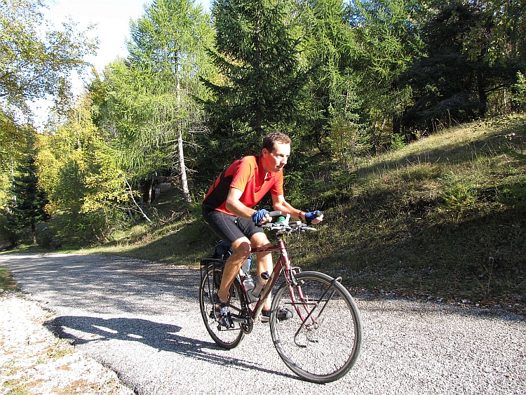
Now there is one little problem: I do not have a mountain bike with me but my touring bike.
My touring bike has never let me down so far, so we must be able to make it work with a bit
of improvising. We will see.
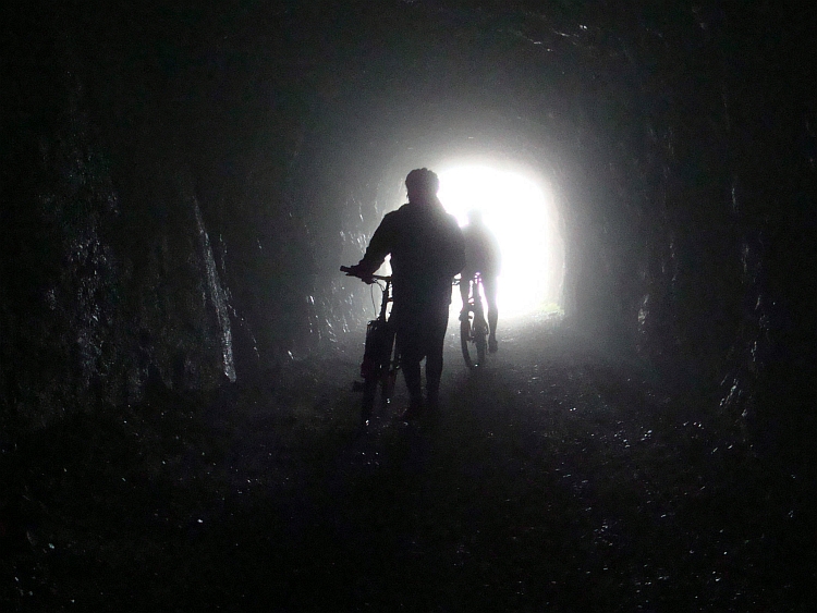
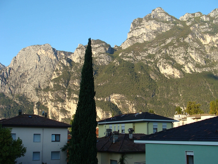
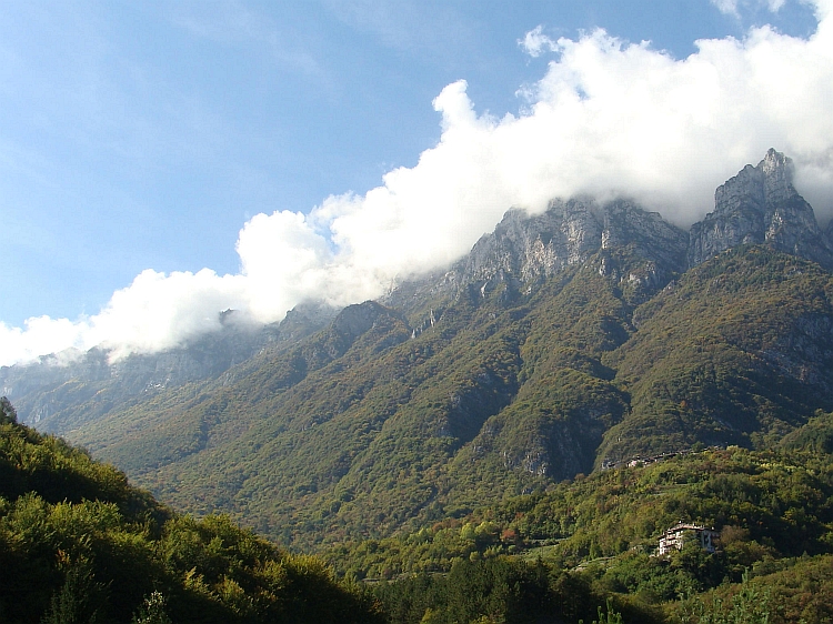
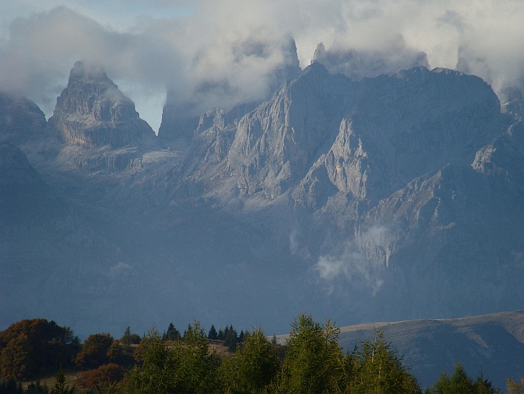
The lake Garda is the mountain bike paradise of Europe and there are many roads that lead up
into the mountains. Some of these roads are a challenge and some roads are a major challenge.
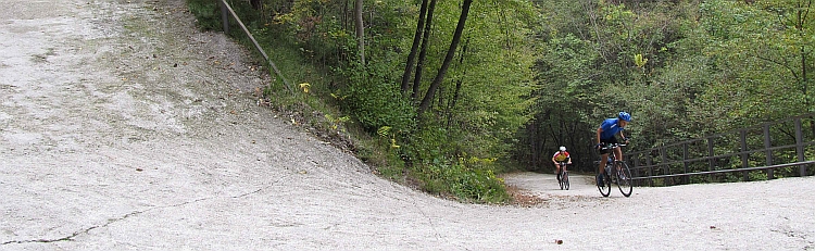
And then there is one tremendous challenge: the Scanuppia, a concrete road that is
leading upwards from Besenello to the small natural area of Scanuppia, which is the steepest ascent
of Europe and maybe the steepest ascent of the World. Reports speak of gradients of 45 %. Whether
it is possible to actually cycle there remains a mystery, yet there seem to be people who have made it.
And so I would be able to do so myself, I try to convince myself. And while we are around now,
we may just as well give it a try.
But we will see whether or not we will try to go up the Scanuppia later. Today is our
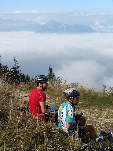
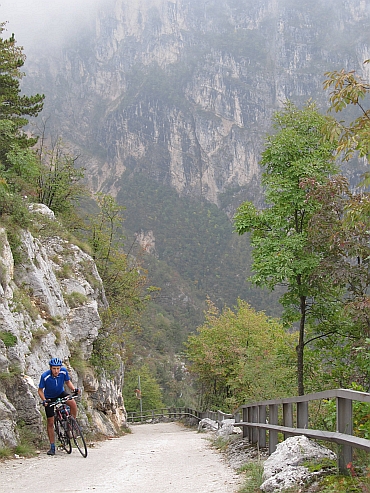
first engagement with the mountains around Lake Garda. We cycle to Arco, where
a steep asphalt road leads steeply up to San Giovanni, over one thousand meters higher
than Arco. Willem and Ron have got mountain bikes and have minor disadvantage on paved roads
like the one w eare going up now. I have just returned from a roundtrip in the Pyrenees on a
fully loaded bicycle and for me it feels like a relatively easy job to climb with no more
luggage than one small bag only. It is a gray October day, but it does not rain. However,
up above it is pretty cool. Where it is still summer around Lake Garda, at this altitude
autumn has already arrived. Below all the leaves of the trees are still green but here most
trees are adorned in autumnal colors.
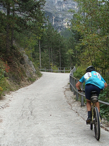
We are having lunch in San Giovanni. From there it is only a few minutes before we are on the
top at 1.137 meters altitude. The descent takes us over a small mountain bike path and it
appears that my touring bike is not the ideal choice for this terrain. Actually it is not so much
that a touring bike cannot handle the bumpy road but it is the state of maintenance that is
inadequate. There is quite some movement between the headset and the stem. The result is that
I do not feel safe with the continuous shocks that my bike has to endure. Moreover, I am sitting
very upright on this bike and that is not an advantage on the steep descent. It must be possible
to go down well without maountain bike. Marco is proving that you actually can go down fast and safe
here. In fact it is not a very difficult trail. So I go down slowly but I am going down at least.
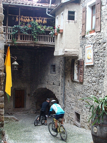
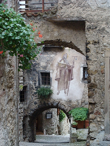
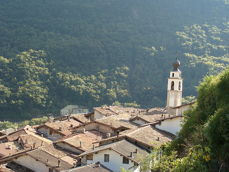
We achieve to reach the charming village of Canale di Tenno, where we are back on pavement.
We make an additional ride to Lago di Tenno where we round the lake. Then we go down to
Riva. That was it for the first day.
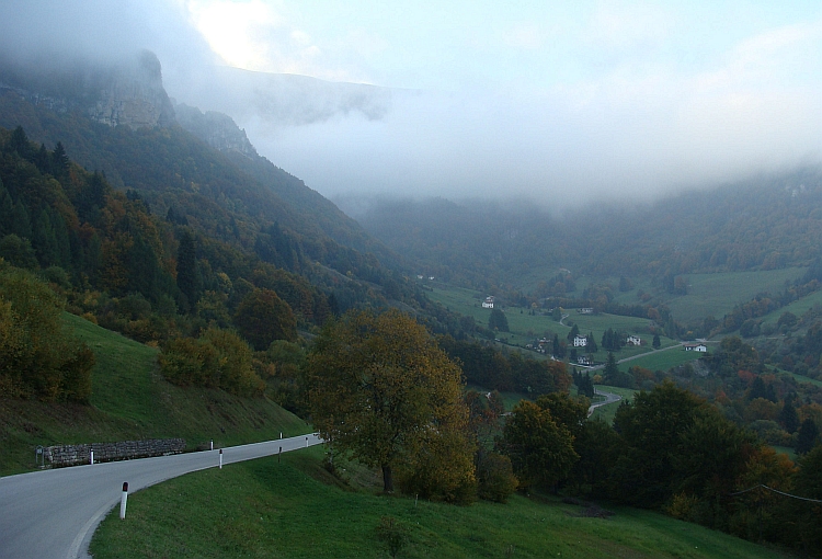
Day 2: Riva del Garda - Molina di Ledro - Monte Tremalzo (1827 m) - Tiarno di Sopra - Lago di Ledro - Molina di Ledro - Riva del Garda 67 km
Today we want to cycle up to the Monte Tremalzo, a climb of almost 1800 meters altitude difference,
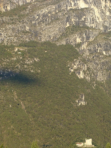
starting in Riva del Garda. The Monte Tremalzo is one of the high, steep, rocky mountains west of
Lake Garda. The first part of the ride I have done before on my bicycle journey from 2009 to
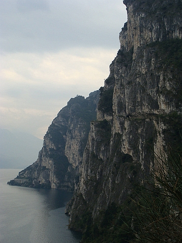
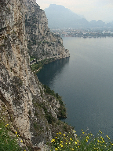
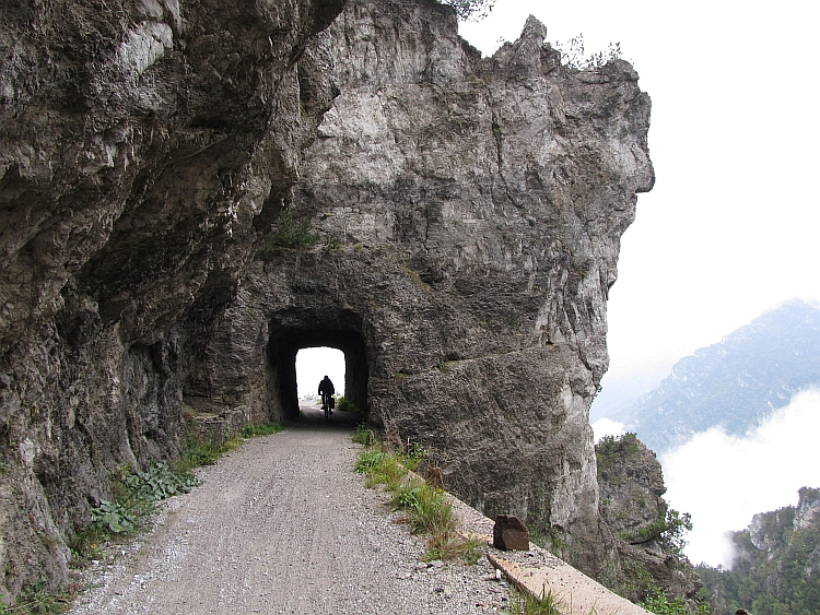
Sicily. Then I descended from the Lago di Ledro to Lake Garda on a mountain bike trail that
seemed to be hewn in the vertical rock wall, right above Lake Garda. Now we cycle on the same
way up.
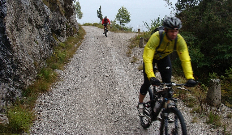
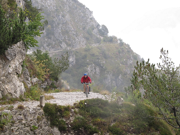
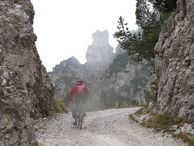
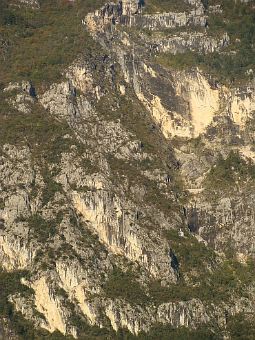
The road is obviously unsuitable for people with vertigo. The views are spectacular.
The road is unpaved but not difficult. Only after having climbed a few hundred meters above the
lake, the road bends away from Lake Garda and reaches the asphalt road which leads to the Lago di Ledro.
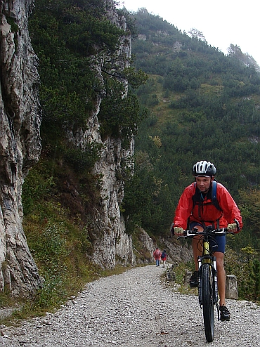
We do not follow the tarmac however but a well maintained mountain bike trail. The concrete passages
are sometimes abominably steep. It is difficult to overcome the passages and if you do not
succeed, you must be react swiftly or otherwise you will fall on the ground.
After having overcome some very nasty passages, we arrive at Molina di Ledro. We continue
to cycle up a steep tarmac road, which after a kilometre turns into a concrete road.
We know already what that change means: that it is going to be really steep. And indeed,
we can release all excess energy on passages of 30%.
This is a taster of what will await us as we will try to go up the Scanuppia. The final 30 % passage is slightly longer
than the passages before. In three hundred meters we must conquer no less than one hundred
meters of altitude difference in one terrible passage. An additional difficulty is the beginning
of a prolonged rain period. The road is already wet. Fortunately, the concrete has a good grip,
even for those without MTB - Marco and me. To go up these steep roads in the rain may not be
impossible, to go down may be another story. Thirty percent slopes on wet pavement, that is
asking a lot of my V-brakes.
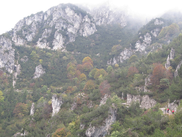
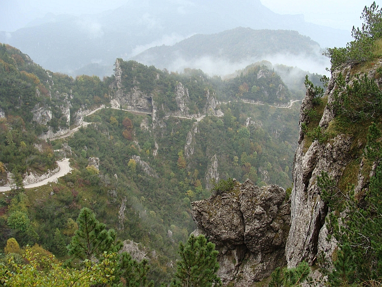
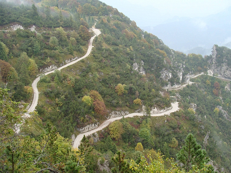
We have conquered all the steep passages now. We reach a ridge. The road winds around both
sides of the ridge, at an altitude of about 1.200 meters altitude. The ridge leads to the
base of the Monte Tremalzo. This is evident from the map, we cannot see as the rain deprives
us from the view of the mountain. At the end of the ridge is a mountain cabin, where we have
lunch and find shelter.
Another six hundred meters altitude difference to go. It is raining harder than before, much harder.
The weather will not improve any more. Not today, that is clear. The question is whether it
is better to wait until it rains a bit less hard or whether it is better to just go on.
Shall we go up to the Monte Tremalzo and go down on the gentle paved road on the other side? Or
shall we go down the steep road that we came? Hoping against all odds and group indecision are
time consuming. When it is still raining hard half an hour later we find oureselves riding up
anyway. We have already had the steep passages on the way to the refuge but that does not mean
that it is easy now. A rough paved road is winding up with gradients of around 10%. The thin
wheels sometimes slip on sandy passages or on the slippery surface of the stones. Here
Willem and Ron have got advantage with their mountain bikes. Marco and I are going strong too.
Despite the rain I have a good concentration and make few technical slippers. It is getting
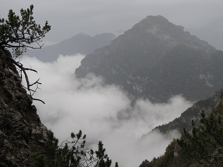
increasingly colder. Despite the rain clouds the views are spectacular. The landscape is steep and
even with limited visibility and the cold, rainy conditions it is great to be here. The autumn
colors of the trees even makes it a frivolous, colorful affair.
What is now becoming a problem is time. Or rather the lack of time. It is 4 o'clock now and
we still have not reached the pass. We have still two hours of light but after the climb we also
have to descend 1800 meters. No talking but just keep on cycling, that is the motto here.
Just before the pass we see that we do not have to climb all the way to the pass. There
is a tunnel just below the pass. A continuation of the road to the pass would not have been
possible here. On either side of the pass are steep cliffs.
After the passage of the tunnel we go down and after a few miles we reach the Rifugio Garibaldi and at the same
time we reach the paved road. Now it is a piece of cake. We go down to the Valle d'Ampola, over one thousand
meters below the Monte Tremalzo. Marco has almost worn down his brakes, at the end of the descent
the power of the brakes is therefore very limited. We intend to do something about it but first we
descend over the gentle road to the Lago di Ledro. We are rushing head over heels through the rain
towards the lake. Then along the lake to Molina di Ledro, where the descent slowly begins again.
Marco is riding ahead and is decreasing with ultra high speed. He has shown some guts yesterday,
but I think he is pushing things a little bit too far now. Hastily Marco rushes off to the first
hairpin. Then Marco clicks the right leg from the pedal and he pushes his foot forcefully against
the asphalt. Sparks are flying. Only now Marco looses velocity. Groaning and moaning the bike stops.
Willem, Ron and I stop too now. "What's going on?" "The brakes - they do not work! "Marco did not
see that the descent was initiated and he did not know that the brakes were gone completely. Only
using his foot as a brake, the bike was able to slow down and Marco was just able to round the
hairpin. That was kind of a shock. We do not have spare brakes but we adjust them so that there is at
least a little bit of brake power. Good enough to go down the last part of the descent safely.
Meanwhile, my pads also need replacing and the headset has got more slack than it already had.
We will settle that tomorrow. Now go down first. It is dark now. Visibility is happily
good enough to safely descend. We achieve to finish the downhill on the mountain bike trail
that we went up this morning and we ride down into Riva. A sense of relief. It was a versatile
day. The steep concrete passages, the stoney trail, the rain, the descent with the brakes of
Marco, the descent into the dark. But we have accomplished and that is enough reason to be
enjoying a good bottle of wine.
Day 3: Riva del Garda - Arco - Santa Barbara (1160 m) - Codelo - Rifugio di Viato ( 1557 m) - Dro - Arco - Riva del Garda 108 km
After our operations on the Monte Tremalzo, we had a repair day yesterday so today we have
bikes with new pads, a new chain, adjusted headsets and everything that is loosened we have
tightened again and the various slacks have been fixed as good and as bad as can be. In short
we have prepared our bikes for a new challenge. But not ourselves yet. Marco is sick and is
forced to remain at home.
Willem, Ron and I opt for a slightly easier day than yesterday. That means:
we limit ourselves to pavement today. We climb over one thousand meters to Santa Barbara, on a climb
with gradients that are continuously around 10 % with peaks of up to 15 %. It is the first sunny day
and we have beautiful views from the pass. We descend on the northeast side, climb to a new pass
and drop a thousand altimeters to Codelo, where the second major climb begins. A climb of almost
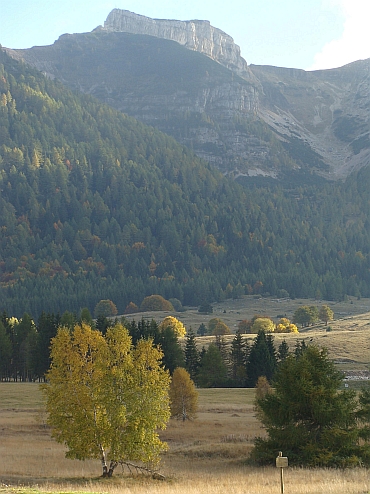
1.300 meters altitude difference brings us to the Rifugio di Viato. Today we see the autumn scenery
for the first time in a beautiful, low lying sun. The views are spectacular on the Dolomiti di Brenta.
The sun plunges the dolomite cliffs in warm colors that contrast sharply with the cool blue and violet shadows.
We descend for miles and eventually cycle back to Riva, where we arrive just before dusk.
Day 4: Riva del Garda - Torbole - Monte Baldo / Rifugio Chiesa (2,078 m) - Brentónico - Riva del Garda 60 km
We are leaving late, at 12 o'clock. Ron, Willem and I are cycling Along Lake Garda to Torbole.
Marco is still sick and stays home. I am having a cold but I am healthy enough to go. I can always
turn back whenever I want. At Torbole begins a steep climb to 1.700 meters altitude. That is an
altitude difference of over 1600 meters. With an average gradient of 10 % this is serious work.
Immediately after Torbole, the road goes up steeply. Because of the effort the symptoms of the cold
are diminished considerably. In fact I feel much better now. Hairpin after hairpin the road
climbs up the flanks of the mountain. Then the road shifts south and a new bunch of hairpins swing
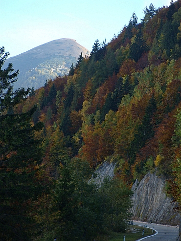
upward. Far below us lies the lake. We climb above the autumn line, the line at about 1000 meters
altitude where a wonderful world around us is painted in autumnal colors. Occasionally we pass
alpine meadows, then we climb through the trees. After 1200 meters height, the road is steeper
with gradients of up to 20 %. From 1450 meters height, the steep road turns unpaved and requires an
utmost effort to get the pedals around. Ron and Willem can pedal a little lighter on their mountain bikes
and slip a little less due to their thick tyres.
We reach the end of the road at 1.700 meters altitude. Ron and Willem will do a difficult
downhill on their mountain bikes. I have a different challenge in mind. I will drag my bicycle
over the footpath to the Monte Baldo, where I will descend on the road at the other side.
It is hard work pushing the bike. The footpath is getting narrower and is almost completely
overgrwon at some places. I simply cannot turn around any more. This is a really bad idea
to do this. The annoying muddy footpath takes a lot of power. After half an hour I have finally
finished the trail through the woods and I am standing on a grassy meadow, on top of
a small ridge. I am out of trouble now. I can even cycle here.
Then the final climb starts. A steep stoney path leads up. I have to walk again. It is difficult
to constantly lift the bike and keep going up the steep trail but finally I reach the Rifugio di
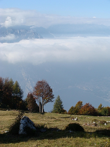
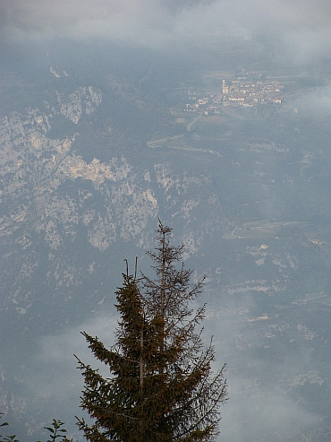
Chiesa on the top of the mountain. I am standing 2.000 meters above Lake Garda, deep down below.
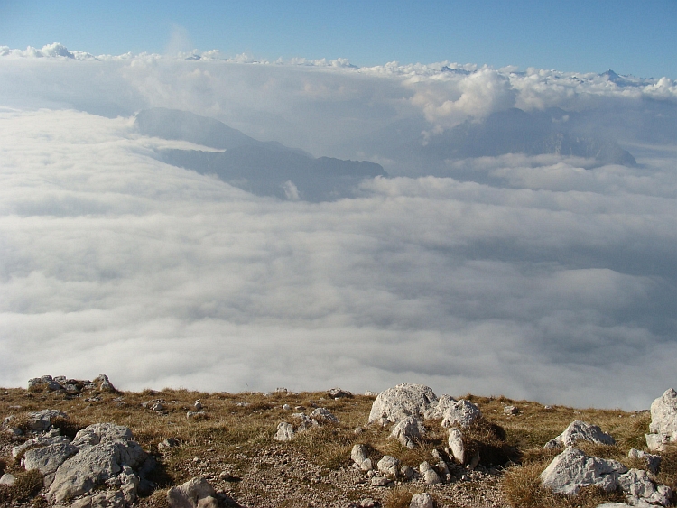
More than one thousand meters below me is a cloud layer that obstrutcts views to Lake Garda
but the views are equally impressive this way.
The good news is: I can go down now. The bad news is that the road is very bad, consisting of
fist-sized stones with layers of rock in between that sometimes tower a decimeter diagonally out
of the road, usually in opposite direction than mine. The road poses severe blows against me and my
bicycle. Slowly I go down and I am thinking how much easier this would be on a full suspension mountain bike.
The road leads over steep grassy slopes to an in-between pas where the road is paved again. At the same time
I descend into the clouds. It is 5 o'clock now. There is only one hour of daylight left and surrounde by the
clouds it is quite dark already. I am hurrying down, I have still quite some kilometres to overcome and
later on there will be some flat and some climbing kilometres as well. In Brentónico I improvise a
route down across small farm roads between the vineyards and over an ultra-steep descent I descend into
the broad valley between Rovereto and Lake Garda. I am cycling at max power through the valley
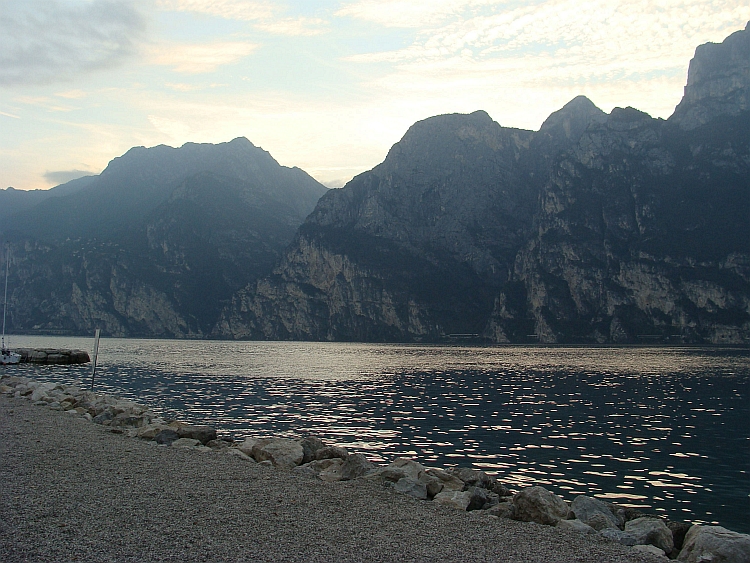
and then up to a minor pass. Then it is only downhill to Lake Garda. I reach Torbole. It is dusk now
as I am riding across the bike path along Lake Garda to Riva. The vistas over Lake Garda
in the twilight are stunning and the steep mountains of the Monte Tremalzo are truly impressive.
Day 5: Besenello - Scanuppia / Malga Palazzo (1,580 m) - Besenello - Rovereto - Riva del Garda 48 km
The last day of the holiday. As we are having breakfast, the discussion is starting up. "Are we
doing the Scanuppia today?" It is a question that can be answered with a simple yes or no but
apparantly everybody approaches the subject in a very careful way. After half an hour there is
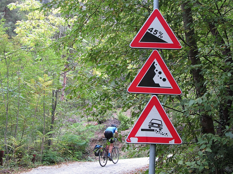
still nothing close to a decision. The hesitations are quite understandable as the Scanuppia is
known as the hardest climb in Europe or at least the toughest paved climb. Rumors are that there
are passages with a slope of no less than 45 %. The climb is not only steep, there are also many
altitude meters to overcome. The concrete road climbs from 198 meter altitude over a concrete road
up to 1.515 meter altitude. Subsequently a dirt road is leading a few dozen meters further up to the
Malga Palazzo. That is more than 1.300 meter altitude difference. Ron is the first who honestly explains
that he will rather cycle a different route, one where you actually know that you will reach the top.
Willem wants to try to cycle up but he is hesitating because of the forty kilometres to the start of
the climb in Besenello that have to be cycled twice. I am having a severe cold and for the second
consecutive night I have hardly slept. Still I want to try the Scanuppia, yesterday I hardly had any
problems because of my cold. Marco is still a bit sick but he wants us to drive the bus to the start of
the Scanuppia climb. So Willem, Marco and I are riding by bus to the village of Besenello, at
the foot of the Scanuppia. Neil Young sings with a cracking, raucous voice through the speakers:
"Hey Hey, My My, Rock and Roll Will Never Die." Neil sounds grinding and foreboding but in the end
the euphoria prevails. Probably this is the best that can happen to us too on Scanuppia.
We park the bus at the church of Besenello and prepare the bikes. And ourselves. Especially
mentally. Marco teasingly asks whether we are enjoying ourselves. "Well uh... uh... well... I think so."
To our surprise, Marco is putting on his bike clothes as well. He will ride the first part up with us
for a bit of mental assistance. So it happens that the three of us are cycling up on the paved road to
the Scanuppia. The road goes up steeply from the very startbut we know that only after the infamous bridge
hell will ultimately break loose, as the asphalt is replaced by concrete. Thereafter 1,200 meters have to
be climbed in 6 kilometres, an average gradient of 20 %. That is two to three times as steep as the
Mont Ventoux or Alpe d'Huez. The challenge is really the only reason why we go up here. The weather
is gray and most of the route is wrapped in clouds. If we are unlucky, it may also be raining soon.
We cycle along a trench and the river stabbing. "The Bridge", I realize with a shock.
Within a second I see the road change from asphalt to concrete, I see a sign prohibiting all
except local traffic, a prohibition sign for cyclists, a warning sign of slopes of up
to 45 % and I see the road going up incredibly steep. The show begins. Because I am
sitting relatively upright on my bike, I must bend as much forward as possible to
prevent myself from falling backwards. I notice that that is not sufficient and there is
no alternative but to stand in the pedals while hanging as far forward as possible. The
lowest gear of my bike is not sufficient and with agonizingly slow rotations I am pushing my
bike forward against the mountain. My bike is not the youngest anymore and my frame is
squeaking and creaking under the constant forces that it is subjected to. Marco and Willem
have slightly lower gears but still it looks very unnatural to see people cycle so slow with such
few rotations.
The concrete road has got a good grip, that is the good news, but the road is very
narrow. The passages are getting a little steeper, and we are all making curves across the narrow
road to minimize the gradient. This is technically more difficult and power transfer
is considerably harder, especially on the steepest parts where I cycle in standing
position. Sometimes I have to bend forward so much that my head is right above my front wheel
to prevent me and my bike falling backwards. Speeds of 3 to 4 kilomtres per hour are normal on the steeper
sections. we are constantly on the verge of collapse. I am cycling on the top of my breathing.
A minor technical error is enough to force a stop, which is in itself a technical challenge.
It is important to avoid a fall sideways or a high-speed roller backwards.
After one kilometre, gradients are even worse than they already were. Occasionally, someone
has to stop, whixh poses new technical challenges. If possible, youmust go on. It is not easy
to start after a stop. After a difficult passage I wait for Marco and Willem. I hear a scream
and a bang. I cycle back. I see that Marco has fallen. He is not injured but for
Marco it is a signal to quit. Because of a recent history of a severe knee injury Marco had
not planned to go up the Scanuppia whatsoever, especially after being weakened by the prolonged
cold. Marco takes the brave decision that it is better to stop now. It would be a shame to be
thrown back into the recovery process.
While Marco is riding back, Willem and I go further. I must once again overcome the steep passage.
After the relative calm in a hairpin the steep passage is followed by a new killing passage.
If that one is overcome as well, I am dead broken. I ask myself whether I still feel like
going up all the way but I leave the question. If I let these thoughts grow, I will turn around
immediately and follow Marco downhill. So I continue to struggle up yet another severely steep
passage. Then we finally reach a shoulder in the landscape. We have overcome the climb out of the
cliffs and we have put the most difficult part of the climb behind us. The last kilometre was
26 to 27 % steep. Now the road is flat for a little while. It is possible to catch our breath back.
Then the road goes up again, with 10 to 15 %. That is a lot less steep than we are used to and it seems
like we are cycling on a flat road. Slowly but surely, however, the road steepens again. We ride into
the clouds, damp and cold. I am having quite a severe cold and the cold, damp atmosphere is hurting me.
Although not as extreme as the first two kilometres it is still so steep, that I need to stand
and hang forward again most of the time. Cycling is much harder in a standing position than in a
sitting position and I am dead tired of the extreme exercise and the cold. Willem is able to
remain in sitting positions most of the time because his bike allows for more forward bended
positions. Willem is also able to cycle more slowly because his lower gear is lighter
than mine. So I am cycling faster but Ihave to stop more frequently. In the end we have the
same pace. On the lighter stretches I am able to sit but I must be bending forward as far as possible.
I am willing to take the risk of falling back. Every turn of the pedals my front wheel looses contact
with the ground slowly and slowly and surely I need to put my front wheel back on the ground, an
extremely unstable and risky way of cycling, but still better than the agonizing exercise of
cycling in standing position.
We are passing a tiny settlement and continue cycling up through the forest. The road surface is wet but
has sufficient grip, except in places where leaves or sand are lying on the road. A small slip of the wheel
immediately causes a planned or an unplanned stop. Oddly enough this is a constant threat but in the end
it rarely happens that I am slipping away so much that immediate countermeasures are necessary. The
biggest problem is actually the larger stones. With these low velocities to simply ride over a stone
causes a temporary higher gradient and so an immediate lift of the front wheel and at the
same time a decrease in the already low speed. Several times this causes an unplanned stop and
so the difficult task of getting myself in motion again. Willem is enjoying this more than I but
we both do not want to give up now that we have come so far. The last kilometre is the hardest
since the first two kilometres of the concrete road but we feel that we are going to make it.
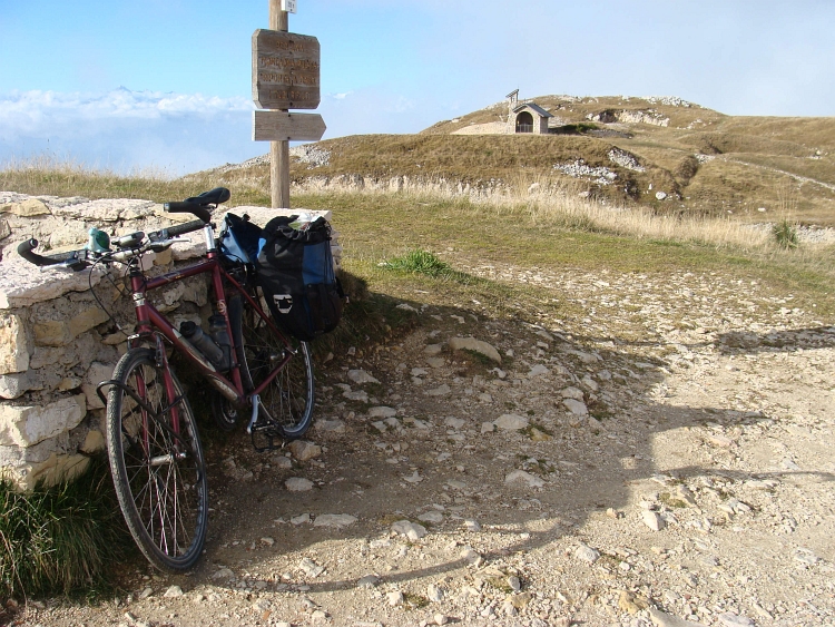
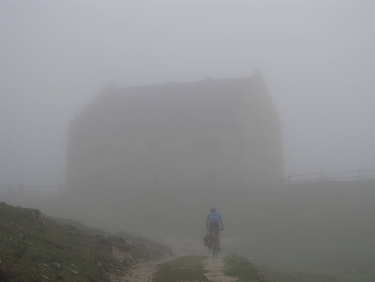
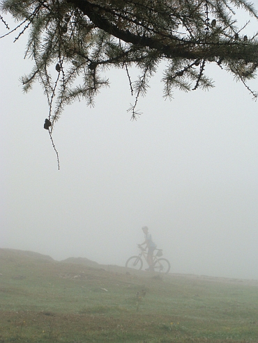
Finally we see the barrier, the end of the concrete road. We decide to cycle on to the
Malga Palazzo. We are cycling on a stone road now, steep initially but soon flattening and
eventually completely flat. We cycle out of the forest and ride into an alpine meadow where we see
the vague shape of a mountain hut in the dense fog. The Malga Palazzo. We have made it! We
make some moody pictures in the fog. It is too cold to linger on here and we start to go down
again.
I was not actually looking forward to the downhill but my V-brakes appear to have sufficient
braking power, even on the wet surface of the road. We do not cycle faster than walking
pace but that is not a problem as we have to descend nomore than six kilometre this way until we
reach the asphalted road. All in all, the descent goes fairly quick. I am having continuous
pain in my hands and fingers during the descent but during the climb every part of my body was in pain.
In fact I am contented with the fact that not all body parts are hurting now. We go down on the
steepest sections now. We pass the bridge and return to the asphalt. We fly down to Besenello.
Now it is forty comparitively flat kilometres back to Riva. We are cycling through the
wide valley of the Adige to Rovereto. I find myself dead broken and I am far from feeling good.
The cold and the absurd climb of Scanuppia have paid their toll. Maybe it was not a good idea
to do the climb with my bad cold but nevertheless we succeeded. We cycle up to a small pass between
the valley of the Adige and Lake Garda. The climb is not difficult at all but it still takes
quite an effort now. We reach the top and we only have to descend to Lake Garda below.
Sick and coughing, wheezing and cracking, but above all deeply satisfied we cycle into Riva.
It is over now.

 We do not follow the tarmac however but a well maintained mountain bike trail. The concrete passages
are sometimes abominably steep. It is difficult to overcome the passages and if you do not
succeed, you must be react swiftly or otherwise you will fall on the ground.
We do not follow the tarmac however but a well maintained mountain bike trail. The concrete passages
are sometimes abominably steep. It is difficult to overcome the passages and if you do not
succeed, you must be react swiftly or otherwise you will fall on the ground.
 It is hard work pushing the bike. The footpath is getting narrower and is almost completely
overgrwon at some places. I simply cannot turn around any more. This is a really bad idea
to do this. The annoying muddy footpath takes a lot of power. After half an hour I have finally
finished the trail through the woods and I am standing on a grassy meadow, on top of
a small ridge. I am out of trouble now. I can even cycle here.
It is hard work pushing the bike. The footpath is getting narrower and is almost completely
overgrwon at some places. I simply cannot turn around any more. This is a really bad idea
to do this. The annoying muddy footpath takes a lot of power. After half an hour I have finally
finished the trail through the woods and I am standing on a grassy meadow, on top of
a small ridge. I am out of trouble now. I can even cycle here.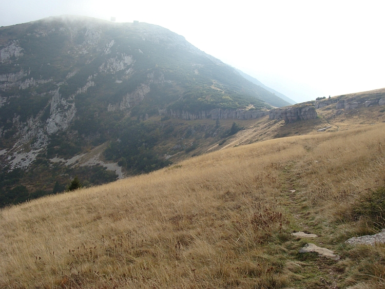
 We cycle along a trench and the river stabbing. "The Bridge", I realize with a shock.
Within a second I see the road change from asphalt to concrete, I see a sign prohibiting all
except local traffic, a prohibition sign for cyclists, a warning sign of slopes of up
to 45 % and I see the road going up incredibly steep. The show begins. Because I am
sitting relatively upright on my bike, I must bend as much forward as possible to
prevent myself from falling backwards. I notice that that is not sufficient and there is
no alternative but to stand in the pedals while hanging as far forward as possible. The
lowest gear of my bike is not sufficient and with agonizingly slow rotations I am pushing my
bike forward against the mountain. My bike is not the youngest anymore and my frame is
squeaking and creaking under the constant forces that it is subjected to. Marco and Willem
have slightly lower gears but still it looks very unnatural to see people cycle so slow with such
few rotations.
We cycle along a trench and the river stabbing. "The Bridge", I realize with a shock.
Within a second I see the road change from asphalt to concrete, I see a sign prohibiting all
except local traffic, a prohibition sign for cyclists, a warning sign of slopes of up
to 45 % and I see the road going up incredibly steep. The show begins. Because I am
sitting relatively upright on my bike, I must bend as much forward as possible to
prevent myself from falling backwards. I notice that that is not sufficient and there is
no alternative but to stand in the pedals while hanging as far forward as possible. The
lowest gear of my bike is not sufficient and with agonizingly slow rotations I am pushing my
bike forward against the mountain. My bike is not the youngest anymore and my frame is
squeaking and creaking under the constant forces that it is subjected to. Marco and Willem
have slightly lower gears but still it looks very unnatural to see people cycle so slow with such
few rotations.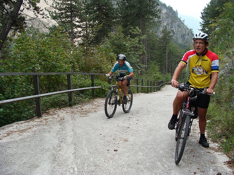
 We are passing a tiny settlement and continue cycling up through the forest. The road surface is wet but
has sufficient grip, except in places where leaves or sand are lying on the road. A small slip of the wheel
immediately causes a planned or an unplanned stop. Oddly enough this is a constant threat but in the end
it rarely happens that I am slipping away so much that immediate countermeasures are necessary. The
biggest problem is actually the larger stones. With these low velocities to simply ride over a stone
causes a temporary higher gradient and so an immediate lift of the front wheel and at the
same time a decrease in the already low speed. Several times this causes an unplanned stop and
so the difficult task of getting myself in motion again. Willem is enjoying this more than I but
we both do not want to give up now that we have come so far. The last kilometre is the hardest
since the first two kilometres of the concrete road but we feel that we are going to make it.
Finally we see the barrier, the end of the concrete road. We decide to cycle on to the
Malga Palazzo. We are cycling on a stone road now, steep initially but soon flattening and
eventually completely flat. We cycle out of the forest and ride into an alpine meadow where we see
the vague shape of a mountain hut in the dense fog. The Malga Palazzo. We have made it! We
make some moody pictures in the fog. It is too cold to linger on here and we start to go down
again.
We are passing a tiny settlement and continue cycling up through the forest. The road surface is wet but
has sufficient grip, except in places where leaves or sand are lying on the road. A small slip of the wheel
immediately causes a planned or an unplanned stop. Oddly enough this is a constant threat but in the end
it rarely happens that I am slipping away so much that immediate countermeasures are necessary. The
biggest problem is actually the larger stones. With these low velocities to simply ride over a stone
causes a temporary higher gradient and so an immediate lift of the front wheel and at the
same time a decrease in the already low speed. Several times this causes an unplanned stop and
so the difficult task of getting myself in motion again. Willem is enjoying this more than I but
we both do not want to give up now that we have come so far. The last kilometre is the hardest
since the first two kilometres of the concrete road but we feel that we are going to make it.
Finally we see the barrier, the end of the concrete road. We decide to cycle on to the
Malga Palazzo. We are cycling on a stone road now, steep initially but soon flattening and
eventually completely flat. We cycle out of the forest and ride into an alpine meadow where we see
the vague shape of a mountain hut in the dense fog. The Malga Palazzo. We have made it! We
make some moody pictures in the fog. It is too cold to linger on here and we start to go down
again.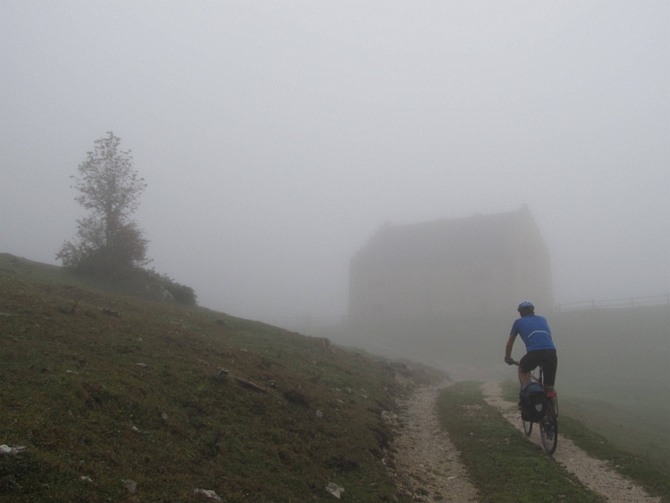
 pain in my hands and fingers during the descent but during the climb every part of my body was in pain.
In fact I am contented with the fact that not all body parts are hurting now. We go down on the
steepest sections now. We pass the bridge and return to the asphalt. We fly down to Besenello.
Now it is forty comparitively flat kilometres back to Riva. We are cycling through the
wide valley of the Adige to Rovereto. I find myself dead broken and I am far from feeling good.
The cold and the absurd climb of Scanuppia have paid their toll. Maybe it was not a good idea
to do the climb with my bad cold but nevertheless we succeeded. We cycle up to a small pass between
the valley of the Adige and Lake Garda. The climb is not difficult at all but it still takes
quite an effort now. We reach the top and we only have to descend to Lake Garda below.
Sick and coughing, wheezing and cracking, but above all deeply satisfied we cycle into Riva.
It is over now.
pain in my hands and fingers during the descent but during the climb every part of my body was in pain.
In fact I am contented with the fact that not all body parts are hurting now. We go down on the
steepest sections now. We pass the bridge and return to the asphalt. We fly down to Besenello.
Now it is forty comparitively flat kilometres back to Riva. We are cycling through the
wide valley of the Adige to Rovereto. I find myself dead broken and I am far from feeling good.
The cold and the absurd climb of Scanuppia have paid their toll. Maybe it was not a good idea
to do the climb with my bad cold but nevertheless we succeeded. We cycle up to a small pass between
the valley of the Adige and Lake Garda. The climb is not difficult at all but it still takes
quite an effort now. We reach the top and we only have to descend to Lake Garda below.
Sick and coughing, wheezing and cracking, but above all deeply satisfied we cycle into Riva.
It is over now.