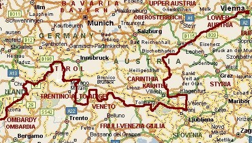
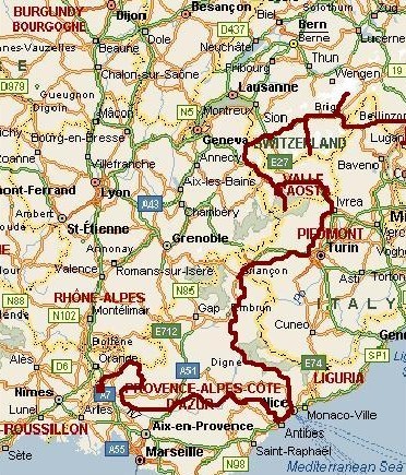
Austria, Slovenia, Italy, Switzerland and France - Cycling from Vienna to Nice & Avignon
Day 0: Vienna - Wienerwald 34 km
"Free hug." The first thing we see as we get out if the train is a student
who is waiting for arriving travellers to give free hugs. We both get a good hug. Welcome in Vienna!
Vienna is the start of a new cycle journey. I want to cycle from Vienna to Nice,
a complete crossing of the Alps from east to west. Then I have to cycle a bit further
to Avignon. About five weeks the cycle bus wil bring me back home. Jeroen will join me two weeks.
In Landeck Jeroen will return home.
It is about two o'clock in the afternoon as we have loaded our bicycles. It is a sunny
day, the first one in a long time. We are cycling through the streets and lanes of
the center of the grand city along the Danube, the city where Mozart, Beethoven, Schubert and
Mahler had lived. Vienna is a nice city for cyclists. Over the narrow cycle lanes we
are zigzagging between the baroque houses. We pass Karlskirche and the Stephansdom. A brief
visit to the Danube is not too inspiring. The river is led through a straight canal and the view
is dominated by a huge industry complex. We go back west to find a camping. We cycle
back to the city center and then up to the hills of the Wienerwald. The way up is not
too steep but therefore also very long. We are climbing a few kilometres through the city now.
The atmosphere in the outskirts of Vienna is still pleasant but we are hopelessly lost. Luckily a man gets out
of his car to help us. He offers to drive before us so that we can follow him to the
right direction. He leads us through the labyrinth. We are very lucky to have met him;
maybe we would still be twisting and turning to find a way out. Within twenty
minutes we are at the camping in Wienerwald, just out of the city.
Day 1: Wienerwald - Purkersdorf - Hainfeld - St Aegyd - Kernhof 103 km
The first kilometres we still ride along a regional road but soon we find ourselves on
ever smaller winding roads. The region is only sparsely populated. So close to the
big city of Vienna the green hills of Wienerwald are a delight of tranquillity. We
cross several hill ranges. For the first ranges we have to climb between one hundred
and three hundred meter. Sometimes there are very steep stretches of 18 to 20 %.
Ever higher hills are looming up. The last ascent is the longest. From Hainfeld
we go up to Kalte Kuchl, a big meeting point of motor cyclists. We climb a bit further
to the Ochsattel, a pass of 864 meter. We descend to St Aegyd and ride in the
direction of the next hill range. Or is this a mountain range? We feel tired in the meantime.
We have climbed a lot for a first day and we have cycled hundred kilometre. Just as
we discuss the issue, we ride along a camping. Five minutes later we lie in the grass of
the campsite in Kernhof. I look at the hills around us. They seem to hold a promise. Today
was a wonderful overture. I am looking forward to being more than a month between my beloved mountains.
Day 2: Kernhof - Mariazell - Lunz - Göstling a.d. Ybbs - Großreifling - Admont 34 km
I am the first to wake up. I cycle a kilometre back to the village of Kernhof to buy
some fresh bread. After having breakfast we leave Kernhof for the ascent to the hill
range that divide us from Mariazell. Unlike yesterday the sun is hiding behind the clouds.
Soon it starts raining. As we arrive at the pass, it is raining heavily. We find shelter
in a typical Austrian Stube. It is best to wait untill the rain is over. After an hour
the rain is reduced to a dull drizzle; we decide to go on again.
After a short descent we climb over an unpaved road to the Krombachsattel, a second
pass. The descent is much longer. The road leads through scenic dark woods. By the
time we reach the Hubertussee, the rain is more or less over. Mists are still hanging
among the high hills around the lake. The grey cloud cover is still intact. The
weather will not change for the better today.
Mariazell is the kind of place, that the Austrians are fond of. Restaurants have
names like "Schwarzer Adler", every shop sells Mozartkugeln. The Pope has planned
a pigrimage to the big church of Mariazell. A tourist trap of the first order. A place
to love and to despise. We cycle further to the pretty Erlaufsee. A relatively long,
steep ascent brings us to the Zeller Rain Pass. We go down to Lunz. Along the Salza river and
the Enns river we go further southwest. We are surrounded by the huge limestone
cliffs of the Hochschwab and the Ennstaler Alpen, the first mountains above
2.000 meter.
Another ascent and another descent bring us in the Gesaøuse National Park.
New limestone cliffs are towering above our heads. As we climb the Buchauer Sattel it
starts to rain heavily. Just as we arrive the pass the thunder is all around and very nearby.
We have to find shelter. In a farm we find a place under a roof. It takes a long time
before the thunderstorm is over. It is getting later and later but there is no chance to leave the place safely.
As the thunderstorm is reduced to heavy rainfalls a permanent grumble of thunderstrokes
in the distance, I want to leave. Jeroen rather waits untill the rain is over. The rain
does stop however. At eight o'clock we decide to go. It is still raining heavily
as we float into the village of Admont. We are lucky to find a youth hostel.
Day 3: Admont - Lassing - Irdning - Stein a.d. Enns - St. Nikolai - Sölkpass - Murau 107 km
It is raining still, the kind of rain that never seems to end. The mountains are hiding in
clouds. It has no use to leave now. We stroll around in the village, waiting for good weather.
Surprisingly at half pas twelve it stops raining. We decide to leave. My knee hurts a bit
so I am riding slowly. We follow the river Enns so that we have no long ascents. Fifty
kilometre further, at Stein a.d Enns, we reach the begin of the ascent to the 1.790
meter high Sölkpass. At that very time the sun effectively breaks through the
cloud cover. We see that fresh snow has fallen on the peaks of the mountains along
the Enns. The mountains around the Sölkpass are much higher. It could be
very interesting to cycle a bit higher today.
It is half past four now so it is quite late to start a thousand meter ascent, but
we are too curious to wait untill tomorrow. Maybe the snow has melted away by then
or maybe it will rain again. We pass through nice villages and superb alpine
landscapes, gaining altitude effectively. We ride straight towards a wall of
white mountains. The road winds up just before the white wall. The last four
kilometres are very steep. On the pass we are surrounded by snow fields that
are nearly melted away. Higher up the snow cover is still intact. A new rain shower
reaches the pass at the same time as us. A cold wind is chasing over. We hurry down,
leaving the icy rain behind. A long descent brings us into places with better
temperatures. To reach the camping of Murau we have to climb a bit first. It is
half past eight as we reach the camping.
Day 4: Murau - Flattnitz - Feldkirchen - Ossiach - Velden - Wörthersee 117 km
From Murau we are heading south. The long ascent of the Paalgraben brings us in Flattnitz.
The village is spread over a wide valley. The sidevalleys are also wide and open. A
few great peaks rise up. The Eisenhut and other peaks still have snow on the higher
slopes. We reach the pass. There are great sights southwards. In the distance
we already see the steep, dark Karawanken mountain chain, the border mountains
with Slovenia. Jeroen and I will be there soon. It could be possible to
reach the Slovenian border tomorrow afternoon. First we will visit the lakes of
Kärnten.
We pass Feldkirchen and reach the Ossiacher See. Our map shows a small road from Ossiach
across the hills. It proves to be a very small unpaved road indeed and very steep.
The road is nearly too steep to cycle. "The Wall of Ossiach" winds through a dense forest.
In only a few kilometres the road leads to the top of the ridge. We have lost a lot of
sweat on the road , but the scenic chapel on the top of the ridge is a good reward.
A steep descent brings us on asphalt again. The tiny road winds up for another hill
range. From there we descend to Velden along the Wörthersee. A few kilomter further
we find a camping.
Day 5: Wörthersee - Maria Wörth - Klagenfurt - Gallizien - Bad Eisenkapel - Seebergsattel (1.215 m) - Slovenian border - Jezersko - Duplje 121 km
After a few kilometre we pass Maria Wörth. The tiny village is not much more than
two churches on a peninsula in the lake. To reach the churches we pass a bunch of hotels and
restaurants. The sight of the churches against the blue lake surely is one of a poetic
beauty that is recognized by a lot of tourists.
We continue along the lake and reach Klagenfurt, where we buy new brakes for Jeroen. Through
ever changing landscapes of farmlands, woods, hillslopes and wide river valleys, we
reach Bad Eisenkapell, the begin of the ascent to the Slovenian border. To reach Slovenia,
we have to cross the Karawanken mountain chain at the Seebergsattel. Despite the clouds
we have good views of cliffs of the Karawanken. The ascent is relatively easy.
We are in Slovenia! The descent offers great views of the huge towering cliffs all around us.
A very long descent brings us in the wide Sava Valley. We find a beautiful camping
in Duplje.
Day 6: Duplje - Lipnica - Bled - Gorje - Radovna - Kransjka Gora - Vršič Pass (1.611 m) - Trenta 85 km
After a few cloudy days the weather is sunny again. We cycle through the hills over Lipnica
to Bled. The turquoise waters of Lake Bled reflect the green hills and mountains. A church
is mirrored on the water surface. The serenity of the view is not supported by a deep
silence. Boom-boom music escape from passing cars. A few men in grey suits and wealthy
bling bling on neck, wrist and nose are talking loudly before the casino. Big men,
big gestures. They do not seem to discuss the music of Beethoven. We escape the
mafia atmosphere and leave Bled.
It takes only a few minutes to reach the tranquillity of the grand countryside
around Bled. We are heading west in the Radovna Valley. After we have passed the
rural villages, we enter the Narodni Park. The road is unpaved now but not too
steep and the surface is very regular. Through the green, narrow, valley we climb slowly
towards the mighty mountains of the Triglav. Just before we reach the pass, a
magnificent view unfolds. The mountains of Slovenia are all below 3.000 meter but they
certainly seem higher.
The big ascent of the day is not the Radovna Valley however but the climb to the
Vršič Pass. From Kransjka Gora the road goes up along the triglav
mountain range. The pass is 1.611 meter high. The road twists its way up in
25 hairpins. The ascent is highly irregular and gets ever steeper. The last seven
kilometre has got a steepness of 10 % average. In the hairpins there is a highly
irregular surface of stones, which adds up to the difficulty. The grandiose
sights of the rock faces of the Triglav makes this one of the most beautiful ascents of
the Alps. I am having a great time. After reaching the pass a steep descent of 26 hairpins
bring us in the camping of Trenta along the Soča River, a truly great place to
spend the night.
Day 7: Trenta - Predil Pass (1.256 m) - Italian border - Nevea - Carnia - Tolmezzo - Ovaro 113 km
Along the Soča Valley we are heading towards Bovec. The early morning light
is magnificent. The rock walls all around do not fail to impress. Jeroen is cycling
far before me while I am taking picture after picture. These are the excellent moments
why I undertake these journeys.
As we leave the Soča Valley to climb up to the Predil Pass, the magic spell
is not broken. The wild harmony of the landscape is shown in ever new views, in ever new
colors. The ascent is not steep. Within two hours we reach the pass and the Italian border.
A short descent brings us to a pretty lake near nevea, where we have a lunch.
After a short ascent to the Nevea Pass and a long way down to the Fella River finally
the magic spell is broken. We are in the last foothills of the Alps now. The valley
is filled with a highway and a big secondary road. No small roads in lovely side valleys,
just a busy valley with big roads and the filthy, polluted, humid air
of the lowlands of North Italy. The sky is not blue but white but still the sun
is burning. Hot. This is something we just have to go through. We both have the
spirit to go through this as fast as possible. We pass the industrial plains around Carnia
and Tolmezzo. Nearly sixty flat kilometres to reach the first promising side valley in
Villa Santina. We cycle into the green valley and find a camping in the friendly
village of Ovaro. The ugliness is definitely behind us.
Day 8: Ovaro - Val Pesarina - Sella di Razzo (1.780 m) - Auronzo - Col san Angelo (1.756 m) - Misurina 84 km
Clocks. They keep on chiming. As we wake up, Jeroen says he had a very bad nights sleep
due to chiming church bells. There are three churches in the neighborhood and there
is always one that is chiming. Then one is chiming five times, a few minutes later another
one is chiming nine times, then the third is chiming a melody. There must be a hidden
purpose why the bells are chiming the way they do. It certainly does not represent the time;
there must be a much more abstract plot behind it. Sleepy eyed and weary we eat breakfast in
the village. Then we go on our way again. As we leave the village Ovaro,
all the church bells of Ovaro are ringing farewell.
Through the Val Pesarina we continue our journey in the direction of the Dolomites.
The sky is crystal blue and the sun paints the landin bright colours and deep shadows. A string of villages lies scattered
in the green valley. The villages have got a kind of poetic beauty, a serenity, there
is a harmony in the fields, in the woods, in the villages, in the mountains. Everything
is perfect right here right now.
After two hours we reach a series of small passes. At the last pass we have the first view
of the Dolomites. We only have to descend to be among the rock monsters. We descend into
an oven. There is still not a cloud in the air so that the temperature could easily rise to
over thirty degrees. Over a busy, not too pleasant road we cycle to Auronzo. Here
we truly stand amidst the Dolomites. The views over the Zwölferkofel and the Drei Zinnen
are impressive, even though we do not see the Drei Zinnen under the famous angle from here.
What to do? Jeroen wants to stop and I want to continue to Misurina, a village
along a big lake at more than 1.700 meter altitude. That means that we have to climb
in the this heat. After a brief discussion Jeroen gives in and we go on our way. And indeed
it is very hot. The ascent is ever getting steeper and I am kind of exhausted as I reach
Misurina. Jeroen is also tired but the views are great. We pitch our tent on a beautiful spot
and I am glad that we have made the climb today after all.
Day 9: Misurina - Cortina d'Ampezzo - Passo di Giau (2.236 m) - Colle Sta Lucia - Arabba - Passo di Campolongo (1.875 m) - Corvara 86 km
We start the day by descending to Cortina d'Ampezzo through classic Dolomite landscapes.
The cliffs of the Monte Cristallo and the Tofana are bathing in the morning light.
After hanging around in Cortina, we go up to the Passo di Giau, our first pass above 2.000
meter altitude on this journey. The sky is still heavenly blue as we reach the pass. We
have great views in all directions. We are right in the middle of the Dolomites now. All
the classic Dolomite peaks are visible: the wall of the Monte Cristallo, the massive
Gruppo di Sella, the glacier of the Marmolada...
After the descent and a long stretch that goes up and down we have our second big ascent
from Arabba to the Passo di Campolongo. The pass is one of the four famous passes around the Gruppo
di Sella. The big ascent is not so big as we thought however. From Arabba it is only 200
or 300 meter climbing to the pass. From here we only have to go down to reach the camping
of Corvara.
Day 10: Corvara - Passo di Gardena (2.121 m) - Passo di Sella (2.244 m) - Canazei - Mazzin - Passo di Costalunga (1.745 m) - Tiers - Bolzano 102 km
Another day of deep blue skies. The ascent to the Gardena Pass is gorgeous. It is
our second of the four Sella passes. Rock pinnacles are standing before the massive rock wall
of the Gruppo di Sella. The second pass of the Gruppo di sella is not much more difficult
than the Passo di Campolongo yesterday. Within an hour we are looking down in the Gardena
Valley on the other side of the pass. We descend a little and turn left towards the
Passo di Sella, the third Pass around the Dolomite giant. The Passo di Sella winds
its way up between the Gruppo di Sella and the Langkofel / Sasso Lungo. Too much beauty.
We go down to Canazei from where we climb to the Passo di Costalunga. It is very hot
right now and we loose a lot of sweat. After reaching the pass, we stay high and we
easily reach the Nigra Pass, right under yet another great Dolomite range: the Rosengarten /
Catinaccio Group.
From the Passo Nigra it is a tremendous long way down to reach the heat oven of
the Adige. The vineyards prove that the climate is mediterranean. Much more
direct proof is the temperature of 38 degrees. Even the speed of the descent does
not bring any coolness, not even a little bit. We ride into Bolzano where we are
looking for a camping. According to our map there should be one but nobody can tell us where.
We are roaming through the stagnant heat of Bolzano for an hour before Jeroen gets the brilliant
idea to look on a second map, where the camping could be. On the map of Austria
the exact place of the camping is clearly shown. Fifteen minutes later I am splashing into
the swimming pool of the camping of Bolzano.
Day 11: Bolzano - Sarentino - Pennes - Penserjoch (2.211 m) - Vipiteno - Gasteig 77 km
We leave Bolzano early in the morning to prevent temperatures like yesterday. We are
heading to the Penserjoch, a giant climb from 263 meter altitude in Bolzano
to 2.211 meter. The landscape is completely diferent from the Dolomites. The steep
slopes of the narrow valley are filled with vineyards. Sometimes there is a castle on a
rock. Schloss Runkelstein is the most impressive. Schloss Runkelstein. I do not know whether
it is the sight or the sound of the words that impresses most. Impressive too are
the number of tunnels. Not less than 21 tunnels we have to cross before we have passed
the gorges.
After the tunnels we reach the middle section of the ascent. The valley is much wider now.
Classic alpine meadows against the backdrop of carved mountain ranges offer idyllic
sights. The road is not steep; slowly we gain altitude through the pastures and villages.
After Pennes the road is much steeper. The last eight kilometre of the ascent keep climbing
steadily without a flaw. There are a few cyclists on racing bikes on the way, further
the road is completely empty. And the landscape is empty. A road and hillslopes with grass
and a few cyclists, that is all. The whole landscape around us is above the treeline. At two o'clock we
reach the pass. We are nearly two thousand meter above Bolzano now. The fifty kilometre between Bolzano
and the pass have offered great and varied landscapes. Certainly a recommendation.
The descent to Vipiteno is not too remarkable, but the small town at the foot of
the Brennerpass, the Jaufenpass and the Pennesjoch is beautiful. We stay the night
at the camping of nearby Gasteig.
Day 12: Gasteig - Jaufenpass (2.099 m) - St Leonhard - Moos - Timmelsjoch (2.501 m) - Sölden - Winkle 98 km
Today we want climb the Jaufenpass and the Timmelsjoch. The Jaufenpass is nearly 1.200
meter altitude difference, the Timmelsjoch more than 1.800 meter. That is a bit too
much on a fully loaded bicycle. There is no camping in between however. We will try to
do it in a day and just see what happens.
Early in the morning we are leaving Gasteig. The Jaufenpass proves to be a
relatively easy ascent. Before ten o'clock in the morning we are drinking coffee at the Jaufenpass
and before eleven o'clock we have descended to St Leonhard and are we beginning to
climb up to the Timmelsjoch.
It is a very long ascent towards the Timmelsjoch. From below 700 meter the road goes up to 2.500 meter
altitude. We have a luch stop in Moos. After Moos the road climbs in a few hairpins high
above the valley. Then the road climbs further parallel to the valley floor but a few
hundred meter above the valley. For a long time we are cycling high above the valley
that lies steeply below. At the end of the valley the road does not go up any more,
so that a few kilometre further we reach the valley. We cross the river over a bridge
and go up steeply on the other side of the river. The road climbs above the treeline and
with a lot of hairpins it finds its way up the steep slope. We have spectacular views down
below, very far down below. Just before the pass there is a long tunnel. Jeroen cannot see
well in the dark and walks its way through the unlightened tunnel. While I am waiting
on the other side of the tunnel, a car driver shouts to me in a wild panic that there
is a cyclist in the tunnel. What is the matter? Has there been an accident? I go back
into the tunnel, afraid of what might have happened. It is too dark to see anybody. I am already
halfway when I hear somebody breathing. It is Jeroen. Luckily he has not got any problems.
Because Jeroen does not have lights on his bicycle, he is really invisible in the dark. We
should not take any tunnels anymore this way. I am glad that there are no tunnels any more.
We reach the pass and descend into the Ötztal in Tirol in Austria. The descent
into Tirol is not so spectacular as the Italian side of the Timmelsjoch. We find a
pretty campsite in Winkle, run by a very hospitable Dutch man.
Day 13: Winkle - Ötz - Imst - Landeck 60 km
No big climbs today. We only have to go down the Ötztal and then follow the Inn Valley
to Landeck, where Jeroen will return home the day after tomorrow. We are hanging around on
the camping in the morning. We do not have a strict time schedule today, we do not have to climb
three thousand meter like yesterday. Luckily. They have excellent coffee in camping Winkle.
This is a wonderfully crazy camping. The thin man of the camping is running around all
the time across the camping, talking to everybody and trying to help or he is just telling
about the thousand problems of a foreigner who tries to run a camping. Openhearted people
like the camping owner always give me a good feeling when I am on the road.
We take a luxury breakfast in the first village and take another coffee in the next village.
As we reach the Inn Valley, we have to follow a very, very busy road. We try to get
off this road as soon as possible and try to find the Inn cycling path. After a bit of
searching we find the path, but get lost near the station of Imst. This is not a cycling path but
a footpath! We have to push our bicycles on a steep slope, our bicycles on the narrow foot path,
we trying to walk on the slope above. It takes ages before we improvise our way to a
normal raod. We get lost again and I am beginning to loose my patience. I can complain
however much I want, but it will not bring us any further. In the end we find a way out.
Back on the right track, it is not difficult to follow the cycling path and soon we
arrive in Landeck.
Day 14: Rest Day
Day 15: Landeck - Ried - Pfunds - Scuol - Flüela Pass (2.383 m) - Davos - Wiesen - Filisur 144 km
It is raining as we wake up. Sebastian and Jeroen will both get home today. Sebastian
has come over from Bavaria yesterday afternoon on his motorbike to have a reunion
of our Himalaya adventures two years ago. We are standing as we try to eat a bit
as a sort of breakfast. It is too wet to sit down now. This no way to say goodbye but
because we cannot change the circumstances, there is no other way to accept things
as they come.
After breakfast Jeroen and Sebastian are leaving. I am alone now. After fifteen
minutes I have removed our rubbish and loaded my bicycle. I cycle through the camping
to the road, I am ready to continue my journey on my own.
On the road again. I am used to cycling alone, but after two weeks cycling with Jeroen in the pretty sunshine,
it feels really alone to be cycling on my own in the dull rain in the Inn Valley. On the
other side I am in a calm, accepting mood. I cannot organize good company now whatsoever.
After two hours it is getting dry. Slowly the weather improves a bit. When I reach the border of
Switzerland, the sun breaks through now and then. Slowly the clouds around the mountains dissolve.
At the same time the dreary feeling of loneliness seems to dissolve. Good times are coming
but they are coming slow. I begin to climb up the Flüela Pass. I am not feeling too strong
but after all I am on top of the pass sooner than expected.
I descend to Davos, where I planned to search for a camping. I do not vibrate too
well to the mundane atmosphere of Davos. Because I have time enough, I decide to
cycle thirty kilometre further to Filisur. The camping of Filisur has a good
atmosphere, so I am glad with my decision to go on. Tomorrow I have a nice programme,
to begin with the ascent of the Albula Pass.
Day 16: Filisur - Albula Pass (2.312 m) - St Moritz - Sils - Maloja - Vicosoprano - Bondo - Chiavenna - Gravedona - Dongo 137 km
The day starts with the ascent to the Albula Pass. Soon there is a first steep passage that climbs up along steep gorges
with a deep waterfall. I reach a wide valley with the pretty village of Bergün in the middle.
A second steep passage along the railway follows. I meet two older cyclists from Switzerland.
One of them is tremendously experienced. He says he has cycled a half million kilometre.
He seems to know all the passes in Switzerland. Despite his age and despite all his
cycling expeience his eyes still glow with fire as he is talking about passes here and there.
The Albula Pass is one of his favourites, especially the descent on the other side.
More than an hour we are talking of passes in Switzerland, Italy, Spain and South America.
After this wonderful meeting I continue for the third and last steep passage.
Through hillslopes with huge boulders the road winds up to the pass.
The descent is a true delight indeed through a small valley with gentle grass
slopes on both sides. Soon I reach the Inn Valley again. The Inn Valley is very
wide, the plains are kilometres wide. Unfortunately there is a very strong headwind.
The plains gently rise up to Sankt Moritz and the Lakes of Sils and Silvaplana.
The beautiful Piz Bernina is the only mountain in the Eastern Alps that rises
above four thousand meter altitude. Unfortunately the Piz Bernina and the neighbouring
mountains are huddled in clouds so I miss the views this time. It takes thirty
dull kilometres to reach the end of the plains in Maloja and far too much time and
energy.
After the Maloja Pass, the road suddenly drops nearly thousand altitude meters to
Vicosoprano. I know this region quite well from holidays with my parents as a child and from
a mountaineering course I made ten years ago. It feels like homecoming in the pretty Bergell
Valley after the dull plains around Sankt Moritz. I swing down over the hairpins.
I briefly visit all the beautiful villages of the Bergell Valley: Vicosoprano, Borgonovo,
Stampa, Bondo. It is a shame that the peaks of the spectacular granite mountains are not
visible today; I have to accept. Soglio is the jewel of the valley, but it is a long ascent to the village. After the
tiring hours to Maloja I am definitely too lazy, so I continue to the Italian border.
The Italian part of the Bergell Valley I do not know too well but the first part proves
to be very beautiful too. Chiavenna is a nice city.
After Chiavenna the fun is over. I have to fight against the wind on a busy road
in a wide valley. Sometimes I take a look behind to see the great granite towers
of Bergell and the mysterious green and very steep Val Codera with the Val Codera
village, the only village in Europe that cannot be reached by a car. Dark, grey clouds
are gathering above the Swiss Bergell and are rapidly spreading towards Italy.
I hurry across the plains to reach a camping along Lake Como before the thunderstorm breaks loose.
Soon I reach the Lago di Como. In Gravedona are a lot of campings. I am rejected at the first camping
because there is no place anymore. Four campings further there is still no space for my
small tent. It is going to be a time consuming affair. In the fifth camping there is no
place for me too but the camping owner tells me that there is probably a possibility in Dongo,
four kilometre further. And indeed, I find a spot to pitch a tent. After one and a half hour
I have finally found a place to stay.
Day 17: Dongo - Menaggio - Gandria - Lugano - Locarno - Sta Maria Maggiore 124 km
It does not rain anymore as I wake up, although the clouds are still dark. I continue my
journey on the busy road along Lago di Como. There are a lot of tunnels along the Lake.
Luckily most of them can be circumvented by following the reamains of the old road.
Still I am glad when I can leave the Lago di Como in Menaggio. I climb up to a small pass and descend
to Lago di Lugano.
The clouds are blown away in the meantime and the sun is shining exuberantly.
The deeply green hillslopes, the crystal water of the Lake, the heavy fragrance
and intense colors of the flowers and the heat of the sun all add up to the
tropical feel of the lake. The Italian Valsolda and the Swiss Gandria are
extraordinary beautiful villages. I enjoy cycling along the lake. Untill I reach Lugano.
There are only busy roads in Lugano. I try to escape the city as fast as possible but the road
I tried is the wrong one. In a wide curve I ride back into the city and again I have to find my way
out. A very slow process because the traffic is completely stuck. It takes a long time
but finally I find a way out.
The road to Locarno and the Lago Maggiore is not too special.
Only after Locarno the landscape is really interesting again. I leave the Lago Maggiore
in Locarno, pass the Italian border again and climb up to the village Santa Maria Maggiore on the pass between the
Lago Maggiore and Domodossola. I want to stay at the camping of Santa Maria Maggiore
but first I want to phone or send an email. I have seen two telephone cabins but there
is no shop left that sells phone cards. There is nobody who can tell me if there are
internet possibilities in town untill an eighty year old woman takes me by the hand and leads
me to a place where I can send my email.
There is a record of Guns'n Roses named "The Spaghetti Incident". Not my cup of tea actually,
but okay, that is the name of the record. After a long day cycling it feels important to have a delicious meal. I have bought
a good piece of Gorgonzola cheese in Santa Maria, I have got spaghetti and some
tomatoes and cucumber and olive oil. Ingredients to make a simple high quality meal.
During the cooking of the spaghetti I have made the tomato salad and in the meantime I have
eaten the sald as well. I take the pan with spaghetti of the stove and walk to a place to let
the boiling water flow off. As I walk back, the pan with spaghetti falls out of my hands.
So there is my meal, on the ground. Surprised and embarrassed I look at the results
of the accident. No good. The shops are closed so I cannot buy new food. Ashamed I
take the spaghetti back into the pan. It does not look too bad I say to myself. It is not the truth,
but that is what I say to myself though. Without deciding to do so, I see myself washing the stones
of the spaghetti, add water to it and cook the whole thing again untill the water is boiling.
This time the operation is successful and I am finally able to eat the mushy, puffy
spaghetti. The gorgonzola is not able to save the meal.
Day 18: Santa Maria Maggiore - Domodossola - Gondo - Simplon - Simplon Pass (2.005 m) - Brig - Visp 92 km
Today I will return to Switzerland by the monster climb to the 2.005 meter high Simplon
Pass, beginning from Domodossola at 277 meter altitude. But I first begin with a splendid
descent to Domodossola from Santa Maria Maggiore. All the time I see the big wall
of the Wallis mountains before me. The Weissmies and the Fletschhorn are around 4.000 meter
high and rise far above the much lower mountains around. It is between these mountains,
that the Simplon Pass lies.
Domodossola is a nice, small town. In a supermarket I buy some bread for lunch.
I cannot find the road to the Simplon Pass. Strange, because it is the major pass around here.
Still all the signs are surely heading into false or unknown directions. There is a strange
place called Sempione that is not shown on my map, but is signposted all the time with
big letters. It is in the right direction, so I just try. Then I understand. Sempione must be the
Italian name for Simplon. Happy with the explanation I feel sure now of the right direction.
The road tothe Simplon Pass is far too wide for cyclists. Cars are passing by with more than 100
kilometre per hour, but luckily it is surprisingly quiet on the road. After the
Swiss border in Gondo I reach a never ending series of tunnels. The tunnels are safe
for cyclists but I miss the grand views of the gorges and the alpine sceneries. Between
the tunnels the views are excellent. The mountains are towering three thousand meter above me.
After the gorges and the tunnels I reach the Simplon village. From here it is not so far
to the pass anymore. I meet another cyclist with a fully loaded bicycle, a young Swiss man who
is cycling to friends in Yverdon. Together we cycle to the pass. I go down to the Rhône Valley in
Brig and continue to Visp. There I will make a few tours without luggage into the high mountains around.
Day 19: Visp - Stalden - Saas Grund - Mattmarksee - Monte Moropass (2.868 m) - Visp 82 km
This time I am riding with only day luggage. I want to reach the Monte Moro Pass,
in the middle of some of the highest mountains of Switzerland. The pass itself is
2.868 meter high. Probably the last part of the ascent is easier by foot than by bike;
I will see how things work out.
In Stalden is the junction of the Matter Valley and the Saas Valley. I go up
through the Saas Valley. Cycling without all the luggage feels relatively easy. I am
covering distance quite easily. I reach Saas Grund at the moment that the sun
has climbed over the eastern mountains and its light reaches the Valley bottom. One kilometre
further I reach a viewpoint over the mountains of the Mischabelgruppe. The mountain
chain looks like the Himalayas with their steep glaciers. The Dom is
the highest mountain of the chain and is with 4.545 meter high; The Mont Blanc and
the Monte Rosa are the only peaks in the Alps that are higher. Also the other peaks of
the Mischabelgruppe like the Täschhorn (4.490 meter) and the Alphubel (4.206 meter)
are impressive with those huge glaciers blistering in the sun.
After Saas Almagell the road goes up steeply. I am glad to ride without the weight of all my luggage.
I have only got warm clothes and food and a few bicycle repair stuff with me. Still
I have a hard time to zigzag up to the barrage of the Mattmarksee. The barrage is
made of stones and does not spoil the landscape too much. In fact the lake is just beautiful
with its turquoise waters. I cycle along the lake untill I reach the south end of the lake.
I leave my bicycle and continue walking. Maybe it is possible to get my bike further up the mountain, but
I would have to carry it upwards and back downwards too. In less than an hour I reach the pass.
I hoped to have views towards the Monte Rosa but clouds come up from the Italian side of the pass
so that sight is reduced to a few meters around. It does not matter. I have seen the majestic
mountains of the Mischabelgruppe and the beautiful Mattmarksee.
Day 20: Visp - Ried - Riederalp - Bettmerhorn - Eggishorn (2.927 m) - Riederalp - Visp 61 km
Today I undertake a second day trip, this time to the Aletschgletscher. According
to the information that I have got, it should be possible to come as far as Riederalp by
bike. That would be great, from Riederalp it is not far anymore to reach the first
viewpoint to the Aletschgletscher.
A little eastward of Brig there is a narrow road that goes up steeply towards Ried. I am
passing nice wooden chalets with lots of flowers. Ried itself is a charming village. The
road continues and then turns into a rough dirt track. The track is sometimes very steep
but manageable.
At eleven o'clock I reach Riederalp, 1.200 meter above the Rhône
Valley. From Riederalp it is forbidden to go any further up with a bicycle; I leave my bike
at the coffee and Kuchen chalet.
From Riederalp I walk to the pass and soon I have a first view over the biggest
gletscher of the Alps. Still. The Aletschgletscher has lost 135 meter the last year.
I have the whole day to walk along the gletscher and that is what I am doing now.
Strolling through the Aletschwood, I take the middle way between the glacier below
and the mountain ridge above. Kilometre after kilometre I walk. The view over the glacier
is one of the best views that I have seen on my journeys so far; therefore I am not
going to stop untill it is getting too late. I guess that the best sight can be
obtained from the Eggishorn so I walk in that direction. The mountain is 2.927 meter high
and from there it is possible to look 'across the corner' and see the upper part
of the glacier.
It is already two o'clock. I still do not see a sign for the Eggishorn so I decide
to follow the signs for the nearby Bettmerhorn. I reach the Bettmerhorn cablecar and a
few minutes later I reach the Bettmerhorn peak. I walk further in the direction of the
Eggishorn. In fact I must say, I am climbing. The way across the ridge is across bare
stones; you need both hands and both feet. There are steep ravines, sometimes on both
sides. In fact it is not a wise idea to be here on my own.
It is not too far to the Eggishorn anymore but the ridge goes up and down all
the time. This is taking too much time. I have not seen any people the last fifteen
minutes. I doubt whether to return or not but in the meantime I am continuing my way.
Then the ridge goes down steeply and flattens out as a scree slope. I climb down to the
scree and hurry down to the pass between the Bettmerhorn and the Eggishorn. A woman
asks me if the way to the Bettmerhorn gets easier than the scree. As I say that it
will be much steeper higher up, she decides to return with her family. She says
that the view from the Eggishorn is magnificent. I decide to go up the Eggishorn
as well. A gentle footpath leads up to the Eggishorn. The view is indeed great,
though it is more or less the same as from the Bettmerhorn. On the Eggishorn I
share the view with eighty others so it is a bit less private.
So now it is four o'clock and I am very far from Riederalp and very, very
far from the camping in Visp. I hurry down back to the saddle between the Bettmerhorn
and the Eggishorn. From there I go down further on the Rhône Valley side of the ridge.
A very narrow path goes down over a steep grass slope and then curves under the rock
walls of the Bettmerhorn. Unfortunately the path dissolves into nothingness on the alpine
meadows under the Bettmerhorn. In a straight line I walk in the direction of the Riederalp.
Hopefully. I cannot be sure here. I walk between the cows. sometimes over plains,
sometimes over gentle slopes. In the distance I see a lake. According to my map,
there is supposed to be a footpath. Ten minutes later I reach the footpath. A bit later
I reach Bettmeralp, from where a flat asphalt road is leading to Riederalp. It is
half past six as I reach Riederalp. Without taking rest I take my bicycle and descend 1.200
meter down to the Rhône Valley. From there it is fifteen kilometre to Visp
and at eight o'clock I am back on the camping.
Day 21: Visp - Sierre - Sion - Martigny - Col de la Forclaz (1.526 m) - Argentière - Chamonix 130 km
After two wonderful day trips it is time to move on. Through the flat Rhône Valley
I am heading west. This part of the journey is not the most interesting. I can choose
between a busy road and a cycling route that zigzags across the valley, sometimes
on rough dirt tracks. Although I love dirt tracks, it feels quite useless to progress
this slowly in a flat valley. A big problem is the very strong headwind.
After Sion the landscape is a bit more interesting. A second change for the good is the cycling
route which is following asphalt roads now. The wind is blowing ever harder though. Dust
is being swept over the valley. I am riding twelve kilomter per hour now, using all my force.
I am glad as a group of cyclists on racing bikes are passing me. I follow the wheel
of the last man and this way I reach Martigny, where I finally leave the Rhône Valley
after hours of headwind.
The Col de la Forclaz from the Swiss side is probably the least interesting ascent
of the Alps. The road is too big and climbs endlessly up on the same slope between
the trees. The only open view is back down into the Rhône Valley, but I have
seen too much of it today. After reaching the pass, the landscape is much more
interesting. There are steep rock walls all around; the view is obscured by clouds
but everything is beautiful after the Forclaz. I pass the French border and after
a second pass the road goes down to Argentière and Chamonix. The Mont Blanc
and the other mountains are hidden in clouds but the big grey glaciers can be seen,
reaching far below the grey clouds. They seem to put out their tongues to me. It
is time to find a camping.
Day 22: Chamonix - Les Houches - Vaudagne - St Gervais - Col du Joly (1.989 m) - Hauteluce - Beaufort 92 km
I wake up at sunrise. The views could not be better. The Mont Blanc and the
surrounding peaks are not surrounded by clouds yet. The white tongues of the Mer
de Glace and the Glacier des Bossons reach down deeply. A magnificent start of
the day.
Today I want to cycle as close as possible around the Mont Blanc. Therefore I have
to cross the Col du Joly from Saint Gervais. The Col du Joly is probably very difficult
on a fully loaded bicycle and maybe impossible. To reach the Col du Joly, I have to make
a long detour to Saint Gervais first. The direct N205 is full of tunnels and is forbidden
for cyclists. So I follow the secondary road to Les Houches. There I see a small
road to the Col de Voza. If I could reach that pass and eventually reach Bionnassay,
I do not have to make the long detour over Vaudagne, Servoz and Saint Gervais. The road
deteriorates rapidly and soon I have to use all my force to simply go ahead over the
big stones.
At that moment a man is coming down. He asks me what I am doing.
"I am trying to go up."
"It is impossible."
"Impossible is a big word, I would say difficult."
"I would say impossible. This is a footpath, not suitable for cyclists and surely
not for cyclists with fully load bicycles."
"I can always try."
"You can, but you will have to return. Even if you reach the pass, you will have to.
The road on the other side is very steep and narrow. I have never seen any cyclists here."
"You come here frequently?"
"I live here in the summer."
"And in the winter?"
"In the Sahara. I am a guide, in the winter I lead trekkings through the Sahara"
"I have cycled in the Sahara, in Morocco."
"For me Morocco is no Sahara. Mali, Mauritania, Tchad. That is the Sahara."
"Mm."
"Are you still trying to go up to the pass?"
"Maybe, well, I think not."
"Where are you going to?"
"I want to do the Col du Joly."
"That is also a footpath."
"But on my map..."
"It is a footpath, but not like this road here. You can try, if you want but it will
be very, very difficult."
So I am making the detour over Vaudagne now and it is not unpleasant. The road to Vaudagne climbs
high above the valley and then goes down. The road goes up at the other side of
the valley to Servoz and goes down again. I reach Saint Gervais, the gateway to the Col du
Joly. Until Les Contamines-Montjoie the road is paved but one or two kilometre further
the pavement is replaced by a rough dirt track. Indeed it is difficult terrain. The road
is steep and the stones are big. Sometimes the tyres do not have enough grip and I have
to stop and walk. Cycling, walking, cycling again. All for the great views to the Mont Blanc.
Unfortunately there are no great views anymore. Everything above 2.000 to 2.500 meter
is hidden in clouds. If the views are less than inspiring, I have to focus on cycling itself.
I have to whatsoever on this terrain. This road is much fun on a mountain bike without
luggage. Still I am pushing my bike up the hill. After three hours of very hard work,
I reach the pass. Luckily there is pavement on the other side of the pass. Over the
beautiful village of Hauteluce I descend to Beaufort. At the camping I meet Sandro,
a nice young man from Rostock, who is cycling from Genève to the Mediterranean Sea through
the French Alps.
Day 23: Beaufort - Arèches - Col du Pré (1.703 m) - Cormet de Roselend (1.967 m) - Bourg St Maurice - - Petit St Bernard (2.188 m) - La Thuile - Pré St Didier 104 km
It has rained a lot tonight, but it is dry as I wake up. The clouds are still
clinging to the mountains. A fascinating sight.
I want to go to the Cormet de Roselend over the Col du Pré. The Roselend I
have made six years ago so this time I go up to Arèches from where the steep
narrow road winds up to the Col du Pré. There is few traffic en route. The
alpine meadows make this a great alternative to the direct road from Beaufort to
the Cormet de Roselend.
I reach the pass and go down to the Barrage de Roselend. I join the main road
to the Cormet de Roselend and pass the chapel. It is not far to the Cormet de
Roselend anymore and soon I reach the pass.
A narrow, winding descent brings me down in Bourg St Maurice. Now I only have to
cross the Petit Saint Bernard to reach Italy. The road goes up with a steepness that
never exceeds 5 percent. It takes 31 kilometre to climb 1.400 meter from Bourg
Saint Maurice to the Pass. The pass is therefore easy going, completely different from
the Col du Pré. I planned to stay at the camping in La Rosière but as I
reach the camping at four o'clock, it looks deserted. I decide that I can go on as well;
it is not too far anymore to the pass. Indeed, an hour later I reach the Petit Saint Bernard.
So I am back in Italy again. The clouds have finally dissolved and I have spectacular
views at the south face of the Mont Blanc, that rises far above the smaller mountains
around. The Italian side of the Petit Saint Bernard proves to be very interesting.
Landscapes change all the time. There are deep ravines, big glaciers and there is of
course the everpresent Mont Blanc. I find a camping down in Pré Saint Didier.
There I have the classic camping problem of a stove that does not work. Luckily Italian
hospitality helps me out of the problems. The nice twin sisters of an Italian family take care
of me and let me cook in the kitchen of the camper, but in fact they are managing
the whole process.
Day 24: Pré St Didier - Val Savarenche - Pont - Nivolet - Pont 46 km
Today I want to cross the Gran Paradiso area. There is a dirt track marked on my map over the Colle del
Nivolet. The pass lies at an altitude of 2.642 meter. A nice paved road goes as far up
as 2.000 meter altitude to the village of Pont. The dirt track to the Colle de Nivolet is not
visible though. I ask where the road might be. They point at a narrow footpath that is impossible
terrain for bicycles, even downhill on a mountain bike is impossible on this road. I
do not know if the road will be better further up, but everybody says that it is
impossible to cycle. I do not know yet what implications this might have for my schedule.
I do not have too much time for big detours, that is for sure. I decide that I am going to pitch my
tent at the beautiful campsite of Pont and that I will walk up to the pass.
The footpath goes up steeply for an hour. Then I reach a wide valley. Just above the valley is the dirt
track that was supposed to take me and my bike to the pass. There must be something wrong with the
tunnel right after Pont. Whatsoever, it is impossible to reach the road by bike. I follow the valley for a
long time untill I reach the paved road that comes from the other side of the pass. I can see
the pass now behind a beautiful lake. I decide to walk to the lake over the asphalt.
I enjoy the sight and turn back. Through the wide grassy valley I walk back. The sun
is sinking low and the Grivola turns to purple. The consequences of the dead end road might be
unpleasant for tomorrow but today is a wonderful day.
Day 25: Pont - Val Savarenche - Aosta - St Vincent - Verres - Rivarola - Caselette - Bussoleno 223 km
The consequences are pretty unpleasant. There are two options. The first is to go
back over the Petit Saint Bernard and then follow the road that I have already taken
in 2001 over the Iséran and the Télégraphe - Galibier. That will probably
cost me three days to reach Briançon. I will loose two days on my schedule and I
will ride on known terrain all the time. The other option is not much better. I could
go down to Aosta and then follow the valley until the Po Delta, ride along the last foothills
of the Alps until the first major valley where I can cross the French border. That will
be the Susa Valley. With two long days I could reach Briançon maybe. I decide to try
the latter option.
Just after sunrise I leave the camping of Pont. I do not know how far it is until
the Susa Valley but it will be at least 170 kilometre. The first thirty kilometre are easy
however. It is only downhill to the Aosta Valley over the same road as I have climbed yesterday.
Aosta is waking up as I have already cycled 40 kilometre. I ride through the center
and take a coffee on the major square. On the road to Saint Vincent I meet a seventy year
old cyclist who asks me to have a coffee at his home. He was a good amateur cyclist in his younger
days. After the coffee stop I continue my way to Saint Vincent and beautiful Verrès.
I buy some bread at the bakery. It is 12 o'clock and I have cycled already 90 kilometres.
The southwind is getting stronger. Just in time I reach the end of the Aosta Valley.
Ten kilometre before Ivrea I take a small road to Lessolo. A tiny road climbs up
over the last foothills of the Alps. I have got rid of the wind but I have a steep
ascent instead. The ascent is much longer than I hoped. It turns in all directions.
Sometimes there are crossroads. Signs point out a dozen of villages that are none of them on
my map. I am getting hopelessly lost. There is nobody out there, so the sun is my only
reliable signpost now. I must go south, in the direction of the sun. On these turning roads
the distance is much longer than planned. I should have taken the road to Torino
through the Po Delta. For hours I am pushing on through the hills, most of the time
I do not have to climb too much but there is always the uncertainty whether I am riding
in the right direction. Most of the villages are not on my map, there are roads between villages that
are not on my map and there are roads on my map that does not exist in reality.
There are no hotels and campings in the area, unless I go to Torino so I have to go on.
At seven o'clock I finally reach the Susa Valley after nearly 200 kilometre. The first camping
is closed however. Continuing the secondary road to Susa, I do not find a camping
until somewhere around Bussoleno. In the end I have cycled 223 kilometre today. That is by far
the most that I have ever cycled in one day on a fully loaded bicycle. Way too much in
fact. But now I can look forward again. Tomorrow the Colle delle Finestre is on the programme,
a partly unpaved old Roman road, followed by a road over the Assietta ridge.
Day 26: Bussoleno - Meana di Susa - Colle delle Finestre (2.178 m) - Pregalato - Sestrière - Cesana Torinese - Montgenèvre - Briançon 93 km
Despite the monster day yesterday I am not feeling tired. I have slept comfortably well and
I am looking forward to climbing the Colle delle Finestre. I have to climb 1.700 meter
to the pass at 2.176 meter. I am not too tired but there are other circumstances that
could cross my plans. Dark grey clouds are gathering in the west. Thunderstorms could
possibly force me to return.
The first part of the ascent goes through a dense wood. The narrow road turns and
twists its way up with a ten % steepness without any flaws. I am feeling well
though and I am making good progress. I reach the unsurfaced part of the ascent.
I meet a young Italian who goes up with a car to cycle on the Assietta ridge.
"Aren't you afraid of the weather?", I ask.
"Oh no, the weather will be fine."
"Have you seen the clouds around the French border?"
"Yes, if the weather comes from France, there is always the chance of a little rain."
He does not really seem to bother. I continue to go on my way. I want to have crossed the pass
before the weather deteriorates. The road is very good. In fact, because the unsurfaced
road is less steep than the paved road, cycling is easier now. Soon I reach the pass.
A nice Italian from Torino has just reached the pass from the other side.
"Ooh, I see a heavy rain shower in the direction of Sestrière."
"Oh no, that are just clouds, we are in the mountains here, don't you know? It has
not rained here for a long time. It will not rain today I think."
I am not so positive. I descend to the crossroads where I can choose to go down
to the Sestrière Valley or go up to the Assietta Ridge. Both are heading to Sestrière.
The first is safer, the latter is much more beautiful. I doubt. It is still not raining and
there is no thunder. I decide to go up. After fifty meter I hear a loud bang. Thunder.
I return immediately to the crossroads. There is a mountain hut near the crossroads that can give me shelter. Two walkers
that go up ask me why I return.
"It is beautiful up there."
"And dangerous. It is not a good idea to cycle 40 kilometre on a mountain ridge with
thunderstorms all around."
"You have to know for yourself."
The Italians never seem to bother. As I have reached the mountain hut, a terrible
rain shower breaks loose. I ask the hut owner if he knows the weather forecast."
"I have not heard it but these are mountains, you know. Sometimes it rains."
"Maybe it will rain the whole day. Thunderstorms could be dangerous."
"Oh No, this is just a summer shower. In twenty minutes it will be fine."
After five minutes I see the Italians who wanted to wander over the Assietta Ridge,
walking straight to the mountain hut. They come in. I look them in the eyes to see
whether they acknowledge that they have misjudged. They give me an innocent look that says that the
thunderstorm was a complete surprise, something that has just happened and could
not be foreseen in any way.
It is raining and thundering for two hours and it is getting cold under the roof
of the hut. There is no thunder a few kilometres around now. I have decided that it is
too late to follow the Assietta Ridge and the weather is still very bad. More thunderstorms
could be under way. It is still raining heavily. I have a chance to go down to the civilized world
now so I go down now. Slowly I descend on the road. Water is flowing all over the
road. An intensely hard and icy rain makes me freeze. As I am down in the valley,
the rains stop and the clouds break open again. It becomes sunny again as I am on
my way to Sestrière. The road to Sestrière is not special. The valley is dominated
by winter sport resorts and cable-lifts. As I reach the pass in Sestrière I
am glad to be able to go down and see new landscapes. Unfortunately the view is
dominated by intensely black clouds and new thunderstorms however. After the short
descent to Cesana Torinese I hear the first rumbles of thunder. It is not raining
yet though. In Cesana Torinese is no camping but in Briançon on the other side of
the Col de Montgenèvre are lots of campings. I decide to try. It is only 500 meter
altitude difference to the col and there are long tunnels where I can take shelter
for the thunder.
And so it goes. Between thunderstorms I cycle from tunnel to tunnel. I reach the
French border and not much later the pass. I cycle as fast as I can to the pass,
chased by a new thunderstorm. I am able to descend into the Durance Valley. It is raining
terribly but the thunder is still a few kilomter far away. The last three kilometres
to Briançon I am racing with the thunder on my heels. I decide to take a hotel as
the campings are all a few kilometre up the mountains. I am able to dry my tent this way
too. I say to myself that I have deserved a bit of luxury after the last intense days.
Day 27: Briançon - Cervières - Col d'Izoard (2.361 m) - Arvieux - Guillestre 52 km
After a few overtly long and physically demanding days I want to take it slow today.
The thunderstorms are over now. The last clouds are hanging around the mountains but
it is going to be a sunny day. For the fourth time I will climb the Col d'Izoard,
my favourite ascent in the Alps. Then I will go down to Guillestre. No other climbs today!
I wander through the streets of Briançon just to hang around and look at the town
before the tourists will take over later in the morning. The citizens of Brian&$231;on
are proud people. Signs show that this is the most sport-minded city of France. Yesterday I
have only seen people eating and shopping. And now in the morning everybody is sleeping.
I wonder exactly when the citizens of Briançon are busy sporting. Maybe it is
like the sign suggests only in their minds. Other signs show that Briançon is the highest city of Europe.
The citizens are also proud of their cultural heritage. Signs show that Briançon
has registered itself by the United Nations to be a UNESCO World heritage sight. Last
but not least there should be 300 sunshine days in Briançon, although I have
been five times in Briançon and four times it was raining heavily at the moment
I reached the city.
The ascent to the Col d'Izoard is wonderful again. There are virtually no cars on
the Izoard. There are many cyclists under way with their racing bikes. I am talking
with a lot of cyclists, for many of them the Izoard is a once in a lifetime experience,
a first and only time to fulfill a long Tour de France climb. The legend of the Tour de France
has not completely faded away.
Cervières is a very nice village at the confluence of two valleys. The most famous part of the
road is the Casse Déserte, a series of huge scree slopes with earth pyramids
randomly spread, towering high above the hillslope.
Guillestre is a pretty village with a nice atmosphere. At the camping I meet Tom,
a fellow cyclist. We take a beer in the village discussing all the ascents around.
For Tom it is the first time to cycle on a fully loaded bicycle and he is very
enthusiastic about it, wants to know everything. Where to go, where not to go. Tomorrow he
will do the Col de Vars. I will go for the Col du Parpaillon, which is a very rough dirt track.
Tom cannot make it on that col with his bicycle but maybe we see each any place, any time.
Day 28: Guillestre - Crévoux - Col du Parpaillon (2.640 m) - Jausiers - Barcelonnette 77 km
On a small road I am cycling above the Durance. It is wonderfully quiet and there are
good views over the Lac de Serre-Ponçon. After Saint André d'Embrun the
road goes up steeply to Crévoux. My very first cycling experience was here,
sixteen years ago, I was nineteen by then. Frank van Nispen and I hired mountain bikes
and went up to Crévoux. I felt strong and went up fast, but not for long. I
had not eaten and after a few kilometre I sat down along the road with shaking knees.
The rest of the day I felt very weak. This time must be a better experience than
sixteen years ago!
After Crévoux the dirt track to the 2.645 meter high Col du Parpaillon begins.
The road is forbidden for cars and motor cyclists but jeeps are allowed. Steep
rocky mountains surround me. The road is made of big stones and goes up with ten percent
all the time. It is just possible to cycle.
Flies are circling by hundreds before my head. They try to sit down on my nose,
in my nose, on my mouth, in my mouth or on my eyes. Some of them bite. I am
having a hard time manoeuvring between the big stones with one hand and waving
the flies away with my other hand.
In the meantime I have climbed above the treeline. Through alpine meadows with
thousands of flowers I go up. Steep mountains are still surrounding me but
gradually I am climbing above the rock cliffs and above the surrounding
mountains. Then I suddenly see the tunnel looming before me. The road to the
Col du Parpaillon actually does not climb up all the way to the pass; instead
an unlightened tunnel of a few hundred meter length cuts through the mountain
and provide the traffic an access to the other side of the mountains.
Slowly I walk through the tunnel. Water is dripping everywhere, Sometimes I am
wading through big puddles. It is creepy not to see the dripping water, the big stones,
the puddles and pools and the walls of the tunnel. The only thing visible is the
white spot which is marking the end of the tunnel. I hear voices, there must be
some other people in the tunnel. At the end of the tunnel, I catch them up.
A man and a woman with large backpacks are touring around. They will return again
through the tunnel. I eat some chocolate and I begin on the long way down. The
road goes down over a big hillslope with a few large hairpins. The descent is
quite steep with big stones. Carefully and concentrated and slowly I go down.
It takes a long time before I reach the forest down below. The road is not so steep anymore and
the stones are not too big. I am just rolling on as in a sudden moment I am sliding over
the ground head first. With my face I am sliding over the ground, the rest of my body
following. I am lying on the ground, my bicycle two meter before me. Am I okay?
I lift my left arm. Okay. Right arm. okay. Left leg. Okay. Right leg. okay. I see
a liitle blood on the ground. I spit. Red. I check my teeth but they are all firmly there.
A liitle inspection shows me that I am pretty much okay. My chin is bleeding a bit,
on my hands a few spots are bleeding and on my knees and a hip. Nowhere I am bleeding
heavily. The worst is the inside of my mouth. My bicycle is okay too. I do not know
what went wrong. I think that my front wheel must have slided over big stone. I
did not use my brakes and the road was straight, no curves, not steep anymore.
Very slowly and carefully I continue my way. Within a minute I reach the pavement.
It is in the last two hundred meter that I have fallen. There is a small chapel
with a fresh water fountain. I wash the little wounds and slowly I descend to La
Condamine. I am gald as I finally reach the flat Ubaye Valley. From here the
camping of Barcelonnette is easily reached. I feel a sense of relief that I have
not fallen again. The song "Fly like an Eagle" from Steve Miller is teasingly
playing in my head.
Day 29: Barcelonnette - Bayasse - St Etinee de Tinée - Col de la Moutuère (2.444 m) - Col de la Bonette (2.802 m) - St Sauveur sur Tinée 94 km
I say goodbye to all the nice camping guests. There are a lot of cyclists on the
camping and everybody is eager to exchange experiences. Yesterday evening was
filled with these kind of discussions. Now it is time to go on my way again.
I go up through the Bachelard Valley in the direction of the Col de la Cayolle. I
have not planned to cycle all the way up the Cayolle. In Bayasse I will follow the dirt track
to the col de la Moutière and subsequently the Col du Restefond. There I will
join the main asphalt road to the Col de la Bonette, the gateway to the Mediterranean.
The Bachelard Valley is beautiful with its gorges and its nice villages. The road is not steep.
Sometimes there are steep ravines along the narrow road. In Bayasse I leave the Bachelard Valley.
A dust track with big stones is leading up to the Col de la Moutière. Apart from the
flies this is the best cycling territory possible. There are no cars, once in an hour a jeep
is passing by. Sometimes I see a group of walkers. There are no cyclists. You must be a
bit crazy to cycle here, especially on a fully loaded bicycle. It is just possible to move on.
At the end of the valley the road leads through scree slopes with huge boulders. The Cime
de la Bonette is still towering a few hundred meter above my head.
I reach the Col de la Moutière. I can ride straight to Nice without having to
climb again. That is not what I am going to do. I descend a little and head for the Col du Restefond.
I have to climb a few hundred meter over the stony pathway until I join the main
Bonette road from Jausiers. Through a deserted world of big stones and a few patches
of grasses I continue my way up. It is completely silent and still. Sometimes I
see or hear a marmot. Further there is not a living soul here.
Finally I reach the Col du Restefond and leave the stony road behind. Two kilometre
of smooth asphalt leads to the 2.802 meter high Col de la Bonette, the highest
asphalt road of the Alps. The Bonette is not the highest road of Europe, though.
The Pico de Veleta in the Sierra Nevada in Spain is 3.400 meter high.
Soon I reach the Col de la Bonette. I hear somebody call my name. It is Tom, the fellow
cyclist I have met in Guillestre. We could not meet at a better place. Tom has cycled
up the Bonette without luggage, tomorrow he will move with luggage over the Cayolle.
After this nice meeting I go down the long way to Nice. It is possible to go down to
the Mediterranean Sea without having to climb for another col, but that is not what I intend
to do. Still I may go down a lot. The first part of the descent follow ever new ridges.
There are astounding views in all directions. The border regions east from Barcelonnette
to northeast from Nice are part of the National Park du Mercantour, one of the six
National Parks of France. The region is drier than the rest of the Alps, although
there are very green areas. Steep valleys and villages perched high on lonely hill tops
are the trademark characteristics of the area. I end the day at Saint Sauveay sur Tinée
at an altitude of no more than 500 meter.
Day 30: St Sauveur sur Tinée - Col Saint Martin (1.500 m) - St Martin Vésubie - Col de la Porte (1.068 m) - L'Escarène - Peille - Nice - Cagnes sur Mer - St Paul de Vence - Vence 159 km
It is cloudy as I climb my way up the Col St Martin. The ascent brings me thousand meter higher
at the pass of 1.500 meter. I descend to St Martin Vésubie, a nice small city in the
middle of the green mountains of the Alpes Maritimes. The city lies steep above the river,
a fascinating sight. I proceed my way over the Col de la Porte and the Col St Roch to
the beautiful village of Lucéram.
In L'Escarène the road is blocked due to repair works. I have nearly reached Nice now. I decide that I have
time enough to make a detour over the high village of Peille. It is not the direct
road, but a very obscure road with lots of loose stones on the asphalt. The road
goes up and down all the time. Because of the loose stones, the steepness of the road
and the unpredictable curves I am going very slow. I am completely alone for a long time now
and I am not sure if I am actually going in the right direction.
After two hours I still have not reached the village as I reach a crossroads. I do not know whether
I have to turn left or right. The only sign points in the direction from which I came
and says that it is a very dangerous road that can best be avoided. I decide to turn left,
a kind of a wild guess in fact. After three kilometre ascent a wild dog comes in my direction
and sniffs at my food bag. The dog jumps before my bicycle, hoping that I will stop.
I do not stop but the dog is still circling around me, every time trying to jump before
my bicycle. The dog is beginning to loose his patience with me and I am beginning to loose
my patience as well. I have enough of this cat and mouse game. I growl as dominant as
I can. For a moment the dog is impressed and jumps away. This gives me just enough
time to stop and take a big stone before the dog is back too attack. As I am threatening with
the stone high above my head, two women come walking from around the corner.
"Hey, what are you doing?", one is shouting.
"A wild dog is trying to attack me."
"That is not a wild dog! That is my dog. He is very sweet."
I feel this is very embarrassing situation. Maybe I have seen too much wild dogs
in my life. As the women explain that I am riding in the wrong direction,
I am feeling like a fool. Ashamed I cycle back. Not far. I have a flat tyre.
After reaching Peille, the road finally goes down. I pass the twin village Peillon,
that lies spectacularly on top of a big rock pinnacle. I am on the big road to Nice
now. It takes ten dull kilometres through the suburbs before I reach the big city.
I move further until I reach the Mediterranean Sea. After three thousand kilometres,
after 30 days, at six o'clock in the evening, I have made the complete crossing of
the Alps from Vienna to Nice. I am riding over the Promenade des Anglais now, the
long boulevard between the city and the beach. I have crossed the Alps now but this
is not the end of the trip. Avignon is the end of this journey, as that is the place
where the bus back home will pick me up.
Today I will have to cycle a bit further as well, as I do not want to sleep in
Nice, nor on a busy camping along the sea. I think that St Paul de Vence or Vence
will be the best bet to find a camping to my taste. I have a difficult time to
find a way out of Nice. In the end I succeed. Along the coast I ride to Cagnes sur
Mer. I leave the coastline and climb to St Paul de Vence. I do not find a camping
there but in Vence I find a well organized campsite. It is nearly dark as I reach
the place. Finally I feel the fulfillment of the successful crossing of the Alps.
Day 31: Vence - St Paul de Vence - Gourdon - Caussols - Castellane 94 km
This time I do not have great blue skies above my head. A dull, grey indifferent
sea of clouds lies still and silent above me, a sense of foreboding gives me a feeling that
evil weather is coming soon. I am cycling in the direction of Grasse. Before Grasse
I turn right in the direction of Gourdon and the Plateau de Caussols. Gourdon lies
steeply above the Gorges du Loup, perched on a cliff far above the river.
The sun is breaking through now and the landscape is looking much more pretty.
From Gourdon I climb to the Plateau de Caussols. As I am crossing the high plains
I see black clouds coming in from the west. The dark clouds are far away yet, But
that won't be for long.
So here I am. In the middle of the high deserted plains, forty kilometre from the
closest camping and thunderstorms already growling and gnarling in the distance. I decide
to skip my plans to cross some obscure mountain passes north of Caussols. Instead,
I will go as straight as possible to Castellane over the busy Route Napoléon
from Cannes to Grenoble. I have just reached the Route Napoléon as the
thunderstorm enters the valley. I cycle as fast as possible. Apart from the wide road,
the landscape is virtually empty. Then I see a garage. I ask a worker if I may have
shelter.
"Do you think it will rain?"
"Definitely," I say.
"Why do you think? It has not rained in two months here."
Usually the local people can predict the weather fairly accurate but this guy was
completely wrong. It is really pouring. Thunder strikes in a few hundred meters
away.
I am really glad that I have found shelter now. The people of the garage give
me a chair, where I wait until the worst is over. After more than an hour, the
first storm is over and quickly I continue my way. It is 25 kilometre still to Castellane
and I have to cross one pass. After two kilometre a second thunderstorm forces me to take
shelter in a bus stop. From bus stop to bus stop I ride, sometimes I have to wait fifteen
minutes for a thunderstorm. As I finally reach the pass, I descend carefully over the
watery road to Castellane. Icy rain comes down by buckets and thunder is striking left and right.
Luckily I am in between the center of the thunderstorms now. I reach Castellane safely.
Soon I find a camping that has turned out into a mud pool. What is the most important:
after three or four cold hours I have finally been able to change a cold shower for a hot shower.
Day 32: Castellane - Gorges du Verdon - Moustiers Ste Marie - Riez - Gréoux Les Bains - Mirabeau - La Tour d'Aigues 122 km
The whole evening the thunderstorms have lasted and the rain has stopped only just
before sunrise. However sunrise? Everywhere are layers of mist and clouds around or above
the mountains. The sun does not show up this morning and probably it will not do
in the coming hours. The fascinating sight of the complex layers of clouds is soon replaced
by a monotone grey cloud cover. I follow the Verdon river and soon I reach the spectacular
gorges. The cliffs are a a few hundered meters high and rise up more or less vertical out of the
river. I enjoy the view at Samson View and the Point Sublime. The weather is is not
improving in the meantime. I have the feeling that it getting darker and darker.
I decide to take the shortest road over La Palud sur Verdon to Moustiers Ste Marie.
As I am climbing up from La Palud sur Verdon to the Col d'Ayen I feel the first
rain drops and at the time I reach the pass it is pouring again. Slowly I descend
to Moustiers Sainte Marie. Somebody has leaked huge amounts of oil so that the
descent is very, very slippery. As I reach Moustiers Ste Marie I take a long break
until the rain is over.
I resume to go on my way as the showers are as good as over. The wind has turned
and is much stronger now. The wind is coming from the north now and, as I am heading
southwest, I am blown right over the road. The sixty uninteresting kilometres to the
Mirabeau in the Durance Valley takes me a little more than two hours. From there it
is not too far to the closest camping from the Lubéron area in La Tour d'Aigues.
Now the northwind is working against me and I am feeling very tired suddenly. I am eager
to give up my idea to cycle a bit further to the camping in Bonnieux. It takes a
long time before I have finally reached the camping in La Tour d'Aigues.
Day 33: La Tour d'Aigues - Ansouis - Lourmarin - Bonnieux - Lacoste - Ménerbes - Gordes - Roussillon - Sault 110 km
As I wake up, the sky is perfectly blue but the wind is very, very strong and despite
the sun it is still remarkably cold, just like yesterday evening. I suddenly
realize that it is the mistral that is blowing. I know that the mistral can blow
for ages. Unfortunately I will not benefit from the wind today. I want to cycle through
the Lubéron region with its lovely villages and then go north to Sault at the
foot of the Mont Ventoux. Tomorrow I have planned to go up the Ventoux and then descend
to Avignon, the final destination of this journey. By far the most of the way I
will have headwind.
Eight years ago I have cycled for the first time through the Lubéron. It was my first
cyling journey in 1999. I went throught the Alps across the Galibier and the Izoard and went
over Gap and Sault and came in the Lubéron. I had expected a boring experience after the
mountainous areas but the beautiful villages like Gordes and Roussillon proved to be
far more interesting than expected. A few hours later the expectations came true in
the Rhône Valley and the Camargue but I have said to myself that I would explore the
Lubéron region once more whenever I have the chance. After I lost my pictures
of my first cycle journey one month later (that is in fact why my first bicycle journey of 1999 is
not included on my website), that promise to myself became all the more urgent.
So eight years later I am back in the Lubéron with its laidback Provence villages.
The first village I visit is Ansouis. Because it is still early, there are no tourists
yet. A few people are buying bread in the boulangerie, a few others are reading a journal
on a terrace on a place sheltered from the wind. And there is one young man who pushes
a bicycle with lots of luggage up a steep, narrow street. A huge and seemingly useless
effort. That young man is me of course, the Lonely Cyclist. Luckily the sweet harmony is
not substantially harmed by the visit of the Lonely Cyclist and after a visit to the
boulangerie, I am on my way again for the second village, Lourmarin, which is as beautiful as
Ansouis. After Lourmarin I have to cross a hill range to reach Bonnieux, the third wonderful
village of my Lubéron tour. On a cafe with beautiful sights over the wide valley
below, I take a coffee break.
I complete my Lubéron Tour and take in all the lovely villages: the richness of Lacoste,
picturesque Meénerbes, the steep village of Gordes on a solitary rock cliff
and the colorful mudstone houses of Roussillon. There will probably be much more beautiful
villages, but you have to stop somewhere. Roussillon is the last village before I am heading
north to Sault against the storm. A young Belgian couple with two small kids come to me.
The kids are interested in my bicycle and ask me a few questions. The man explains that
they are doing bicycle journeys as well, that is why the kids are so interested. After
the short interlude with this happy, harmonious family, I go on my way to Sault.
It was a really nice day so far. For more than a month I have made big ascents all
the time. I have missed the pleasure of just travelling around in a relaxed pace.
And once again I have to force my way up a mountain. I have to climb 600 meter to
cross the hill range. It is not the climbing that causes the strain however, but
the mistral that is blowing. Slowly I find my way up through the completely deserted
hills. A river runs throug a deep crack in the hills down to the Lubéron.
After some time the hillside becomes flatter and flatter and after a few kilometre
further I must have reached the pass. I am going down now, ever steeper. I reach
the lavender field around Sault. Most of the lavender has already been harvested,
but a few fields are still filled with flowering lavender. Soon I reach Sault where I find a camping to spend
the last night of the journey.
Day 34: Sault - Mont Ventoux (1.912 m) - Bédoin - Carpentras - Avignon 103 km
The last day, the last ascent, and the mistral blowing harder than ever. A soaring storm
is moaning and growling. I am not even climbing now but still I am not able to cycle
more than twelve kilometre per hour. The ascent from Sault to the Mont Ventoux must
be quite straightforward in normal circumstances - ascents from bédoin and
Malaucène are steeper and longer - but in these conditions it will take me six
hours to reach the top.
The road goes up now. It takes a tremendous effort just to go on. Although I am
feeling extraordinary strong, I am riding only five kilometre per hour, sometimes
even less. After two hours climbing I have had only ten kilometre of the ascent.
Then suddenly the road turns substantially so that I suddenly benefit from the wind.
At the same time the road flattens. I am flying over the road now. The next ten
kilometres took me only twenty minutes.
I have reached the bare slopes of the Ventoux now. It is only six kilometres to
the top now. Sometimes I have the wind in the back, then I am nearly swept out
of my bicycle and I have to use all my force to go up with three or four kilometre
per hour. The wind changes all the time on the curving slopes. The wind is chasing
clouds with dazzling velocities a few meter above the mountain ridge, no more than twenty or
thirty meter above my head. I pass the Simpson monument, then the mountain top is cloud
free for a moment. Then again the clouds come falling like a rollercoaster across
the mountains.
As I cycle towards the Col des Tempêtes The wind is so hard that my bicycle comes
to a halt. In the lowest gear I try once again to get myself in motion. Like a snail I
am crawling forward. As I reach the pass after a few minutes, the road takes a curve and
the wind is in my back again. I am getting blown up the mountain. One last curve
and I am on top of the Wind Mountain. Ventoux. Vent Toux. Everywhere wind, from all directions.
The Ventoux is more than living up to its fame today. I have climbed the Mont Ventoux once before,
it was windy then as well, but this experience certainly beats everything. More than
the experience in itself, it is also the end of a journey. A journey with lots of contrasts.
Contrasts regarding climatic, cultural and geographic conditions and qualities as well as personal conditions.
I had expected the journey to be physically demanding. It was of course, but all in all it was
much more mentally demanding. The solitude of a journey like this can break down
a wall or two of unconstructive attitudes, but it is also possible that ambitions
can grow wildly. Despite the experience of my journeys so far I had difficulty
to calm down this time, always eager to do more and more. Is it me who is digging
life or is life digging me? Maybe the next journey will reveal the answers.

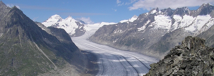
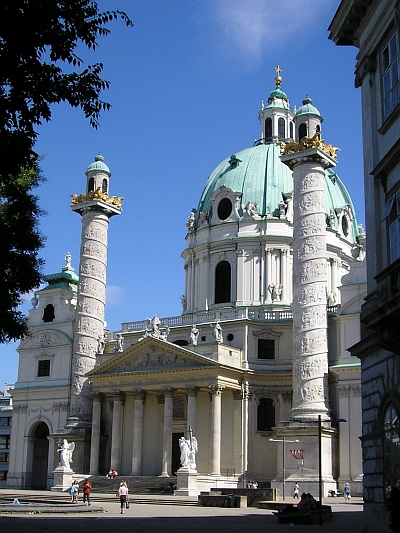
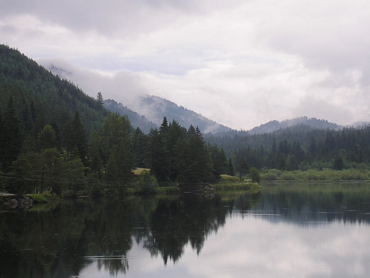
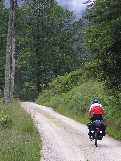 After a short descent we climb over an unpaved road to the Krombachsattel, a second
pass. The descent is much longer. The road leads through scenic dark woods. By the
time we reach the Hubertussee, the rain is more or less over. Mists are still hanging
among the high hills around the lake. The grey cloud cover is still intact. The
weather will not change for the better today.
After a short descent we climb over an unpaved road to the Krombachsattel, a second
pass. The descent is much longer. The road leads through scenic dark woods. By the
time we reach the Hubertussee, the rain is more or less over. Mists are still hanging
among the high hills around the lake. The grey cloud cover is still intact. The
weather will not change for the better today.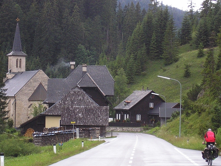
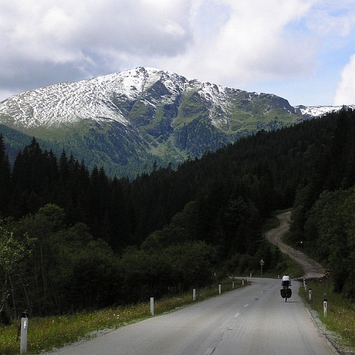 From Murau we are heading south. The long ascent of the Paalgraben brings us in Flattnitz.
The village is spread over a wide valley. The sidevalleys are also wide and open. A
few great peaks rise up. The Eisenhut and other peaks still have snow on the higher
slopes. We reach the pass. There are great sights southwards. In the distance
we already see the steep, dark Karawanken mountain chain, the border mountains
with Slovenia. Jeroen and I will be there soon. It could be possible to
reach the Slovenian border tomorrow afternoon. First we will visit the lakes of
Kärnten.
From Murau we are heading south. The long ascent of the Paalgraben brings us in Flattnitz.
The village is spread over a wide valley. The sidevalleys are also wide and open. A
few great peaks rise up. The Eisenhut and other peaks still have snow on the higher
slopes. We reach the pass. There are great sights southwards. In the distance
we already see the steep, dark Karawanken mountain chain, the border mountains
with Slovenia. Jeroen and I will be there soon. It could be possible to
reach the Slovenian border tomorrow afternoon. First we will visit the lakes of
Kärnten.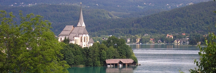
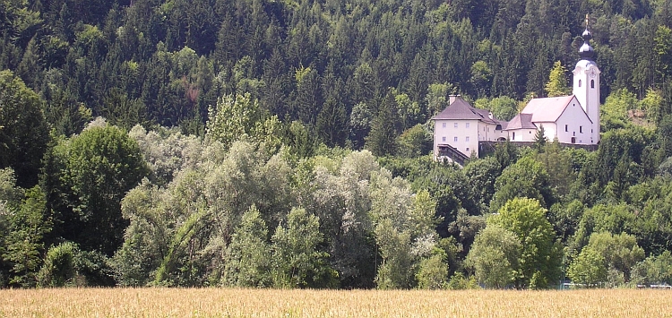
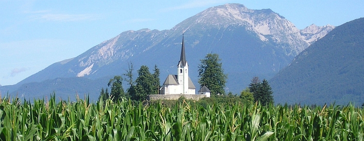
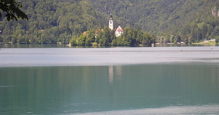
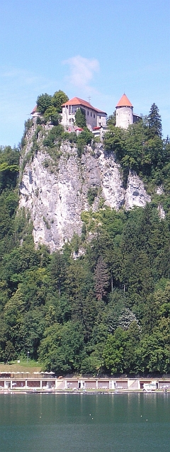
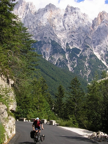
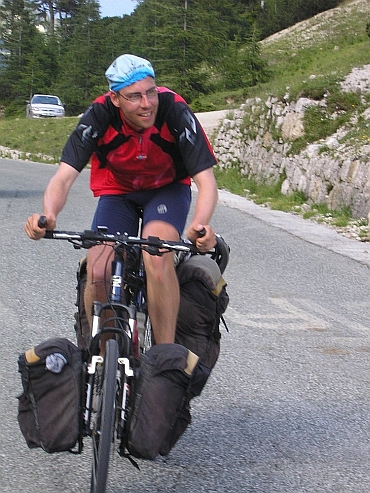
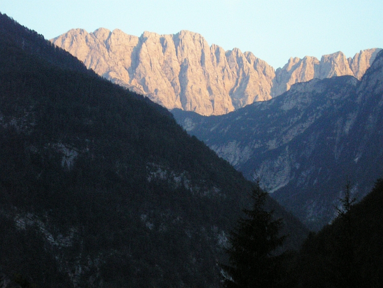
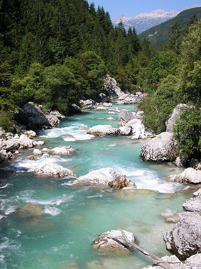
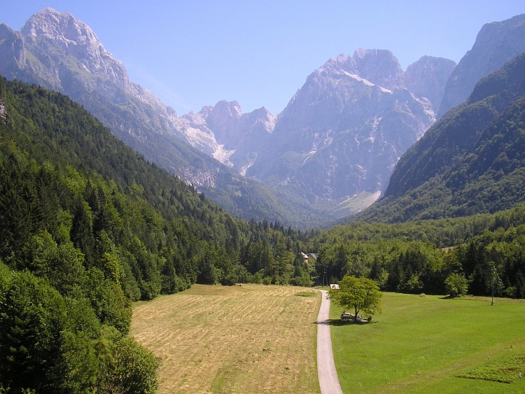
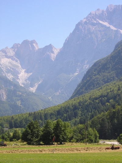 After a short ascent to the Nevea Pass and a long way down to the Fella River finally
the magic spell is broken. We are in the last foothills of the Alps now. The valley
is filled with a highway and a big secondary road. No small roads in lovely side valleys,
just a busy valley with big roads and the filthy, polluted, humid air
of the lowlands of North Italy. The sky is not blue but white but still the sun
is burning. Hot. This is something we just have to go through. We both have the
spirit to go through this as fast as possible. We pass the industrial plains around Carnia
and Tolmezzo. Nearly sixty flat kilometres to reach the first promising side valley in
Villa Santina. We cycle into the green valley and find a camping in the friendly
village of Ovaro. The ugliness is definitely behind us.
After a short ascent to the Nevea Pass and a long way down to the Fella River finally
the magic spell is broken. We are in the last foothills of the Alps now. The valley
is filled with a highway and a big secondary road. No small roads in lovely side valleys,
just a busy valley with big roads and the filthy, polluted, humid air
of the lowlands of North Italy. The sky is not blue but white but still the sun
is burning. Hot. This is something we just have to go through. We both have the
spirit to go through this as fast as possible. We pass the industrial plains around Carnia
and Tolmezzo. Nearly sixty flat kilometres to reach the first promising side valley in
Villa Santina. We cycle into the green valley and find a camping in the friendly
village of Ovaro. The ugliness is definitely behind us.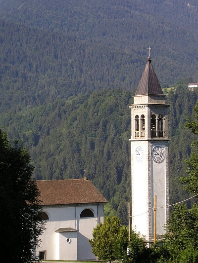 Clocks. They keep on chiming. As we wake up, Jeroen says he had a very bad nights sleep
due to chiming church bells. There are three churches in the neighborhood and there
is always one that is chiming. Then one is chiming five times, a few minutes later another
one is chiming nine times, then the third is chiming a melody. There must be a hidden
purpose why the bells are chiming the way they do. It certainly does not represent the time;
there must be a much more abstract plot behind it. Sleepy eyed and weary we eat breakfast in
the village. Then we go on our way again. As we leave the village Ovaro,
all the church bells of Ovaro are ringing farewell.
Clocks. They keep on chiming. As we wake up, Jeroen says he had a very bad nights sleep
due to chiming church bells. There are three churches in the neighborhood and there
is always one that is chiming. Then one is chiming five times, a few minutes later another
one is chiming nine times, then the third is chiming a melody. There must be a hidden
purpose why the bells are chiming the way they do. It certainly does not represent the time;
there must be a much more abstract plot behind it. Sleepy eyed and weary we eat breakfast in
the village. Then we go on our way again. As we leave the village Ovaro,
all the church bells of Ovaro are ringing farewell.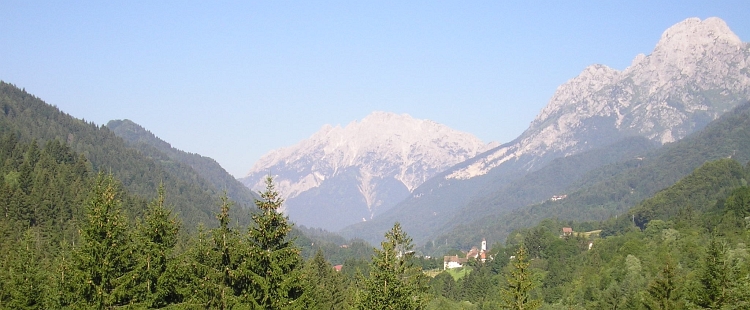
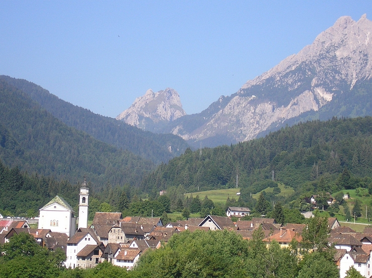
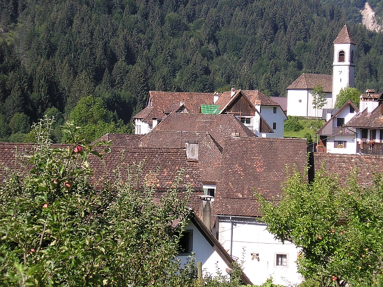
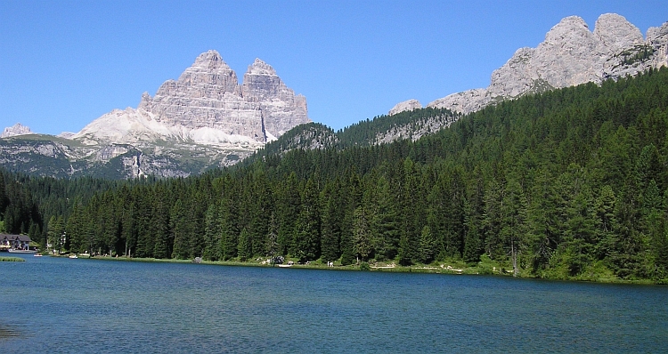

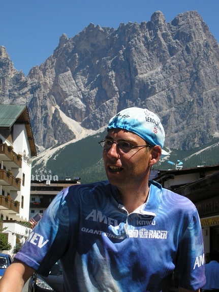
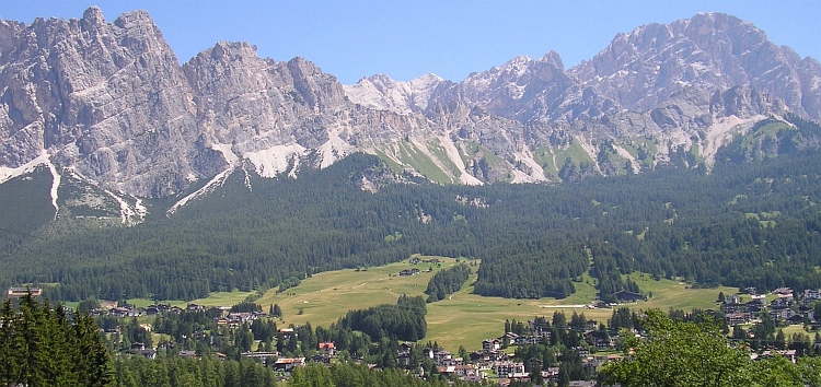
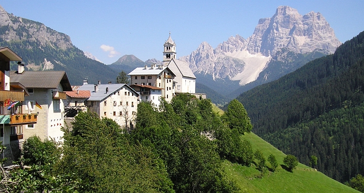
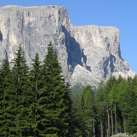 Another day of deep blue skies. The ascent to the Gardena Pass is gorgeous. It is
our second of the four Sella passes. Rock pinnacles are standing before the massive rock wall
of the Gruppo di Sella. The second pass of the Gruppo di sella is not much more difficult
than the Passo di Campolongo yesterday. Within an hour we are looking down in the Gardena
Valley on the other side of the pass. We descend a little and turn left towards the
Passo di Sella, the third Pass around the Dolomite giant. The Passo di Sella winds
its way up between the Gruppo di Sella and the Langkofel / Sasso Lungo. Too much beauty.
Another day of deep blue skies. The ascent to the Gardena Pass is gorgeous. It is
our second of the four Sella passes. Rock pinnacles are standing before the massive rock wall
of the Gruppo di Sella. The second pass of the Gruppo di sella is not much more difficult
than the Passo di Campolongo yesterday. Within an hour we are looking down in the Gardena
Valley on the other side of the pass. We descend a little and turn left towards the
Passo di Sella, the third Pass around the Dolomite giant. The Passo di Sella winds
its way up between the Gruppo di Sella and the Langkofel / Sasso Lungo. Too much beauty.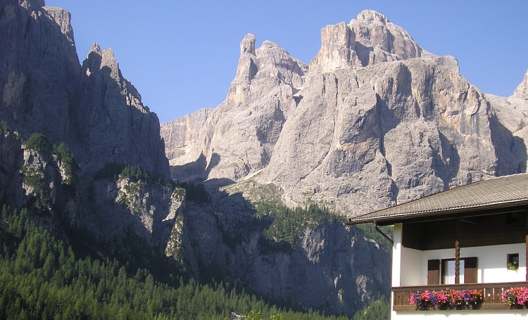
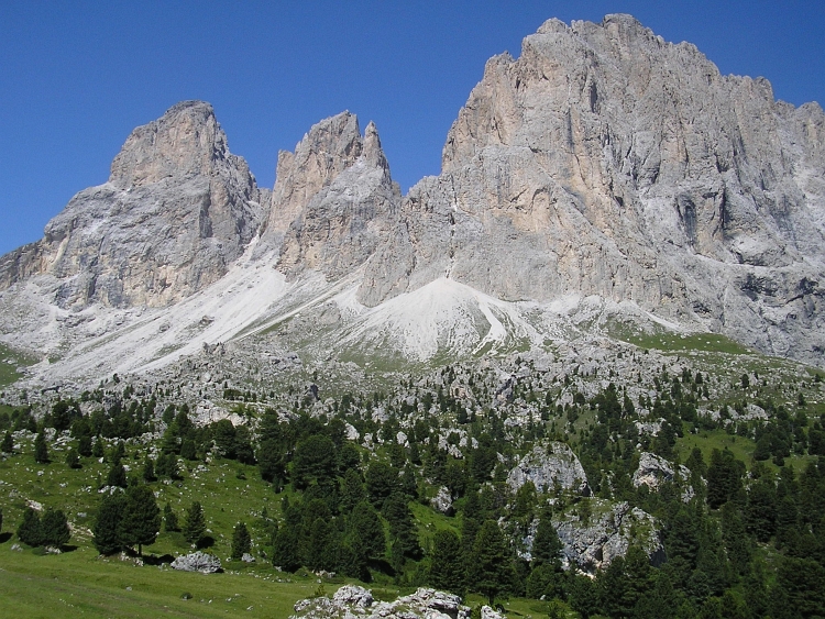
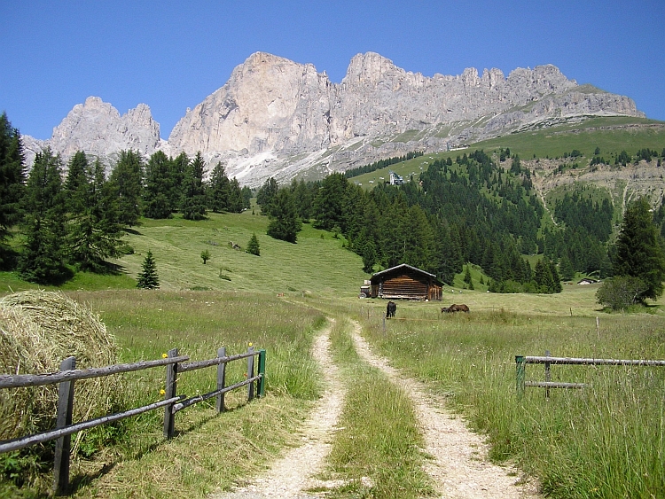
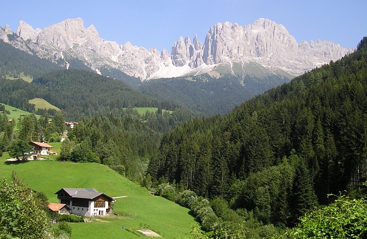
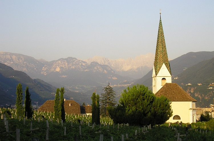
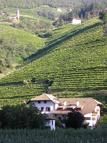
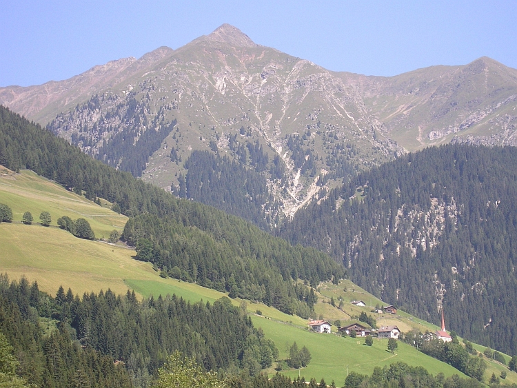
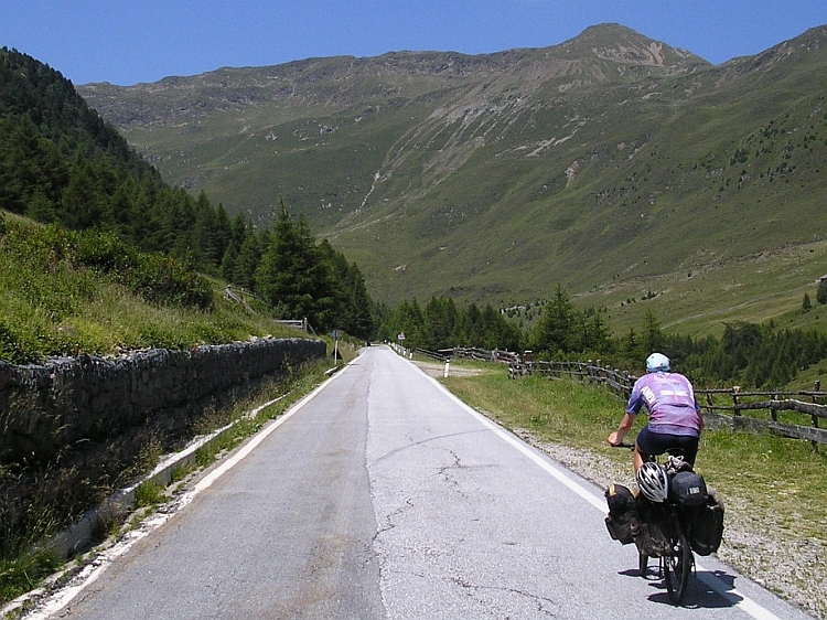
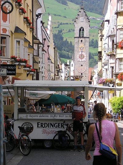 After the tunnels we reach the middle section of the ascent. The valley is much wider now.
Classic alpine meadows against the backdrop of carved mountain ranges offer idyllic
sights. The road is not steep; slowly we gain altitude through the pastures and villages.
After Pennes the road is much steeper. The last eight kilometre of the ascent keep climbing
steadily without a flaw. There are a few cyclists on racing bikes on the way, further
the road is completely empty. And the landscape is empty. A road and hillslopes with grass
and a few cyclists, that is all. The whole landscape around us is above the treeline. At two o'clock we
reach the pass. We are nearly two thousand meter above Bolzano now. The fifty kilometre between Bolzano
and the pass have offered great and varied landscapes. Certainly a recommendation.
After the tunnels we reach the middle section of the ascent. The valley is much wider now.
Classic alpine meadows against the backdrop of carved mountain ranges offer idyllic
sights. The road is not steep; slowly we gain altitude through the pastures and villages.
After Pennes the road is much steeper. The last eight kilometre of the ascent keep climbing
steadily without a flaw. There are a few cyclists on racing bikes on the way, further
the road is completely empty. And the landscape is empty. A road and hillslopes with grass
and a few cyclists, that is all. The whole landscape around us is above the treeline. At two o'clock we
reach the pass. We are nearly two thousand meter above Bolzano now. The fifty kilometre between Bolzano
and the pass have offered great and varied landscapes. Certainly a recommendation.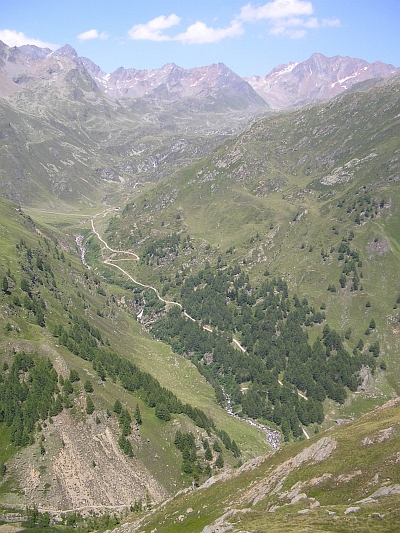
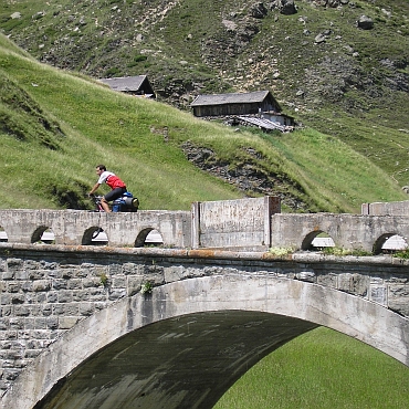
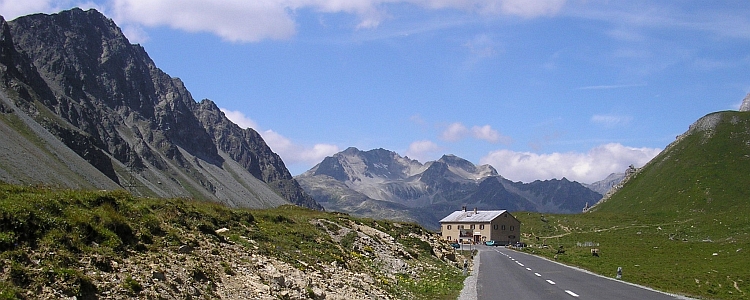
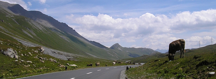
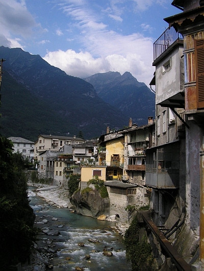
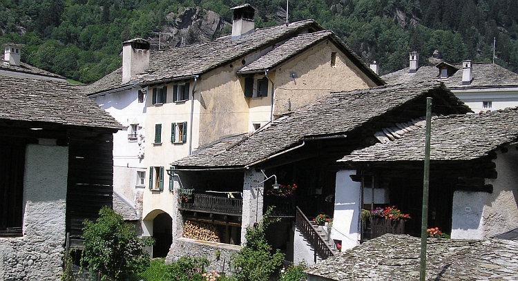
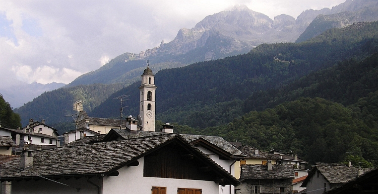
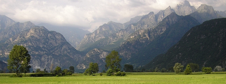
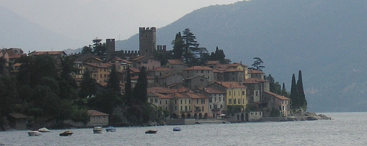
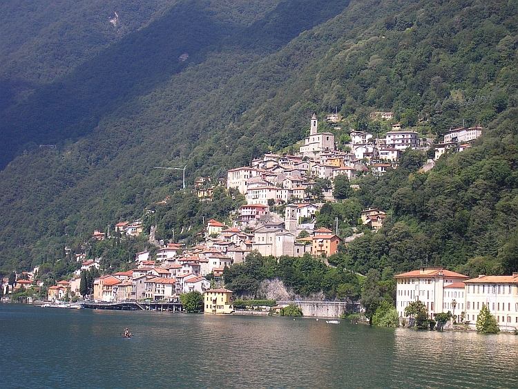
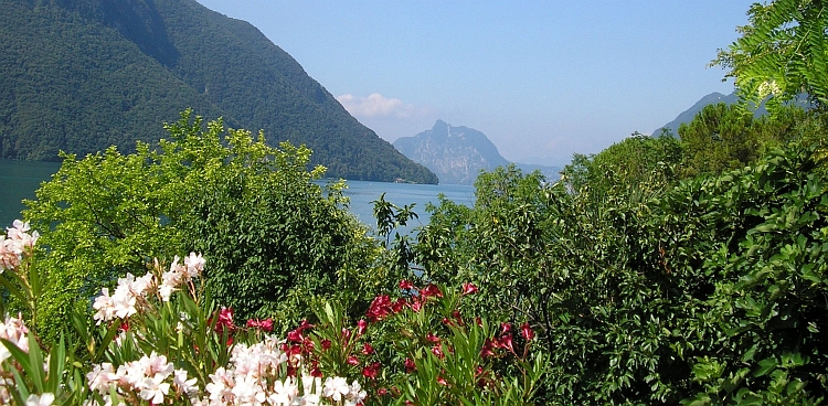
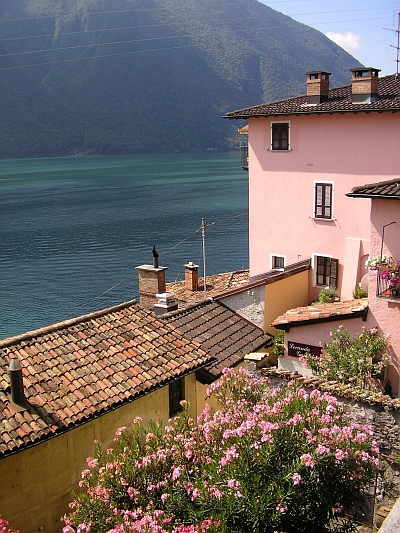
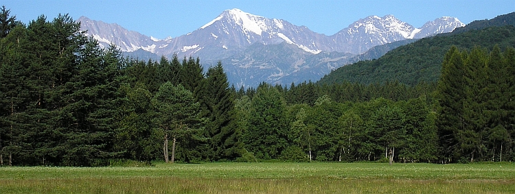
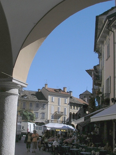
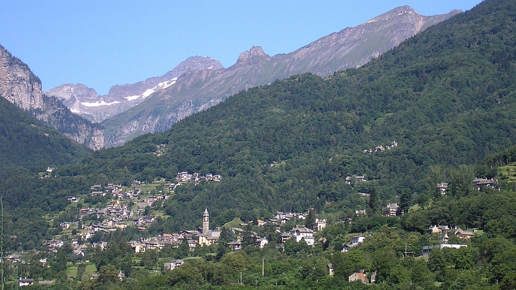
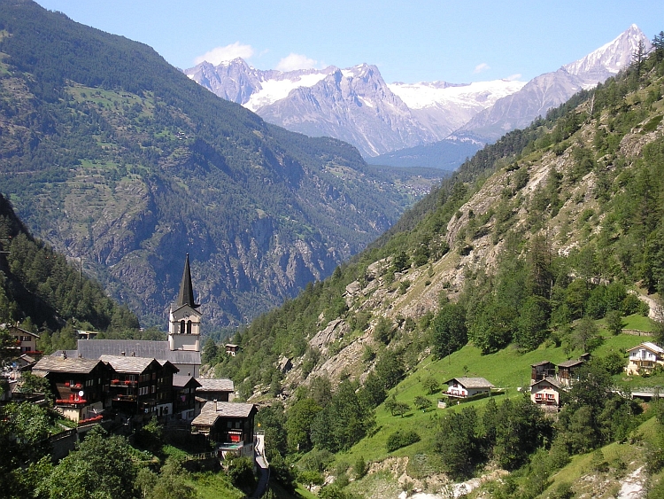
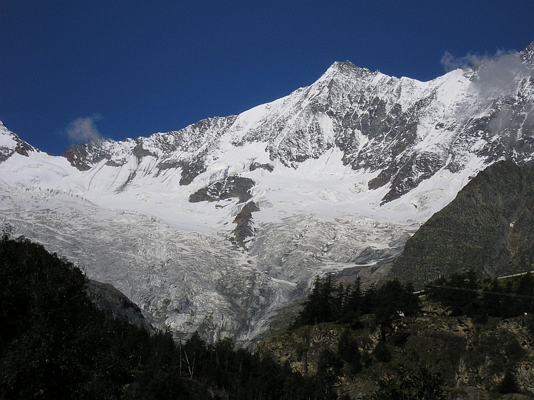
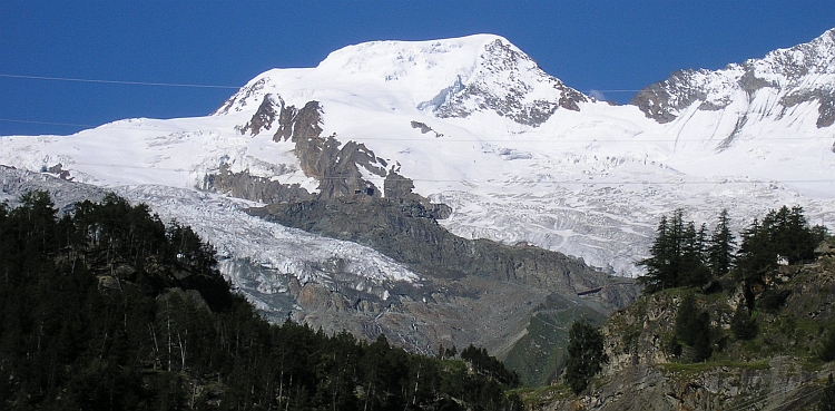
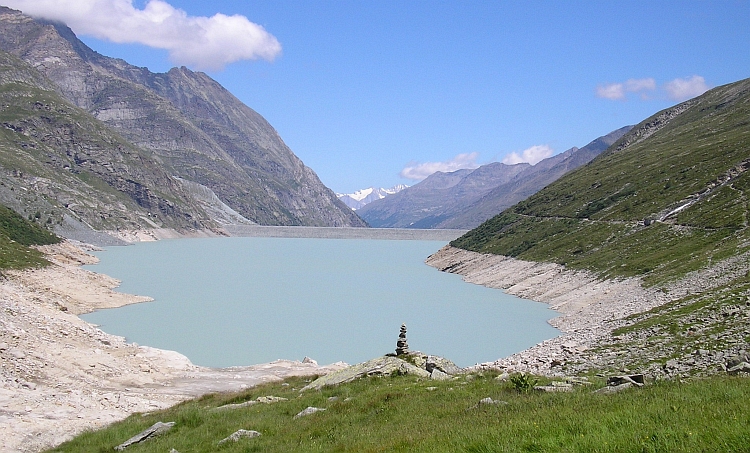
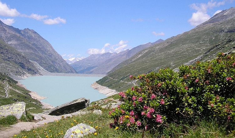
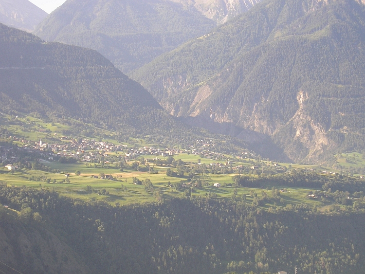
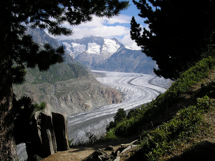
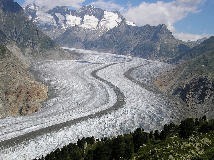
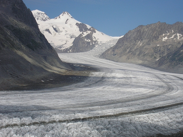
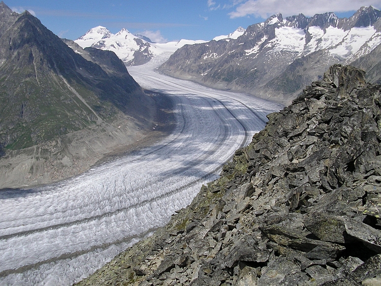
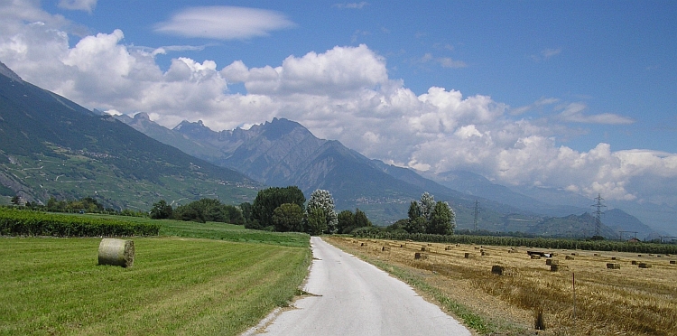
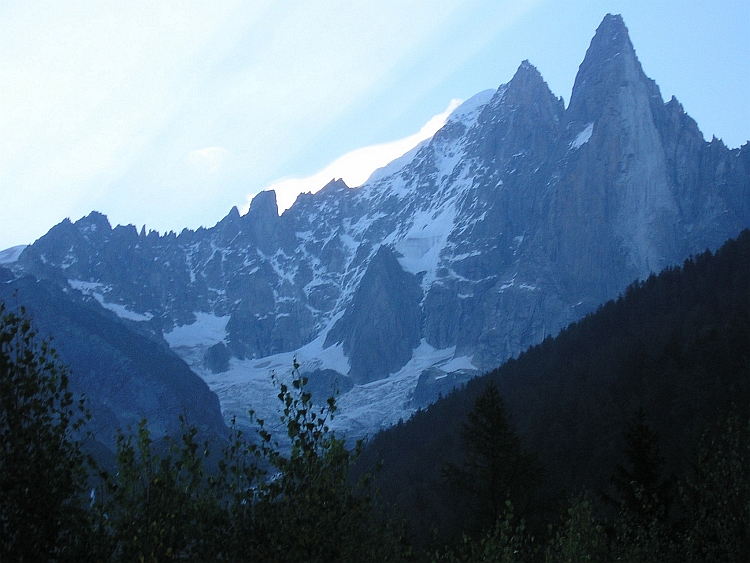
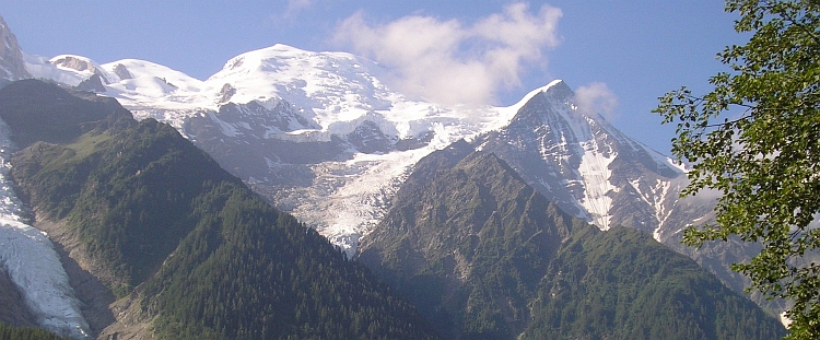
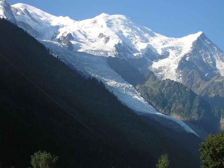
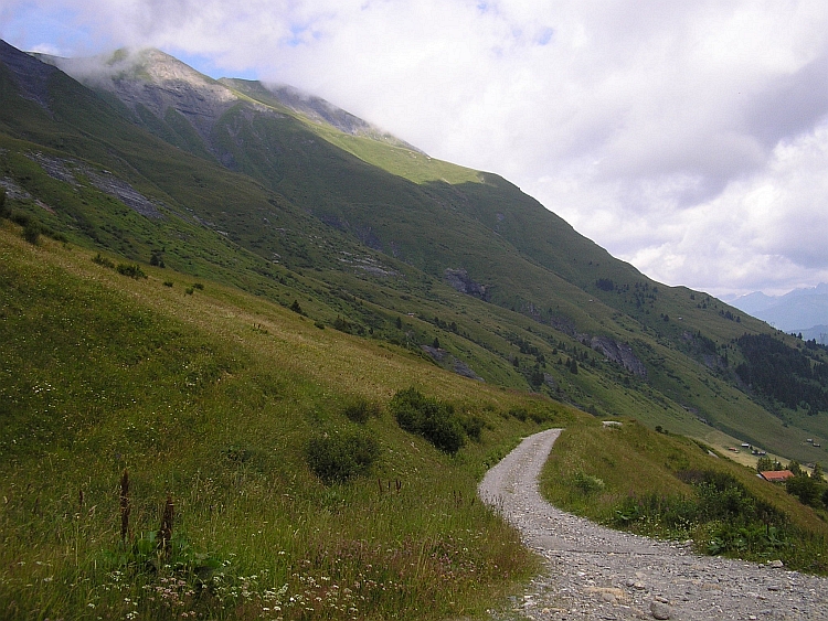
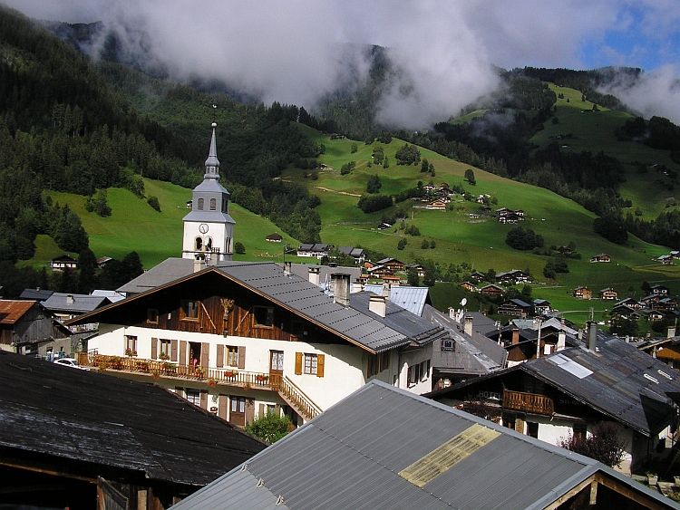
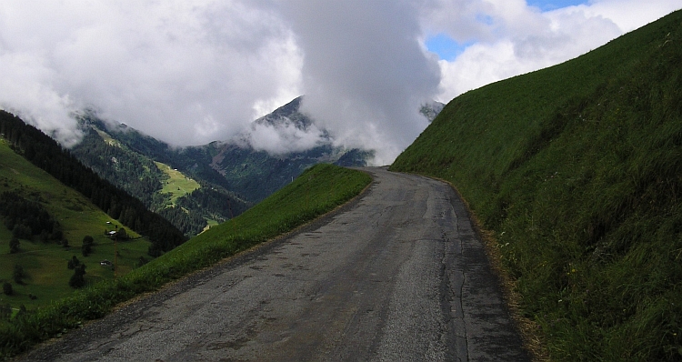
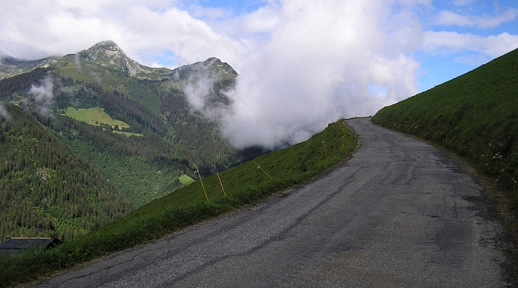
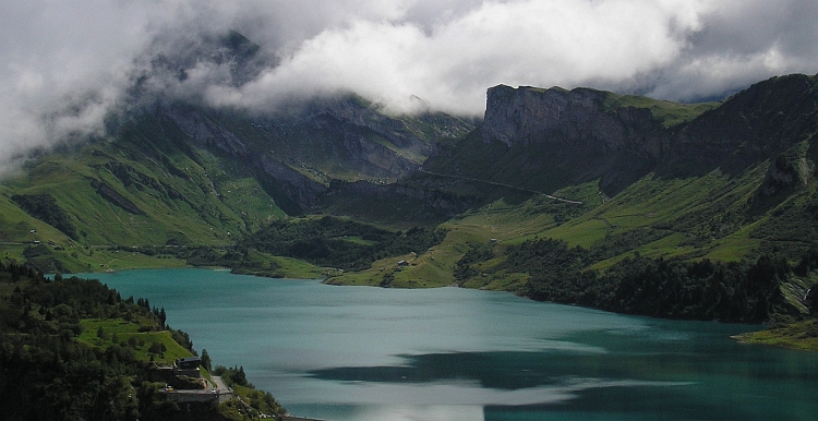
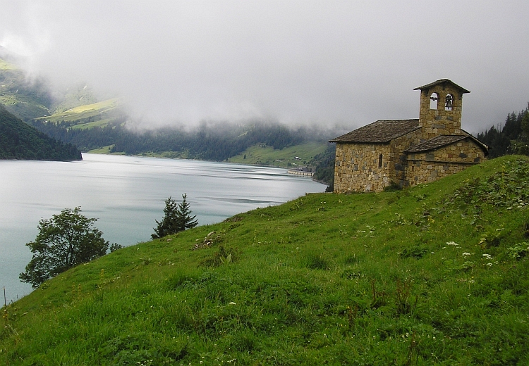
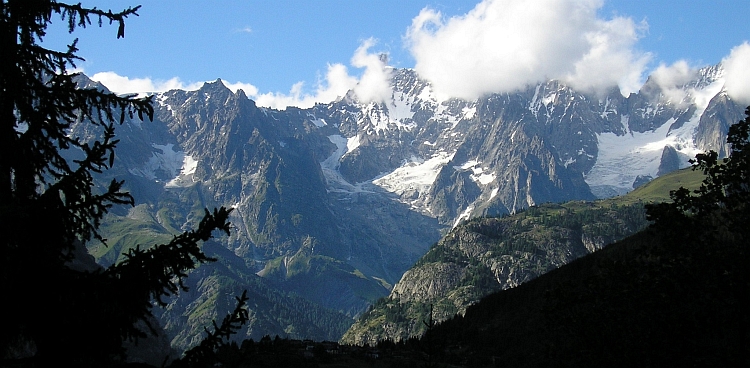
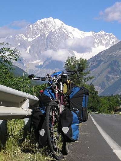
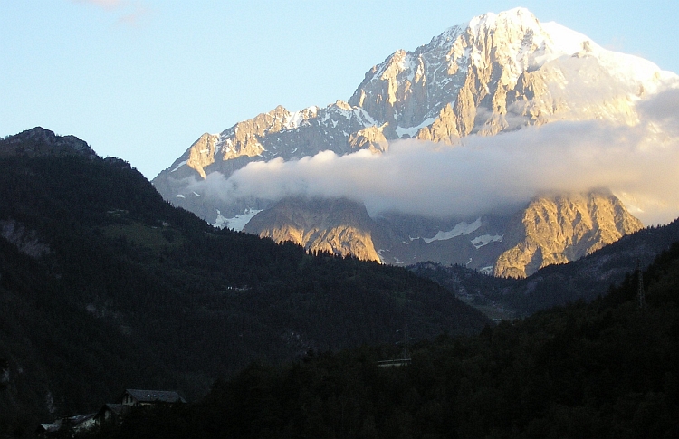
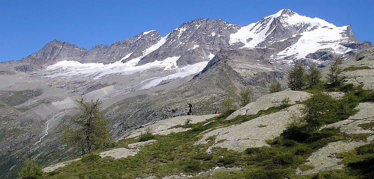
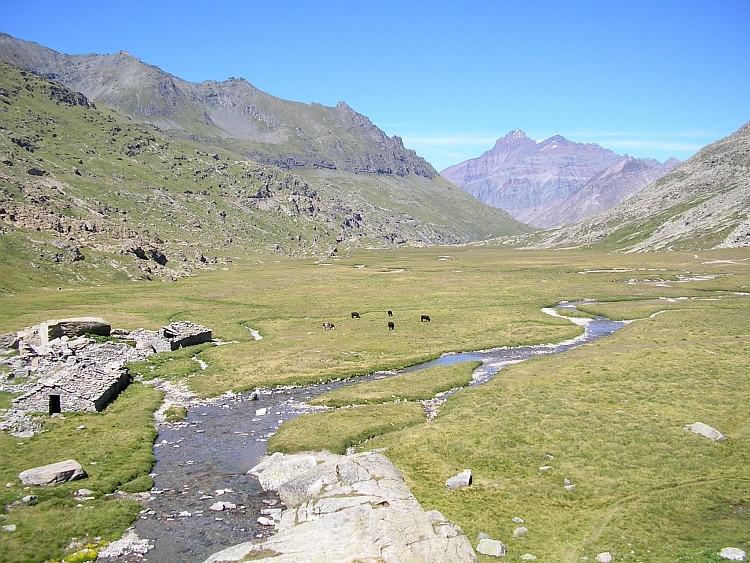
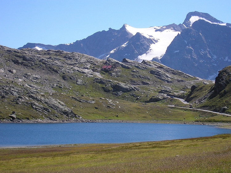
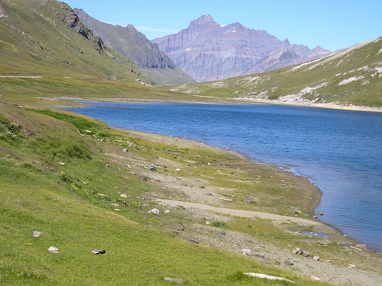
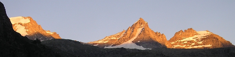
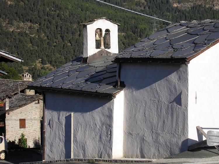
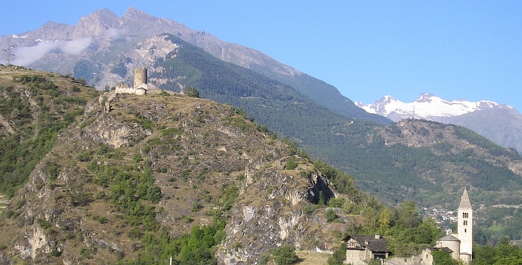
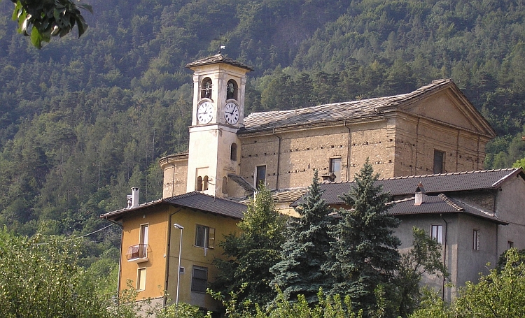
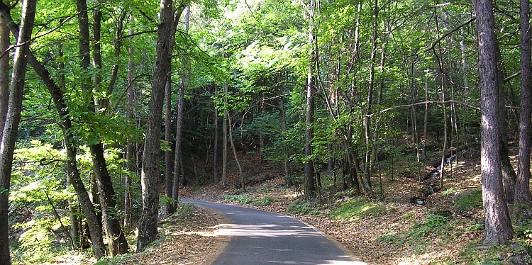
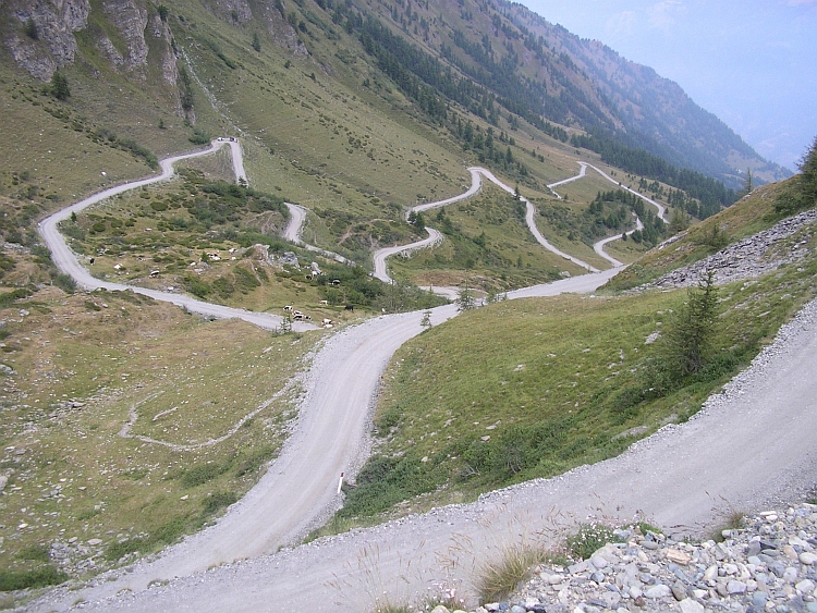
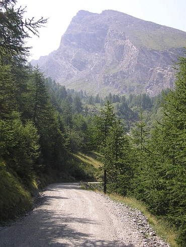
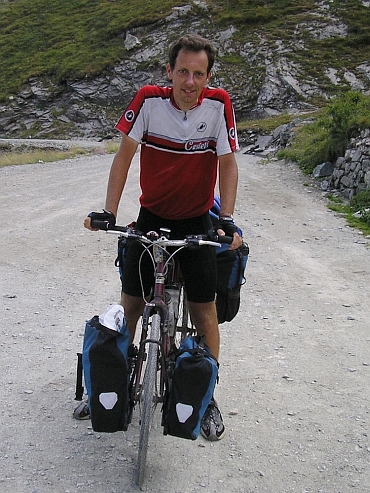
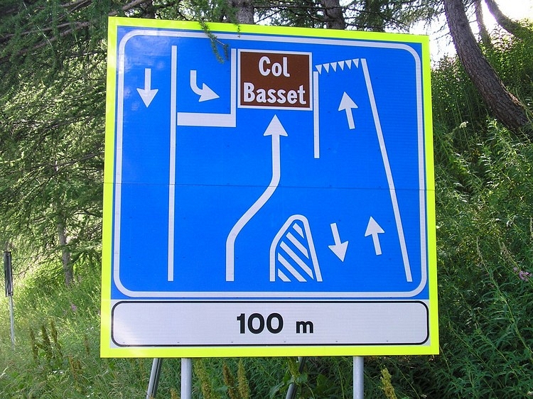
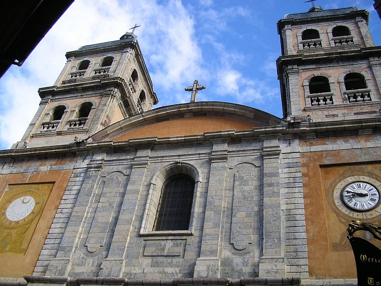
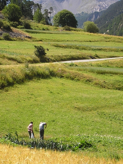
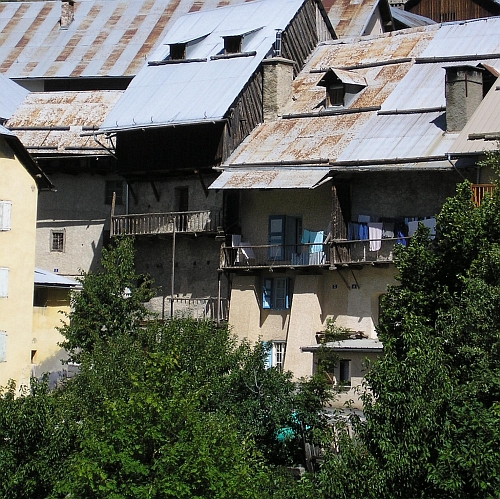 The ascent to the Col d'Izoard is wonderful again. There are virtually no cars on
the Izoard. There are many cyclists under way with their racing bikes. I am talking
with a lot of cyclists, for many of them the Izoard is a once in a lifetime experience,
a first and only time to fulfill a long Tour de France climb. The legend of the Tour de France
has not completely faded away.
The ascent to the Col d'Izoard is wonderful again. There are virtually no cars on
the Izoard. There are many cyclists under way with their racing bikes. I am talking
with a lot of cyclists, for many of them the Izoard is a once in a lifetime experience,
a first and only time to fulfill a long Tour de France climb. The legend of the Tour de France
has not completely faded away.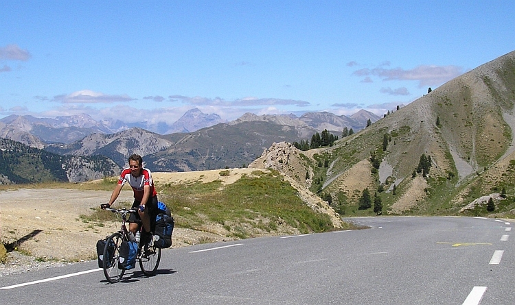
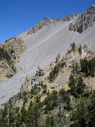
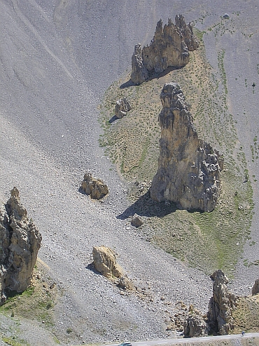
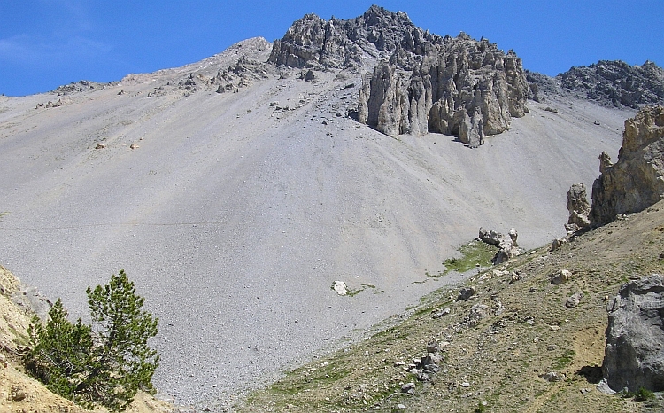
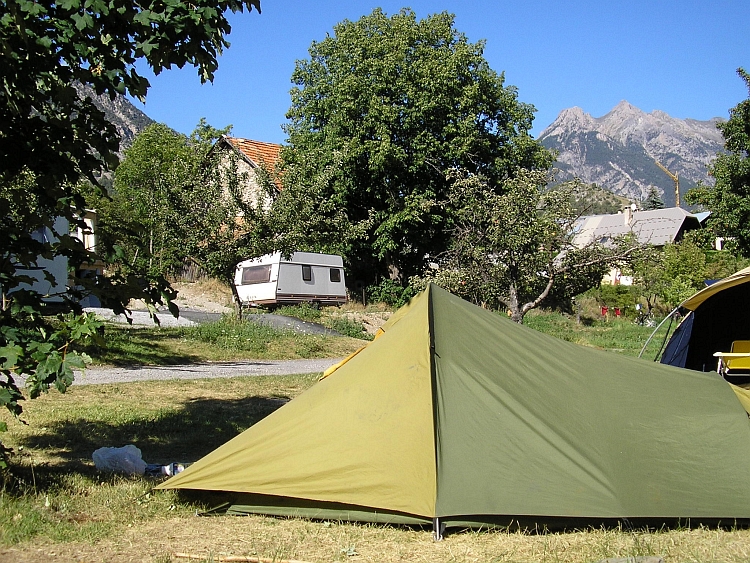
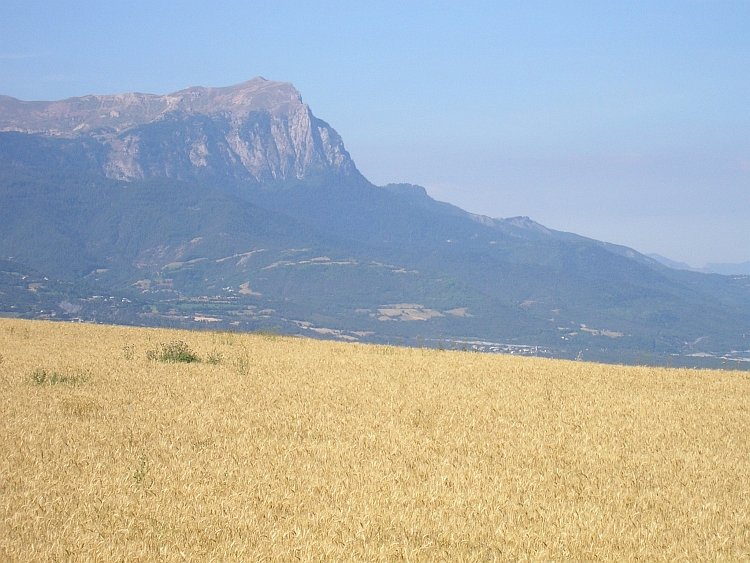
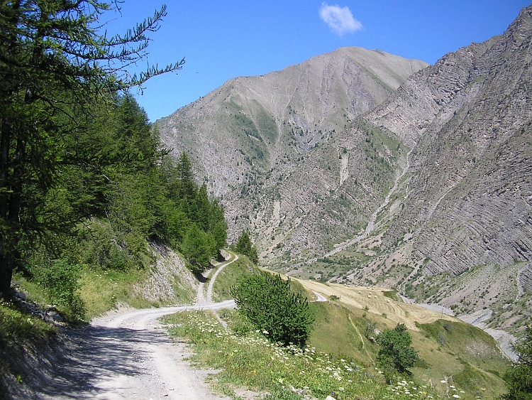
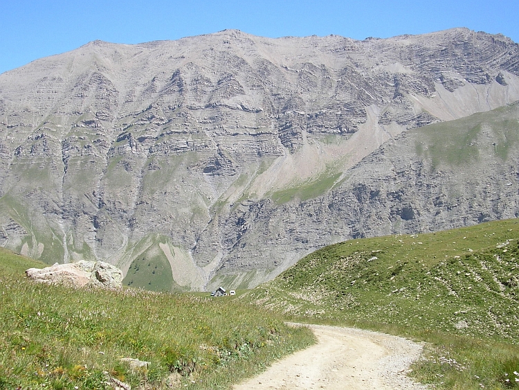
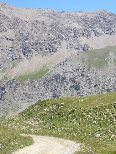
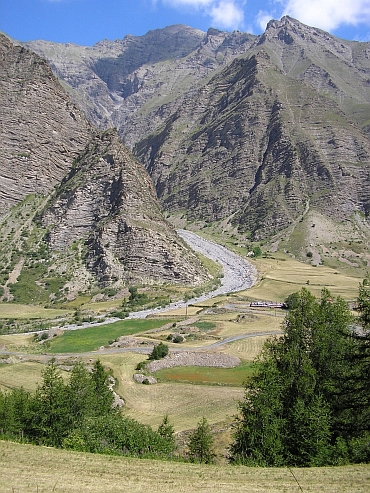
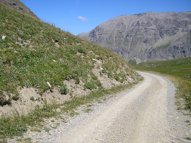
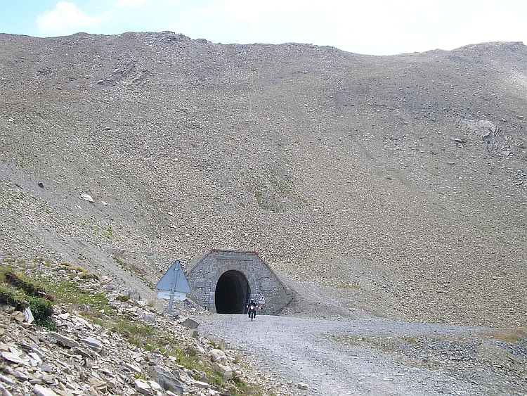
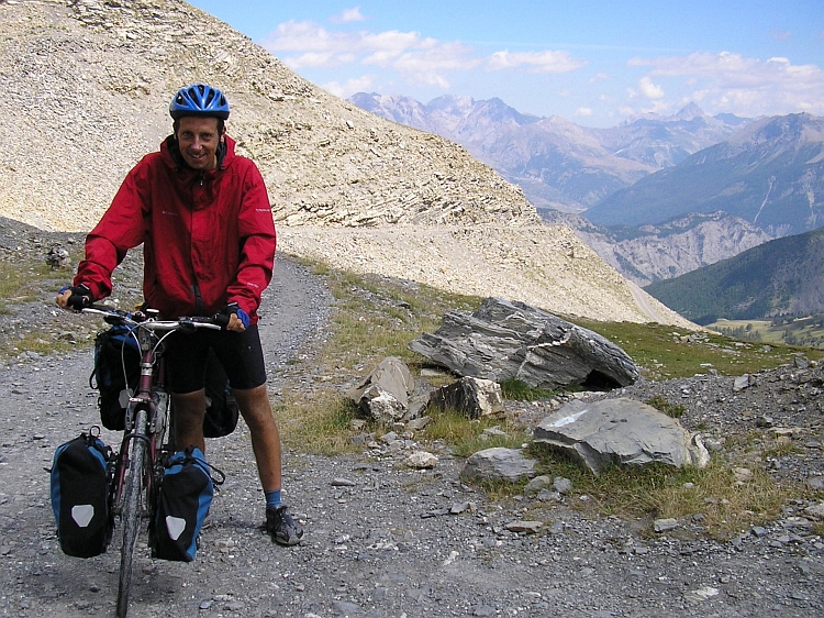
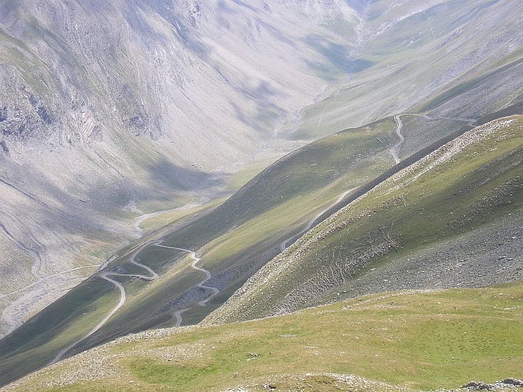
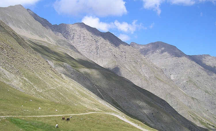
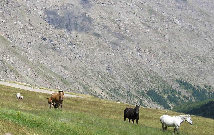
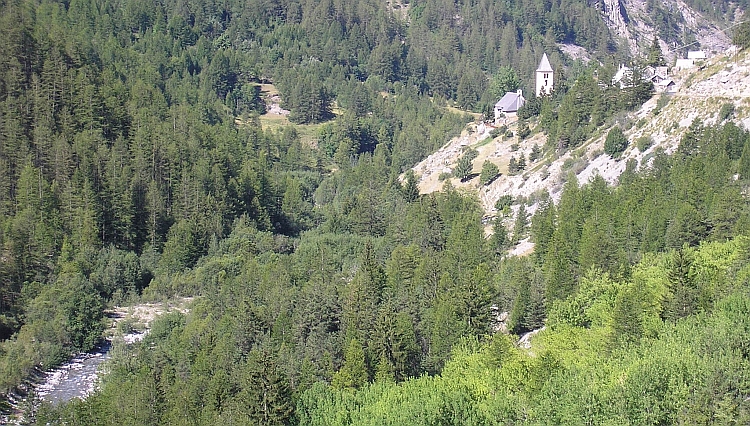
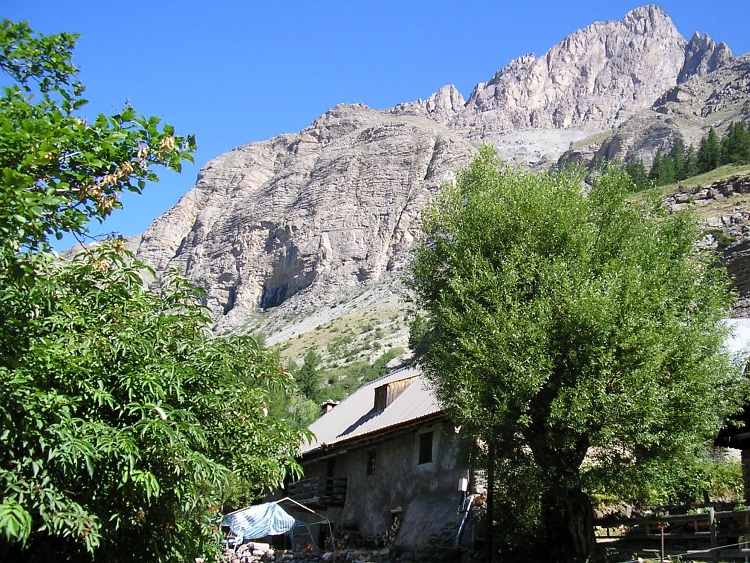
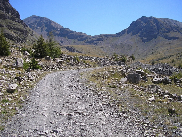
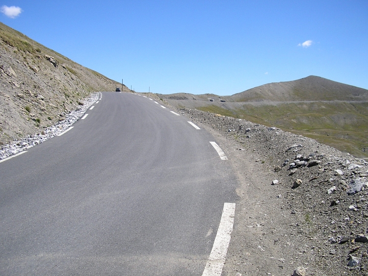
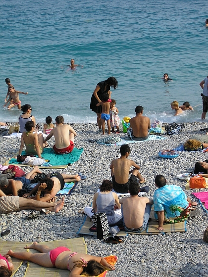
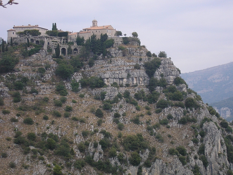
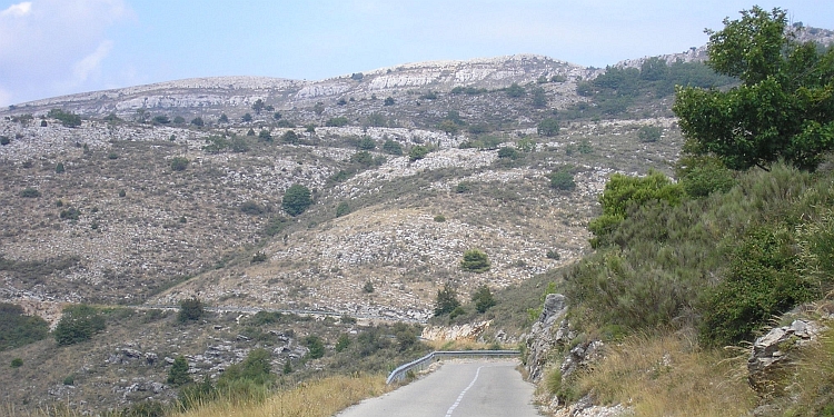
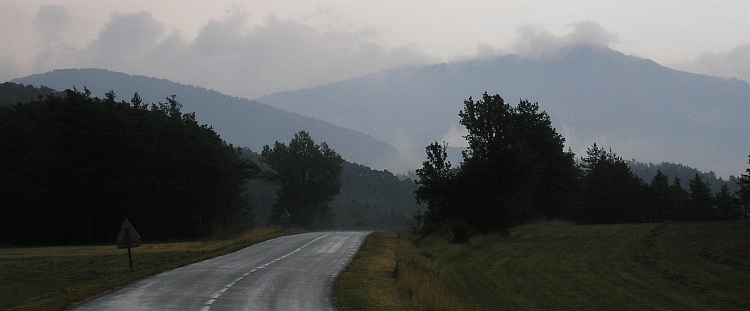
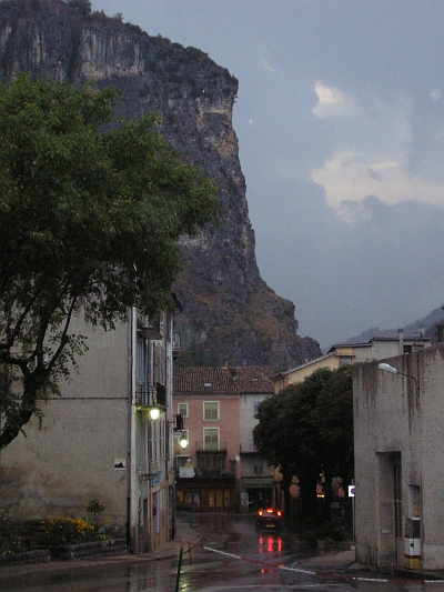
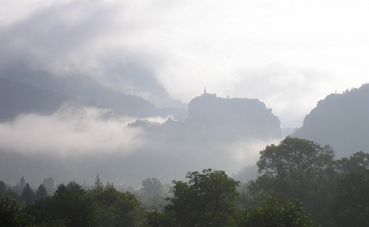
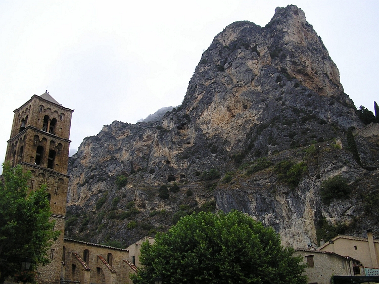
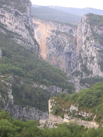 I resume to go on my way as the showers are as good as over. The wind has turned
and is much stronger now. The wind is coming from the north now and, as I am heading
southwest, I am blown right over the road. The sixty uninteresting kilometres to the
Mirabeau in the Durance Valley takes me a little more than two hours. From there it
is not too far to the closest camping from the Lubéron area in La Tour d'Aigues.
Now the northwind is working against me and I am feeling very tired suddenly. I am eager
to give up my idea to cycle a bit further to the camping in Bonnieux. It takes a
long time before I have finally reached the camping in La Tour d'Aigues.
I resume to go on my way as the showers are as good as over. The wind has turned
and is much stronger now. The wind is coming from the north now and, as I am heading
southwest, I am blown right over the road. The sixty uninteresting kilometres to the
Mirabeau in the Durance Valley takes me a little more than two hours. From there it
is not too far to the closest camping from the Lubéron area in La Tour d'Aigues.
Now the northwind is working against me and I am feeling very tired suddenly. I am eager
to give up my idea to cycle a bit further to the camping in Bonnieux. It takes a
long time before I have finally reached the camping in La Tour d'Aigues.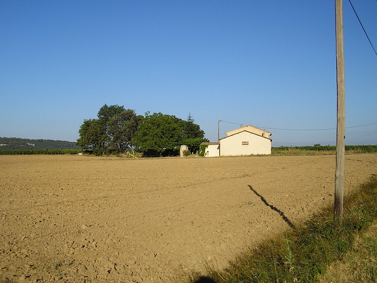
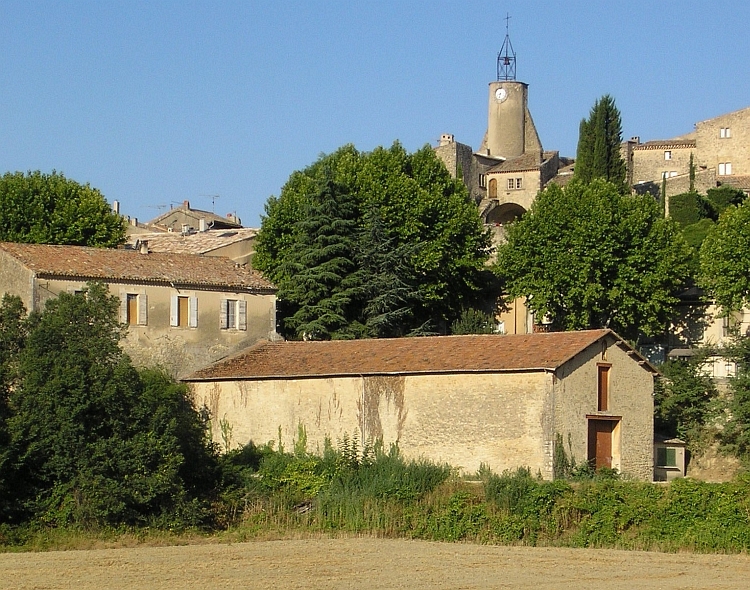

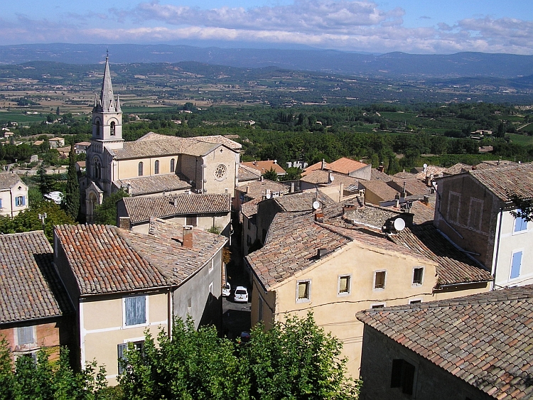
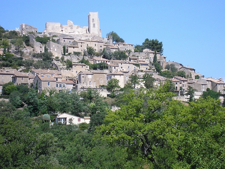
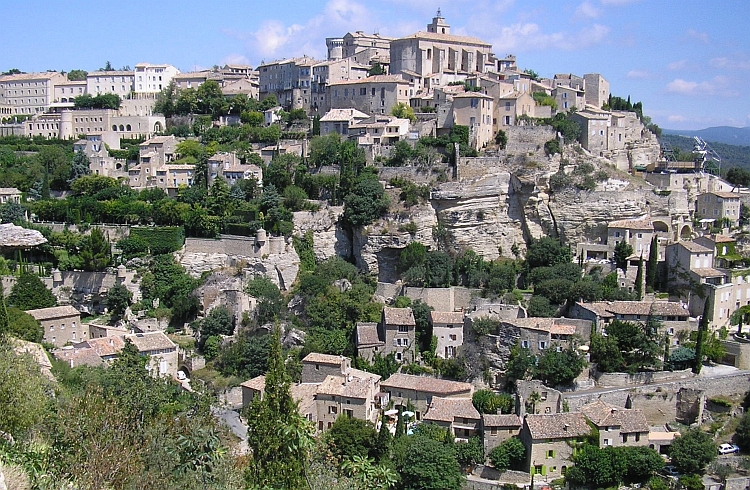
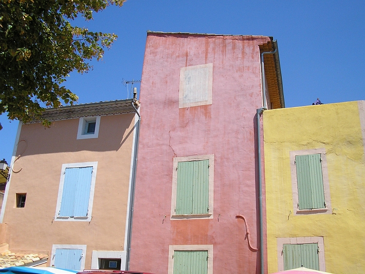
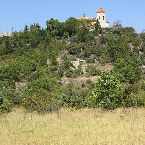 And once again I have to force my way up a mountain. I have to climb 600 meter to
cross the hill range. It is not the climbing that causes the strain however, but
the mistral that is blowing. Slowly I find my way up through the completely deserted
hills. A river runs throug a deep crack in the hills down to the Lubéron.
After some time the hillside becomes flatter and flatter and after a few kilometre
further I must have reached the pass. I am going down now, ever steeper. I reach
the lavender field around Sault. Most of the lavender has already been harvested,
but a few fields are still filled with flowering lavender. Soon I reach Sault where I find a camping to spend
the last night of the journey.
And once again I have to force my way up a mountain. I have to climb 600 meter to
cross the hill range. It is not the climbing that causes the strain however, but
the mistral that is blowing. Slowly I find my way up through the completely deserted
hills. A river runs throug a deep crack in the hills down to the Lubéron.
After some time the hillside becomes flatter and flatter and after a few kilometre
further I must have reached the pass. I am going down now, ever steeper. I reach
the lavender field around Sault. Most of the lavender has already been harvested,
but a few fields are still filled with flowering lavender. Soon I reach Sault where I find a camping to spend
the last night of the journey.