Life is good. Between the black mountains of the Cordillera Negra and the white
mountains of the Cordillera Blanca lies the fertile valley of the Rio Santa, a gorgeous place
to start my journey through the Peruvian Andes. It is harvest time in the valley.
Everyone is working on the land. The man and the woman, the young and the old. Older men and women have got beautifully
weathered faces. The harsh climate and the fierce sun leave their imprint on the skin
of the farmers.
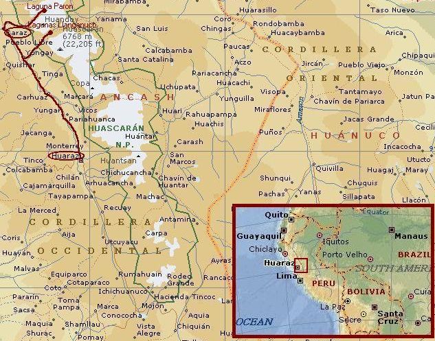
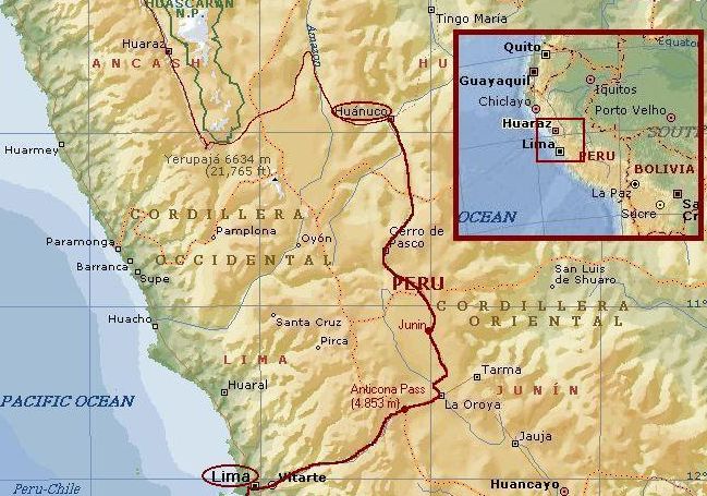
Yesterday I arrived in the city of Huaraz. The bus from Lima took me to the start
of my cycling journey. Today I have left the city of Huaraz. Now I am descending
along the river to Caraz where I want to make some day trips to get used to the
altitude. Riding high and sleeping low is the way to get your physique ready
for the hard labour in the high Andes. Caraz lies at an elevation of 2.300 m altitude.
After a few hours of cycling I reach Caraz, a provicial town with about 25.000 inhabitants.
I find a clean and safe hotel for the coming days at the central square.
Day 2: Caraz - Lagunas LLanganuco - Caraz 89 km
Today I will try to reach the Llanganuco lakes. The two lakes lie at an elevation
of 3.800 m altitude and will be my first cycling experience on real high altitudes. Untill
now I have not been higher than the Spanish Pico Veleta at 3.400 m altitude. The lakes
are situated in the heart of the Cordillera Blanca between mountains of plus 6.000 m
altitude.
I have just left the town of Caraz when I see a young man cycling before me in the distance.
I want to know who that could be and I am making effort to overcome the distance between.
After fifteen minutes I am finally there. The cyclist says he is a young man from Colombia;
he is called Ariel. We decide to cycle together today. Today we will try to reach the small
lakes of LLanganuco.
In Yungay a small dirt track leaves the main road and climbs steep and high above the
valley of the Rio Santa. Within half an hour a breathtaking view of the green valley
and the dark mountains of the Cordillera Negra is developing.
We are passing small, traditional Indian villages. The deep blue skies are the domain
of the fierce sun. Although the temperature is around ten degrees, the power of the sun warms
the skin adequately. There is a certain kind of harmony in the land. The yellow terraces, the
green eucalyptus trees, the brown adobe houses, every element adds up to the mosaique. The
towering granite cliffs and the huge ice cathedrals of the Cordillera Blanca provide a dramatic
background.
Late in the afternoon we reach the lakes and the scenery is well worth the efforts.
My first day in the high Andes is very well spent. I am looking forward to the days to come...
Day 3: Caraz - Laguna Parón - Caraz 66 km
Ariel and I meet at the colourful market of Caraz. My Columbian amigo knows where to find
good value on the market. I learn to know the juicy fruit that is called pepenillo
and I experience that the best power drink in the world is quinoa. Also very good value
is eating avocado on bread with a little salt and fresh tomatoes. Add some onion
for a deluxe version.
The sun is climbing above the hills as we ride into a small valley that must lead up
to the little Parón Lake. Today we have to climb 2,000 vertical meters on
the dirt track to an altitude of 4.200 m. As yesterday was terrific, today is grandiose.
The road to Laguna Parón must be one of the Worlds most beautiful cyclable roads.
first we pass tiny Indian villages, just like yesterday. After the first thousand meters
of climbing, we enter a very narrow valley, a dazzling vertical rock world towering above
our heads. The road follows the small valley and winds up further and further.
Ariel tells about his work for the district of Ancash. He is doing film and research work
to enhance the touristic potential of the Cordillera Blanca region. Ancash owes a lot of
interesting archeological sites according to Ariel. Unfortunately there are not enough funds
for reasearch of all the potential sites.
It takes many, many hours of hard work before we arrive at the lake. The lake is surrounded
by a magnificent white glacier world. Famous Andean mountains with intriguing Indian
sounding names like Chacraraju are surrounding us. The highest mountain of Peru, the
Huascarán is another famous mountain of the Cordillera Blanca, just one valley
further to the north. The most famous mountain of Peru however is the perfect white
triangle of the Alpamayo, which is just one valley to the south but cannot be reached
by bicycle.
It is late. We have got one and a half hour to return before the sun goes down.
Luckily we only have to descend. After more than an hour the last sunrays shine the higher parts of the
Cordillera Negra and we return the town of Caraz with legs dead tired, stomachs starving
from hunger but spirits in eerily Cordillera Blanca high atmospheres.
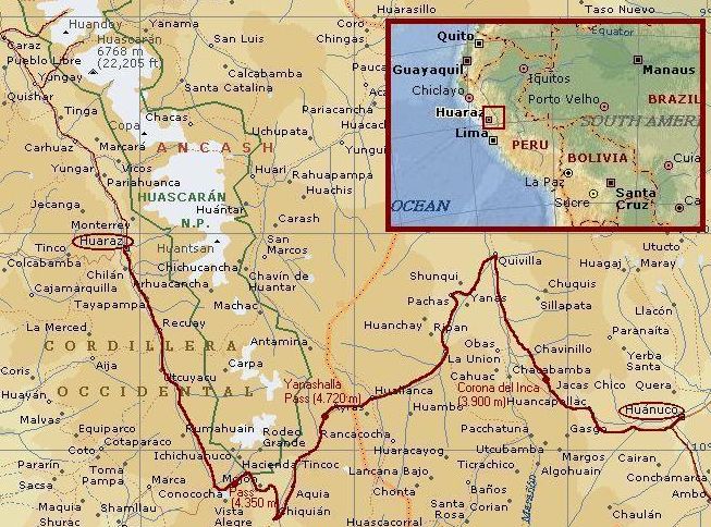
Day 4: Caraz - Yungay - Huaraz 71 km
Now I am acclimatized to elevations of up to 4.000 m altitude, I am ready to do
some true bicycle trekking. I want to reach Huánuco on the Amazone side of the
Andes. Huánuco is the entrance to the Amazone region in central Peru. To reach
the place I have to climb three big cols. For the first col I have to cycle back along the
Rio Santa to Huaraz and further up along the river to the plateau of Conococha at an
elevation of 4.000 m. Conococha is nearly 200 km from here. With a little luck I
will reach Conococha tomorrow and maybe I can even make the descent to Chiquián as
well.
Today is an easy day. I cycle back from Caraz to
Huaraz. In the mountaneering capital of Peru I indulge myself in good food and social
talk with other travellers. Two good things of life I will have to do without the
coming days.
Day 5: Huaraz - Conococha - Chiquián 115 km
The ascent to Conococha is a long one. Maps are inaccurate so I do not know exactly
how long. The first 40 kilometres I ride through the small valley of the Rio Santa.
The landscape is still friendly with lots of eucalyptus trees that provide a welcome
shelter for the wind. The shelter of the trees does not last for long unfortunately.
Catac is situated on a huge gently sloping plain just above the treeline. There is
no shelter at all on the windswept plateau that stretches out tens of kilometres
untill Conococha. I fear I will have to face the storm for the rest of the day.
Black mountains, white mountains. To the right are the black mountains of the Cordillera
Negra. To the left are the white mountains of the Cordillera Blanca. In between is
the completely yellow coloured valley of the Rio Santa, ten kilometres wide and infinitely
long. The whole world around me is yellow. The thick, oily, yellow grasses of
the so-called puna vegetation are the only plants that survive the harsh conditions
of the cold, the altitude, the fierce sun and the raging storms. There is no relief,
no shelter, no hiding for the wind.
After two hours of extremely hard work I am still alone in the wide yellow plains.
I see the same huge mountain on the other side of the valley. I do not seem to come
any closer to the end of the valley. I do not even know how far it is from here to
Conococha. Even worse, my stomach is beginning to hurt. Have I eaten something
wrong? Or is it the altitude?
Counting distances on the roadsigns, counting lamas, I try to do whatever keeps my mind
away from the fatigue and the hurt in my stomach. It feels better to keep the
mind drugged. Eventually everything must come to an end. And so does the road to
Concocha. But unfortunately the suffering does not come to an end. Conococha
proves to be a small, miserable place. Not a place to spend the night. In contrary to what
I thought, the road has not yet reached the highest point. After 80 km of ascending
I see the road crossing the plain and winding up against the slopes of the mountains
of the Cordillera Blanca. I have to do some additional work today. That means, first
I have to cross the plain, second I have to ascend yet another slope, and last
I have to descend to Chiquián.
Surrender to the void. It is only in abstract terms that I can express what I feel.
Or maybe what I do not feel. Anymore. Everything hurts untill the point that it
does not matter any more what exactly hurts. This must be the last ascent of the day.
The fatigue is overwhelming. My body must be producing overloads of chemicals that help me bring myself in some kind of
physical anaesthesia. I feel quiet now. I know what I have to do. Just keep going,
slowly, slowly. I do not have much time anymore before the sun goes down but I have
no choice but to go on. If I go in a quiet pace, I will be faster in the end.
It is five o'clock when I reach the watershed. I must be at an elevation of about
4.300 or 4.400 meter I guess. After a few hunderd meters of descending, a phantastic view
stretches out. Right before me I look into the depths of a deep valley, 2.000 m below.
Behind the valley are the mighty towers of the Cordillera Huayhuash mountains, more
than 2.000 m above me. Shocks of exhilaration, waves of joy, flow through my body
and suppress the hurt. A winding dust trail leads me down along old inca terraces
on steep slopes. I am in a giant 3-D puzzle of a vertical world. Downward I go
along the first tiny settlements. When the last sunrays touch the flanks of the mountains
on the other side of the valley, I reach my destination. In Chiquián I find a
place to rest. Eventually.
Day 6: Sickbed in Chiquián
My stomach still hurts. The awesome food of yesterday night did not help to improve
my conditions. It is impossible to cycle further today. My life is divided between
hallucinations, nightmares and unhappiness in my sickbed on the one hand and
diarrhea, stomach hurts and fatigue in the toilets on the other hand. This is a
day to bury as deeply as possible in the outer realms of the mind.
Day 7: Chiquián - Abra Yanashalla - Huallanca 84 km
Far from being recovered I prefer to travel further than to spend another restless
day in bed. Today I shall try to reach the Abra Yanashalla, the highest point on the
journey to Huánuco. First I have to go down however. After an hour I reach the valley
below. From now on the only way is up. Although my stomach problems are still lingering
on, I gain altitude quite comfortably. After a few hours of climbing, pasture scenes
are replaced by puna vegetation. To my surprise this is not the only change; the
dust trail is replaced by straight asphalt. There is also a change for the worse.
The wind is blowing again. Storms are raging again in the high valleys. Again the wind
is straight in the face.
I see the road winding upward kilometre after kilometre. I hope that the highest visible point
is the end of it all. When I reach the spot after an hour I find myself in a wide valley
that is still sloping upwards gently. I can see the road as a straight line through
the wilderness; at the end of the valley the road zigzags up above the valley floor
and ends at yet another high point far above me.
It takes an hour again to reach this hopeful destination but again my hopes are not
fulfilled. I see the road winding and turning yet higher and higher through the valley floor
and then steeply up another cliff face. The altitude really takes the breath away as
do the fiery winds. My breath is choking and my stomach is shaking. But I must not
surrender to self-pity. My decision to cycle in these remote parts of the world
does simply have some consequences. That is what life is all about. Decisions, circumstances,
consequences. I have to take the inconveniences as a consequence of my decisions.
This time I reach the highest spot at 4.700 meter. The road does not climb further but goes down
steeply on the other side. I have made it! From now on the gravity works in my
favour. I descend to the poor village of Huallanca.
The dinner in Huallanca makes me yearn desperately to cycling holidays in France.
The hotel does not have higher standards than the restaurant. If cleanliness is
indeed next to godliness, I do not want to meditate about the goods and wrongs
I have done in my life.
Day 8: Huallanca - La Unión 22 km
The diarrhea is far from over. The night is dominated again by frequent visits of
the toilet room. Today I will not go any further than the small provincial town of La Unión,
the only town between Huaraz and Huánuco. The route to La Unión proves to
be fine. The altitude is not too high any more. The dust trail in the narrow valley
follows the course of the river. In La unión I find a good hotel with friendly
staff where I can recover from the days ahead.
Day 9 : Rest day (recover day) in La Unión
Day 10: La Unión - Chavanillo 83 km
For the first day after my stomach problems began, I feel completely recovered.
I did not know that cycling could be this easy. If the dust trail goes up or down,
it does not matter to me anymore. The day ends with a long climb high, higher and
still higher above the Maranán river. I find a sleeping place in the village of
Chavanillo where I join the kids in a never ending volleyball game.
Day 11: Chavanillo - Corona del Inca - Huánuco 73 km
Yesterday afternoon I climbed four hours, this morning another two hours take me to
the last pass: the Corona del Inca. Along the way I see some of the kids from yesterday.
Some of them go to school, others go to work. All happy, smiling people from the friendly
Chavanillo village. After reaching the 3.900 meter Corona del Inca it is all the way
down, down, deeper down to Huánuco which resides at a friendly elevation of 1.800 m.
That means a lot of descending, that means a lot of dust on the road and that means
a lot of dust in my clothes, on my skin and in my hair. The frequency as
well as the size of the villages grow, the further I descend. The consequence is that there
are more and more people on the road and also more and more dogs on the road. The last
days I learned to make friends with farmers, hotel owners, beggars and even with
truck drivers but I fail to trust those angry machines. And they fail to trust me
as I can hear from their growling, gurgling and gnarling noises and as I
can see from the harsh, wildly grim expression on their faces.
After a few hours of bumping and stumping on the road I have descended all the way down
to the 4,000 year old temples of Kotosh. Those temples have been the place of offerings
of animals of the far, far ancestors of the Incas to their Gods. It is fascinating
stuff to contemplate about how life in those times must have been like. These must
have been scary days for young maidens. The Gods could sometimes be very demanding.
From Kotosh it is no more than a few kilometres before I enter the civilized world
of Huánuco.
Day 12: Huánuco - Huariaca 68 km
The city of Huánuco is not as civilized as I thought it would be. My bank pass
is not accepted in the banks and that is truly bad news. I can not cycle further south
through the highlands of Central Peru without serious risk of being unable to acquire
money. I have no alternative but to go straight to Lima. After completing a traverse
through the Andes, I can immediately cross the Andes again. After a few hours in
different bank offices, I am able to accept the consequences. In the afternoon I take
my bicycle and with a fierce wind in my back I reach the village of Huariaca.
Day 13: Huariaca - Cerro de Pasco - Junín 118 km
With a storm in the back, cycling is easy, also in the high Andes mountains. Within
three hours I have climbed up to 4.300 m elevation. There is a song that is called
"Who let the dogs out?". That is what I ask myself when I am surrounded by no less than
sixteen rough, loud and snotty dogs. A few minutes later I still find myself in a
status quo where I cannot go forward and I cannot go backward. As a local passes on
an old bicycle, some of the dogs leave me alone and follow the new victim. I can finally
flee now. I am riding away as fast as I can.
From Cerro de Pasco I cross the high plains of Junín and eventually I reach
the old city. Junín is historic ground where a battle was fought between
the Spanish army and the Incas. I find a simple place to spend the bitterly cold
night. I am lucky to find a tea stall where they make lemon pies so I can avoid
the horrible papas fritas for a day.
Day 14: Junín - La Oroya - Abra de Anticona - San Mateo 136 km
After a cold night I am able to find some warm, delicious sheep milk for breakfast.
This gives me the courage to step back into the arena of the cold, desolate plains
of the Pampa of Junín.
Again I have the wind in my sails and within a few hours I reach the city of La Oroya
where I planned to spend the night. I am happy to be this early because the city of La
Oroya proves to be a less than awful mining town. Man have ruined the environment completely
here, the mountains seem to be bleeding. Everything in this place is a devastating mess.
I am heading forward along dark industrial buildings. This is not a place of life, this
is a place of death.
I am happy to find myself in the plains of puna vegetation once again. After La Oroya
starts the ascent of the 4.800 m Abra de Anticona. Ten kilometre before the pass is the
place of Morococha. I reach Morococha after two hours of relatively easy climbing
because of a storm in my back. Unfortunately Morococha is another subaesthetical
mining town. Not a place of doom and gloom like La Oroya but I have seen more
picturesque places in my life. I decide to go on. I have the wind in my sails so
probably I have enough time left to reach the pass with enough time to descend
sufficiently for finding a good place to sleep. It takes quite some time to reach
the watershed. Those last kilometres really take the breath out of man. Now I am
standing on a special place. I am at the start of the biggest descent in the world. From
here it is only down to Lima, more than 4.800 m vertically and 140 km horizontally.
Today I descend the first 50 km within an hour through a paradise of brilliantly
painted rock and end up in the friendly town of San Mateo.
Day 15: San Mateo - Lima 112 km
Today is the day of the comeback to Lima. Before reaching Lima I only have to descend.
And I have to endure the dogs who jump before my bicycle. I lose all patience with
the dangerous and stupid behaviour but there is not much that I can do.
After little more than two hours I have descended to the suburbs of the huge city
of Lima. The sea mist is already present. Lima has an unpleasant climate where the
wind is most of the time bringing sea mist to the land. Although Lima is situated on
sea level in the tropics, day temperatures do not exceed 20 degrees frequently.
Lima has around 8 million inhabitants and life takes place on the street. That
makes Lima a busy place. The first kilometres through Lima are comparatively easy
because I follow the left bank of the Rimac river so there are no sideroads coming from
the right. I planned to do so as long as possible so that I am able to go on
continuously. This part of the plan worked out great but after crossing the
famous Panamericana road I enter the center of the city. From now on I just go with the
flow which is in fact quite a major stream with dangerous currents. It is like jumping
into the unknown. Just doing it and keep calm, that is the way I try to make it.
After an unknown time period I have made it through the center. I am heading forward,
not knowing if I go to the right direction for my favourite hotel in Barranco in the Southern
part of the city. After a few kilometres through relatively quiet neighborhoods the
traffic is busy again in this business district. Then I see in between the high office
buildings the relatively tiny cathedral of the Miraflores district. From here on I
know the way. I am not far from the sea. Along the sea cliffs I reach the tranquil
district of Barranco where I easily find the way to my hotel.
Safe in Lima. So far so good. After obtaining money I feel a free man again.
Because I want to walk the famous Inca Trail to Machu Picchu and the rain season
can enter the Machu Picchu region very soon, I decide to travel the road to Cuzco
by bus. After walking the Inca Trail there are enough kilometres of South American
roads ahead to explore on my favourite mode of transport.
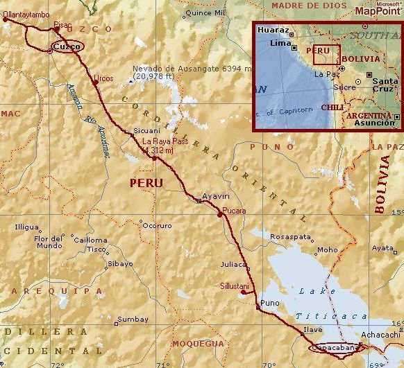
Day 17 and 18: Cuzco
How tiring a bus ride can be. I feel like a broken old man as I reach Cuzco.
Fortunately, I had good companionship during the long bus ride. A young man
from Chiclayo in Northern Peru told me all the way about life in Cuzco. He prefers Northern Peru however,
where life is more quiet and relaxed and the people are more openhearted.
The first thing I have to do in Cuzco, is to organize the Inca Trail. I have to join a tour group
because nowadays it is obliged to join such a group and to pay for a guide, cooke and porters.
Usually I tend to rather organize things myself but after my lonely wanderings in Central
Peru, I decide I could use a more relaxed 'holiday' feel for a few days. I heard
a lot of stories about difficulties in organizing the trip. It would cost days to organize
and the organization during the trip should be a mess. My experience however is
much better. The overwhelmingly friendly hotel owner herself joins me as we go
to the touring agency. Within a few minutes everything is arranged. The day after
tomorrow I will join a group of 9 tourists, a guide, a cooke and a few porters. I
do not like the idea of porters doing the hard work for rich tourists, I could easily
carry a tent and some food myself. On the other hand, you cannot change the whole world.
Sometimes you just have to join the game.
I have one and a half day to explore the city of Cuzco. Cuzco is the old capital
of the ancient Inca empire. Qosqo was the name that means 'Navel of the world'. For
the Incas Cuzco was the center of the world. At least, it was the center of the empire,
running from Ecuador to the North of Chile, from the Pacific deserts to the Amazone
rain forests. Not much is to be seen from the splendour of the old Inca empire. The Spanish
have completely overthrown the city. Just a bit of stonework of a few houses is
left. The center of Cuzco is built in a colonial style that has its own charm. In the
vicinity of Cuzco some old Inca sites can be visited. Sacsayhuamán for example is well worth
a visit. It is amazing how the Incas could manage to build these walls with such
big stones and even more amazing how the stones fit like a glove with the other stones.
Day 19: First day of the Inca Trail
After another busride the tour company arrives at the starting point of the trekking.
Just somewhere out in the wilderness, this is not how you would expect the start
of one of the most famous trekkings in the world. After a few minutes of walking the
scenery however becomes extraordinary. The glacier peak of the Nevado Veronika is
towering far above the other mountains.
I am lucky with my tour group. Tom is a real nice fellow with an energy
that never fails to encourage, Najib is always good enough for providing spiritual
elements in discussions about every possible matter and the three English girls Kirsty,
Carry and Karen always remind me there is a female side to things. Samuel shows to
be the perfect cooke for us and Nancy is the best guide we could wish. Social, personal
and she has a good feeling for the nature and culture of the area.
Today is an easy day. After a few hours of walking we arrive at the first camp where
a party in honour of Virgen de Santa Ana is held by the locals. That means a cacophony
of saxophones. Ensemble music is very popular, especially in the mountainous areas
of Central Peru. The sound is a bit different than European ensemble music. Sometimes
the music can be very exhilirating, dramatic or even ecstatic, sometimes at the cost
of decent melody. But it is always good to hear something different, something out
of the ordinary. Shows you that there always some hidden worlds, shows that there
are always things to learn about yourself and the world around you.
Day 20: Second day of the Inca Trail
The second day should be the hardest day. We have got to climb to the Dead Woman
Pass at an elevation of 4.200 m altitude. Because I am acclimatized to even higher
altitudes and beacuse I am well trained after the slavery work on my bike, I have
no difficulties. Where the others have a real bad time in the long, steady ascent,
I am just beginning to enjoy things. Unfortunately, within two hours I am already
at the pass. While I am waiting for the others of my group, I see all those
people from all those trekking groups, making their stand against the elements. In some
cases it is really a batlle against the elements and sometimes the battle is lost. The
Inca Trail is not too difficult when you are well trained and well acclimatized, but
doing this work out of the blue is a whole different story.
Day 21: Third day of the Inca Trail
The third is the most interesting day. After a short ascent to the second pass of the Inca Trail, we
enter a very green valley. We are coming closer and closer to the Amazone Rain Forest.
These are the outer realms of the former Inca empire and likewise the outer realms
of the Andes mountains.
We are walking through the zone of the so-called cloud forest, the mountain
version of the rain forest. The atmosphere in these regions is nearly always very humid.
Even when it does not rain, the mists around the mountains provide sufficient water
for the vegetation to develop wildly. There is a completely green world we enter.
There are no flowers or trees that I recognize, except for the ferns and the orchids.
After a short descent, we climb again to a third pass. High above we see the Urubamba
River deep below us. The Urubamba Valley is the Sacred Valley of the Incas. Machu Picchu
and all the inca sites on the trail are built hundreds of meters at least above the
Urubamba River and out of sight from anywhere in the valley. This is why the Spanish
never found those gems and why they are preserved untill the present day. From now on
it is only downward to the third camp. Tom and I take the long way via the steep terrace
complex of Intipata. Fascinating, strange and wonderful stuff. Are those old sites
so fascinating because its mysteries hide glimpses of a world of higher and unknown value than
ours or are they fascinating just because they are a mystery?
Day 22: Last day of the Inca Trail
This is the day. The day we will reach the Machu Picchu, the most famous archeological
site of South America. We are awakened right before dawn. After Samuel has done
a great job in the kitchen tent and the tour group has taken proof of that, we can
walk the last kilometres to the temple complex. When we walk foot by foot through the
darkness, dawn is already spreading from the eastern horizon. Within fifteen minutes
the atmosphere is set ablaze with pink and purple streaks. The peaks of the Cordillera
Vilcabamba are towering high above our heads on the other side of the valley. Deep
down below are the holy waters of the River Urubamba, The Sacred River of the Incas,
cutting their way through the mountains on the way to the Amazone Forest and ultimately
the Atlantic Ocean. The granitic mountains along the river are nearly vertical and
incredibly green. Even without the Machu Picchu, it is fascinating to walk through
this awe-inspiring landscape.
We arrive just before sunset at the Sunrise Gate. This is the place where the trekking groups
are waiting for the sun to come up and to rise and shine over the mystical place
of Machu Picchu. After walking in the beautiful scenery in the fascinating time
between night and day, waiting for the sun to come up just seems to be a bore. I even
ask myself if Helios is taking a day off today.
Eventually the sun comes and she sets the whole scene in a tremendous golden light.
The vista is stunning. But after seeing all the ptictures it is exactly what it should be,
brilliant but on the other hand because I know that it is going to brilliant, that just
makes it a little less brilliant. Surely after all those other brilliant experiences on
the way to this famous gem of the Andes.
We enter the site of Machu Picchu and learn about the mystical references of the buildings
with animals, nature and the astronomical and astrological world. The Incas had a good
sense of the changing of the seasons and the position of the stars. And they knew how
to build a city earthquake resistant. Most of the Spanish churches and buildings could not
resist the times where the older Inca remains firmly stand the test of time.
After half an hour the first tourists are visiting the Machu Picchu site. It seems that the
temple complex could easily have been built by the Japanese. Hundreds of tourists are
spreading out over the complex. Most of the trekking tour groups leave the place.
Tom and I do not. We ascend the stairs to the Wayna Picchu, the steep granite basilisc next to
Machu Picchu. On top of the Wayna Picchu there are some additional temples. And there
are awesome views into the Urubamba river thousand meters below. A great end of
four supremely well spent days at the Inca Trail.
Day 24: Cuzco - Chinchero - Urubamba - Ollantaytambo 82 km
It is more than a week ago that I rode the last kilometres on my bike. The first
kilometres of my comeback on bicycle are quite nervous: leaving the busy city of Cuzco. The road climbs steady above
the streets. The view over the old Inca Capital is improving by the minute. All
in all the ascent is not too tough. After an hour I am on gently rolling hillside landscape
above and in between two river valleys. The landscape reminds me of Tuscany, but is in fact much
more quiet and relaxed. The colors are even better and there is the added bonus of
the high Andes Mountain Range with big white peaks in the distance. I am on my way
to the Sacred Valley, the valley of the Urubamba. Machu Picchu and the other sites
of the Inca Trail are not the only archeological highlights in the holy valley
of the Incas. Two other important highlights are Ollantaytambo and Pisac.
I descend to the Urubamba River and reach the nice village of Ollantaytambo.
I visit the archeological site. Like all the other sites a lot of stonework is
to be seen. The old stones never fail to fuel the imagination. Does this place really
breathe a faint odour of a sophisticated, spiritual past or is it just imagination?
I do not really know. Maybe it does not even matter. If it results in deep feelings
of peace and tranquillity, why should I bother to judge these feelings as unreal?
Day 25: Ollantaytambo - Urcos 108 km
The transcendental feelings of yesterday did not leave a deep imprint. Today is
a cloudy day and I do not feel any more inspired than the weather. After cycling 50 flat,
easy kilometres to Pisac, I lack motivation for the ascent of 7 km to the archeological
site of Pisac. I have seen enough of those old stones the last days.
Of course, skipping the highlight of the day is not a good investment in spirit or
motivation. Just like an ordinary day of office work, I am glad to finish the 9 to 5
day in the village of Urcos where I can visit one of Perus many, many internet cafes.
Day 26: Urcos - Sicuani 95 km
A horrible night in South Americas worst smelling hotel fails to raise spirits. Sleepy
and dirty I am glad to arrive in the provincial town of Sicuani where I can have a
cold but highly appreciated shower.
Day 27: Sicuani - Abra la Raya - Pucará 145 km
After two dull, cloudy days, the weather is improving just in time. Today I will
climb to the Abra la Raya, the pass between Cuzco and Lake Titicaca. The valley above Sicuani
is very colourful. The farmlands in the valley are painted in all the earth colours
provided: yellow wheat, orange and brown earth and the olive green eucalyptus trees.
The Indian population is at work on the land. This is great cycling landscape.
After an hour the landscape changes into all too familiar puna landscape. They call
me mellow yellow sings 60s folky Donovan lazily. That can truly be said of Pachamama,
the so-called Mother Earth of the Indians. The whole world seems to be painted
in Donovans favourite colour.
The pass is 4.300 m high. Because the road is paved and never too steep,
it was not quite the effort of some of the passes in Central Peru.
The descent of the pass is relatively short. On the Titicaca side of the La Raya pass
is the famous Altiplano, the high and barren plains of around 4.000 m elevation. The
land of the condor and the land of the lama. Condors I do not see but lamas are all the more abundant.
The friendly, woolly monsters are everywhere to be seen in the punas of Peru. One of the
best qualities of the Altiplano is the air above it. The sky is as deeply blue as I can imagine.
Panoramic is too small a word. The white clouds are constantly moving, constantly
changing shape. The clouds seem to be pure liquid, as if they can take any shape
possible.
In the afternoon the wind is getting stronger and stronger. It is hard work pushing
myself forward on this altitude with this wind force. It is getting more cloudy as well.
After a few hours I drop the torch in the village of Pucará. Just in time.
As I pass through the entrance door, a cracking thunderstorm turns the Altiplano in
a hell of wind rain, hail and thunder and lightning.
Day 28: Pucará - Juliaca - Sillustani - Puno 138 km
Today the weather is fine again. Clear blue skies welcome me. Because of the rains of
yesterday the air is even more crystal clear than usual. The immense Altiplano is
every bit as inspiring as I thought it would be.
After passing a village, two young lads are cycling around me. They do not say a word to
me and when I speak they do not answer. I do not trust them. Every time they cycle just
a few meters behind me. They seem to negotiate about something I am not supposed to hear.
I decide to behave as calm as possible. I will not try to cycle away. They do not have 25 kg
of luggage on their bikes and will surely be faster. Luckily I am not the own person that
feels their bad presence. They feel each others too. When they are quarrelling,
I can slip away.
I am coming closer and closer to the famous Lake Titicaca. The landscape is completely
flat. After twenty kilometre cycling in the flat nothingness, the mountains are really
far away. Only the thin air suggests the high altitude. Lake Titicaca lies above 3.800 m
elevation. As a big oasis in the middle of nowhere, the city of Juliaca is sprawling
with life. There is a procession going on in the Main Street of the big Altiplano city.
Processions in Peru are full of colour and surely full of life too. Waves of
cheering and noise escape the moving masses. I meet a French missionary. In a tea
stall we are drinking quinoa and wait untill the crowds are gone. After half an
hour the Main Street is still filled with the multicoloured crowds. The missionary
has to cycle as well to the other side of the town. Together we ride the backstreets
of Juliaca. With 250.000 inhabitants Juliaca is the biggest city of the Peruvian
Altiplano. On my own I would have had difficulties finding my way through the alleys
and sidestreets. With my guide it does not take more than half an hour to leave the place.
I am on the Altiplano again.
It is now only 45 kilometre to go to reach Lake Titicaca. Between here and Puno, the biggest
city of Lake Titicaca, the road is very unattractive. The busy traffic makes cycling a
nervous experience. Halfway I take a break to relieve the tension. A few kilometres
beside the main road lie the Inca death tombs of Sillustani. The tombs are a welcome break.
Back on the main track it is gas, dust and noise again for more than an hour.
After an unexpected ascent of a small hill range, I descend into the city of Puno.
Puno is situated steeply on the hill range behind the Lake like an Altiplano variation
on Monte Carlo. The views over the blue Lake are fascinating and feed the enthusiasm
to explore the Titicaca region.
Day 29: Puno
Lake Titicaca is the highest navigable lake in the world. It is also the place
of the Floating Islands. These islands of reeds are totally made by hand out of
the reeds that grow abundantly along the shores of the Lake. The reed islands are home
to many hundreds of families. Everything is made of reed. Even the houses on the islands are
made of reed. Only the postoffice box is made of steel.
The people make a living of fishery but the last centuries tourism is commercially
far more commercially attractive than fishing. find out that the Islands are indeed
crowded with tourists. Too many people. I must not complain. Tomorrow
I can cycle again. With a little luck I can reach Bolivia tomorrow afternoon...
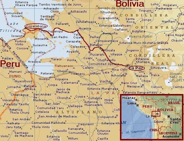
Day 30: Puno - Juli - Pomata - Yunguyo - Copacabana (Bolivia) 148 km
I had high expectations of cycling along Lake Titicaca but the crowded traffic diminish
my enthusiasm with the minute. I did not sleep too well tonight, maybe because of the
altitude. I am feeling a little exhausted. The result is that I am not having a
happy time. It takes me two hours to get myself together and to enjoy life again.
Maybe the changing landscape helps a bit. I have left the Lake for a while and I
am riding through a wide, open valley. Heaven and Earth lie before me as a grand
panorama. Little white clouds accentuate the deep blue sky above, their shadows
chasing restlessly over the ground surface.
At one o'clock I reach Juli. The small city is a little jewel along Lake Titicaca.
The landscape remains beautiful. The road does not leave the Lake anymore. The
landscape is very dry. Barren hill ranges flank the Lake now and then. The occasional
valleys however are very green and full of life. Everybody is working on the land.
The people are greeting me wildly enthusiastic. I feel my spirits rise in this
friendly atmosphere.
I see the large bay before me that must lead me to Bolivia. The wind is strengthening
again but I will hold on. Behind the lake I can see the white peaks of the cordillera Real,
the high mountain range of Bolivia. The mountains must be some 150 kilometre far away.
The last kilometres of Peru are not the most easy. After the beautiful gem Pomata, the
wind is raging over the plains. Slowly, slowly I see the small city of Yunguyo coming
closer. Yunguyo is the last Peruvian city before the border. After Yunguyo it is only
8 kilometre to Copacabana in Bolivia. I have no difficulties at the border. The friendly
administration is doing a good job and within a few minutes I am outside the office.
With my first steps in Bolivia I see the sun sinking in the waters of Lake Titicaca.
The romantic inside of me cannot help but love the beautiful sundown. The responsible
inside of me knows I have to hurry to reach Copacabana before it is dark. And the
traveller inside of me feels that new adventures loom behind the horizon.
Day 31: Copacabana
My first day in Bolivia will be a rest day. There is enough
to do in Copacabana. The tourist gem is beautifully located. Little mountains in
and around the lake make Copacabana a spot that everybody loves. The beach of Rio
de Janeiro is named after the Bolivian Copacabana, not vice versa!
Another highlight is the strange white cathedral. For me the good food can surely
be called a highlight. And have I forgotten to mention the beautiful sundowns in Lake
Titicaca?
The best thing about Copacabana however is its proximity to the Isla del Sol, the
Island of the Sun. Early in the morning I am waiting on the beach for the boat.
I am chatting with a nice french young woman called Helena. We decide to wander
together on the Island. There is a small half day trek right over the hill ridge
on the island. Some inca ruins can be visited right along the way.
It is a brilliant day. The sun is very strong on these altitudes. It feels like 25
degrees although it will probably be colder. Everything on the island seems Greek.
fierce sunshine, blue skies, blue water, ruins with archeologically respectable past,
mediterranean like hillslope vegetation. And of course Helena could not have a
more apt name.
This is a really relaxed day. No headwinds, no steep ascents, no stomach problems, no
fatigue. This day is filled with lazing around, chatting and smalltalk, picknick and
laying in the grass. Female company surely makes a difference. Helena proves to be
an intelligent and sensitive woman. She tells about her work in Cochabamba. She is
helping the locals in setting up cultural activities. A hell of a task, because Bolivians
are not especially blessed with a grand reputation in the field of planning and logistics.
This sunny day also comes to an end. The boat brings us back to copacabana. Helena
goes back to Cochabamba. I will go in the direction of La Paz tomorrow. My bicycle
cannot wait another day. I wish Helena all the luck and good things in life.
Day 32: Copacabana - La Paz 156 km
The romantic Greek atmosphere of yesterday is replaced by a grim Siberian ambiance today.
As I wake up, everything lays under a thin blanket of fresh snow. It is still snowing
lightly. The road climbs steeply above Copacabana, into the hills, into the clouds.
After a few minutes everything around me is cloud or snow. No sound can be heard
in the dimming clouds, only my own breath. Time seems to stand still. Slowly I am
moving on, careful not to slip away on the sometimes icy road.
After a long time I descend under the clouds. An icy view over icy Lake Titicaca
is whatsoever really beautiful.
Slowly the weather is improving. The snows have stopped but the clouds still cover
the skies. I am unfortunate to miss the views over the 6.000 m high mountains of the
Cordillera Real, Bolivias most spectacular mountain range.
After more than 200 kilometre along Lake Titicaca I am leaving the lake, this time
for good. I am not leaving the Altiplano however. Along the Cordillera Real, hidden
in clouds, I move on to La Paz, one of Bolivias capitals (Bolivians do not agree if Sucre
or La Paz should be their capital). La Paz is the worlds highest capital. Its center
is situated on an elevation of 3.700 m.
After a long day I reach La Paz just before dusk. I am having a problem however.
The city is getting busier and busier but the streets are not corresponding with my map.
Everyone is telling me to keep going straight forward, so that is what I do. It
is really strange. I am cycling for kilometres through the city without any sign of
direction and without seeming to come closer to the center. It even looks like
I am leaving the city now. As I follow the road in a bow around a hill ridge,
things finally become clear. I am standing above a wide valley which is completely
filled with houses. All the time I have cycled through a huge suburb and only now
I am looking over La Paz, down below in the valley.
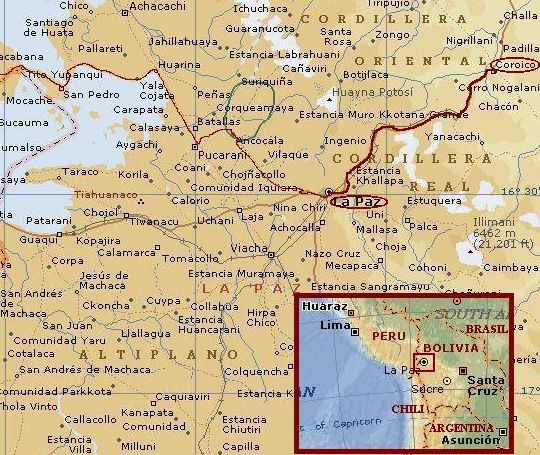
Day 34: La Paz - La Cumbre - Death Road - Coroico 102 km
After a day of sightseeing in La Paz, it is time to move on. I want to cycle into the
Yunga's today. Behind the Cordillera Real, the Andes Mountains fall down into the Amazone
basin. Within a relatively short distance the landscape makes a significant drop in altitude.
The region between the mountains and the jungle is called the Yunga's. The Yunga's are
famous for heavy rainfall, superb green landscape and steep mountain slopes. The most important
road between La Paz and the Yunga's has the sinister name 'Death Road'. Lots of
fatal accidents occur every year. The Death Road begins at the pass across the
Cordillera Real, La Cumbre, at 4.700 m altitude. The Death Road ends in Yolosa
at 1.200 m altitude. Most of the tourists however travel a few kilometres further than
Yolosa. Coroico lies at 1.700 m high above the valley and has great views over the Yunga
valleys and mountains.
So the first thing to do today is the ascent of La Cumbre. It is a sunny day. I can see
the mountains of the cordillera Real for the first time, without clouds. I am really lucky about
that because of the rainy reputation of the mountains behind the Cordillera.
It is a nervous experience to do a high altitude ascent in the complete chaos
of a big South American city. It is impossible to keep moving on in the
crowds. My bicycle with luggage is too wide to zigzag in between taxis that
stop for clients. From time to time I am stuck in traffic jams. The city of La Paz
stretches out untill halfway up the pass. When I have left the city behind, the
valley is completely quiet. The last kilometres to the pass are much easier therefore.
Unfortunately, nothing is as good as it seems. I reach the La Cumbre Pass but find out
that everything is completely wrapped in clouds. I ask myself where they
come from this fast.
The descent is remarkably easy. The road is well paved and follows the valley downward.
It is straight ahead downhill. It is beginning to rain a bit but I could expect that
in a region that is known as very wet. No worries whatsoever.
After half an hour the road starts to climb. The landscape is completely green right now.
No little spot is without vegetation. The pavement is gone. In these rains the
road is not much more than a dirty mud trail. It is hard work to push myself
forward through the mud. I ask myself if I follow the right road. I should descend
but this road only goes up. I cannot check on my compass because the road is
twisting and turning in all directions. There is nobody to ask the way. My hopes
are with the wind.
It never rains it really pours. It is raining cats and dogs right now while the road
is still going higher. I am climbing half an hour through deep muds. Curiously the
rains stop at once. At the same time I come at the top of a ridge. The view from the
ridge explains a lot. Before my eyes lies a vertical, green world. Immense green slopes
fall into the depths below. I can see the mud trail go down endlessly along
the mountain flanks. Now I finally understand the name and fame of the road.
Within a few minutes the rains return. This time it is for real. The rain comes
in merciless measures. The water is everywhere. It is coming out of the clouds,
dripping of the trees, falling from waterfalls on the road. All I have,
including myself, is dressed in thick clods of mud. My bags, my wheels, my brakes,
everything is dirty. The road is slippery. I cannot descend with velocities above 7 or 8 km/hour.
The road passes deep ravines so I must not make any mistake at all. When does this come
to an end?
Not soon. The status quo is released only after hours. I am soaked untill the bone as
the rains finally stop. It is not too far any more to Yolosa, the end of the Death Road.
At a lost bus stop I see a colleague cyclist. It is Christian, A young man from
Switzerland. He goes back to La Paz. I ask why he does not go down the last kilometres
to finish the road. Because he does not have a reason, he decides to join me. Christian
is a fascinating mystery. He cycles without luggage, without food, only a bit of water.
Also spiritually Christian seems to cycle without luggage. Without goal or purpose.
Christian tells when he does not feel like moving on, he just hitchhikes his way back.
Christian and I split in Yolosa. We have made the Death Road. Christian will try to go
back to La Paz today. I have a bit more than an hour to reach Coroico before dusk.
I have to hurry. I have to ascend 500 m and dark clouds are gathering behind Coroico.
After 15 minutes it is raining like I have never experienced in my life. The road is
overflowing with water. I am afraid my luggage will be damaged severely by the huge amounts
of water today. Then thunder strikes, completely out of the blue. At once my whole
world is white, Lightning has nearly struck me! I have to wait untill the thunder has
passed. It takes an age and lots of water before I can ride on for the last kilometres.
Wet and dirty, a Yeti lookalike cycles to the Plaza de Armas of Coroico. It is me,
looking for a hotel.
Day 35: Coroico, La Paz
As I wake up, everything is still soaked. The roof of the hotel is leaking. My luggage
has not dried even a tiny little bit. Everything is completely wet. Even my passport,
money and other important things. I decide to dry my luggage in La Paz before I travel
any further. With a small minibus I return to the big city.
Day 36: La Paz, Tiahuánuco
While my stuff still needs to dry another day, I decide to join a tourist excursion to
the pre Inca site of Tiahuánuco. We will not reach the place. We find
out that there is a riot going on in El Alto, the twin city of La Paz which I had
mistakenly taken for La Paz when I came in from Copacabana a few days ago. Our bus driver
is taken out of the bus by force and has to negotiate with a furious crowd. Hundreds,
thousands of people are on the streets. The people have blocked the major road and most
of the sidestreets. It takes us many hours of waiting, negotiating and good luck before they
let us go back to La Paz. Of course we did not see anything of the archeological site.
What is the matter? It is the 'gas problem' that causes the strikes. The USA want
to transport gas from Bolivias rich resources to Chile via a pipeline. Because the
ordinary people of Bolivia do not make any profit, they feel that the politicians
take everything for themselves. The fact that the pipeline goes to Chile,
really is the limit. Since Chile has won the Pacific War in the nineteenth century,
Bolivia has lost its sea harbor Antofagasta and has lost its pride as well. Maybe the
people do not have especially good reasons to oppose the plans. It is like Bob Marley sang:
a hungry mob is an angry mob.
Tomorrow strikes are planned all over the country. It seems better to wait some time before
moving on. I decide not to cycle tomorrow. But mountaineering remains a possibility
in this region. The Cordillera Real is just around the corner. In the agency
everything is realized efficiently. Within an hour I have a guide, a pickel, shoes,
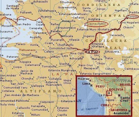
crampons and a cord. Tomorrow I will start the ascent of the 6.088 m Huayna Potosí!
Day 37: La Paz - Base Camp Huayna Potosí
A taxi brings us to the mountain hut where the expeditions to the Huayna Potosí
take off. The weather is good as we start to walk to the campsite. Over big moraine
walls we go up. The slopes are sometimes slippery with bits of snow and ice between
the loose stones. All in all it does not take too long before we reach the campsite.
There are a few other groups with guides that will also make an attempt to reach the top
tomorrow.
The campsite lies beautifully at the foot of the glacier. We have great views over the
nearby mountains of the Cordillera Real. After pitching our tent and having a simple dinner
it is social hour between the groups. Two Spanish men and a Swiss man are quite experienced
climbers. A young Dutch couple seems to be less used to this kind of terrain. Both
of them seem to be a bit worried about things to come tomorrow.
Day 38: Base Camp - Huayna Potosí
The guide wakes me up at half past 12 in the night. I am glad he is waking me. I
have not fallen asleep because of the altitude. Being awake brings other problems.
It is 25 degrees below zero. Way too cold for me. I am not hungry, probably an effect of
altitude and temperature. I know I have to eat something, though. I am chewing some brick hard
chocolates. They taste awful.
I am glad that we are walking now. The other groups have been woken up more than half an
hour ago and are long gone. my guide is only 20 years and has a good physical condition.
He has a steady pace, I am able to follow without too much problems. Within
two hours we have passed all the other groups. We have the advantage of being a small group.
The Spanish and the Swiss however walk a good pace too. The ascent of the Huayna
Potosí is straightforward untill we reach a huge crevasse with a long ladder
across. Carefully we cross the obstacle. After the crevasse a twenty meter steep
section of sixty degrees is the first serious test for my crampons.
We gain altitude steadily. I see the nearby mountain peaks sink in the depths below.
It is still night as we reach a huge plateau at 5.800 m elevation. The altitude
is beginning to make life difficult right now. It is heavy work to push forward through
the snows with less than half of the oxygen in the air compared with sea level. Like an old
man I need the support of the pickel to release my legs of my own weight. I see that
my guide is walking in the same way. After an hour we have traversed the plateau and we
stand right before the top section. The last two hundred meters of climbing are much
steeper than the rest. The slope has a minimum of 40 and a maximum of 60 degrees.
I try to push my pickel as deep as possible into the ice. It will not get any better
than a centimeter at the most. My crampons do not perform better. The ice is as
hard as a rock. We will have to do with it. I use all my force to stay as still and
quiet as possible. I am breathing like a dog. Every step again I have to kick my feet
as hard as I can in the ice face. Usually the circumstances should be much better,
but usually it is warmer than minus 25 degrees. In deep concentration I go on and on,
untill unexpectedly I reach the summit. My guide and I are the first today to reach
the top. Right now, the sun is climbing above the horizon and sets the
top face in the sun. Thousands of meters below are the Yunga's. A thin cloud cover is
already spread out over the Yunga's and the jungle. On the west side the Altiplano can
be seen. Two to three hundred kilometres to the west I see the border mountains with Chile
including the Nevado Sajama, the highest mountain of Bolivia and nearly five hundred
meter higher than here. Could be nice cycling there...
Day 39: La Paz. Tiahuánuco
After the succesful ascent of the Huayna Potosí, I need a rest day. I decide
to give the excursion to Tiahuánuco a second chance. This time it is quiet in
La Paz and El alto; without problems we reach the site. The Tiahuánuco culture
is not only much older than the Inca culture, it also has existed much longer. For two
thousand years the Tiahuánuco culture was the most important civilization of South America.
Only the last hundred years before the Spanish set foot on American ground, the Inca culture
has overthrown the Tiahuánuco civilization.
After an interesting day I hear bad news. Tomorrow widespread strikes are planned
in La Paz. It will probably be impossible to leave the city tomorrow. No taxis
and buses will ride in La Paz the next days. I have to wait again
in La Paz. I decide that as soon as I have the chance, I will cycle straight out
of La Paz to the Chilean border. A civil war could be at hand and even if it will
not come to that, I am not in South America to be stuck in a third world capital
for days or weeks.
Day 40: La Paz
There is a riot going on. Over the highway I see a procession of several kilometres
flow into the city. They are all coming from the poor twin city of La Paz, El Alto.
The high city has been the center of unrest from the beginning. This time the riots
will not be restricted to El Alto. Thousands of people gather at the Plaza de los
Héroes, only 150 m from my hotel. After returning to my hotel, I see on the
Bolivian television shooting at the nearby square. With a few tourists from the hotel,
we are going to a cafe. We walk along the masses. I hear people demanding the death(!)
of the president, of the whole government.
The whole day there are riots, shootings, the army tries to control the streets
but do not succed completely. On the television I see politicians being beaten on
the streets by the crowds. Late in the evening things calm down a bit after the president
declares that there is a compromise with the opposition. To me it is not exactly clear
if there is any substance behind this statement. The opposition declares a few minutes later
that the negotiations have not been succesful at all and that the strikes will be
prolonged. For this time the president has succeeded in confusing the masses, for the
nearby future we have to fear the worst for the government.
Day 41: La Paz - Patacamaya 110 km
I will not wait in La Paz for things to come. I expect that the protest of yesterday
will not be resumed at six o'clock in the morning. Most of the people were terribly drunk
yesterday and at this early hour they will surely be less energetic than the day before. Because
no buses and taxis ride through the streets, it is probably the best day in ten years
to climb the otherwise very busy highway up to El Alto.
I have been right. Nobody is awake in El Alto. I can trespass without any problems.
After a week of adventures La Paz and the Cordillera, I am back on the windy but beautiful
Altiplano.
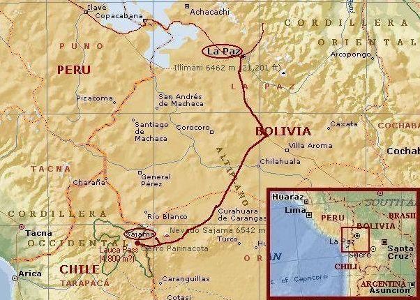
Day 42: Patacamaya - Curahuara de Carangas 100 km
Even in this remote western corner of Bolivia, I feel the impact of the political unrest.
There is practically no traffic. In fact traffic is virtually impossible because
around La Paz and the other big cities, people have thrown thousands of big stones on the
road. I can easily circumvent the stones, cars and trucks cannot. The situation
causes me problems as well. There is nearly no food available any more. There are only
few villages and nowhere I can obtain anything substantial. I have to do with a few biscuits
the whole day. The landscape however is as panoramic as I could hope for. Small clouds are scattered
across the blue sky, their shadows chasing restlessly over the land. As the afternoon
progresses, the shadows grow taller. Unfortunately, not only the shadows grow taller but also the clouds
that cause them. The wind is growing too. As I reach Curahuara de Carangas, dust is
being blown across the streets. Curahuara looks like a ghost town. Within a few minutes I
find a hotel, though. The reason for being here however is to find some food. That takes
considerably more time. In the end I obtain a little bit so I can have a good
night's sleep.
Day 43: Curahuara de Carangas - Sajama 100 km
There is no breakfast available in Curahuara. Because there are no villages untill Sajama,
it looks like hunger is ahead. In the early morning sun, trouble however seems far away.
Through a small valley I slowly gain altitude. The Altiplano is highest at the border
with Chile. Along the border there are several volcanoes and mountain ranges that
loom above the plains. After the ascent out of the valley, I am standing on a huge plateau
that ends up in the border mountains. The view is phantastic. The road goes straight to
Bolivias highest peak, the Nevado Sajama. Behind the mountain, the village of Sajama
will be my goal for today. First I have to climb to a watershed that is the extension
of the Nevado Sajama. The ascent is not steep but very long. With the late afternoon
Altiplano windforce 8 or 9 this is hard work again.
After reaching the watershed a descent of a few kilometres brings me in a wide depression
between high mountains. Right behind me lies the mountain range that is the barrier
that divides me from Chile. To the right a wide valley lies between the highest mountains
of Chile: The Nevado Sajama right of the valley, the twin volcanoes left of the valley.
In between is the village of Sajama. To reach the place, there is only one obstacle,
a road of twelve kilometre of loose sand. Sajama itself has a respectable elevation of
4.400 m.
I cannot cycle faster than 6 to 8 kilometre per hour. Sometimes my bicycle comes to
a halt in the deep sands. This is incredibly hard work. This would have been, even if I had not been hungry
or if I had not cycled hundred kilometres on high altitude already. The gain
is in the end worth the effort.
The village of Sajama is lying between the Nevado Sajama and the twin Volcanoes of Pomerape and Parinacota.
The village must be one of the most scenically beautiful places in the world. The village itself has an
extraordinarily beautiful old church. The atmosphere of the place is grandiose, the mountains, the plains,
the church, the smiling people of the village. In the restaurant of the village a few
tourists gather. We sit at one table. Among the tourists are the twins Frank and Gary,
really good lads. We have a great time in a great place.
Day 44: Sajama - Putre (Chile) 105 km
The trail back to the road to Chile is a tiring start of the day but the landscape
is so beautiful I do not really feel the effort. Back on the track, I cross the
depression where the last ascent begins. It is a cloudy day. Snow is falling lightly
as I am trying to get rhythm. The ascent is not too long. More than an hour of
climbing takes me to the pass. I have made it. I have succeeded in leaving Bolivia!
I feel relieved and happy. From here it is 200 kilometre straight down to the Pacific
harbor of Arica. Chile, here I come!
I have made it. I have succeeded in leaving Bolivia. From here it is only 200 kilometre
straight down to the Pacific harbor city of Arica. The first 60 kilometre pass
through the National Park Lauca and is as beautiful as the National Park Sajama
at the Bolivian side of the mountains. I see some vicuña's before the Parinacota
Volcano. The vicuña is family of the lama but far less abundant. In the Lauca National Park
there are plenty of them. It is difficult to photograph them, because they are very shy.
The vicuña's are not the only highlight. After a descent of a few kilometres
I reach the Chungara Lake, the highest lake of the world at 4.600 m elevation. Flamingos
live in the ice cold water. Different types of flamingo species have been able to
adapt to the extreme conditions of high Andes lakes.
After Lake Chungara the road climbs a few kilometre to a new watershed. A huge
valley filled with large boulders is spread before me. Ponding waters lie between the rocks.
It is snowing lightly but the views are still good and the road remains dry.
The dark landcapes are nearly uncovered with vegetation. This is due to the altitude
but in equal measures to the lack of precipitation. I am blessed that I experience one
of the few precipitation events in the year but also this time the few flakes of snow
will not result in a blooming high altitude desert. More grim than the snows is the wind.
A raging storm is developing over the plains. My velocity is dropping below 10 kilometre
per hour on flat stretches. I have to climb again so the velocity is even lower right now.
I am waiting for the road to finally begin the descent to Arica, but the road is only
climbing.
This could be a tough day. When I finally reach the crest of the ridge, I descend
two hundred meters but then there is another huge valley to cross and behind a new
ridge that is much higher than this one. Another disappointment comes when I have
descended to the valley. The two villages are abandoned. I have planned to buy some
food here. Now I have to do without for the rest of the day. I have not eaten anything
since the morning and I was not able to buy anything in Sajama or later in the day.
This will again be a hungry day.
The crossing of the valley is a torture and the ascent of the ridge is even worse.
These are times that the glamour of a journey like this seems distant and far away.
I have no choice but to go on. Eventually I reach the top and, finally, the road starts to go down.
The weather improves rapidly as I am losing altitude. When I reach the the civilized
world just before the sun goes down, clear blue skies welcome me. The pretty, quiet
village of Putre is shook up by a primal, earthy outrage in a restaurant by a hungry,
underfed cyclist.
Day 45: Putre - Arica 145 km
Today I want to reach Arica, the big harbor town of Northern Chile. From Putre, I
have to descend 3.600 m to sea level. Strange enough, the road is not descending
at all. It is not the first time these days that I am confronted with a
scenario that is far worse than my expectations. The road is going up and
down and the wind is blowing straight in the face with a force that is as strong as yesterday.
After six hours of cycling I am still far from halfway and I have not descended
substantially yet.
The landscape is completely dry. Nothing is growing here. Finally the road starts
to go down. Actually, the road falls down with steep gradients. After 10 kilometre
I am surrounded by strange cactuses. The cactuses only grow between 2.500 and 2.800
m elevation. If I descend further, the slopes and valleys of the mountains are blank
with vegetation again. The desert has all kind of colors before I descend into a valley,
flanked by huge ridges, hundreds of meter high and completely white. The white sands I am
surrounded with by now, are the strangest thing I have seen untill now. The sun is omnipresent in the reflection
of the white sands. The sands themselves are also omnipresent, the wind is blowing sand
in my clothes and in my eyes, in my mouth and in my ears.
After 30 kilometres the descent is over. I am below in the valley that will lead me
to the ocean. The ocean is however still 50 kilometre away from here and the wind is
not anything less than in the mountains above. The last 50 kilometres to Arica are
not characterized by pure cycling joy.
After three hours I I reach the Pacific. There is a great view over the bay and the
city of Arica and the rock cliff of the Morro. The sun is just going down in
the Pacific when I reach the city. I am experiencing a huge culture shock. Green
grasses, real shops, people in nice western clothes, orderly traffic. This
cannot be South America! With a confused mind I am walking through a pedestrian
shopping zone (!), as I hear my name. I decide not to take account of the shouting,
there is nobody I know in Chile. After three times, my mind takes another step.
If I do not know anybody in Chile, how come that someone does know my name and shouts
it to me? I turn around and I see the smiling face of Gary, one of the twins of
Sajama. The rest of the day is filled with wining, dining and having a damned
good time.
Day 48: San Pedro de Atacama - Valle de la Luna 50 km
I do not have too much time any more. Because of the political trouble in Bolivia,
my plans to cycle in the high country seem unrealistic. At the moment the borders of
the country are said to be closed. Tourists will be stuck in the country. The German
government is thinking about plans to evacuate the tourists in Bolivia by their army.
I have to change plans. I am thinking about doing a tour in the Lake district of Chile,
two thousand kilometres southward. On the way, I could explore the Atacama desert in San Pedro.
San Pedro lies in the heart of the Atacama desert, the driest place of the Earth. There
are places in the desert, where there has not fallen a drop of rain since the Spanish
presence on the continent. That means that it has not rained for 400 to 500 years.
San Pedro lies in the biggest oasis along the Rio Loa. The green resort is surrounded
by utter nothingness. In the distance the Atacama desert rises up slowly to the
range of mountains and volcanoes that form a barrier between the high Altiplano and
the low Atacama desert.
Today I am doing a day trip through the Valle de la Luna, which means literally the
Moon Valley. The name is apt. The colours in the valley have an otherworldly quality.
At some places the rocks are deeply red, at other places white from salt. The rocks sometimes
have strange shapes, weathered by the wind in bizarre sculptures. The mountains of the
Altiplano can clearly be seen, however distant they are. No scale seems to be able to
set things in perspective. Mountains of 6.000 m altitude seem twenty minutes of cycling
away. It is impressing to see the mountains of the Andes in a faint bow behind the desert
plain, climbing steadily out of the valley into the thin air.
Day 49: San Pedro de Atacama - Laguna Blanca - San Pedro 120 km
I cannot resist the idea to climb for one last time to the Altiplano. In a day trip I can
climb to the pass across the Andes and descend to the Laguna Blanca and the Laguna Verde,
two high lakes just across the Bolivian border. The whole ascent I will have the Volcan
Licancabúr on my left hand. The volcano is nearly 6.000 m high, though lacks any
substantial snow cover. The lack of snow is not caused by high temperatures but by the
absence of substantial snowfall.
It is not possible to enter Bolivia at the normal frontiers. In Southwestern Bolivia
there are no villages and cities, neither are there angry demonstrators nor unreliable politicians.
According to the people of San Pedro de Atacama it should be possible to cross the border for
a day trip.
Early in the morning I am on the way to the long, long slope that progresses up
into the realms of the volcanic peaks of the Andes. After nearly 15 kilometre I have
crossed the valley floor. From now on the only way is up. The slope is not too steep.
Therefore the road goes straight up with only faint curves. There are no changes
along the way. One long road through nothingness, slowly climbing through a landscape
of orange red stones. After three hours of climbing the colour of the ground changes a bit to
somewhere between brown and orange. Some streaks of puna vegetation are proof that
I am gaining altitude.
It takes another two hours to reach the dust trail that leads up to the pass. It
is not too far anymore. The road was said to be in a poor shape but until now it is better than I expected.
I reach the pass after less than an hour of cycling over and through the sand road. The landscape is
very surrealistic with the deep red surface and the lonesome mountain ranges, rising
out of Mother Earth. From the pass at an elevation of about 4.600 m it does not take too
much time to descend to the lakes. After one of the longest ascents I have made
in one day, I reach the lakes.
Laguna Verde means 'green lake', Laguna Blanca means 'white lake'. Both lakes seem
to have a colour somewhere in between. The strange colour is caused by the high
content of heavy metal, the result of the high volcanic activity. However chemical,
acid or radioactive the water, it does not matter to the the flamingo's. They
can adapt to every circumstance, except for human beings. The animals are
extremely cautious. I try to get the gracious birds on picture, but every time
they fly away. It is already three o'clock. I have to return.
I should have returned earlier. The wind has grown again to a storm. The climb back
to the pass is a horror scenario of raging storm, sand in my eyes and breathing in
an overdrive frequency. Because of the wind, the cold or the altitude, but most probably
because of a combination of those three factors, I have to cough at an intensity
that is far out of control. It is difficult to stop the coughing, but also very important.
There is not too much oxygen in the air and I need the sparse oxygen for cycling.
The coughing is a complete waste of oxygen. The short distance back to the pass
takes me two hours. From now on it is only down over one of the best descents
in the world: nearly 2.500 m elevation downward in more than 30 kilometres without any
substantial curves nor any traffic. Within half an hour I am back in the Atacama
plains. Another half hour brings me back in San Pedro.
Day 55: Curacautín - Lonquimay 60 km
I have traveled south by bus through La Serena and Santiago. I have two weeks left to make
a tour through Araucaría and the Lake District. Further south begins the highly
interesting region of Patagonia. The season is too early for Patagonia however. The area will be largely
under snow. Public transport will not be able to bring me back for my flight to the Netherlands.
I will not go south from Chiloë therefore.
I must not complain. As I get out of the bus in Curacautín I step into an other
world. After the Altiplano and desert landscapes of Bolivia and Northern Chile, the
world around me is completely green now. Once in a while a big white volcano comes up out of
the green. The biggest of them is the Volcan Llaima, which is 3.100 m high. The mountains
are much lower than in the areas where I have traveled before. They are however by no means less
spectacular. The snow line lies at 1.200 m, so there is a whole lot of snow on a mountain
like the Llaima volcano.
The first ascent is over the Cuesta to Lonquimay. The dirt track has not been traveled yet by cars.
It is just spring in the south of Chile. The road has got unorthodox gradients. Because
I am used to climb at much higher elevations, I have so much oxygen that I am
feeling very light, despite the steepness of the road. I have complete control over my breathing.
There have surely been days that things were not going this smoothly.
In the higher regions the special Araucaria tree gives a very distinctive flavour
to the landscape. The Araucaria trees paint the slopes dark green. The tree is
only abundant in Southern Chile and Southern Argentina.
At the pass I am completely surrounded by snow. Only the road is more or less free of
snow. After a comfortable descent I reach the village of Lonquimay.
Day 56: Lonquimay - Icalma - Melipéuco 120 km
One of the most beautiful cycling days of my journeys begins already early. The sun
fills the valley and brings a second warm day in the early spring. Early october
can be far worse in these areas. Wintertime has only recently lost terrain to the spring.
Snow still covers the higher hill and mountain ranges. After ten kilometre I change
the comfortable paved road for a dust trail that leads to the National Reserve
Guallatué. The road climbs soon to the Araucaria zone. Although I am cycling through
dense woods, sometimes there are open spaces with remarkable views. After two hours
of cycling I reach the pass.
On the other side of the watershed the terrain is quite flat and far less forested.
The landscape looks like a tundra. Wide valleys are filled with big snow fields
in between the grasslands. Huge boulders lie everywhere in the valley and on the
mountain slopes. There are some icy lakes in the valley. The biggest lake is the Guallatué
Lake in the middle of the wide valley. After an hour of cycling the valley is narrowing.
The road leads me to the beautiful Icalma lake, only three kilometres from the border with
Argentina.
Instead of going to Argentina however, I begin to climb to a new pass that must
bring me to the National Park Conguillio. Halfway the trail is cut off by a river.
It takes me some effort but in the end I manage to climb to the other side. No
further surprises arise and I reach the pass. Now it is only downward. A long descent
brings me in the civilized world again. In the lower parts of the valley it is
springtime already. Apple and pear trees are in full blossom. The melting snows
of the higher parts of the land come down from the sidevalleys and gather in the main valley.
Everywhere on the slopes are waterfalls. In the distance the Llaima volcano comes
in sight again, this time from the south instead of from the North in Curacautín.
The last sunlight softly touches the upper crest. Dusk is already fading as I reach
the first true village of the day. In Melipéuco I find a place to rest.
Day 57: Melipéuco - National Park Conguillio 60 km
Today I will try to cycle into the National Park Conguillio as far as possible. I
know that the higher reaches of the Park are under a thick snow blanket but before
there are some lakes that are supposed to be very beautiful. I will cycle without all
the luggage today to those lakes; I will return in Melipéuco.
Without luggage I do not bother that the road is sometimes very steep. Soon I have climbed
high above the main valley. I enter a sidevalley that will bring me to the Llaima Volcano.
I find out that the volcano is an active one. The whole valley floor is filled with black
lavas. Only a small strip of trees on the volcano has been saved from the cataclysmic event.
The outburst dates from only a few years ago.
The lava field offers difficult cycling. The tyres cut deep in the volcanic sand.
With complete luggage this day tour would not have been possible. It takes ages before I
have crossed the lava field. I reach the Laguna Verde, the Green Lake, that owes its
existence to the natural barrier that the volcanic lavas have provided. The small
but lovely Laguna Arco Iris is a true beauty. That cannot be stated about the road that climbs with
brutal gradients further upward. The tour ends with the big Laguna Conguillio that is
surrounded by high mountain ranges, white with snow. This has been good enough for today.
The air is growing greyer and greyer without any cloud formation. In fact this looks far worse
and promises the worst for the nearby future.
Day 58: Melipéuco - Villarica - Pucón 120 km
It looked like the weather was going to be bad yesterday and that was not a false
promise. But after a night of thunderstorms it is dry now, early in the morning.
I decide to go, although it is hard to imagine that the weather will really improve
today.
After a few kilometres it is indeed raining again severely. That is bad news because it is
quite far to the Villarica Lake. Today I want to reach the most northern Lake of the Lake
District. Pucón is the most touristic spot of the Lake District. It could be nice
to be among the people for a day or two. The road to Villarica goes through hilly landscape,
not through the high mountains of the Andes anymore. If it did not rain this hard, it
would be an easy cycling day. But an otherwise comfortable dust trail is a sloppy
mud trail now.
I have problems with the chainrings. The ones that I use most frequently have run down too far. Because
they gather lots of sand on the mud trails, they now and then block the chains for
a while, which means an abrupt brake. This happens especially during the climbs.
It is really frustrating but there is not much to do about it. I do not have spare parts.
I have to do with it the last week of my journey.
Late in the afternoon I reach the Villarica Lake. I could sleep in the small town
of Villarica but I decide to cycle the last 25 kilometres to Pucón as well.
These are paved, I do not have to bother about the chainrings anymore.
Day 59: Pucón
It is still raining. The Villarica National Park has to wait for a day.
Day 60: Pucón - National Park Villarica - Coñaripe 80 km
After two days of very bad weather today is a whole different story. Clear blue
skies give way to a good day of sunshine. Today I want to go through the Villarica National
Park to Coñaripe. As soon as I am in the National Park, the dust road climbs
steeply. There are some famous waterfalls in the National Park. They can all be sighted.
After visiting the waterfalls I have to climb much further. The road is deteriorating
frighteningly. I do not know if it is wise to continue. It is impossible for cars
to drive on the highly irregular surface.
After an hour circumstances get even worse. Trees start to grow in the road, gullies
make the road sometimes impossible to ride. No one has driven here for years. I
think that the road has not been busy with cyclists either. Sometimes it is even
difficult to push the bicycle upward. The road is too steep to get sufficient
grip for my shoes on the loose stones. I hope that it will not get worse than this. I am
thinking about an ultimate horror scenario where a bridge is swept away by a
river on the other side of the pass.
Why am I doing this? There are no good reasons at all. Of course, going back means
a 100 kilometres or more extra kilometres. But why should I bother? The ratio has a
day off however. So I am still pushing my bike further uphill. Near the pass the
road lies under the snow. The snow is deep enough that I wade untill my knees
through the snow. Now I have wet boots as well.
After half an hour I have passed also this obstacle. There are new problems however.
The road is is completely run down. It is filled with deep gullies and overgrown
with big tree trunks. This is more like a rodeo safari than a decent bicycle
excursion. After a few kilometres I hear a big bang. My front pannier has come
between my spokes and has the shape of a nice Frankfurter Wuerstl. Nice to see but
further useless. From now on I can take only three bags instead of four. I reshift
my luggage and have to go on. It is getting late.
I was lucky not to fall, it is a miracle that I have not broken any spokes. I am
lucky today. My stupid behavior could have had worse results. Very careful I descend further.
After an hour of highly concentrated downhill manouevring a new problem arises: the
horror scenario lies before me. A bridge over a river is wiped away and lies in
pieces 50 meter downhill. I decide to give it a try. I definitively do not want to go back
this awful road, despite it is the wisest thing to do. I take the bicycle in my arms.
I keep my shoes on to have better grip on the stones. My shoes are already
wet any way. in the deepest part of the river, the water surface is nearly tipping the
bike. If that happens, I will surely lose the bicycle. Everything goes fine luckily.
I have reached the other side.
Now the worst part is over. The road is steadily improving.
Just before dusk is setting in, I reach the nice village of Coñaripe.
I see the smoking crater of the active Villarica volcano reflected in the Coñaripe
Lake.
Day 61: Coñaripe - Pangapuilli 40 km
Yesterday was one of the most physically and mentally challenging day rides I made.
This needs compensation. Through green valleys with lovely pastures I cycle to
Pangapuilli, a pretty village along yet another beautiful lake.
Day 62: Pangapuilli - Valdivia 115 km
From Pangapuilli I am going to Valdivia, a city in the coastal plains. I cycle out
of the Andes and into the lowlands. Soon I have left the high mountains behind me. I am
cycling in comparatively flat landscape now. The grey weather does not make this stretch a real
highlight. The afternoon programme however is worse. It is starting to rain. It is often
raining a lot in these areas. There are large stretches of temperate rain forests.
I am riding in the Coastal Mountain Range now, the other big mountain range of Chile
except for the Andes. The Coastal Mountains are not as high as the Andes and I do
not have to climb much because I am following the course of a river. I have
problems again with my chains due to the combination of sand roads and rain.
I am more tired than I planned to be as I arrive in Valdivia.
Day 63: Valdivia - Osorno 125 km
Yesterday I crossed the Coastal Mountain Range the easy way: following the course
of a river. Today I want to cross the mountains in a proper way: to climb to the passes
and descend. After ten kilometres the road ascends for the first hill ridge.
The road is surprisingly steep. After a few kilometres I am already on top of
the hills. It takes also a few kilometres before I am in a new valley. Again the
road goes upward. This cycle goes on and on. This is surely not an easy day ride.
The nature is quite different from the Andes. There are strange, large trees that
do not grow elsewhere but in Chile and Argentina. After the Sequoia, the Alerce
and the Coïgue are the second and third highest trees in the world. They
can become very old. Some trees are 3.000 to 5.000 years old.
It takes hours before I have crossed all the hill ranges of the Coastal Mountains.
After seventy kilometres I have crossed the Coastal Mountain Range. I am back in
the civilized world again. The dense forests are replaced by smallscale pastures.
Steeps hills are replaced by gently rolling hills. The terrain is not too difficult
any more. Just before I arrive in Osorno, I overlook the valleys from a hill crest
and in the far distance I see the snowcapped peaks and volcanoes of the Andes.
Tomorrow I will ride towards the Andes for the last time.
Day 64: Osorno - Ensenada 115 km
An easy day of cycling brings me to the Llanquihue Lake. There are beautiful views
over the lake to the Osorno Volcano.
Day 65: Ensenada - Lago todos los Santos - Ralún - Ensenada - Puerto Varas 140 km
From Ensenada there are two beautiful half day rides possible. The first is via
the waterfalls of Petrohue to Lago Todos los Santos, a large glacier lake. The other
half day ride is to the fjord near Ralún. I decide to begin with the lake.
After a few kilometres I am inside the National Park Perez Rosales. Inside the park
the road starts to climb. Soon I reach the waterfalls. Not very far behind the waterfalls
I see two cyclists coming from the other side.
We stop. Peter and Debby are Dutch like me. It is the first time since weeks that I speak
Dutch. Speaking in my own tongue feels strangely familiar but above all strange.
Peter and Debby have cycled a lot in their lives. They are more than four and a half months on their
way. We decide to meet in Puerto Varas. That means that I have got to do quite some kilometres
today. We say goodbye and will meet each other soon...
It is a lovely day. The Lago Todos los Santos is a beautiful lake, the fjord
is grandiose. All the time the Osorno Volcano rises above everything. After going up
and down the Lake and subsequently down to and up from the fjord, I have to cycle
along the Llanquihue Lake to Puerto Varas. With the volcano reflecting in the lake
this is a beautiful end of a beautiful day.
Day 66: Puerto Varas - Puerto Montt - Chacao 75 km
It is nice to cycle with colleagues. There have not been too many on the way. The
weather is less friendly. Sometimes it rains, sometimes it stops raining but never
the sun comes through. The landscape is not too special either. We want to cycle to the
Island of Chiloë. The road from Puerto Montt to the ferry is quite dull. Sixty
kilometre of nothingness is the least attractive part of my days in South America.
Eventually we reach the ferry. It takes less than an hour before the boat arrives
at Chiloë. We stay in the first hotel we find in Chacao. Chacao is a nice
village that lives from fishery and a little bit tourism. The wooden houses and the
wooden church give a nice old-fashioned atmoshere to the village.
Day 67: Chacao - Quemchi 65 km
A rainy day makes the landscape more islandish than is good for its sake. Despite
the weather the fishery atmosphere makes the island a special place to be. You have got to like
boats and wooden churches, otherwise this is not the ideal destination.
Day 68: Quemchi
Another rainy day. Good for a day of melancholy wandering along the coast. And for having
a nice glass of beer in the cafe in the village.
Day 69: Quemchi - Tenaún - Castro 90 km
It is raining again. We go on although the weather is just as bad as yesterday. I have only two days
left before I have to start the long journey back to Lima by bus. From Lima I will fly home.
The landcape is scenic although more of the same. Boats, churches. My favourite church
is the smurf blue coloured of Tenaún.
Day 70: Castro - Achao - Castro 85 km
The last day. Peter and I will endure the rain together for the very last time. Debby does
not feel like doing so. She has had enough of it the last days. So Peter and I are riding
to the nice village of Achao. The village has the oldest wooden church of the island.
We are staring over the beach of Achao, looking into the Pacific. it is the last highlight of the journey.
From now on there is only the long way back to Lima by bus...
Detailed Maps
Statistics
Fast Facts
Fast Facts
# Days
# Cycling days
Distance on bicycle
Distance / Days
Distance / Cycling days
Longest distance on a day
Highest altitude difference on a day: climbing
Highest altitude difference on a day: descending
Highest point on bicycle
Highest point (alpine climbing)
# papas fritas meals
# delicious papas fritas meals
# terrorists and other bandits
# friendly people on the way
# times I thought about family and friends
# times I was homesick
Numbers and Statistics
70
43
4.200 km
60 km
98 km
156 km
2.400 m (San Pedro to Bolivian Border)
3.600 m (from San Mateo to Lima)
4.800 m (Abra de Anticona, Peru)
6.100 m (Huayna Potosí, Bolivia)
many
not that I remember
zero
nearly everybody
lots
zero
Highlights of the Journey
Region
Central Peru
Central Peru
Central Peru
Southern Peru
Southern Peru
Southern Peru
Bolivia
Bolivia
Bolivia
Northern Chile
Northern Chile
Northern Chile
Central Chile
Central Chile
Central Chile
Highlights
Exploring the many (side)valleys of the Cordillera Blanca
Strolling on the markets of Caraz, Yungay or Huaraz
Finding out you have reached the 4.700 m Abra Yanashalla and you are still breathing
Taking a shot of culture and mysticism on the Inca Trail and see the sunrise over Machu Picchu
See, feel and sense the atmosphere of the Altiplano
Cycling along Lake Titicaca and experience how blue blue can be
Finding out why Rio's Copacabana is named after Bolivia's & find out that paradise exists on the Isla del Sol
Testing your nerves on the Death Road from La Cumbre (4700 m) to the rain forests of the Yunga's (1200 m)
Taking in the supreme beauty of Sajama's church and its magnificent National Park
Cycling along flamingo's, vicuña's and worlds highest big lake in Lauca National Park
Finding out the many colours of the desert in Valle de la Luna near San Pedro de Atacama
Experience a world where the water is green and the mountains are red in Laguna Verde near San Pedro
Redefine nature in the many National and Natural Parks in Arucanía
See as many lakes and volcanoes as you can in the Lake District
Seeing the sun go down in Lago Llanquihue
The most important passes
Day
2
3
5
7
11
13
14
27
34
44
49
Pass
Lagunas llanganuco
Laguna Parón
Unnamed
Abra Yanashalla
Corona del Inca
Cerro de Pasco
Abra Anticona
Abra la Raya
La Cumbre
Lauca Pass
Laguna Blanca / Verde
Start
Caraz
Caraz
Huaraz
Chiquián
Rio Maranón
Huanuco
La Oroya
Sicuani
La Paz
Tambo Quemado
San Pedro de Atacama
Altitude
2250 - 3800 m
2250 - 4200 m
3100 - 4350 m
2970 - 4750 m
2980 - 3900 m
1800 - 4380 m
3720 - 4820 m
3550 - 4370 m
3600 - 4710 m
4130 - 4760 m
2300 - 4600 m
Road type
Dirt track
Dirt track
Pavement
Dirt track
Dirt track
Pavement
Pavement
Pavement
Pavement
Pavement
Dirt Track
Day to Day
Central Peru (Huaraz-Cordillera Blanca-Huánuco-Cerro de Pasco-Lima)
Day
1
2
3
4
5
7
8
10
11
12
13
14
15
Route
Huaraz - Yungay - Caraz
Caraz - Lagunas llanganuco - Caraz
Caraz - Laguna Parón - Caraz
Caraz - Yungay - Huaraz
Huaraz - Conococha - Chiquián
Chiquián - Abra Yanashalla - Huallanca
Huallanca - La Unión
La Unión - Chavanillo
Chavanillo - Corona del Inca - Huánuco
Huánuco - Huariaca
Huariaca - Cerro de Pasco - Junín
Junín - Abra Anticona - San Mateo
San Mateo - Lima
Remarks
Most downhill through the valley
Beautiful lakes at 3.800 m
Poor road to icy lake at 4.200 m
Up and down but more up through the valley
Headwinds. Plains. Pass at 4.350 m
Headwinds. Endless climb to 4.700 m
All downhill
Lots of climbing
A long way up and a very long way down
All uphill, never steep
Uphill to 4.380 m, then high plains
Abra de Anticona 4.800 m high
Only downhill
Km
76
89
66
71
115
84
22
83
73
68
118
136
112
Southern Peru (Cuzco-Inca Trail-Machu Picchu-Valle Sagrado-Lake Titicaca-Bolivian border)

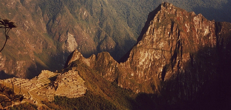
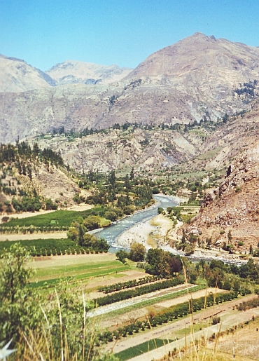 Life is good. Between the black mountains of the Cordillera Negra and the white
mountains of the Cordillera Blanca lies the fertile valley of the Rio Santa, a gorgeous place
to start my journey through the Peruvian Andes. It is harvest time in the valley.
Everyone is working on the land. The man and the woman, the young and the old. Older men and women have got beautifully
weathered faces. The harsh climate and the fierce sun leave their imprint on the skin
of the farmers.
Life is good. Between the black mountains of the Cordillera Negra and the white
mountains of the Cordillera Blanca lies the fertile valley of the Rio Santa, a gorgeous place
to start my journey through the Peruvian Andes. It is harvest time in the valley.
Everyone is working on the land. The man and the woman, the young and the old. Older men and women have got beautifully
weathered faces. The harsh climate and the fierce sun leave their imprint on the skin
of the farmers.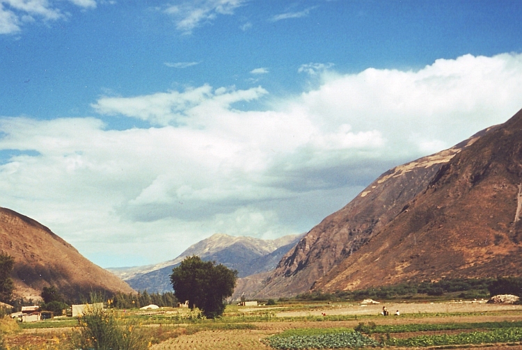
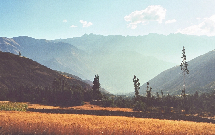
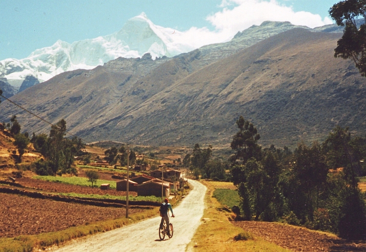
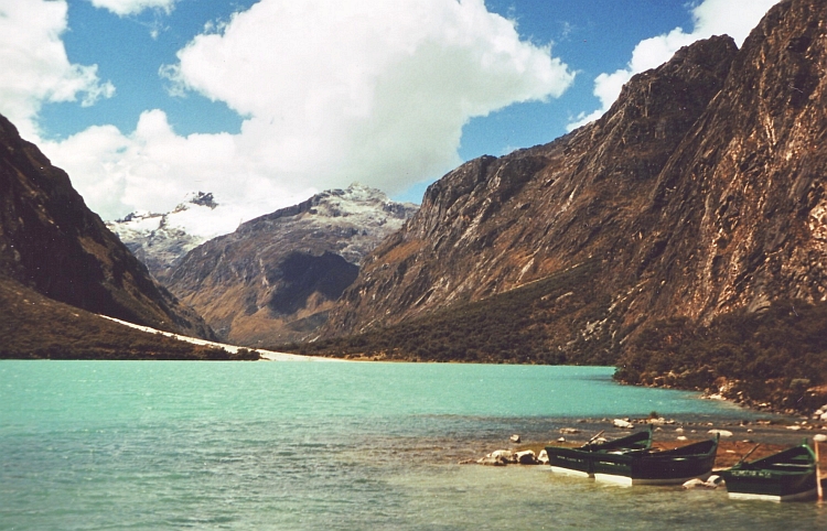
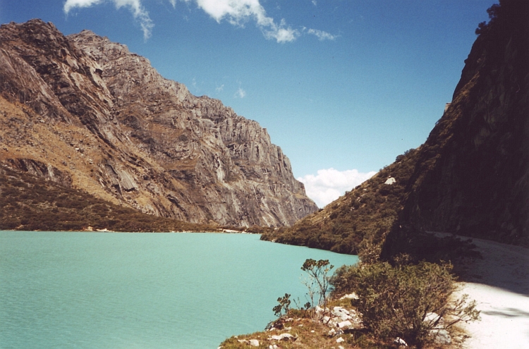
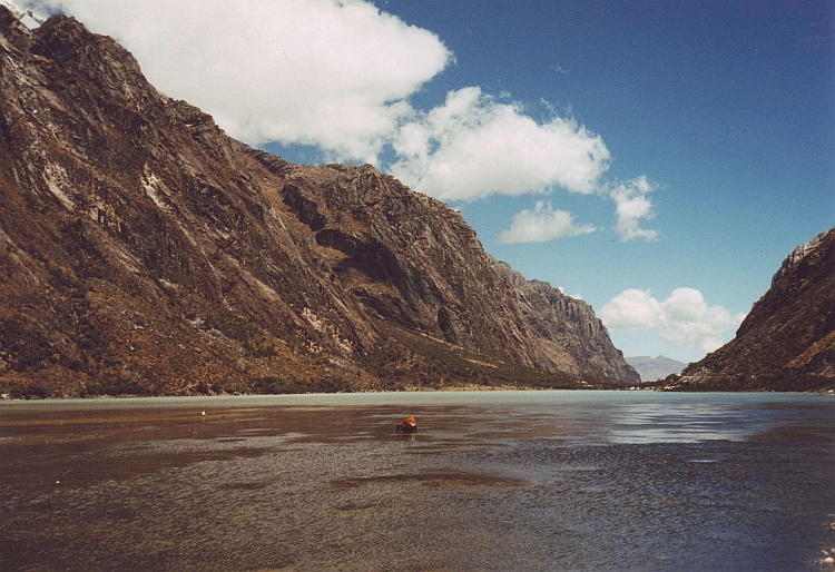
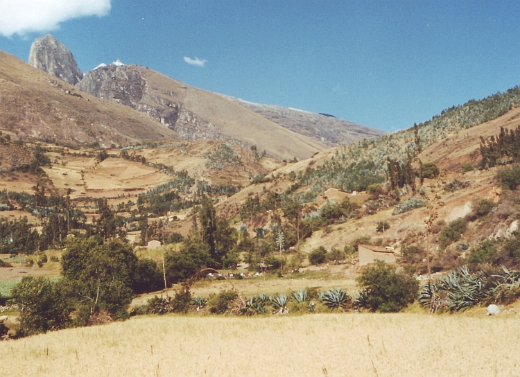
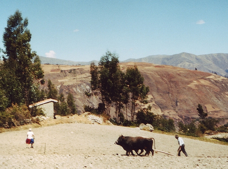
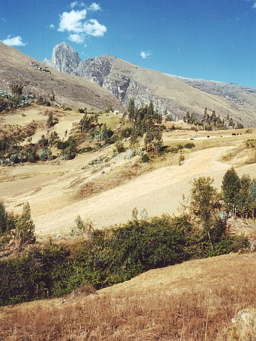 Ariel tells about his work for the district of Ancash. He is doing film and research work
to enhance the touristic potential of the Cordillera Blanca region. Ancash owes a lot of
interesting archeological sites according to Ariel. Unfortunately there are not enough funds
for reasearch of all the potential sites.
Ariel tells about his work for the district of Ancash. He is doing film and research work
to enhance the touristic potential of the Cordillera Blanca region. Ancash owes a lot of
interesting archeological sites according to Ariel. Unfortunately there are not enough funds
for reasearch of all the potential sites.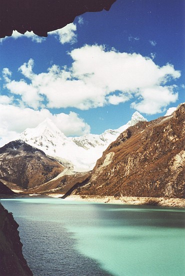
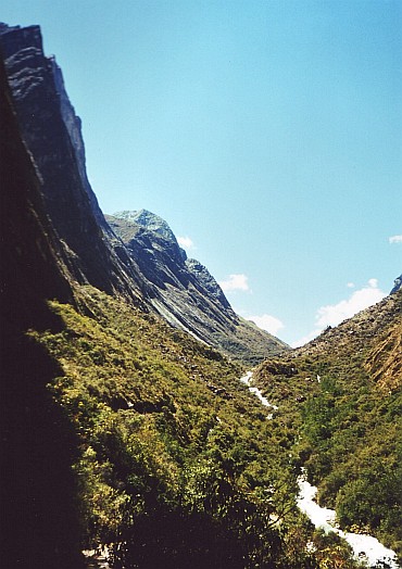
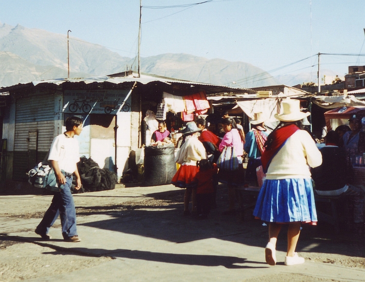
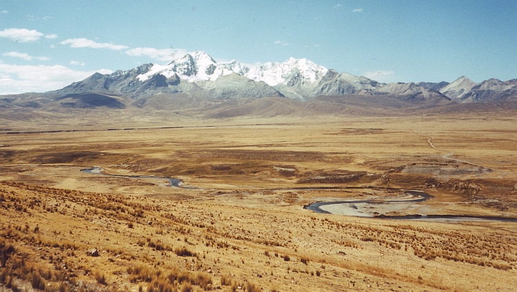
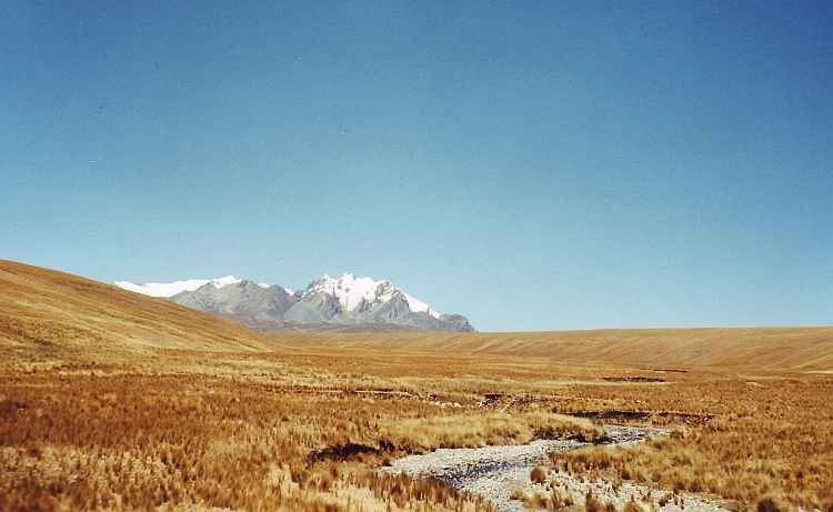
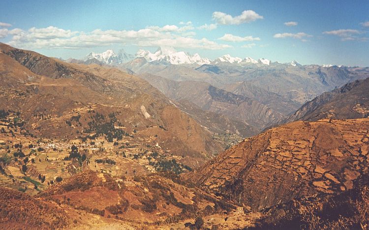
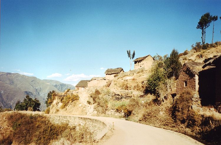
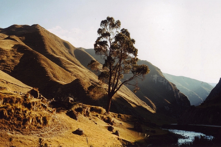
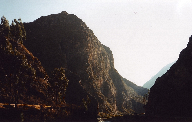
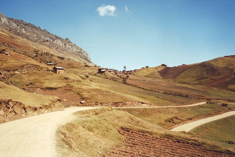
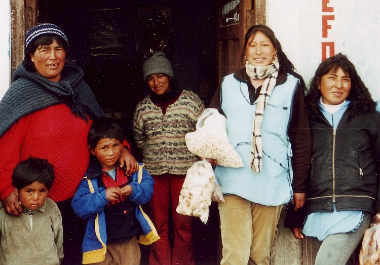
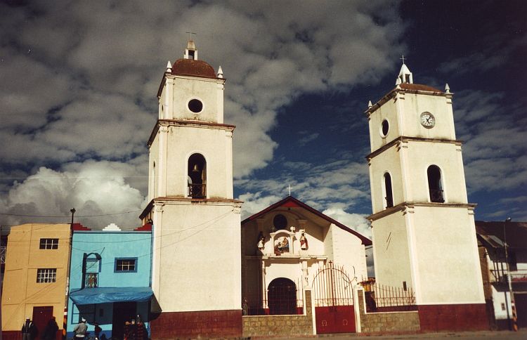
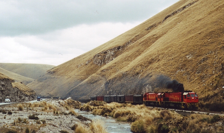
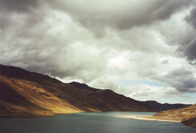
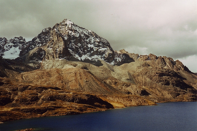
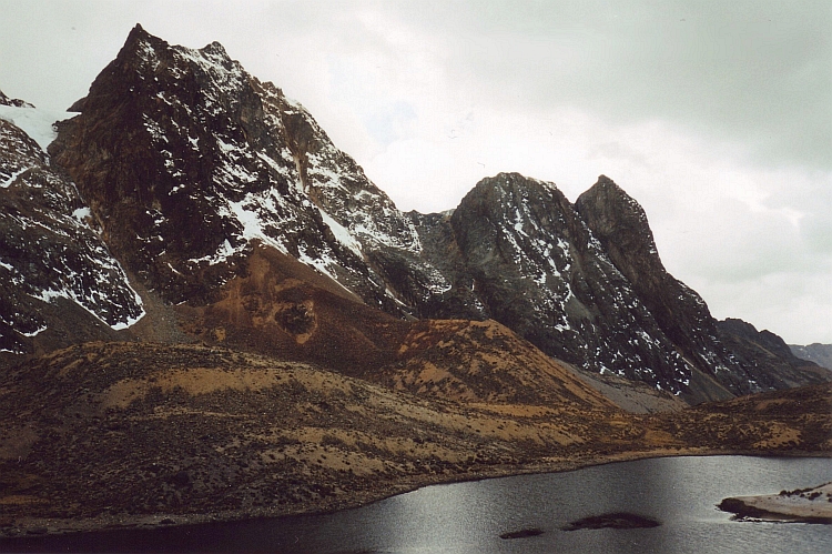
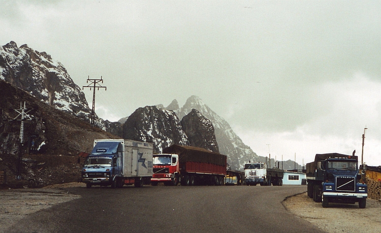
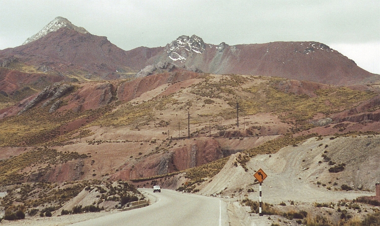
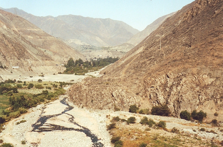
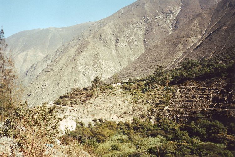
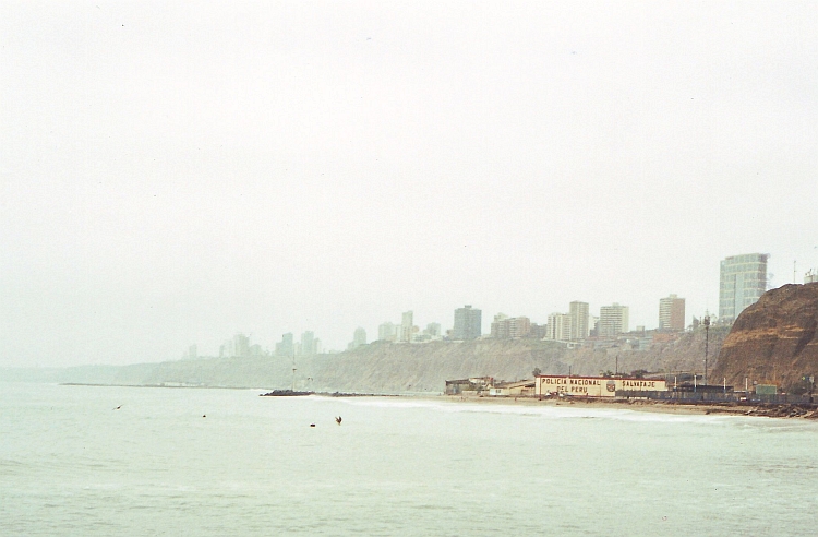
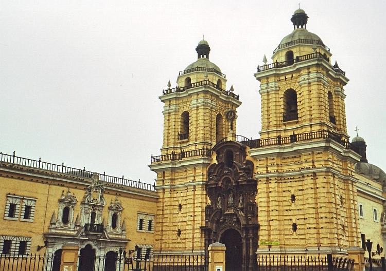
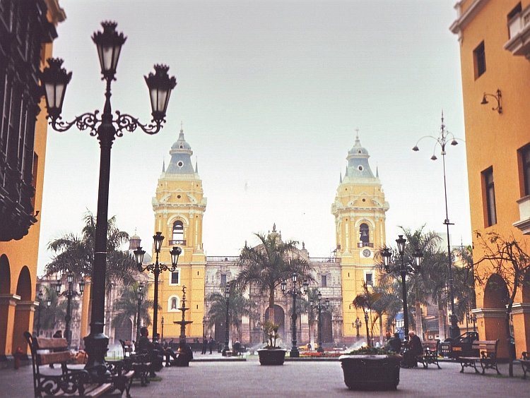
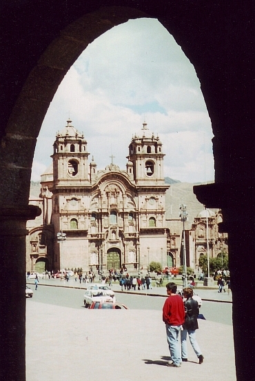 How tiring a bus ride can be. I feel like a broken old man as I reach Cuzco.
Fortunately, I had good companionship during the long bus ride. A young man
from Chiclayo in Northern Peru told me all the way about life in Cuzco. He prefers Northern Peru however,
where life is more quiet and relaxed and the people are more openhearted.
How tiring a bus ride can be. I feel like a broken old man as I reach Cuzco.
Fortunately, I had good companionship during the long bus ride. A young man
from Chiclayo in Northern Peru told me all the way about life in Cuzco. He prefers Northern Peru however,
where life is more quiet and relaxed and the people are more openhearted.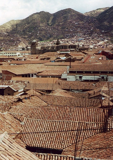
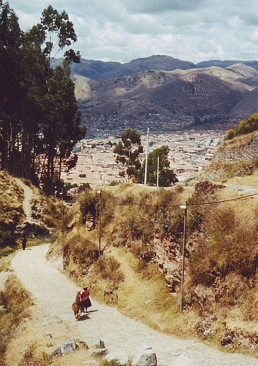
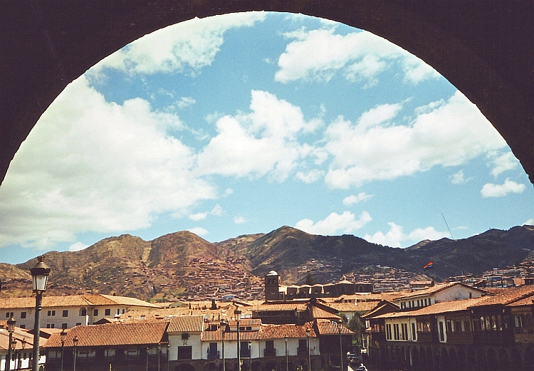
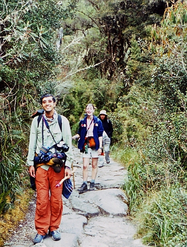 I am lucky with my tour group. Tom is a real nice fellow with an energy
that never fails to encourage, Najib is always good enough for providing spiritual
elements in discussions about every possible matter and the three English girls Kirsty,
Carry and Karen always remind me there is a female side to things. Samuel shows to
be the perfect cooke for us and Nancy is the best guide we could wish. Social, personal
and she has a good feeling for the nature and culture of the area.
I am lucky with my tour group. Tom is a real nice fellow with an energy
that never fails to encourage, Najib is always good enough for providing spiritual
elements in discussions about every possible matter and the three English girls Kirsty,
Carry and Karen always remind me there is a female side to things. Samuel shows to
be the perfect cooke for us and Nancy is the best guide we could wish. Social, personal
and she has a good feeling for the nature and culture of the area.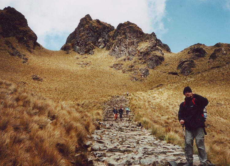
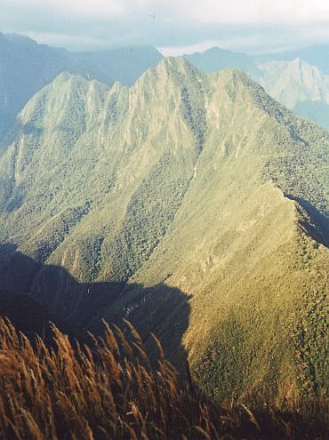 We are walking through the zone of the so-called cloud forest, the mountain
version of the rain forest. The atmosphere in these regions is nearly always very humid.
Even when it does not rain, the mists around the mountains provide sufficient water
for the vegetation to develop wildly. There is a completely green world we enter.
There are no flowers or trees that I recognize, except for the ferns and the orchids.
After a short descent, we climb again to a third pass. High above we see the Urubamba
River deep below us. The Urubamba Valley is the Sacred Valley of the Incas. Machu Picchu
and all the inca sites on the trail are built hundreds of meters at least above the
Urubamba River and out of sight from anywhere in the valley. This is why the Spanish
never found those gems and why they are preserved untill the present day. From now on
it is only downward to the third camp. Tom and I take the long way via the steep terrace
complex of Intipata. Fascinating, strange and wonderful stuff. Are those old sites
so fascinating because its mysteries hide glimpses of a world of higher and unknown value than
ours or are they fascinating just because they are a mystery?
We are walking through the zone of the so-called cloud forest, the mountain
version of the rain forest. The atmosphere in these regions is nearly always very humid.
Even when it does not rain, the mists around the mountains provide sufficient water
for the vegetation to develop wildly. There is a completely green world we enter.
There are no flowers or trees that I recognize, except for the ferns and the orchids.
After a short descent, we climb again to a third pass. High above we see the Urubamba
River deep below us. The Urubamba Valley is the Sacred Valley of the Incas. Machu Picchu
and all the inca sites on the trail are built hundreds of meters at least above the
Urubamba River and out of sight from anywhere in the valley. This is why the Spanish
never found those gems and why they are preserved untill the present day. From now on
it is only downward to the third camp. Tom and I take the long way via the steep terrace
complex of Intipata. Fascinating, strange and wonderful stuff. Are those old sites
so fascinating because its mysteries hide glimpses of a world of higher and unknown value than
ours or are they fascinating just because they are a mystery?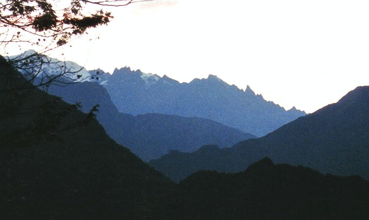
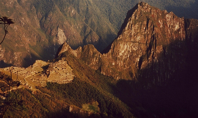
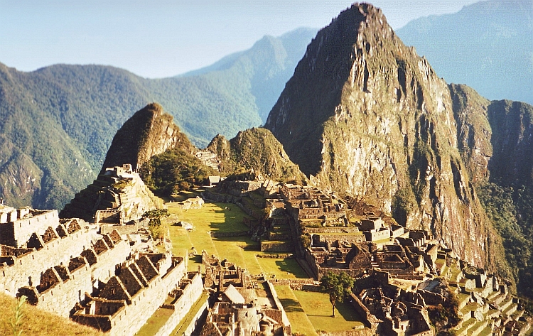
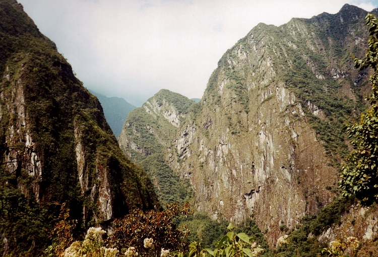
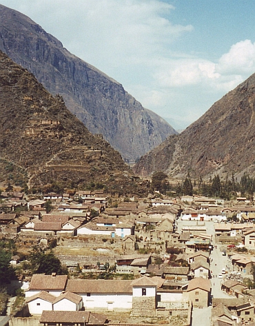 It is more than a week ago that I rode the last kilometres on my bike. The first
kilometres of my comeback on bicycle are quite nervous: leaving the busy city of Cuzco. The road climbs steady above
the streets. The view over the old Inca Capital is improving by the minute. All
in all the ascent is not too tough. After an hour I am on gently rolling hillside landscape
above and in between two river valleys. The landscape reminds me of Tuscany, but is in fact much
more quiet and relaxed. The colors are even better and there is the added bonus of
the high Andes Mountain Range with big white peaks in the distance. I am on my way
to the Sacred Valley, the valley of the Urubamba. Machu Picchu and the other sites
of the Inca Trail are not the only archeological highlights in the holy valley
of the Incas. Two other important highlights are Ollantaytambo and Pisac.
It is more than a week ago that I rode the last kilometres on my bike. The first
kilometres of my comeback on bicycle are quite nervous: leaving the busy city of Cuzco. The road climbs steady above
the streets. The view over the old Inca Capital is improving by the minute. All
in all the ascent is not too tough. After an hour I am on gently rolling hillside landscape
above and in between two river valleys. The landscape reminds me of Tuscany, but is in fact much
more quiet and relaxed. The colors are even better and there is the added bonus of
the high Andes Mountain Range with big white peaks in the distance. I am on my way
to the Sacred Valley, the valley of the Urubamba. Machu Picchu and the other sites
of the Inca Trail are not the only archeological highlights in the holy valley
of the Incas. Two other important highlights are Ollantaytambo and Pisac. 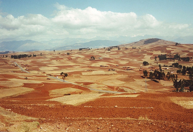

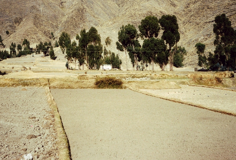
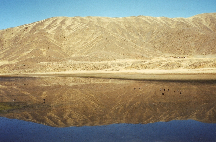
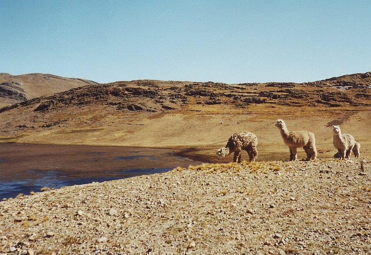
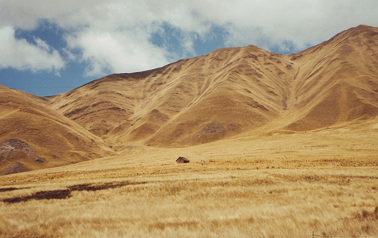
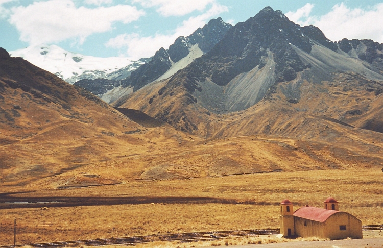
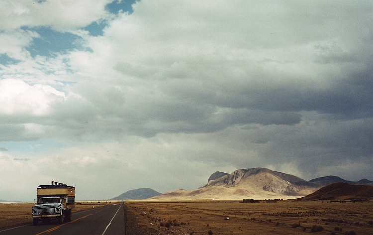
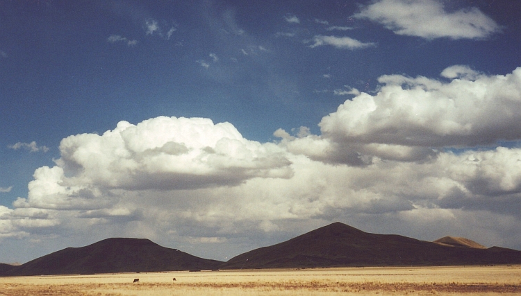
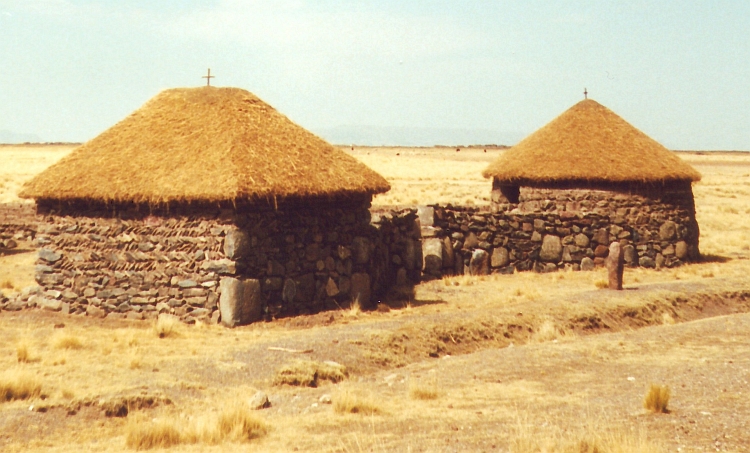
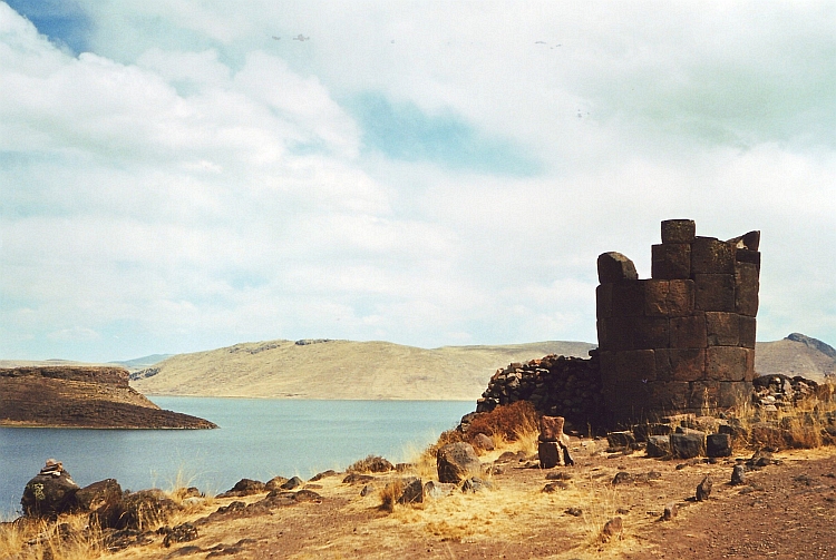
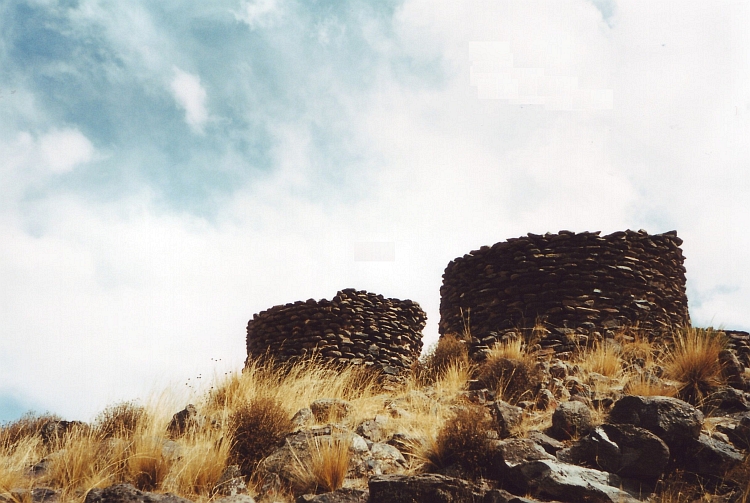
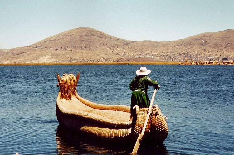
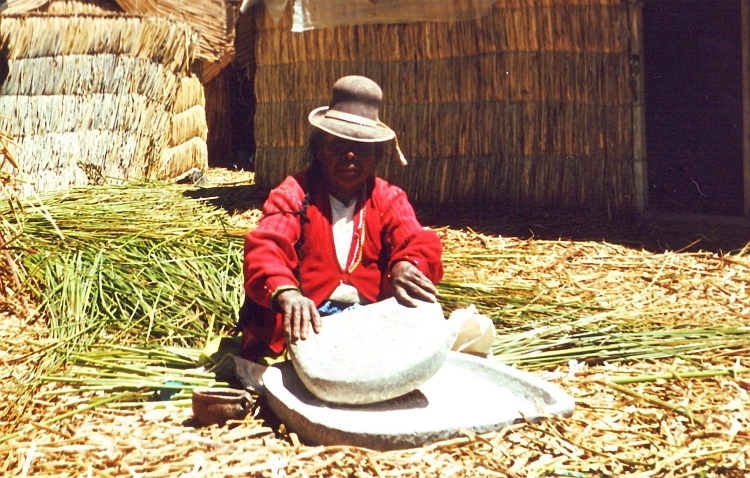
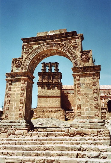 At one o'clock I reach Juli. The small city is a little jewel along Lake Titicaca.
The landscape remains beautiful. The road does not leave the Lake anymore. The
landscape is very dry. Barren hill ranges flank the Lake now and then. The occasional
valleys however are very green and full of life. Everybody is working on the land.
The people are greeting me wildly enthusiastic. I feel my spirits rise in this
friendly atmosphere.
At one o'clock I reach Juli. The small city is a little jewel along Lake Titicaca.
The landscape remains beautiful. The road does not leave the Lake anymore. The
landscape is very dry. Barren hill ranges flank the Lake now and then. The occasional
valleys however are very green and full of life. Everybody is working on the land.
The people are greeting me wildly enthusiastic. I feel my spirits rise in this
friendly atmosphere. 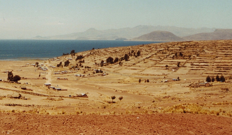

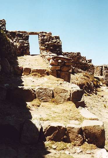
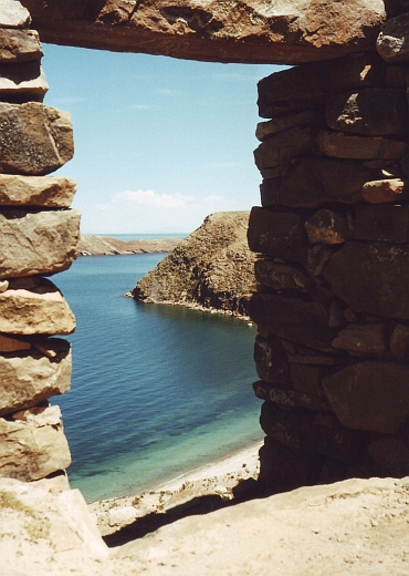
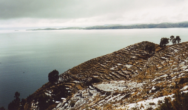
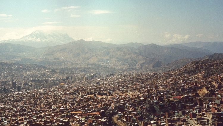
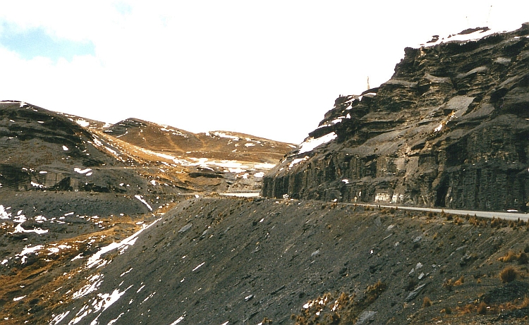
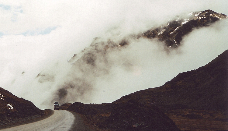
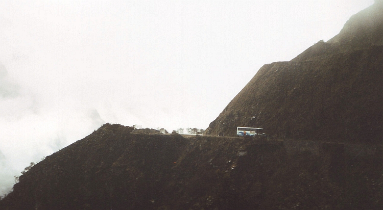
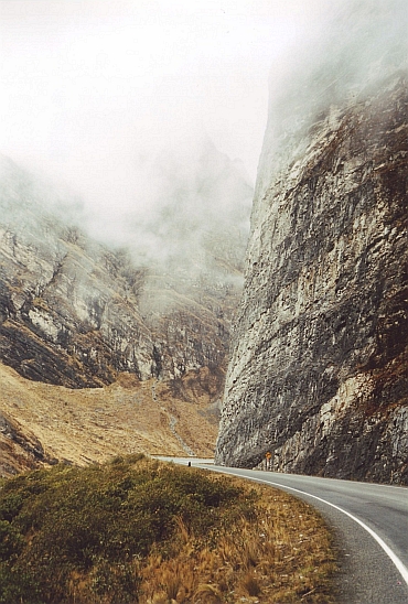 The descent is remarkably easy. The road is well paved and follows the valley downward.
It is straight ahead downhill. It is beginning to rain a bit but I could expect that
in a region that is known as very wet. No worries whatsoever.
The descent is remarkably easy. The road is well paved and follows the valley downward.
It is straight ahead downhill. It is beginning to rain a bit but I could expect that
in a region that is known as very wet. No worries whatsoever.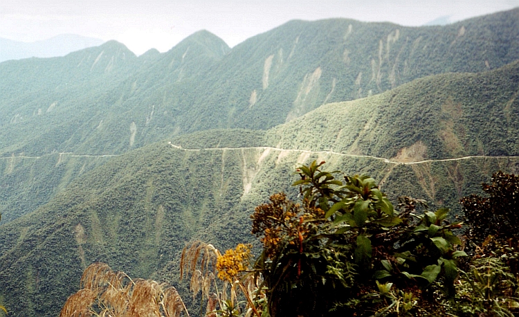
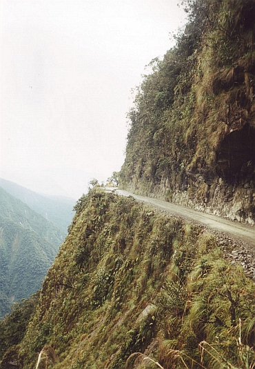
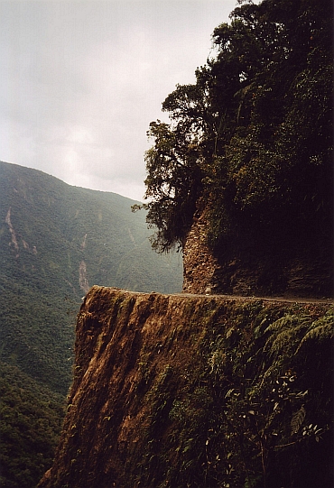
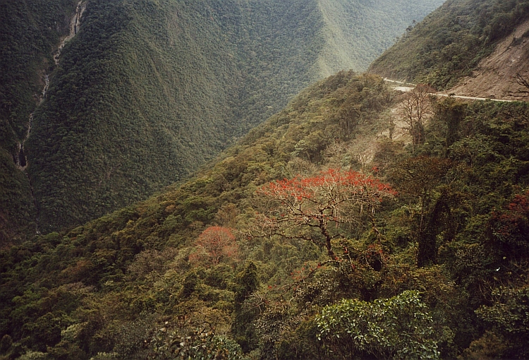
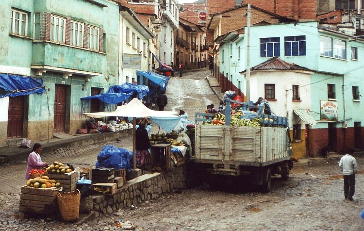
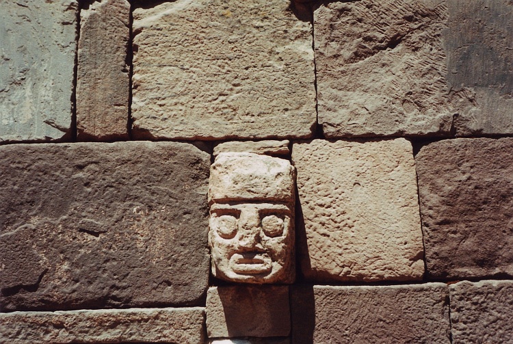
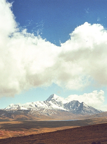 A taxi brings us to the mountain hut where the expeditions to the Huayna Potosí
take off. The weather is good as we start to walk to the campsite. Over big moraine
walls we go up. The slopes are sometimes slippery with bits of snow and ice between
the loose stones. All in all it does not take too long before we reach the campsite.
There are a few other groups with guides that will also make an attempt to reach the top
tomorrow.
A taxi brings us to the mountain hut where the expeditions to the Huayna Potosí
take off. The weather is good as we start to walk to the campsite. Over big moraine
walls we go up. The slopes are sometimes slippery with bits of snow and ice between
the loose stones. All in all it does not take too long before we reach the campsite.
There are a few other groups with guides that will also make an attempt to reach the top
tomorrow. 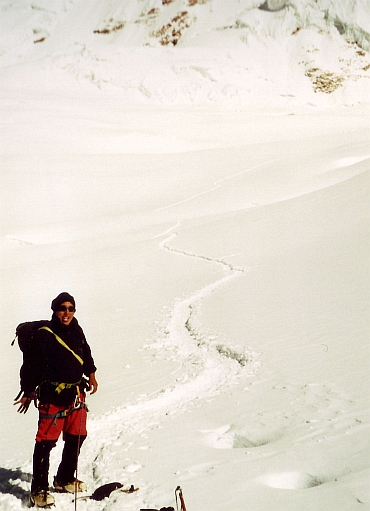 The guide wakes me up at half past 12 in the night. I am glad he is waking me. I
have not fallen asleep because of the altitude. Being awake brings other problems.
It is 25 degrees below zero. Way too cold for me. I am not hungry, probably an effect of
altitude and temperature. I know I have to eat something, though. I am chewing some brick hard
chocolates. They taste awful.
The guide wakes me up at half past 12 in the night. I am glad he is waking me. I
have not fallen asleep because of the altitude. Being awake brings other problems.
It is 25 degrees below zero. Way too cold for me. I am not hungry, probably an effect of
altitude and temperature. I know I have to eat something, though. I am chewing some brick hard
chocolates. They taste awful.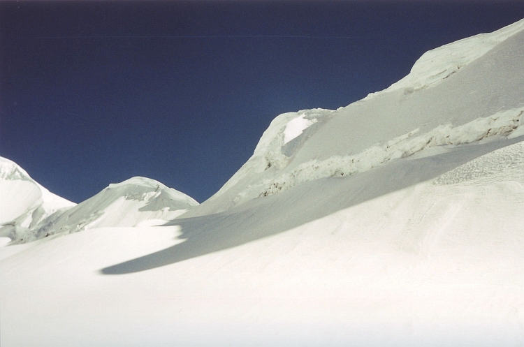
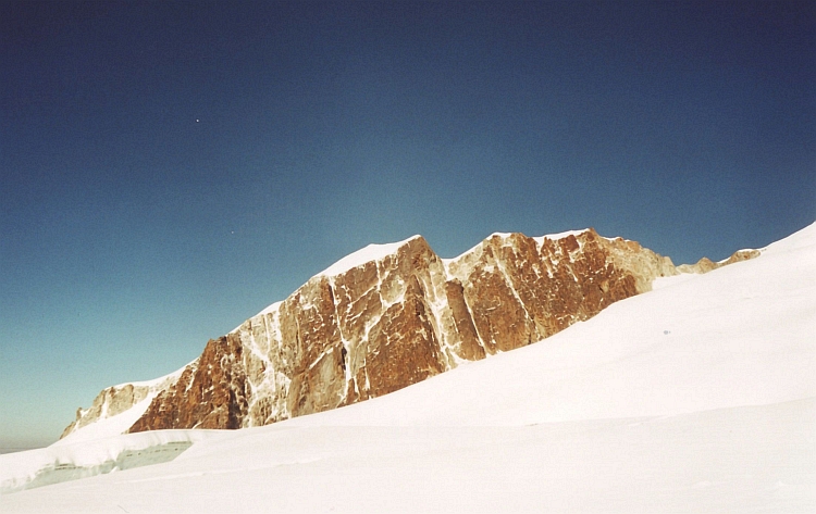
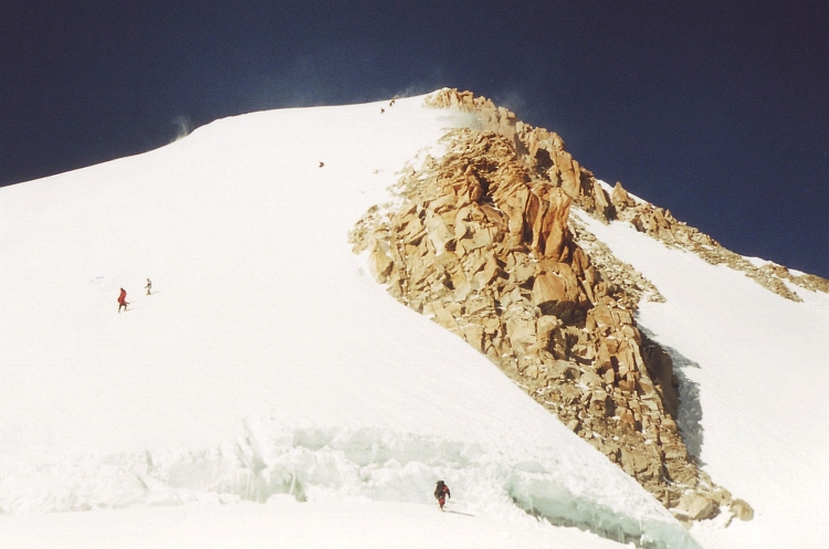
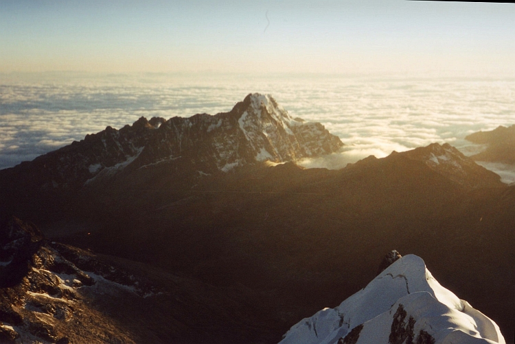
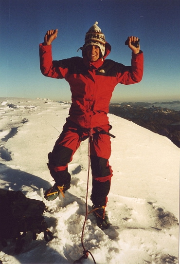 I try to push my pickel as deep as possible into the ice. It will not get any better
than a centimeter at the most. My crampons do not perform better. The ice is as
hard as a rock. We will have to do with it. I use all my force to stay as still and
quiet as possible. I am breathing like a dog. Every step again I have to kick my feet
as hard as I can in the ice face. Usually the circumstances should be much better,
but usually it is warmer than minus 25 degrees. In deep concentration I go on and on,
untill unexpectedly I reach the summit. My guide and I are the first today to reach
the top. Right now, the sun is climbing above the horizon and sets the
top face in the sun. Thousands of meters below are the Yunga's. A thin cloud cover is
already spread out over the Yunga's and the jungle. On the west side the Altiplano can
be seen. Two to three hundred kilometres to the west I see the border mountains with Chile
including the Nevado Sajama, the highest mountain of Bolivia and nearly five hundred
meter higher than here. Could be nice cycling there...
I try to push my pickel as deep as possible into the ice. It will not get any better
than a centimeter at the most. My crampons do not perform better. The ice is as
hard as a rock. We will have to do with it. I use all my force to stay as still and
quiet as possible. I am breathing like a dog. Every step again I have to kick my feet
as hard as I can in the ice face. Usually the circumstances should be much better,
but usually it is warmer than minus 25 degrees. In deep concentration I go on and on,
untill unexpectedly I reach the summit. My guide and I are the first today to reach
the top. Right now, the sun is climbing above the horizon and sets the
top face in the sun. Thousands of meters below are the Yunga's. A thin cloud cover is
already spread out over the Yunga's and the jungle. On the west side the Altiplano can
be seen. Two to three hundred kilometres to the west I see the border mountains with Chile
including the Nevado Sajama, the highest mountain of Bolivia and nearly five hundred
meter higher than here. Could be nice cycling there...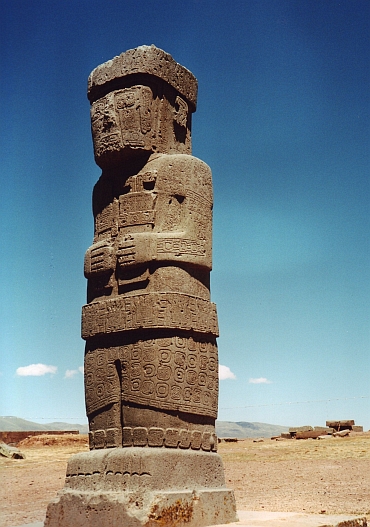 After the succesful ascent of the Huayna Potosí, I need a rest day. I decide
to give the excursion to Tiahuánuco a second chance. This time it is quiet in
La Paz and El alto; without problems we reach the site. The Tiahuánuco culture
is not only much older than the Inca culture, it also has existed much longer. For two
thousand years the Tiahuánuco culture was the most important civilization of South America.
Only the last hundred years before the Spanish set foot on American ground, the Inca culture
has overthrown the Tiahuánuco civilization.
After the succesful ascent of the Huayna Potosí, I need a rest day. I decide
to give the excursion to Tiahuánuco a second chance. This time it is quiet in
La Paz and El alto; without problems we reach the site. The Tiahuánuco culture
is not only much older than the Inca culture, it also has existed much longer. For two
thousand years the Tiahuánuco culture was the most important civilization of South America.
Only the last hundred years before the Spanish set foot on American ground, the Inca culture
has overthrown the Tiahuánuco civilization.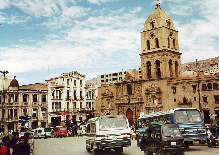
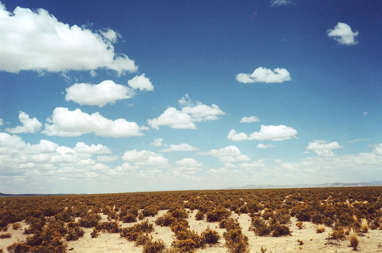
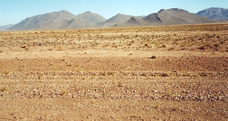
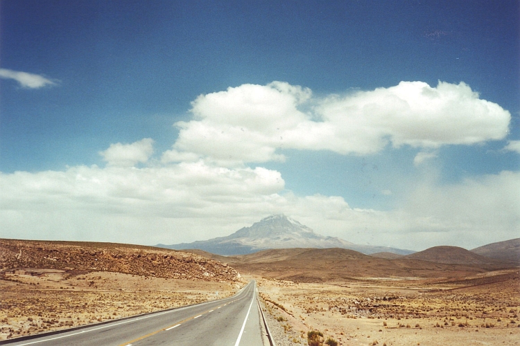
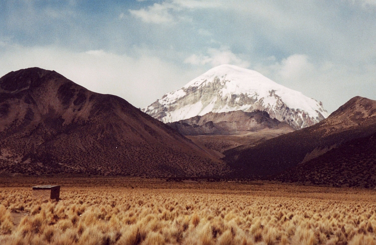
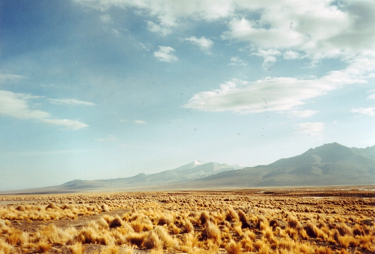
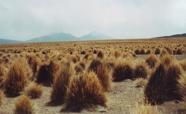
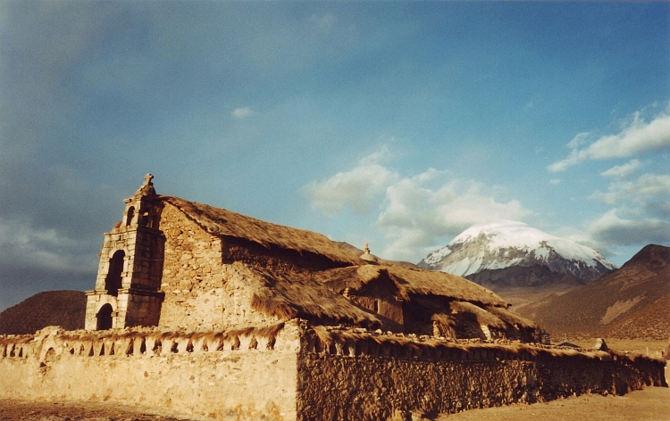
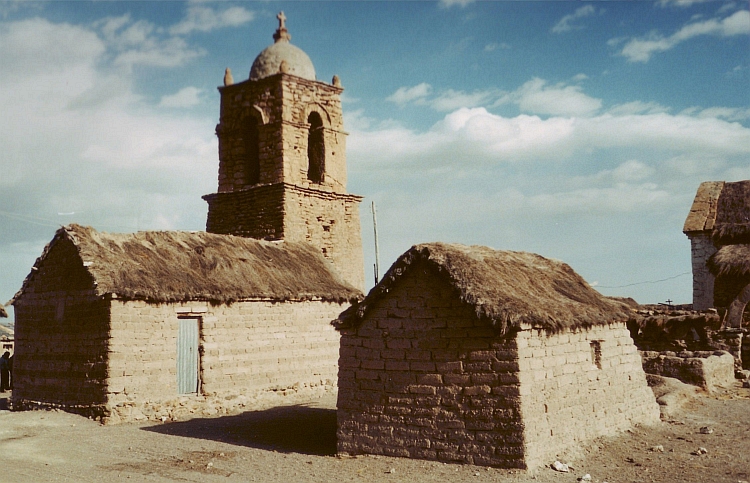
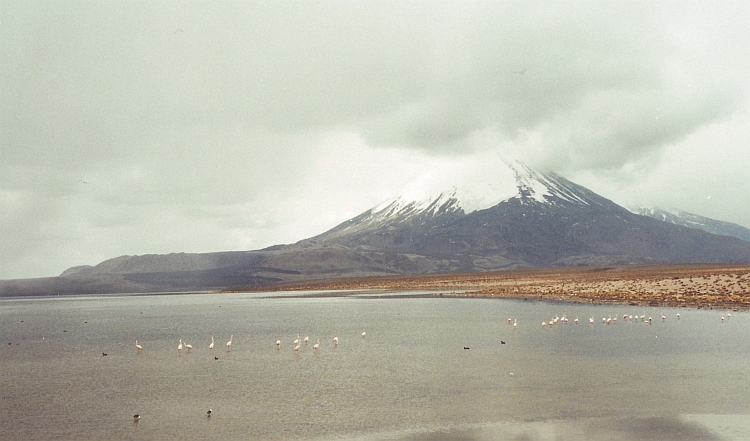
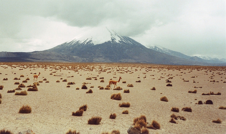
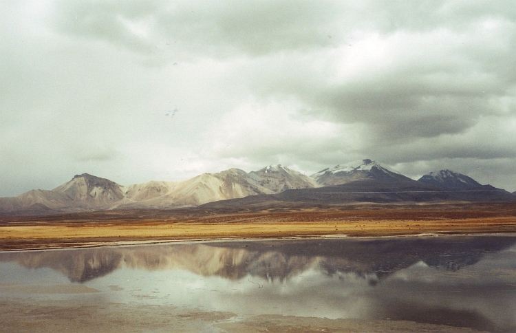

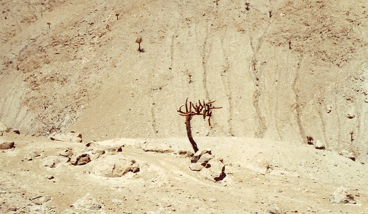
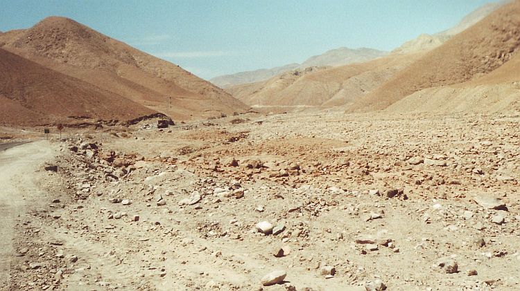
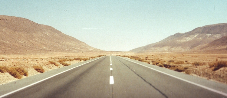
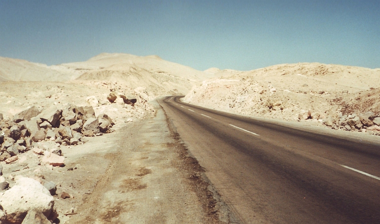
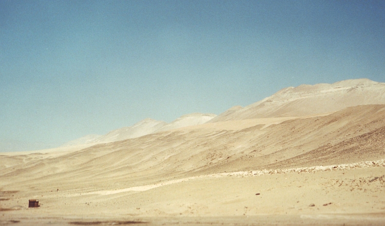
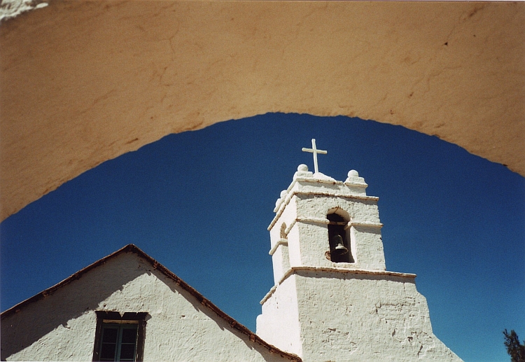
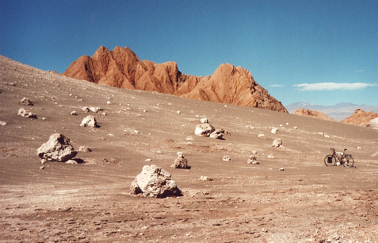
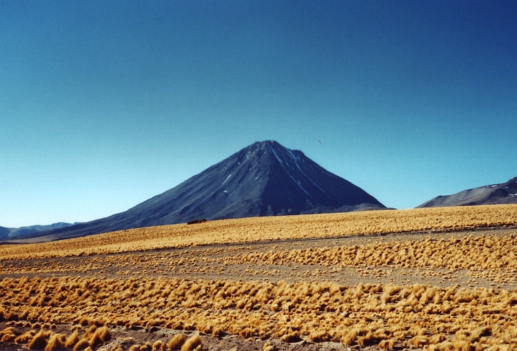
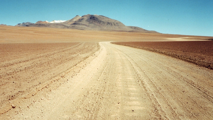
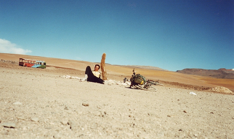
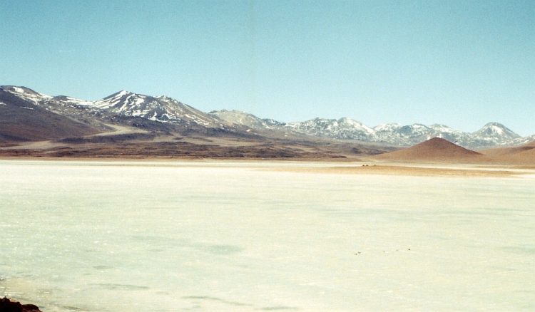
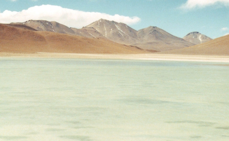
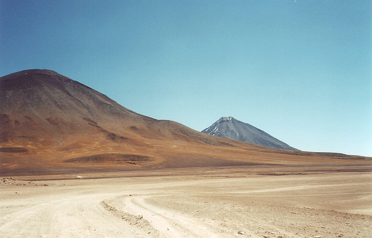
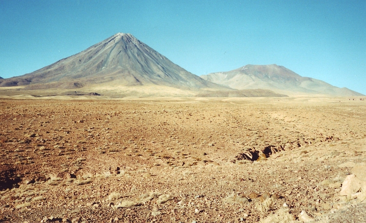
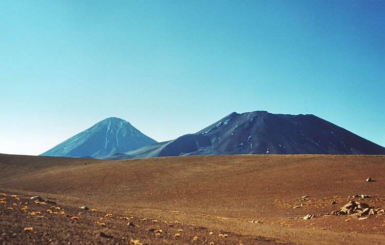
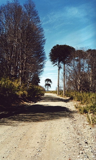 The first ascent is over the Cuesta to Lonquimay. The dirt track has not been traveled yet by cars.
It is just spring in the south of Chile. The road has got unorthodox gradients. Because
I am used to climb at much higher elevations, I have so much oxygen that I am
feeling very light, despite the steepness of the road. I have complete control over my breathing.
There have surely been days that things were not going this smoothly.
The first ascent is over the Cuesta to Lonquimay. The dirt track has not been traveled yet by cars.
It is just spring in the south of Chile. The road has got unorthodox gradients. Because
I am used to climb at much higher elevations, I have so much oxygen that I am
feeling very light, despite the steepness of the road. I have complete control over my breathing.
There have surely been days that things were not going this smoothly.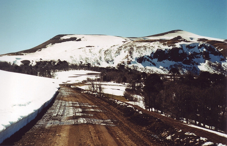
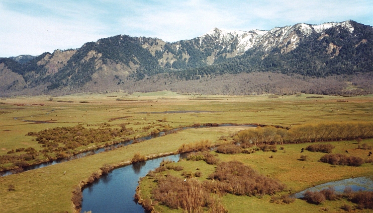
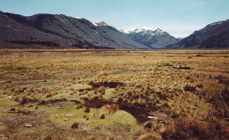
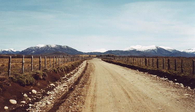
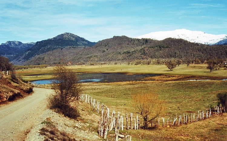
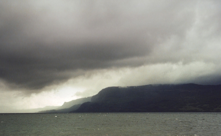
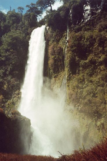 After two days of very bad weather today is a whole different story. Clear blue
skies give way to a good day of sunshine. Today I want to go through the Villarica National
Park to Coñaripe. As soon as I am in the National Park, the dust road climbs
steeply. There are some famous waterfalls in the National Park. They can all be sighted.
After two days of very bad weather today is a whole different story. Clear blue
skies give way to a good day of sunshine. Today I want to go through the Villarica National
Park to Coñaripe. As soon as I am in the National Park, the dust road climbs
steeply. There are some famous waterfalls in the National Park. They can all be sighted.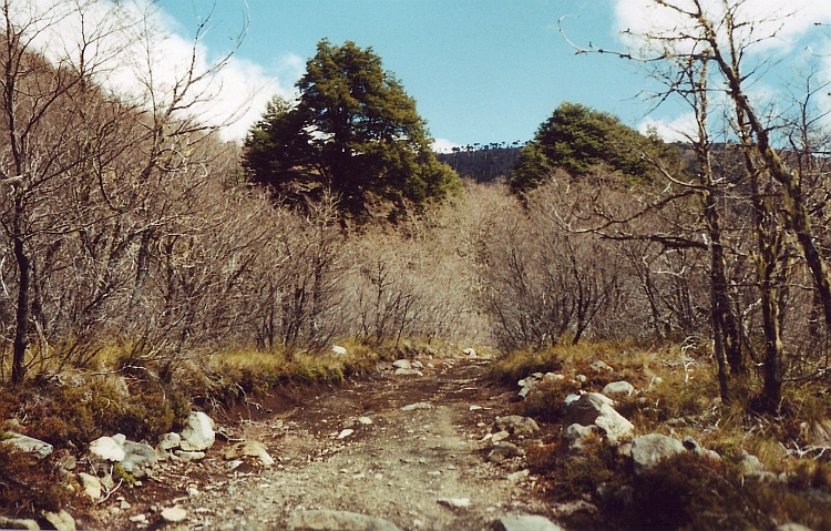
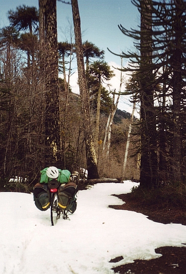 After half an hour I have passed also this obstacle. There are new problems however.
The road is is completely run down. It is filled with deep gullies and overgrown
with big tree trunks. This is more like a rodeo safari than a decent bicycle
excursion. After a few kilometres I hear a big bang. My front pannier has come
between my spokes and has the shape of a nice Frankfurter Wuerstl. Nice to see but
further useless. From now on I can take only three bags instead of four. I reshift
my luggage and have to go on. It is getting late.
After half an hour I have passed also this obstacle. There are new problems however.
The road is is completely run down. It is filled with deep gullies and overgrown
with big tree trunks. This is more like a rodeo safari than a decent bicycle
excursion. After a few kilometres I hear a big bang. My front pannier has come
between my spokes and has the shape of a nice Frankfurter Wuerstl. Nice to see but
further useless. From now on I can take only three bags instead of four. I reshift
my luggage and have to go on. It is getting late.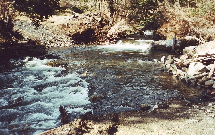
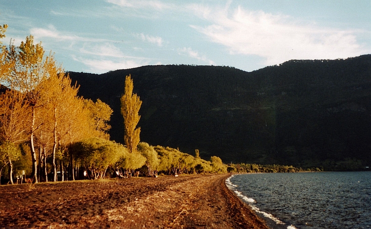
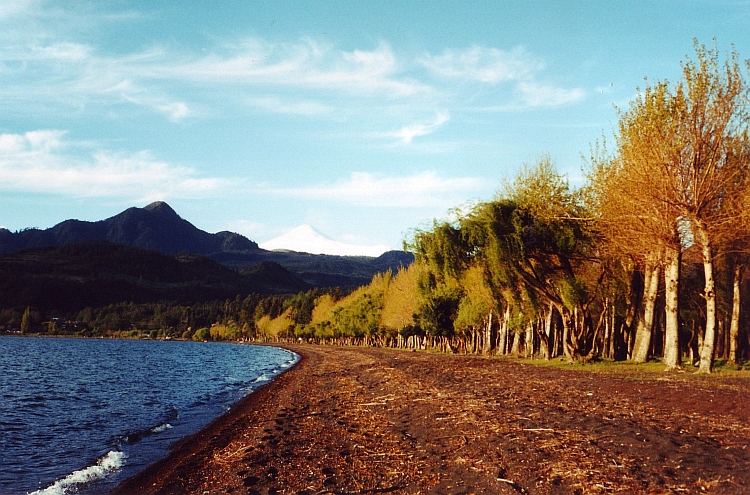
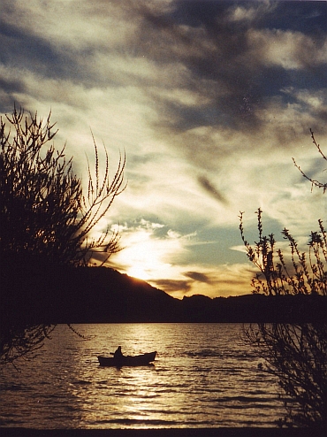
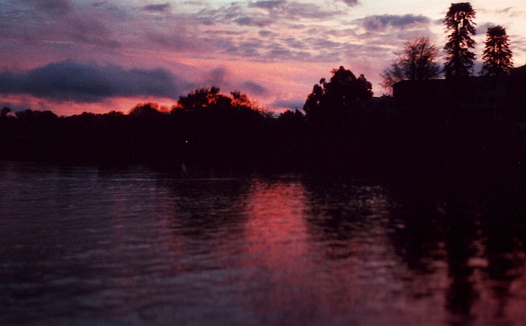
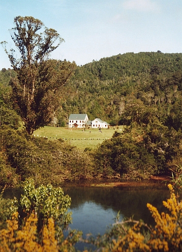 Yesterday I crossed the Coastal Mountain Range the easy way: following the course
of a river. Today I want to cross the mountains in a proper way: to climb to the passes
and descend. After ten kilometres the road ascends for the first hill ridge.
The road is surprisingly steep. After a few kilometres I am already on top of
the hills. It takes also a few kilometres before I am in a new valley. Again the
road goes upward. This cycle goes on and on. This is surely not an easy day ride.
Yesterday I crossed the Coastal Mountain Range the easy way: following the course
of a river. Today I want to cross the mountains in a proper way: to climb to the passes
and descend. After ten kilometres the road ascends for the first hill ridge.
The road is surprisingly steep. After a few kilometres I am already on top of
the hills. It takes also a few kilometres before I am in a new valley. Again the
road goes upward. This cycle goes on and on. This is surely not an easy day ride.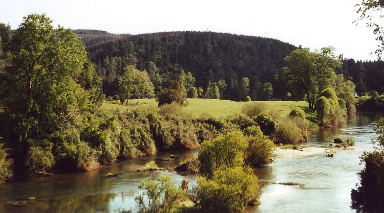
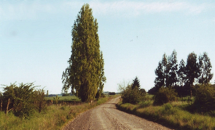
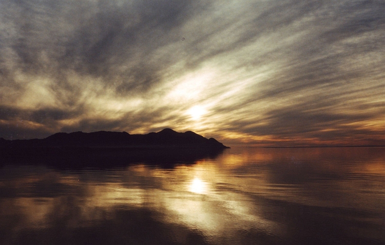
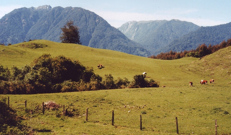
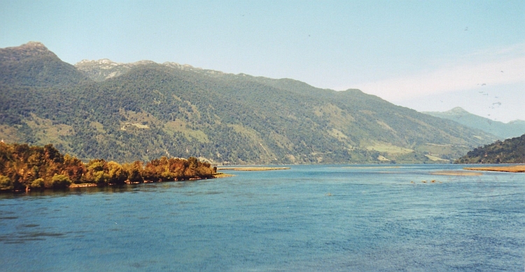
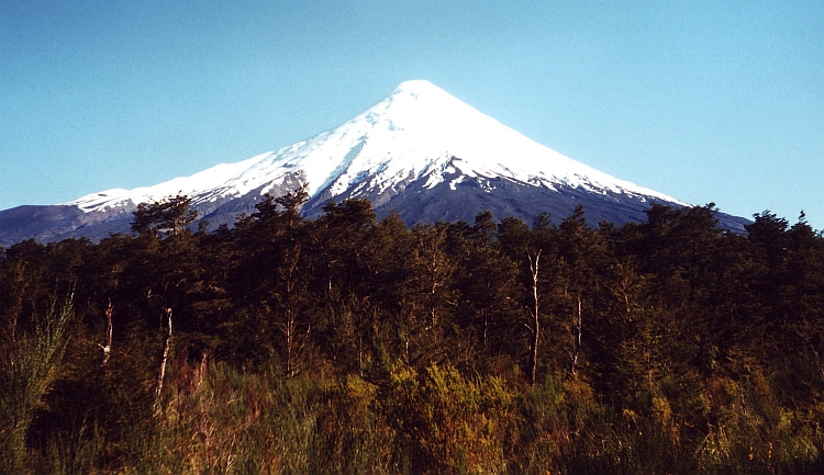
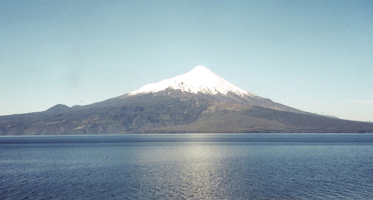
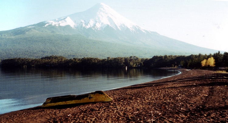
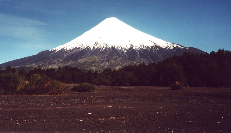
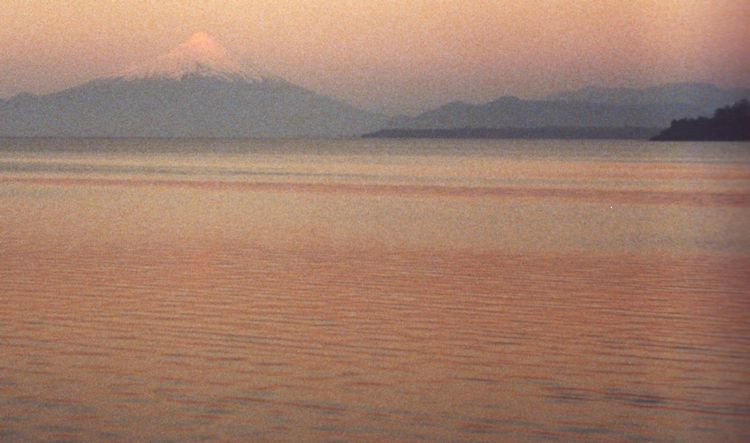
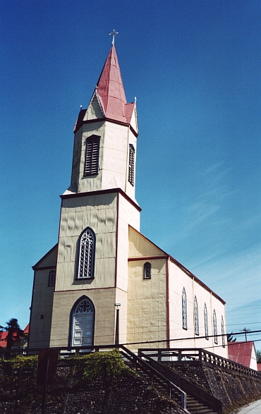 It is nice to cycle with colleagues. There have not been too many on the way. The
weather is less friendly. Sometimes it rains, sometimes it stops raining but never
the sun comes through. The landscape is not too special either. We want to cycle to the
Island of Chiloë. The road from Puerto Montt to the ferry is quite dull. Sixty
kilometre of nothingness is the least attractive part of my days in South America.
It is nice to cycle with colleagues. There have not been too many on the way. The
weather is less friendly. Sometimes it rains, sometimes it stops raining but never
the sun comes through. The landscape is not too special either. We want to cycle to the
Island of Chiloë. The road from Puerto Montt to the ferry is quite dull. Sixty
kilometre of nothingness is the least attractive part of my days in South America.