Travel with a smile on your face - Cycling the Indian Himalayas
Day 1: Delhi; Shimla 25 km
OK. Our Tibet 2000 plan was delayed a little. And it is certainly true that the last
years the realization became more and more unsure. But as we travel by taxi from Delhi
to Shimla it seems perfectly natural to be here. Jeroen, Willem and I cycle a lot on
our racing bikes in the flat lowland area at our home in the netherlands but the idea
to be cycling in the rugged Himalayas feels just as natural. We want to cycle to Leh
which means that we have to ascend some of the highest motorable (and cyclable) passes in the world.
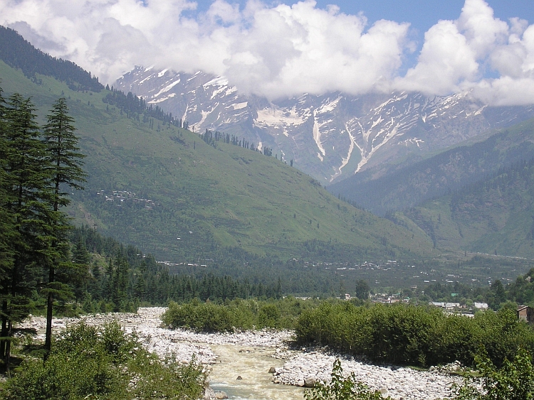
Tomorrow we will descend from 2.200 meter high Shimla on the first hill range of the Himalayas
to the 500 meter low Sutlej Valley, which is virtually out of the Himalayas.
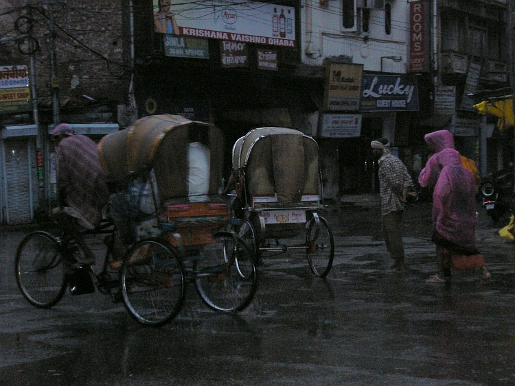
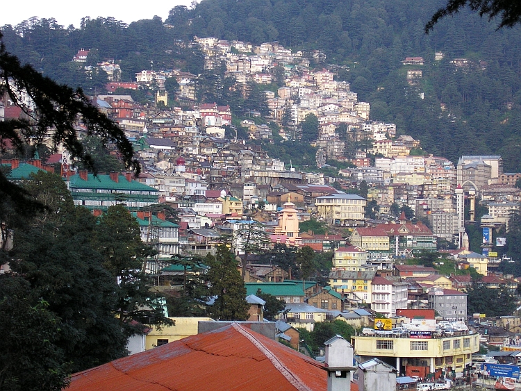
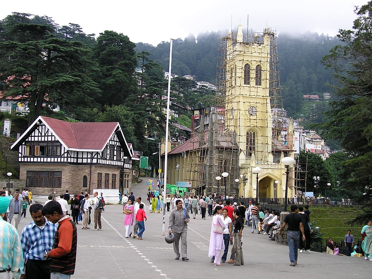
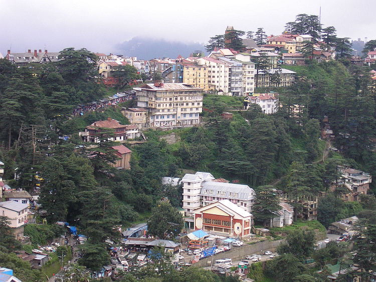
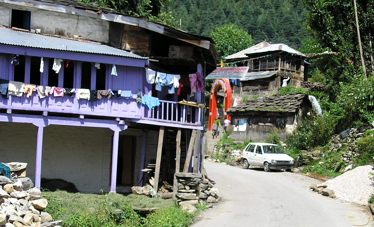
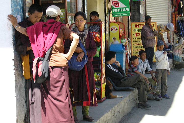
India Light. That is the conclusion of the first impressions of Shimla. Shimla feels
truly Indian but is richer, cleaner and more accustomed to foreigners than other places.
Shimla is a true hill resort. In the old colonial days Shimla was used by the British as the
unofficial summer capital of India. Also nowadays Shimla attracts many foreign
but even more Indian tourists. Two thousand meter higher than Delhi, the temperatures
are pleasant in comparison with the Indian capital. When we cycled from the Delhi
International Airport to the Train Station of Delhi this night, we found out that
temperatures easily exceeded thirty degrees, even in the night. Monsoonal air
humidity and extreme air pollution further add to the unpleasant mix of the Delhi
atmosphere.
Day 2: Shimla - Sallaghat - Dehar 95 km
The woman that runs the hotel asks us about our journey as we are packing our bicycles.
Her ten year old son is very interested in bicycles and inspects our material. He
is very impressed as there are virtually no European standard bicycles in India. I
explain some technical details to the child. His mother asks whether the bicycle does
have a horn. In India the people more than regularly use a horn or better stated: there is not
a second in which you do not hear a blowing horn. As Jeroen answers that he does
not owe one, the woman stares bewildered at us. Riding on a vehicle without being
able to blow horns is like sentencing yourself the death penalty, she seems to think.
She asks us if we have other means of protection. I point to my St. Jacques shell,
a souvenir of my journey to Santiago de Compostela. Spontaneously the woman and the boy
touch the shell and make a cross. She looks very intense as she makes some deep bows, her hands
in a vow. As we are leaving, she gives us one last message of the heart: "Travel
with a smile on your face". We have to promise.
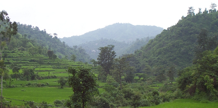
Travelling with a smile on my face is not a difficult task. Through a fabulous
green landscape we descend. We ride far above the valleys, frequently on top of
the hill crest. Like the 'Route des Crêtes' in the Vosges of France, the road
more or less parallels the hill crest. As we go westward, the road goes down with the same
pace as the crest. Sometimes the road climbs to the crest for a village on the other
side of the hills. Despite a few ascents, we progress rapidly as most of the way
is downward.
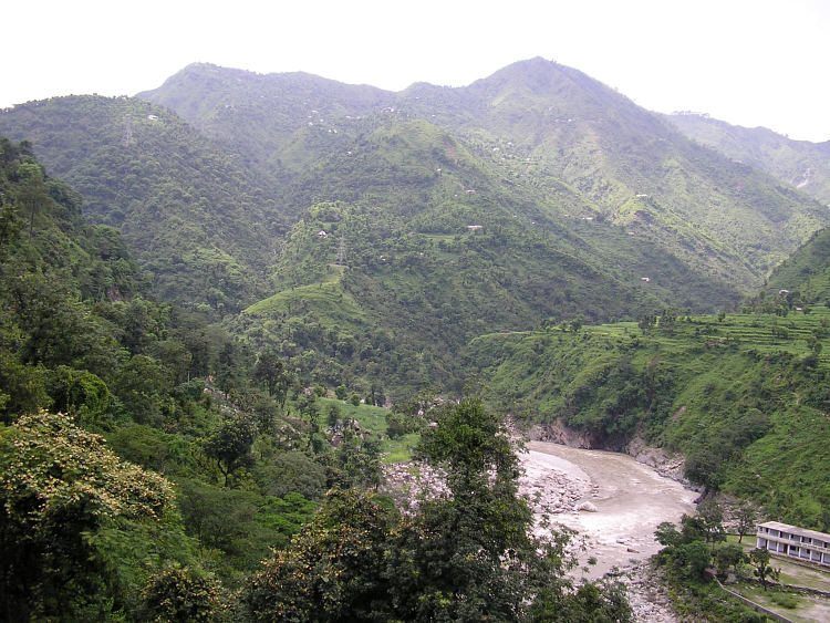
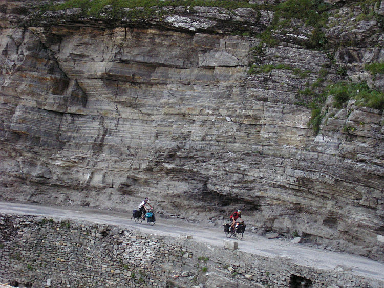
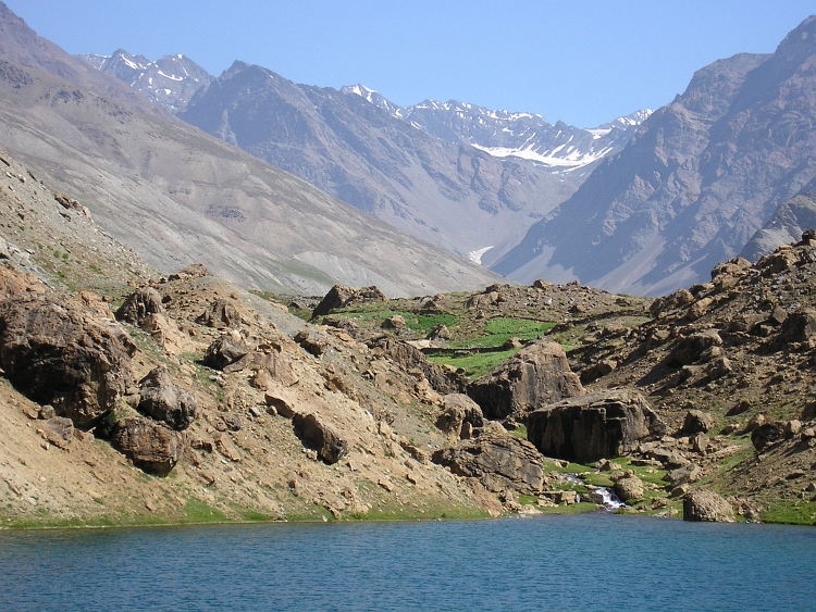
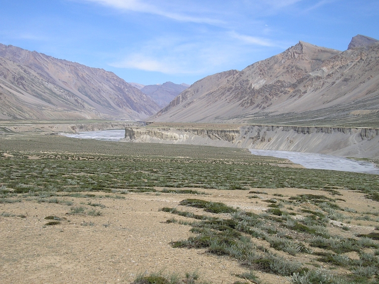
In the end we have descended hundreds and hundreds of altitude meters as we reach the
valley bottom. It is really hot and humid here. Being in one of the wettest places
on Earth in the monsoon time, we must be lucky with every dry minute. We are
surrounded by rice fields and steep hills. We have left the main road for a very
uncertain secondary road. The road ascends steeply to pass a hill range and descends
again. We have to cross another hill range which takes another hour. After the second
hill range, we descend to the Sutlej Valley. We are below 600 meter altitude now
and virtually outside of the Himalayas. We cross the huge Sutlej river and find
a hotel after ten kilometers.
Day 3: Dehar - Sundernagar - Mandi - Pandoh - Bhuntar 95 km
It is devastatingly hot as we cycle up to the watershed. We sweat heavier with every
meter we progress. It is still dry today, the sun is even shining. It takes ages before
we reach the small town Sundernagar.
From Sundernagar we cycle twenty kilometer up and down before
we reach the pass. We see the valley of the Beas below. We descend a few kilometers
and reach the river in Mandi. From the busy town of Mandi we have to climb 107 kilometer
along the river to reach Manali at 2.000 meter altitude. After Manali the civilized world
ends more or less. From Manali to Ladakh is 450 kilometer of high mountain wilderness
with some of the highest passes of the world.
At this moment the tranquil ascent along the Beas River brings us enough difficulties.
I am feeling exhausted after a steep stretch of a few kilometers but Jeroen
and Willem seem to be in an even worse shape. Willem does not feel well. Maybe heavy salt losses due
to excessive sweating have caused a nutrition shortage. After eating chips in a
little village it goes better again. After an hour we decide it was good enough for today.
We stay in a hotel in Bhuntar with an excellent restaurant. Unfortunately, like most
restaurants, no alcoholic drinks are served but the curries are delicious.
Day 4: Bhuntar - Kullu - Naggar - Manali 55 km
From Bhuntar to Manali is a relatively short distance. I am feeling awfully tired even
before the start. I have not slept the whole night because of the heat and the mosquitoes. Untill
Kullu I am not having a great time. Kullu is the capital of the valley. The small, busy town
owes lots of hindu temples. Although not a truly beautiful town, Kullu is far from unpleasant.
I am still feeling low, though. After a long rest I am feeling better. We do not follow
the main road on the west side of the river but the secondary road on the east side.
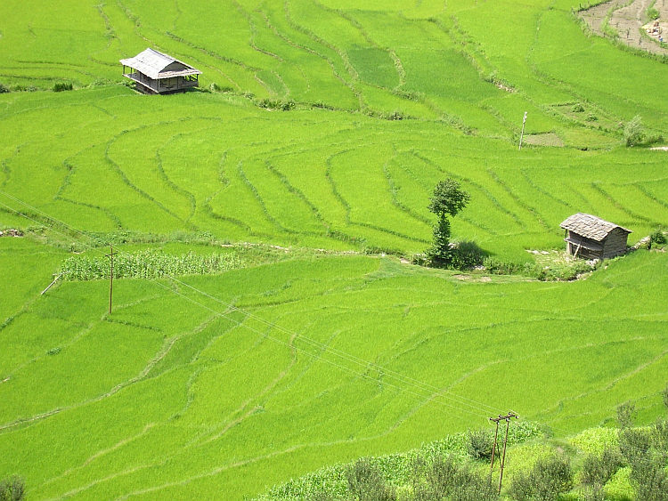
Across river terraces and through apple orchards (kullu is Hindi for apple!) we ride. Sometimes far above the valley,
sometimes below at the valley bottom. This means that we ride through nicely alternating
landscapes. This means a lot of additional climbing as well. We expected an easy day ride
but as we reach Manali we must have climbed nearly 2.000 altitude meters. We have reached
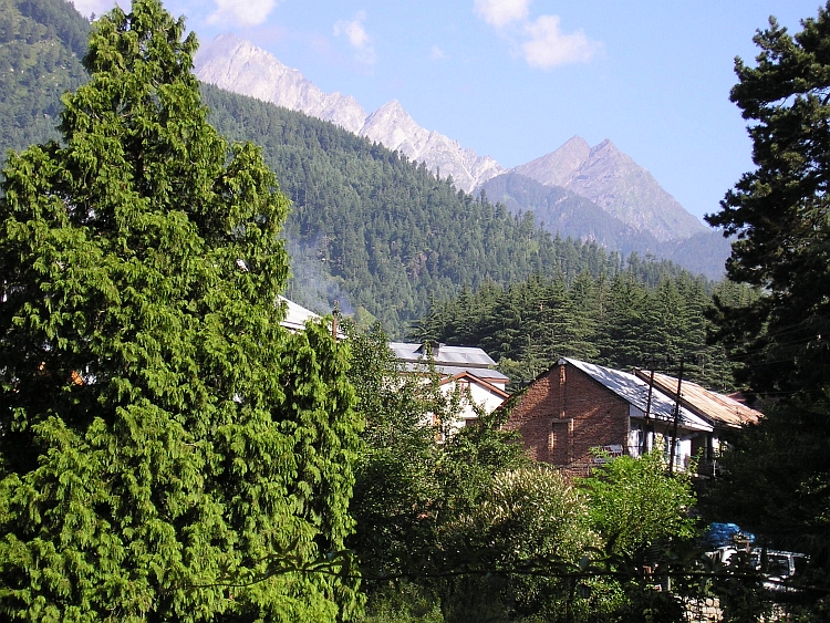
Manali whatsoever. The green forested mountains and the alpine meadows make Manali some
sort of Little Switzerland. Not all is well, though. Now it is Jeroens turn to feel unwell.
He will not dine with Willem and me but he returns home.
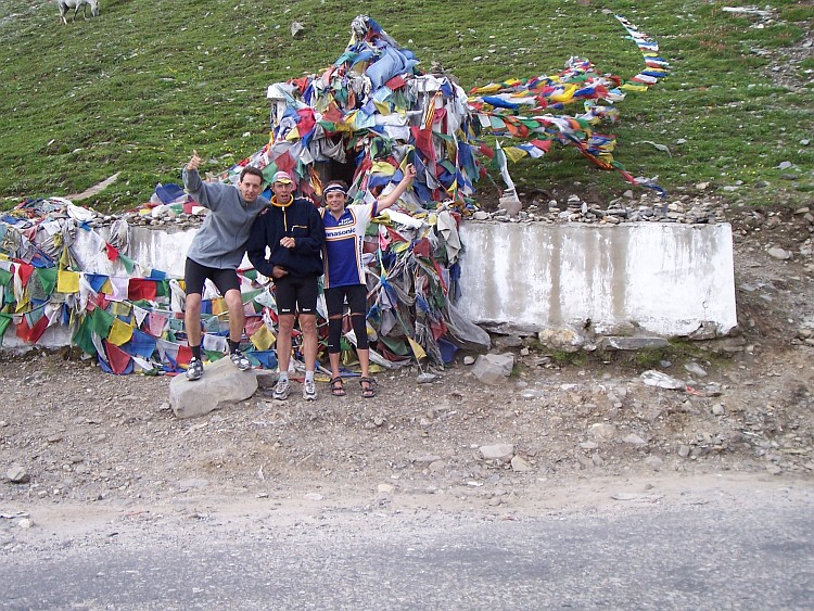
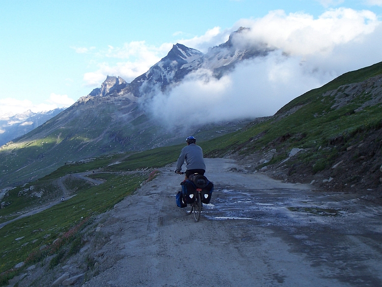
Day 5: Manali - Rohtang Pass (3.974 m) - Khoksar 70 km
Jeroen seems to have recovered quite well last night. As we sit in the garden of our hotel
we decide that we will try to do the long ascent of the Rohtang Pass today. The
weather is still excellent. Now we only have to wait for our breakfast. And we
have to wait a long time! The guests from our hotel are mostly very spiritual and
open people. Happy to discuss their freshly learnt meditation teachings and practices
or their spiritual progress of the last days. And also very aware of all the small details
that determine a good meal to start the day with. The problem for us is that this
leads to discussions with the waiters which easily become quite lengthy. The poor
waiter has to listen patiently to demands in the style of "I would like
to have a tuna salad with onions and tomatoes but the tomatoes must not be too ripe
because my stomach cannot handle that and can you make the salad with only a bit
mayonnaise please but not too few of it. And please use a lot of onions but only
very small slices, otherwise it is too strong and is the tuna fresh? No? Do not
they live here? Only in the ocean? Oh please do me an omelette of the house then,
please without cheese but instead with extra tomatoes but not too ripe! Do you
remember? Please add some bacon to the omelette. And please not too much salt
on it. A bit of pepper is okay but not too much please and is the omelette cheaper
because it is without the cheese?". When the omelette is served finally, this is the
moment for some additional finetuning: "Oh my Gee! The onions in the omelette are
really large. Can you please remove them because I explained to you that my yoga
teacher has said that large pieces of onion can disturb the 'third eye' chakra".
All these demands and complaints are taken very seriously by the waiters or at least they are
convincing in feigning so. When the waiter comes back again with an omelette with
really super small slices of onion, he has to hear the complaint that it really
took a long time before a "simple" omelette is served.
After the other guests all have their breakfasts according to their specific taste, we
finally get our breakfast after one and a half hour. Five minutes later we are finished
and we have paid. After packing our bicycles it is 11 o'clock when we start cycling.
Much too late in fact to start an ascent from 2.000 meter to nearly 4.000 meter
altitude. Especially because we are not yet used to these high altitudes. The first
ten kilometers are not too difficult yet. Through the wide Beas valley we ride straight to
the huge Pir Panjal mountain range that we have to cross. I am really imposed. A
sheer rock and snow wall lies before us, looming ever steeper above our heads as
we come closer. The Pir Panjal mountain range has peaks of over 5.000 and 6.000 meter
altitude. Despite the tops of the mountains are hidden in clouds, the wall before us
is imposing enough to impress. I am really feeling small, knowing that we have to
cross this immense natural barrier today. After ten kilometers we leave the valley
and the road winds up into the unknown.
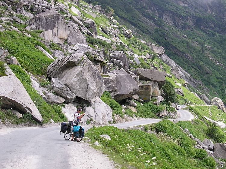
Rapidly we climb above the valley floor. The road is steep enough to gain altitude
effectively but not too steep. Most of the road is in quite good condition. There
are some very bad strectches of mud road too, however. The biggest problem is the
traffic. Lots of Indian tourists make the ascent to the pass to see and
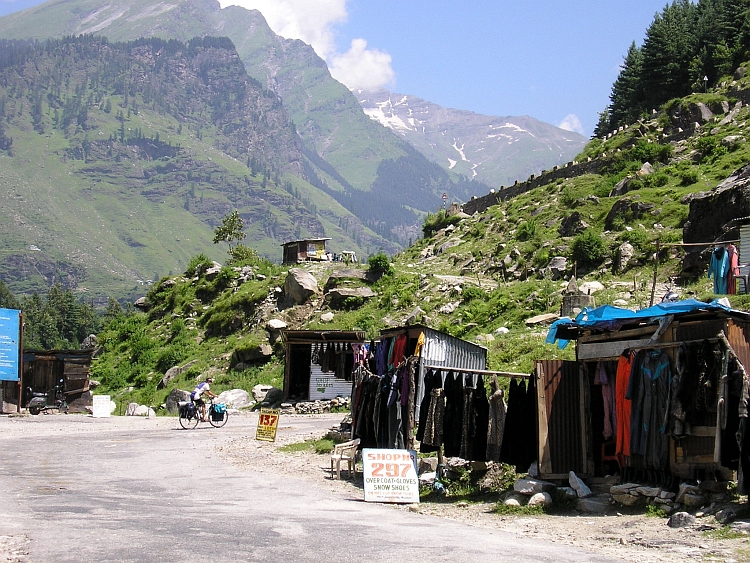
feel snow, for most of the Indians a once-in-a-lifetime experience. Everywhere
along the roads there are shops where tourists can buy fur jackets. Usually the
temperature is high enough to make the coats unnecessary but the tourists do not know
and buy them thankfully. There are also a lots of trucks on the way to Ladakh. The road
is open for only three months so everything has to be transported in this small time
span for a whole year. There is definitely too much traffic for such a small road
which leads inevitably to roadblocks that even cyclists sometimes cannot pass. This can
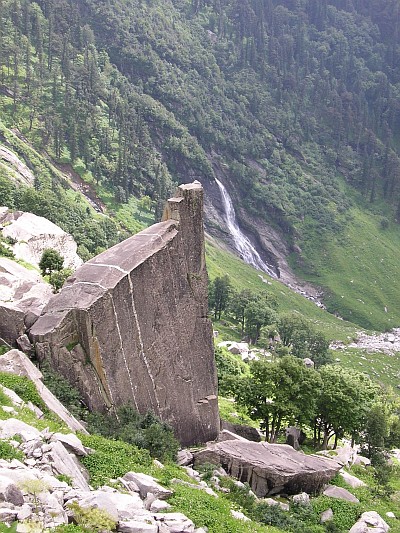
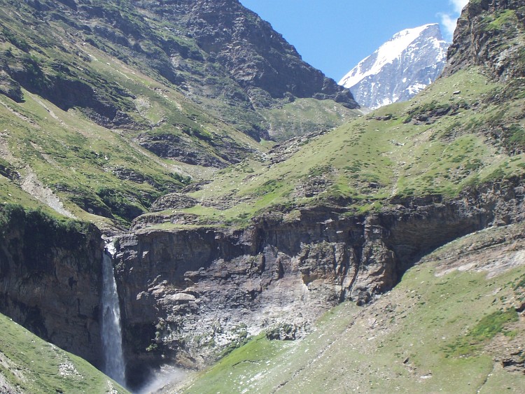
sometimes be annoying because it disturbs the rhythm. Through steep forested slopes
we proceed, passing several imposing waterfalls. Sometimes we catch a glimpse of
the high mountains above us. We progress well. We have a late lunch at 3.300 meter
high at the tourist village of Marhi.
From Marhi the road goes up over a long slope with lots of hairpins. Although the road
is still in good condition, our progress seems to be not as fast as before. We
all feel the altitude sipping our powers. Jeroen has some problems with his bicycle as
well. We have to repair the chains. Not a complicated repair but it takes half an hour
before we find the necessary missing links in Jeroens bags. It is quite late already. We
must not have too many problems like these, otherwise we have to make camp in the wilderness
without a decent evening meal. We have no further problems any more. After an hour
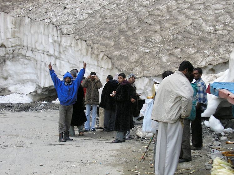
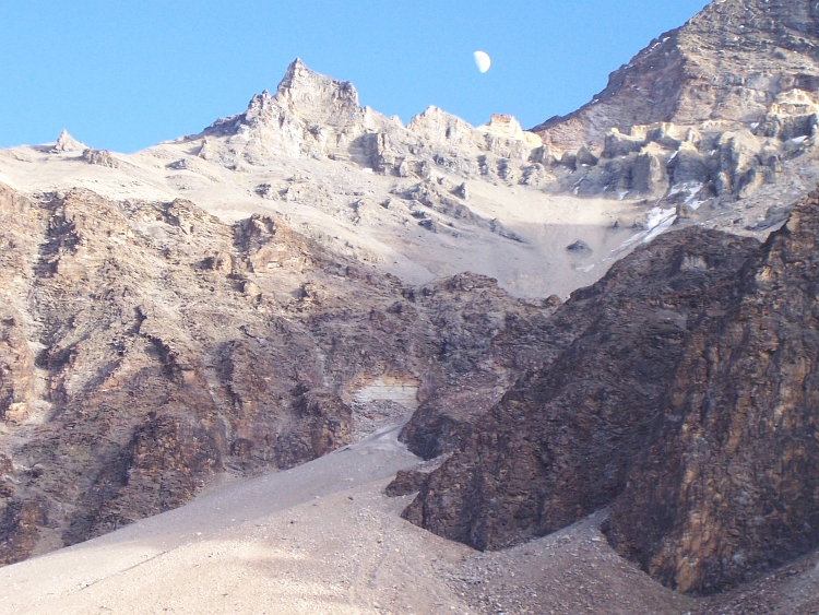
we pass Snow Point where most of the Indian tourists have already left the place.
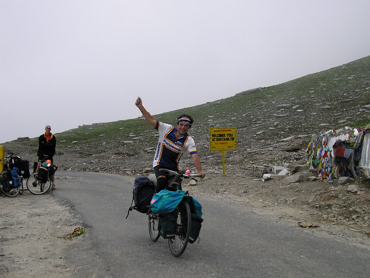
Half an hour later I finally arrive at the Rohtang Pass, completely dissolved in a thick fog.
It is already six o'clock. This means that we have only an hour left for the descent
to Khoksar in the Lahaul Valley on the other side pass. At 7 o'clock it will be dark.
After ten minutes Jeroen and Willem are also on the pass. We quickly begin the descent.
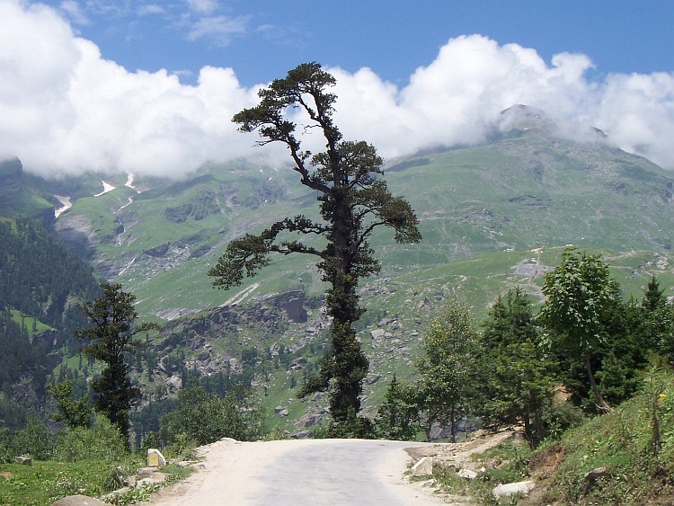
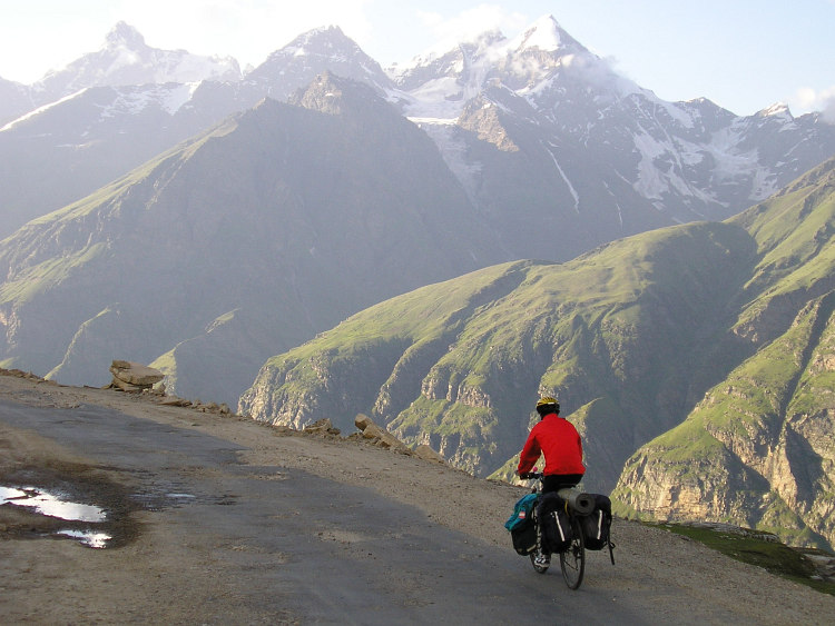
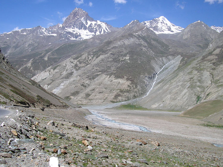
After a few kilometers we cycle out of the fogs. A magnificent mountain world surrounds
us. The Lahaul Valley lies thousand meters steeply below. In front of us are
snowcapped mountains of more than 6.000 meter high. The world around us seems composed
of pure vertical elements.
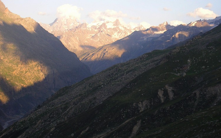
The sun has left the road down into the Lahaul Valley already long ago and now enlightens
only the mountain tops orange. The road is extraordinarily bad after the
surprisingly good road at the Manali side of the pass. I experience that I am far
from razor sharp. I am feeling tired and cannot concentrate on the descent. I make
many small misconducts and I am feeling insecure about myself. I am a little
distressed to descend rapidly in this steep landscape in these conditions but I have
no choice but to go on. It is already very cold and it is becoming darker and darker.
I see that Jeroen also has some problems, he is going very slow as well. Only Willem
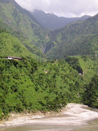
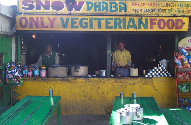
descends normally. Its is already late as we reach the small village of Khoksar where
we find a dhaba, a hut where we can eat and sleep. And that is everything we need
right now.
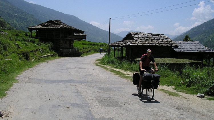
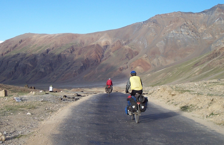
Day 6: Khoksar - Sissu - Gondhla - Tandi - Keylong 50 km
We are not the only cyclists who sleep in the Snow Dhaba. Sebastian, a 42 year old
German cyclist, has also spent the night here and is also on the way to Leh. Because
Sebastian has started off much earlier yesterday, we have not seen each other on the ascent
of the Rohtang Pass. Yesterday we have discussed the whole evening about how to tackle
some difficulties that lie ahead of us on the way. We have more or less the same plans
and we get along together very well, so we have decided to cycle together today.
Today we both want to cycle 50 kilometers to Keylong which is not such a difficult
stretch. The whole day we will have to cycle around 3.000 meter altitude, which is
probably not too high.
There is a small problem however. The weight of Sebastians bicycle is way too high.
How experienced a mountain biker he is, Sebastian has never ever done a cycling journey.
One aspect of cycling journeys is the importance to keep the weight low and still
being prepared for everything. In this delicate balance, Sebastian has packed too
many things on the process. As a result, his bicycle is at least ten kilograms heavier
than ours. Sebastian must have suffered a lot on the monster climb to the Rohtang Pass
yesterday.
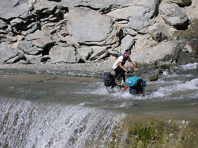
Today is a lot easier luckily. The road conditions however are very bad.
The road is unsurfaced virtually all the time with too many big stones. There are a
lot of river crossings. These can be technically difficult. The "road" has only
large stones on those crossings. Because the water is ten to twenty centimeters deep
and is flowing rapidly, the road is often dificult to be seen. If I want to keep my
shoes dry, I must stop pedalling on the deeper stretches and furthermore and I
must have enough velocity to reach the other side of the water where I might be able to pedal
again. On the other hand I must have a velocity that is low enough to
be able to wind across the big stones, which are difficult to circumvent under
these slippery conditions.
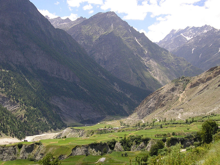
Life is not too complicated however. The weather is excellent again. A clear blue
sky and a fierce sun make life pleasant. The landscape is awesome. Left of us are
the Pir Panjal Mountains that rise sheer out of the river to 6.000 meter. Right of
us is the same story. There is a strangely vertical world above our heads. There is only
a little bit of horizontal space left along the river. Sometimes there is a wider river
terrace where wheat and barley are grown. On the bigger flat areas there is always
a village. Even very steep meadows are used for growing different crops. However
rough the Lahaul district is, the valley is still relatively populated.
The road is too bad to progress well. It takes us nearly two hours for the first
twelve flat kilometers. The next twelve kilometers take us one and a half hour.
Sebastian is not feeling well. He is feeling worse and worse over the course of the day.
The small villages are not ideal places to stay however. As we reach Tandi we sit in
a tea stall, contemplating what to do. Tandi does not have so much facilities. We decide
that we will make the ascent to Keylong. It is only seven kilometers of climbing.
We just hope for the best.
Luckily, the road to Keylong is very good. We cycle very slowly but we have
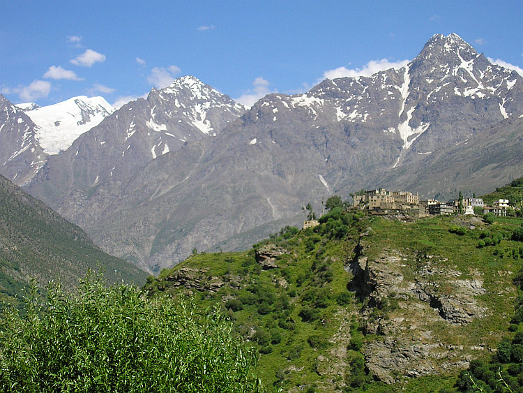
no difficulty reaching Keylong. Keylong is the capital of the Lahaul district. The
village is predominantly buddhist but owes also a significant hindu population. Keylong
has got lots of hotels because the buses to Ladakh have an overnight stay here. After
Keylong, there are only a few small villages in the first thirty kilometers. From there
on untill the Indus Valley there will be only very rough, uninhabited high altitude
terrain. The bus companies do not want their guests to sleep in the tent camps in Sarchu
on 4.200 meter or Pang on 4.600 meter elevation because too many guests suffer from
altitude problems on those altitudes. This means that, for the last time, we are among
tourists now. Sebastian is able to drop the excess luggage with tourists on the way to Leh.
From now on, he can ride on with a 'normal' weight of luggage.
Day 7: Keylong
Jeroen is still not a 100 %. He has diarrhea and has caught a cold as well. Sebastian is
feeling really ill however. I have caught a mild cold too, but I do not have too
many problems. It seems wise however to stay in Keylong and to enjoy the facilities
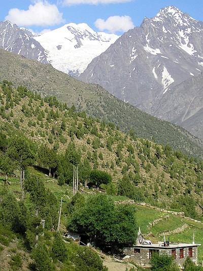
we have to miss the coming week. Keylong is a nice place to hang around for a day. The village
gives a first glimpse of the buddhist world. Jeroen, Willem and I want to walk to the monastery
a few hundred meter above Keylong. We get lost on the small tracks and soon we are
trekking through loose screeslopes, seraching for a way in the mountain landscape. Views are overwhelming but the climbing on the
loose scree is less than comfortable. It takes us more than an hour of slight distress
on slippery scree to reach a decent footpath again. A few minutes later we reach the
monastery. As we arrive, the gompa is deserted and so we have to return without
being able to visit. In Ladakh we will see enough buddhist monasteries however.
Day 8: Keylong - Darcha 30 km
"What road? There IS no road. Just stones and rocks and rivers flowing over what
is supposed to be the road. You cannot cycle there. Still there are some who try.
I do not know how, but they do. But it is impossible." An old English traveller
tells about the road from Keylong to the Baralacha La. "But I do not want to discourage
you."
There are no signs to be seen of a steady progression of our physical state. In fact,
I am the only one who feels well. Sebastian is feeling a little bit better but still
does not feel good. Jeroen still has diarrhea and today Willem too has stomach problems with
diarrhea. We decide to wait untill the afternoon to decide whether to cycle thirty
kilometers to Darcha. Darcha is the last village on the way to Ladakh and the base
to climb the 4.900 meter Baralacha La. That means that if we go today, we must be
strong enough for the difficult stretch of tomorrow.
In the afternoon the conditions have improved a little, but the overall situation is
still shaky. We are too impatient to wait another day in Keylong however.
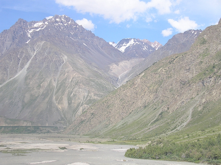
The stretch to Darcha goes through dazzling landcapes. The road climbs far above the river. The
river lies nearly vertical under us, the mountains on the other side of the river
rise to a maximum of 6.700 meter. After fifteen kilometer of predominantly climbing,
we descend to Darcha on 3.300 meter. Darcha is the base for trucks to reach Leh
in one long day. We will be very pleased if we could reach Baralacha La tomorrow
in a very long day.
Day 9: Darcha - Baralacha La (4.900 m) - Sarchu 80 km
I wake up completely tired after a mosquito dominated night. Luckily Sebastian seems to
have recoverd quite well. Jeroen and Willem are also quite okay. The weather is also excellent
again. This means that circumstances are ideal for the monster ascent to Baralacha La.
The first stretch is immediately steeply uphill. In Darcha the road begins to climb
up the hillslope with hairpins. This is a truck dominated stretch with lots of roadblocks
of trucks that try to pass each other on the small road. I am still mentally tired
and easily agitated when truck drivers cause me to ride on very bad parts of the
road. After this first ascent the road starts to follow the course of a large river
valley and we can ride freely again. The landscape is really nice now and I am
beginning to enjoy. We pass lots of river crossings. I am having a good time and
crossing the just too deep rivers is lots of fun.
After Patseo we seem to have progressed really well. There is no wind, the temperatures
are good and despite we climb above 4.000 meter now, we can deal with the altitude
well so far. The road is unpaved but okay. We climb gradually with the valley. Looking
back downstream into the valley we see us rising quickly above mountains that seemed
untouchably high an hour ago. We reach Zing Zing Bar at 11 o'clock. We make a small
but important miscalculation here. We think Zing Zing Bar is between 4.300 and 4.400
meter altitude and are in high spirits. We think that we progress very well and
expect to be on the pass at 1 o'clock or maybe 2 o'clock when we slow down. We make jokes
about the Englishman with his poetically exaggerated phrases. "A road? There IS no road!
Just stones and rocks..."
From Zing Zing Bar the road is tending to deteriorate in a slow but steady pace.
I am feeling better and better however and I am still climbing with a good pace.
I am quite a lot ahead of the others. After climbing 100 meter above Zing Zing
Bar I rest in a tea stall and wait. In the two kilometers from Zing Zing Bar
things have changed quite drastically. Willem reaches the tea stall after a few
minutes and looks quite fresh still.
Jeroen comes along again a few minutes later
and he is looking extraordinary tired. I have never seen him like this. Usually he
is the fittest of us all. He does not want to sit and eat in the tea stall and he is pushing on
without bothering to talk it over. Willem and I are waiting for Sebastian now. Another few
minutes later Sebastian arrives. He is looking okay, compared with Jeroen, athough he
complains that he is feeling bad again. I am thinking about the words of the Englishman
again: "Usually they look very unhealthy and completely worn out when they reach Leh.
IF they reach Leh in the first place."
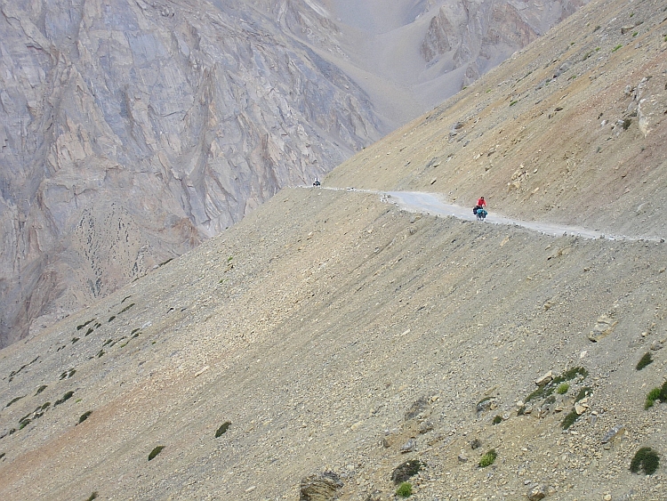
We are cycling again and now the road is really awful. I see the road winding up
kilometers ahead, climbing further and further upstream and ever higher above the valley.
The road is composed of big stones. We proceed very slow now because of the irregular
surface. Another big annoyance are the trucks. There are lots of them on the way.
There is a mine not too far from the pass. Sometimes we have to stop for roadblocks.
At this altitude on this very bad road it is difficult to obtain a good rhythm again.
Usually I do not have to stop though, but cycling small stretches next to the
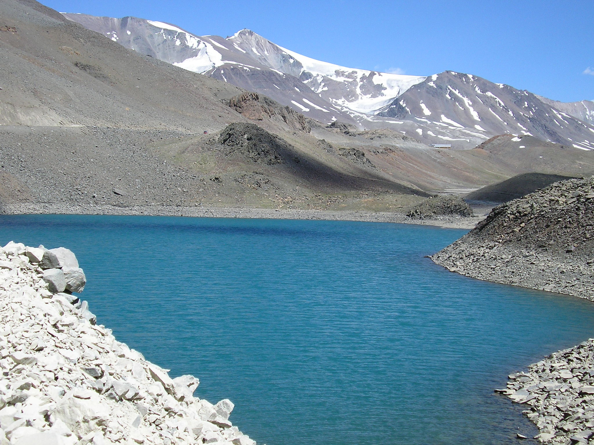
road is difficult enough. It is already 3 o'clock when I reach the Suraj Lake on 4.800
meter elevation. The icy lake lies within a deserted land of loose rock flats and
snowcapped hills. It is not far anymore but the last hundred meters of climbing
have a high cost. The altitude takes all the strength.
I am exhausted as I reach the pass. It does not take too much time before Willem
arrives. Half an hour later Jeroen reaches the pass, looking very exhausted. His
eyes look strange. He wants to go on. He does, while we wait for Sebastian who arrives
fifteen minutes later. We descend quickly because it is getting late. I hope that
we are able to descend to Sarchu today, the lowest place in between the Baralacha and Lachlung
Passes at 4.200 meter elevation. The road is so bad that we still proceed with
only a few kilometers an hour. After a few kilometer there is a very difficult river
crossing. The river is plusminus 60 centimeter deep and is flowing with quite a
strong velocity. We take all our luggage from our bicycles, take our shoes off
and walk hence and forth untill everything is on the other side of the river. The
rivers must not become deeper than this, otherwise we have to hitchhike the river
crossings.
Half an hour later we arrive at a small tent camp at 4.600 meter elevation. We only
have one and a half hour of daytime to cycle the last thirty kilometers to Sarchu,
but I think it is still the best to try. The lower we sleep, the better. The road
is still bad. After an hour we have done just a little bit more than ten kilometers.
I think Jeroen is having altitude problems. He does not look well and is reacting very
slow on situations. It looks like we have to make a camp ourselves. Just when things
seem to turn out wrong, the road improves dramatically. The road is paved now and
finally really goes down. We are able to cycle 30 to 40 kilometer per hour now.
At the moment the sun goes down, we see the campsites of Sarchu in the distance.
We have made it!
Our worries are not completely over now. Jeroen has a severe headache and only wants
to sleep. As Willem, Sebastian and I are eating our bellies full, we are thinking about things to come.
The next two passes are even higher than the Baralacha La; we will not get any lower
than today. It is really important that Jeroen recovers tonight, otherwise we will
have to break off the journey. At this moment however, there is not much that we can
do except for hoping the best.
Day 10: Sarchu - Brandynala 30 km
Jeroen seems to have recovered remarkably well. He says he is feeling quite okay
in fact, the dizzy feeling is gone. I see that his eyes look much brighter than
yesterday evening. A faint headache is everything that reminds of the Baralacha La.
And a tiredness that we all feel. We decide to wait with the ascent of the Lachlung La
untill tomorrow. The Lachlung La is with 5,100 meter altitude even higher than the Baralacha
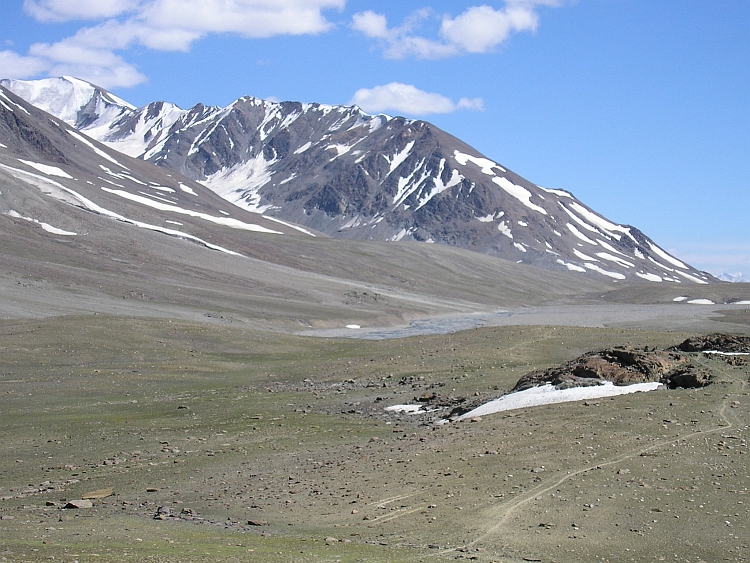
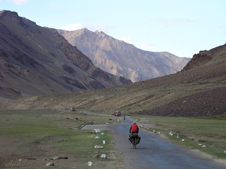
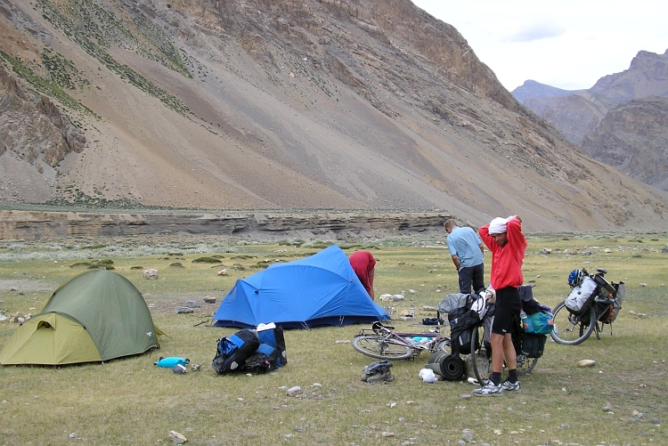
La. Slowly we cycle thirty flat kilometers through the highlands of Sarchu and beyond
to the abandoned Brandynala campsite, which is on foot of the Lachlung La. For the first
time we sleep in our own tents. Jeroen is still feeling well. Willem has diarrhea again
however. Will there ever come a day that we are all feeling strong?
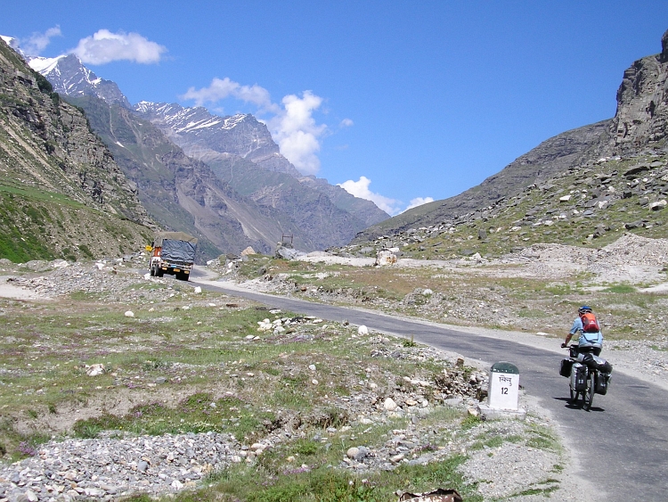
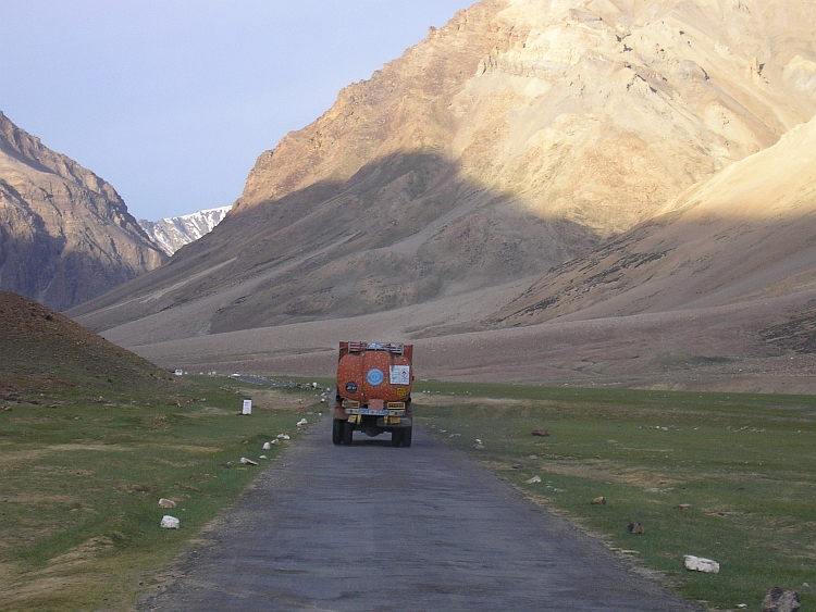
Day 11: Brandynala - Lachlung La - Pang 55 km
Yesterday evening we asked ourselves if there will ever come a day that we all feel strong.
We will at least have to wait untill tomorrow to see that happen because today Willem as well
as Jeroen have diarrhea. Sebastian is feeling weak also. Everybody wants to go on however.
We do not expect an easy day but the ascent should be easier than the ascent of the
Baralacha La. The Lachlung La is a bit higher than the Baralacha La but we are starting
much higher so that the ascent is much shorter. A little problem could be the
secondary pass of the Nakeela Pass of 5.000 meter altitude. We do not know yet how
much the road will go down after reaching this first pass. All extra altitude meters
that we also have to climb up again.
The ascent takes off with the Gata Loops, 21 hairpins against a massive screeslope.
In fact hairpins are ideal cycling. Because you can see yourself climb rapidly above the
curves below, it is easy to think that you are in a good shape. After climbing the Gata
Loops we reach a shapeless landscape. We can see the Nakeela Pass far in the distance.
There are some light snow showers on some of the mountains. This is not the most beautiful
part of the journey so far. The colourless mountains and the grey sky tend to depress a
little. I proceed extraordinary well however. In two hours of cycling I am on top of
the Nakeela Pass. It does not take too much time before we are all on top of the pass.
Willem reacts extremely disappointed as he sees the road going down three hundred meter
to see it going up 400 meter to the Lachlung La, the real pass. I thought Willem knew that
this was not the real pass yet.
There is not much to do about it however. After the descent it is starting to snow too.
This second ascent does not go as well as the Nakeela ascent. I am coughing all the
time because of the cold I caught or maybe because of the altitude. Coughing your
lungs out in combination with an already severe oxygen shortage is a bad mix. What do
I say, that is a bad trip. I am not feeling like a wreck though untill I have
to pass the road workers. On lots of stretches these workers are trying to improve
the road conditions. Often the road is blocked for hours in which no traffic
can pass. We have to carry our heavy bicycles for hundred or two hundred meter
on the scree slope above or below the just asphalted road and along pots of
burning, smoking asphalt that seems to take all the oxygen that is left on this altitude.
The work is severely hard and is carried out by people from the poorest regions of India
like Bihar. In very harsh conditions, these people lead an extremely raw life. Day and night
the people have to handle the extreme climate, the altitude and the extreme physical
endurance of the hard work. The constant production of black smoke make me choke after
a second, these people are living in this hell on Earth the whole day, every day again
untill the summer season is over and they have to return home.
After passing the road workers it is only a few kilometer to the pass. I am really
tired but I can keep moving. Just when I am feeling a good rhythm I am at the pass.
For the first time I am this high with a bicycle (I myself have been higher a few times).
After some time the others reach the pass as well. Now only the 5.300 meter high Tanglang La
separates us from Leh and the Indus Valley. First we have to descend to the tent hotels
of Pang on 4.600 meter altitude, the lowest place where we can stay the night.
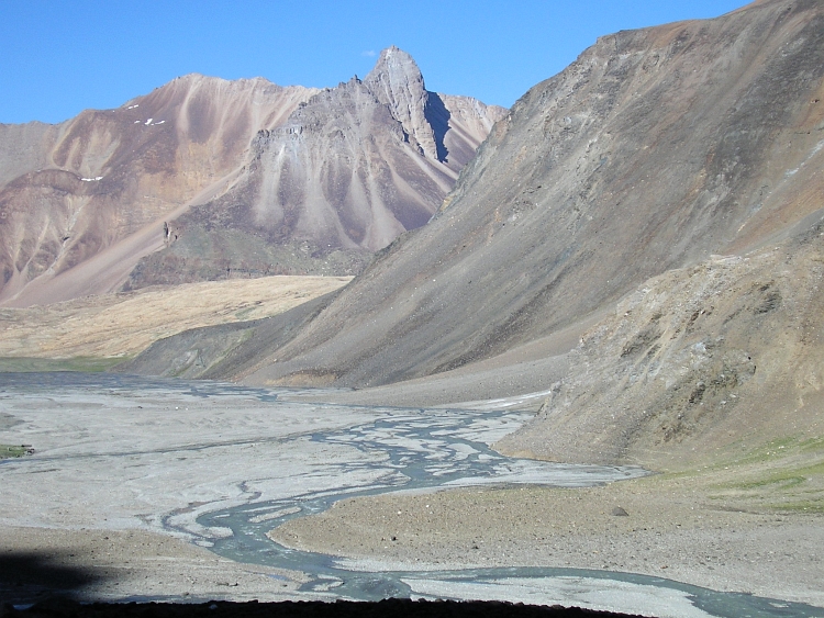
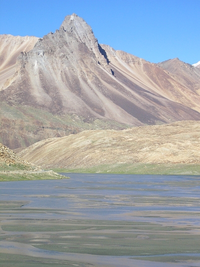
After the greyish landscape of the ascent, the downhill ride from the Lachlung La is
special again. The landscape is very dry. This is high altitude desert. Small
patches of white salt deposits are scattered all over the valleys. Neither trees,
nor other plants grow here. The landscape is painted in ever different colours.
Most impressive however are some magnificent rock walls and an extraordinary thin
pinnacle of at least 1.000 meter sheer verticalness. All our efforts during the ascent
are easily forgotten. In raised spirits we reach the tents of Pang. We stay with
"the girls", two women that could be a grandmother and a child. They take care of
us well and make lots of noodles for us.
Day 12: Pang - Morey Plains - Tanglang La - Rumtse 100 km
Today it is Jeroen who is feeling bad. Severe headaches with feelings of disorientation
seem all the ingredients of altitude sickness. Willem says he is not feeling a 100 % as well.
We discuss what is the best thing to do. Jeroen is seriously looking sick. Staying
on these high altitudes does not seem to solve the problem. Going on could easily be
worse but at least we are able to arrange a truck for transport to the safe altitude of
Ladakh. We decide to try to cross the Morey Plains and the 5.300 meter high Tanglang
La pass in one long day. From here to Rumtse, hundred kilometer further, there will
be no rivers nor tea stalls on the way. The more time it takes to reach Rumtse,
the more water we have to carry. Sebastian and I are feeling good so we divide our
water supplies. I carry both the tents as well so that my bicycle is a lot heavier
than usual.
As we take off, Jeroen seems to feel really shaky. It looks like every moment he
can fall from his bike. Luckily that does not happen. We are climbing 200 meter to the
Morey Plains now, the long flat highlands that bring us to the foot of the Tanglang La,
sixty kilometers further. We discuss again what is the best thing to do. Jeroen wants to
try one more time. Fortunately after two minutes we reach the end of the climb. We
have reached the Morey Plains!
The grey weather add a dark melancholy mood to the plains. The highlands resemble
the Bolivian Altiplano. Dark, mysterious and beautiful, the nothingness that surrounds
can depress and uplift the spirit. This time it does both at the same time. While
Willem, Sebastian and I are making pictures, Jeroen is going on. We try to cycle to
Jeroen but we are not coming closer. Jeroen is farther ahead than it seemed. Sebastian
is feeling unwell now. Because Willem is recovering, he will carry Sebastians water
supplies from now on.
We reach Jeroen as he is waiting for us right before the climb to the Tanglang La.
Jeroen must have recovered a lot. He is looking better again. From now on we have
"only" fourteen kilometer left before we reach the 5.300 meter high Tanglang La.
Of course these kilometers are uphill, that is also a fact. According to India Tanglang La is
the second highest motorable pass of the world but maybe the Indians have overlooked
a few Tibetan passes of unknown altitude. The Indians state that the highest pass
in the world is the 5.600 meter high Khardung La between Leh and the Nubra Valley and
the second highest pass in the world should be the Tanglang La. (Note
from 2015: In the meantime we know that both claim are untrue. GPS measurements
have determined that the Kardhung La pass is around 5.350 meter high. Several passes
in Tibet are higher.)
The ascent of the Tanglang La is difficult beacuse of the altitude. On the other hand,
fourteen kilometer is not that far. It is far enough though but in the end we
reach the pass. After all our problems it is a magnificent feeling to reach the
pass. From here on we only have to go down. Every meter we descend, we will have
nicer temperatures, more oxygen, less wind.
The first kilometers of the descent are quite difficult because of the bad road, the heavy
wind and because the road does not go down in fact. When the road starts to go down in the end,
we roll nice and easy to Rumtse at 4.200 meter altitude. We are in Ladakh now. All
the ingredients are there: the white houses, the stupas, the friendly people. We are
dead tired. But we made it. We can stay in a basic hotel (a REAL hotel!) and tomorrow
we can order all the luxury food we want in Leh!
Day 13: Rumtse - Upshi - Thiksey - Leh 80 km
Rumtse is a very nice village. We see how life passes by in the course of the
morning. We are not in a hurry. To reach Leh, we have to descend 30 kilometer to
reach the Indus Valley. After reaching the Indus Valley at Upshi, it is less than 50
kilometer through the valley to Leh.
Eventually we take off nonetheless. After a few kilometer a dramatic change in the landscape
takes place. We are surrounded by steep, vertically layered rocks in mint green and magenta.
Tiny villages cling to the steep rocks. The valley is filled with stupas, the whitewashed
stone sculptures that represent the universal composition of the components that
make up our existence. The road goes on forever through these strangely painted
rocks. Ever new side valleys show imposing mountain scenery of a different world.
In Upshi we reach the Indus Valley. The otherworldy landscape is changed for yet
another otherworldly landscape. In the Middle of the Himalayas the huge Indus
River lies in a wide valley flanked on both sides by bare mountain slopes. Along
the river there are willows and poplars. Some of the side rivers of the Indus that are
used for irrigation are surrounded by bright green oases. Further there is no green at all
in or around the valley. Just ochre coloured earth, stones and rock. The highest mountains
are snowcapped but most of the mountains are just bare rock.
Sometimes an old monastery is built on top of a rock. Ladakh is Tibetan Buddhist country. The monks wear the
same dark red robes as in Tibet and the same Gelugpa and Kargyupa orders are found.
The Dalai Lama frequently visits the region. Unlike Tibet, the people in Ladakh are free
to live their lives and practice their religion.
Through flat stretches of stone desert we proceed. We pass the Stakna Monastery
and the huge Thiksey Monastery. The sight of the small white monastery houses
clinging to the rock is unforgettable. A formidable reward for the efforts we made.
The last few kilometers to Leh we have to climb again but this is not difficult any more
as the altitude of Leh is a reasonable 3.500 meter. We find a nice hotel with a little garden.
This will be our base for excursions in the region the coming days. There are a
lot of interesting monasteries and villages to be seen, some very near, some a little
further. Sometimes we will cycle, sometimes we will take a jeep to spare some time.
Day 14-17: Leh & Ladakh
Four days we take the time to rest, write cards and just hang around. And of course,
we visit monasteries. Some monasteries are very popular by the tourists, other ones
seem to be overlooked by the tourist agencies. In the latter we are able to feel
and appreciate the atmosphere of the monasteries. We are always received kindheartedly.
We see the monks chanting, meditating. Sometimes the monks just hang around and relax.
Lots of young children live between the walls of monastery complexes. It is impressing to see how
some of the young kiddy monks are very aware of their role as a monk and behave in a very refined way.
Young as they are, they seem to be unattached by worldly things. Children are free to play like
children do but if their is work to be done, they seem happy to fulfill their task
adequately.
Leh is the capital of Ladakh. Before the English colonized the region, Ladakh was a
kingdom of its own. At first Shey was the capital of Ladakh but later Leh became the
capital. Leh has always been an important stop along one of the secondary branches of the
silk route. Maybe therefore, the bazaars and Markets of Leh have a certain Central
Asian flavour. From Tibet, China, India and Pakistan came salt, tea and spices into the
region over the long and deserted trading routes that cross the high passes that
surround Ladakh. Apples and apricots and pashmina wool were from old being exported.
Nowadays the trade routes are still being used, some of them secretly because of
political border problems with Pakistan and China. Of course, trading with India has become
much easier since Ladakh is connected with the rest of India by road. Nowadays especially
fuel is transported into Ladakh. Petrol has replaced yak faeces as main energy source.
In that respect Ladakh must have been modernized enormously over the last thirty years.
From a self sufficient rural economy Ladakh has grown rapidly in the largely tourism
based economy it is by now.
Day 18: Leh - Khardung La (5.600 m?) - Khardung - Diskit 115 km
The last days we have not done too much cycling. Instead we had quite a light programme. We have
explored the monasteries in the region and simply relaxed and let the days pass by. All
the time however the project hung above our heads. Literally. The highest pass in the world
that could reasonably be cycled without having to carry or push the bicycle. The road starts
in Leh and goes up to the Khardung La. It is also possivle to descend the Khardung La into
the Nubra Valley on the other side of the pass. Sebastian will also try to cycle up the Khardung
La but he will do it as a day trip on the day after our return. Two days later he will travel
by airplane to Delhi and a few days later back home so he cannot descend into the Nubra Valley.
We have got some more time and we will certainly use it to go down the Nubra Valley. We have even more time
that we will use to explore the Spiti Valley after our return from the Nubra Valley.
But first of all we have to cross the Khardung La, the highest pass of the World,
at least according to the Indians.
The Khardung La begins in Leh and crosses the Ladakh Range north of the Indus Valley. The pass is 5.602 meter
high according to the maps and is the only connection with the Shyok and Nubra
Valleys. The Nubra Valley is the farthest north that foreigners can get into India.
Tourists and travellers must not pass any further than Panamik because of border
problems with China and Pakistan.
The idea of cycling the highest pass in the world is simply too hard to resist. After
four days of cultural activities and relaxing, today is the day. With only day luggage
Jeroen, Willem and I try to reach the pass. We want to descend the same day to the
Nubra Valley where we can sleep in one of the few hotels. Because we are lightweighted
this way, the chance of reaching the Nubra Valley in one day improves significantly. But also
without much luggage we must not think too easy about the climb. Leh is 3.500 meter high;
that means that we have to climb more than 2.000 vertical meters, the second half
on really high altitudes.
We start early in the morning. Like every day, the weather is magnificent in Ladakh.
Crystal blue skies with only a few white clouds. Along the oases of Leh we climb.
The first kilometers we see the wall of the Ladakh mountain range rapidly coming
closer. Then the green valley ends and the road starts winding up the barren flanks.
There is no wind and the temperature is perfect. Therefore, we proceed surprisingly
well. We see the oases further and further down below us. We see a young woman pushing
her bicycle upward. It is uncertain if she will make it to the top today; it seems impossible
to push the bicycle the last thirty kilometer to the pass.
We reach South Pullu, an army camp where we have to show our permits. From South Pullu,
it is only fourteen kilometer to go. We have to cross the chain of mountains that lie
before us. It seems still a long way from here. Like all Himalaya passes untill now,
the road deteriorates badly the last kilometers. The ascent of the Khardung La is no
exception. The road gets more and more stony. There are no really big problems with
river crossings or really bad stretches. We can go on fairly well. In fact, I am
surprised as I reach the pass. Is this the highest pass in the world? And should not
I have been much more tired now?
Soon after we are united on the pass. Spirits are raised, knowing that from now
on we only have to go down. We get a lot of attention from the few Indian tourists that
are making pictures or take a look in the highest temple of the world (and maybe
the smallest too). The highest toilets of the world are closed. (Note from 2011:
we know now that the claim of the Khardung La as the highest motorable pass in the world
is untrue. GPS measurements have determined the Kahrdung La pass at around 5.350 meter instead of
5.600 m.)
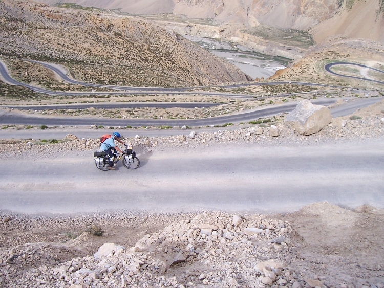
The way down into the Nubra Valley is far worse than the ascent from Leh. The tiny road
is made of big stones. It is impossible to cycle faster than a few kilometers per hour.
The way down leads through a dry, deserted landscape of large boulders. A huge procession of
buses and trucks is coming up the mountain and makes the progress very difficult to impossible.
Passing is not always possible and not everywhere. Sometimes we have to wait a minute or two
before we can ride again for a few seconds. The passing of the convoy takes ages.
The first seven kilometer of the descent takes us an hour. That is more time than the
last seven kilometer of the ascent had cost us!
Luckily, from here the road improves bit by bit. From the checkpost of North Pullu, the
road is asphalted again. Landscapes float by in the long descent to the Shyok
Valley. From the top of the Khardung La to the valley at 3.000 meter the way down
is 60 kilometer. We can see the steep, bare mountains behind the Shyok Valley. The rocky,
craggy mountains are much steeper than the gentle slopes of the Ladakh Range. North of
the Shyok and Nubra Valleys the mountains are becoming progressively higher untill the
mighty Karakoram Chain with its 8.600 meter high K2.
The sun is already going down behind the mountains, throwing increasingly deeper shadows
into the valleys. As we descend deeper and deeper the slopes remain dry but there are
more and more spots where lavender bushes are able to grow. The purple glow of
the sunlit slopes increases the mysterious feel of this obscure but rarely beautiful
territory.
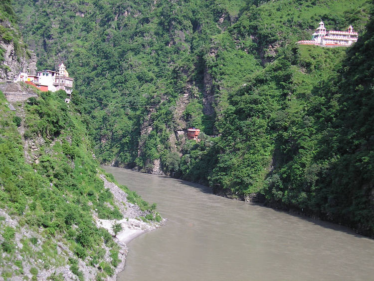
After a few hours we are down in the Shyok Valley. The river lies between the incredible big
mountain walls. Once in a while there is a side valley between the massive mountain walls.
Some of these side valleys are very green but others are completely barren. Every kilometer
the landscape changes dramatically. Now we find ourselves in a desert wasteland of large
stones. Not a tree or a scrub can be seen. A stark, intensely dark blue sky complements the unearthly feel
of the valley.
After a few kilometers we leave this hauntingly desolated but strangely beautiful landscape
as we reach the confluence of the Shyok and Nubra Rivers. An immense flatland of a few kilometers
wide lies befire us, right in the middle of one of the roughest mountain terrains in the world.
We keep following the course of the Shyok River and end up in the village of Diskit. We are
back in civilization, on the edge of the world. We find a hotel and a Tibetan restaurant,
value enough to fulfill our needs.
Day 19: Diskit - Hundar - Diskit - Sumur - Panamik - Sumur 95 km
Today we want to explore the Shyok and Nubra Valleys. But the first thing to do is to pay a visit to the
Monastery right above the hotel. A footpath leads up steeply to the rock on which
the gompa is built. We have some nice views into the Shyok Valley. Then we take off
for Hundar. In Hundar is a small strech of sand desert with nice dunes. Here lives
the Bactrian Camel, a specific race that is able to survive on these altitudes.
We do not spot one of those camels from nearby.
After Hundar we cycle to Sumur, where we find a hotel. Willem and I cycle on to Panamik.
Panamik is as far as we can get. It is the most northern place of India that foreigners
may go. Because of border circumstances foreigners are not allowed to go north further
than Panamik. I have to admit that Panamik is less than spectacular. We return with
a fierce wind in the back. The wind is blowing harder and harder and we see a sandstorm
growing. We cycle back to Sumur as fast as we can, but we take pictures too. It
is a magnificent sight. We are back in Sumur just in time. Right after we close the doors,
the world around us is veiled in powder and dust.
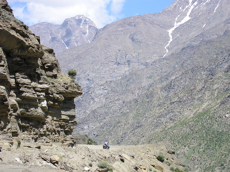
Day 23: Khoksar - Khhatru - Upper Lahaul Valley 45 km
In Panamik we kind of reached the end of the world. We simply could not get any further
any more. We decided to take the bus back to Leh and then another bus to Khoksar,
the place where we also slept after our first Himalaya Pass.
So now we are in Khoksar again, in the Lahaul Valley. We intend to cycle upstream
along the Chandra River to the Kunzum La. The Kunzum Pass divides the Lahaul Valley from the
Spiti Valley. The remote Spiti Valley has got three famous thousand year old Tibetan
monasteries, the monasteries of Key, Dhankar and Tabo. These monasteries are older
than the monasteries in Ladakh and even older than the monasteries in Tibet. Reason enough
to linger a bit longer in the high Himalayas. So we go happily on
our way from Khoksar after a long, dull and tiring bus excursion.
After a few weeks of traveling in the Himalayas we already knew there would
always be specific problems that makes life uneasy. So we had learned to cope with
high altitude, bad roads and severe river crossings. On the way to Spiti it is
goats we have to deal with. And sheep. And they have lots of friends! For every few
minutes that we can actually cycle, there are as many minutes that we get stuck
inside a herd of goats. it is a lot of fun to try
to manouevre a way in the flowing stream of goats and sheep. The animals add a
lot to the couleur locale and provide a welcome rest. We find out that the
combination of a river crossing and a goat herd rendezvous is a guarantee for
wet shoes.
Unfortunately the weather deteriorates badly. We take shelter in a windy tent in
the village of Khhatru. Severe monsoon clouds flow across the Pir Panjal Mountains
and icy rains pour down. After two hours the worst has gone and we proceed for another
fifteen kilometers very rough terrain. It is already freezing when we arrive in a
lonely dhaba late in the afternoon. I have some problems with my stomach and go
to bed without eating.
Day 24: Lahaul - Kunzum La - Lhosar 45 km
After our first cold night in the Himalayas we are happy to see the first sunrays
shining over the mighty mountains of the Pir Panjal. We are leaving early in the morning. The
landscapes that we cross have a wild splendour. Everything around us is awe-inspiring.
Huge cliffs rise up on the left and on the right. High alpine mountain tops soar into
the deep blue skies. One of the mountain tops has a bizarre, razor sharp peak in the
shape of a needle. Immense glaciers are cracking their way down to the valley.
We are cycling through large fields of boulders with the size of complete houses.
The road is rough but not too bad. We proceed slowly but fast enough. There is
one last tea stall before the road winds up above the valley. We sit down for a long
time enjoying the sights as well as the tea and biscuits.
After the break we climb rapidly above the valley. We are zigzagging our way upward. Many zigzags
above our heads we can see the hill becoming less and less steep. We have to climb at least
untill there before we reach the pass.
Despite the passes we have climbed before, the ascent is an exhausting experience again.
Luckily the pass is not as high as it looked like from below. Usually this is not the
case and there is some extra work to be done when you think you have nearly reched
the top. We have reached the 4.554 meter high Kunzum La Pass. Not the highest pass
from the Himalayas but surely one of the most impressive that I have seen.
Now we only have to go down to reach the Spiti Valley. We see that the mountains on
the east side of the Kunzum La Pass are not as high, steep and rough as the Pir Panjal
Mountains we passed westward of the pass.
The mountains east of the pass may lose some sheer grandeur, they gain at subtlety.
They seem composed of a thousand different colours, continuously changing in hue
and tone as we sre looking from ever new viewpoints and angles as we proceed.
Bumping and stumping we struggle a way down the rocky trail. After a while we have
descended into the upper reaches of the Spiti Valley nad through the flat, wide, boulder-strewn
valley we continue until we reach the first village Lhosar. We decide to stay for a relaxed
afternoon and a good night sleep. Surprisingly, we meet some colleague cyclists.
An English guy and an English girl are leading a group of mountainbikers through
the rough highlands of Spiti. They provide some helpful tips and information
of sights and trails here and there and everywhere in the Indian Himalayas.
Day 25: Lhosar - Hanse - Kaza 60 km
Today is going to be an easy day. Sixty quite flat kilometers divide us from Kaza,
the district headquarters of Spiti. We have heard that the road from the Spiti Valley
further down into the Sutlej Valley and Shimla is closed for more than two hundred
kilometers. We decide that we do not have enough time to try this uncertain way
down into the Indian lowlands. This means also that we should not cycle any further
than Kaza. From there we can reach the famous monasteries of the valley on easy
day trips.
Despite the landscapes are once again splendid, I have an uninspired day. After
a few hundred meters I have a flat tyre because of a huge spike. The tyre is completely
worn down. The spare tyre is also flat a few hundred meters further and after a few
kilometer I have a third flat tyre. I cannot cope too well with the bad luck.
Only because the bad luck has left me after the three flat tyres and because of
continuous extraordinary landscapes, spirit is slowly coming back. Eventually we
reach Kaza where we find a place to stay for a few nights.
Day 26: Kaza - Key - Kibber - Key - Kaza 40 km
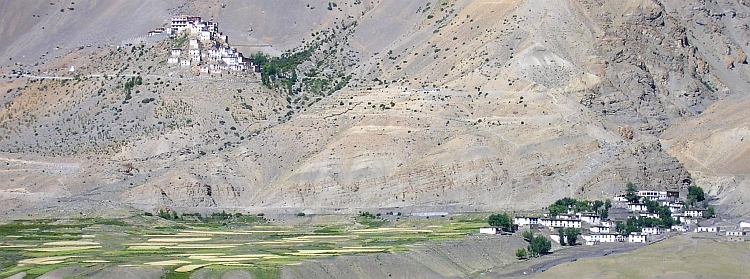
The first of our day trips brings us to the Key Monastery and to Kibber. The Key
Monastery is surely one of the most beautifully situated Tibetan monasteries. The tiny
white houses are perched on a perfectly coneshaped rock outcrop, high above the village
of Key. The monastery is a thousand years old and is one of the older Buddhist
monasteries in the Himalayas. We are invited for a ritual cup of tea.
After two hours we make the ascent to Kibber. Cycling without the heavy luggage
is a true delight. I do not seem to feel the altitude of more than 4.000 meters any more.
Our destiny, Kibber, is the highest village of the world according to some travel
guides. Kibber lies at an elevation of 4.200 meter. I am sure that the account of
highest village is highly untrue. In Peru and in Bolivia I have been in higher places
and there must be many places in Peru and Bolivia that I have not visited which are
even higher. Nonetheless the altitude is fair enough. There is not much to be done
in Kibber but from the restaurant we have a pleasant sight on the village. Within
an hour we descend back to Key and Kaza.
Day 27: Kaza - Dhankar - Lalung - Kaza 70 km
The second daytrip brings us further down the Spiti Valley. After twentyfive kilometers
along the Spiti river we have a serious ascent to the Dhankar Monastery. The Gompa
lies a few hundred meter right above our heads on top of a giant cliff. Without
luggage the ascent is not too difficult. We reach Dhankar where we cannot visit
the monastery. There is a festival for the elder monks. Some children monks are
waiting outside and have some fun on our bicycles.
From the English cyclists in Lhosar we heard that there is a trail leading to the
very remote village of Lalung. The trail is of the worst order. I get a flat tyre
on a large boulder and I fall from my bicycle once after a small misconduct between
the stones. This is some expert cycling. It takes a long time before we reach eerie
Lalung, a very beautiful village. There is one restaurant/hotel in the village.
There is a very welcoming atmosphere in the recently opened place, we feel sorry
that we have our luggage and stuff back in Kaza. The owner owes the key to
the monastery, again a 1000 year old monastery. While the monasteries of Key,
Dhankar and Tabo are very famous, the village and monastery of Lalung are virtually
unknown. The frescoes of the monastery are though highly original. The village,
the monastery, the remoteness and the welcoming atmosphere: the Shangri La really
DOES exist!
Day 28: Kaza - Tabo - Kaza 100 km
Today Willem and Jeroen do not feel like cycling. Because I want to see the monastery
of Tabo, I am leaving on my own. Tabo is the most downstream village of Spiti. The first
twentyfive kilometers are the same as yesterday. Five kilometers further, The Spiti
river is at once surrounded by steep slopes. The river valley is narrow. the river
is not at all flat anymore, but flows with quick currents downstream. I lose very
much altitude meters although there are some steep ascents as well. I am afraid
that the return trip in the afternoon could be very tiring, especially because
I will have head wind on the way back. The last kilometers to Tabo are magnificent.
I am very close to the border with Tibet. I can see the valley that goes up towards
Tibet. At the end of that valley must be the Shipki La, the crucial pass from the
important old trading route which is now closed due to the Chinese occupation
of Tibet.
I reach Tabo, once again a 1000 year old monastery. Rumour says that the Dalai Lama
will possibly retire here. The monastery is stylistically very different from all the other monasteries.
No whitewashed buildings this time but earth brown adobe houses. I do not have much time in
Tabo unfortunately. I have to go back. There is 50 kilometer to go with lots of climbing
and loads of head wind. Untill now I must not complain these holidays but the 50 kilometers
to Kaza are devastating, even without luggage. I am dead broken as I finally return
in Kaza after many hours of struggling against wind and altitude. Tomorrow we will
return to Manali with the bus.
Day 30: Khoksar - Rohtang Pass - Manali 75 km
Yesterday we went by bus from Kaza back to Manali across the Kunzum La and the Rohtang
La. At least: that was supposed to happen. Even before we had to climb up for the Kunzum
La, the bus had its first flat tyre. The spare tyre was hardly better. It had large holes
and cracks. It was not a surprise when we stood still again fifteen kilometers further
across the pass. After hours of non-decison whether to go further or wait for a
miracle, we drove slowly to Khoksar. It was already seven o'clock in the evening
when we arrived in Khoksar. We could not get a spare tyre within a clear timespan.
Another period of non-decison came. We did not want to wait for a miracle. We
took a dhaba for the night and decided to cross the Rohtang Pass ourselves, tomorrow,
on our bicycle.
So now we are cycling up to the Rohtang Pass for the second time, this time of course
from the other side as we did on the way to Leh. Then it was our first pass and
a big confrontation with the altitude. Now we are completely used to the altitude.
That time we were impressed by the poor state of the road. This time we are
surprised by the excellent quality of the road. Doing the road twice is not too
exciting but gives a good insight in the way we have got used to the circumstances.
The ascent from Khoksar is much shorter than the descent to Manali. It is big fun
to have such a long descent. Early in the afternoon we reach Manali.
Day 31: Manali - Kullu - Bhuntar 50 km
Down along the Beas river. A month ago we cycled the secondary road on the other side
of the river, above the valley. This time we take the easy way. Not too interesting
after everything we have seen the last weeks, but nonetheless okay. It is quite
a change to cycle in the humid air among such a green landscape after weeks of
high altitude deserts. We stay the night in the same hotel as one month ago, in Bhuntar.
Day 32: Bhuntar - Manikaran - Bhuntar 70 km
Today we will cycle to Manikaran, a holy Hindu site. We will go on a day trip,
so we do not need to carry a lot of luggage when we make the climb
to the pilgrimage site.
Manikaran proves to be a colorful and atmospheric location. The village along
the Parvati River is the place where Shiva's wife Parvati shed tears because
a serpent stole her earrings. There is a warm water spa at this place where Hindus
wash their bodies in Shiva's tears.
The Parvati river is a tributary river to the bigger Beas river. The river is
flanked by steep hillsides. It is impressive to see such a big river in such a
narrow landscape. It is 35 kilometers up along the river to Manikaran. Most of
the time the road is not too steep.
The weather is a bit uncertain. It is clear to us that the monsoon has not left North
India right now. Unexpectedly though, it remains dry, the whole day. We reach Manikaran
where we check out the village. We have a lunch break at a village not far from Manikaran.
A long descent brings us back in Bhuntar.
Day 33: Bhuntar - Bajaura - Kandi - Jogindernagar 100 km
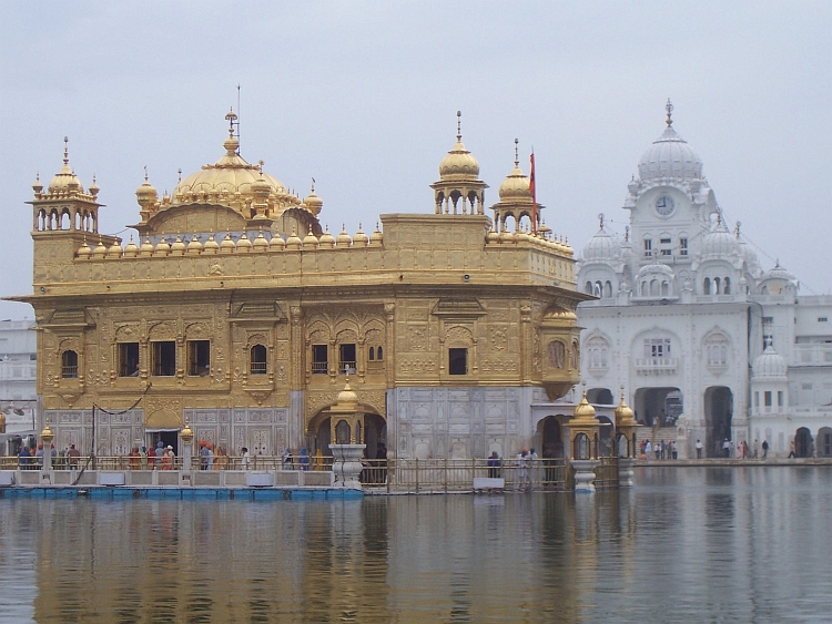
We have decided to cycle to Amritsar, the City of the Golden Temple and the Sikhs.
Amritsar is the perfect final destination of the trip. Today we want to reach
the Kangra Valley on the southwest side of the mountains. It is bloody hot as we
wind up over the small local road up into the mountains. The landscape is
overwhelmingly green again. We are not higher than 1.200 meter altitude so the
temperatures are much higher than we are used to the last weeks. The road goes up
steeply. Within a few hundred meters I am completely wet. Beads of sweat are flowing
down all over my body. The taste is more and more salty. The ascent is much steeper
than the high altitude passes between Manali and Leh. Climbing on "normal" altitudes
is nonetheless much easier. After two hours we reach the pass at Kandi. There is
a teastall at the pass where we take some rest. We are in the clouds right now.
After a long descent, we find out that there is one more hill ridge that is dividing
us from the Kangra Valley and that ridge is surprisingly high. Worse, the road that
takes us over the ridge is surprisingly steep as well. With a temperature between
35 and 40 degrees we are climbing on a road with a steepness of 20 %. There is no
shadow. There are clouds everywhere except between us and the sun. It takes us 45
hallucinatory estranging minutes to reach the ridge. We are completely exhausted
and keep drinking on the top.
We are thousand meter above the Indian Plains now. We can see the lakes, the cities,
the villages below us. Our road remains high however. The road to Dharamsala follows
the ridge, sometimes on the northside, sometimes on the southside. There is one last
ascent of an hour before we reach the small city of Jogindernagar where we find a hotel.
Day 34: Jogindernagar - Bajinath - Palampur - Dharamsala 80 km
The first highlight on the way to Dharamsala is the temple of Bajinath. The Hindu
temple was built in the 8th century and is one of the older temples in Northern India.
We walk between the age-old structures of the complex. In one of the pathways we
have a strange encounter with a well-known friend. Between all the
Gods and Goddesses we find a plastic colourful Donald Duck. India keeps
surprising.
It takes us quite some climbing and descending before we finally reach
Dharamsala. From here it is seven kilometer up to the mountain resort McLeodGanj
where the Dalai Lama has taken refuge after his flee from the Chinese in 1959. This will
be our last ascent of the journey. I take it as a kind of time trial. The road is very good
and because of the heavy rainfall there is lots of oxygen in the air. After a month
high altitude training I seem to be flying upward, despite the luggage.
Day 35: McLeodGanj (Dharamsala)
From the beginning to the end of the day torrential rains pour down over McLeodGanj.
The rains stop at seven o'clock in the evening. The rains have made a huge impact.
There are cracks in the road, in some places parts of the road are completely washed away.
We see a house which is nearly completely divided by a crack from bottom to top.
McLeodGanj is one of the wettest places on Earth, but the showers of today were exceptional,
even in this place. Despite the damage, life seems to go on as usual.
Day 36: McLeodGanj (Dharamsala) - Triund
Today we wander to Triund. Triund is a very special viewpoint at 3.000 meter altitude.
On the alpine meadows of Triund it is possible to see the highest mountains of the Dhaula
Dhar mountain range 2.000 meter above and the Indian Plains, 2.500 meter below.
We are lucky with the weather conditions. The weather is dry today between
days of nearly continuous rain showers. The views are superb, despite the
Dhaula Dhar mountains are surrounded by clouds. When we are
down in McLeodGanj, it spontaneously starts raining again. It is definitely time
to leave this unearthly wet place!
Day 37: McLeodGanj (Dharamsala) - Nurpur - Pathankot - Mukerian 135 km
We pack our bicycles early in the morning. We visit the family where Willem has done a
voluntary project nine years ago. We are welcomed heartily. We talk the whole morning
and stay for the lunch as well.
After our lang stay with the family, we nonetheless manage to cycle 135 kilometers.
The roads are good, the terrain is getting less and less hilly and there is no wind. After
Palampur we have finally left the Himalayas. We are in the Punjab now, the fertile
flatlands of India and Pakistan where the basmati rice is produced. The last seventy
kilometers we ride through the vast plains. Eventually we reach a non-assuming smalltown called
Mukerian, where we find a simple, friendly place to stay with an a restaurant where they
serve first class curries.
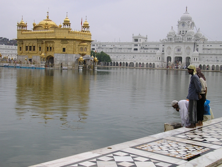
Day 38: Mukerian - Batala - Amritsar 95 km
Huge showers of rain mark our final cycling day in India. Everything is wet and muddy.
It is no fun to cycle in these circumstances. There is nothing to be seen in this weather.
I am yearning to reach Amritsar. For this time I have had enough of cycling.
The last 35 kilometers from Batala to Amritsar the weather improves fortunately. Jeroen is far
ahead of us as we reach Amritsar. Only, Jeroen is nowhere to be seen. Where could he be?
He would not cycle on his own into the city? Willem and I do not know what to do and
decide to cycle into the city towards the Golden Temple. No Jeroen. We keep searching around
the temple complex but we cannot find Jeroen. After phoning home, we still do not have
any sign of life of Jeroen. It is six hours later as we coincidentally bump up against
Jeroen after leaving a phone cell once again. How lucky we are, to meet each other
spontaneously in a place of more than a million inhabitants! We are very relieved.
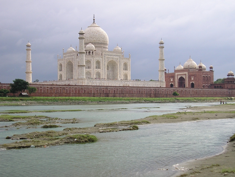
We have made it! We have two days in India. Tomorrow we can go back to Delhi by
train and the day after we will be able to make a day trip to Agra to see the Taj.
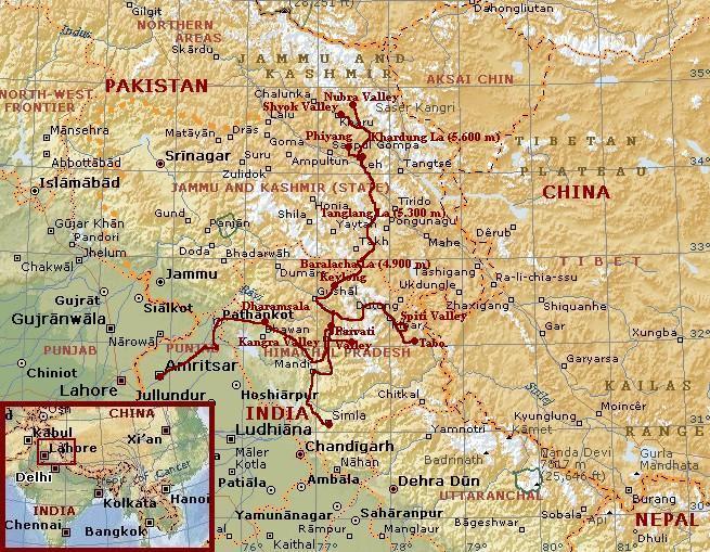
Map of the route
Statistics
Fast Facts
# Days
# Cycling days
Distance on bicycle
Distance / Days
Distance / Cycling days
Longest distance on a day
Highest altitude difference on a day: climbing
Highest altitude difference on a day: descending
Highest point on bicycle
# days that one of the group was unwell
# temples, stupas and other religious monuments
# cyclists we have met in the Himalayas
# friendly people on the way
# chaotic traffic moments
# buses and trucks down in the ravine
38
27
2.060 km
54 km
76 km
135 km
2.150 m (from Manali to Rhotang La)
2.600 m (from Khardung La to Nubra Valley)
5.600 m (Khardung La)
21 (out of 38!)
uncountable
around 20
100 %
less than expected
too many
Highlights
Himachal Pradesh
Himalayas
Himalayas
Ladakh
Ladakh
Spiti
Punjab
Watch life go by from a Shimla rooftop terrace
Forgetting fatigue and altitude and enjoy the landscapes on both sides of the Baralacha La
Sit on a stone in the landscape and contemplate where the world has gone wrong
Descending from Tanglang La into the monastery world of the Indus Valley
Reaching the top of Worlds highest motorable road, the 5.600 m high Khardung La, by bicycle
Exploring the landscapes and Tibetan monasteries of remote Spiti Valley
Cover your hair, put out your shoes and absorb the vibes and music of Amritsars Golden Temple
Day to Day
1
2
3
4
5
6
8
9
10
11
12
13
16
18
19
23
24
25
26
27
28
30
31
32
33
34
37
38
Delhi; Shimla
Shimla - Sallaghat - Dehar
Dehar - Mandi - Bhuntar
Bhuntar - Kullu - Naggar - Manali
Manali - Rohtang La (3.974 m) - Khoksar
Khoksar - Tandi - Keylong
Keylong - Darcha
Darcha - Baralacha La (4.900 m)-Sarchu
Sarchu - Brandynala
Brandynala - Lachlung La - Pang
Pang - Tanglang La (5.300 m) - Rumtse
Rumtse - Upshi - Thiksey - Leh
Leh - Spitok - Phiyang - Leh
Leh - Khardung La (5.600 m) - Diskit
Diskit - Hundar - Panamik - Sumur
Khoksar - Khhatru - Upper Lahaul Valley
Lahaul - Kunzum La - Lhosar
Lhosar - Hanse - Kaza
Kaza - Key - Kibber - Kaza
Kaza - Dhankar - Lalung - Kaza
Kaza - Tabo - Kaza
Khoksar - Rohtang Pass - Manali
Manali - Kullu - Bhuntar
Bhuntar - Manikaran - Bhuntar
Bhuntar - Bajaura - Jogindernagar
Jogindernagar - Bajinath - Dharamsala
Dharamsala - Pathankot - Mukerian
Mukerian - Batala - Amritsar
.
Magnificent green landscapes
Deeper and deeper into the Himalayas
Up and down all the time
Very long ascent
For the first time the road is really bad
Vertical world
Into thin air!
All flat on 4.200 m
No potable water untill Pang
No water untill just before Rumtse
Only down untill the Indus Valley
.
Reasonable road to Khardung La (5.600 m?)
Feel that you have reached the end of the world
Stony road. Difficult terrain. Lots of goats
Rough landscape. Glaciers! Kunzum La 4.500 m
Enjoy the colours of the Spiti Valley
What is there to say about Key Monastery?
If you do not mind the bad road, visit nice Lalung

 Rapidly we climb above the valley floor. The road is steep enough to gain altitude
effectively but not too steep. Most of the road is in quite good condition. There
are some very bad strectches of mud road too, however. The biggest problem is the
traffic. Lots of Indian tourists make the ascent to the pass to see and
feel snow, for most of the Indians a once-in-a-lifetime experience. Everywhere
along the roads there are shops where tourists can buy fur jackets. Usually the
temperature is high enough to make the coats unnecessary but the tourists do not know
and buy them thankfully. There are also a lots of trucks on the way to Ladakh. The road
is open for only three months so everything has to be transported in this small time
span for a whole year. There is definitely too much traffic for such a small road
which leads inevitably to roadblocks that even cyclists sometimes cannot pass. This can
sometimes be annoying because it disturbs the rhythm. Through steep forested slopes
we proceed, passing several imposing waterfalls. Sometimes we catch a glimpse of
the high mountains above us. We progress well. We have a late lunch at 3.300 meter
high at the tourist village of Marhi.
Rapidly we climb above the valley floor. The road is steep enough to gain altitude
effectively but not too steep. Most of the road is in quite good condition. There
are some very bad strectches of mud road too, however. The biggest problem is the
traffic. Lots of Indian tourists make the ascent to the pass to see and
feel snow, for most of the Indians a once-in-a-lifetime experience. Everywhere
along the roads there are shops where tourists can buy fur jackets. Usually the
temperature is high enough to make the coats unnecessary but the tourists do not know
and buy them thankfully. There are also a lots of trucks on the way to Ladakh. The road
is open for only three months so everything has to be transported in this small time
span for a whole year. There is definitely too much traffic for such a small road
which leads inevitably to roadblocks that even cyclists sometimes cannot pass. This can
sometimes be annoying because it disturbs the rhythm. Through steep forested slopes
we proceed, passing several imposing waterfalls. Sometimes we catch a glimpse of
the high mountains above us. We progress well. We have a late lunch at 3.300 meter
high at the tourist village of Marhi.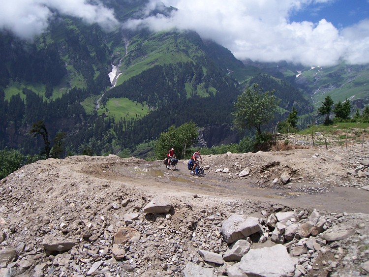
 Today we both want to cycle 50 kilometers to Keylong which is not such a difficult
stretch. The whole day we will have to cycle around 3.000 meter altitude, which is
probably not too high.
Today we both want to cycle 50 kilometers to Keylong which is not such a difficult
stretch. The whole day we will have to cycle around 3.000 meter altitude, which is
probably not too high.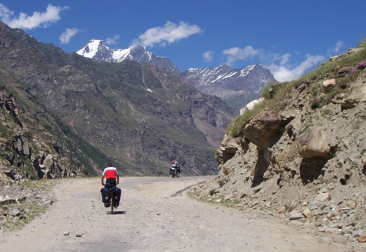
 From Zing Zing Bar the road is tending to deteriorate in a slow but steady pace.
I am feeling better and better however and I am still climbing with a good pace.
I am quite a lot ahead of the others. After climbing 100 meter above Zing Zing
Bar I rest in a tea stall and wait. In the two kilometers from Zing Zing Bar
things have changed quite drastically. Willem reaches the tea stall after a few
minutes and looks quite fresh still.
From Zing Zing Bar the road is tending to deteriorate in a slow but steady pace.
I am feeling better and better however and I am still climbing with a good pace.
I am quite a lot ahead of the others. After climbing 100 meter above Zing Zing
Bar I rest in a tea stall and wait. In the two kilometers from Zing Zing Bar
things have changed quite drastically. Willem reaches the tea stall after a few
minutes and looks quite fresh still.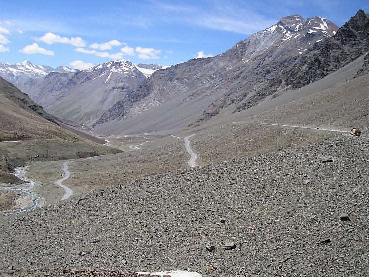
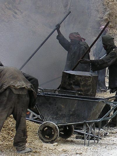 There is not much to do about it however. After the descent it is starting to snow too.
This second ascent does not go as well as the Nakeela ascent. I am coughing all the
time because of the cold I caught or maybe because of the altitude. Coughing your
lungs out in combination with an already severe oxygen shortage is a bad mix. What do
I say, that is a bad trip. I am not feeling like a wreck though untill I have
to pass the road workers. On lots of stretches these workers are trying to improve
the road conditions. Often the road is blocked for hours in which no traffic
can pass. We have to carry our heavy bicycles for hundred or two hundred meter
on the scree slope above or below the just asphalted road and along pots of
burning, smoking asphalt that seems to take all the oxygen that is left on this altitude.
The work is severely hard and is carried out by people from the poorest regions of India
like Bihar. In very harsh conditions, these people lead an extremely raw life. Day and night
the people have to handle the extreme climate, the altitude and the extreme physical
endurance of the hard work. The constant production of black smoke make me choke after
a second, these people are living in this hell on Earth the whole day, every day again
untill the summer season is over and they have to return home.
There is not much to do about it however. After the descent it is starting to snow too.
This second ascent does not go as well as the Nakeela ascent. I am coughing all the
time because of the cold I caught or maybe because of the altitude. Coughing your
lungs out in combination with an already severe oxygen shortage is a bad mix. What do
I say, that is a bad trip. I am not feeling like a wreck though untill I have
to pass the road workers. On lots of stretches these workers are trying to improve
the road conditions. Often the road is blocked for hours in which no traffic
can pass. We have to carry our heavy bicycles for hundred or two hundred meter
on the scree slope above or below the just asphalted road and along pots of
burning, smoking asphalt that seems to take all the oxygen that is left on this altitude.
The work is severely hard and is carried out by people from the poorest regions of India
like Bihar. In very harsh conditions, these people lead an extremely raw life. Day and night
the people have to handle the extreme climate, the altitude and the extreme physical
endurance of the hard work. The constant production of black smoke make me choke after
a second, these people are living in this hell on Earth the whole day, every day again
untill the summer season is over and they have to return home.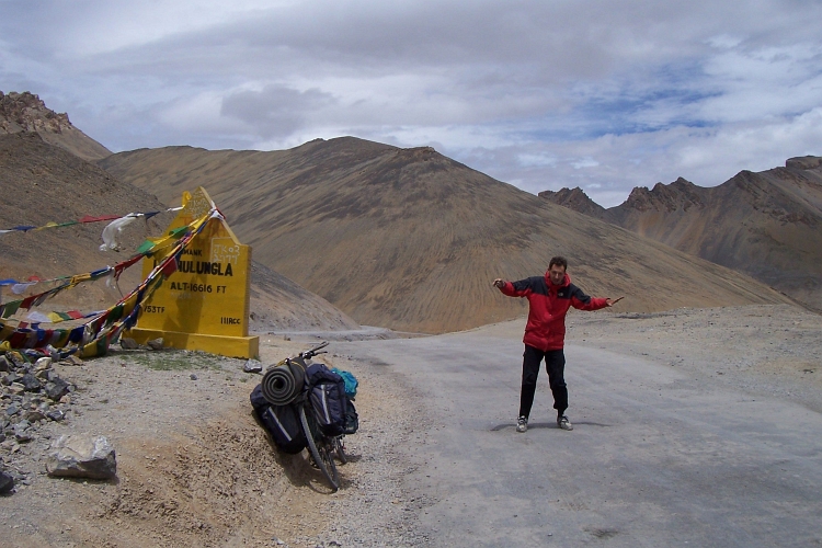
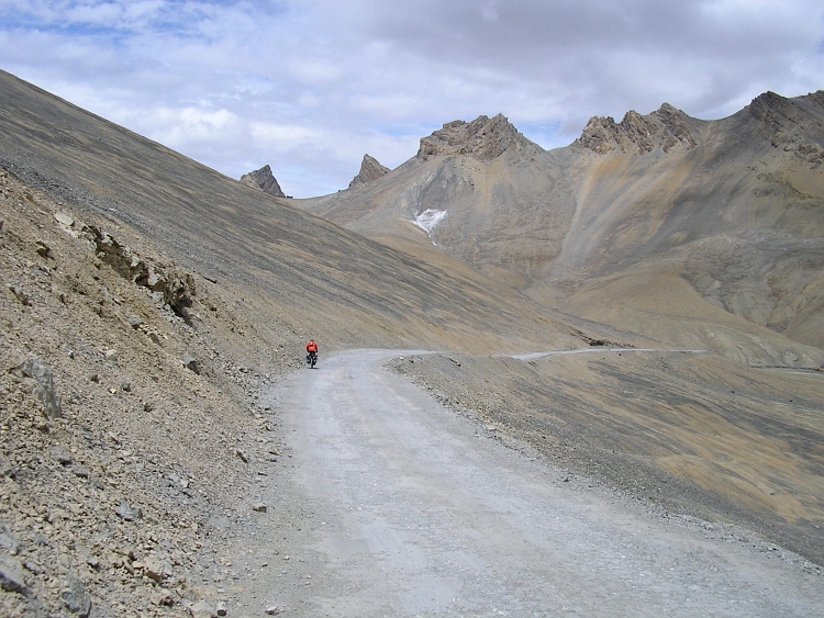
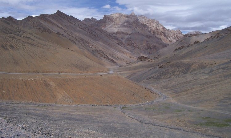
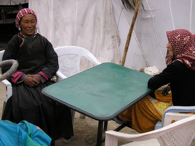
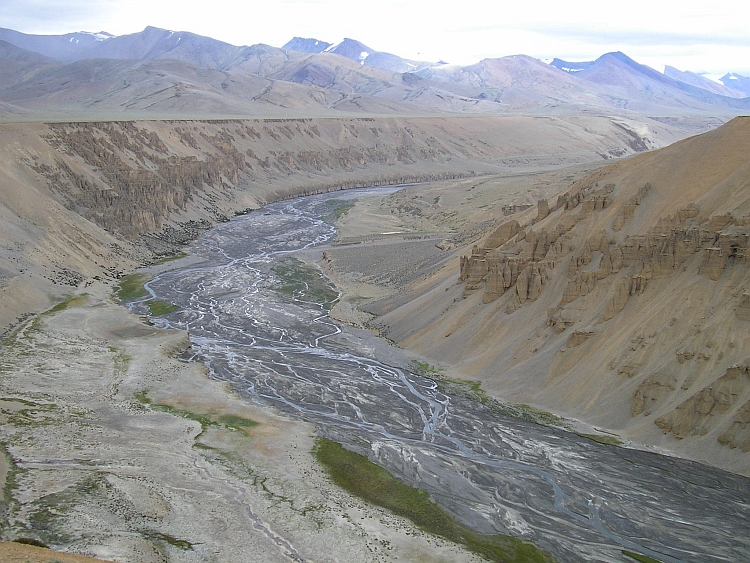
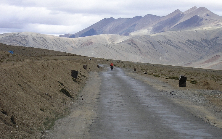
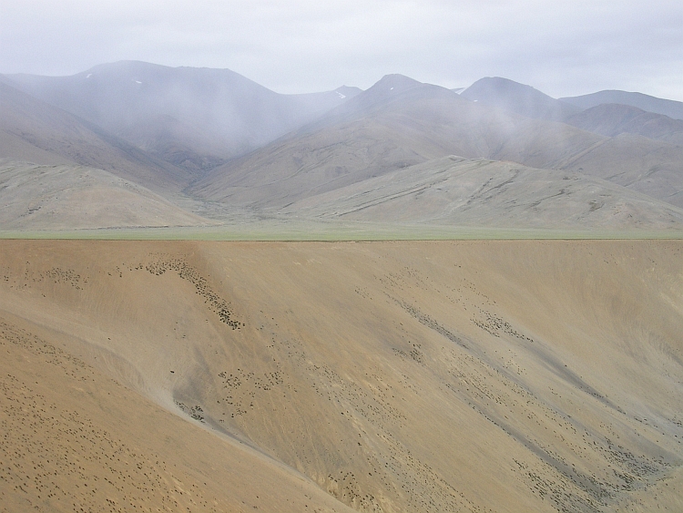
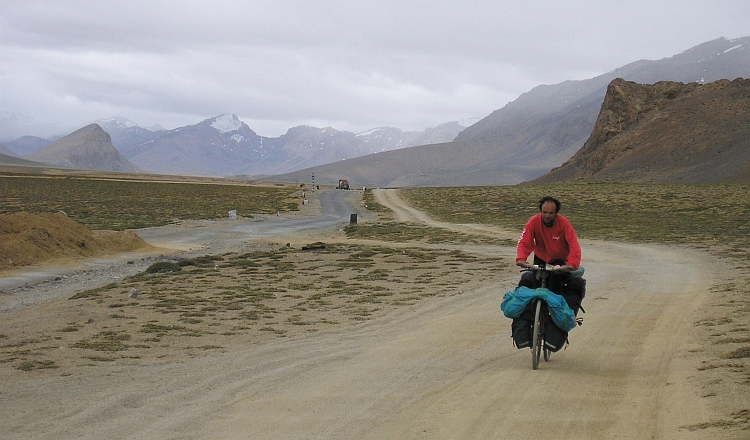
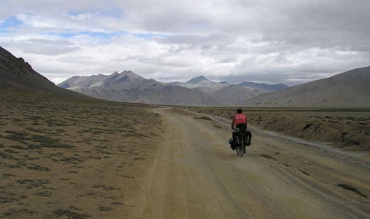
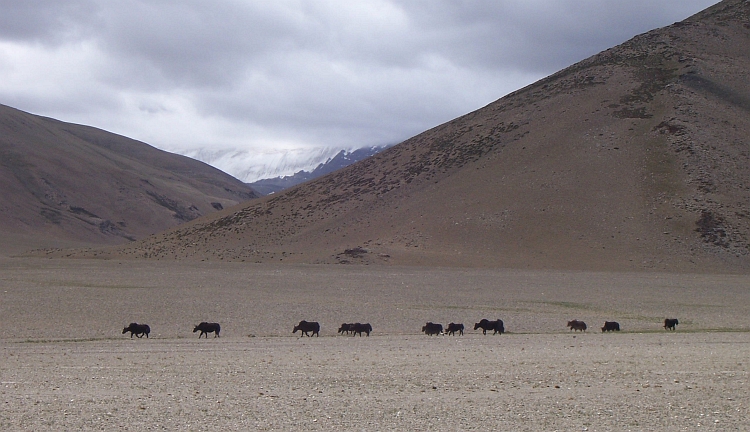
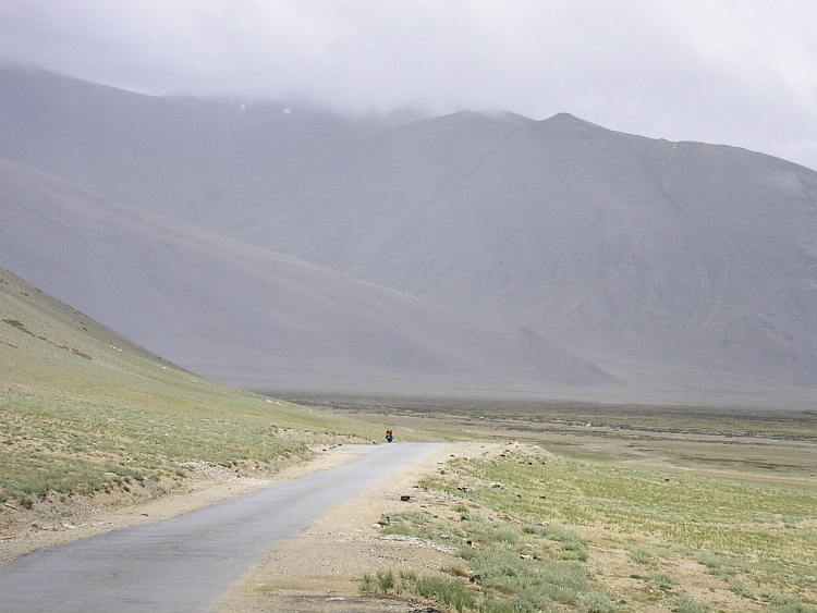
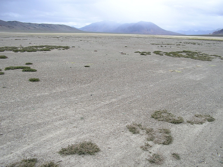
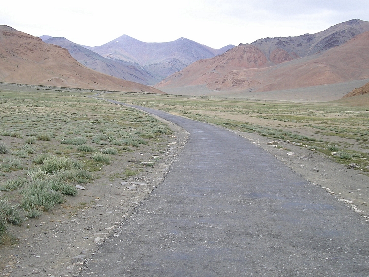
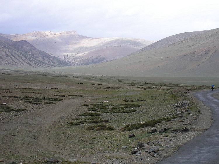
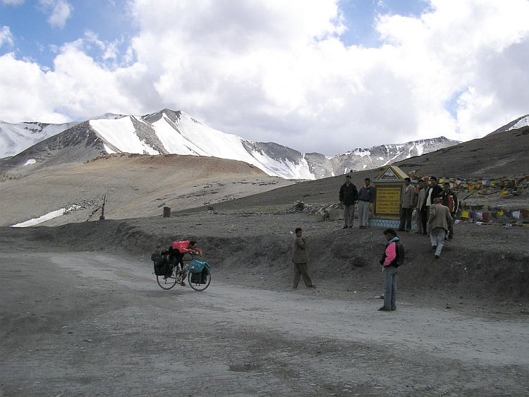
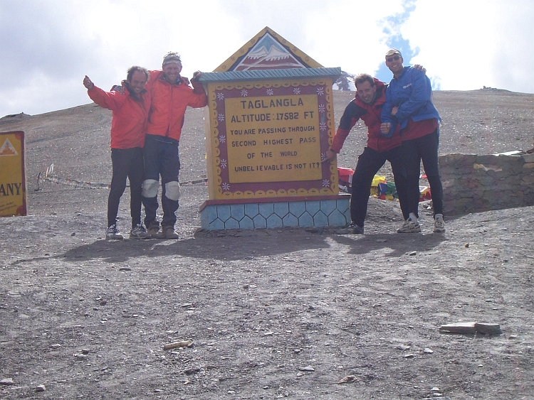
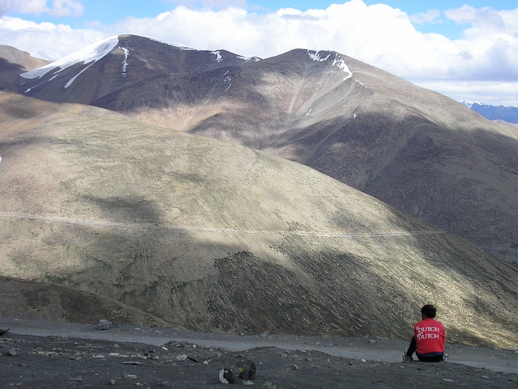
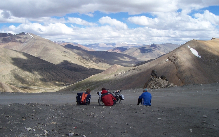
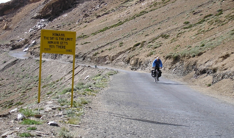
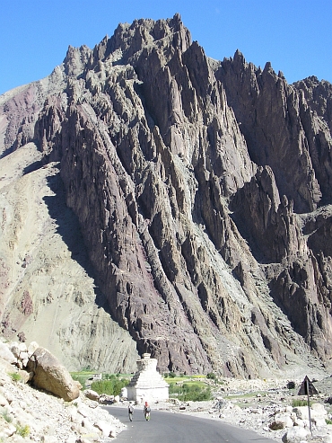
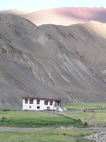
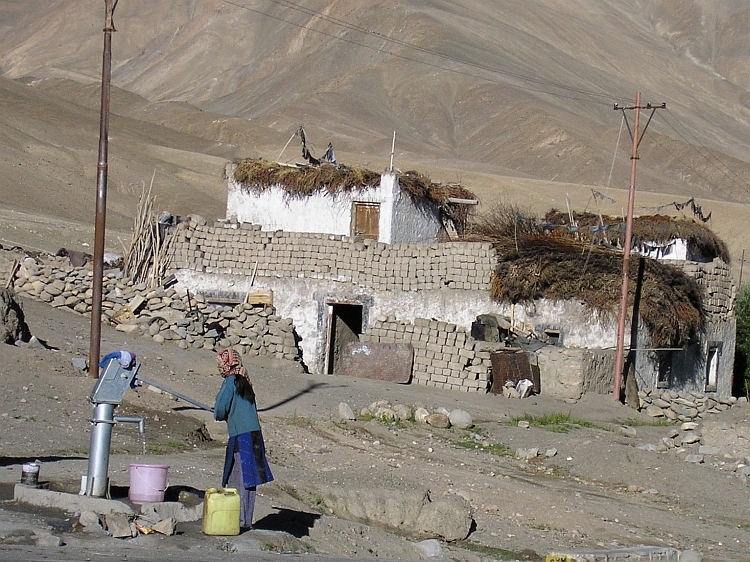
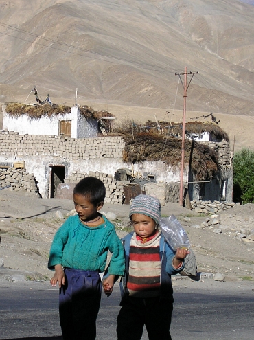
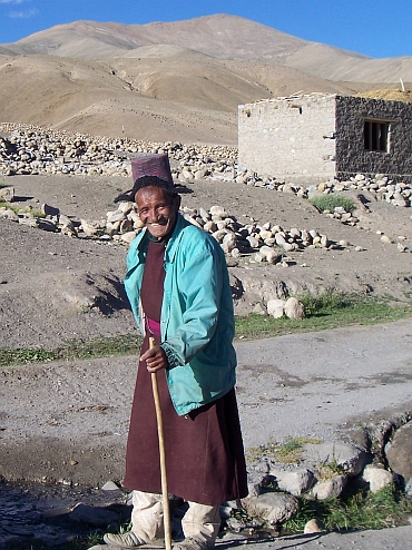
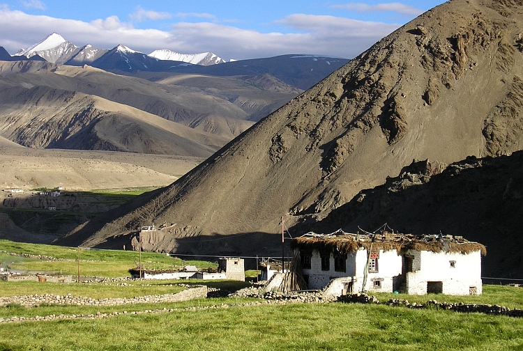
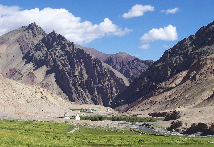
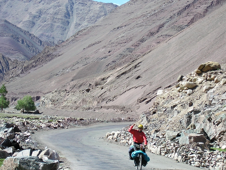
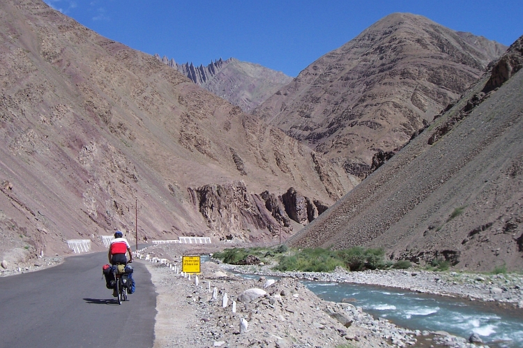
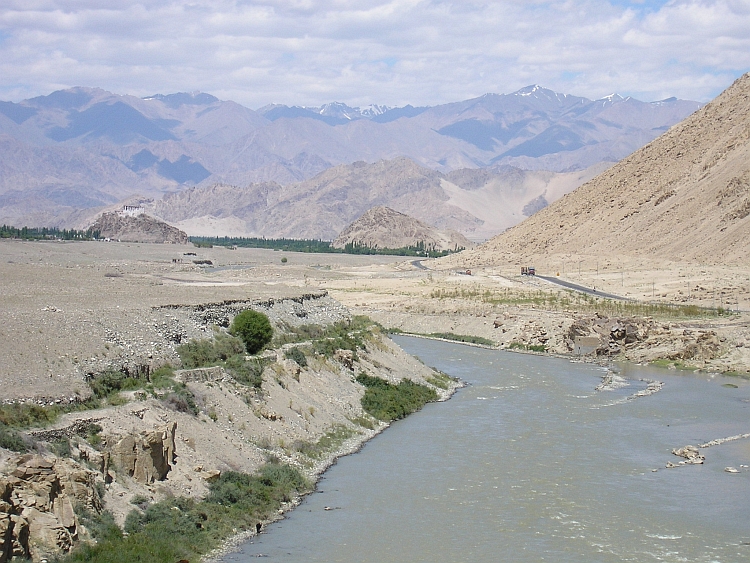
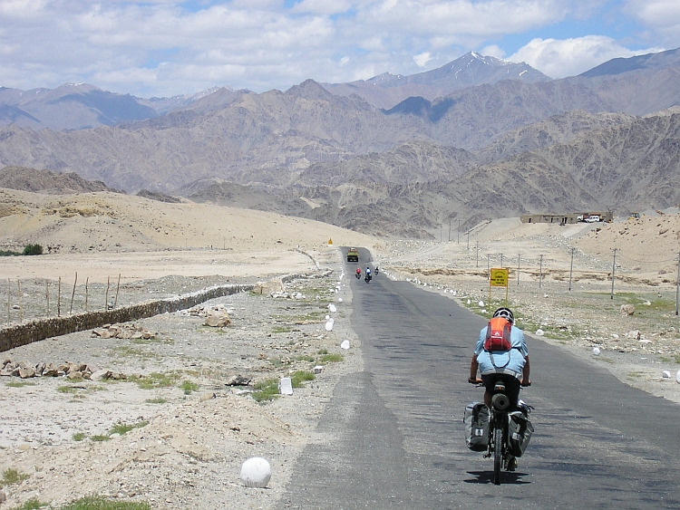
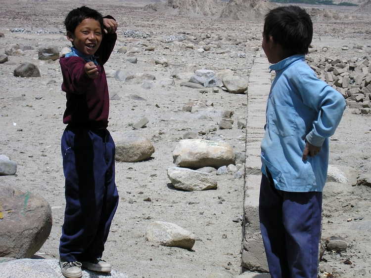
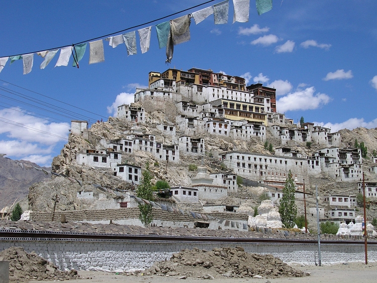
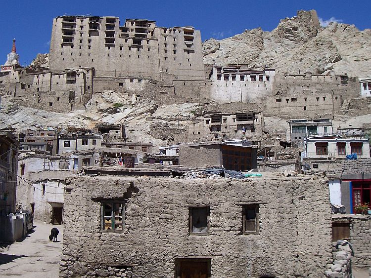
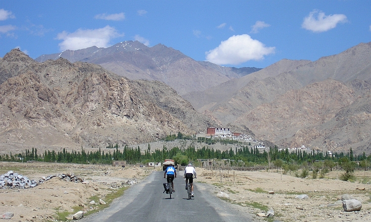
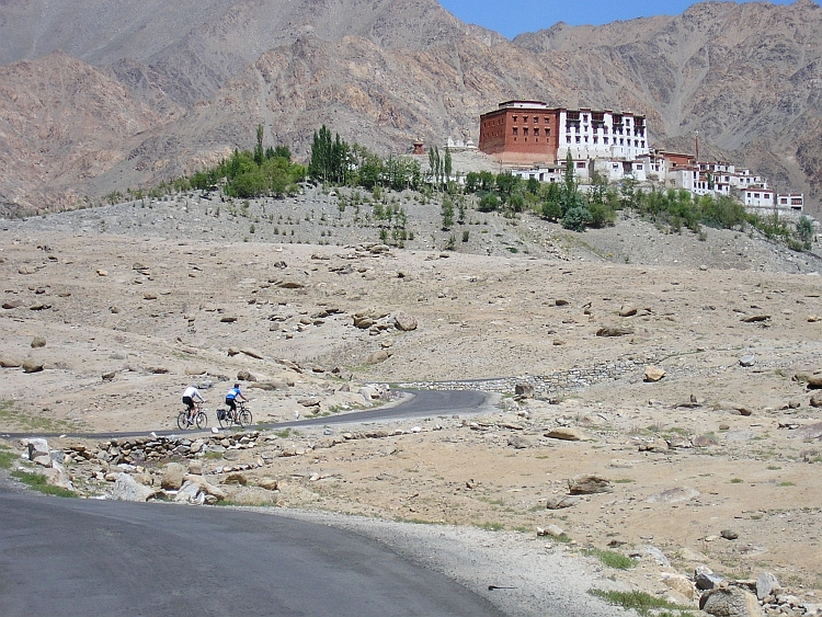
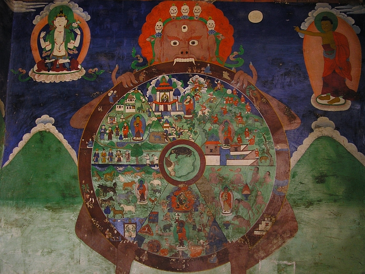
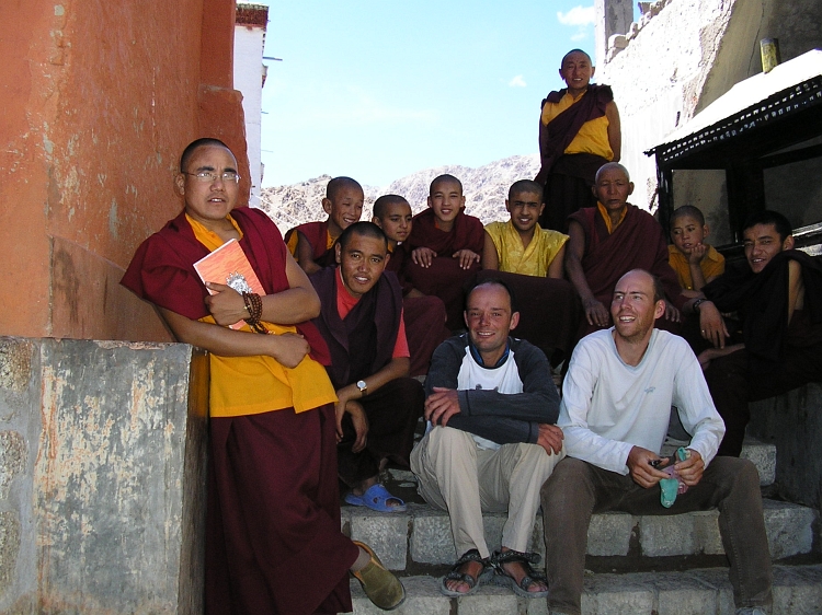
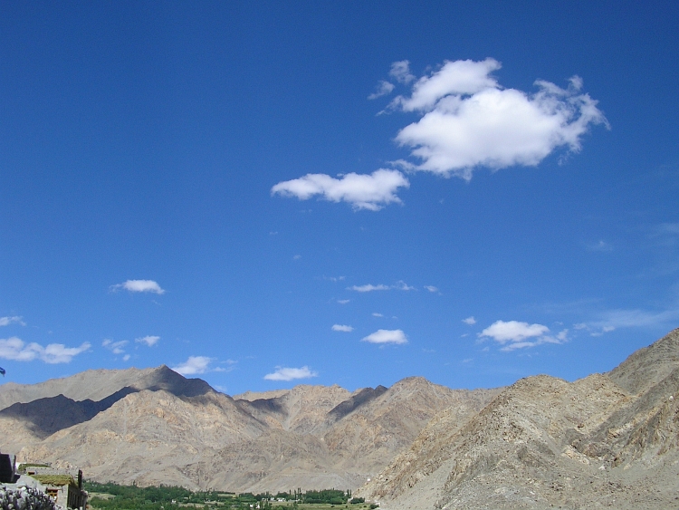
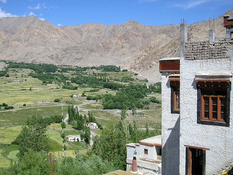
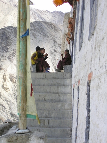
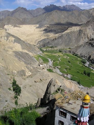
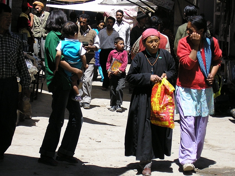
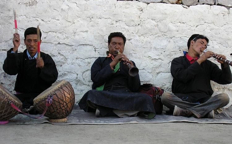
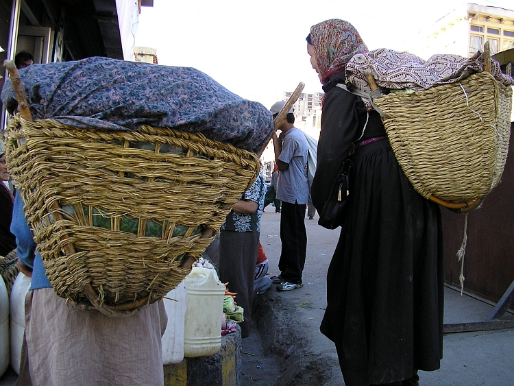
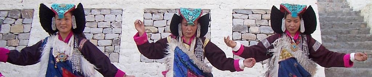
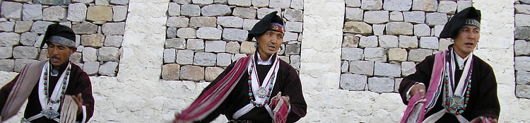
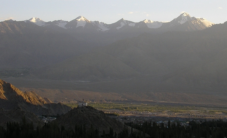
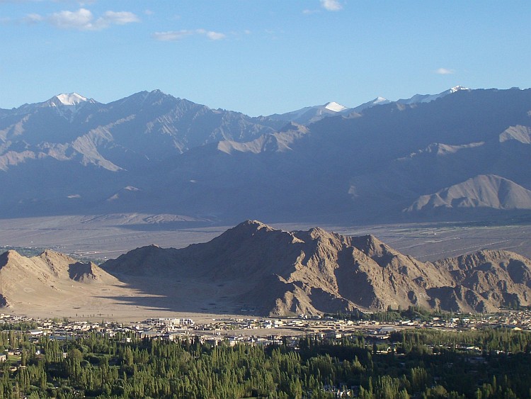
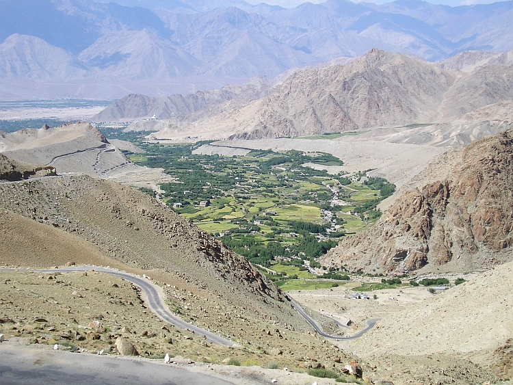
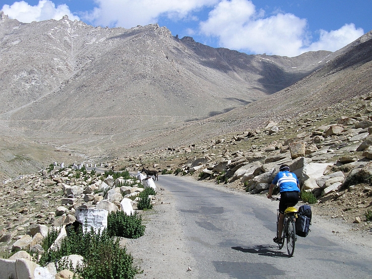
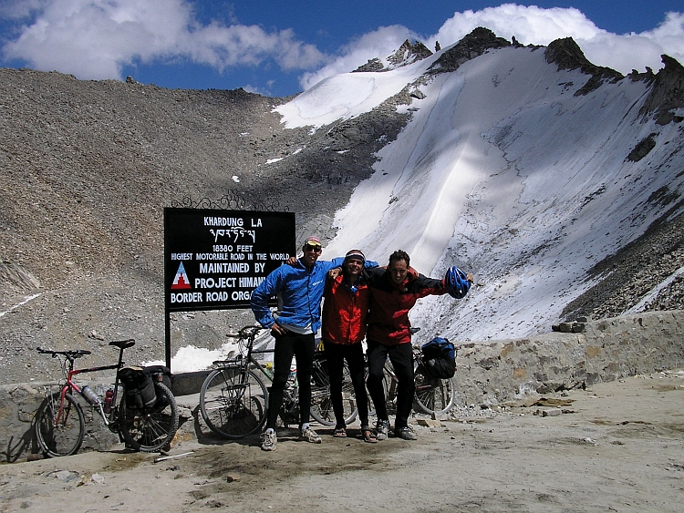
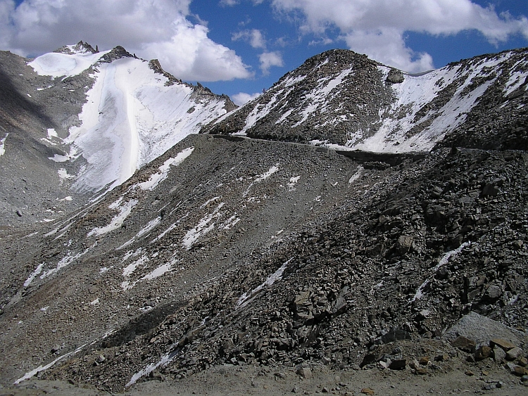
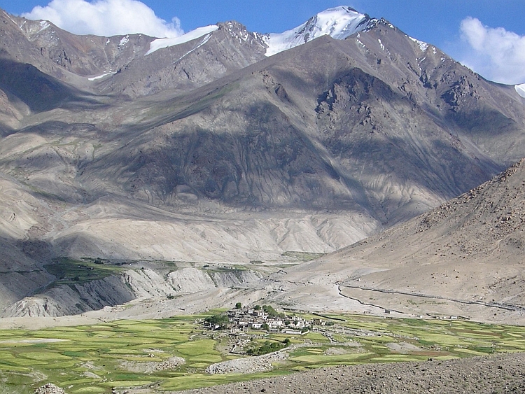
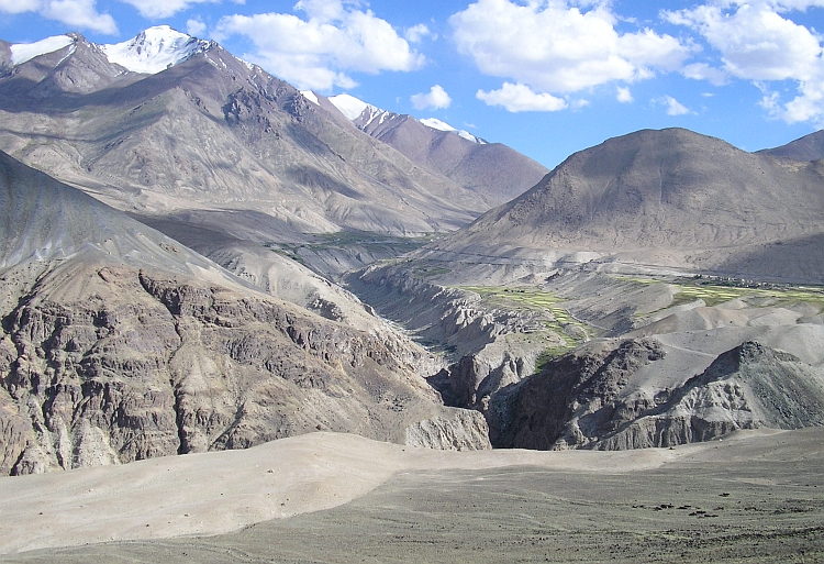
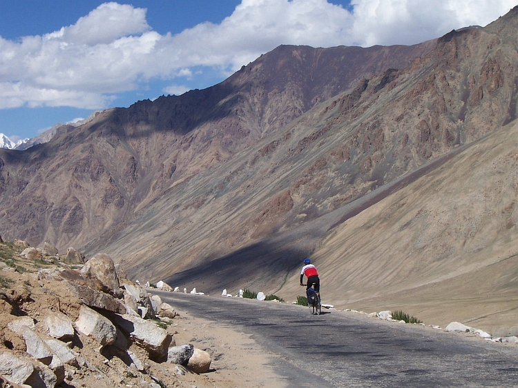
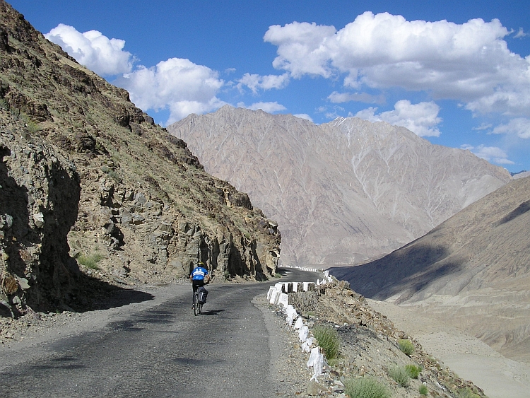
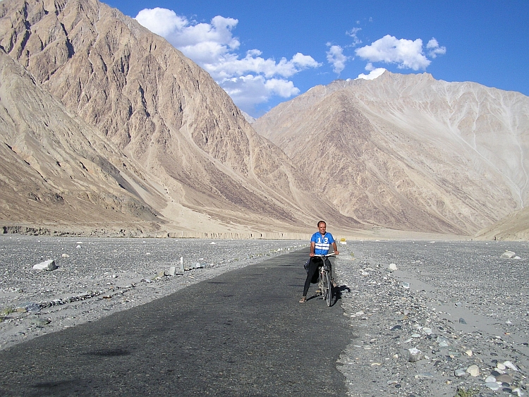 After a few kilometers we leave this hauntingly desolated but strangely beautiful landscape
as we reach the confluence of the Shyok and Nubra Rivers. An immense flatland of a few kilometers
wide lies befire us, right in the middle of one of the roughest mountain terrains in the world.
We keep following the course of the Shyok River and end up in the village of Diskit. We are
back in civilization, on the edge of the world. We find a hotel and a Tibetan restaurant,
value enough to fulfill our needs.
After a few kilometers we leave this hauntingly desolated but strangely beautiful landscape
as we reach the confluence of the Shyok and Nubra Rivers. An immense flatland of a few kilometers
wide lies befire us, right in the middle of one of the roughest mountain terrains in the world.
We keep following the course of the Shyok River and end up in the village of Diskit. We are
back in civilization, on the edge of the world. We find a hotel and a Tibetan restaurant,
value enough to fulfill our needs.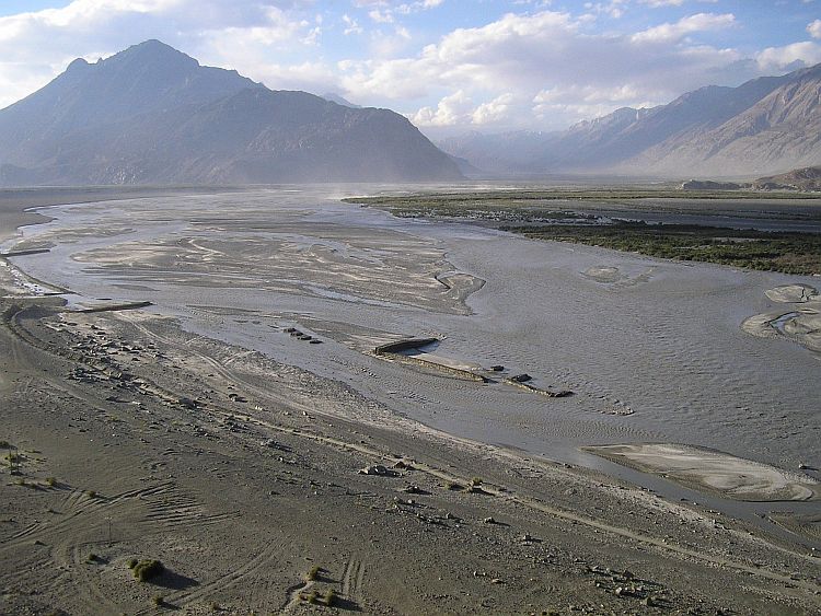
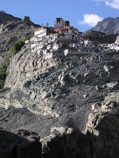 Today we want to explore the Shyok and Nubra Valleys. But the first thing to do is to pay a visit to the
Monastery right above the hotel. A footpath leads up steeply to the rock on which
the gompa is built. We have some nice views into the Shyok Valley. Then we take off
for Hundar. In Hundar is a small strech of sand desert with nice dunes. Here lives
the Bactrian Camel, a specific race that is able to survive on these altitudes.
We do not spot one of those camels from nearby.
Today we want to explore the Shyok and Nubra Valleys. But the first thing to do is to pay a visit to the
Monastery right above the hotel. A footpath leads up steeply to the rock on which
the gompa is built. We have some nice views into the Shyok Valley. Then we take off
for Hundar. In Hundar is a small strech of sand desert with nice dunes. Here lives
the Bactrian Camel, a specific race that is able to survive on these altitudes.
We do not spot one of those camels from nearby.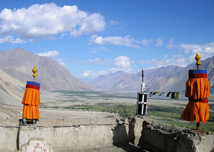
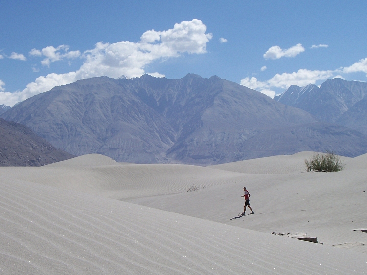
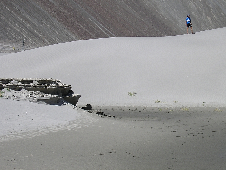
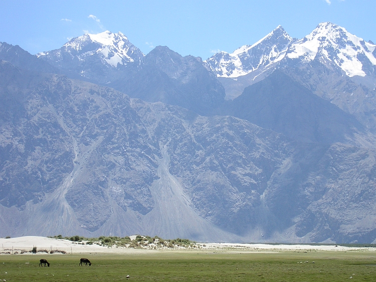
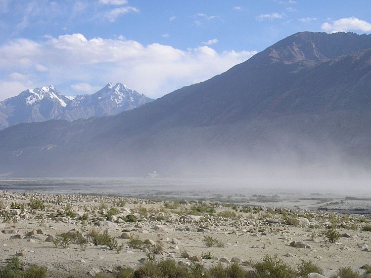
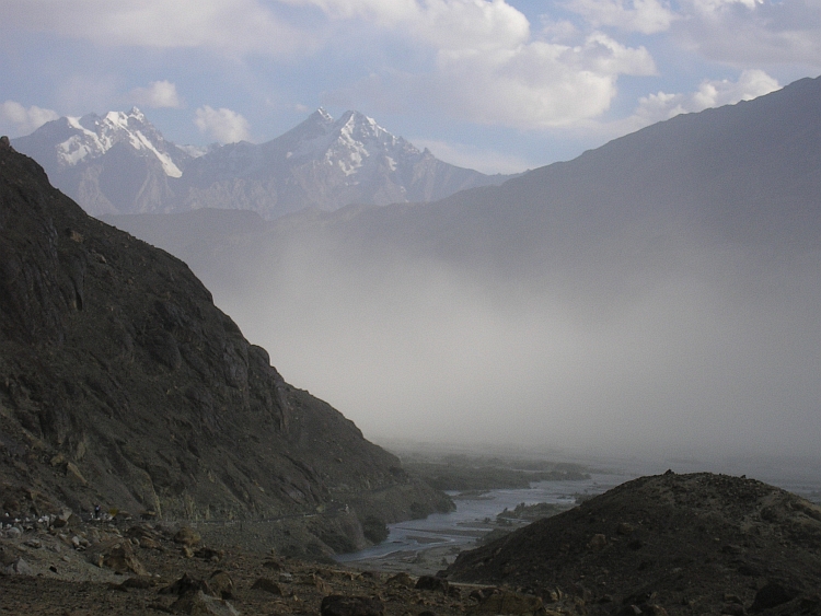
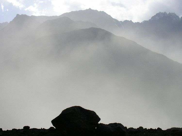
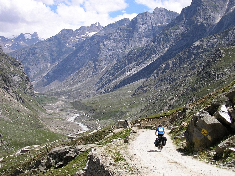
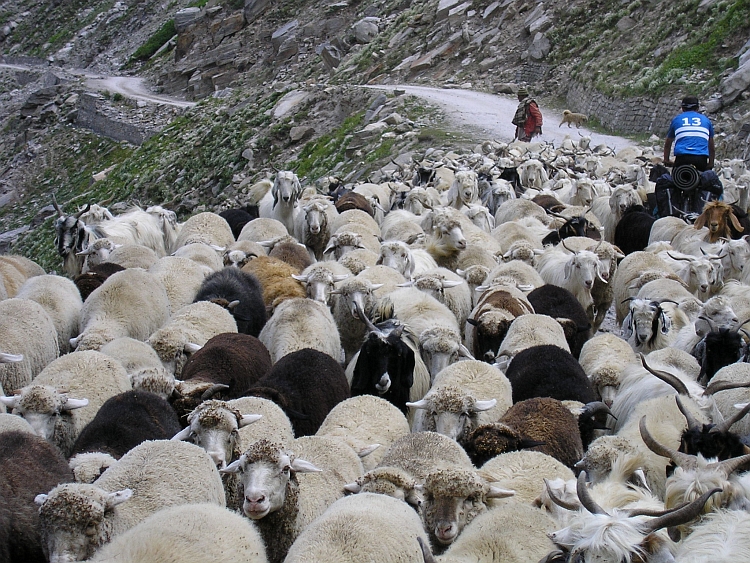
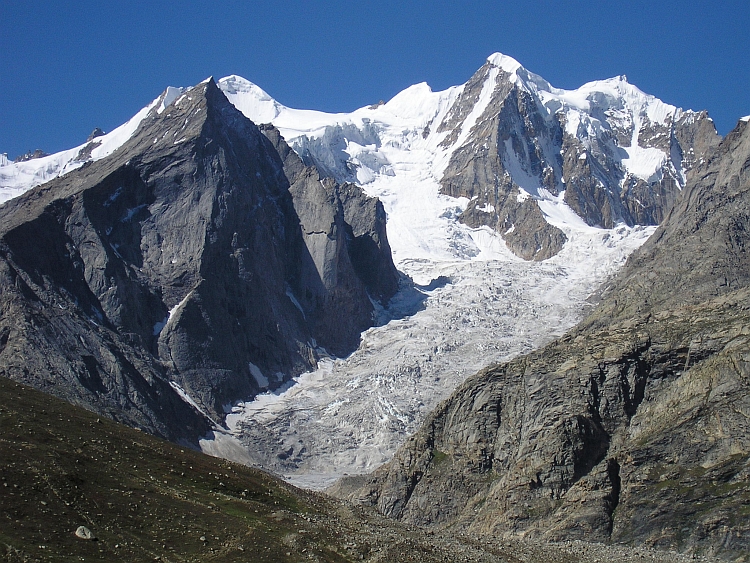
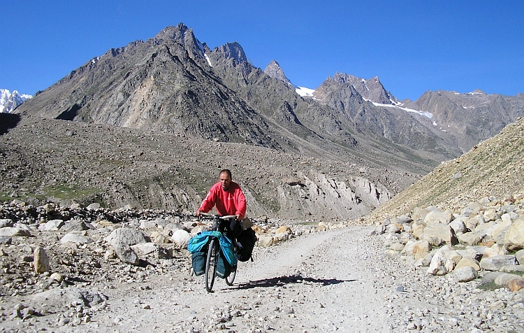
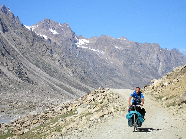
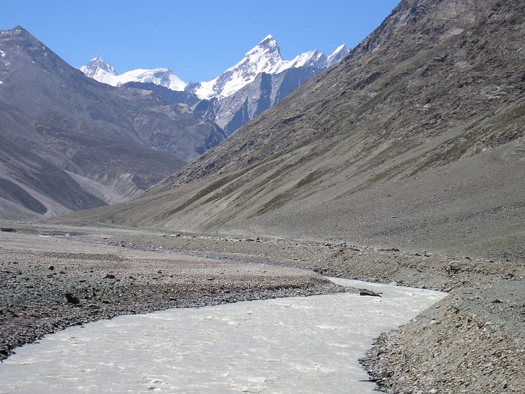
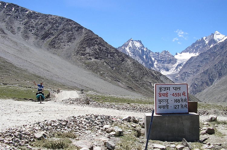
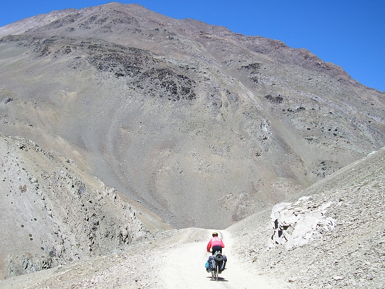
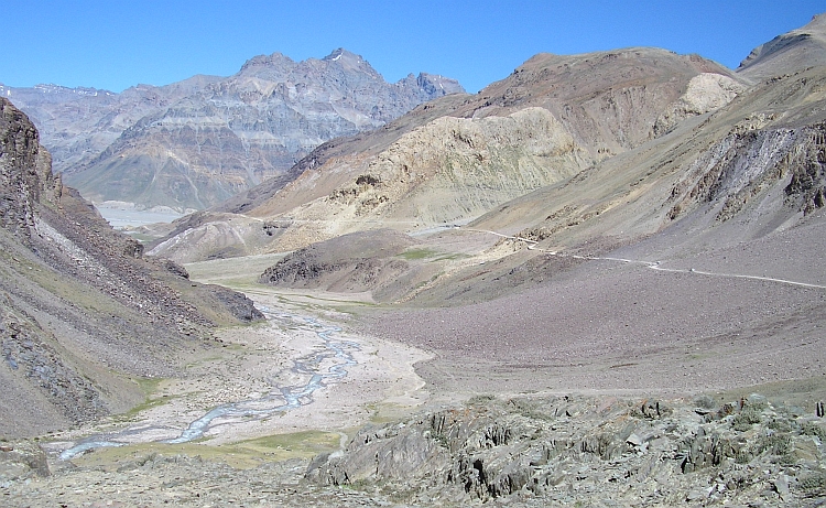
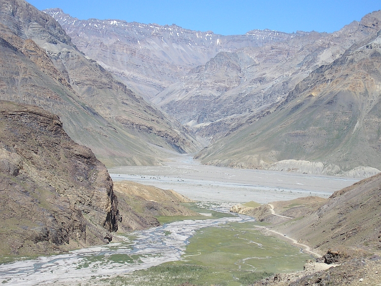
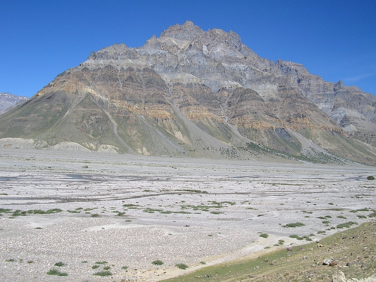
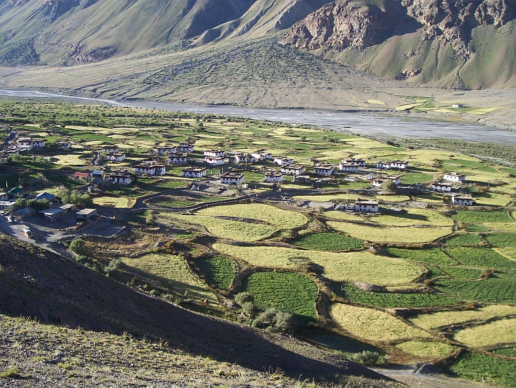
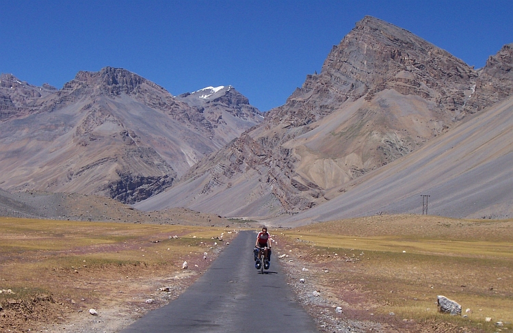
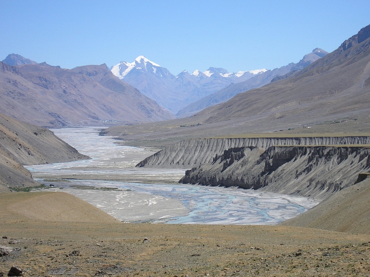
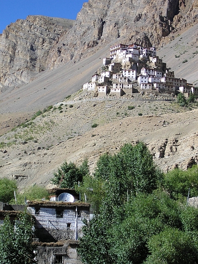 The first of our day trips brings us to the Key Monastery and to Kibber. The Key
Monastery is surely one of the most beautifully situated Tibetan monasteries. The tiny
white houses are perched on a perfectly coneshaped rock outcrop, high above the village
of Key. The monastery is a thousand years old and is one of the older Buddhist
monasteries in the Himalayas. We are invited for a ritual cup of tea.
The first of our day trips brings us to the Key Monastery and to Kibber. The Key
Monastery is surely one of the most beautifully situated Tibetan monasteries. The tiny
white houses are perched on a perfectly coneshaped rock outcrop, high above the village
of Key. The monastery is a thousand years old and is one of the older Buddhist
monasteries in the Himalayas. We are invited for a ritual cup of tea.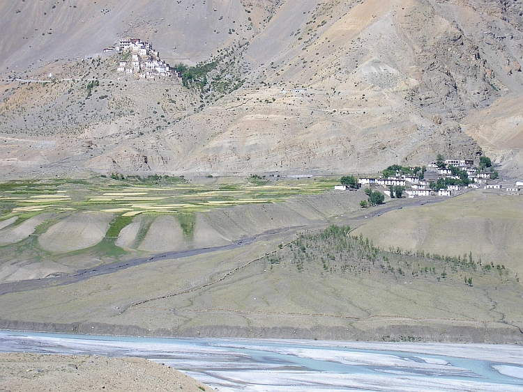
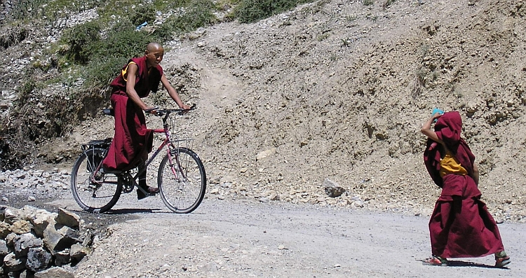
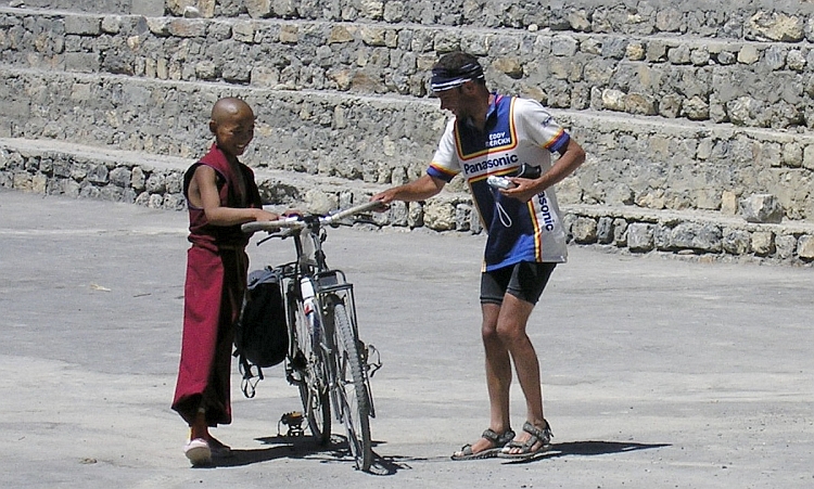
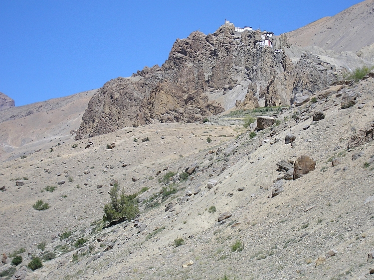
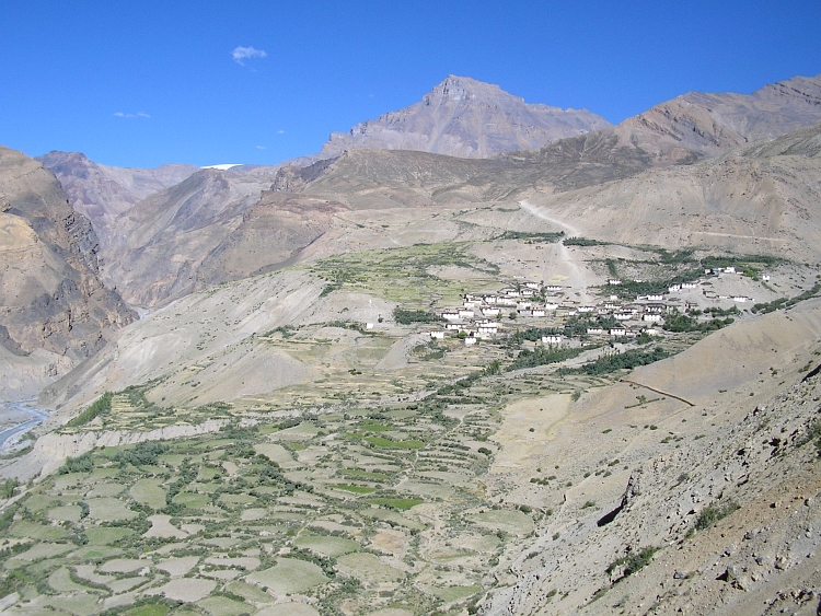
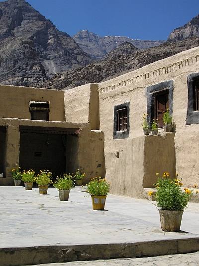 Today Willem and Jeroen do not feel like cycling. Because I want to see the monastery
of Tabo, I am leaving on my own. Tabo is the most downstream village of Spiti. The first
twentyfive kilometers are the same as yesterday. Five kilometers further, The Spiti
river is at once surrounded by steep slopes. The river valley is narrow. the river
is not at all flat anymore, but flows with quick currents downstream. I lose very
much altitude meters although there are some steep ascents as well. I am afraid
that the return trip in the afternoon could be very tiring, especially because
I will have head wind on the way back. The last kilometers to Tabo are magnificent.
I am very close to the border with Tibet. I can see the valley that goes up towards
Tibet. At the end of that valley must be the Shipki La, the crucial pass from the
important old trading route which is now closed due to the Chinese occupation
of Tibet.
Today Willem and Jeroen do not feel like cycling. Because I want to see the monastery
of Tabo, I am leaving on my own. Tabo is the most downstream village of Spiti. The first
twentyfive kilometers are the same as yesterday. Five kilometers further, The Spiti
river is at once surrounded by steep slopes. The river valley is narrow. the river
is not at all flat anymore, but flows with quick currents downstream. I lose very
much altitude meters although there are some steep ascents as well. I am afraid
that the return trip in the afternoon could be very tiring, especially because
I will have head wind on the way back. The last kilometers to Tabo are magnificent.
I am very close to the border with Tibet. I can see the valley that goes up towards
Tibet. At the end of that valley must be the Shipki La, the crucial pass from the
important old trading route which is now closed due to the Chinese occupation
of Tibet.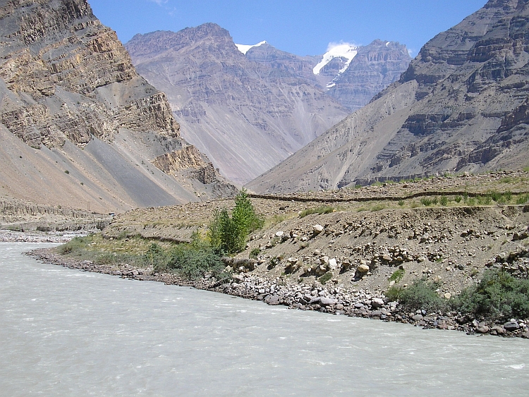
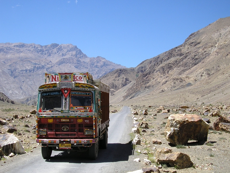
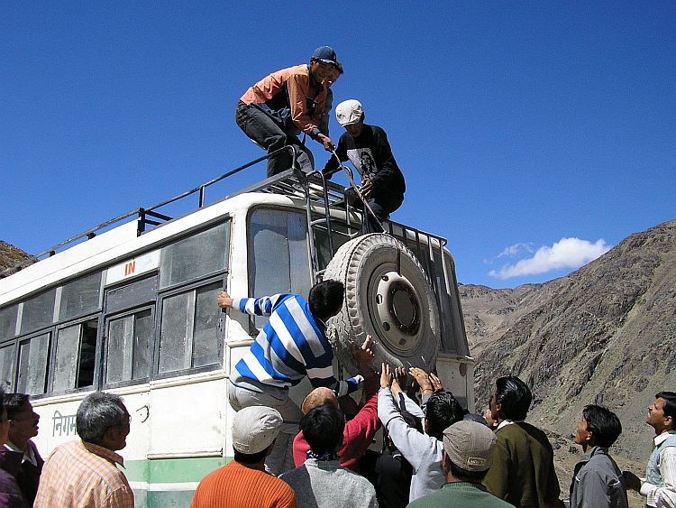
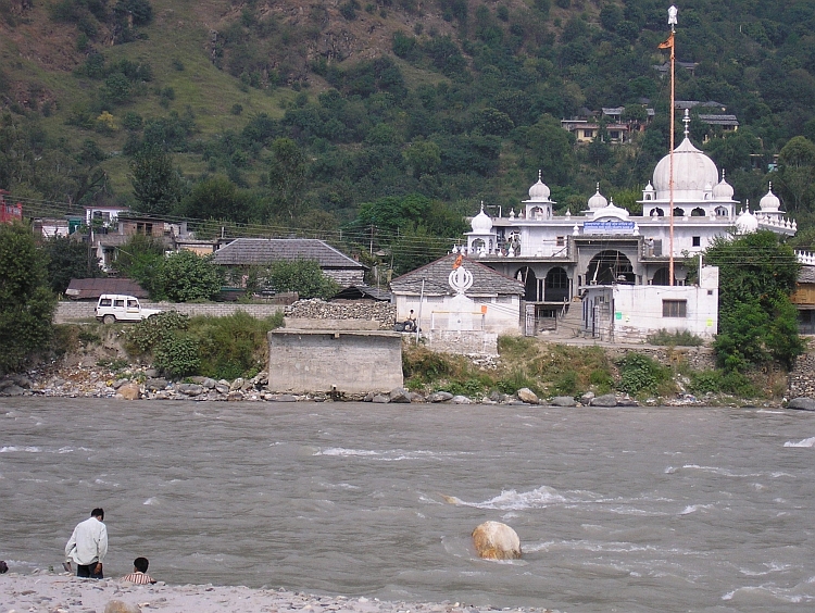
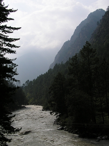
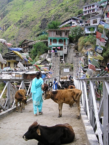
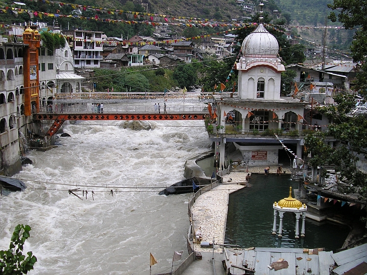
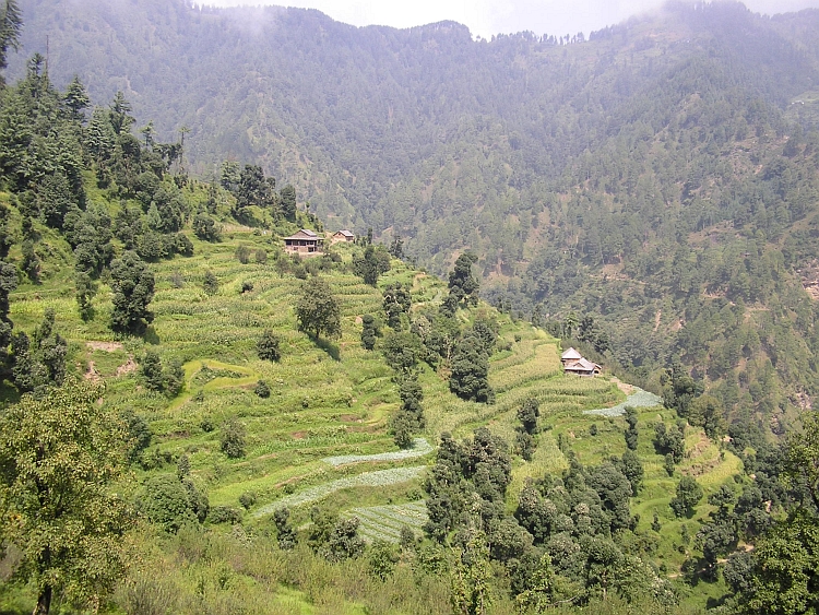
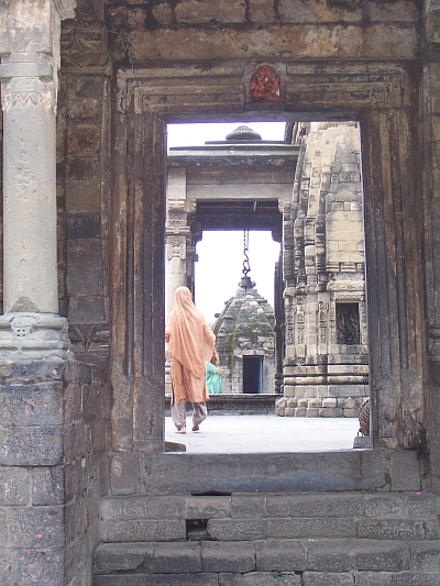 The first highlight on the way to Dharamsala is the temple of Bajinath. The Hindu
temple was built in the 8th century and is one of the older temples in Northern India.
We walk between the age-old structures of the complex. In one of the pathways we
have a strange encounter with a well-known friend. Between all the
Gods and Goddesses we find a plastic colourful Donald Duck. India keeps
surprising.
The first highlight on the way to Dharamsala is the temple of Bajinath. The Hindu
temple was built in the 8th century and is one of the older temples in Northern India.
We walk between the age-old structures of the complex. In one of the pathways we
have a strange encounter with a well-known friend. Between all the
Gods and Goddesses we find a plastic colourful Donald Duck. India keeps
surprising.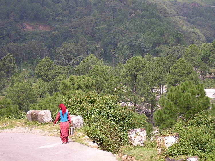
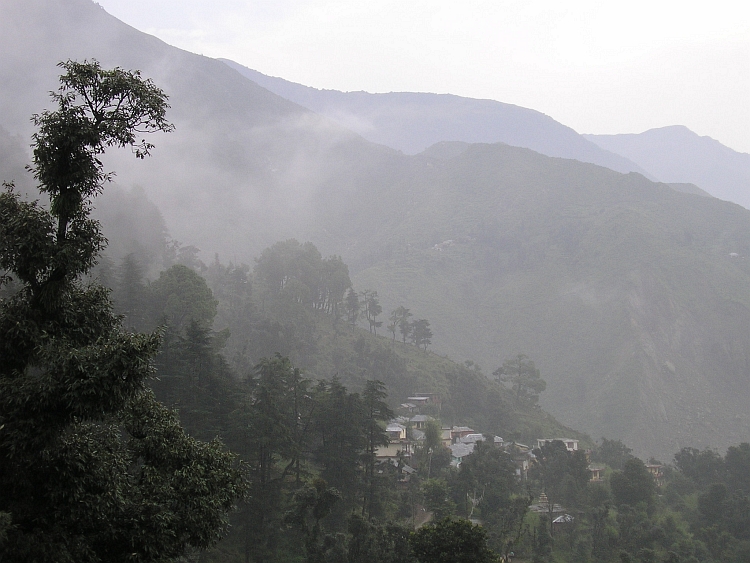
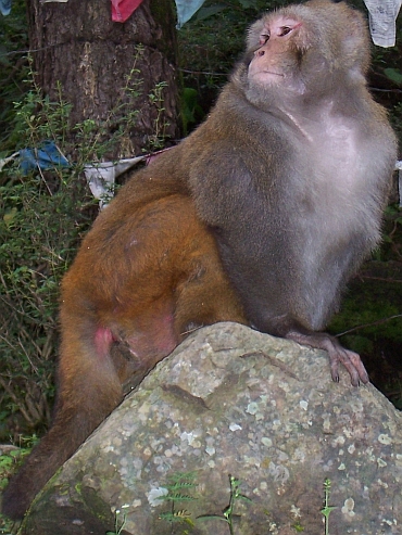 Today we wander to Triund. Triund is a very special viewpoint at 3.000 meter altitude.
On the alpine meadows of Triund it is possible to see the highest mountains of the Dhaula
Dhar mountain range 2.000 meter above and the Indian Plains, 2.500 meter below.
Today we wander to Triund. Triund is a very special viewpoint at 3.000 meter altitude.
On the alpine meadows of Triund it is possible to see the highest mountains of the Dhaula
Dhar mountain range 2.000 meter above and the Indian Plains, 2.500 meter below.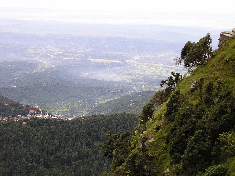
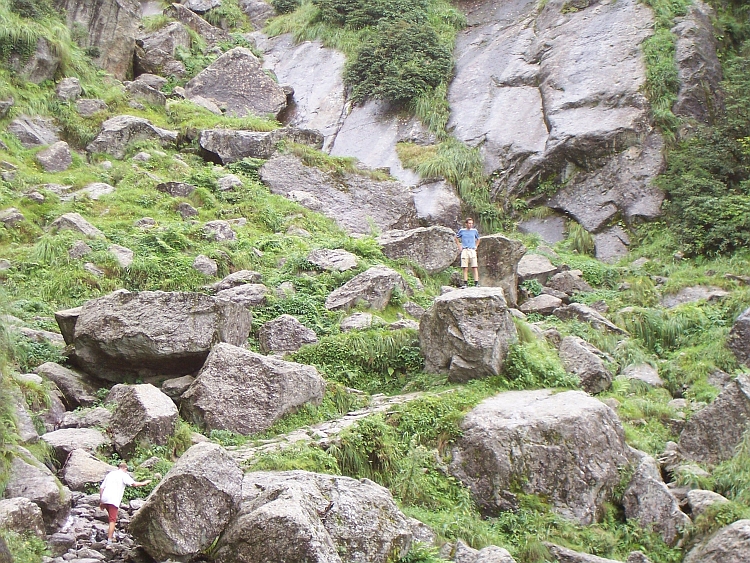
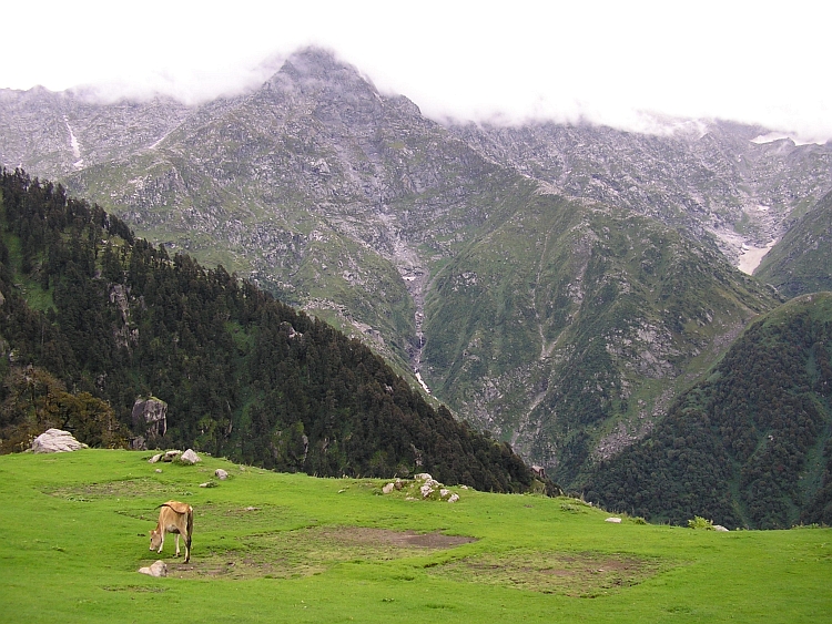
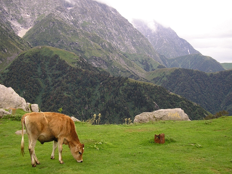
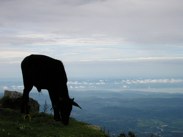
 We pack our bicycles early in the morning. We visit the family where Willem has done a
voluntary project nine years ago. We are welcomed heartily. We talk the whole morning
and stay for the lunch as well.
We pack our bicycles early in the morning. We visit the family where Willem has done a
voluntary project nine years ago. We are welcomed heartily. We talk the whole morning
and stay for the lunch as well.

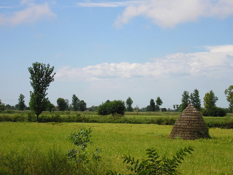
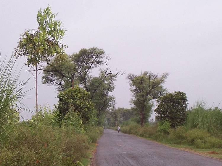
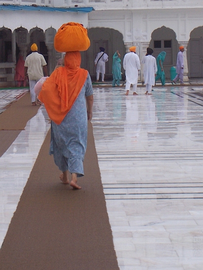 The last 35 kilometers from Batala to Amritsar the weather improves fortunately. Jeroen is far
ahead of us as we reach Amritsar. Only, Jeroen is nowhere to be seen. Where could he be?
He would not cycle on his own into the city? Willem and I do not know what to do and
decide to cycle into the city towards the Golden Temple. No Jeroen. We keep searching around
the temple complex but we cannot find Jeroen. After phoning home, we still do not have
any sign of life of Jeroen. It is six hours later as we coincidentally bump up against
Jeroen after leaving a phone cell once again. How lucky we are, to meet each other
spontaneously in a place of more than a million inhabitants! We are very relieved.
We have made it! We have two days in India. Tomorrow we can go back to Delhi by
train and the day after we will be able to make a day trip to Agra to see the Taj.
The last 35 kilometers from Batala to Amritsar the weather improves fortunately. Jeroen is far
ahead of us as we reach Amritsar. Only, Jeroen is nowhere to be seen. Where could he be?
He would not cycle on his own into the city? Willem and I do not know what to do and
decide to cycle into the city towards the Golden Temple. No Jeroen. We keep searching around
the temple complex but we cannot find Jeroen. After phoning home, we still do not have
any sign of life of Jeroen. It is six hours later as we coincidentally bump up against
Jeroen after leaving a phone cell once again. How lucky we are, to meet each other
spontaneously in a place of more than a million inhabitants! We are very relieved.
We have made it! We have two days in India. Tomorrow we can go back to Delhi by
train and the day after we will be able to make a day trip to Agra to see the Taj.