A short cycling journey in the French Massif Central
Day 1: Nîmes - Anduze - Florac 129 km
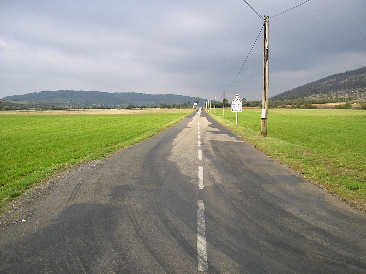
We take off under clear blue skies at the old Roman city of Nîmes, thanks to
the cycling bus that brought us there safe and comfortable. We start cycling directly
after the bus drops us with all of our luggage and our bicycles of course. After
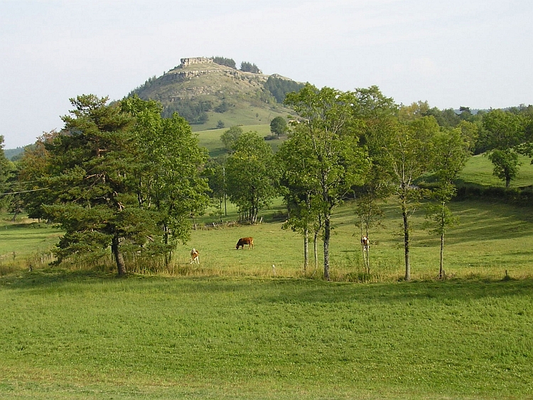
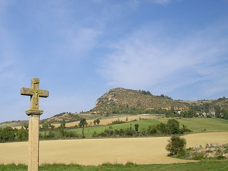
more than forty kilometres of gently rolling hills we reach Anduze, at the foot
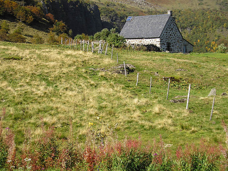
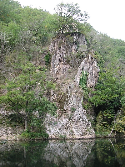
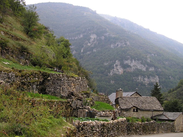
of the high plateaus of the famous Cévennes. Anduze lies in between the cliffs
of a narrow gorge and is for us the entrance door to the special environments of the
remote Cévennes. After a short break in Anduze we climb higher and higher through
narrow, brilliant green river valleys. Bamboo bushes accompany the flanks of the
river beddings. Sometimes the road is climbing high above the valley, at other times
the road is following small streams which can grow into huge and dangerous currents
during heavy autumn showers.
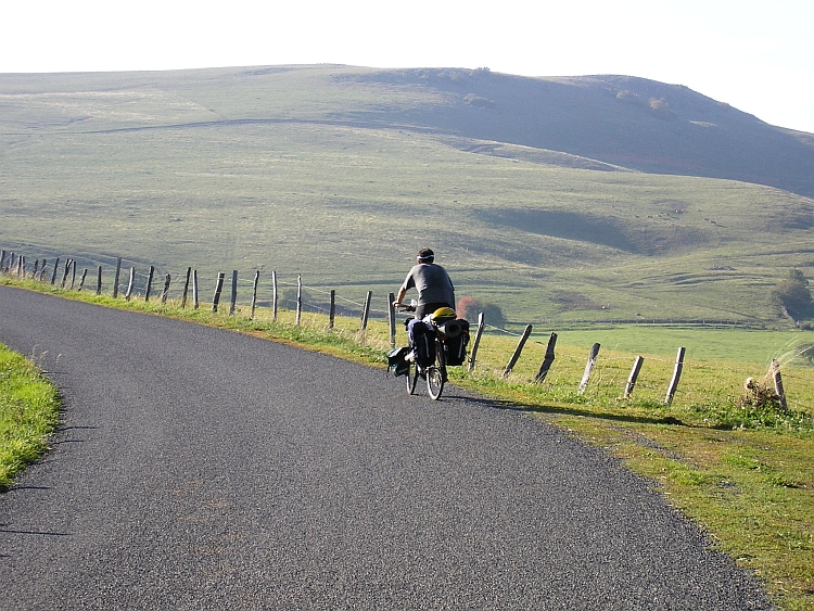
At this moment however a friendly autumn sun is laying the lofty landscape
in warm, soft, hazey hues. Less idyllic is the hard climbing labour we have to
take as a consequence of our wish to explore the Cévennes. The road climbs
to an altitude of thousand meters at Barre des Cévennes. I feel I am developing
a cold. Willem caught the cold a few days ago already. Due to our physical conditions
the effort is much bigger than it would be otherwise. We have to go on however
because there will be no camping possibilities untill we are in the valley of the
Tarn on the other side of the pass. Luckily the hard work is being rewarded. After
we reach the pass, a beautiful view into the canyon of the Tarn is well worth the
efforts.
After enjoying the grand views, we descend into the valley of the Tarn and pitch our
tent in the deserted camping of Florac. All in all we have cycled nearly 130 kilometres
on our first day. According to Willem this was one of the toughest day rides in his
life.
Day 2: Florac - St Enimie - Causse Sauveterre - Chirac 73 km
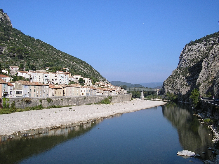
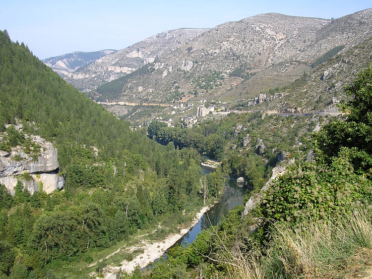
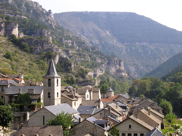
After a few flat kilometres along the Tarn, we reach the beautiful village of Ispagnac.
After Ispagnac the valley of the Tarn is narrowing and steepening. The National Park
of the Cévennes is the only National Park of France that is not situated on
high altitude but on a middle altitude elevation.
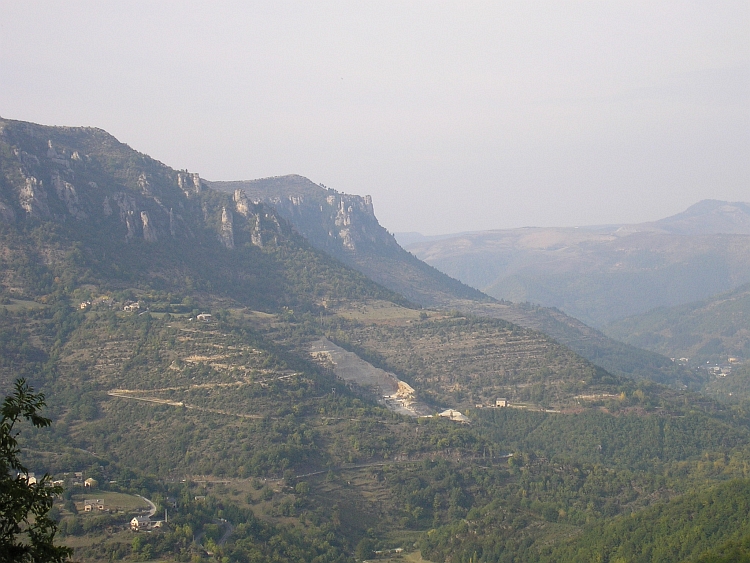
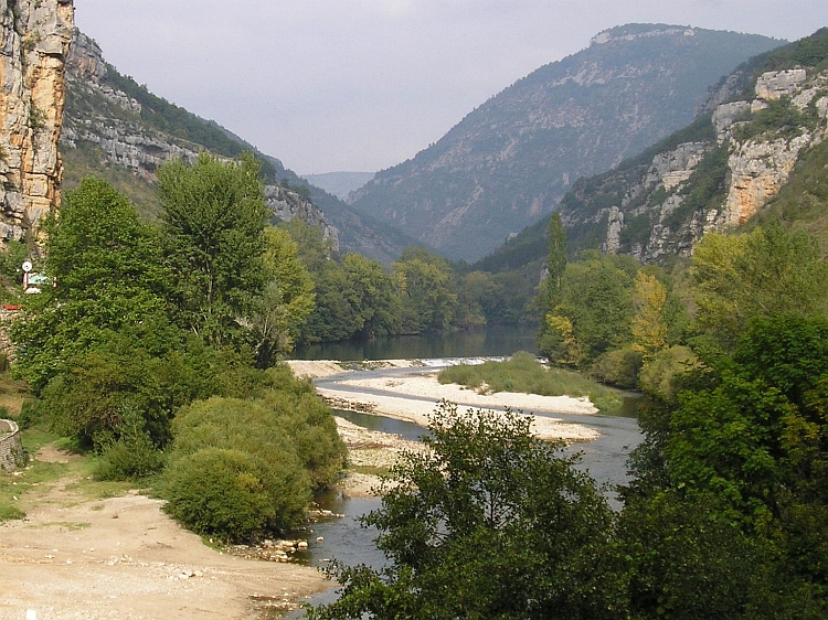
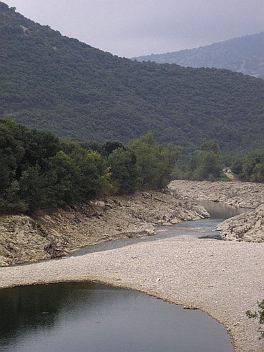
The canyon of the Tarn is one of the obvious highlights of the Cévennes National Park.
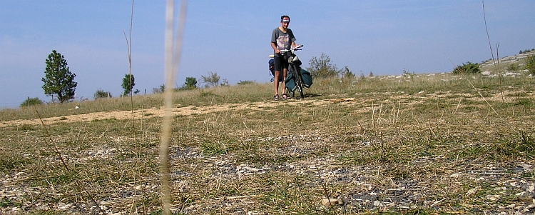
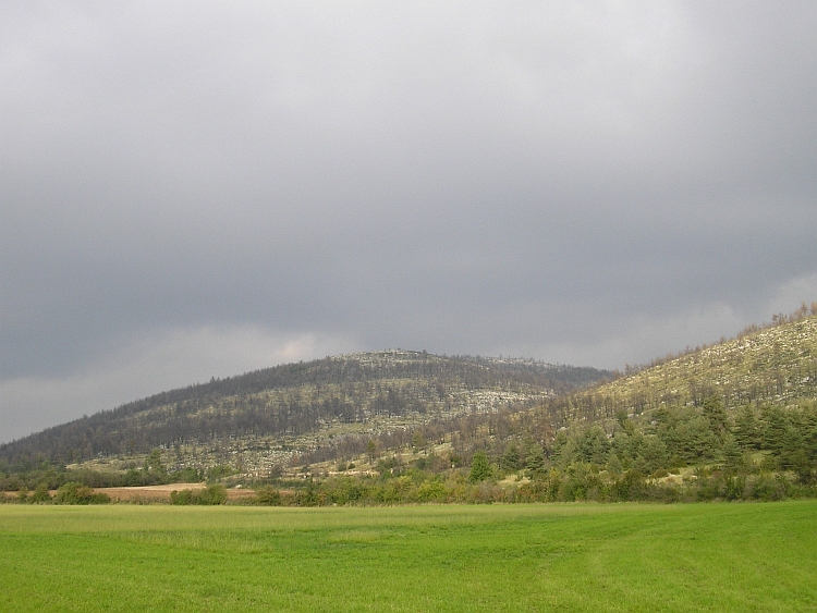
Another landmark landscape phenomenon are the so called 'Causses'. Causses are
the bleak and barren high limestone plateaus of the Cévennes National Park.
There are four of those Causses. Two of them flank the Tarn Canyon. To the left of us
is the Causse Méjean which is the highest of all with an elevation of about
1.200 meter altitude. The Causse Méjean is towering some six hundred meters
above us. To the right is the Causse de Sauveterre. We shall climb the plateau and cross
it to the famous Lot Valley on the other side of the Sauveterre highlands.
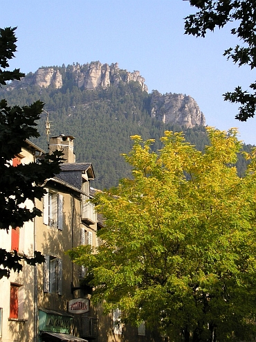
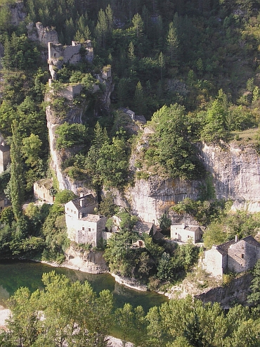
St. Enimie is the touristic center of the Tarn Valley. On this dreamy autumnn
morning however, tourists are difficult to find. Instead, only locals are visiting
the market now. And of course two bicycle travellers, Willem and I.
After our visit to the picturesque village of St. Enimie, there is some climbing work
to be done. The winding road leads us five hundred meter higher to the plateau of the
Causse de Sauveterre. Under a happy autumn sun this is a far from unpleasant effort,
although the cold is trying to complicate breathing. After an hour we enter the
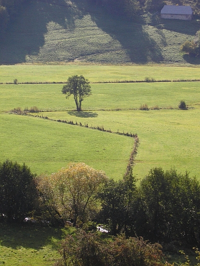
plateau. The barren landscape offers a fascinating contrast to the lush,
green valley of the Tarn. It is these stark changes in landscape, people and cultures
which make travelling by bicycle such a rewarding experience. The Causse shows to
be not as flat as we expected it to be. The highland is more of a gently rolling
hillside landscape instead. We do not have to make another great effort however.
Cycling in France means that breakfast and lunch are taken on the road. With the
bizarre opening and closing times of shops and bakeries there is no other choice.
The pulsating heart of the French countryside, the boulangerie, is closed at
twelve o'clock in the morning. For us, that is tea time and way to early to
celebrate the astonishing achievements of French cuisine. We do not bother a
single moment because what is a better time to enjoy the baguettes and quirky
french cheeses than after a physical effort like the climbing work we have
just accomplished. And what is a better place to do so than under the sun in the highlands
of the panoramic Causse de Sauveterre? Life can easily be less fulfilling.
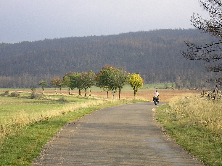
After the lunch break we take off with easy kilometres: the descent of the Causse
de Sauveterre to the Lot Valley. A lot of strangely beautiful villages are located
along the rivers of the Lot and Dordogne but those are more to the west of us. The
rural landscape along the Lot river here and now is really nice also with the
quiet charm of a slow pace of life.
After following the course of the Lot for a few kilometres, fresh climbing labour
is awaiting us. Over minor peripheral roads we are winding upward through obscure
hillside landscapes. Each climb has to end and also this one comes to a finale. After
three quarters of an hour we are on the divide. In a few minutes we descend to
the small village of Chirac, the spot which must have determined the name of the
French president. The camping is closed. In these surroundings this does not
necessiraly mean trouble. If a camping can close on one day, then it can as well
open again on another day and so is happening right now. The 'patron' even insists
on offering a free stay for us. Because he cannot provide warm water for the showers,
it is unfair asking money for a stay, so he explains. Our protests do not
result in a change of view. Whatever we try, he simply does not accept any gift.
Day 3: Chirac - Plomb du Cantal - Albepierre / Murat 121 km
The third day of our small journey begins with quite a long climb. The splendid
weather conditions of yesterday and the day before seemed so obvious that any
thought of a weather deterioration seemed to be completely outside the realms of
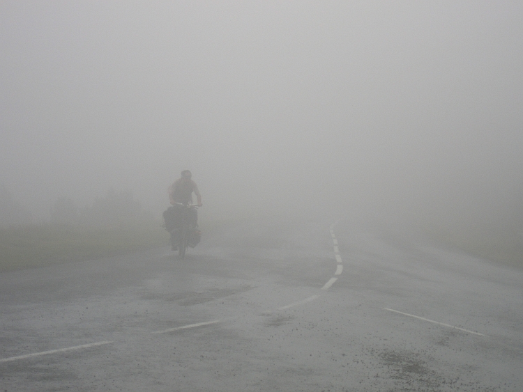
the possible. But now the day starts with a feverishly cold, humid fog, the sudden
greyness is equally convincing. Shows us how much our mind is framed by the
coincidental nature of the conditions and situations. The fog makes natural, steady
breathing impossible. Under these circumstances the colds that we have caught, are deteriorating rapidly.
After more than an hour of climbing we reach the pass. On the other side of the pass
the road keeps on climbing after a short flat stretch on the shoulder with great views
of the cloud landscape. The ridge brings us to higher hills where further climbing
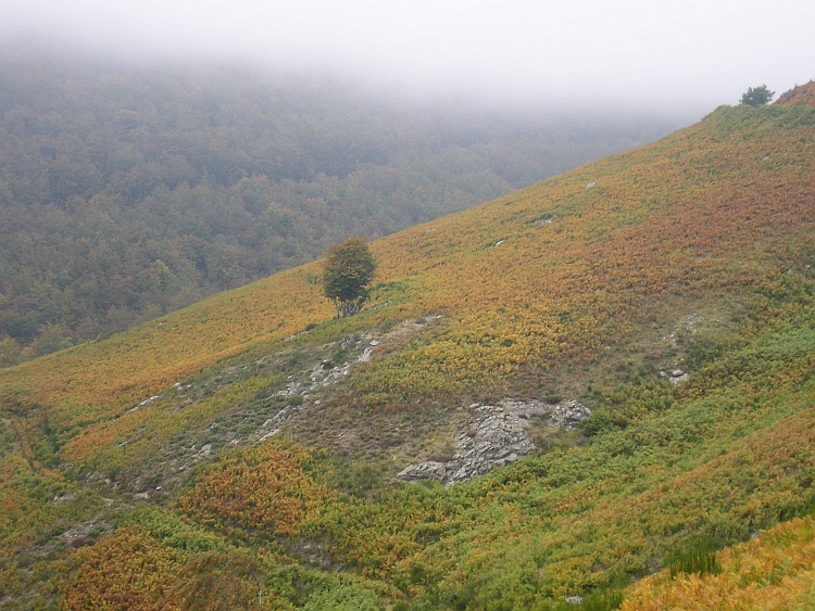
is required. The high hills offer fascinating landscape. The Earth is painted in an
autumnal palette and an atmosphere of subdued melancholy. After the explosion of colour
we enter the zone where we are completely surrounded by clouds. An undulating soup of clouds
thickens the air and adds to the mysterious feel of the strange colours of these hills.
Melancholy becomes stillness in the silence of the grey clouds around us.
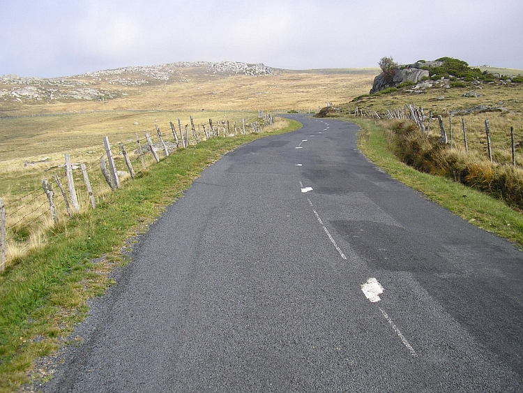
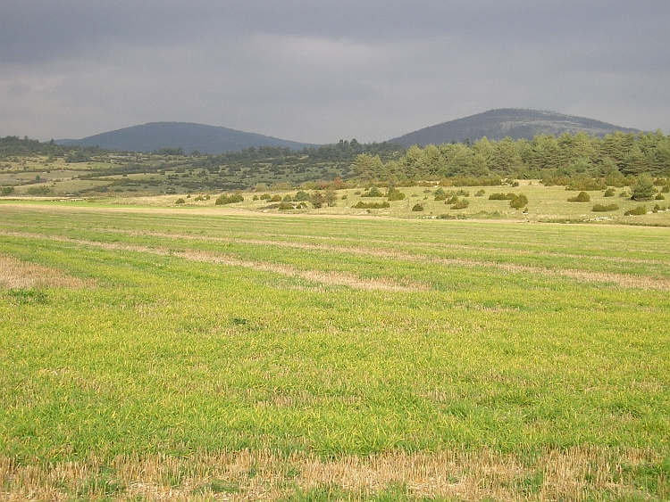
We thought that the Causse de Sauveterre was desolate but on hindsight that
image must be adjusted. The granite plateau of the Aubrac has the personality
of a grand old man that has come to a long, rewarding finale after a long life of
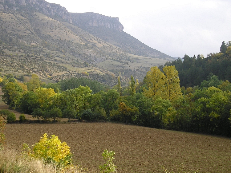
inner and outer struggle. The landscape is astonishing. The weathered highland
is covered by a huge amount of big stones. Small deep blue lakes fill the depressions.
Big cows are grazing the lands. Very few trees can be found. Only rugged grasses and moors
survive on the bleak, deserted highlands. We are lucky that the mists have vanished
so we can enjoy the wild beauty of the Aubrac.
In contrast to the limestone plateaus of the causses, there are some small lakes on
the Aubrac. A few minor hill ridges divide the plateau. Sometimes we cross a ridge,
sometimes we leave them unvisited. A few hours we cross the high lands untill
the road suddenly descends into the canyon of the Truyère river.
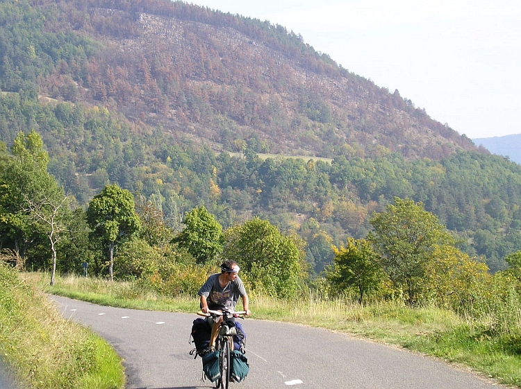
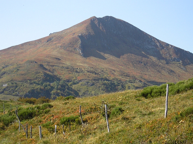
On the other side of the Truyère river we have to climb again, this time to
the volcanic complex of the Plomb du Cantal. The Cantal district hosts a lot of
old, dead volcanoes. Once again we enjoy new, fascinating lanscapes today, this
time under the soft colours and long, dark shadows of a mellow late evening sun.
The last kilometres of the last and longest of the climbs from today takes a heavy toll,
probably partly due to the cold. I feel a bit feverish as we descend to the village
of Murat. As the camping is closed, we are forced to climb back to Albepierre halfway
the descent from the Plom bu Cantal. In Albepierre is a gîte d'étape where
we finally find rest and a place to stay.
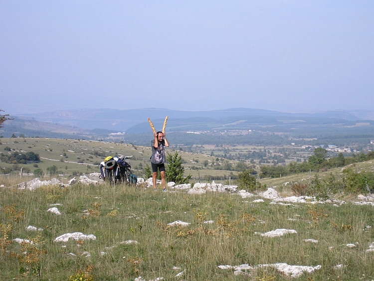
Day 4: Albepierre - Puy Mary - Aurillac 75 km
After a feverish night I awaken weak and tired. Problems arise even before we
take off. I get rid of everything during packing my bicycle, a process which usually
is and what always should be a routine. When I find one lost cycling bag, another one
in the meantime has mysteriously been gone. And when I find that one, the first
is lost again. Finding back only results in losing a third bag. After I have packed
all my stuff in the end, I come to the conclusion that my cycling gloves are
definitely lost. I may have forgotten them on the pass of the Plomb du Cantal
yesterday. We decide to leave quickly before more luggage mysteriously gets lost.
The ascent and descent of the Puy Mary is our goal for today. On my first cycling
journey in 1999 I have traversed the Puy Mary already. That time I came from the North
and after the ascent I headed westward toward the Dordogne Valley and further south
to Spain. This time we do not have more than a few days. After reaching the top,
we have to cycle in the direction of Narbonne where the cycling bus will pick us up
at the end of the week. After climbing the Puy Mary from the east we will therefore
descend to the south west in the direction of Aurillac. From Aurillac we will have
four days to reach Narbonne. That means that we have to cycle at least a hundred
kilometres per day. That should not be too difficult, but because of the short autumn
days not too many problems must arise. At the moment I think about this, my crank makes
eeching and creeching noises. Luckily they have good spare parts in the big cycling shop
of Aurillac.
Day 5: Aurillac - Entraygues - Estaing - Espalion 82 km
Thunder and lightning are causing a loud wake up call at 8 o'clock in the morning. There is no use in departing now.
We drink some coffee to pass the time. When the first cloud bursts are over, we can finally
start to cycle. It still raining heavily when we travel northward and climb another
plateau. The plateau is far from flat. Lots of climbing and descending has to be done
on the minor meandering roads before we eventually reach the river Lot again near
Entraygues. The rains finally stop although the clouds are as dark as before. We pass
delicious old medieval cities like Estaing and Espalion. In Espalion we are welcomed
again by a severe thunder storm, this time a long term affair with fiery showers.
We decide to stay in the abandoned camping of Espalion. The owner again does not
charge anything so once again we have a free stay.
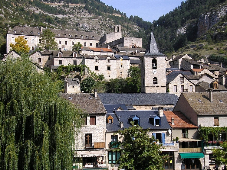
Day 6: Espalion - St Eulalie d'Olt - La Malène - Meyrueis 115 km
The last fragments of mists from the showers of yesterday evening still linger along
the flanks of the hills as we set out in the direction of the Tarn. We climb far above
the valley of the Lot before descending again to the beautiful village of St.
Geniez d'Olt. We are following the course of the Lot further to the east. Soon
we are climbing a few hundred meters above the river again. The valley is narrow
and surprisingly green. The valley at this stretch is so lush and the air is so
warm and humid that I fancy being in the Tropics. It seems as if we have entered
the upper breaches of the Amazone river. The water is thick and brown with
sediments. Rains like those of yesterday seem to guarantee huge amounts of erosion.
We climb again far above the valley of the Lot. This time we leave the Lot for good.
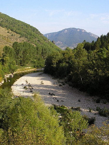
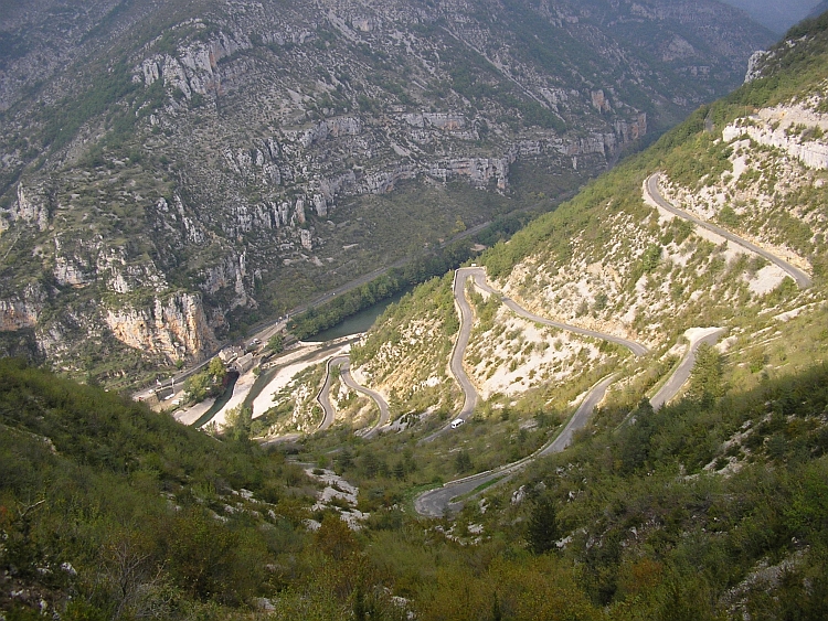
We climb to the Causse de Sauveterre. After crossing the plateau, we descend to the Tarn Valley. In
La Malène we cross the Tarn. The canyon is at its narrowest near La Malène.
The ascent to the Causse Méjean therefore has breathtaking views down into the
Tarn. After lots of hairpins and hard work we have reached the plateau. Of course the
Tarn river lies far below in the meantime.
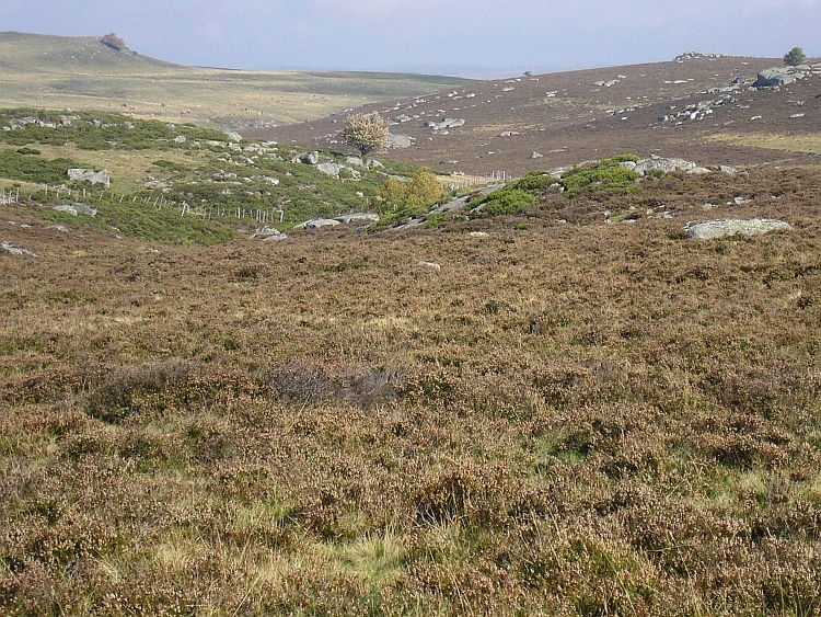
We have seen some barren landscapes the last days but the Causse Méjean is setting
new standards. The desolate nature of the landscape is enhanced by cloud fragments
that are chasing across the highlands just above our heads. The Causse Méjean
has a unique atmosphere and belongs to the most beautiful landscapes of France.
Much time to enjoy is not left unfortunately. It is already late. We do not have
more than an hour of sunlight before the sun goes down. After we have traversed
the plateau we descend into another canyon. Down along the Jonte Canyon we reach
Meyrueis. Just before dusk we find a place to rest in the friendly atmosphere of its
gîte d'étape.
Day 7: Meyrueis - Mont Aigoual - St Guilhem le Désert - Clermont l'Hérault - Lac de Salagou 138 km
Along the Jonte river we cycle upward. We are on our way toward the top of the Mont Aigoual.
The friendly woman of the Meyrueis bakery has warned us for awful weather. Because of
strong southerly wind the weather on the other side of the Mont Aigoual should
be really bad. I see the top of 1.650 meter altitude cannot be distinguished
because it is indeed covered by clouds. In the Jonte Valley the weather is okay still.
Seven kilometres from the top in a small place called Cabrillac, circumstances have deteriorated
quite severely already. Ice cold mists and clouds sweep over the plateau, over the trees,
over the road and give a clue about how conditions will be on the other side of the
mountain...
We do not have to guess how things will be. Even on the 'good' side of the mountain
conditions already turn out to be very grim. The last kilometres to the top we are welcomed
with heavy rain showers. At this time we are completely surrounded by clouds.
The woods, the road, we ourselves, everyting dissolves in the greyness. The clouds
are chasing with dazzling velocities across the roads and disturb the orientation. Sometimes I
think I will be swept from my bicycle with a mighty stroke of the wind.
Eventually we reach the top, cold and wet and forlorn. The long descent on the south side is even wetter,
as we were promised. After an hour we have descended all the way down to the valley of the
Hérault. It is not very cold any more at these lower altitudes. After a few kilometres
we are out of the rain zone. Behind our backs however, the Mont Aigoual still suffers
from the ascension rains and will continue to do so the whole day. For us, we only have to
follow the river into the lowlands of the Languédoc. After sixty kilometres along the
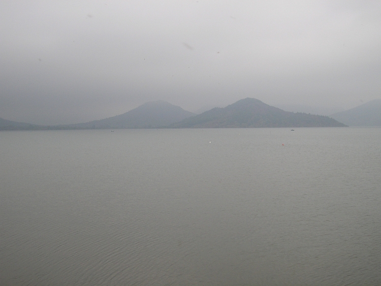
Hérault river we reach Clermont l' Hérault where we sleep in a camping
along the Lac de Salagou.
Day 8: Clermont l'Hérault - Lac de Salagou - Narbonne 93 km
The last day of our journey. Tonight the cycle bus departs from Narbonne. The
last stretch to Narbonne is not too difficult. Through the vineyards of the lowlands
of the Languédoc we ride south. The weather is grey still. We may not be
dissatisfied however. We have made a terrific traverse through the Massif Central.
We have seen all the major important areas during periods of beautiful weather.
The canyons, the highlands, the volcanoes: the good thing about travelling by
bicycle is that within a week you can enter completely different worlds.
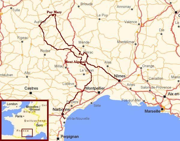
Map of the route
Statistics
Fast Facts
Fast Facts
# Days
# Cycling days
Distance on bicycle
Distance / Days
Longest distance on a day
Highest altitude difference on a day: climbing
Highest altitude difference on a day: descending
Highest point
# open campings: # closed campings
# times we nonetheless found a good place to stay
# times we had to hurry to buy a lunch before siesta
Statistics
8
8
826 km
103 km
138 km
1.000 m (from Meyrueis to Mont Aigoual)
1.450 m (from Mont Aigoual to Clermont l'Hérault
1.588 m (Pas de Peyrol - Puy Mary)
1:10 (in the first week of October)
every time
every day
Highlights of the Journey
Region
Lozère
Lozère
Cantal
Highlights
Cycling through the gorges and over the causses from National Park the Cévennes
Cycling over the scenic, granitic plateau of Aubrac
To be between the volcanoes of Cantal and to climb the Puy Mary

 After a feverish night I awaken weak and tired. Problems arise even before we
take off. I get rid of everything during packing my bicycle, a process which usually
is and what always should be a routine. When I find one lost cycling bag, another one
in the meantime has mysteriously been gone. And when I find that one, the first
is lost again. Finding back only results in losing a third bag. After I have packed
all my stuff in the end, I come to the conclusion that my cycling gloves are
definitely lost. I may have forgotten them on the pass of the Plomb du Cantal
yesterday. We decide to leave quickly before more luggage mysteriously gets lost.
After a feverish night I awaken weak and tired. Problems arise even before we
take off. I get rid of everything during packing my bicycle, a process which usually
is and what always should be a routine. When I find one lost cycling bag, another one
in the meantime has mysteriously been gone. And when I find that one, the first
is lost again. Finding back only results in losing a third bag. After I have packed
all my stuff in the end, I come to the conclusion that my cycling gloves are
definitely lost. I may have forgotten them on the pass of the Plomb du Cantal
yesterday. We decide to leave quickly before more luggage mysteriously gets lost.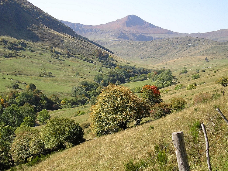
 Thunder and lightning are causing a loud wake up call at 8 o'clock in the morning. There is no use in departing now.
We drink some coffee to pass the time. When the first cloud bursts are over, we can finally
start to cycle. It still raining heavily when we travel northward and climb another
plateau. The plateau is far from flat. Lots of climbing and descending has to be done
on the minor meandering roads before we eventually reach the river Lot again near
Entraygues. The rains finally stop although the clouds are as dark as before. We pass
delicious old medieval cities like Estaing and Espalion. In Espalion we are welcomed
again by a severe thunder storm, this time a long term affair with fiery showers.
We decide to stay in the abandoned camping of Espalion. The owner again does not
charge anything so once again we have a free stay.
Thunder and lightning are causing a loud wake up call at 8 o'clock in the morning. There is no use in departing now.
We drink some coffee to pass the time. When the first cloud bursts are over, we can finally
start to cycle. It still raining heavily when we travel northward and climb another
plateau. The plateau is far from flat. Lots of climbing and descending has to be done
on the minor meandering roads before we eventually reach the river Lot again near
Entraygues. The rains finally stop although the clouds are as dark as before. We pass
delicious old medieval cities like Estaing and Espalion. In Espalion we are welcomed
again by a severe thunder storm, this time a long term affair with fiery showers.
We decide to stay in the abandoned camping of Espalion. The owner again does not
charge anything so once again we have a free stay.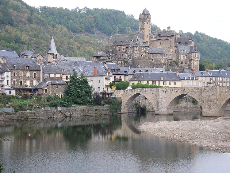
 Eventually we reach the top, cold and wet and forlorn. The long descent on the south side is even wetter,
as we were promised. After an hour we have descended all the way down to the valley of the
Hérault. It is not very cold any more at these lower altitudes. After a few kilometres
we are out of the rain zone. Behind our backs however, the Mont Aigoual still suffers
from the ascension rains and will continue to do so the whole day. For us, we only have to
follow the river into the lowlands of the Languédoc. After sixty kilometres along the
Hérault river we reach Clermont l' Hérault where we sleep in a camping
along the Lac de Salagou.
Eventually we reach the top, cold and wet and forlorn. The long descent on the south side is even wetter,
as we were promised. After an hour we have descended all the way down to the valley of the
Hérault. It is not very cold any more at these lower altitudes. After a few kilometres
we are out of the rain zone. Behind our backs however, the Mont Aigoual still suffers
from the ascension rains and will continue to do so the whole day. For us, we only have to
follow the river into the lowlands of the Languédoc. After sixty kilometres along the
Hérault river we reach Clermont l' Hérault where we sleep in a camping
along the Lac de Salagou.