"It is so cold here."
Even before I get out of the plane, my predecessors confirm all the famous clichees
of the Icelandic weather.
"Jeeh, this is soooo cold!"
It looks like all the people that are stepping out of the plane are undergoing similar
experiences. Then I am going out myself. The icy wind hits my face and I cannot deny
that it is cold indeed. Or at least it feels cold. Visually there is nothing wrong
with the weather. The sun is shining and the sky is deep blue with only a few small
clouds. The few clouds are moving very quickly, which I feel as an unfavorable sign
for the near future.
After a small walk I reach the airport. After half an hour I have got my bike bags and
a little later I also have my bicycle and the bike box. Unfortunately hardly like a
neat package, as the bike box is ripped open in the central part of the box and the
bicycle is half inside and half outside the box. "How the hack could they make this
happen?" I wonder. Fortunately the rear side of the bike is oustide the box and not the
front where I have hung up my front wheel on the frame with two thin tiewraps. I am
also glad that all the spokes from my rear wheel appear to be intact. Only the bike box
itself has suffered severe damage. That is not an overwhelming disaster, but it is very
regrettable at least. In the airport Bike boxes are not being sold. They can be stored,
but that costs an incredible EUR 10,- per day during the first week and EUR 5,- per day in
the subsequent days. As I will be traveling in Iceland for thirty days, storing the box would
cost EUR 185,-. The value of a bike box is no more than EUR 20,-, a box that is intact,
and not the miserable box that is completely torn apart. I take another decision.
I am dragging my bike with cardboard rafel coat outside, looking for a bus that can
take me and the bike to Reykjavik. An hour later I am standing with my bike, the box
and the bags before the camping site of Reykjavik. Here they can store the bike box - or
what is left of it - for EUR 35,-. Still far too expensive, but at least better than
EUR 185,-.
It is already evening at the time that I have pitched my tent, adjusted my bicycle
and taken a shower. But I still have to buy gas for my burner, get myself food for
tomorrow and eat something today. I manage to obtain gas rapidly. They turn out to
sell gas at the camping site. I also get my hands on the priceless but free bicycle map
"Cycling Iceland". Certainly not free was the supermarket, where I buy a simple evening meal
plus emergency supplies for an exorbitant amount above EUR 40,-. In any case, the organization
part is ready now.
I walk over the Söbraut, the road that parallels the sea up to the very city center and
the old harbor. A wide cycle path and pedestrian promenade flank the road. On the other side of the
sea I have views over a mountain range with pretty much snow on its slopes. The Arctic panorama
is complete with the backdrop of the volcano with ice cap of the Snaefallsjökull, which I can
clearly distinguish in the distance. I am surprised by the icy appearance of the landscape as
seen from the capital, notably the warmest part of the country. At the same time I am
confronted with the reason. The icy wind is still chasing over the sea and has hardly lost
any strength in the evening. I have to prepare myself for the possibility that the wind
might become a permanent companion during the course of this trip. If I look to the left,
I do not see any nature at all but I look upon the modern city that is Reykjavik. Modernist
business buildings is the dominant feature here. I get rarely overwhelmed by the appearance
of office buildings, but I have to acknowledge that most buildings are tasteful and that the
complete image intrigues. Each building looks like having its very own, unique vision,
but they have in common that the buildings have a clear cut design and they they are
all radiating individualism and self-esteem. And yet all of these buildings are still
forming a quite harmonious whole. Along the architectural masterpiece of the Harpa
cultural center I am waking to the old port, where I order a modest fish meal. Through
the old town and the AlÞingi, the parliament building that is constructed with
large dark gray stones, I am walking to Reykjavik's most famous building, the Hallgrimskirkja.
The concrete cathedral with its tight basalt shapes dates back to 1986 but has become
the eye-catcher of Reykjavik ever since. The dizzying vertical lines seem to represent
a giant organ. An organ with pipes of pure ice, as the cathedral is dominated bt white
tones. To my surprise there actually is a giant organ, which is being played beautifully
at the time that I enter the church. Thet are playing Bachat the moment. The interior
is as modernist as the outside, dominated by sheer vertical lines that er carefully bended
to each other at the very upper part of the building.
Day 1: Reykjavik - Þingvellir - Laugarvatn 84 km
Reykjavik was an interesting experience, but I have not traveled to Iceland for its
beautiful cities. Then I could better have gone to Italy. Just like everyone who travels
north, I am here for its landscapes. If I have a little luck, I already might experience those
today. Geysir's famous geysers are situated no more than a hundred kilometers or so
from Reykjavik and the Gullfoss waterfall is not far beyond.
I am leaving the camping site early in the morning. Through the empty streets of the
outskirts of Reykjavik I am trying to find my way out of the city. I am reaching
a wide road, which is already busy. I therefore follow the bike path that parallels
the road, hoping that there will be a place to cross the road. After a few minutes of
cycling it appears that the bike path will not cross the road at all. Th bike path makes a curve
to follow an equally busy side road. I am looking to verify if I might be able to cross
the busy side road, but the bike path also does not seem to cross this road and even
manages to make a curve to the worst direction possible. So I am not only driving the
wrong way, I have to cross not only one but even two busy roads. Eventually, after
a few minutes cycling, I am finally able to cross the first road through a very steep
bridge. Once descended to the other side of the road, I find out that the bike path
is completely closed because of construction works. I have to drink the poison cup
completely and backtrack the whole way in the hope that there is a possibility of
crossing the road over there. That is what I am supposed to do, but instead I decide
to let the poison cup pass by. I ride my bike down over the talud to reach the freeway,
where I easily cross the other highway. So, those are two flies in one blow. A steep
climb over the highway brings me on an ugly office park with lots of gas pumps. But
at least I am able to leave the highway. A long series of ever easier obstacles takes
me from office parks to an endless string of suburbs and finally a series of small suburbs
and golf courses. I am no longer being hampered by real setbacks and after two hours
I have left the city behind me. It is hard to imagine that it takes me more than two hours
to cross an urban area with hardly 200,000 inhabitants, including suburbs. A bicycle bridge
crosses the N1, the infamous Ring Road of Iceland, the only long-distance road of Iceland and
I find myself at the open, panoramic landscape of Iceland.
The emptiness of the landscape is in stark contrast to the urban areas that I have just crossed.
I am riding through a wide valley that is climbing slowly. A few kilometers on either side
of the valley are steeper mountain ridges, but the width and emptiness of the valley makes
more impression than the mountain ranges. And then there is the road that cuts through the empty
landscape, but that is far from empty itself. Continuously the cars are chasing along. The road
does not have a shoulder so I have no option but to ride on the same road as the endless
flow of cars and that the car drivers have no other choice but to pass by close beside me.
And then I am not even riding on the Ring Road that connects the cities and villages and
settlements of Iceland, but on a road that only leads to some scenic landscapes.
It is not nice to ride a bicycle on such a busy road, but the car drivers are at least
paying close attention to me. That cannot be said of the wind, that is blowing
frantically. As there are very few trees in Iceland, the wind has free play. The wind
is no true headwind, but is against under an oblique angle, so that I have to hang
against the wind steeply in order to not being blown off the road. Fortunately, the
wind has got a massive consistency. If the wind had been flaky, I would have probably
hung over the guardrails at the first time that the wind would drop suddenly.
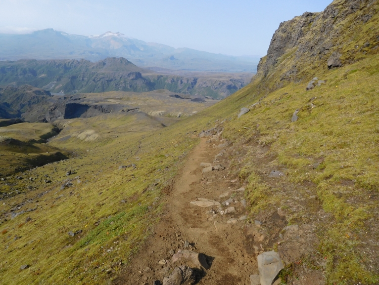
As an ant, I crawl up, up against the mountain and up against the stormy wind. I do not have
to climb very high but still it takes a lot of time to reach an undulating plateau.
I am hardly able to pick up some speed and even as the road drops I am still moving
slow. Far before me I can distinguish Þingvellir's wide valley, as well as the
great lake Þingvellavatn. The descent is hardly relaxed with this wind. I have to
work very hard to almost get the speed that I am used to ride on a flat road. But at
least I can see myself amke any progress in the landscape.
Þingvellir is the first scenic highlight of the trip. It is the best place to see
how North America and Europe are geologically moving away from each other. Through currents
in the liquid inner of the Earth the geological plates of North America and Eurasia
are driven apart from each other five centimeters per year. It turns out that Europe
and America are not only driven away from each other politically, but that Trump and the white house
are actually drifting away from Europe. This phenomenon of continental drifting of the
continents takes place throughout the Atlantic from north to south, but nowhere as
much as in Iceland. Because of the forces the earth is literally torn apart, leaving a
landscape full of parallel cracks and fissures. Many of these cracks are filled with
water. Another spectacular feature is a river that is reaching the main crack and
falls down as a clashing waterfall.
Þingvellir is not only of geological and landscape importance but it is also of
important historical value. After the first people have settled at the end of the ninth and
at the beginning of the tenth century, it was decided around 930 AD that people should
gather every year fro about two weeks at Þingvellir to run the current affairs. The
journey to Þingvellir could be long, as the colonists, mostly farmers, were living far
apart throughout the country. The litmus test for the experimental parliamentary system was
the religious opposition between believers and the infidels. Eventually it was chosen
that Christianity was appointed as the official state religion but that at the same
time unbelievers and heathens should have the right to exercise their (non-)belief
in private. Political tolerance proved to be a good deal. The tensions were over, as
everyone felt the freedom to shape his own life according to his or her own insights.
The Lonely Cyclist also shapes his life according to his own insights. Those insights bring
me to new highlands, between Þingvellir and Laugarvatn. I am treated to a headwind
that has swollen in the meantime. The clouds are rushing across the landscape. And the
cars are passing me by closely. Þingvellir was beautiful, but cycling itself has not
brought me too many highlights so far. The odometer is usually showing around ten kilometers
per hour and also on the descents I am not able to pick up any pace at all. The first hour
after Þingvellir I have covered ten kilometers and the second hour would not get me
further. Do I have such a bad day? Or am I getting old? Or does the wind really blow so hard,
that it is simply impossible to fight the wind? Whatsoever, I have to give up my ambitions
to visit Geysir today. In Laugarvatn I pull the brakes to sleep in the local hostel. There
is also a camping site in Laugarvatn, but I am finished with the ruthless, icy wind.
Moreover, the hostel of Laugarvatn is very beautiful and not too expensive for
Icelandic terms.
In the evening I take a walk along the lake. The sun lights up the landscape in a golden glow,
but in the meantime the wind is still raging. The lakeside is relatively sheltered though, as
is being shown by the fact that there are trees here that obviously manage to survive. That is
a special treat in Iceland, where even plant species barely can survive in many parts of the country
because of the snow, the cold and especially the wind. Lake Laugarvatn is the most idyllic
place I have seen so far and possibly it will not be this idyllic in the future when I
will be moving towards the highlands and later on to the ice caps of the south or the
fjords in the east and northwest. And then I have not discussed the volcanoes yet,
which might represent the potentially most destructive forces of Iceland. The destructive
power is not only caused directly by heat and lava, but also indirectly due to the
massive melting of ice, that in turn can cause terrible floods. In the distance I see
one of these troublemakers. The Hekla, Iceland's best known volcano, is partly veiled
in clouds, but the overaal appearance is nonetheless highly impressive. I will do
some detours in the highlands first, but within about a day or three I hope I can
see the mythical volcano more closely.
Day 2: Laugarvatn - Geysir - Gullfoss - Flúđir - Årnes 91 km
During breakfast I speak with the youth hostel owner. She tells about the major increase
in tourism of the recent years. Several years ago there were only a few hundred
thousand visitors a year in Iceland, where this year may be the first year that two
million people are visiting the country. The woman says that the increase has brought a
mentality change. Nowadays there are tour groups that are immediately fencing their
'own' space within a campsite with stones. That is unheard of for the free, independent
Icelanders. She says she does not recognize her own country sometimes.
It is beautiful weather as I am leaving the youth hostel. It is sunny and the wind
is not blowing at all now. Through rolling agricultural areas I am cycling towards
I am rding through rolling hills, but the mountains and highlands are not far away
either. To the north I see the first mountains and far in the distance I can distinguish
the Langjökull, one of the great ice caps from Iceland. To the east I see The Hekla
in the distance, the best-known volcano of Iceland, covered with glaciers and snow.
Because I have left early today, it is still quiet on the road. Þingvellir,
Geysir and Gullfoss form three the so-called Golden Circle together, the most famous
excursion of Iceland. Logically, Þingvellir is usually the first because it is
closest to Reykjavik. That gives me a bit time to reach Geysir before the tourist
masses.
I succeed in my plan and I meet Iceland's most famous tourist attraction before
the masses. Well, there are two cyclists. They turn out to come from Barcelona. They
are riding without luggage today. I ask them about their experiences with the wind
of yesterday. They say that they have stopped after 40 kilometers. Today they cycle without
luggage from Laugarvatn to Geysir and Gullfoss and back again. Later they will take
the bus to the northwestern fjords. It should be much quieter there than here.
Iceland is an expensive country but they do not charge ant fees for the scenic
sights. Not even for the famous hotspot of Geysir. Worldwide, the phenomenon of
geyser is named after the sizzling and spraying hot waters of this place in Iceland.
Traditionally the most important geyser of Geysir is eponymous Geysir, but that geyser
is not functioning as such anymore. Nowadays Strokkur is the most impressive geyser of
Geysir. In the hour that I am walking through the stinking, gurgling, blurring and
sizzling plains, the geyser is spraying heaps of hot water and hot fumes up to
many meters high into the sky on a regular basis. In addition to the spraying geysers
more visual spectacle is provided by the unusual colors of the landscape as a result
of high concentrations of particular minerals. All in all, Geysir is not as big
as the Geiserwalhalla of Yellowstone National Park in the United States, but all the
beautiful landscapes are packed within a small space of no more than five hundred
meters. Geysir is a great start to the day, which in fact has only just begun.
The next unmistakable highlight will not last for a long time. From Geysir I need
only cycle some fifteen kilometers to reach Gullfoss, one of the most famous waterfalls
from Iceland. The wind is still quiet and effortlessly I am riding up to the waterfall.
On the way to the waterfall I undergo the vast views of the huge Langjökull
ice cap, a magnificent sight, especially because the end of the ice cap is not visible.
From this point of view, the ice cap could easily be infinite, if I did not know better.
How impressive the views are, as I approach the waterfall, the ever deafening noise
makes the attention shift back from the ice to the water.
Soon I reach the waterfall. Through a wide plain the water flows steadily down from the
highlands, fed by two ice caps as well as rain water until the river reaches the end of
the plateau. In two stages the water is dazzling with a thunderous noise over a width
of a few hundred meters into the soaring depths, from where it is snaking its way through
a narrow, deep gorge. With the two cyclists from Barcelona I walk past the many viewpoints.
Gullfoss literally means golden waterfall and under this sparkling sun there is a lot
to give credits for its name, since the low sun seems to radiate golden light indeed.
Statistics indicate that the weather can also be very different here. And if the
statistics are not convincing enough yet, then the waterfall itself should convince,
especially if you think that every water drop of the waterfall started as a rain drop
or snow flake in the catchment area.
Just after Gullfoss I am cycling the first kilometers of dirt road over road 358.
It is not a very difficult stretch of road and within an hour I reach the asphalted
road 30. I am riding to the south in the direction of Flúđir now. It is still
sunny, but the windless weather has been blown to rags in a few minutes. A stormy wind
is chasing over the plains now. It is only blowing slightly less hard than yesterday.
Even though I am heading to another direction, I am again confronted with counterwind.
At this moment it is fuul-blon headwind, which is actally better than the oblique haedwinds
of yesterday.
When I finally reach Flúđir, it is time to start a late lunch. The only
supermarket is so busy however, that I do not even try to go inside and instead I am
eating my emergency stock of peanuts somewhere out of the wind. That should be enough
to reach Årnes, the intended overnight place on one day of cycling from
Landmannalaugar National Park.
After another twenty five kilometers of counterwind, I reach Årnes, which is not much
more than a gas pump and a youth hostel. I am lucky. I grab the last bed in the hostel.
I am surprised that a hostel in a remote place like this is fully booked, while there
is actually nothing to see and nothing to do. I must prepare myself for trouble finding
places to sleep as I will be cycling in areas that are just as sparsely populated, but
with a far higher touristic profile. For the moment, I am glad that I have a place
to sleep and moreover a German man is offering me a beer. He is traveling with his family
through Iceland. His wife is going to do a multi-day horse ride over the vast grasslands
of this part of Iceland, while he and the children are going to make excursions to waterfalls
and other sights in the region. While I am eating a poor dinner with canned tuna and
tasteless Icelandic pesto - the only thing affordable that was available in the
small supermarket of the petrol pump - a Spanish tour guide is providing me with
the remainders of a luxurious oven meal. And so I can still enjoy a three-star
meal.
Day 3: Årnes - Hrauneyjar - Landmannalaugar 104 km
Today the weather is considerably less beautiful than yesterday. It is heavily clouded
and the wind is already blowing hard early in the morning. Again I am having headwind.
Occasionally it is raining lightly. And it is cold. All in all it is a far from
inspirational start of the day, but I still feel like cycling and for the first time
counterwind cycling goes relatively smooth and effortless. Probably the wind is blowing
just a bit less hard than yesterday and certainly than the day before yesterday. The
gloomy, sombre-toned weather actually fits well in the open, weathered and increasingly harsh
landscape. Along the river Þjórsá I ride up, mostly very gradual, but sometimes
I have to really climb as well. Meanwhile, I catch up a Canadian woman, with whom I drink
coffee in Hrauneyjar, the only cafe in a radius of seventy kilometers. After the coffee,
I am riding on mu own again, and soon I reach the junction with the exit to Landmannalaugar.
After the junction I cycle along a large lake, Hrauneyjalón, surrounded by a virtually
vegetationless plain filled with pitch dark rocks and stones. In the background, the Hekla
reappears, now considerably closer than yesterday, but nearly completely shrouded in clouds.
The road is still paved here, but it will not endure for a long time. I am passing the lake
and subsequently I am climbing up a steep scree slope. After a small descent the asphalt abruptly
ends. There are three roads that lead into Landmannalaugar and all three are unpaved
roads. All three roads are classified as so-called F-roads. My personal qualification
fits in seamlessly. After no more than a few meters I slip away and a word that actually
begins with an F escpes from my lips. The name of the F-roads has a rather different origin
though. The F-word stands for Fjölur, Icelandic for mountains. So F-roads are literally
mountain roads. On these mountain roads you are insecured in a normal hired car. A four-wheel
drive is required at least. Or a single-wheel drive like my bike. The single-wheel drive
might spin occasionally, but I am able to move on through the landscape, although it
I am not progressing that fast.
After an hour of cycling, the road gets a bit better and I am able to move faster
through the ever more beautiful and awe-inspiring landscape. I reach a crossroads,
from where an ultra-steep road leads up to a crater. I am trying to cycle up the
increasingly steep road. Finally I reach the crater rim and I look into the cobalt-blue
crater lake of Bláhylur.
A couple of kilometers further I am taking a new exit to another crater lake. This road is
longer and the last hundreds of meters are even steeper. The last part I have to walk, but
I finally get upstairs. The crater lake Ljótipollur is as impressive as crater lake
Bláhylur and is surrounded by deep red flanks. From the crater rim I have impressive
views of the much lower-lying river valley of the Tungnaá.
From the crater lake Ljótipollur it is not far to Landmannalaugar campsite anymore.
After a few kilomters of cycling, I reach the wide valley of Landmannalaugar, which is flanked
by mountains that are painted in zillions of colors. A kind of arctic, three-dimensional
version of Van Gogh, with the gloomy dark complexions of his beginnings as well as the full,
deep colors of his later work, all fitted with the rough, bright brushstrokes of the
master himself.
A wide deep river must be crossed just before the campsite. Specially equipped
superjeeps can drive through the river, but most jeeps are parked by the river.
The campsite can be reached via a pedestrian bridge. Through a meadow full of hail-white
Arctic Riverbeauty flowers the footpath leads to the campsite. At that moment it begins to
rain. It does not rain, it really pours. From one moment to another a bucket of large,
ice cold drops is emptied down. I ask for the possibilities to sleep in the mountain
hut. There seems to be place, but then I have to pay EUR 80,- to sleep in my own sleeping
bag in a 70-room dormitory. I will not do that and so I am pitching my tent in the pouring
rain.
Earth, water, fire and air. All elements are there today. After two hours of continuous
and heavy showers it is suddenly dry and I decide to leave for a small hike. I am climbing
up a moraine ridge. I follow a path that meanders between the loose stones and rocks.
Eventually I reach a new valley, maybe even more beautiful than the valley of the campsite.
The whole wide valley is dotted with Arctic Riverbeauty and is flanked by pink with
silvery gray mountains. From the slopes volcanic fumes and gases escape continuously.
I walk through the breathtaking landscape to almost sunset. Then I hurry back, the
more so because it is starting to rain hard again.
Day 4: Landmannalaugar - Leirubakki - Hella - Vestmannaeyjar 145 km
During the night there were still a number of heavy showers, but early in the morning it is
dry. I have no idea what time it is, but it should be very early, as everyone is still
sleeping. I myself do not have sleep anymore and I decide to get on my way. Then I can
cycle the first hours without jeeps crawling past. After a hearty breakfast with bread
and salads I go on my way.
It is dry, but that does not say that the weather is particularly bright and shining.
The sky is overcast and the mountains are completely wrapped in clouds. Only in the
lower valleys I have sights of more than one hundred meter. Where I had free views over
the landscape yesterday afternoon, I find myself in a claustrophobic little world now,
visually bounded by the diffuse clouds. And strange enough, the landscape is breathtaking
this way. The dark colors of the volcanic stones contrast well with the intense fluorescent
green of the mosses and the grasses. Nowhere the grass is as green as in Iceland.
The first part of the F225 is very bad. In addition the road continuously goes up and
down steeply. As a result, I only cycle five to six kilometers per hour. Occasionally
the bike gets stuck in deep sand and I have to walk short distances.
Especially in the higher parts I am completely surrounded by the clouds. All sound
dissolves in the thick mist. I am surrounded by a complete silence. And by a complete
solitude. I am the only one in the landscape. Since I left, I still have not seen a
single living soul. After the hard strech of the first two hours, the road is a lot
easier now. The F225 is composed of clay here and is amazingly even. It is all the
easier because of the absence of steep ascents. The road is running through a wide
river valley that hardly climbs at all. I suddenly reach speeds of twenty kilometers
per hour. Until I reach the first river without a bridge...
The F-roads of Iceland are notorious because of its river crossings. This is the first of two
river crossing on the F225. It is especially these river crossings that make these roads
unpassable for normal cars and can even cause problems for jeeps. I was insecure therefore
how much trouble these river crossings could cause for me as a cyclist. The question became
even more prominent after the huge amounts of rain that had fallen tonight. I have got quite
some experience with river crossing, in particular in South America, where I had to ford several
wide, waist deep and strongly flowing rivers, one time with a waterfall downstream.
I do not feel much for subjecting myself to such risks again. That is not really necessary
now, because I will be back at the Landmannalaugar campsite in three hours if I want.
As I approach the river, it does not seem too wide. I take off my socks and I start to
cross the river in my sandals. For the moment I do not lift my bike, but I push the two-wheeler
through the gently flowing river until it gets too deep. To my surprise, that moment does not
come. The river is no deeper than just above the ankles. My first river ford of Iceland
is a piece of cake.
Not much later the second river crossing follows. This river is slightly more potent
than the previous one. This river is actually flowing, albeit slowly, and the river is
quite wide. The river is also somewhat deeper. The water reaches until halfway between the
ankles and the knees. I will not say that this was a piece of cake, but I will not get
sleepless nights from this experience. After the river crossing, a final climb floows
and a long descent that finally brings me on road 26, the asphalt road to Hella.
After fifty kilometers I have left behind the beautiful sceneries for today. In more favorable
conditions I might enjoy spectacular views of the Hekla, Iceland's most imposing volcano,
but the mountains are still covered in clouds. Another disappointment is that the wind
is suddenly blowing heavily. At the moment that the wheels of my bicycle makes contact
with the pavement, the wind has been accelerated from windlessness to a hell of a
pouring storm. And again I am confronted with oblique counterwinds.
I am on a duty now. There is no one living here in this bare landscape, there are no
facilities, the landscape is devoid of views over the mountains and volcanoes, it is
very boring and it is icily cold. There is no reason to stay here longer than necessary.
I quickly eat some bread and then I continue again. The landscape slowly becomes less barren
and there is more space for agriculture. This is the flattest part of the country and it is
the largest agricultural area of Iceland. That does not imply very exciting landscapes,
but it does offer the opportunity to exchange the dull road 26 for the parallel dirt
road 272. This road is definitely more fun, even though I am progessing slower on
the dirt road.
After a long and uneven battle with the wind, I reach Hella. I had been wise if I would
have squeezed in the brakes to continue cycling tomorrow. It is still early in the day
however, and I should have enough time to ride further on the Ring Road today and
reach the ferry to the island of Vestmannaeyjar. That is still forty-five kilometers
cycling, but I should have headwind for the biggest part.
After leaving Hella I see that my calculations have failed. I am still confronted
with the raging counterwind. The only difference is that there are loads of cars passing
me by closely. Because the wind is coming from the right now, I am continuously being
blown towards the past hunting cars. After fifty kilometers of dirt roads and fifty
kilometers of heavy headwinds fatigue becomes to claim a toll. The toll consists among
others of lactic acid in the legs, permanent gushing for air, intense feelings of cold,
downright frustration, fear of being hit by a car, self-repraochful about my
bad choices, but worst is the fear that all the self-sacrifice could be in vain.
According to my information, the last ferry would leave at 6 o'clock. A fast calculation
teaches me that a speed of twelve kilomters per hour should be sufficient. I am cycling
fourteen to fifteen kilometers per hour now, but that is the absolute limit, I really cannot
go faster. In addition, I have to eat something quicly. And if I get a flat tyre or if
the wind increases even more, I just will not make it. At a petrol pump I eat some bars
and then I move on again. My mindset has strayed far from the Buddha teachings now.
I am fighting the elements, but I cannot win the fight. So now I need a draw at least. If I am
not in time for the ferry, it will be a hungry affair in an area where nobody lives.
I reach the exit road to the ferry. Twelve kilometers at flat as a pool table separate
me from the ferry. Or those same kilometers separate me from the same place, but
without a ferry. Or the kilometers separate me from the place where I will see the
ferry leaving the harbor without me. The latter thought makes me ride just a little
bit faster. For a very short time. I am too tired and I immediately have to slow down
again. But the end is in sight. I am reaching the last kilometer. The road turns
and suddenly I have the wind coming from the side. Now I can finally accelerate. I am
racing to the harbor now, as hard as I can, afraid that the wind will turn again
or that the boat is leaving.
In the office I see myself in the mirror. I am overflowing with sweat and intensely tired.
But at least I have made it. My fears proved completely unnecessary. The boat will leave
much later and I will have to wait two hours and a quarter.
The boat brings me finally to Heimaey, the city that almost got buried under lava
after the volcanic eruption in 1973. It is a very nice town, where I find an overnight
stay as well. That is rather on the expensive side for me, so tomorrow I have to get
away from the island again.
Day 5: Vestmannaeyjar - Seljalandsfoss - Skógar 104 km
There are several reasons for going to the Vestmannaeyjar islands. one of the reasons is
the town of Heimaey, one of few locations in Iceland which feel like a place where people
really live. The city focuses primarily on fishing. There are various fish restaurants
with an outstanding reputation. My personal sample of only one single fish restaurant does
not give much reason to fight this reputation. Rarely have I eaten fish this tasty. Another
good reason to visit the islands are the volcanic landscapes. The volcano that almost destroyed
the town in 1973 looms over the city. The most spectacular, however, are the towering cliffs
that seem to pop up everywhere, sometimes straight from the sea. But in the end
most of the people go to the island for the puffins. The beautiful birds with the
remarkable orange beak and the equally remarkable black eyes are found on the most
remote cliffs of Iceland, mostly on islands. The Vestmannaeyjar Islands is one of the
easiest and most promising places to see the birds.
I am riding from the town to the mountains. I reach the cest of the mountain range.
I am having views over the ocean on either side, far below. A final climb brings me
to the mountain with the most puffins. At the top, I leave my bike and I walk to the
cliffs. A narrow path is leading far above the ocean. I see dozens of birds but no
puffins. Will they still be there? I am late in the season, so they might have left.
I see a number of people with binoculars in the distance. I immediately spotted
that those people should be birdwatchers. Well, then the puffins will be there too.
A little later I see the first puffins. And if I progress a little further, there appear
to be dozens of them. I am watching breathlessly. Without binoculars, but I can come close
enough to see them well. In my enthusiasm I am taking fifty pictures, that suffer a bit from
a certain degree of interchangeability. It does not matter to me all.
After the visit of the cliffs, I walk back to my bicycle. I actually have nothing more to do here,
the mission has been successful. I therefore decide to descend to the ferry to return to
mainland Iceland. I would like to ride for another two hours to the famous Skógafoss
waterfall. After yesterday's hell of a day, I want to take it easy today. I have a little
problem, though. When I turn on my GPS, the light stays out. The batteries are okay, so it
must be the GPS itself that is broken. That might become a problem in the future.
The ferry brings me back to the 'mainland' of Iceland, where I can start for the twelve
kilometers back to the Ring Road. Unlike yesterday, I have a stormy wind in the back now.
I am flying with more than 30 kilometers per hour over the road. I turn right on the Ring Road
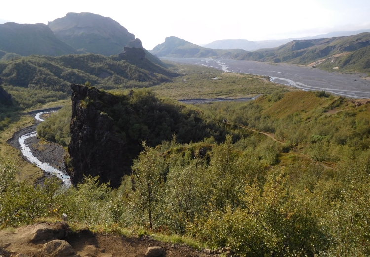
and soon I reach the Seljalandsfoss, one of the famous waterfalls of Iceland. The water
falls from old sea cliffs down on the recent sedimentary coastal plains.
The itinerary continues over the sedimentary plain. So I have a wild mountain scenery
on the left and the Atlantic Ocean on the right hand. It is a strange landscape like this,
with a an endless sequence of waterfalls, dizzying rocky walls, glaciers, ice caps and
other highlights to the left and a boring, sedimentary plain to the right. Ultimately
you can only look at one side at the time, so it is great cycling here, the more so
with the wind coming from the backside.
It is an easy day today. And that is exactly what I am in need of now. Still, it alomst goes wrong
in the end. A heavy shower is nearly hitting Skógar, my intended final destinayion for today.
But I am lucky again. The heavy shower misses Skógar by a hair. Skógar appears
to be a place without people. Or rather, a place without permanent residents. There are
definitely people enough in Skógar. And they are all coming for one of the best
known waterfalls of the world. The Skógafoss falls down 62 meters. That is a big fall,
although there are plenty of waterfalls that fall down a lot deeper. There are also plenty
waterfalls with higher volumes of water. But there are almost no waterfalls that have
the aesthetic beauty of the Skógafoss.
Rarely have I set up my tent in such a beautiful place as today. The campsite of Skógar
lies right in front of the Skógafoss. The hundreds to thousands of hikers and tourists
must cross the campsite to reach the waterfall. Here are no gates necessary to protect
property. Iceland is a remarkably safe place in this respect. It seems like there is
no crime at all on the sparsely populated island.
In the evening I am going for a small walk. At the Skógafoss one of the most
famous treks of Iceland begin, the Fimmvörđuháls trekking. The first
part of the trek is passing by no less than 22 waterfalls. I am undergoing the first
waterfalls under a sublime aetting sun. A great end of a beautiful day.
Day 6: Skógar - Dyrhólaey - Reynisfjara - Vik - Kirkjubæjarklaustur 131 km
The weather is beautiful today. I am continuing eastwards over the Ring Road.
The road runs largely across the coastal plains. To the left there are stunning
rocks, waterfalls, glaciers and ice caps. To the right the landscape is for the
most part flat, but occasionally a lonely mountain rises up from the plain. All
in all the same ingredients as yesterday.
I am riding in the direction of Vik. There are special basalt cliffs at Dyrhólaey
and Reynisfjara. Both locations are six kilometers away from the Ring Road. So I
have to go go hence and forth twice if I want to visit these places. The cliffs of
Dyrhólaey are the first in turn. A wild coastal landscape of black volcanic
rocks and black beaches stretch out before me. Erosion of waves and tides have produced
weirdly shaped rocks over the course of years and centuries, like a steep rock pinnacle
in the middle of a wide black beach and a rock wall in the sea with large open holes
where the ocean water is flowing through. On the cliffs of Dyrhólaey I see some
puffins again. There are not as many as on the Vestmannaeyjar Islands, but the abundance
of the birds still adds up to the overall wildlife experience.
After my visit of Dyrhólaey I am riding back to the Ring Road. A short, steep
climb brings me on a plateau, from where I take the exit to Reynisfjara. I am going
down the plateau and reach the basalt rocks of Reynisfjara after six kilometers.
Behind the black beaches a rocky wall rises up. The basalt rocks are partly composed
of hexagonal pillars, like a kind of huge organ. A bit further three triangular rocks
rise up from the sea. On the other side I have views over Dyrhólaey, which is not
much further than a kilometer away as the crow flies. The holes in the rocks of
Dyrhólaey are, despite the greater distance, even better visible than in Dyrhólaey
itself.
I climb back to the plateau and the Ring Road and then further on to a small pass.
Then the Ring Road descends steeply to Vik, the only village or town in a radius of
fifty kilometers. But just like Skógar, Vik does not appears to be a normal village.
There are hardly any people that actually live here. I only ecounter tourists and
travelers, in huge numbers. The gasoline pump and the associated fast food restaurant
are trampled underfoot by the hungry tourists and travelers. I also belong to this
category after about 60 kilometers with moderate to hard wind. I am in doubt. It is not
too attractive to queue up here. The ambience of both the service personnel as well
as the clients is somewhere between stressed up and cranky. The intense aroma of
boiling fat is also far from attractive. And then the price level is also very high.
A fries with a hamburger costs EUR 20,- and that is as cheap as it gets. That is no
different than elsewhere in Iceland, but I am still not used to the excessive price
level. In the end I decide to join the queue, because there may be nothing else in Vik.
It turns out to be both a bad and a good choice at the same time. I receive the same
routine treatment as the other guests and the food is exactly as good or bad as
the smell suggested. Still, it was also a good choice, because immediately after I joined
the queue, there are dozens to hundreds of people standing in line. If I had not queued up
immediately, I might still have stood in line.
East of Vik, the road is clearly quieter. For day trippers from Reykjavik the action radius reaches
no further than Vik and the nearby cliffs of Dyrhólaey and Reynisfjara. It is
wonderfully quiet without all that traffic. In contrast, the wind has swollen from
average conditions to stormy weather. Again I am having headwind. That means hard work.
Even more so because the landscape is very open here. I am cycling straight to the
Mýrdalssandur, a forty kilometer long plain where the wind will be completely free,
followed by the Eldhraun, just as flat, with the only difference that mountains
will be in the north again.
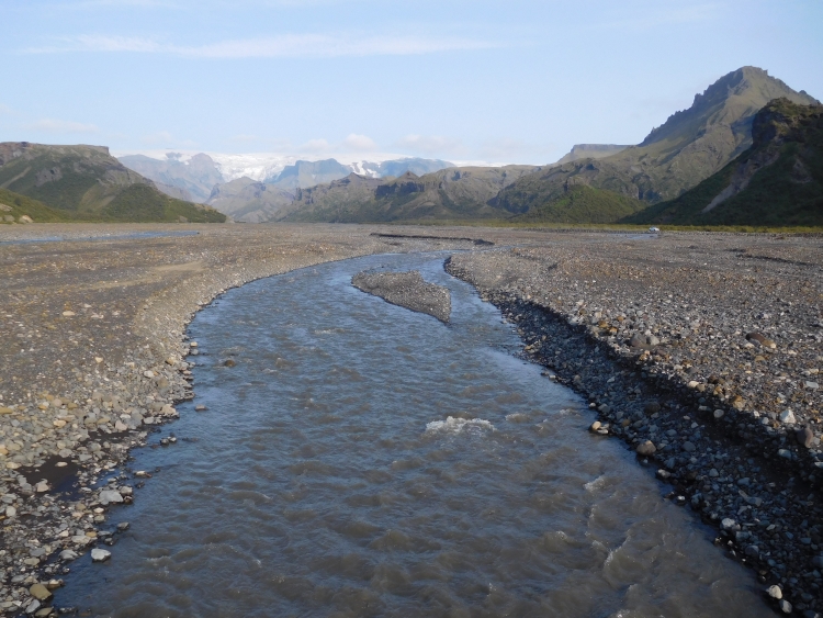
After ten to fifteen kilometers, I reach the Mýrdalssandur. I cross a wild, dark gray
stone filled valley filled with braiding rivers. The ash gray colors of the barren river valley
will be the most cheerful view of the coming hours. After the river follows the Mýrdalssandur,
one of the gloomiest landscapes in the world. A sandr or sandur is a kind of dump site of
glacial waste material, which has been left behind by the rivers over the centuries, coming
down from the mountains and dumping the stones recklessly between the mountains and the sea.
The stones and blocks are often covered by a gray-green moss species, but sometimes the
they are as bare as the moment they were dropped and abandoned there. The mountains and
ice caps are far away from the sandur and most of the route the views are limited to the
endless plain and the endless road that is leading to the diffuse horizon and the gray
clouds which are growing quickly and threateningly. The wind is punishing the landscape
almost permanently and so it does right now. I am having counterwind and I want to cross
the plain as fast as possible. I put myself mentally in the time trial mode. And so
I am bending myself in an awkward, aeroodynamic position and I begin to contribute
power so that I can ride as fast as possible without exhausting myself. I must keep
this pace for the next three hours.
After three hours I am still going strong as I leave the sandur behind me. I am
glad to find myself in an excellent shape today. It has not been done yet, though.
after the plain of the Mýrdalssandur, the plain of the Eldhraun follows, which is
essentially the same landscape, but with mountains on the north side this time. Pretty soon
there is nothing to be seen of the mountains, however, beacuse of a series of heavy showers,
which are chasing b. I wonder how it would feel to be inside such a shower. That must
certainly be quite a hellish experience. I might easily have vbeen in the middle
of such a shower in the Mýrdalssandur. Then I could have been in the rain and
storm for many hours. If I look back, I see that the weather is actually horribly
wrong there right now. Actually, I find myself in the only place where it does not
rain now. This luck cannot last forever this way. Fortunately, I am almost in
Kirkjubæjarklaustur. Just before reaching the unpronounceable village, I am cycling
in the back of the shower. The road and the landscape are covered with loads of water,
but the rain itself has just stopped. I am cycling to the campsite with an indoor
kitchen area. And so I ride back to the supermarket, where I am able to buy the ingredients
of one of my specialties: pasta with pesto. This time I avoid the tasteless Icelandic
pesto, which brings me the only alternative: Jamie Oliver pesto. As if the guy himself
has personally invented the pesto. The Italians should be grateful to him. While it is
raining outside, I am eating my pasta while talking with a senior lady from Oregon,
who is walking and trekking in Iceland. I met her shortly before, while she was washing
and drying her clothes in the laundry room. This costs EUR 12,- at an average of one and
a half hours of drying. But because she was impatient, she threw in extra coins. A
capital mistake, because of course it only took longer as she was buying more drying
time that way. Meanwhile I was plaguing her with another capital mistake, with the fact
that her people voted massively on Trump. But my state has voted against Trump on a
massive scale! So 'the others' are to blame? I ask vilein. Yes!, she resists, we
really could not do anything about it!
Day 7: Kirkjubæjarklaustur - Skaftafell 55 km
After the desolate landscape of the Mýrdalssandur of yesterday, I am cycling through
much more idyllic landscapes now. The Ring Road runs along a series of elongated mountain
ridges. Waterfalls tumble down from the cliffs and continue headlong towards the ocean.
The slopes are dominated by bright green grasses, so green that I think I have ended up
in a dream or I have just entered paradise. At the foot of the cliffs are a few farms.
It is completely windless, what contributes significantly to the paradisiacal feeling.
I am riding over Dverghamrar to Núpsstađur, the oldest turf houses in Iceland.
The houses date back to the nineteenth century and have a roof of peat, where grasses
and plants grow. The cultural and historical value of these rare houses are praised
unanimously in Iceland, but the houses have been sold to private ownership. A large
fence must keep the interested people at distance. The turf homes are not even
visible in the distance from outside the fence.
Just beyond Núpsstađur I reach a new high or low point: the Skeiđárarsandur,
the largest sandur of Iceland. A new desolate, icy, windy plain stretches out before
me. I am cycling from paradise into sheer hell. The windless conditions of the first hours
was caused by the lee side of the mountain ridge. Now I have passed the mountain ridge
the lee side conditions have gone, and I am confronted by brutal headwinds again.
The Skeiđárarsandur is populated by, Greater Skua, one of the bigger birds
of prey in Iceland. Life is harsh and difficult in these barren plains and it is not easy
to survive here. The Greater Skua are constantly under pressure and they absolutely do
not like any animal or human invade their territory. People who do, are treated by
reckless divebomb flights where they just will or just won't kick you with their claws.
The aim of of this behavior is to hunt you away. So their motive might not be bad, but
I do not think that it is a good idea to have a collision with a big bird of prey
while cycling. There is not too much that I can do to reduce risks, but I can at least
put my helmet on. Maybe it helps. Fortunately the nasty animals reign in absentia
and soon I stop my fight against the absent birds and I am focusing on another relentless,
but altogether more prominent foe, the never revoking counterwind.
Unlike the Mýrdalssandur, I am not in an empty landscape now. I am cycling
right towards the highest mountains of Iceland. Behind the mountains lies the largest
ice cap from Iceland and between the peaks the glaciers slowly flow downwards, more
or less all the way down to the sandur. A crazy glacial landscape lies before me, cold and
dismissive and at the same time imposing and majestic. Because of the dark gray to
black cloud deck, the ice masses look excessively grim, an effect that is reinforced
by the howling icy wind. It is blowing even harder than all the previous days.
With all possible efforts I crawl with no more than twelve kilometers per hour
over the huge plain. While the mountains in the background were a nice point of view
initially, after two hours of cycling I do not seem to have come anywhere closer.
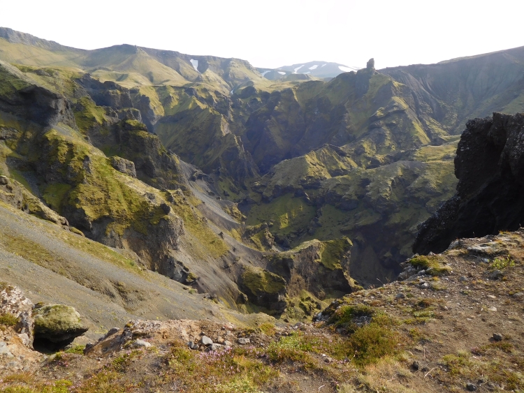
At the end of the long plain is Skaftafell, one of Iceland's most important natural areas.
Sheltered between two large glaciers there is relative protection against the daily
storms, which provides the constraints for the large area where trees grow in the midst
of the starkest landscapes of Iceland. Apart from the forest of dwarf trees, the area inhibits
the Svartifoss, a waterfall that is descending from basalt cliffs. And of course there are
views on the glacier and the ice caps. I set up my tent in the campsite and I walk to
the Svartifoss. An easy walk, but also the beginning of a more challenging long trek. I
have enough time and therefore I continue. It starts to rain soon, though. After the first shower
follows a second one and now the whole area of the trek is suspended in clouds. The wind,
however, comes from the other side and there the weather looks even worse. This is
definitely going to go wrong. I decide to turn around. Back to the Svartifoss three
young girls ask me whether they follow the right route for the long trek. I answer them
that they follow the right track, but that they can better get back because there is bad
weather rolling in. Like young people are supposed to do, the young ladies ignore the
advice of the older and wiser traveler and continue on their way up. I am in a hurry down
now, hoping that I will be able to reach the campsite on time. I almost manage. I am no
more than five minutes too late but that is enough to make me wet to the bone. I am
dripping so heavily that I cannot even hide in my tent and so I am hiding under a
small roof at a barbecue spot. After fifteen minutes I see the young ladies pass by,
looking at me a little ashamed. But they really should not feel that shame. The
older wiser traveler has also returned too late and he is just as wet as the young
girls.
It has been raining for a couple of hours, but at eight o'clock it is finally dry. At least, below
at the campsite. There are several showers still, especially higher in the mountains, but I do not mind.
I take a short walk to the mouth of the Hvannadalshnúku glacier, which ends in a black lake,
full of sediments. The glacier almost reaches the sandur, an imposing view. The sun
and the showers provide an exciting light play and a rainbow arises right before me.
After an hour of enjoying the spectacle, a shower comes close and I rush back to the campsite.
It is bedtime meanwhile. Tomorrow I have to cover almost 140 kilometers to the campsite or
youth hostel in Höfn. And based on the permanent eastern storms of the last days, I assume
that I will have to fight against a stormy headwind again tomorrow.
Day 8: Skaftafell - Jökulsárlón - Höfn 138 km
There are 140 kilometers of headwind that lie before me. I must admit that I do not feel sure
that I am able to make it. To maximize my chances I get up as soon as there is light.
That is at four o'clock in the morning. I am rewarded for this craziness with a beautiful
sunrise over the mountains but punished at the same time with a biting coldness,
even though there is no wind yet.
The first twenty-five kilometers I am cycling to the southeast, around the chain of
high mountains. The same mountains that I was looking at all the time yesterday morning
while crossing the Skeiđárarsandur. Due to the absence of the wind, I am
able to cover these first kilometers fast and smoothly. Only a hundred and fifteen kilometers
I think. The moment that I turn around the cape, the northeast wind relentlessly blows in
my face however, as if it had been there all the time. Immediately my velocity falls down
to the usual headwind velocity. The first hour went so well, but the second hour I am not able
to cover more than ten kilometers. In addition, the landscape is becoming more and more open.
I am cycling on a big, open plain. Right to me are the plains and the ocean. To my left I see
the plain, which gegin to rise after a few kilometers, up to the high plains. Both the plains
and slopes are covered with ice of the Vatnajökull, the largest ice cap of Iceland and
of Europe. Dozens of kilometers stretching out to all directions.
Curiously, in this ultimate open landscape the wind seems less difficult than at the cape.
I am making progress fairly well now and at half past nine I reach the famous Jökulsárlón
ice lake, usually referred to simply as 'the ice lake'. The glacier ends in a large lake near
the sea. Everywhere in the lake dozens of icebergs are floating, which are reflected beautifully
in the water. I am lucky that the sun is breaking through the clouds now and then. I am able
to see the ice lake both under grim, gray conditions and under heavenly blue conditions. Both faces are
equally mpressive, but provide a radically different atmosphere.
The last eighty kilometers to Höfn I cycle in alternating sunny but more frequently gray
and rainy conditions. Despite the sometimes rainy and gloomy weather, circumstances are never
grim today. The wind is hesitant, which makes me progress much faster than the days before.
The landscapes are impressive yet just a little less impressive than the extreme landscapes
of the last days. Very far from impressive is the small town of Höfn, the first 'real'
'town' in four days. In my imagination this was an enchanting little place, but there is
nobody in the streets and there is nothing to see. Where are they, the Icelanders? Wherever
I come, there are people, but these are always tourists. The people who are in the hostels,
campsites and restaurants come from the Netherlands, Poland, Italy, Spain, the Czech Republic
and all other European countries. Except from Iceland. It is well-known that Iceland is
very sparsely populated, with only three hundred thousand people living in the country,
most of whom live in Reykjavik. But if I come in one of the few villages where people actually
live, I still do not get to see any residents.
There is nothing to see and there is nothing to do in underwhelming Höfn, but
there is a supermarket with many tourists. After the visit to the supermarket I walk
back to the hostel, where I prepare a meal of pasta with Jamie Oliver Pesto.
Day 9: Höfn - Djúpivogur 105 km
The southern part of the Ring Road between Hella and Höfn leads almost completely
across large sedimentary plains between the mountains and the sea. From Höfn on
in Eastern Iceland, the Ring Road also leads between the mountains and the sea, but
everything else has changed. The sedimentary plains are largely absent and the mountains
often reach all the way down to the sea. And the sea reaches inland in the valleys between
the mountains. The Ring Road passes along the rugged coastline with all its bays, capes,
fjords and cliffs, sometimes far below and sometimes high above the sea. Different from
the previous days, there are regular climbs and descents. The hardest climb takes place
after a few kilometers. The Ring Road leads through a tunnel here, to avoid a long detour
around a cape with six hundred meter high rock walls. But there appears to be an alternative
to the tunnel. I see a dirt road that steeply crawls its way up to a narrow passage
between the rocks of the cape and the continuation of the same mountain range inland.
The road is not tracked and is hardly possible to cycle, but it is definitely more fun to do
than the tunnel. I have to stop three times to grasp for breath, but in the end I reach
the pass. After a similarly steep descent, I am on the Ring Road again and I can continue
my way.
Today is a gray day. The sun does not come through, but there are no heavy showers either.
The mountains are partly in the clouds. Long elongated clouds cling to the higher
parts of the mountain peaks and obscure the views. The heavily cloudy weather also
cause the contrasts in the landscape to be eliminated and are also the reason that
all colors tend to be medium to dark gray. The sea is just as gray. Not a single
trace of blue can be found in the ocean. The gloomy color palette is not really
beneficial for the landscape, but the result is
still impressive enough. The huge scree slopes are the most impressive feature here.
Below the rock walls, which are largely obscured by clouds, hundreds of meters high
slopes of rocky blocks can be found. Those uge boulders have fallen from the rock wall
once and are lying on these giant slopes ever since. The blocks are lying here at the
maximum angle of inclination. If the slope becomes too steep due to fresh new boulders,
gravity will cause a few blocks to tumble down. Everywhere in these surroundings,
mountain ranges with these boulder slopes can be distinguished, usually a few hundred
meters high and up to a few kilometers long.
Except for the scree slopes, today's route is dominated by another geographic phenomenon,
the lagoons. At various places a little bit off the coast are narrow natural barriers
in the sea, which protect the coastal areas against waves. These lagoons are an ideal
habitat for whooper swans, which live here in high numbers. Gracefully the animals
slide through the calm lagoon water, the silhouettes beautifully reflecting in the
water surface. Iceland is a great place for birdwatchers. Traditionally there were
no land mammals in Iceland other than the arctic fox and so there are only a few
natural enemies and there is little competition for the various bird species. The
supply of food in the rivers and seas on the other hand is overwhelming. Especially
in the coastal areas there are birds everywhere. Against the cliffs, in lagoons or
in the tidal areas. Everywhere I go, i am cycling with the background music of a
concert of bird sounds. The most common birds in the coastal areas are swans, ducks,
geese, northern terns, gulls and kittiwakes. On the cliffs there are also species
like razorbills, cormorants, guillemots and sometimes also puffins. These are mostly
species which are only highly abundant in Iceland or only occur in arctic areas.
During the afternoon, the sun peeps through the cloud deck for the first time and after
a little while the sun is getting more space. There are clouds that are still lingering
against the higher mountain flanks, but the landscape gets a significant color injection
by the sun and the fast growing patches of blue sky. The Hamarsfjördur, just
before Djúpivogur, is magnificent. The all-encompassing gray in the landscape
seems to melt away by the sun. The sky is blue again, the clouds are white and the
grass green. The sea is transformed from a gray pool into a sparkling, deep blue
water mass.
Djúpivogur seems to be a rather enjoyable village. There is life and activity
around the small harbor with a small cafe and a hotel with restaurant. The campsite
is located on a hill above the harbor. From my tent I have beautiful views over the harbor,
the fjord and the mountain ranges on the other side of the fjord. I am undergoing a brilliant
sunset, which is soon broken down by invading sea mists.
Day 10: Djúpivogur - Öxi - Egilsstađir - Seyđisfjörđur 114 km
Today I want to reach Seyđisfjörđur in the area of the eastern fjords.
Iceland has got two coastal strips that are dominated by fjords: in the east and in the
northwest. In addition to these two major areas, there are also some fjords in the north.
I am starting early this morning with the first fjord of today, the Berufjördur,
in the dense fog. The whole landscape is suspended in a thick cloud soup. Because
of the absence of wind, it looks like I will continue to cycle through the mist for quite
some time more.
The eastern part of the Ring Road has much less traffic than the western and southern
parts. The logical explanation is that this section is far away from Reykjavik. There is
so little traffic here that this part of the road has not been paved yet. The Ring Road
continues to snake around the fjords and will eventually pass through a long tunnel that
leads ultimately to Egilsstađir, the largest village in eastern Iceland. But there
is also an alternative route. From the mouth of the Berufjördur is a direct unpaved
route to Egilsstađir. The distance from the place where the routes divert until the
place where they convert again is nineteen kilometers over the shortcut road and one hundred
kilometers over the Ring Road. I decide to take the shortcut. I am sorry to miss the
beautiful fjord landscapes, but I want to avoid the long tunnel. I will pick up the
fjord landscapes later on today when I plan to ride to Seyđisfjörđur.
It is soon becoming clear why the Ring Road doe snot follow the shortcut. The direct
road is terribly steep. You cannot let all traffic go up here. Presumably cars with
two-wheel drive will have severe difficulties here under wet conditions. And for
myself it is also not easy. I am hardly able to conquer the long pieces of 20 % gradient.
It is raining gently now, which makes the road a little slippery. The higher I come,
the harder the rain gets and the more slippery the road is.
Eventually the road climbs more than five hundred meters high, to a small highlands,
the Öxi. For a few kilometers, the road crosses the cloud-covered landscape. Then
suddenly there are holes in the clouds and I am leaving the dense clouds behind me.
I have clearly reached the lee side of the mountains now. Moreover, there are stormy wind
conditions, out of the blue. In a few seconds the wind accelerates from zero to a
raging storm, everything seems possible in Iceland. This time I am enjoying tailwind, though.
On the steep descent with the heavy tailwinds I have difficulty braking hard enough.
After reaching the Ring Road, the descent is less steep and the road is better. A little
further down the road is even asphalted again. I find myself in an elongated valley
now, with some large elongated lakes. It is ultra easy terrain, especially with the
current storm from the back. With forty kilometers per hour I am flying over the
asphalt. In no time have I have covered the fifty kilometers from the Öxi to
Egilsstađir.
I drink some coffee in Egilsstađir and then I start the final climb between
Egilsstađir and Seyđisfjörđur. The climb leads over a wide slope
up with wide hairpin curves. The road is continuously increasing with 10 %, but
the road is asphalted and the climb might be quite demanding, it is significantly easier
than the Öxi. The pass is located at more than six hundred meters high. Upstairs
I find myself on a new highland area with large lakes. There is still a lot of snow in the
beautiful arctic landscape.
After about ten kilometers the road descends steeply to the town of
Seyđisfjörđur at the mouth of the eponymous fjord. The fjord looks very
much like a quitessential Norwegian fjord. It is a relative - for Icelandic terms - friendly
landscape with a significant proportion of grass and flowers relative to stones, snow
an ice.
The village of Seyđisfjörđur is idyllically located on the fjordside
and is remarkably lively. In the Icelandic context, you might even call the village
with 650 inhabitants exuberant or ecstatic. Everywhere are people. The cafes are
fully occupied despite the fast-deteriorating weather and the place is vibrating
energy. Next to the cafes and the restaurants there are also a lot of artists in
the village, who also organize workshops and all sorts of activities. Once in a week,
it is even more crowded here, as the ferry from Denmark and the Far Oer Islands arrives.
It is the only shipping link between Iceland and the European mainland. After a
couple of hours of suspension, it ultimately goes completely wrong with the weather.
The rain is pouring out of the sky, and that it looks like theis is not going to
improve during the rest of the evening. I run back to my tent and go to sleep, hoping
that the weather will be better tomorrow morning. The weather forecasts for the coming
days are in any case no good at all. Tomorrow it will be fluctuating, but tomorrow
and the day after tomorrow it is going to be grim. Or even worse than grim.
Day 11: Seyđisfjörđur - Egilsstađir - Möđrudalur 123 km
It has rained the whole night, but when I wake up in the morning it is dry. That
does not mean that the weather is beautiful. It is heavily cloudy and it is very
cold. The temperature is just above zero degrees, but because of the wind it feels
much colder. Initially that is not really a problem. I am cycling myself warm on
the climb to the pass. The first 25 kilometers to Egilsstađir are the same as
yesterday. This means that I first have to climb to six hundred meters altitude and
then I must cross the small highland area before descending to Egilsstađir. At
the end of the climb it is raining lightly. The shower only takes a short time, but
as a result I am wet as I begin with the descent. With the cold temperature and the
hard wind the descent is terribly cold. When I arrive in Egilsstađir, I want to
warm myself in the same cafe where I drank coffee yesterday. The cafe is still closed
however and I have the choice to sit down in the dreary cafeteria of a gasoline pump station
or to cycle into the uninhabited area of two hundred kilometers that lies ahead of me.
The choice is easy. I step into the cafeteria, where I am being helped by a puber. I order
a coffee. I am looking curiusly to the cake that looks like an artificial sugar bomb. Not
a very attractive choice beforehand but I like to eat something and I do not see anything
better. I ask if it is a chocolate cake. The waiter lifts up the cake, looks boed and
uninterested, thinks a moment what to say, and answers: "Yes, that's a chocolate cake."
I ask about the other pie. The puber repeats the process and comes to the conclusion:
"That's also a cake." I had also jumoped to that conclusion, so I ask if he can also
tell me what kind of cake it is. Again he picks up the cake to take care of everything.
"This is not a chocolate cake." I pay for a coffee and a chocolate cake and I sit down,
hoping that the weather will be improving.
The northeast of Iceland is even more sparsely populated than the rest of Iceland
and between Egilsstađir and Mývatn are no cities, no villages and no settlements.
The area is not only uninhabited but the area is even essentially uninhabitable. This
part the island consists of vast dark-brown lava plains, a bare and weathered landscape
where almost nothing grows and where wind, rain and snow punish the landscape. Only two
farms are in this area, Skjöldólfsstađir, and Möđrudalur. In
recent years, both have been upgraded with touristic facilties such as hotel rooms and
Möđrudalur has also got a campsite.
Just beyond Skjöldólfsstađir, an interesting alternative route to
Mývatn begins. The inland route passes the Askja volcano and the Herđubreiđ
tableberg over a series of different unpaved F roads with many river crossings. With
the grim weather forecast for tomorrow and the day after tomorrow in mind, that route
is not an option. I would need to spend four consecutive days in uninhabited areas
without the possibility of warming myself up. The river crossings might become unmanageable
obstacles with the expected rainfall and also the way back could be cut off. My GPS is also
broke, which adds a little bit more to the risk profile of the Askja route.
The Ring Road between Egilsstađir and Mývatn leads through a boring landscape.
The road leads to Skjöldólfsstađir through a valley that is cut in the
lava plateau. I am cycling against a stormy wind, but I am still moving forward, although
a bit slower now because of the accelerating wind. What is worrying me more now is the
ever increasing frequency and intensity of the showers. I have already undergone two showers
at th time that I reach Skjöldólfsstađir. I am going inside to hide and
so I miss the third and fourth shower, whiche are both much more intense tha the previous
ones.
After the showers I am continuing again. Everywhere around I see new showers developing
and it is clear to me that the weather will develop from bad to worse today. And then
I must consider that the forecasts for today were relatively good in comparison with
the forecasts for tomorrow and the day after tomorrow. I am passing the exit road
to the Askja and I decide not to go there. Four days in the wilderniss and solitude
would be miserable at best, but could also bring me in serious trouble. A little further
down the road, I can temporarily leave the Ring Road for a forty kilometer long dirt road
across Möđrudalur. I leave the Ring road and at the moment that the asphalt
is replaced by dirt and gravel, the landscape immediately becomes much more interesting.
The surroundings consist of volcanoes and lava plains. The mountain ranges are much higher
than expected. The road runs at perpendicular angles to the mountain ranges, which
means an alternation of steep climbs, steep descents and wide, flat valleys. The
weather is horrific now. The wind has developed to a storm and the showers follow each other
at breakneck velocity. The icy rain pours down from the pitch-black sky and is insanely
cold.
The elements are not advantageous today. The weather is getting worse and worse. The wind
velocity is increasing and the showers follow each other up faster and faster. I am
faced with a phenomenon that I did not know before today and which I would call cluser
showers because of the great collateral damage that these showers produce. Because it
used to rains softer at the edges of the showers than in the center, the drops there
are so small that the storm drives the spray of fine rain nearly horizontal over the
landcape. In the center of the shower the drops are much larger and the rain falls
more vertically, despite the hard winds. Thus it happens that while being fully hit
by one shower the horizontally driven spray from the next shower is already hitting me,
providing a kind of trailer for what is yet to come.
The cluster showers and the storm cool me down to the point that even the exercise
of the sometimes rather steep climbs is not warming me up at all. All my clothes
are completely soaked and do not provide any protection against the rain and the
wind. Because of the cluster showers it is never dry and there is no chance to dry
up or to get myself warmer in any way. Despite the grim weather conditions, the landscapes
are phenomenal. I cannot make a lot of pictures in the hard rain, but at least I am
enjoying the scenery while cycling.
After many hours of cycling against the wind and the rain, I finally reach the plains of
Möđrudalur. There is a campsite and there is also an indoor area with a
fireplace. It takes me an hour to get a little bit warm again. I quickly go outside
to set up my tent. It is dry now, but the wind is still hard and it is terribly cold,
even without the cluster showers. After setting up the tent I hurry back inside where
I can have a shower. In Möđrudalur there is also a restaurant, where they
serve the mysteriously sounding moss soup. The soup indeed contains moss and it turns out
to be very nice.
Day 12: Möđrudalur - Mývatn 77 km
It was bad weather yesterday, but regarding the forecasts it would be even worse today.
When I wake up at 4 o'clock, it is dry, however. I decide it is all or nothing today.
I pack my gear to go on my way for the remaining eighty kilometers to Mývatn.
After twenty minutes I have packed the soaked tent and the other soaked belongings and
I am ready to leave> At that time however, it starts to rain terribly hard. No cluster
cluster showers this time, but a long, uninterrupted shower without end. I have gambled
and I have lost. It is not an option to return to my tent again. Everything is wet,
including myself. Waiting for the restaurant to open is also not a preferrable option.
When will the doors open? At eight o'clock? Nine o'clock? Ten o'clock? I will have to
wait at least 4 hours. Well yes, Well, during these time periods I must have covered most
of the kilometers towards Mývatn.
And so I am riding the last gravel kilometers to the Ring Road in the rain. On the
Ring Road I have asphalt under the wheels again, but that does not stop the icy rain
drops that are still hitting horizontally against me, driven by the freaking wind.
It is possibly even colder than yesterday. I am continuously cooling down and after
an hour I am so cold that I wonder how long you actually survive this. The scenery
on the road is ultimately boring, but the fact that everything is in the clouds
does not help of course. But it does not matter if the landscape would have been
beautiful with good weather or not. The only thing that matters is that I must survive
this, preferrably by covering the distance quickly. The strategy is simple: move on.
If I stop now, the cooling process will only go faster.
Under these circumstances, it usually it would not come up in your mind to cycle even
a hundred meters, but eighty kilometers like this is incomprehensible. This is the
superlative of miserable. How can people survive in this landscape? The hard answer
is that they cannot, and that is the reason that nobody lives here and that I am riding
in a completely deserted highland landscape here. I pass the exit to the Dettifoss,
the waterfall with the largest volume per second in Europe. I am not really surprised
that here is a waterfall with so much water here. How spectacular the waterfall might be,
under these ruthless rains I do not feel like cycling fifty kilometers extra in
order to visit a place with more water.
Some twenty kilometers before Mývatn, I have an unexpected piece of luck. It
has stopped raining. During a short period of time the sun is even shining. It is
enough for an upgrade from extremely grim circumstances in favor of 'normally' grim
circumstances and a while later the circumstances are ugraded further from grim to
naughty. Good enough in each case to give myself a detour of a kilometer to visit the
volcanic landscape of Hverir.
Hverir is one of the bizarre volcanic landscapes in the vicinity of Mývatn.
The landscape boils and bubbles on all sides and heaps of smoke and bubbling, viscous
chemical juices are popping up from the depths of the earth. The colors in the landscape
are just as bizarre. Rocks are orange, pale yellow and turquoise and the water has
the color of ice.
At twelve o'clock I reach the campsite of Reykjaliđ, the tourist settlement
on Lake Mývatn. Between two showers I put my tent up and between two other showers
I run to the facilities area for a hot shower and subsequently the rains seem to quit.
At least below at the lakeside. There are several showers higher in the landscape,
but here it is dry. I decide to use the unexepected opportunity to go hiking a bit.
Through one of the few forests of Iceland I will first walk to Grjótagjá and
then to the volcano of Hverfell. The forests of Iceland usually consist mainly of
dwarf birches, and that is also the case here. The trees are never more than three meters
high, but together they form a fully green deck. After half an hour I reach Grjótagjá,
where the cracks show how the earth splits apart. Like Þingvellir, I find myself
on the line where America and Europe drift apart again. In some of the cracks are
pools with deep blue water.
Because it is still dry, I want to continue from Grjótagjá to the Hverfell
volcano. I am not able to find the right way however and I have to backtrack fifteen
minutes. In second instance, I find the right exit and half an hour later I reach
the grim black volcano of Hverfell. It is a classic stratovolcano, with steep slopes
and a perfect cone shape. A path leads up to the crater rim. From the top there are
nice views of Lake Mývatn and the surrounding large and small volcanoes. Everywhere
are showers in the landscape, but for now I am lucky. Even without rain it is cold
enough. The temperature is still just above zero degrees and the wind is still blowing
fiercely. The dwarf forests provide shelter on the way back. It takes me an hour to walk
back. I am happy that I could carry out this nice afternoon program in dry consitions
on this day that had started so unrelentlessly grim but ultimately had a happy end.
Tomorrow will be another bad day, but after that the weather conditions should slowly
improve. Unlike last night, I am at least in a place where I can stay for a day, even
though there is nothing much to do here in this settlement in bad weather.
Day 13: Mývatn - Laugar - Gođafoss - Akureyri 106 km
The weather forecast for today was bad and that is how it turned out to be. It is
raining while I am lying in my tent. At nine o'clock, I get up, not because I have
all kinds of plans for today, but because cannot sleep anymore. I am strolling to a
cafe where I have all the time of the world for a coffee. In the meantime I study the
map, in the absence of real landscapes. After an hour I walk back to the campsite,
thinking about what I could do today. It is dry now, but it is still bitterly cold,
the wind is stormy and there are several showers in the landscape. I cannot think of
anything that I would like to do more than cycling. Then I suddenly get a brilliant
idea. Why would not I just go cycling? It is dry now and about fifty kilometers is a
possible overnight accommodation in Laugar. That is not very far away. That is
a risk that I can take.
And so I am leaving. It is many hours later than other days, but that does not matter
too much. I cycle along the Mývatn, the Icelandic freshwater paradise for
all types of birds. Especially all kinds of duck species are present in very large
numbers. After twenty kilometers I leave the lakeside and I climb to a plateau. I
am riding into the first shower now, but this one looks more threatening than it
actually appears to be. In the end, I reach the place of Laugar, the intended overnight
place, without a problem.
I had planned to cycle to Laugar's campsite, but the sun is shining and the weather looks
good enough to continue aal the way to Akureyri. Right after Laugar a climb brings
me to a small plateau. Once I reach the highland area I see ink-black clouds before me.
I have taken this scenario into consideration. I will not bacjtrack, but I will
continue to moce on. On the descent to the Gođafoss waterfall the shower breaks
loose. Just when it starts to rain really hard, I reach a large restaurant which is
overlooking the waterfall. Here I can hide until the rain is over.
During an hour it is raining very hard. After that the intensity decreases slightly.
The end is not in sight, however. I decide to move on and I obviously have to accept that
I will get wet by the rain. And that is what is happening now. It is not as cold as yesterday
or the day before yesterday, though. After half an hour it stops raining and a bit later the sun
is even appearing. The wind, however, is also appearing and it is headwind again.
The landscape is surprisingly beautiful here. I find myself in a wide valley flanked by two
mountain ranges with snowy mountain peaks. The partly cloudy weather and the traffic
lights ensure an exciting game of light and shadow and provide an extra contribution
to the northern feeling.
The last climb of the day is quite a difficult one, because I am cycling on a steep slope and at
the same time I must cope with the stormy counterwind. I am ultimately rewarded for the hard work.
The descent is beautiful. Far below me lies the Eyjafjörđur, an elongated
fjord that is part of the Northern Ice Sea. The idea alone that I am cycling along
the waters of the Northern Ice Sea, provides another contribution to the northern
feeling. After the descent I cycle southwards along the fjord, now with a raging backwind.
The bizarre clouds and the setting sun provide a beautiful apotheosis. The last twenty
kilometers to Akureyri feel like a heavenly gift.
I am riding into Akureyri. It is already late, but I am lucky and there is a bed for
me available in the first youth hostel that I try. Akureyri is the largest city
from Iceland after Reykjavik. There are more than 17,000 people living in the northern
town. Akureyri is also the first place after Reykjavik that actually has a center.
The center is small, though. It consists of a street and a square and that is about
it. In addition, there is also any activity along the fjord, so maybe I should be generous
and conclude that the center consists of two streets and one square. Whatever, it is
a nice place and there are even people on the street.
Day 14: Akureyri - Varmahlíd - Sauđarkrokúr 120 km
Last night seemed to announce good weather to come, and here is the confirmation: it
is a splendid day. The deep blue sky is reflected in the blue waters of the Eyjafjörđur.
The Ring Road follows the fjord to the north, to quickly turn westward to the mountains
and highlands of the Öxnadalsheiđi. I had actually wanted to make a detour
through the north. I would ride over Dalvík and Isafjđrdur, but I have reconsidered
my plans after being informed in the hostel about the long tunnels there. One of those
tunnels would have only one lane with only a handful of safehavens to pass each other.
I do not feel like cycling in those conditions and so I turn left to the Öxnadalsheiđi
instead of continuing north to Dalvík and Isafjđrdur.
After the exit to the Öxnadalsheiđi, the road slowly climbs. The landscape
is not dominated by volcanism or ice caps this time. The road leads through a beautiful
green valley, bounded on both sides by mountains with sharp, serrated rock walls. These
were carved out by glaciers during the ice age. The mountains are not only steep, but they
are also quite high. The higher mountains still have got a lot of snow. It is the most
alpine landscape so far in Iceland.
It takes a long time before the road starts to climb substantially. Only after twenty kilometers
the valley becomes steeper, but after three kilometers the valley climbs is nearly flat again.
I find myself between the most spectacular mountains so far. Rock pinnacles tower far above
the narrow valley. Eventally I reach the final climb. When I arrive at the pass,
the weather is still beautiful. There is no wind and I only have to descend and ride
through flat terrain to reach Sauđarkrokúr, the intended destination for
today.
It looks like it will be a piece of cake. That is the idea when I start the long descent.
But soon I find out that things do not always go the way I pictured them to be.
Agsin it is the wind that gives me a hard blow. And that wind is coming from the front
once again. And this time the wind is blowing harder than ever. From out of sheer
nothingness there I am confronted with a huge storm. Even on the steep parts of the
descent I have to deliver all my power to make a bit progress. I have to prepare myself
for a hard job to bridge those last forty to fifty flat kilometers. After reaching the
end of the descent, I feel that the wind is even harder here. The wind almost throws me
off my bike once in a while. It would be safer to stop now, but that is not an option.
There is no campsite or another place where I could set up a tent and where I would be able
to cook out of the wind. Moreover, it is still early. So even if I keep going slowly,
I should still be able to reach Sauđarkrokúr. And I am also in a good shape today.
It is the challenge to keep staying on the bike.
I find myself in a very wide valley flanked by high and wide mountains. I have been
looking at the same mountains for an hour or two now. I have the impression that the
road is a kind of conveyor belt that is moving in the wrong direction and that it moves as fast
as I am cycling and that I do have not progressed a single meter during the last two hours.
It looks like I am in the same geographical position as two hours ago in relation with
the surrounding landscape. Fortunately, it is only an impression, because in the end I
reach the village of Varmahlíd, the only sheltered spot in the wide area, between
the trees. There is also a cafeteria where I take a break before confronting myself with
the last twenty kilometers of headwind. On the terrace I am sheltered from the wind.
I can feel the strenghth of the the sun now it turns out to be quite warm without the
wind. I enjoy the sun, but after a long rest I get on again, but not for a long time.
I pass the historic town pf Glaunbær, which looks so picturesque, that I park
my bicycle to take a look. I stroll along the turf houses and the picturesque church
and I am making a few pictures. Then I move on again.
After an hour of ver hard work, I have also traveled the last fifteen kilometers
and I have reached Sauđarkrokúr, which is a very nice, small town with,
for the first time, more Icelanders than tourists. It is one of the few villages and
towns of Iceland that are quite far away from the Ring Road. The campsite is beautifully
located on two levels. There is a lower level adjacent to the village. Immediately
behind this part of the campsite lies a steep slope of about forty meters high. Above
the landscape is flat again. There is the upper level of the campsie, with views
over the town and over Skagafjördur, the wide fjord behind the town. The center
has a few picturesque houses and a beautiful church. There is also a budget restaurant,
the first one that I have ebcountered in Iceland. For the price that I would otherwise
have to pay for uninspirational fast food, I am having a nice meal here. What they
offer is essentially fast food as well, but here it is original and very well executed.
And so I can look back to a beautiful day, which was tough because of the storm,
but which brought me in beautiful landscapes.
Day 15: Sauđarkrokúr - Blönduós - Hvammstangi 111 km
Today should not be a special stage beforehand, but in reality the landscape proves to be
rather enjoyable so far. The fifty kilometers between Sauđarkrokúr and Blönduós
are leading through an area with quite low, gentle hills, but the round mountain shapes
have their own charm and as a result of the striking lights and the mysterious fogs,
the landscape is enchantingly beautiful actually. The wind has also lied down, so
cycling takes far less effort than yesterday afternoon. Before I have actually realized
it, I have covered the first 50 kilometers through the hillside area. I have reached
the Ring Road again and a little bit later I reach Blönduós. The small town
is not very inspiring; the most beautiful part of the stage is behind me now.
The first kilometers after Blönduós are still beautiful. With the Northern
Ice Sea on the west side I am riding through an open landscape with lonely mountain
ridges. As the day proceeds, traffic numbers are increasing rapidly on the Ring Road,
and the fun is over. Because the road does not have a shoulder, I have to stay focused
on traffic all the time. The weather also deteriorates somewhat and left and right
a few scattered showers are developing. The showers luckily all miss me, apart from
an occasional rain drop here and there.
I turn off at a junction to go to Hvammstangi, the self-proclaimed seals capital of
Iceland. Eventually it proves that there are no seals at Hvammstangi, an expensive
excursion is needed to spot the sea mammals. In fact, Hvammstangi does not classify as
a capital at all. There is no one in the streets of the sleepy village and suddenly I
fall asleep too.
Day 16: Hvammstangi - Broddanes 108 km
I get up early today. I have to ride another 35 kilometers before I reach the junction
of the Ring Road and the road that leads to the northwestern fjords. Because of the
traffic I did not have a great time on the Ring Road yesterday, so I want to cover
the distance to the junction before it gets busy around ten o'clock. The strategy
works. It is still quiet on the road and I prove to be impressively fast. The reason
for the high velocities is the help that I get by a hard tailwind. For the first time
in my life I am not happy with the tailwind. After reaching the mouth of Hrýtafjödur
after 35 kilometers, I turn right to continue on road 68 and for the rest of the day
I will have headwind.
I am glad that I have left the Ring Road. From Blönduós the road was too
busy. On road 68 towards the northwestern fjords it is much quieter and it is great
cycling.
The northwest of Iceland is very sparsely populated. A look at the map shows that
the coastline is quite erratic. And that is an understatement. The area is a tortuous
whirl of fjords and together it looks like the scissors of a crab. The expectation
is that the landscape will become ever more spectacular. The mountains will be higher,
the fjords steeper and there is also an ice cap.
The distances are long in the northwest and there are almost no facilities. The only
place that might classifiy as a town is Isafjördur, three long cycling days away
from here. Today I want to reach Broddanes or Hólmavík and tomorrow I hope
to reach Reykjanes.
Road 68 runs continuously along the sea. That is alternately over asphalt and partly
over sand and gravel. The scenery is not really impressive yet, but it is nice cycling.
To the left side are rolling hills, on the right side is the sea. The hills are slowly
getting rougher and steeper. More and more, the road leaves the sea to rise over a
tortuous road to a plateau above the cliffs to descend doen to the coastline again.
The last climb is by far the hardest. With a brutal gradient of twenty percent the
gravel road winds up. The tyres have good grip on the road, which makes it possible to
not slip away and eventually I reach the top without problems and I descend steeply
to Steingrimsfjördur, the fjord abd the tiny settlement of Broddanes adjacent to
the fjord. The place is so beautiful that I decide to stay here in the hostel instead
of continuing to Hólmavík.
Broddanes turns out to be no more than a farm and a youth hostel. Except for me,
an American couple are the only guests. After a meal of pasta with pesto and tuna
I am talking with the American guests. They are traveling by car and they want to
explore the northwestern area in one day from here. I show them on the map that this
could prove to be quite ambitious because the distances are high and the traveling slow.
The Americans turn out to be nice people. She works in health care, he is a police
officer. When the sun goes down, I make a small walk through the beautiful surroundings.
During the walk I am chased away by Nordic terna that makes grueling divebombs to my
head. I am too close to a nest, apparently. It does not spoil the party and I undergo
the most beautiful sunset in Iceland so far.
Day 17: Broddanes - Hólmavík" - Reykjanes 128 km
While I am preparing my bike in the early hours, somebody else has left earlier than
me this time. The American police officer is going off for a run. And he is running
fast. I have left the building only a few minutes later, but I am not able to pass
him on the dirt road along the Steingrimsfjördur. That is partly because the
landscape is so beautiful and I am making a lot of pictures. There is a thick fog,
but the landscape is just as beautiful as at the moment that I arrived or much later at
sunset. And I am not in a hurry either. I might have to bridge some 130 kilometers
today, but I have started so early today that I should not have a problem to reach
Reykjanes today.
After an alternation of paved and gravel stretches, I reach the town of Hólmavík. From here
on, the route will remain paved. I turn off road 68 to visit the town. I am especially
curious about the Museum of Witchcraft and Sorcery. In the sixteenth and seventeenth
centuries, there were quite a few people who were put to death because of alleged
dark forces. The museum explains how difficult it was at that time in this foreboding
area. The very hard survival struggle could have played an important role in providing the
background in which the many prosecutions could have taken place.
After the special history lesson, I move on through northwestern Iceland. I am climbing
to an icy, high plateau with lots of snow. Here I first see the ice cap of the northwestern
area. The ice cap is located on the other side of the wide fjord that divides the
northwest into two halves. In the distance I can distinguish the dizzying cliffs of
Strandir and Hornstrandir. I myself will not go there. In that area there are no roads;
it is an area of pure wilderness.
After a long descent I reach the Isafjördur, not to be confused with the eponymous
fjord that lies much more westwards. From where I am right now, it is not further than one
or two kilometers as the crow flies to Reykjanes, the intended destination for today.
But because the long fjord is in the way, I have to ride forty kilometers around the mouth of
the fjord to reach the place.
Two hours later I have cycled around the fjord and I have reached Reykjanes, a beautiful
location again. In addition, there are natural hot springs where I relax the muscles
deliciously. And at the end of the day I am blessed with yet another phenomenal sunset.
Day 18: Reykjanes - Suđavík - Isafjördur 144 km
Today I want to reach Isafjördur. The largest village in the northwest is more
than 140 kilometers away. That is quite in windy conditions, but there is no alternative.
Between Reykjanes and Isafjördur are no settlements or campsites with the only one
except for the village of Suđavík, but that is so close to Isafjördur that
if I am there, I could continue for the last few kilometers anyway.
After two days of cycling in the northwestern fjords I am slowly reaching the wildest
part now. A look at the map shows how tortuous the coastline is. The road follows the
coast, which means that I will ride in and out of the fjords all the time.
There are so many fjords in this section that the idea might pop up that all of these fjords
might suffer from a certain interchangeability, that if you have you seen one, that
you have seen them all. Nothing proves less true. Each fjord has its own atmosphere
due to variations in rock types, mountain shapes and undoubtedly also a variations in
the pressure of the ice. The further northwest I come, the more powerful the erosion
seems to have been in increasingly higher and steeper walls. I am cycling into and out
of those large fjords, but these are essentially all small inlets in comparison with
the giant Isafjarđadjúp. On the other side of the megafjord are even more
impressive cliffs than where I am cycling myself and on top of that there is the ice cap,
from where the massive, icy Kaldalón glacier crashes down to just above the sea.
Meanwhile, Hornstrandir's tower-high cliffs also come in sight, in the far northwest
of Iceland. Hornstrandir is known as the most rugged wilderness in Europe, where nobody
lives and where arctic foxes
roam. The cliffs would be full of birds, including lots of puffins in the summer.
It should also be a beautiful area for trekkings. An excursion with a boat to the
area, however, is very pricey. Back and forth costs at least EUR 400,-. Only one boat
in several days will make the trip. I will miss the boat because it will be leaving
today; the next one will leave in three days. But nevermind, I do not have to pay the
huge sum of money anyway to spot an arctic fox. I have just seen a unit, from very close.
Inquiry at the quaint café in the Litlibær turf house learns me that the waitress
is not impressed at all by my observation. Arctic foxes are spotted here quite frequently.
Apart from arctic foxes, I also encounter sunbathing seals and throughout the route I
am enjoying musical accompanied by an orchestra of bird noises.
The further I get, the more impressive the landscape becomes. Every time I think
that the summum has been reached, the expectation in the next fjord is surpassed
again. The northwestern fjords are already one of the absolute highlights of the
trip, together with Landmannalaugar. The conditions are also favorable today. The wind
is blowing firmly, but it won't blow my head off. But whether these conditions will
last for a long time, I dare to doubt. There are dirty-looking high clouds that occupy
ever larger parts of the sky. According to the weather forecasts, the weather will
deteriorate badly tomorrow. Then it will remain bad for a week at least.
It will be bad weather tomorrow, but at least I can still enjoy the beautiful views
today. Certainly now the high clouds dissolve as quickly as they originated out of
nothing. It is early in the afternoon when I reach Suđavík. It is not far
fro here anymore. I cycle around the cape and reach the Isafjördur, the last
fjord of today with the town that is also called Isafjördur. Well, town, there
are about two thousand people living, you can only call this a toen in the Icelandic
context.
Isafjördur is a bit of a difficult town in terms of accommodation. There is a
campsite five kilometers from the city, but that is just a bit too far. There is
also a campground in town, but I cannot find it. There is also a campsite in the
harbor, but that could also be a place for campers. In the end, I cannot find a
possible overnight place. There is no youth hostel in town. In the end, I find out
that there is a place with sleeping accommodation, where I can stay cheaply, at least
on Icelandic terms. And I can eat fast food. In the supermarket is a Thai eatery stall,
where I can eat for EUR 10,-. The food is tasty and good and it is even cheaper than
my own cooking specialty of pasta with tuna and pesto mixed together.
Day 19: Isafjördur - Þingeyri - Dynjandi - Flókalundur - Stykkishólmur 128 km
The weather forecast for today were terrible, but when the sun rises I see that the
weather is still good. After 18 consecutive days on the bike, I actually could use
a rest day, but I will wait until it is really bad weather. Today I can at least ride
the fifty kilometers to Þingeyri. Part of the route is leading through a tunnel,
so there I will not be bothered with the rain anyway. The initial plan was to circumvent
the six kilometers long tunnel, but the old dirt road has become impassable because
of avalanches and erosion. I will cross the tunnel as early as possible, before the
traffic.
The sun is still very low when I reach the tunnel. I turn on my lights and ride
into the black hole. The tunnel is narrow, but it is illuminated. Civil engineers
have realized a special feature in the tunnel, a major crossroads right in the middle.
I go in the direction of Þingeyri and fifteen minutes later I am outside again.
The strategy worked. I was earlier than all the other traffic. I have been alone
in the tunnel all the time. I continue my way. After a few seconds, the relief that
I have passed the tunnel is completely overshadowed by much more powerful emotion.
There is a wonderful panorama right before me. The steep mountain cliffs are bathing
in the golden light of the rising sun, which are reflecting in the still, cobalt blue
waters of the Önundarfjördur.
I pass the fjord mouth of Önundarfjördur and climb up to the pass between the
Önundarfjördur and the Dýrafjördur. After three quarters reach the pass
and I descend to the Dýrafjördur. This fjord is also breathtakingly beautiful.
I am left speechless by the panorama of the long row of serrated mountains on the other
side of the fjord. One of those mountains is the highest one of the entire northwestern
fjord area. The peak is just a bit lower than a thousand meters high. Oon the other
side of the fjord I see the town of Þingeyri in the narrow strip between the
cliffs and the sea. In order to reach the village, I have to circumvent the fjord.
And that is not so easy. There was no wind at all so far, but now there is a heavy
storm going on. The ten kilometers to the mouth of the fjord take me an hour. The
ten Kilometer after the circumvention, I am riding with tailwind and these ten kilometers
take me only fifteen minutes. All in all, everything went pretty smooth today. It is
only half past nine and I have already traveled fifty kilometers. There is not a trace
of bad weather to be seen. The sky is deep blue. And it might continue to storm all day
long, I cannot believe that it will be raining today.
And so the choice is made quickly: I will benefit from the beautiful day and I will
continue. I have a whole day before me, after all. I am going to have a second breakfast
in the local hotel. My first breakfast dates from six hours ago and the road ahead
is tough. From here, the roads will be unpaved and there are three major climbs.
The climb to the first pass already begins in Þingeyri. An ultra-steep passage
leads up. After an initial gain of hundred meters elevation, the climb quickly becomes
gradual and then the road goes down and I lose almost all altimeters. So I can more
or less start over again on the long climb of more than five hundred altimeters.
But nevermind, the scenery is breathtaking rock pinnacles and cliffs all around me.
After crossing a valley I start climbing again. This time it is a regular climb, that
continuously goes up with a gradient of about 10 %. That is quite steep for an unpaved climb,
but not unusual in Iceland, where everyone has a car that is equipped for the rugged
terrain. This time there is no plateau upstairs. The road goes down immediately on
the other side.
The road ends in a new fjord, the epic Arnarfjördur, which is as breathtaking
as the other fjords of today. All is fine, but I also do have a problem. My rear brake
does not function anymore. With hydraulic brakes it is usually easy, they function or they
don't. This time however it is somewhere in between. The brakes sometimes function
and sometimes they don't. This was also the case during my short trip in Portugal last
year with Marco. I thought that I had solved the problem, but that seems to have been
temporarily now. After 15 minutes I have the brakes working again, but I know that
this is not the real solution. Presumably I need new ones, but they wull not have
them here. It will remain a bit of a fuss until the end of the journey.
Once down below a new challenge follows. The wind. I had ten kilometers of counterwind on
the way to Þingeyri, but now the real work begins: twenty kilometers of stormy
headwind over a road that is constantly climbing and descending along the wide fjord.
If you are making progess as slow as a snail, then it should be a beautiful landscape.
And that is definitely the case. The Arnarfjördur is as impressive as the
Önundarfjördur and the Dýrafjördur, which I passed in the
morning, but the Arnarfjördur is a longer and wider. Therefore the number of
imposing mountains in the panorama is also much higher. The most important highlight,
however, is Dynjandi's waterfall, which might be one of the most beautiful waterfalls
of Iceland. At least I cannot imagine that there many waterfalls which are equally
beautiful. From a distance of twenty kilometers I can already see the waterfall. Besides
beautiful, the waterfall is also high and there is quite a huge volume of water that
is falling down.
The storm rages like crazy in the fjord and picks up the dust of the earth. It idoes
not matter to me. Let the wind blow, I do not mind. It is so beautiful here, that I
do not experience a problem. And in the end, a little bit of wind belongs to the
couleur locale. Occasionally I am almost blown off my bike, but what is the problem?
If I fall, I will get up the saddle and continue again.
I have finally reached the Dynjandi waterfall. It is the ideal place for a lunch.
That is a late lunch. I see that it is already half past three. I need to hurry
to reach an overnight place. I have two options. I can ride south and stay in
Flókulandur. The most beautiful option will be the town of Bildurdalur however.
In both cases I have to cross two more passes, but in the second case I have to
continue for forty kilometers further to the Arnarfjördur afterwards, just to
reach the fjord where I am right now. I decide that I will be going to Bildurdalur
if I reach the exit to Bildurdalur before half past five. If I reach the crossroads
later, I will not try to reach Bildurdalur anymore but I will descend to Flókulandur.
Just after Dynjandi, the climb to the first pass begins. I have to clim five hundred altimeters.
I am starting to get tired after the long, hard day so far, but I still manage to
keep a good pace, despite the difficult road, the steep gradient and the wind. I
reach a wild and vast plateau full of lakes. Occasionally there is a big bite in
the highlands where a fjord reaches far inland. It turns out that the plateau is not
the highest point and that the road is still ascending. This way I will never reach
the pass. Certainly because there are also small downhills. Just as I begin to believe
that the road will keep on meandering like this infinitely, I eventually and unexpectedly
reach the pass.
On the rugged, steep descent, I am facing a new problem. The head set of my front
fork has wrecked. It is easy to fix with two wrenches of the right size, but I do not
have one with me, let alone two. And I really do not expect that I will encounter two
wrenches of size 36 anywhere in the northwestern fjords. I was actually planning
to ride another hundred kilometers back and forth tomorrow and the day after tomorrow
to Látrabjarg, the westernmost point of Europe (apart from the Azores) with
very high cliffs and tens of thousands of birds. With the wrecking in the head set,
that plan is no longer viable.
The road runs right along and very high above the mouth of a new fjord, the Suđurfiđir.
This means that the last climb of the day will be a lot shorter than the ones before.
And so I have completed the last climb quite quickly and I reach the junction.
It is seven to six now, too late to reach Bildurdalur today. Ii is later than half
past five and in that case I would descend to Flókalundur. And so I begin the descent.
I have also worked out a strategy for the head set. I will not go to Látrabjarg
anymore, but instead I will cross the ferry to Stykkishólmur on the Snæfallsnes
peninsula. There will probably be a car repair shop where I can use two wrenches. And even if
they do not have any wrenches there, the roads are paved on Snæfallsnes and that
is not so bad for the head set as these rugged gravel roads.
The road descends more than 400 altimeters to Flókalundur. I am not stopping,
but I carry on to the ferry, six kilometers further. The ferry leaves at seven
o'clock so I do have to hurry up. That is a piece of cake in this case. I have a
raging storm in the back and with more than 40 kilometers per hour I am covering
the last flat stretch. And so I suddenly leave behind the beautiful northwestern
fjords. But on the other side, I am going to an equally interesting area, the long
volcanic peninsula of Snæfallsnes.
Day 20: Stykkishólmur - Grundarfjördur 45 km
I am sleeping out this morning. Only at half past nine I am leaving, looking for
a garage to repair my bicycle. I find a car repair shop and there are two wrenches
of the right size. In a few seconds I solve the problem and without problems I can
pursue my way.
I do not have too many ambitions for today. I have not taken a single rest day this
trip yet and the last four days were long and demanding. The main reason however is
that I essentially have too much time. Even if I will be riding all around the
Snæfallsnes peninsula and make a detour to Reykjavik afterwards, I will still
have a couple of days left. Wherever possible, I will cover as little distance as
possible. That is a mindset that I am not really used to, as I usually want to do
as much as possible in a day. Today is an easy day to quickly pull the brakes. After
45 kilometers lies Grundarfjördur, where I could stay in the local youth hostel
and explore the surrounding area in the afternoon.
So I need to cover only a small distance today. And just right now that I really do
not need it, I am helped by a hard backwind. It is heavily cloudy today, but it
is probably not going to rain. Quietly I continue, surrounded by the black, purple
and wine red colors of the volcanic landscapes. Unfortunately, the powerful colors
are muted consiederately by the clouds.
The scenery is varied. Alternately I cycle along the coast or a bit further inland. I
pass cone-round volcanoes, rugged mountain ranges, vast plains and deep bays. The
higher mountains inland are veiled by clouds unfortunately. Surprisingly quick I see
Grundarfjördur before me on the bayside, against the background of the high
mountains of Snæfallsnes. Further in the distance I see the Kirkjufell already,
probably the most famous mountain of Iceland where nobody ever heard of.
I get a small room in the youth hostel and after a little rest I walk towards the Kirkjufell,
that may be called the Matterhorn of Iceland. Just like the Swiss mountain dominates virtually
every picture of Switzerland, the Kirkjufell is the postcard mountain of Iceland. In terms of
shape there are also parallels. Like the well-known Swiss mountain, the Kirkjufell also
has a distinctive pyramid form. Where the Matterhorn is surrounded by Swiss clichés
like cows, alms and a glacier, so does the Kirkjufell which is surrounded by volcanic
rocks, sparkling waterfalls and a rugged cliff coast. In terms of size the comparison fails
though, as the Kirkjufell is about ten times as low as his Swiss equation. While the
Matterhorn reaches to an elevation of almost 4,500 meter, the Kirkjufell has a modest
altitude of no more than 500 altimeters.
I am lucky with the weather. On the way the clouds have gone and by the time I reach
the waterfalls of Kirkjufell, it is even sunny. I am not the only one here. Dozens of
people with big cameras are fighting for the best places. The Kirkjufell is a nice
mountain, but I am glad that I do not have to experience these scenes on the rest of
Iceland and that I can cycle through these kind of beautiful landscapes in the much
more uplifting conditions of quiet solitude.
Day 21: Grundarfjördur - Hellnar - Arnarstapi 124 km
Unlike yesterday, today is not a good day for a short stage. Or I have to stop after twenty
kilometers in Olafsvík or after thirty kilometers in Hellisandur. I want to cycle
around the peninsula and it is clear that after Hellisandur there will be no suitable
overnight places until Arnarstapi and maybe that is also not a suitable overnight place,
considering some ugly stories about the campsite on the internet. So I am heading for
Arnarstapi in uncertainty, but I must take into account that I may have to continue after
Arnarstapi, even if that means that there will probably be nothing as well. I can worry
about how things could or should be, but I decide to focus on the here and now. Here
is the road 574 where I am riding high above the cliffs, with views over the deep bay that
extends miles ahead against the backdrop of the volcano and ice cap of the næfallsjökull.
Now is very early in the morning, with a rising sun that is throwing beautiful subdued lights over
the arctic landscape and the frosty morning mist patches.
I was planning to drink a cup of coffee in Olafsvík, but everything is still closed.
It is completely silent in the empty streets of the relatively big Icelandic village
of about thousand inhabitants. A little further down the road in Hellisandur I do not
encounter an open restaurant or cafe or petrol station either. As there will be not
a single hamlet in the coming ninety to one hundred kilometers, I must prepare myself
to rehab cold turkey from my coffee addiction.
After Hellisandur I enter the domain of the Snæfallsjökull. The volcano
is surrounded by extensive lava fields, but also small volcanoes pop up from the plain.
And the lava fields are surrounded by the ocean, which is eroding the lava and basalt
coasts to sometimes whimsical, sometimes strangely bizarre and sometimes downright
beautiful shapes. All in all enough ingredients to keep me busy for the rest of the
day, especially because if all the other things fail, there will still be gorgeous
views over the volcano and the ice cap of the majestic Snæfallsjökull. Now
it must be said, that the landscapes do disappoint so far. I am cycling over a bad
dirt road to the lighthouse of Öndvarđernes, but it is uncertain whether
or not this detour is actually worth it. The bad road and the hard winds make progress
very slow. On the way there is the beautiful beach of Skarđsvík with an
impressive basalt cliff, but after the beach, I am cycling through a landscape with a
lot of stones and basically nothing else. Then I decide to turn around. My adagio is
that if you do not feel like doing something, you should not do it. How many disasters
would not have been avoided for ourselves or for the whole world if we all convert to
this simple way of living our lives. The realist in me says that we are not ready yet
to make that step. And let's be honest, I was myself was apparently not ready anyway,
as it took me almost half an hour to finally decide to turn around.
Back on road 574 I ride north in the direction of Hellnar and Arnarstapi. On the way
I am passing a small solitary volcano in the middle of the lava plains. It is the
Hólahólar volcano. A footpath leads to the top. I cycle to the volcano
and walk up. I am rewarded with brilliant views of the lava plains, the surrounding
ocean and of course the Snæfallsjökull which rises far above the rest of
the landscape.
After the Hólahólar Volcano I take the exit to Djúpulónssandur, a beach
that is surrounded by freakish rock formations. On a viewpoint, I am eating some bread
and then I ride back up again to road 574, that still runs through the lava plains.
Eventually I reach the south coast of the island at Lóndrangar, where the most
bizarre rock formations can be found. One of the rock formations rises above all others.
Everybody sees something different in the rock sculptures, but I think it is a bath
duckling.
After Lóndrangar it does not take long before the road finally leaves the lava
field. I have finally rounded the peninsula and now I am cycling eastwards in the
direction of Borgarnes and Reykjavik. And of course Arnarstapi, the intended final
destination for today. Arnarstapi is a place where nobody really lives - almost no
one lives in the south of Snæfallsnes whatsoever - but there is a big tourist
complex where you can sleep for a few hundred euros a night in a refined log cabin.
Undoubtedly very romantic, but I prefer my own tent, especially when it comes to such
prices. The campsite also is not cheap. Twenty euros for a neglected lawn without
proper shelter against the wind and with the only facility an equally neglected
toilet room. Showers do not even exist, although when I suggest that I really have
to shower and I will otherwise will look for another place, there are showers suddenly,
but they cost ten (!) euros without warranty that the water will be hot. What to do?
I do not have to think long. It seems to me that it is a correct starting point not to
pay for a service that is not being offered. That the service is there, does not really
matter. Never have I saved so much money with a shower. That is why I really enjoy this
lovely hot shower for a long time.
Not everything is good at Arnarstapi, but not everything is bad either. There is a
stall where I eat the best fish and chips ever. And I meet the Italian cyclist Marco.
He does not feel like walking with me along the basalt cliffs, but tomorrow we will
cycle to Borgarnes together. And with the basalt cliffs we have come to the point why
there is this outrageous tourist activity in the middle of nowhere. I make the lovely little
trekking to Hellnar, a settlement with eight inhabitants and a luxurious hotel and a magnificent
church on a plateau. Of all the beautiful landscapes of today the basalt cliffs of
Arnarstapi and Hellnar are the most beautiful. Especially when the sun goes down and
the landscape is immersed in a mysterious purple glow.
Day 22: Arnarstapi - Borgarnes 120 km
Today is once again a wonderful day. Marco and I are leaving under a steel blue,
cloudless sky. Marco is 32 years old and lives in Verona. A beautiful setting for
trips on a mountain bike, close to Lake Garda and not too far from the Dolomites
either and also the mountains of Trentino are close by.
You can tell by his skinny appearance and by the way he cycles that Marco has spent many
an hour cycling in the mountains. He is especially strong as the road goes up. Today
there are not too many climbs, though. We are cycling between the high mountain ridge
of the peninsula and the sea. And although we have breathtaking views over the mountains
and volcanoes, we do not have to climb very much. It is not only rather flat today,
there is also no wind at all. We are therefore moving fast.
The first fifty kilometers were continuously beautiful, but the highlight is a completely
still lake, in which the mountains reflect like a mirror. We should not have come here
much later. Short after we have pass the lake, the wind suddenly appears and we have
to face the stormy wind for the rest of the day. I actually feel like counterwind
cycling today, especially since the beautiful part of the landscape is over. Marco
with his flyweight appearance is not really a headwind cyclist. In the 75 kilometers
headwind to Borgarnes Marco does not cycle ahead for a single meter. The last thirty
kilometers a Spanish world cyclist joins us. He has been cycling for two years already.
But he does not come ahead either. And so I have a personal record of riding ahead
75 kilometers consecutively. For me it is fine, it was a beautiful day today with the
young cyclists.
We reach the town of Borgarnes, where we eat lunch on a deserted bench in the city.
Then we say goodbye to the Spanish cyclist and Marco and I go to the local youth hostel.
There I meet the Spanish tour guide that I know from the youth hostel of Årnes, where
she cooked so delicious and gave me a lot of the lovely food that she prepared. She is
on the road with a new group now. I tell the sympathetic lady that I would never have
gone to the supermarket if I knew that I would come to see her again. And so the pasta
with canned tuna and pesto is complemented with fresh salmon and an equally fresh
vegetable dish.
Day 23: Borgarnes - Húsafell 67 km
Marco will cycle to Geysir today. I myself want to ride the Kaldidalur corridor, a
road that goes through the highlands, very close to an extensive ice cap. I will ride
the Kaldidalur road tomorrow. I want to cycle the last highlight of the vbicycle journey
under optimal conditions, early in the morning with the greatest chance of beautiful light
conditions. It os sure that I will not get great light conditions today. The sky is overcast
with diffuse clouds without shape, scattering all the light. The clouds are boring today,
but the landscape is boring just as well. I cycle from Borgarnes to Húsafells
campsite with no mentionable highlights. I do not have much to do at the campsite
either. I just have to wait for the day of tomorrow. Apparently today is by far
the dullest day of the trip and actually even one of the dullest bike days of all
my journeys.
Day 24: Húsafell - Þingvellir - Laugarvatn 97 km
Yesterday I was basically waiting most of the day for the moment that I could start
on the Kaldidalur route. And now it is the moment. Finally. The sun is not up yet
as I crawl out of my tent. I do not want to wait any longer. It turns out to be a
beautiful day again. The formless cloud soup of yesterday has gone. For the first
time I have good views on the mountains. Those views are dominated by the Eiríksjökull,
a wide mountain ridge with a large circular glacier on the top. This is not the ice cap
yet, that is a bit further. For the time being it is a promising overture whatsoever.
I am leaving and after one or two kilometers I reach the end of the asphalt road and
I enter the Kaldidalur route.
It is beautiful, clear weather, but it is cold. I experience the icy temperature
more like a fitting couleur locale than a problem. The road is bad. The Kaldidalur is
not an F-road, but nevertheless the insurance of most rental cars do not cover the
damage if somthing happens. As a cyclist I am always able to overcome any given
passage that a car or even a jeep can cover. The bad road conditions do not provide
decisive problems, but the going is tough. The long passages of washboard are interchanged
and combined with passages with large stones and there are also some very steep passages.
Thosee steep passages are exceptions, but they are still there.
Slowly but surely I get higher and higher and the wide panoramas are unfolding in full,
majestic splendor. The landscape consists largely of wild, desolate plains, strewn with
stones and boulders. The road meanders between the awesome heaps of stones. If this were
it, it would already have been fantastic, but the real drama is provided by the other half
of the landscape. An even more desolate world of snow and ice stretches out on the left
hand side. An immense ice cap covers the entire mountain range and between the mountain
peaks huge glacier tongues are penetrating from the ice cap all the way down to the
valley of the Kaldidalur. Some immensely black rock formations pop up between the
snow and ice. How impressive, these rock formations seem to drown in the sea of snow
and ice and only emphasize the immensity of the ice cap and the glaciers.
After a few kilometers, the road becomes a bit better and I also have covered the
lion's share of the climb. Loneliness prevails sovereignly in the highlands. After
two hours of climbing I have not encountered a single living soul yet. I am the
only person here in a radius of at least ten kilometers around me.
I am already quite high. I am passing the first snow fields to the left and to the
right. The road here goes up and down through an undulating landscape. But ultimately
I am climbing more than I am descending and so I gain elevation slowly but certainly.
I am constantly thinking that I am going up for the final climb, but after every ascent
follows a new descent and after every descent comes a new ascent.
I have been climbing for a few hours now and slowly I should have reached the pass.
But after each climb, another descent follows and then a climb that is just as long
as the descent. Then suddenly there is a steep climb. That must be the final climb.
When I reach the top after a few minutes, I can see the road go down, only to go up
again a few hundred meters further.
Now I am finally busy with the final climb. I can distinguish a tourist bus upstairs, which
must have come up from the other side. There are twenty people in front of the bus,
lined up in a row, all watching how the Lonely Cyclist is performing on the climb.
When I arrive a little later, I am riding to the people to park my bicycle right before
my audience. "Good morning", I greet casually. Twenty people wish me a good morning as
well. A pleasant conversation follows, in which a few older gentlemen ask for details about
my bicycle and about cycling in the Icelandic landscape. After a couple of minutes,
the bus has to leave. I am waving to the people and the people are waving back. And so
am I alone again in the landscape.
I make a few pictures and start the long descent. The road is completely messed up
and I am bumping to all sides. Cautiously, I am heading my way down. I have the feeling
that I got faster on my way up than I am descending now. Yet I see that I make
progression in the large-scaled landscape. Ever further am I riding away from the world
of snow and ice. In the meanwhile, the sun has warmed the landscape and also the temperature
does not remind of the ice world that I have left behind. In fact, the temperature,
the steel blue sky and the vegetationless landscape could have been in Morocco too.
I reach the asphalt, although this may be the worst asphalt possible, consisting of
mutilated gravel grains. And sometimes the grains are catapulted against my legs
and even once against my head. After a little climb I leave the vegetation-poor
and vegetationless landscapes behind and I descend into the wide fertile valley of
Þingvellir.
The first day of my trip I have also been passing through Þingvellir. At that time I
have not benefited fully from the special destination that is Þingvellir. That was
on the one hand because I had just started and I was filled with curiosity to the "larger"
landscapes of Geysir, Gullfoss and Landmannalaugar. And that was on the other hand because
I already had in my mind that I could pass Þingvellir again on the wy back. And so
it happened, because now I am here again. At the time I had fairly favorable conditions,
but it was partly cloudy. Now, however, it is a super day. And there is still a lot of
beauty that I had missed the first time, like the fissures filled with water pools, which
originated by the plates of America and Eurasia that are moving apart.
Another special place within Þingvellir is the Öxarárfoss, a waterfall that
is falling from the American side into a long fissure. I will keep that place for
tomorrow. I do not ride to Reykjavik, but I will go to the other side, to Laugarvatn.
I have enough time and so I go to Iceland's most idyllic place, the place where I have
also ended up on the first cycling day. I am looking for the same youth hostel, the finest
that I have had in this trip. And I walk along the lake with the beautiful flowers again,
where I enjoy the sunset.
Day 26: Laugarvatn - Þingvellir - Reykjavik 85 km
Today will be an easy day. I have to go back to Reykjavik once and I will do that now.
The weather is beautiful once more when I am riding along the big lake Þingvellavatn
and when I reach Þingvellir a little later. I walk to the Öxarárfoss,
the largest waterfall of Þingvellir and one of the most beautiful of Iceland.
I cycle towards Reykjavik over the same route as the first day, but now in the opposite
direction of course. And this time with tailwind instead of headwind. And the sun is
staying by my side this time around. A week ago in the northwestern fjords they predicted
a week of horribly bad weather, but it became a week of splendid weather. And at
the most important moments the weather was the best.
I cycle into Reykjavik's suburbs. From here on I have to search my way and for the first time
in two weeks I miss my GPS. But I am doing okay. At the place that I got lost on the first
day, I see a double bridge over two sea arms. If I had known that by then, I could have
saved more than half an hour. But now I am lucky that I hit the bridges by pure coincidence.
Instead of half an hour and searching, I make a shortcut and all of a sudden I reach the
campsite, the end of the cycling trip. So I will not cycle anymore, but I'm not ready
either. Tomorrow I want to walk the Fimmvörđuháls trekking, one of Iceland's
most popular trekking tours.
Day 26: Fimmvörđuháls trekking from Skógar to Gođaland and Þórsmørk 28 km (lopen)
I bought a bus ticket to Skógar yesterday, the place where the famous
Fimmvörđuháls trekking to Gođaland starts. I want to walk the 23.4
kilometer long trekking with only a small cycling bag. That means that I will go without
tent, without sleeping bag, without spare clothes and without food supplies other
than food for today. After I bought the bus ticket, it appears that the bus does not
stop at the campsite as was said initially, but that I need to walk to the bus station
four kilometers away; so those kilometers will be added to the trek. In the early hours
of the morning I walk to the bus station. The weather forecasts were favorable, but
it is heavily cloudy, a serious setback. I cannot see if it is fog or that these are real
clouds.
I reach the bus on time. At 8 o'clock the bus leaves. The bus does not ride according
to schedule, at least it is not riding according to my schedule. The bus ride would last
two hours, but the bus appears to stop in every little village, sometimes even as much
as fifteen minutes. After two hours it starts raining. It is no more than a light drizzle,
so I can still hope for the best. After the bus has passed all villages, there is still
a pointless extra stop of twenty minutes at Seljalandsfoss. Eventually the bus arrives at
half past 11 at Skógar.
And there I am only with only a bit of food. The trekking would take around ten hours. If
I also make it in ten hours, I will arrive at Gođaland at half past nine. That is
one and a half hours after the last bus will have left from the mountain hut. And then
I do not even have a ticket for the return trip. To be secure, I would actually rather be
in Gođaland before six o'clock to avoid the worst case scenario that I have to spend
the night without food, without shelter and in sweaty clothes. I have six hours at my
disposal to avoid that scenario.
I am thinking quickly whether or not I want to take the risk of starting. I can still
decide to buy a ticket back again now. I do not have to think about this dilemma for a
long time. I will be taking the risk. And I will have to run like hell.
The first part of the trekking I have already walked when I stayed overnight in Skógar.
Back then I climbed up at the famous Skógafoss waterfall and I have walked up some
three kilometers further along a series of waterfalls. Then there were beautiful light
conditions of the setting sun. Today it is heavily cloudy, but it does not rain anymore,
luckily. Under the gray cloud deck, the scenery is still amazing. The first part of the
trek is steep up along the river and passes a total of 22 waterfalls. I am gaining
elevation rapidly. Soon I have advanced far enough to have left behind the largest
crowds of people. After three kilometers I am more or less alone. Who else begins
such a long trekking in the middle of the day? I pass a sign that is telling me that I
have actually walked less than three kilometers so far and that I have another 23.4
kilometers to go. That is a double disappointment. I thought I would have traveled five
kilometer at least, but even more disappointing is the fact that I have another 23.4
kilometers to go. According to my information beforehand that should be the total distance
of the trekking and now I still have to walk exactly the same distance and I have already
spent one hour.
I am already waling at my maximum pace, so I suppress the tendency to accelerate. Which
would also be a shame in this beautiful landscape. The Skógafoss, the first waterfall,
is by far the most famous and impressive waterfall, but the other 21 waterfalls are also
beautiful and some of them come close to the Skógafoss. I have gained a lot of altitude
by now and the landscape becomes somewhat smoother and more spacious, but still the river
is flowing in a deep gorge through the landscape. The distance between the falls
is considerably bigger here than at the start of the trek, but occasionally I am passing
waterfalls that tumble down for a few tens of meters.
A new sign teaches me that I have walked 4.8 kilometers and still have 21.2 kilometers to go.
So the total distance of 26 kilometers seems to be correct. And again the traveled distance
does not correspond with my feeling, which says that I have walked a lot further. There
is also an unexpected favorable condition: the sun is breaking through. The cloud deck
disintegrates rapidly and it seems to become another beautiful day. That is a concern
less. If I miss the bus and if I have to spend the night outside because the cabin is full,
then at least it might not be going to rain.
I have finally passed the series of waterfalls. A wild volcanic landscape stretches out
before me. It is the place where the eruption of the Eyjafjallajökull took place
in 2010, which seriously disrupted air traffic in Europe and North America. In addition
to the black and deep red colors of the volcanic stones, there is also the white and gray
of ice caps, glaciers and snowfields. I knew that the trekking would lead right between two
ice caps, but it is a surprise that the trekking itself is carrying over snowfields and
glaciers.
The first crossing over a snowfield is a big one. Fortunately the snow is quite hard.
I am walking in my sports shoes and if I am dropping just a little bit through the snow,
my shoes will be wet. The first snowfield is followed by a scree slope with very loosely
packed debris. I am slipping away and with difficulty I avoid sliding back over
the snowfield. I am walking my bike bag that hangs with a long strap around my neck.
If I am a little bit out of balance, the bag starts to swing from left to right, causing
me to lose my balance even more. The conclusion can only be that I was very badly
prepared for this trek. Nevertheless, it seems that I have come close to the first pass.
According to the travel guide there would be two passes; it is still uncertain how
far I will have to go down and climb up again between the two passes. Given the small number
of kilometers that I seem to have walked so far, it is the question if there is a lot of
distance between the passes or have I walked much farther than I am thinking now?
Snowfields and rocky passages alternate, with increasingly more snow. At a certain point, I
even have to cross a small glacier. The passage looks very steep from a distance, but once
on the spot it is easy to overcome. I am lucky to still have dry shoes. And fortunately, I
do not have problems with my eyes either. I am walking more than an hour for the most part
through the snow and I do not have any sunglasses with me, a new blunder, because I could
easily get snowblind. Another positive fact is that I have descended as much as I have climbed
the last half an our or so. I have no idea which point is the highest and whether I have passed
either of the two passes yet.
My attention is drawn by two small volcanoes that rise above the surrounding area. That
must be the Magni and the Módi, the two youngest mountains of our planet. I permit
myself a short detour and I undertake the short, steep climb to the top. I have a fantastic
view over the ice caps Eyjafjallajökull to the one side and Mýrdalsjökull
to the other side, which literally are a stone's throw away and that nearly touch each other.
I do not exactly know if I have reached the pass and whether there will come another climb to
another pass, but it looks like I am really descending now. In my perception I have crossed only one
pass now and not two passes. Whatsoever, it looks like this was it. I can see the valley of
Þórsmørk far below and I think that I can determine the position of Gođaland
too, the final destination of the trekking on this side of the wide Þórsmørk valley.
Behind the valley I see the mountain ridges between Þórsmørk and Landmannalaugar.
Much further on the foreground is a landscape that crashes down steeply with a crazy mix of towering
rock pinnacles, volcanoes and wild river valleys.
I am suddenly a lot farther than I had thought and suddenly I am in the position that I do
not really need to worry to catch the bus. Even better: possibly I will not need to take the last bus
and i might be able to catch an earlier bus. The descent leads over steep, loose debris. The terrain
is still not easy, especially not on my running shoes. I am between the people again. Because I am
lightly packed and because I was in a hurry, I have walked up considerably faster than most
of the others. And now I am going down, I still catch up a lot of people. Now I feel that it is
going to be okay, I have time for a chat here and there. It feels good to share the beauty of
this environment with others. And to stand together if there is a difficult passage to be overcome,
like a real climbing passage after my temporary group has taken a wrong route.
After a long steep passage follows a plateau that is surrounded by dazzling abysses. In two
perfectly flat kilometers with large boulders I cross the plateau. From the end of the surrealistic
plains, the route definitely goes down. The vegetation gets more nad more abundant, and the
proportion of stones and boulders in the landscape decreases sharply. A bit later the
landscape is too steep whatsoever for large stones on the slopes. I find myself in immensely
rugged landscape full of dizzying steep rocks and angular incisions. These must be the
mountains of Gođaland!
Gođaland is the last highlight of the long trek. The path hops from rock pinnacle
to rock pinnacle, with ever new viwes which are unfolding. In addition to the immediate
environment of rock pillars and rock cathedrals, there are views over the majestic
Þórsmørk valley. The route often runs across a ridge between two rocks
with minor abysses on both sides. Every time it looks like the path will reach a dead-end,
it hops over to another ridge and eventually decreases so fast that I am suddenly all the
way down, in one of the most green landscapes of Iceland. Gođaland is almost completely
hemmed in between glaciers and ice caps and is thereby sheltered for the ruthless winds of
Iceland, which have become very familiar to me as a cyclist. So it is because of the protection
of the glaciers that a forest could develop in this wild area, where elsewhere in Iceland barely
a tree survives. Gođaland is an unprecedented final of a beautiful trek. After a kilometer
walk through the woods I reach the mountain hut Básar, the official end of the trek.
In the cabin I would like to buy a bus ticket, but that only turns be possible in the bus itself.
It is just over half past four now, and it will take about one and a half hour for the bus to
leave. So far I had only eaten bars and peanuts while walking, but now I finally have the
time to quietly have a belated lunch. I eat a significant portion of my stocks and spend
the rest of the time to walk to the Langidalur hut in Þórsmørk, from where I can
also take the bus to Reykjavik.
In half an hour I cross the wild, stone-littered valley. Rivers split and come back
together. Bridges for walkers ensure that many river runs can be safely crossed. The
river valley lies against the dramatic background of a massive mountain wall.
The top of the mountains is the beginning of the Mýrdalsjökull ice cap.
I reach the Langidalur hut. The superbus is already there. Only specially equipped buses
can safely cross the wild rivers of Þórsmørk. From outside I can see
nothing special about the bus, however. I ask if there is a place in the bus, but it
appears that there is no space anymore. While I am negotiating quietly, there are
other people without a ticket who also need to return to Reykjavik. I am inshape with
negotiating and eventually everyone can join. And so I leave the magic Þórsmørk
valley, the last great highlight of my trip through Iceland.

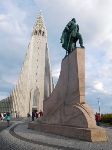 I walk over the Söbraut, the road that parallels the sea up to the very city center and
the old harbor. A wide cycle path and pedestrian promenade flank the road. On the other side of the
sea I have views over a mountain range with pretty much snow on its slopes. The Arctic panorama
is complete with the backdrop of the volcano with ice cap of the Snaefallsjökull, which I can
clearly distinguish in the distance. I am surprised by the icy appearance of the landscape as
seen from the capital, notably the warmest part of the country. At the same time I am
confronted with the reason. The icy wind is still chasing over the sea and has hardly lost
any strength in the evening. I have to prepare myself for the possibility that the wind
might become a permanent companion during the course of this trip. If I look to the left,
I do not see any nature at all but I look upon the modern city that is Reykjavik. Modernist
business buildings is the dominant feature here. I get rarely overwhelmed by the appearance
of office buildings, but I have to acknowledge that most buildings are tasteful and that the
complete image intrigues. Each building looks like having its very own, unique vision,
but they have in common that the buildings have a clear cut design and they they are
all radiating individualism and self-esteem. And yet all of these buildings are still
forming a quite harmonious whole. Along the architectural masterpiece of the Harpa
cultural center I am waking to the old port, where I order a modest fish meal. Through
the old town and the AlÞingi, the parliament building that is constructed with
large dark gray stones, I am walking to Reykjavik's most famous building, the Hallgrimskirkja.
The concrete cathedral with its tight basalt shapes dates back to 1986 but has become
the eye-catcher of Reykjavik ever since. The dizzying vertical lines seem to represent
a giant organ. An organ with pipes of pure ice, as the cathedral is dominated bt white
tones. To my surprise there actually is a giant organ, which is being played beautifully
at the time that I enter the church. Thet are playing Bachat the moment. The interior
is as modernist as the outside, dominated by sheer vertical lines that er carefully bended
to each other at the very upper part of the building.
I walk over the Söbraut, the road that parallels the sea up to the very city center and
the old harbor. A wide cycle path and pedestrian promenade flank the road. On the other side of the
sea I have views over a mountain range with pretty much snow on its slopes. The Arctic panorama
is complete with the backdrop of the volcano with ice cap of the Snaefallsjökull, which I can
clearly distinguish in the distance. I am surprised by the icy appearance of the landscape as
seen from the capital, notably the warmest part of the country. At the same time I am
confronted with the reason. The icy wind is still chasing over the sea and has hardly lost
any strength in the evening. I have to prepare myself for the possibility that the wind
might become a permanent companion during the course of this trip. If I look to the left,
I do not see any nature at all but I look upon the modern city that is Reykjavik. Modernist
business buildings is the dominant feature here. I get rarely overwhelmed by the appearance
of office buildings, but I have to acknowledge that most buildings are tasteful and that the
complete image intrigues. Each building looks like having its very own, unique vision,
but they have in common that the buildings have a clear cut design and they they are
all radiating individualism and self-esteem. And yet all of these buildings are still
forming a quite harmonious whole. Along the architectural masterpiece of the Harpa
cultural center I am waking to the old port, where I order a modest fish meal. Through
the old town and the AlÞingi, the parliament building that is constructed with
large dark gray stones, I am walking to Reykjavik's most famous building, the Hallgrimskirkja.
The concrete cathedral with its tight basalt shapes dates back to 1986 but has become
the eye-catcher of Reykjavik ever since. The dizzying vertical lines seem to represent
a giant organ. An organ with pipes of pure ice, as the cathedral is dominated bt white
tones. To my surprise there actually is a giant organ, which is being played beautifully
at the time that I enter the church. Thet are playing Bachat the moment. The interior
is as modernist as the outside, dominated by sheer vertical lines that er carefully bended
to each other at the very upper part of the building.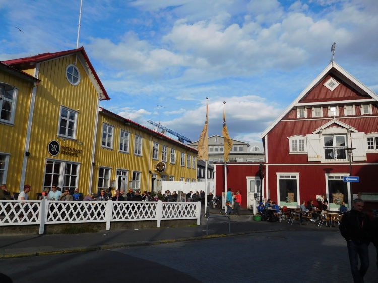
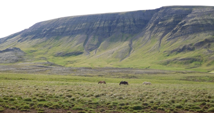
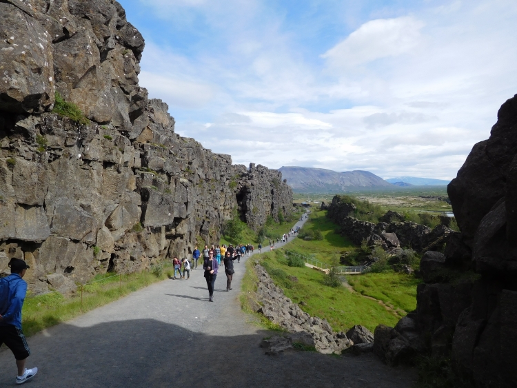
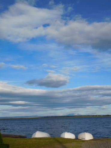 The Lonely Cyclist also shapes his life according to his own insights. Those insights bring
me to new highlands, between Þingvellir and Laugarvatn. I am treated to a headwind
that has swollen in the meantime. The clouds are rushing across the landscape. And the
cars are passing me by closely. Þingvellir was beautiful, but cycling itself has not
brought me too many highlights so far. The odometer is usually showing around ten kilometers
per hour and also on the descents I am not able to pick up any pace at all. The first hour
after Þingvellir I have covered ten kilometers and the second hour would not get me
further. Do I have such a bad day? Or am I getting old? Or does the wind really blow so hard,
that it is simply impossible to fight the wind? Whatsoever, I have to give up my ambitions
to visit Geysir today. In Laugarvatn I pull the brakes to sleep in the local hostel. There
is also a camping site in Laugarvatn, but I am finished with the ruthless, icy wind.
Moreover, the hostel of Laugarvatn is very beautiful and not too expensive for
Icelandic terms.
The Lonely Cyclist also shapes his life according to his own insights. Those insights bring
me to new highlands, between Þingvellir and Laugarvatn. I am treated to a headwind
that has swollen in the meantime. The clouds are rushing across the landscape. And the
cars are passing me by closely. Þingvellir was beautiful, but cycling itself has not
brought me too many highlights so far. The odometer is usually showing around ten kilometers
per hour and also on the descents I am not able to pick up any pace at all. The first hour
after Þingvellir I have covered ten kilometers and the second hour would not get me
further. Do I have such a bad day? Or am I getting old? Or does the wind really blow so hard,
that it is simply impossible to fight the wind? Whatsoever, I have to give up my ambitions
to visit Geysir today. In Laugarvatn I pull the brakes to sleep in the local hostel. There
is also a camping site in Laugarvatn, but I am finished with the ruthless, icy wind.
Moreover, the hostel of Laugarvatn is very beautiful and not too expensive for
Icelandic terms.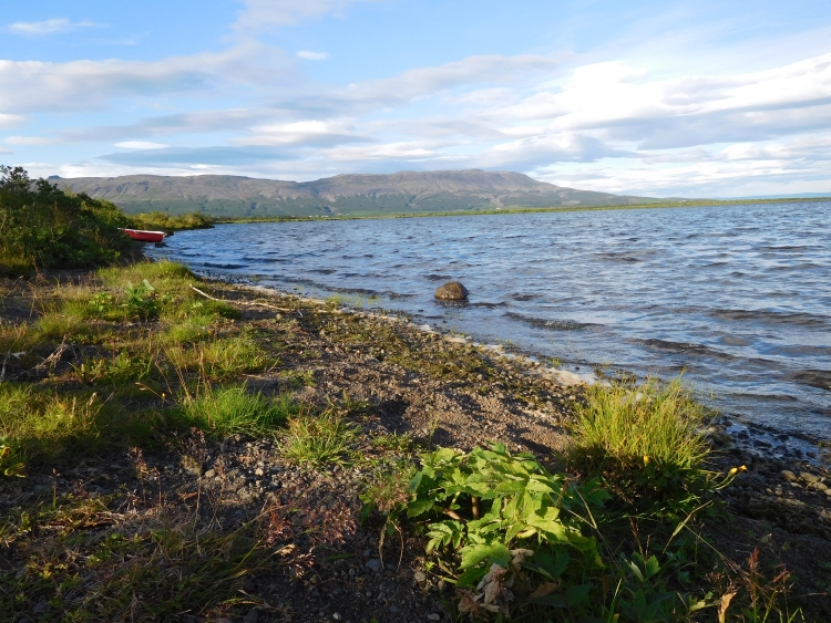
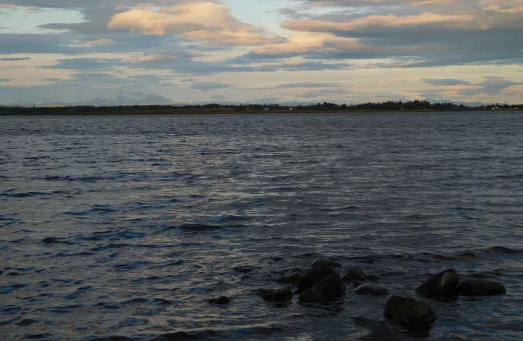
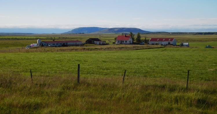
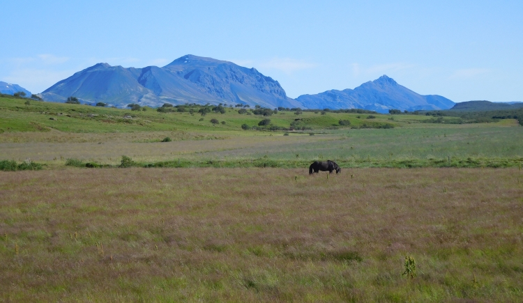
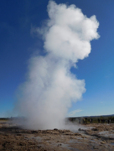 Iceland is an expensive country but they do not charge ant fees for the scenic
sights. Not even for the famous hotspot of Geysir. Worldwide, the phenomenon of
geyser is named after the sizzling and spraying hot waters of this place in Iceland.
Traditionally the most important geyser of Geysir is eponymous Geysir, but that geyser
is not functioning as such anymore. Nowadays Strokkur is the most impressive geyser of
Geysir. In the hour that I am walking through the stinking, gurgling, blurring and
sizzling plains, the geyser is spraying heaps of hot water and hot fumes up to
many meters high into the sky on a regular basis. In addition to the spraying geysers
more visual spectacle is provided by the unusual colors of the landscape as a result
of high concentrations of particular minerals. All in all, Geysir is not as big
as the Geiserwalhalla of Yellowstone National Park in the United States, but all the
beautiful landscapes are packed within a small space of no more than five hundred
meters. Geysir is a great start to the day, which in fact has only just begun.
Iceland is an expensive country but they do not charge ant fees for the scenic
sights. Not even for the famous hotspot of Geysir. Worldwide, the phenomenon of
geyser is named after the sizzling and spraying hot waters of this place in Iceland.
Traditionally the most important geyser of Geysir is eponymous Geysir, but that geyser
is not functioning as such anymore. Nowadays Strokkur is the most impressive geyser of
Geysir. In the hour that I am walking through the stinking, gurgling, blurring and
sizzling plains, the geyser is spraying heaps of hot water and hot fumes up to
many meters high into the sky on a regular basis. In addition to the spraying geysers
more visual spectacle is provided by the unusual colors of the landscape as a result
of high concentrations of particular minerals. All in all, Geysir is not as big
as the Geiserwalhalla of Yellowstone National Park in the United States, but all the
beautiful landscapes are packed within a small space of no more than five hundred
meters. Geysir is a great start to the day, which in fact has only just begun.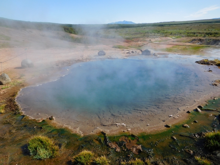
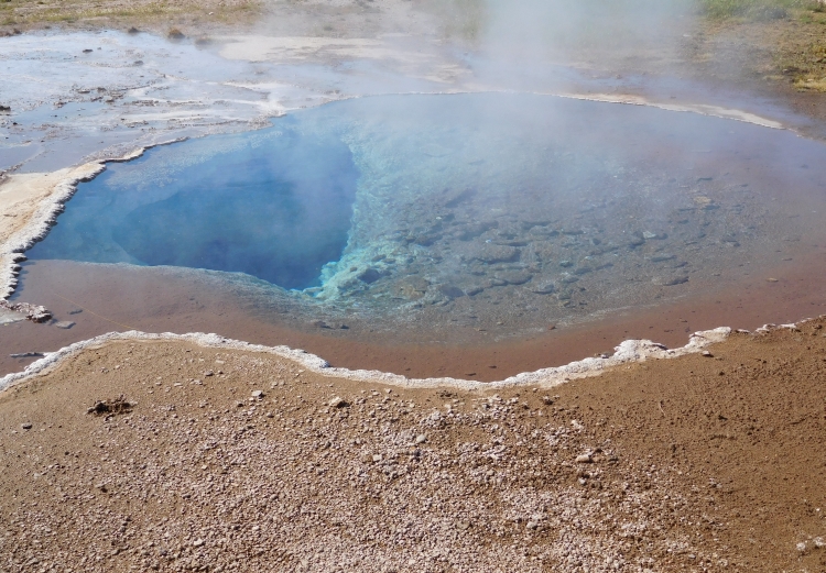
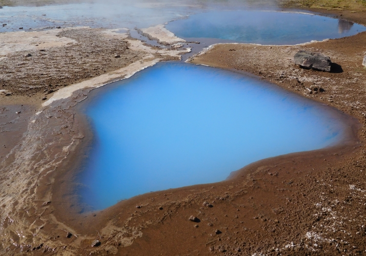
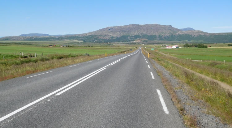
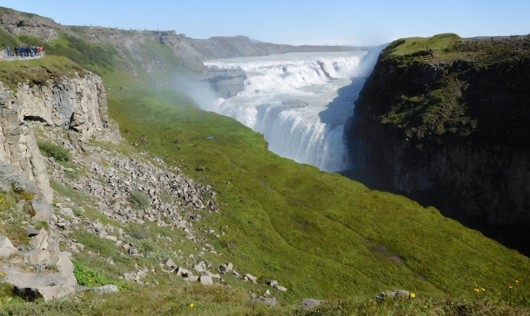
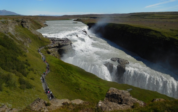
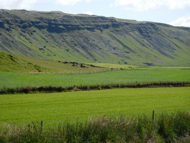
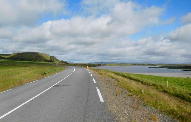

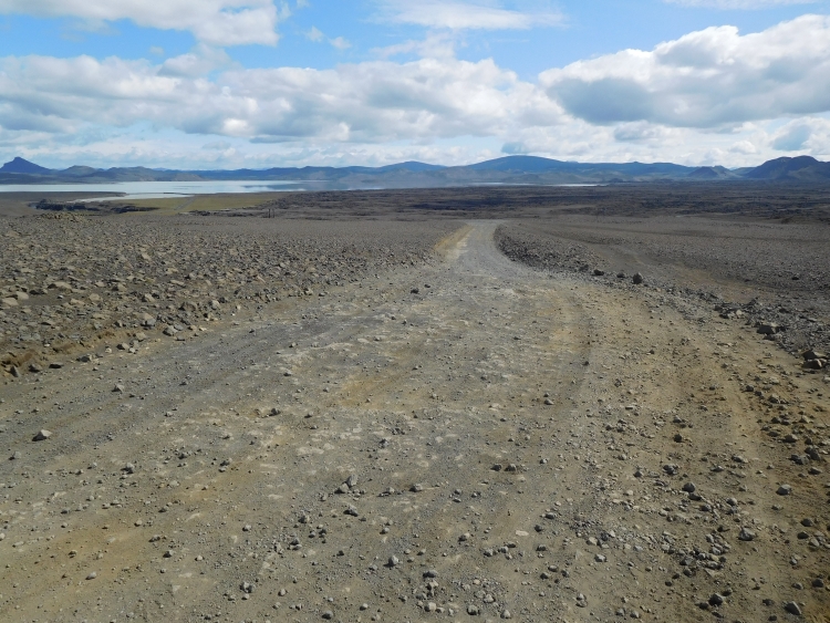
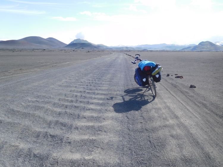
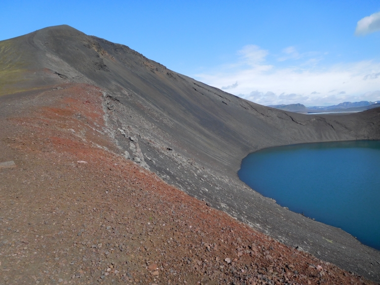
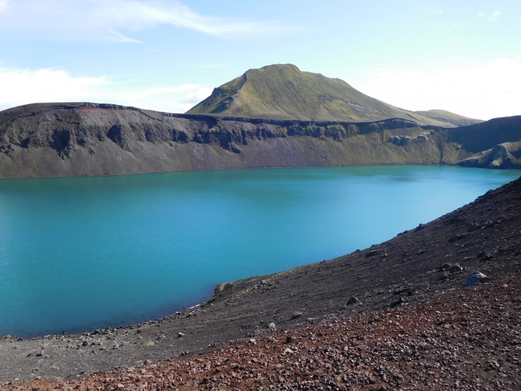
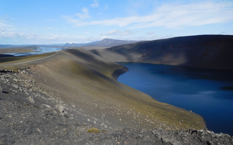
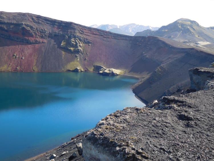
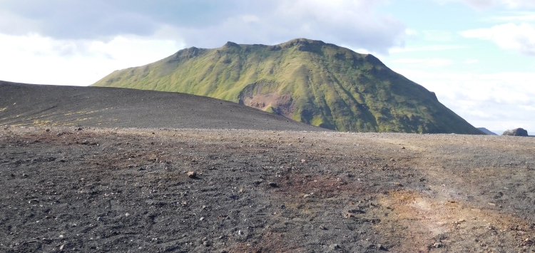
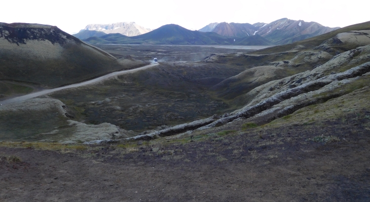
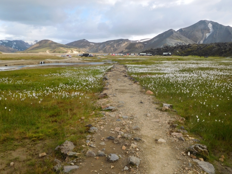
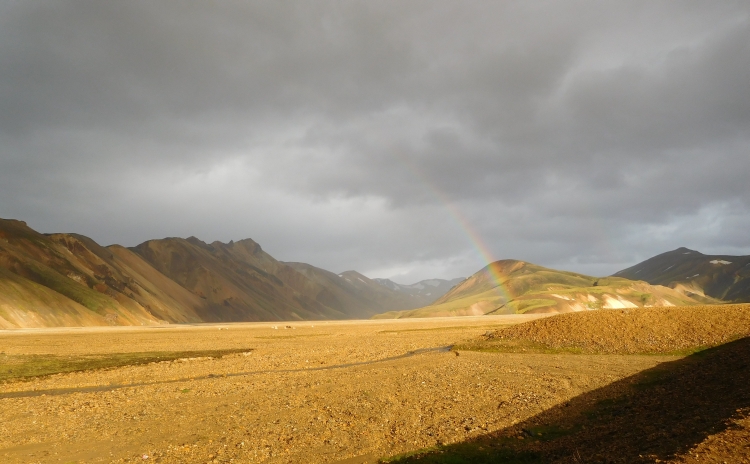
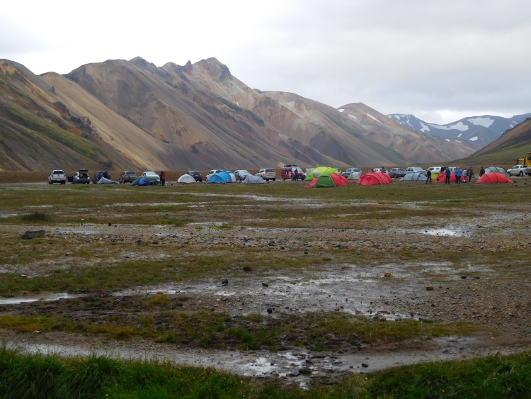
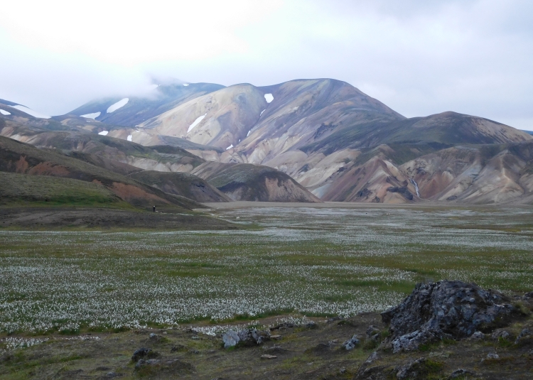
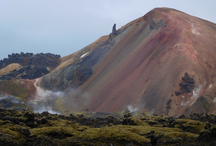
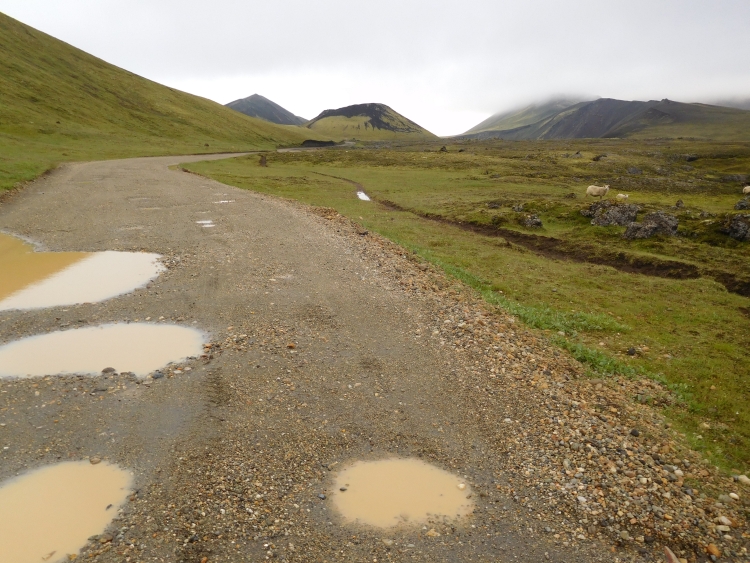
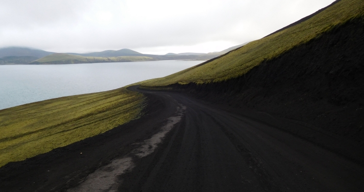
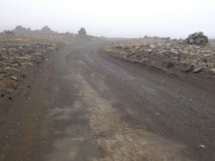
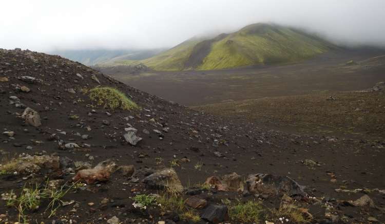
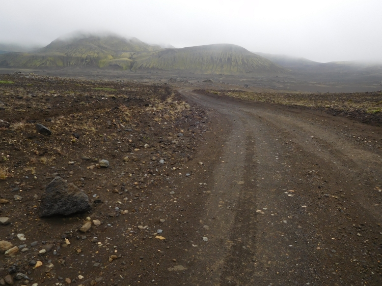
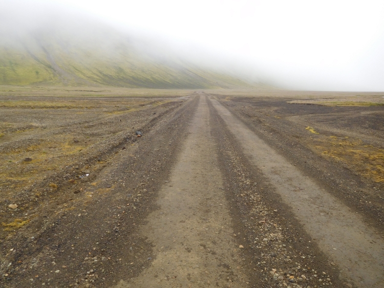
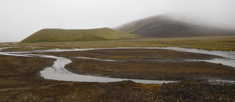
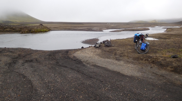
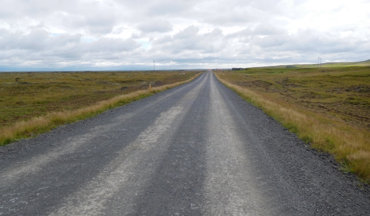
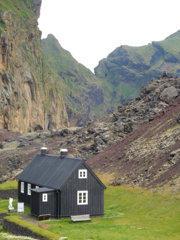
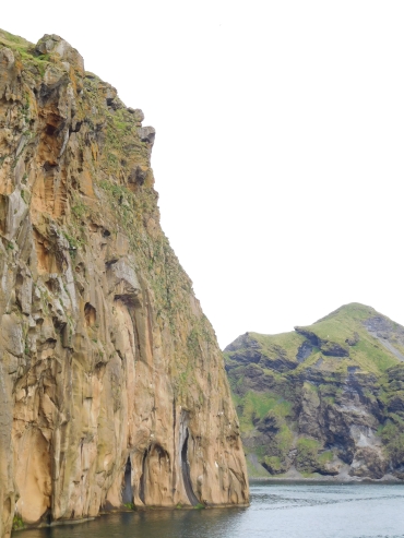
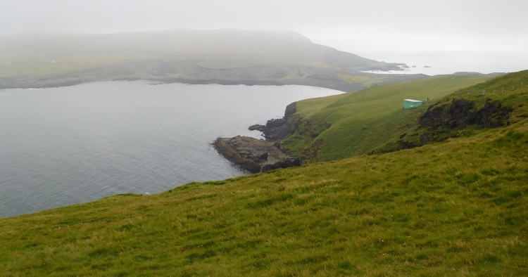
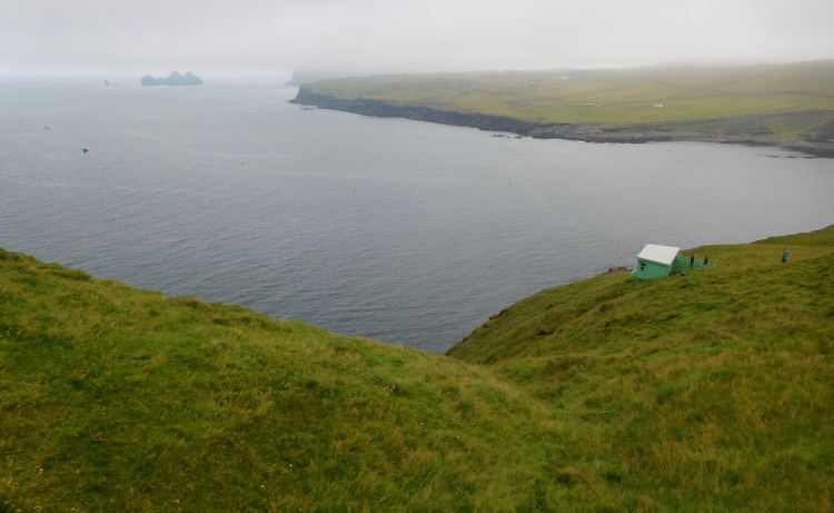
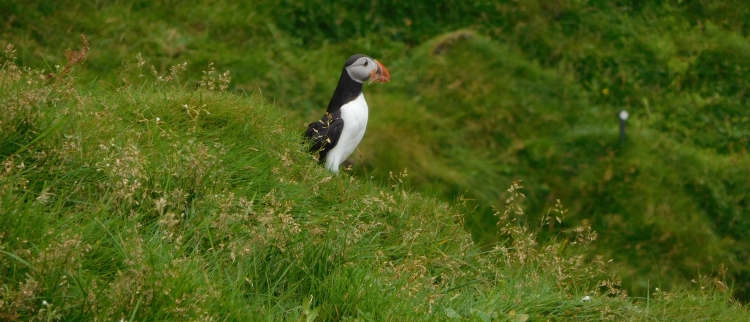
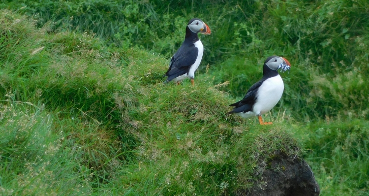
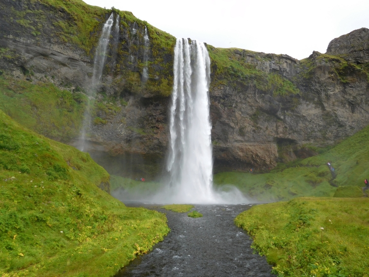
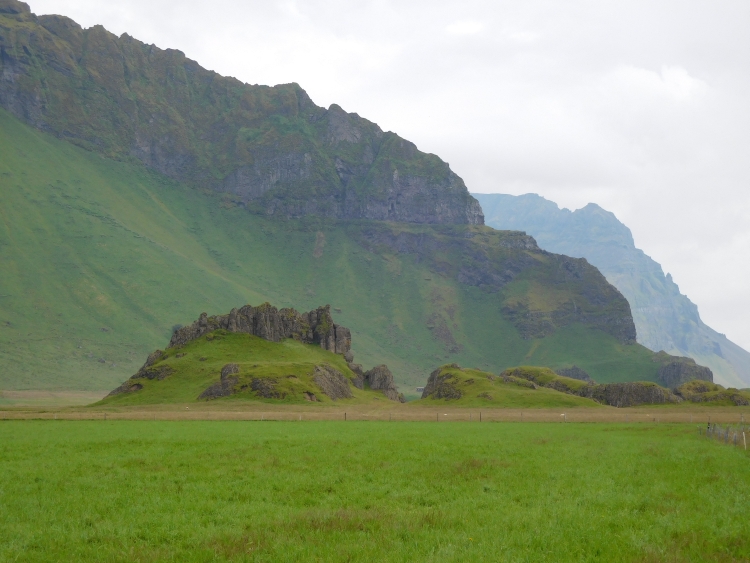
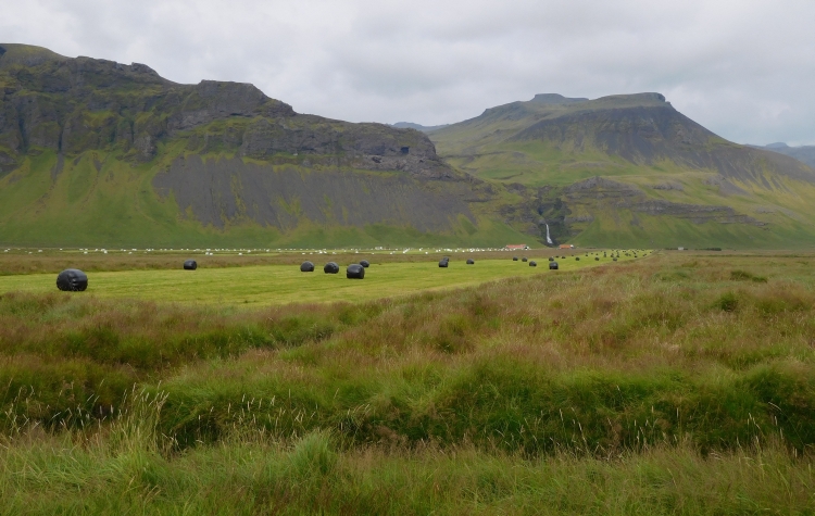
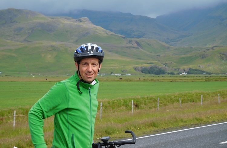
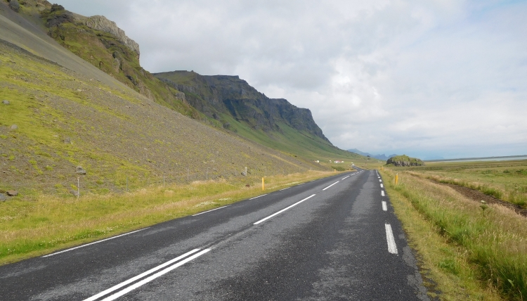
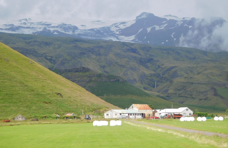
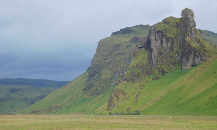
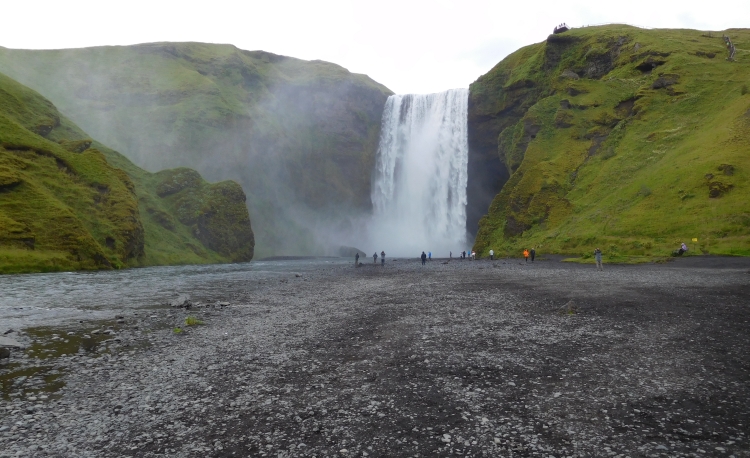
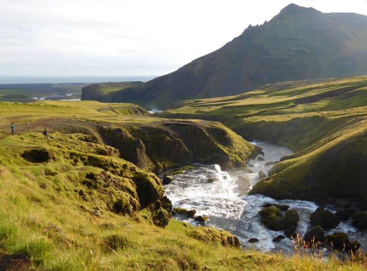
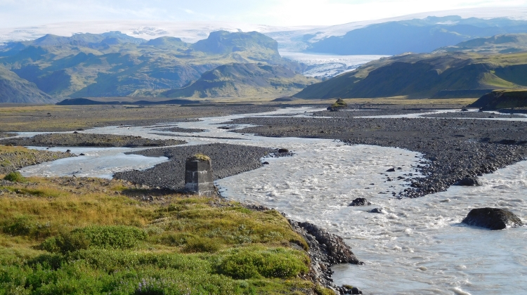
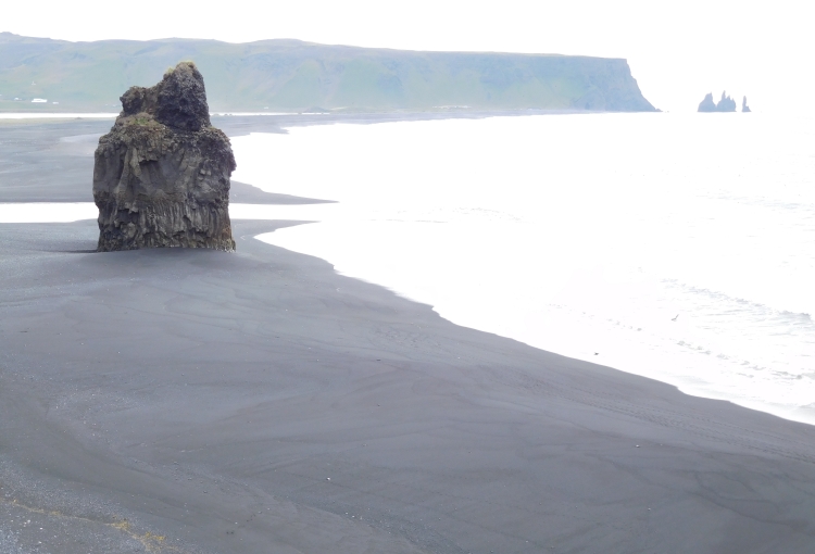
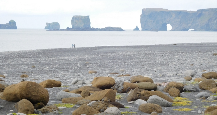
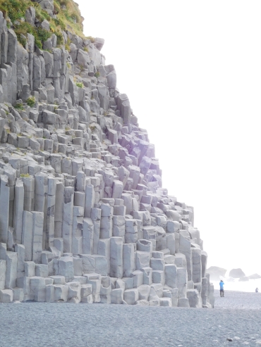 After my visit of Dyrhólaey I am riding back to the Ring Road. A short, steep
climb brings me on a plateau, from where I take the exit to Reynisfjara. I am going
down the plateau and reach the basalt rocks of Reynisfjara after six kilometers.
Behind the black beaches a rocky wall rises up. The basalt rocks are partly composed
of hexagonal pillars, like a kind of huge organ. A bit further three triangular rocks
rise up from the sea. On the other side I have views over Dyrhólaey, which is not
much further than a kilometer away as the crow flies. The holes in the rocks of
Dyrhólaey are, despite the greater distance, even better visible than in Dyrhólaey
itself.
After my visit of Dyrhólaey I am riding back to the Ring Road. A short, steep
climb brings me on a plateau, from where I take the exit to Reynisfjara. I am going
down the plateau and reach the basalt rocks of Reynisfjara after six kilometers.
Behind the black beaches a rocky wall rises up. The basalt rocks are partly composed
of hexagonal pillars, like a kind of huge organ. A bit further three triangular rocks
rise up from the sea. On the other side I have views over Dyrhólaey, which is not
much further than a kilometer away as the crow flies. The holes in the rocks of
Dyrhólaey are, despite the greater distance, even better visible than in Dyrhólaey
itself.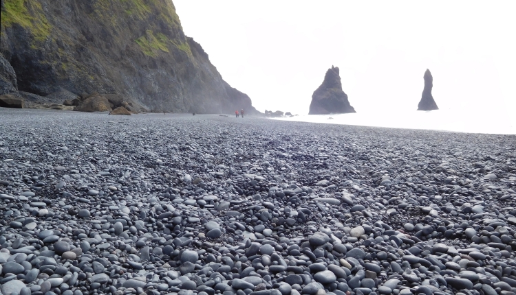
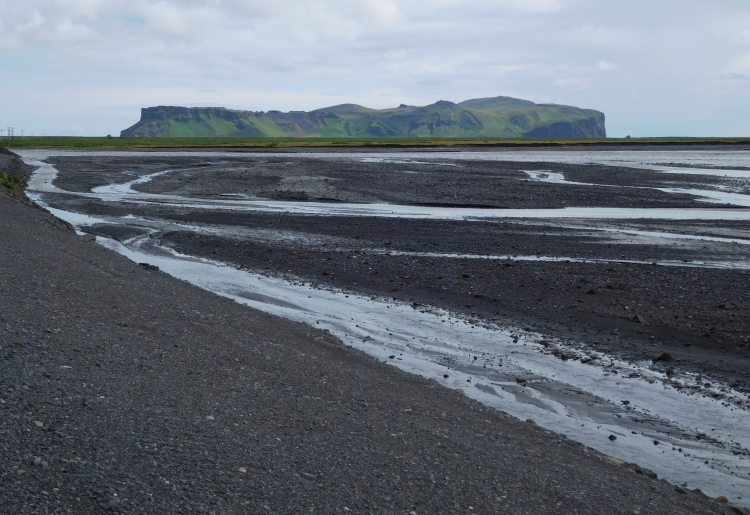
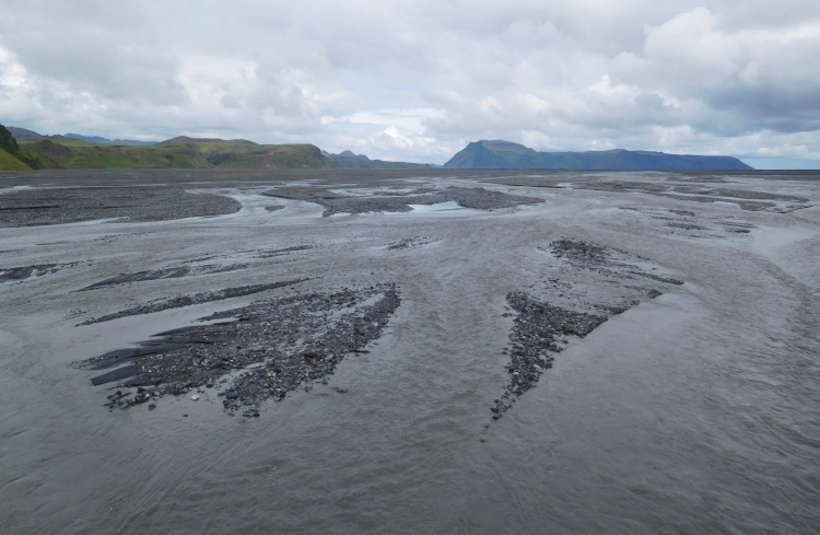
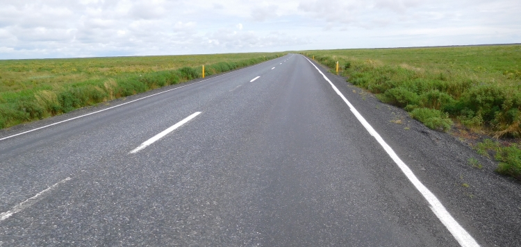
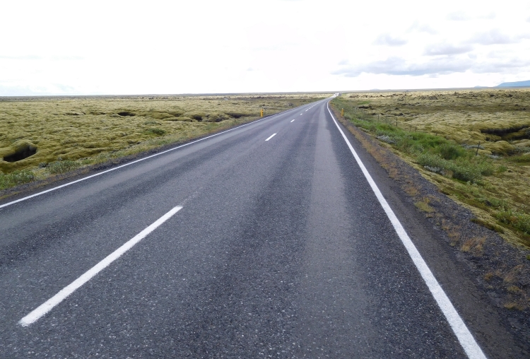
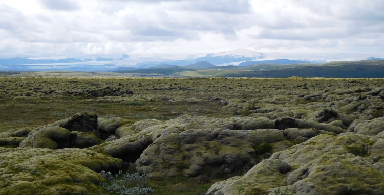
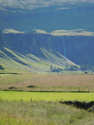 After the desolate landscape of the Mýrdalssandur of yesterday, I am cycling through
much more idyllic landscapes now. The Ring Road runs along a series of elongated mountain
ridges. Waterfalls tumble down from the cliffs and continue headlong towards the ocean.
The slopes are dominated by bright green grasses, so green that I think I have ended up
in a dream or I have just entered paradise. At the foot of the cliffs are a few farms.
It is completely windless, what contributes significantly to the paradisiacal feeling.
I am riding over Dverghamrar to Núpsstađur, the oldest turf houses in Iceland.
The houses date back to the nineteenth century and have a roof of peat, where grasses
and plants grow. The cultural and historical value of these rare houses are praised
unanimously in Iceland, but the houses have been sold to private ownership. A large
fence must keep the interested people at distance. The turf homes are not even
visible in the distance from outside the fence.
After the desolate landscape of the Mýrdalssandur of yesterday, I am cycling through
much more idyllic landscapes now. The Ring Road runs along a series of elongated mountain
ridges. Waterfalls tumble down from the cliffs and continue headlong towards the ocean.
The slopes are dominated by bright green grasses, so green that I think I have ended up
in a dream or I have just entered paradise. At the foot of the cliffs are a few farms.
It is completely windless, what contributes significantly to the paradisiacal feeling.
I am riding over Dverghamrar to Núpsstađur, the oldest turf houses in Iceland.
The houses date back to the nineteenth century and have a roof of peat, where grasses
and plants grow. The cultural and historical value of these rare houses are praised
unanimously in Iceland, but the houses have been sold to private ownership. A large
fence must keep the interested people at distance. The turf homes are not even
visible in the distance from outside the fence.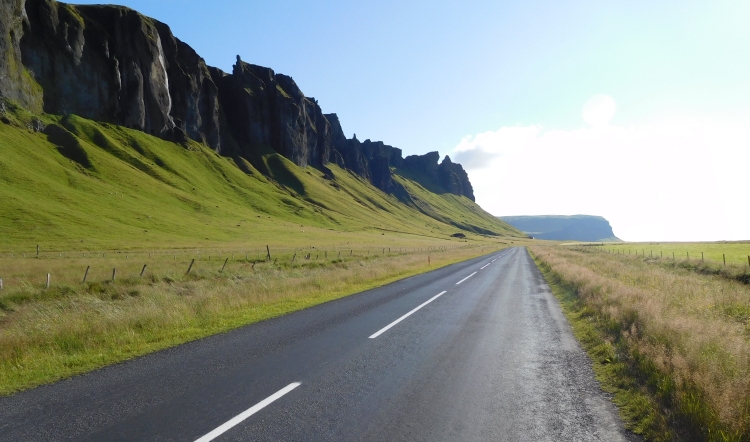
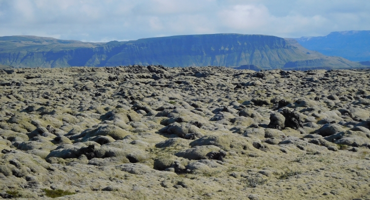
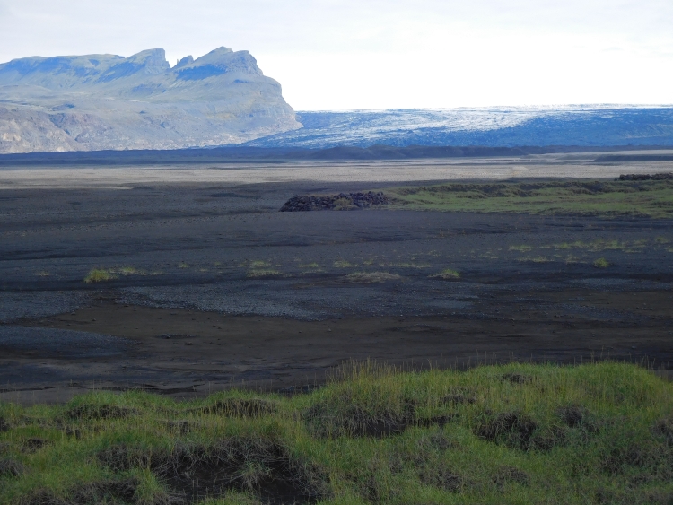
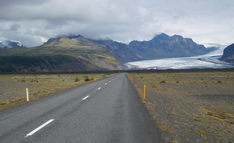
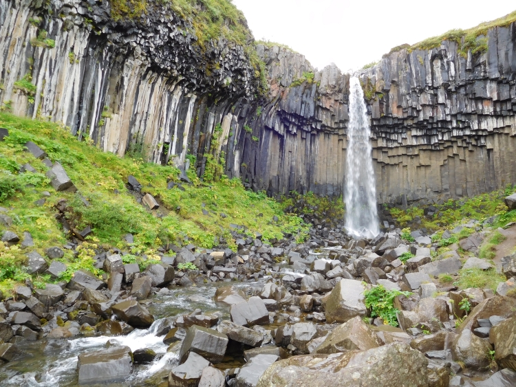
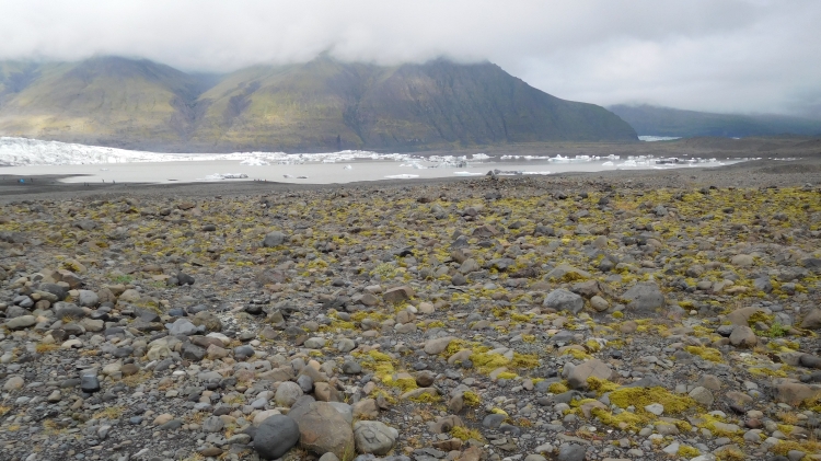

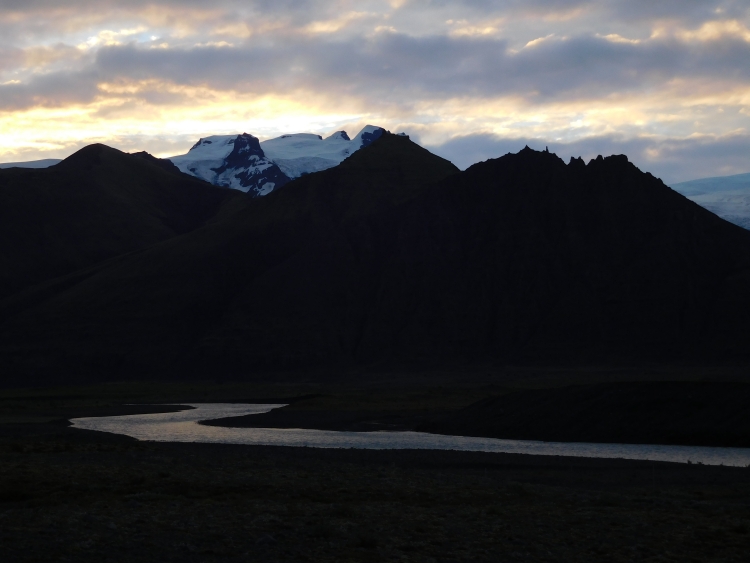
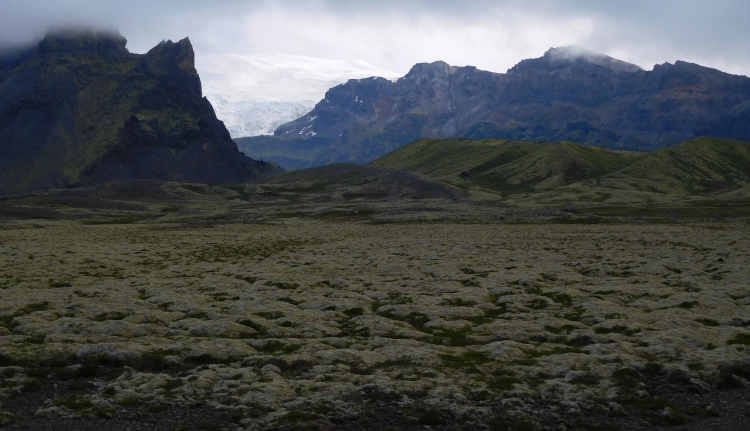
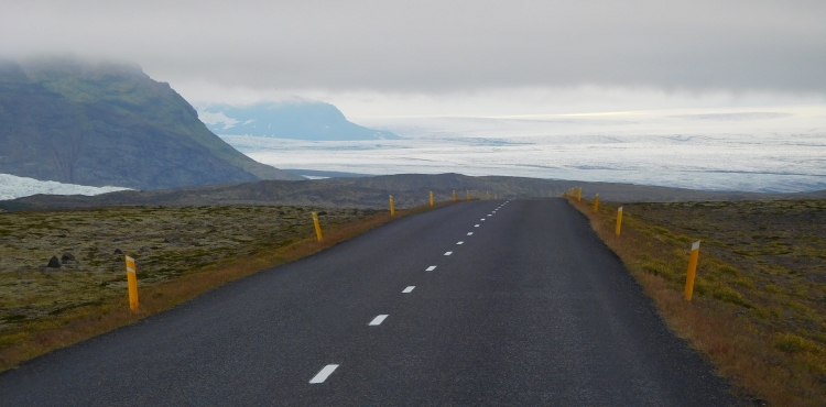
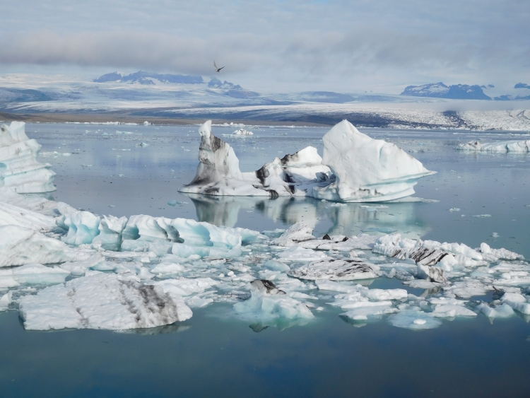
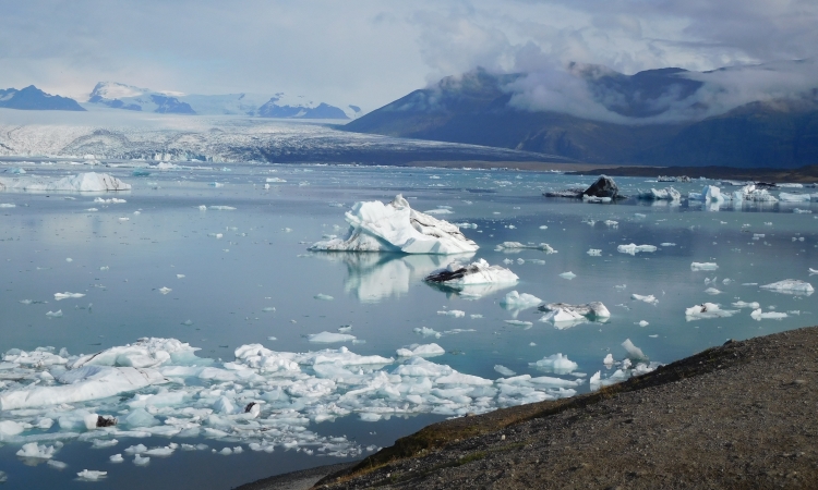
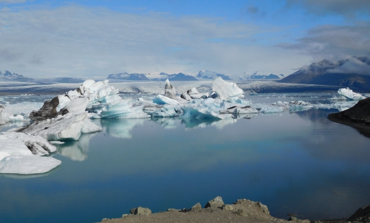
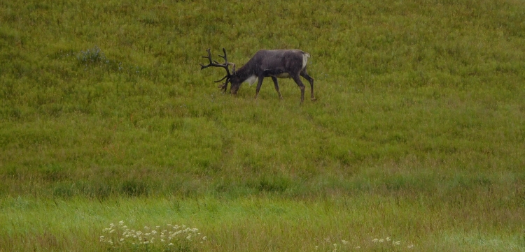
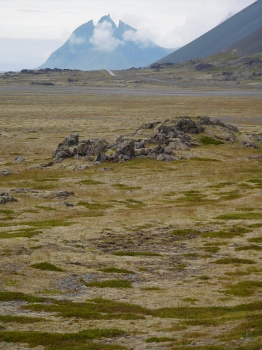 The southern part of the Ring Road between Hella and Höfn leads almost completely
across large sedimentary plains between the mountains and the sea. From Höfn on
in Eastern Iceland, the Ring Road also leads between the mountains and the sea, but
everything else has changed. The sedimentary plains are largely absent and the mountains
often reach all the way down to the sea. And the sea reaches inland in the valleys between
the mountains. The Ring Road passes along the rugged coastline with all its bays, capes,
fjords and cliffs, sometimes far below and sometimes high above the sea. Different from
the previous days, there are regular climbs and descents. The hardest climb takes place
after a few kilometers. The Ring Road leads through a tunnel here, to avoid a long detour
around a cape with six hundred meter high rock walls. But there appears to be an alternative
to the tunnel. I see a dirt road that steeply crawls its way up to a narrow passage
between the rocks of the cape and the continuation of the same mountain range inland.
The road is not tracked and is hardly possible to cycle, but it is definitely more fun to do
than the tunnel. I have to stop three times to grasp for breath, but in the end I reach
the pass. After a similarly steep descent, I am on the Ring Road again and I can continue
my way.
The southern part of the Ring Road between Hella and Höfn leads almost completely
across large sedimentary plains between the mountains and the sea. From Höfn on
in Eastern Iceland, the Ring Road also leads between the mountains and the sea, but
everything else has changed. The sedimentary plains are largely absent and the mountains
often reach all the way down to the sea. And the sea reaches inland in the valleys between
the mountains. The Ring Road passes along the rugged coastline with all its bays, capes,
fjords and cliffs, sometimes far below and sometimes high above the sea. Different from
the previous days, there are regular climbs and descents. The hardest climb takes place
after a few kilometers. The Ring Road leads through a tunnel here, to avoid a long detour
around a cape with six hundred meter high rock walls. But there appears to be an alternative
to the tunnel. I see a dirt road that steeply crawls its way up to a narrow passage
between the rocks of the cape and the continuation of the same mountain range inland.
The road is not tracked and is hardly possible to cycle, but it is definitely more fun to do
than the tunnel. I have to stop three times to grasp for breath, but in the end I reach
the pass. After a similarly steep descent, I am on the Ring Road again and I can continue
my way.
 Today is a gray day. The sun does not come through, but there are no heavy showers either.
The mountains are partly in the clouds. Long elongated clouds cling to the higher
parts of the mountain peaks and obscure the views. The heavily cloudy weather also
cause the contrasts in the landscape to be eliminated and are also the reason that
all colors tend to be medium to dark gray. The sea is just as gray. Not a single
trace of blue can be found in the ocean. The gloomy color palette is not really
beneficial for the landscape, but the result is
still impressive enough. The huge scree slopes are the most impressive feature here.
Below the rock walls, which are largely obscured by clouds, hundreds of meters high
slopes of rocky blocks can be found. Those uge boulders have fallen from the rock wall
once and are lying on these giant slopes ever since. The blocks are lying here at the
maximum angle of inclination. If the slope becomes too steep due to fresh new boulders,
gravity will cause a few blocks to tumble down. Everywhere in these surroundings,
mountain ranges with these boulder slopes can be distinguished, usually a few hundred
meters high and up to a few kilometers long.
Today is a gray day. The sun does not come through, but there are no heavy showers either.
The mountains are partly in the clouds. Long elongated clouds cling to the higher
parts of the mountain peaks and obscure the views. The heavily cloudy weather also
cause the contrasts in the landscape to be eliminated and are also the reason that
all colors tend to be medium to dark gray. The sea is just as gray. Not a single
trace of blue can be found in the ocean. The gloomy color palette is not really
beneficial for the landscape, but the result is
still impressive enough. The huge scree slopes are the most impressive feature here.
Below the rock walls, which are largely obscured by clouds, hundreds of meters high
slopes of rocky blocks can be found. Those uge boulders have fallen from the rock wall
once and are lying on these giant slopes ever since. The blocks are lying here at the
maximum angle of inclination. If the slope becomes too steep due to fresh new boulders,
gravity will cause a few blocks to tumble down. Everywhere in these surroundings,
mountain ranges with these boulder slopes can be distinguished, usually a few hundred
meters high and up to a few kilometers long.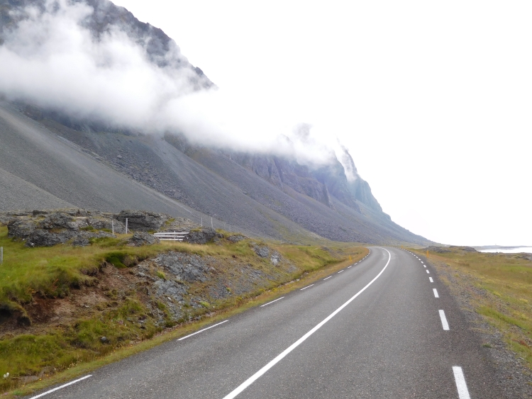
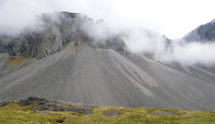
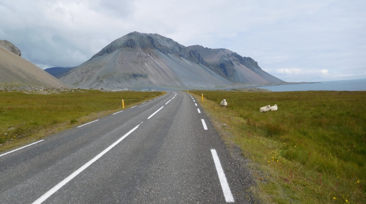
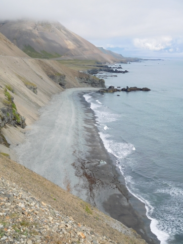 Except for the scree slopes, today's route is dominated by another geographic phenomenon,
the lagoons. At various places a little bit off the coast are narrow natural barriers
in the sea, which protect the coastal areas against waves. These lagoons are an ideal
habitat for whooper swans, which live here in high numbers. Gracefully the animals
slide through the calm lagoon water, the silhouettes beautifully reflecting in the
water surface. Iceland is a great place for birdwatchers. Traditionally there were
no land mammals in Iceland other than the arctic fox and so there are only a few
natural enemies and there is little competition for the various bird species. The
supply of food in the rivers and seas on the other hand is overwhelming. Especially
in the coastal areas there are birds everywhere. Against the cliffs, in lagoons or
in the tidal areas. Everywhere I go, i am cycling with the background music of a
concert of bird sounds. The most common birds in the coastal areas are swans, ducks,
geese, northern terns, gulls and kittiwakes. On the cliffs there are also species
like razorbills, cormorants, guillemots and sometimes also puffins. These are mostly
species which are only highly abundant in Iceland or only occur in arctic areas.
Except for the scree slopes, today's route is dominated by another geographic phenomenon,
the lagoons. At various places a little bit off the coast are narrow natural barriers
in the sea, which protect the coastal areas against waves. These lagoons are an ideal
habitat for whooper swans, which live here in high numbers. Gracefully the animals
slide through the calm lagoon water, the silhouettes beautifully reflecting in the
water surface. Iceland is a great place for birdwatchers. Traditionally there were
no land mammals in Iceland other than the arctic fox and so there are only a few
natural enemies and there is little competition for the various bird species. The
supply of food in the rivers and seas on the other hand is overwhelming. Especially
in the coastal areas there are birds everywhere. Against the cliffs, in lagoons or
in the tidal areas. Everywhere I go, i am cycling with the background music of a
concert of bird sounds. The most common birds in the coastal areas are swans, ducks,
geese, northern terns, gulls and kittiwakes. On the cliffs there are also species
like razorbills, cormorants, guillemots and sometimes also puffins. These are mostly
species which are only highly abundant in Iceland or only occur in arctic areas.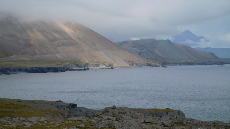
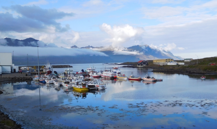
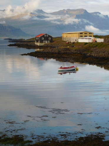
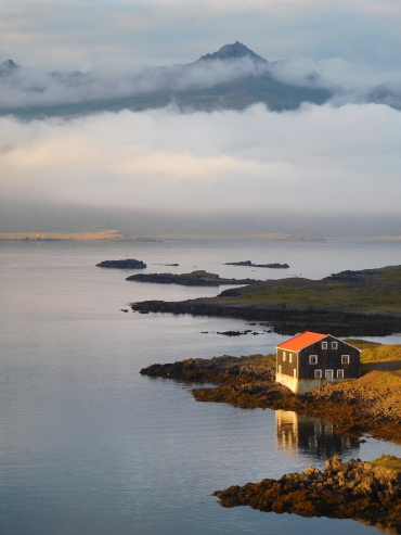
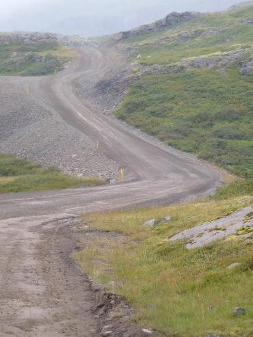
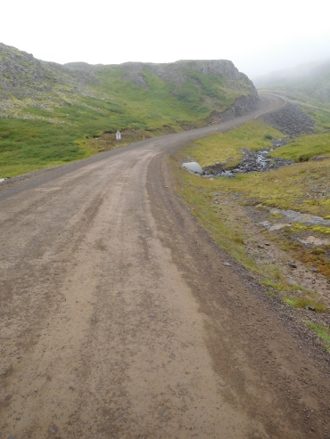
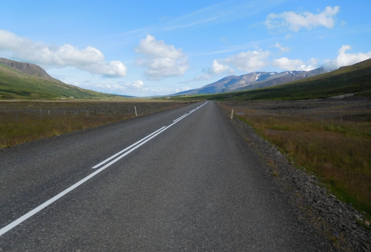
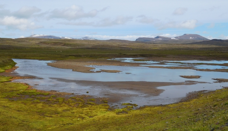
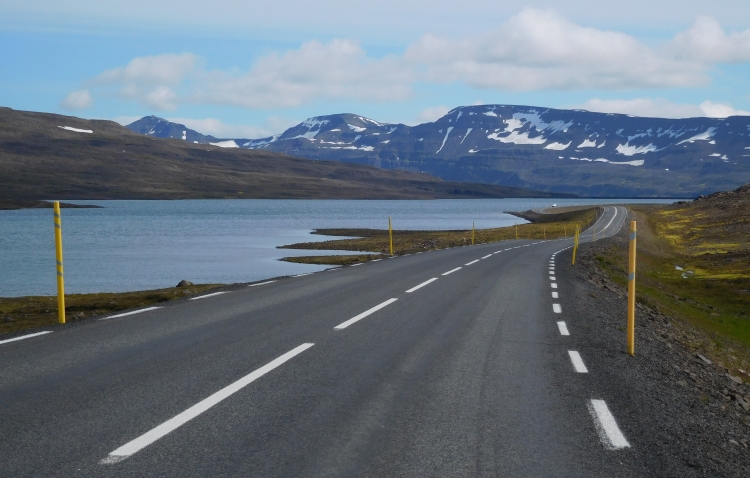
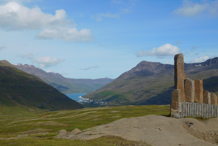
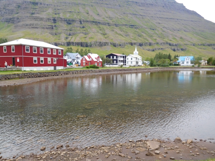
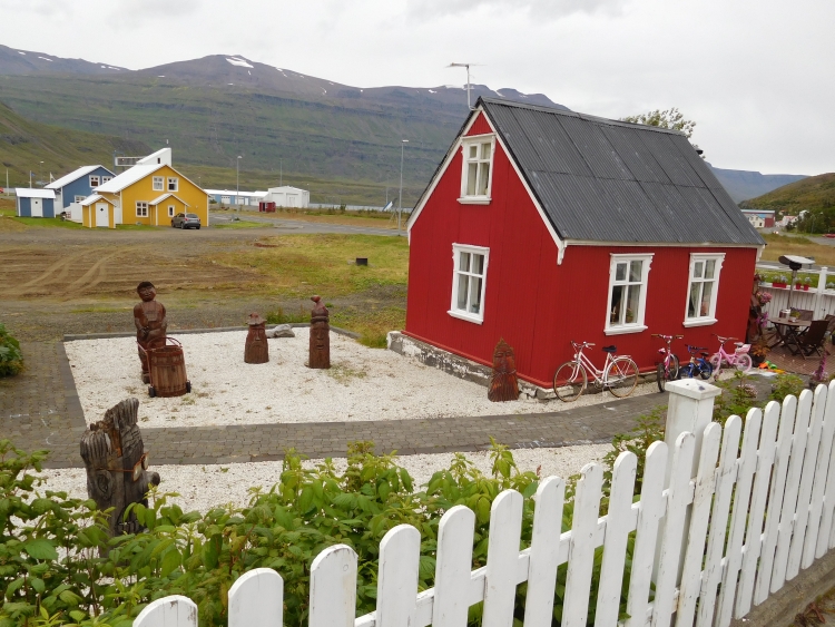
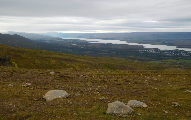
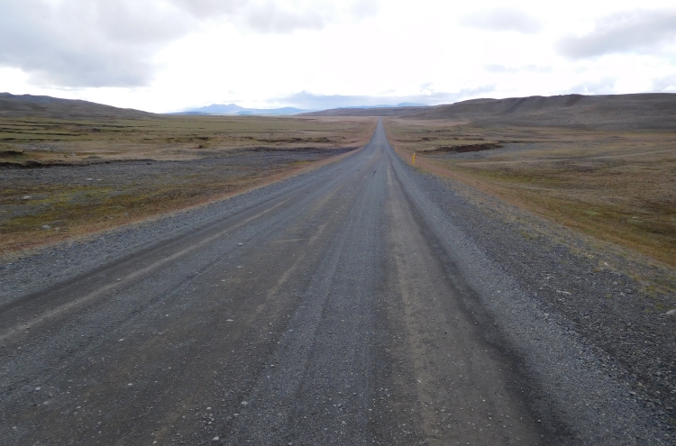
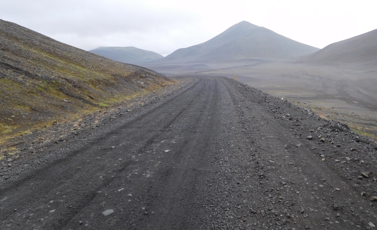
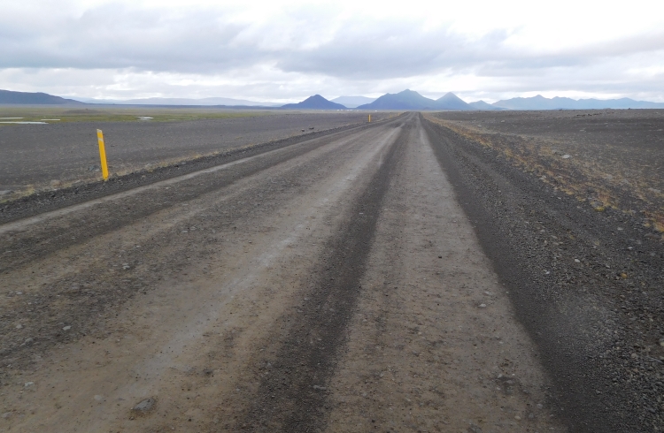
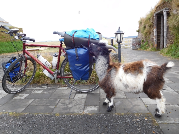
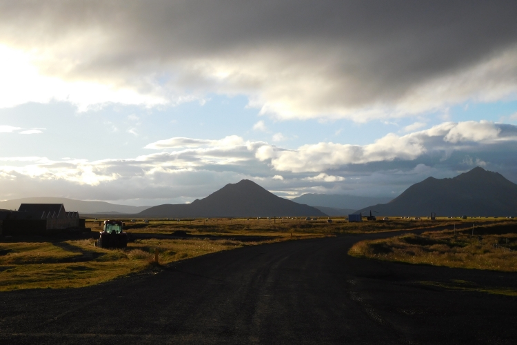
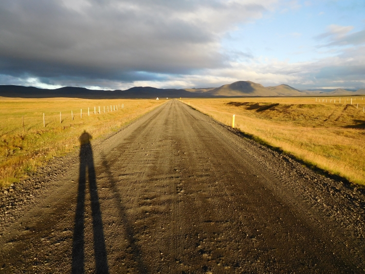
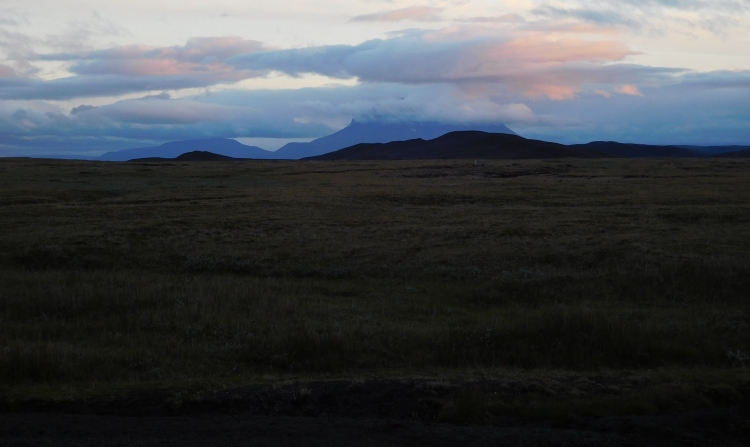
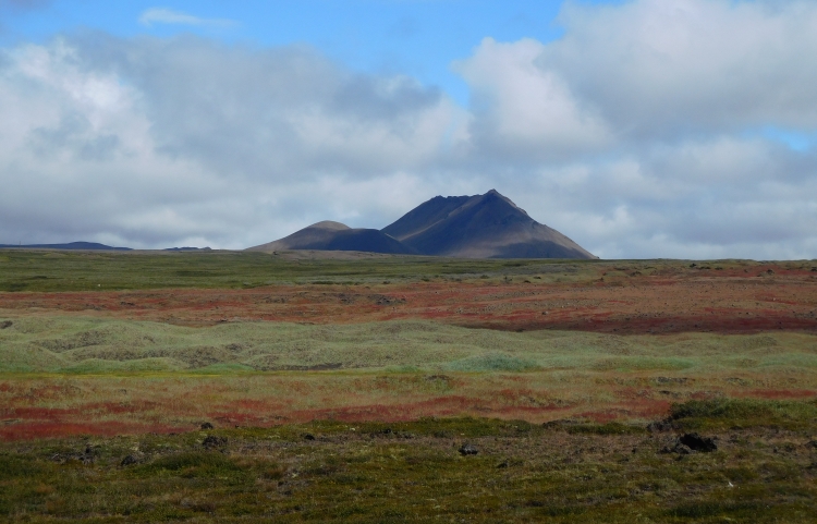
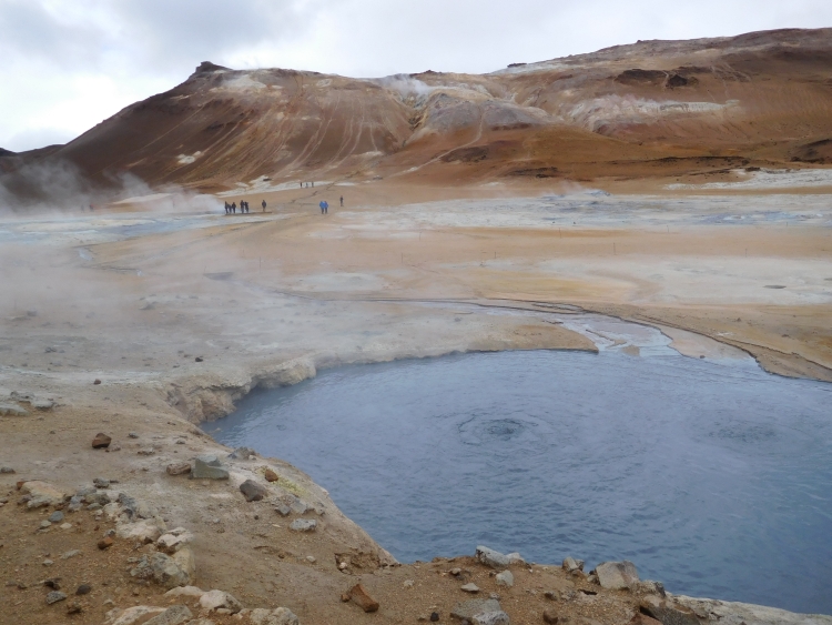
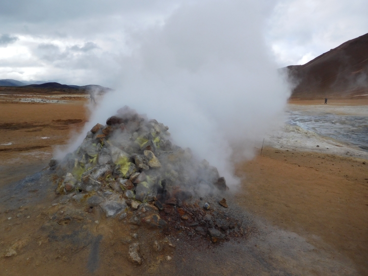
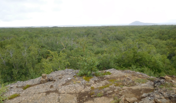
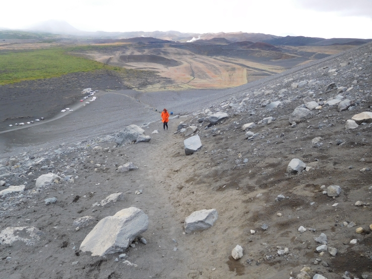
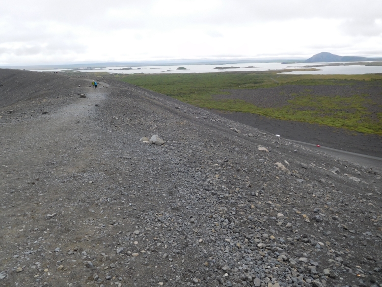
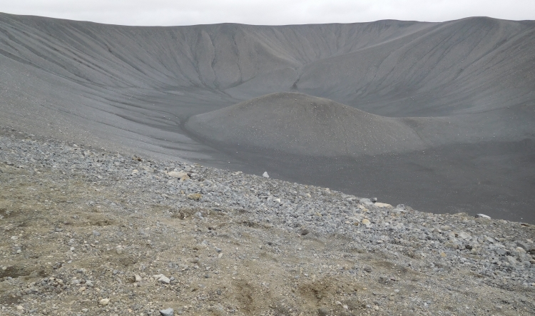
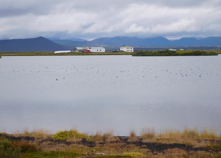
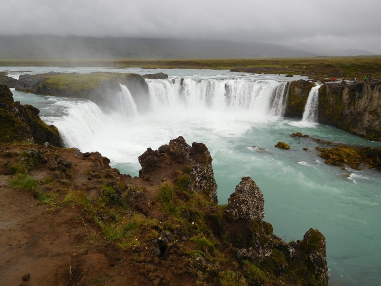

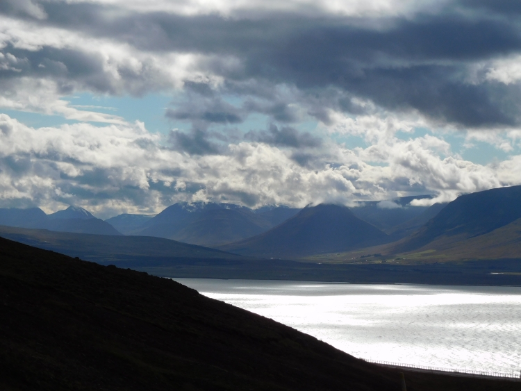
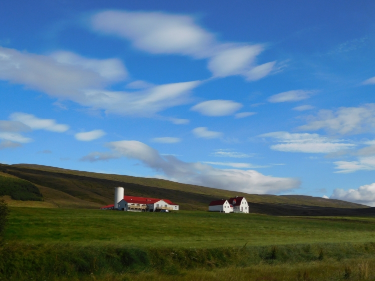
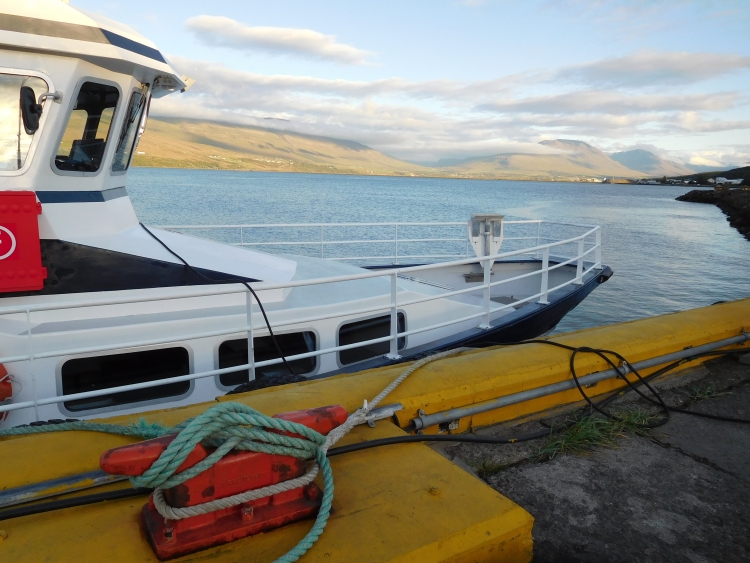
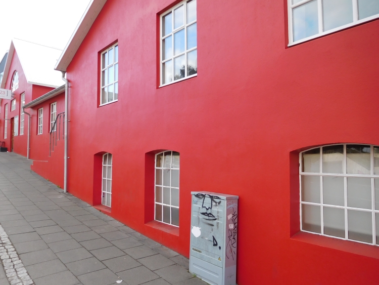
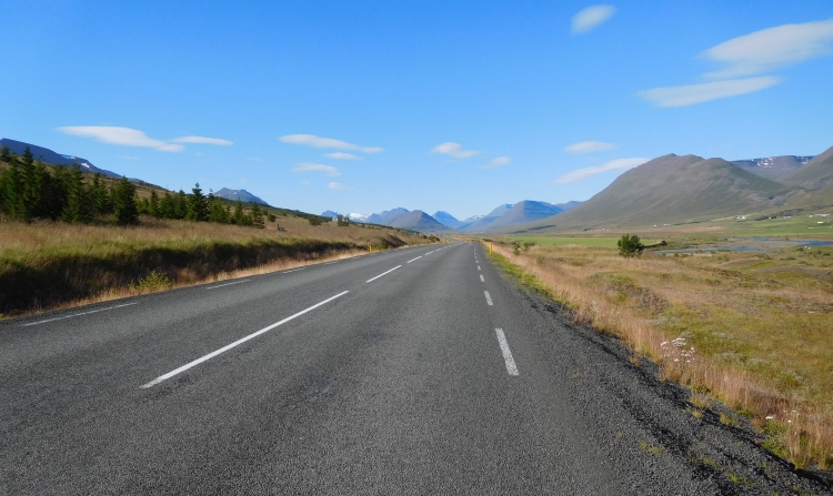
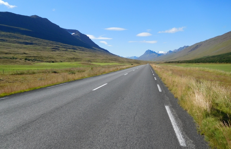

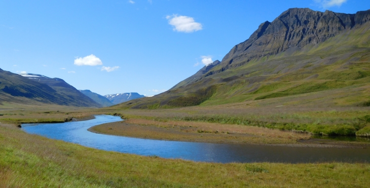
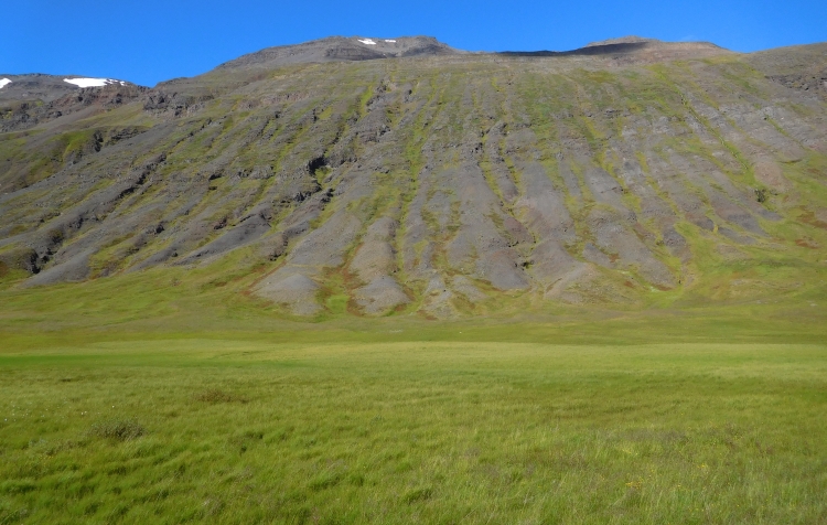
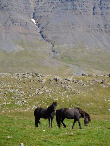 It looks like it will be a piece of cake. That is the idea when I start the long descent.
But soon I find out that things do not always go the way I pictured them to be.
Agsin it is the wind that gives me a hard blow. And that wind is coming from the front
once again. And this time the wind is blowing harder than ever. From out of sheer
nothingness there I am confronted with a huge storm. Even on the steep parts of the
descent I have to deliver all my power to make a bit progress. I have to prepare myself
for a hard job to bridge those last forty to fifty flat kilometers. After reaching the
end of the descent, I feel that the wind is even harder here. The wind almost throws me
off my bike once in a while. It would be safer to stop now, but that is not an option.
There is no campsite or another place where I could set up a tent and where I would be able
to cook out of the wind. Moreover, it is still early. So even if I keep going slowly,
I should still be able to reach Sauđarkrokúr. And I am also in a good shape today.
It is the challenge to keep staying on the bike.
It looks like it will be a piece of cake. That is the idea when I start the long descent.
But soon I find out that things do not always go the way I pictured them to be.
Agsin it is the wind that gives me a hard blow. And that wind is coming from the front
once again. And this time the wind is blowing harder than ever. From out of sheer
nothingness there I am confronted with a huge storm. Even on the steep parts of the
descent I have to deliver all my power to make a bit progress. I have to prepare myself
for a hard job to bridge those last forty to fifty flat kilometers. After reaching the
end of the descent, I feel that the wind is even harder here. The wind almost throws me
off my bike once in a while. It would be safer to stop now, but that is not an option.
There is no campsite or another place where I could set up a tent and where I would be able
to cook out of the wind. Moreover, it is still early. So even if I keep going slowly,
I should still be able to reach Sauđarkrokúr. And I am also in a good shape today.
It is the challenge to keep staying on the bike.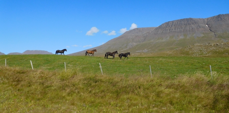
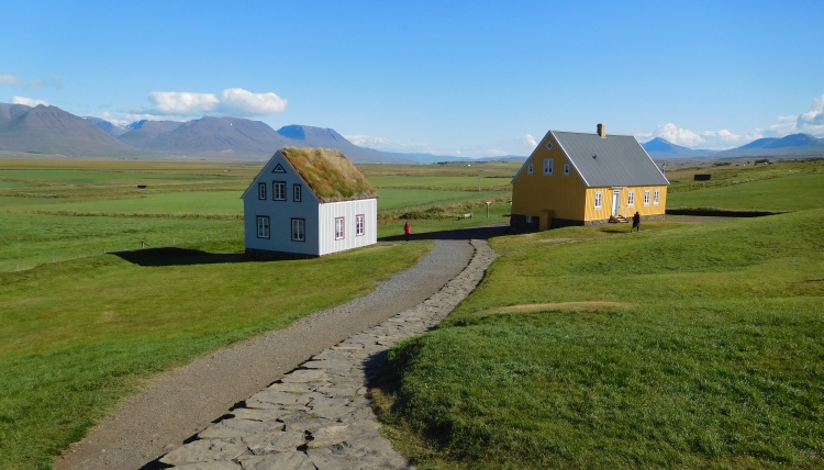
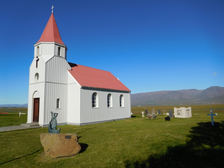
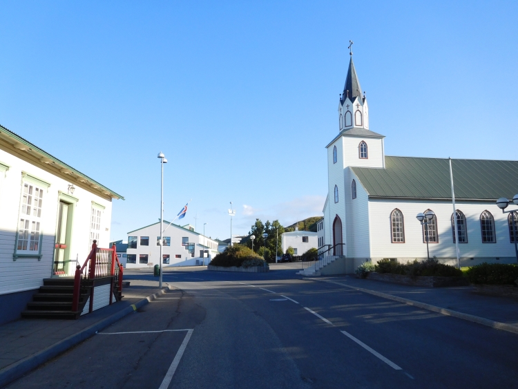
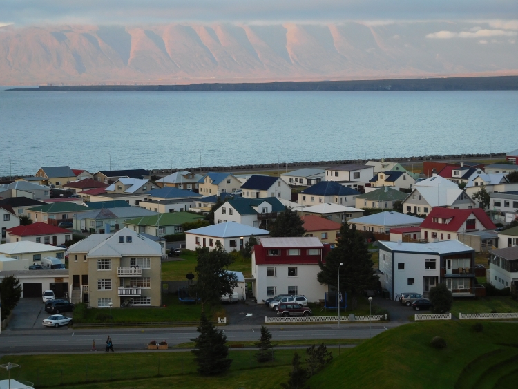
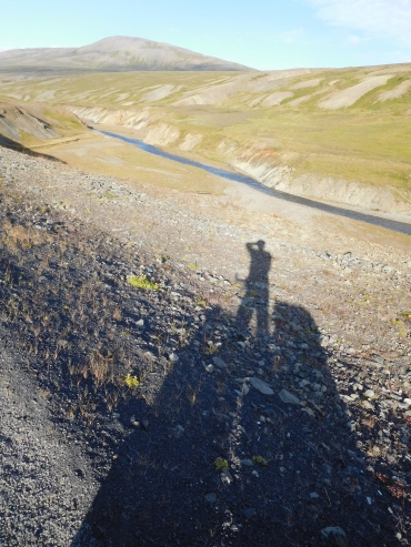 Today should not be a special stage beforehand, but in reality the landscape proves to be
rather enjoyable so far. The fifty kilometers between Sauđarkrokúr and Blönduós
are leading through an area with quite low, gentle hills, but the round mountain shapes
have their own charm and as a result of the striking lights and the mysterious fogs,
the landscape is enchantingly beautiful actually. The wind has also lied down, so
cycling takes far less effort than yesterday afternoon. Before I have actually realized
it, I have covered the first 50 kilometers through the hillside area. I have reached
the Ring Road again and a little bit later I reach Blönduós. The small town
is not very inspiring; the most beautiful part of the stage is behind me now.
Today should not be a special stage beforehand, but in reality the landscape proves to be
rather enjoyable so far. The fifty kilometers between Sauđarkrokúr and Blönduós
are leading through an area with quite low, gentle hills, but the round mountain shapes
have their own charm and as a result of the striking lights and the mysterious fogs,
the landscape is enchantingly beautiful actually. The wind has also lied down, so
cycling takes far less effort than yesterday afternoon. Before I have actually realized
it, I have covered the first 50 kilometers through the hillside area. I have reached
the Ring Road again and a little bit later I reach Blönduós. The small town
is not very inspiring; the most beautiful part of the stage is behind me now.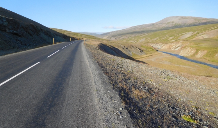
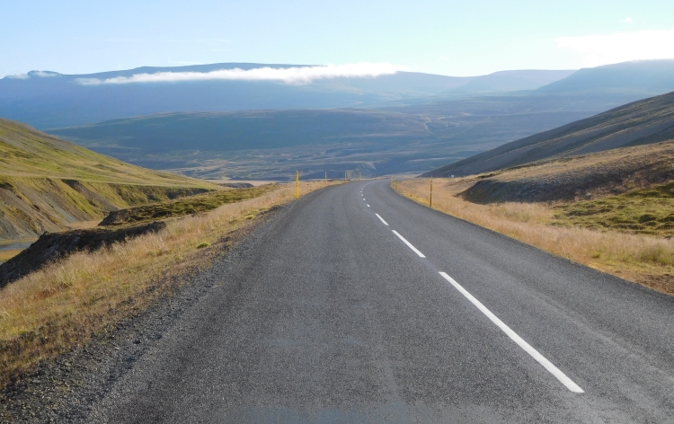
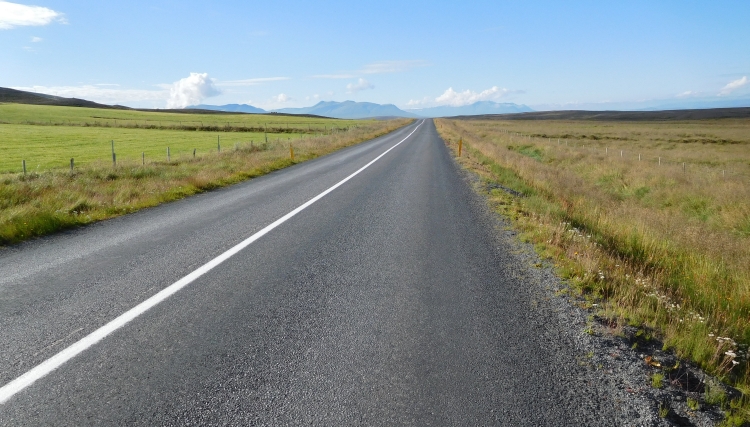
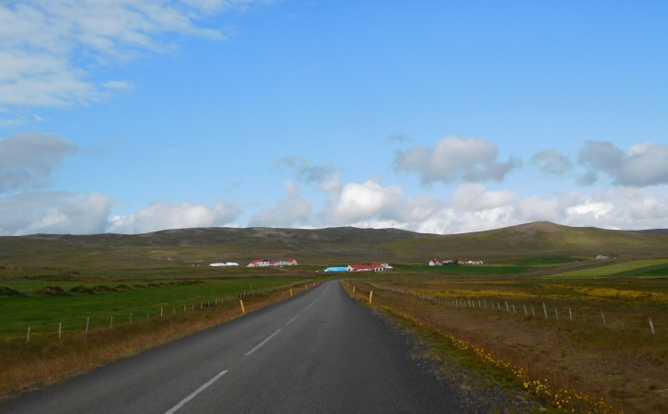
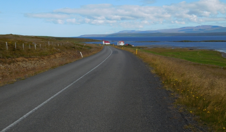
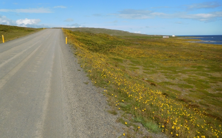
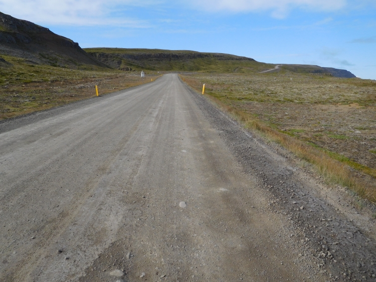
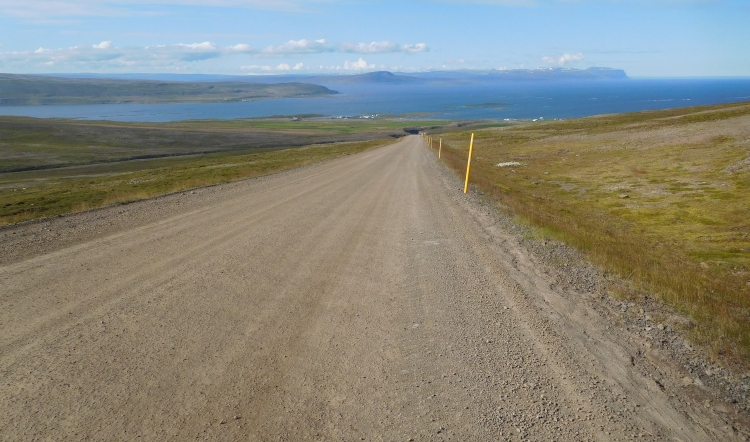
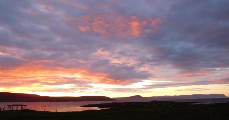
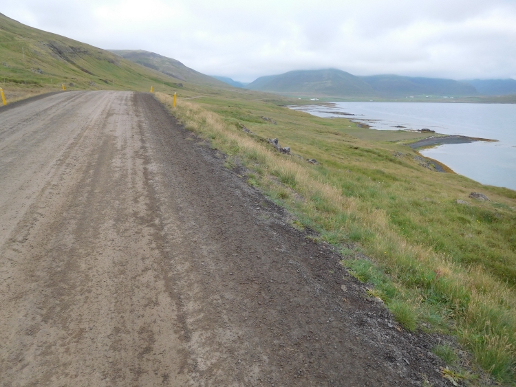
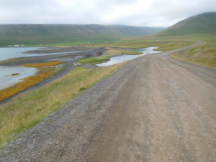
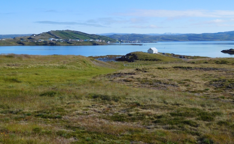
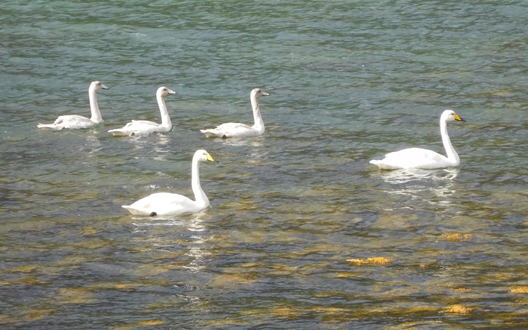
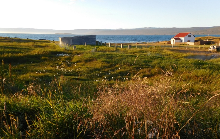
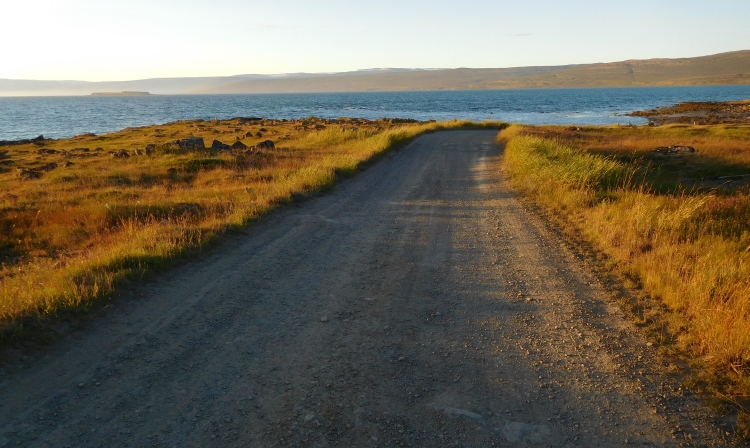
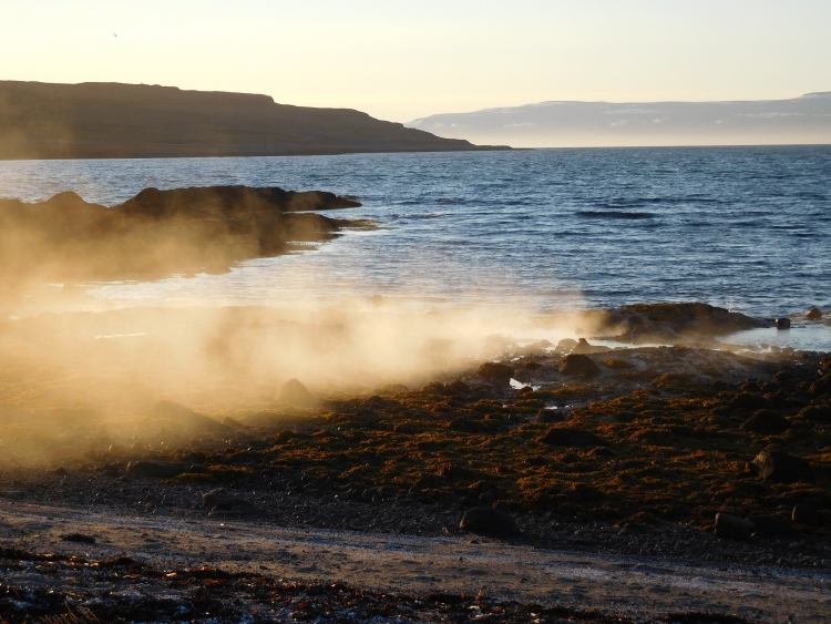
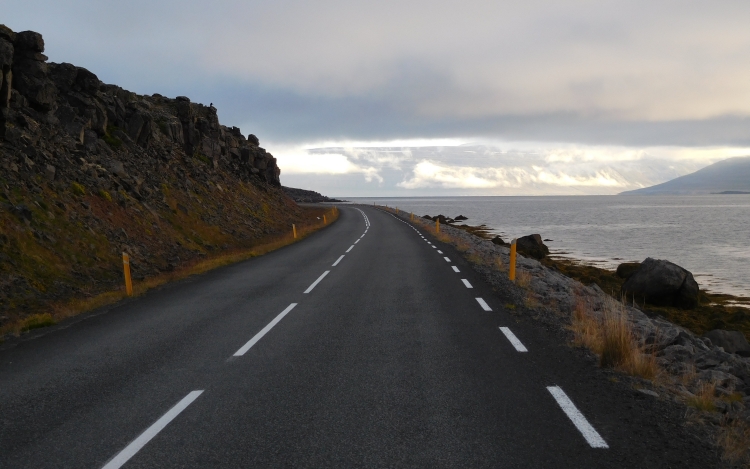
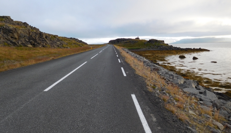
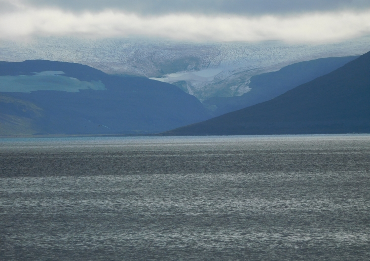
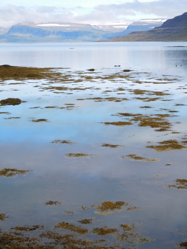 roam. The cliffs would be full of birds, including lots of puffins in the summer.
It should also be a beautiful area for trekkings. An excursion with a boat to the
area, however, is very pricey. Back and forth costs at least EUR 400,-. Only one boat
in several days will make the trip. I will miss the boat because it will be leaving
today; the next one will leave in three days. But nevermind, I do not have to pay the
huge sum of money anyway to spot an arctic fox. I have just seen a unit, from very close.
Inquiry at the quaint café in the Litlibær turf house learns me that the waitress
is not impressed at all by my observation. Arctic foxes are spotted here quite frequently.
Apart from arctic foxes, I also encounter sunbathing seals and throughout the route I
am enjoying musical accompanied by an orchestra of bird noises.
roam. The cliffs would be full of birds, including lots of puffins in the summer.
It should also be a beautiful area for trekkings. An excursion with a boat to the
area, however, is very pricey. Back and forth costs at least EUR 400,-. Only one boat
in several days will make the trip. I will miss the boat because it will be leaving
today; the next one will leave in three days. But nevermind, I do not have to pay the
huge sum of money anyway to spot an arctic fox. I have just seen a unit, from very close.
Inquiry at the quaint café in the Litlibær turf house learns me that the waitress
is not impressed at all by my observation. Arctic foxes are spotted here quite frequently.
Apart from arctic foxes, I also encounter sunbathing seals and throughout the route I
am enjoying musical accompanied by an orchestra of bird noises.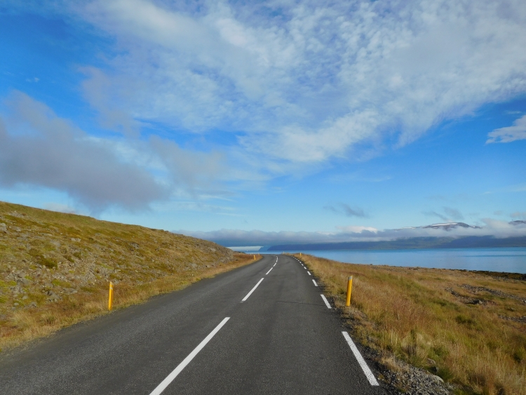
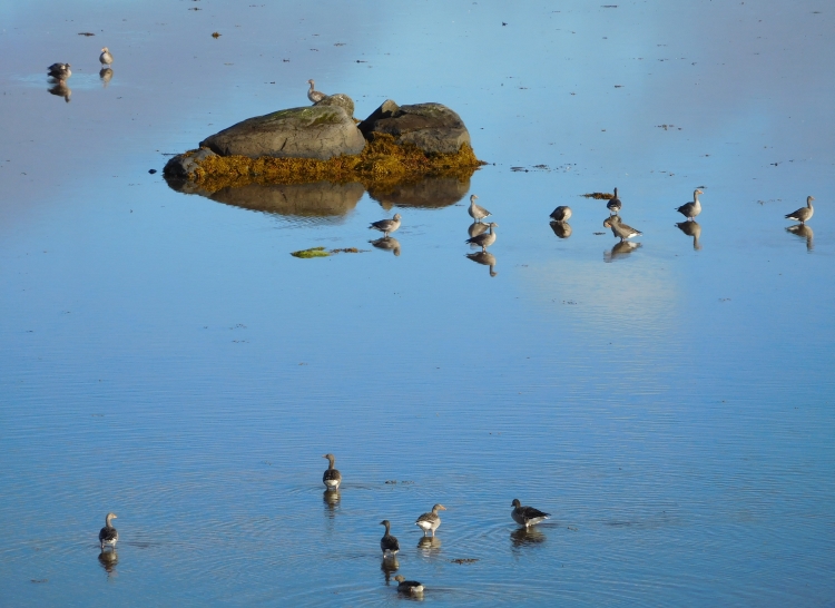
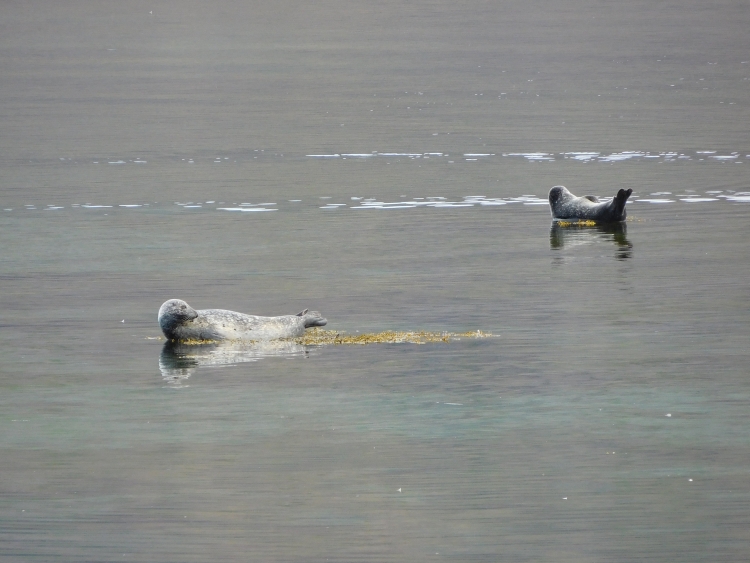
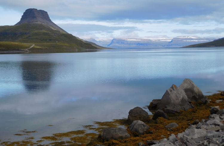
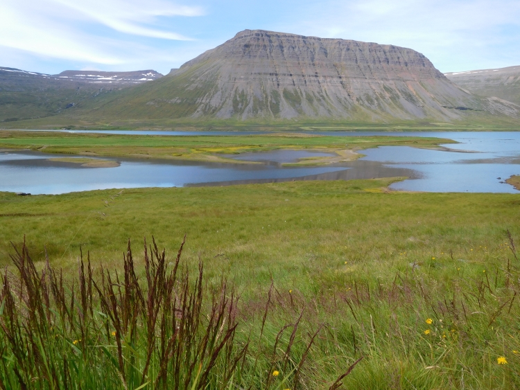
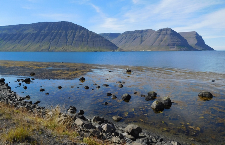

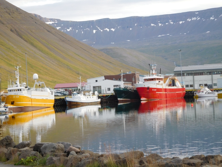
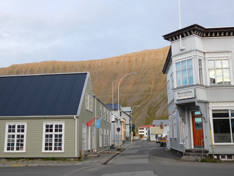
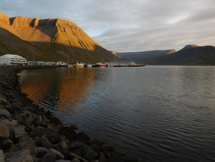
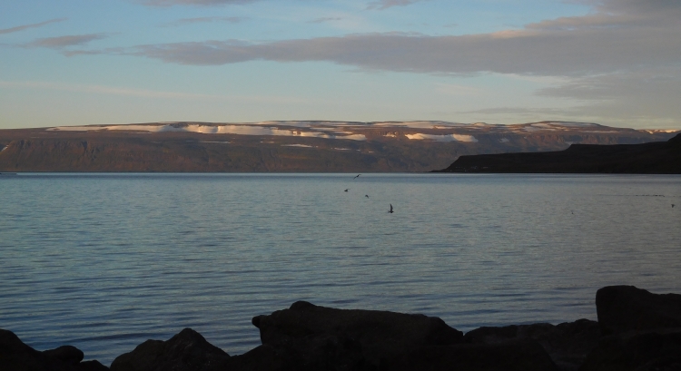
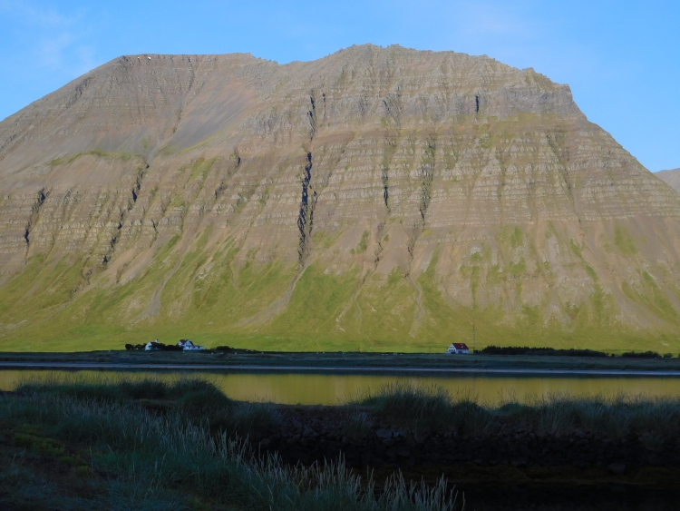
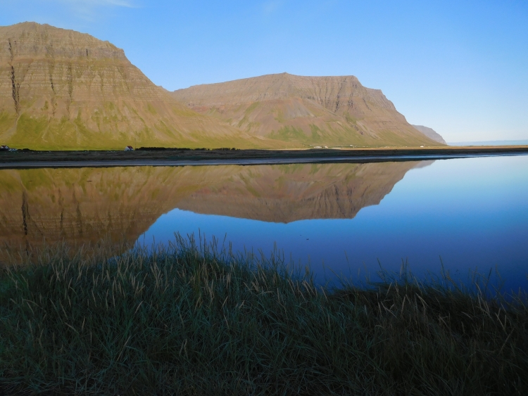
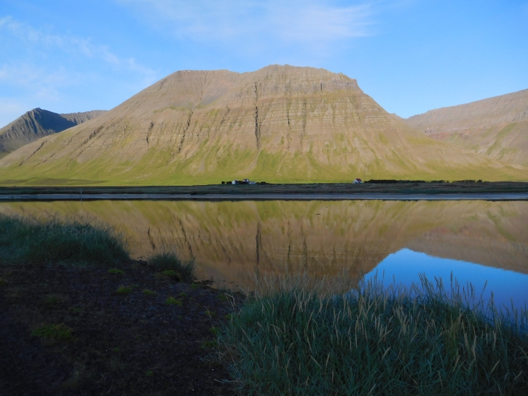
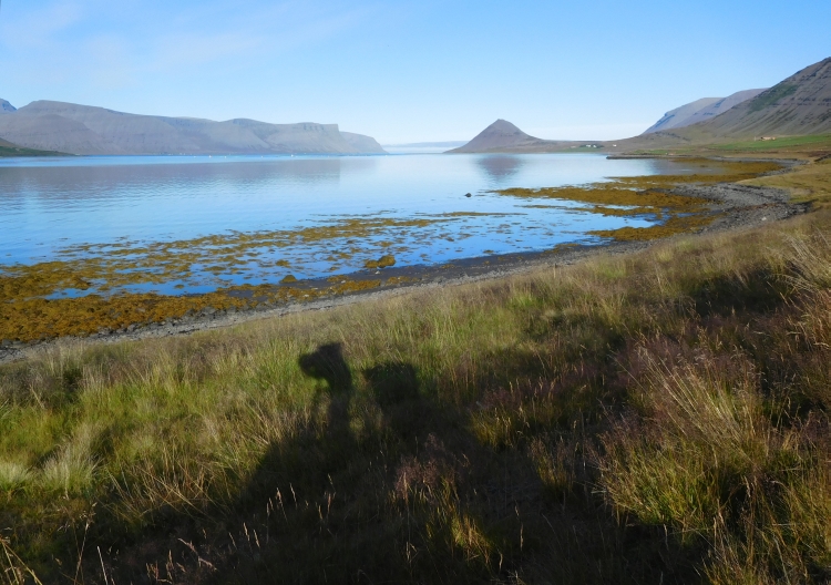
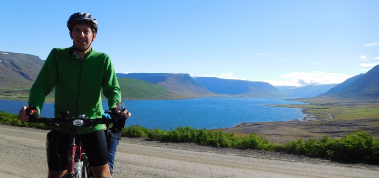
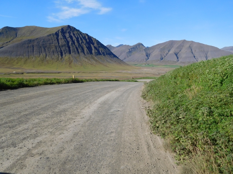
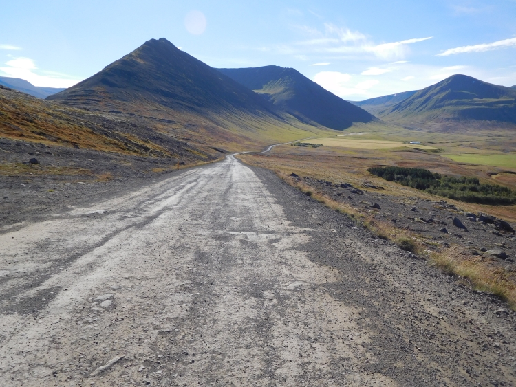
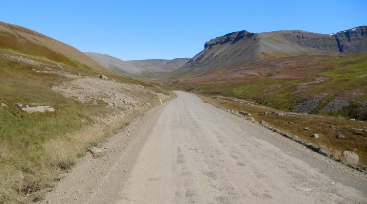
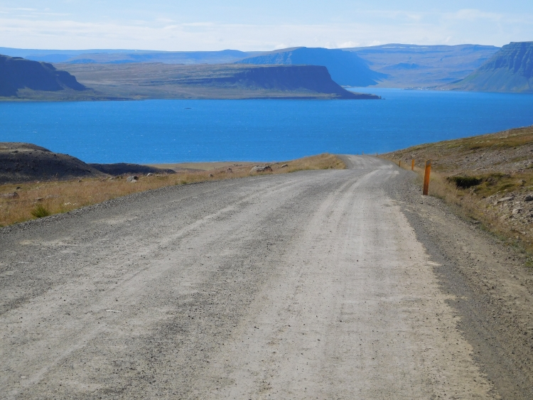
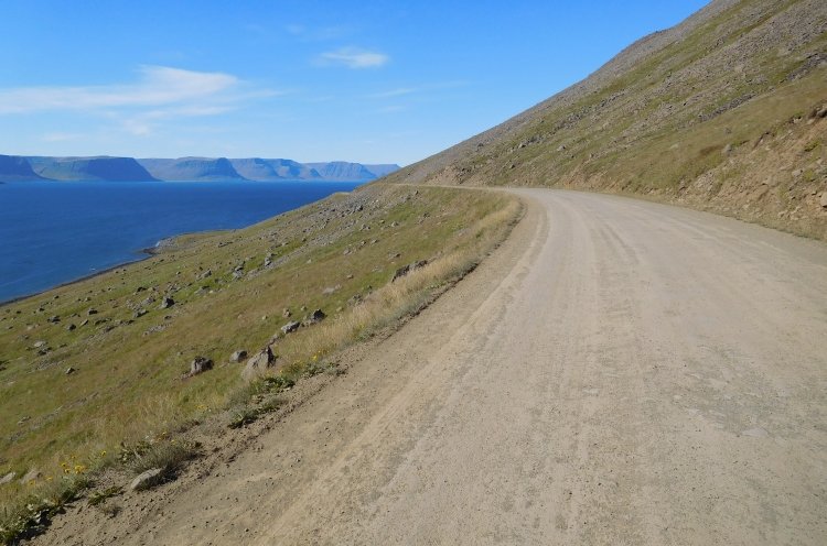
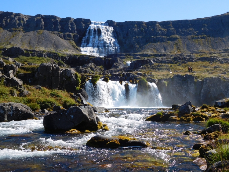
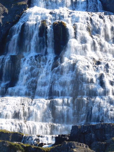 In both cases I have to cross two more passes, but in the second case I have to
continue for forty kilometers further to the Arnarfjördur afterwards, just to
reach the fjord where I am right now. I decide that I will be going to Bildurdalur
if I reach the exit to Bildurdalur before half past five. If I reach the crossroads
later, I will not try to reach Bildurdalur anymore but I will descend to Flókulandur.
In both cases I have to cross two more passes, but in the second case I have to
continue for forty kilometers further to the Arnarfjördur afterwards, just to
reach the fjord where I am right now. I decide that I will be going to Bildurdalur
if I reach the exit to Bildurdalur before half past five. If I reach the crossroads
later, I will not try to reach Bildurdalur anymore but I will descend to Flókulandur. 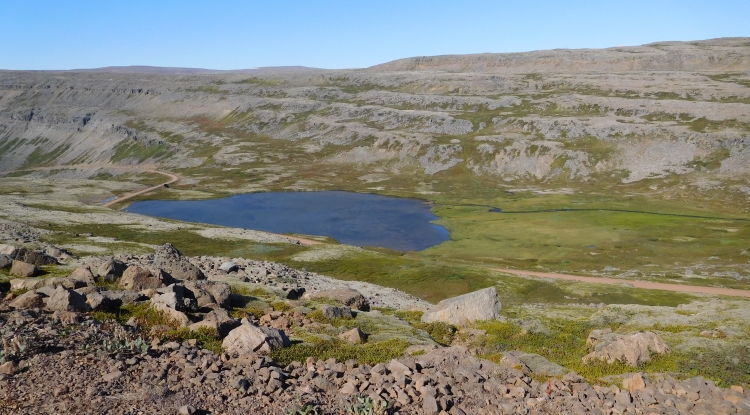
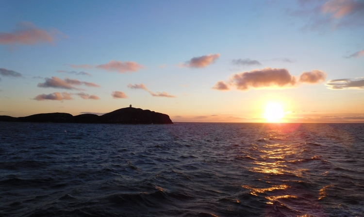
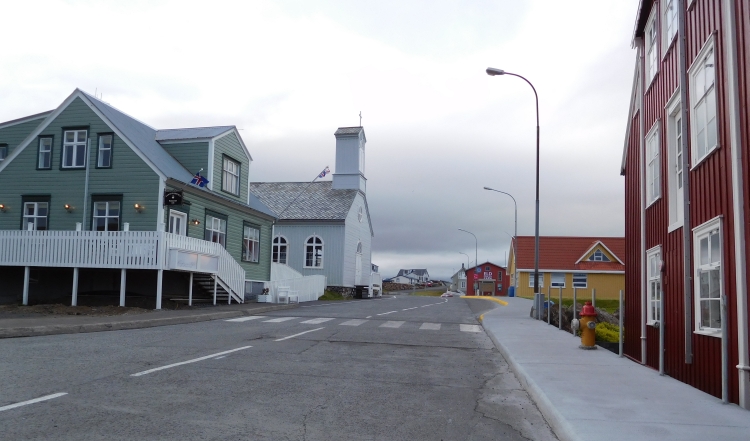
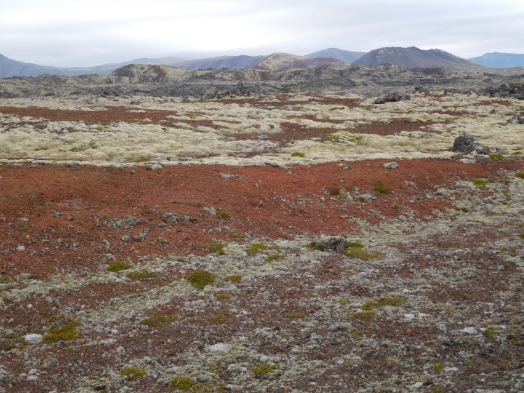
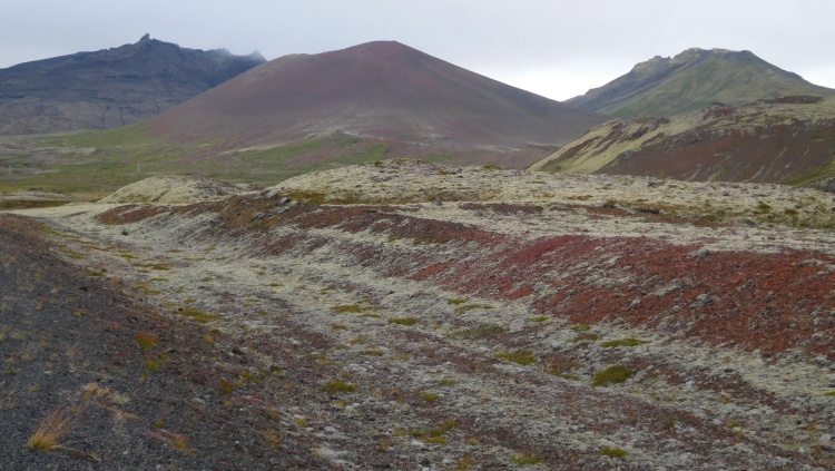
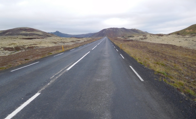
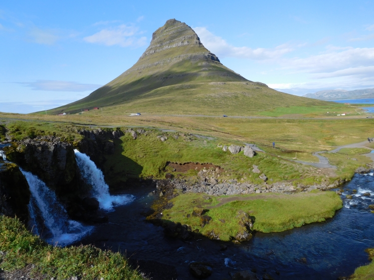
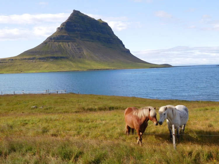
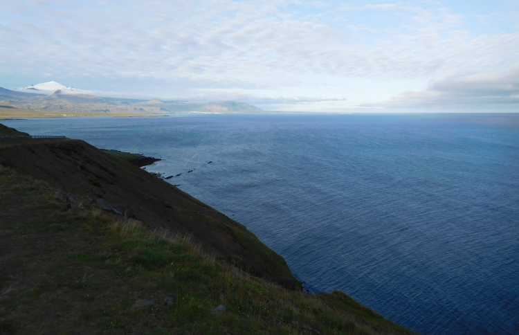
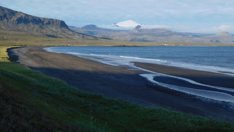
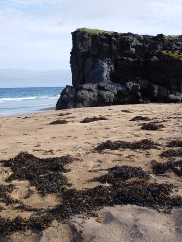 After Hellisandur I enter the domain of the Snæfallsjökull. The volcano
is surrounded by extensive lava fields, but also small volcanoes pop up from the plain.
And the lava fields are surrounded by the ocean, which is eroding the lava and basalt
coasts to sometimes whimsical, sometimes strangely bizarre and sometimes downright
beautiful shapes. All in all enough ingredients to keep me busy for the rest of the
day, especially because if all the other things fail, there will still be gorgeous
views over the volcano and the ice cap of the majestic Snæfallsjökull. Now
it must be said, that the landscapes do disappoint so far. I am cycling over a bad
dirt road to the lighthouse of Öndvarđernes, but it is uncertain whether
or not this detour is actually worth it. The bad road and the hard winds make progress
very slow. On the way there is the beautiful beach of Skarđsvík with an
impressive basalt cliff, but after the beach, I am cycling through a landscape with a
lot of stones and basically nothing else. Then I decide to turn around. My adagio is
that if you do not feel like doing something, you should not do it. How many disasters
would not have been avoided for ourselves or for the whole world if we all convert to
this simple way of living our lives. The realist in me says that we are not ready yet
to make that step. And let's be honest, I was myself was apparently not ready anyway,
as it took me almost half an hour to finally decide to turn around.
After Hellisandur I enter the domain of the Snæfallsjökull. The volcano
is surrounded by extensive lava fields, but also small volcanoes pop up from the plain.
And the lava fields are surrounded by the ocean, which is eroding the lava and basalt
coasts to sometimes whimsical, sometimes strangely bizarre and sometimes downright
beautiful shapes. All in all enough ingredients to keep me busy for the rest of the
day, especially because if all the other things fail, there will still be gorgeous
views over the volcano and the ice cap of the majestic Snæfallsjökull. Now
it must be said, that the landscapes do disappoint so far. I am cycling over a bad
dirt road to the lighthouse of Öndvarđernes, but it is uncertain whether
or not this detour is actually worth it. The bad road and the hard winds make progress
very slow. On the way there is the beautiful beach of Skarđsvík with an
impressive basalt cliff, but after the beach, I am cycling through a landscape with a
lot of stones and basically nothing else. Then I decide to turn around. My adagio is
that if you do not feel like doing something, you should not do it. How many disasters
would not have been avoided for ourselves or for the whole world if we all convert to
this simple way of living our lives. The realist in me says that we are not ready yet
to make that step. And let's be honest, I was myself was apparently not ready anyway,
as it took me almost half an hour to finally decide to turn around.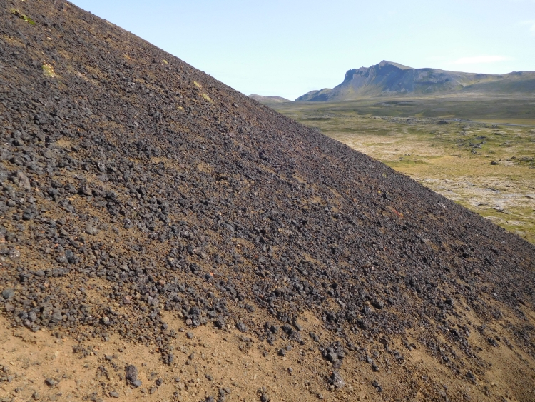
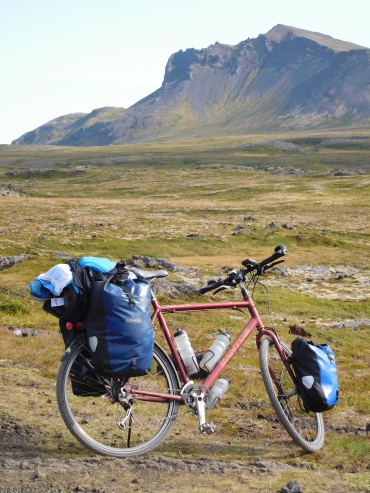
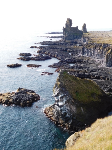
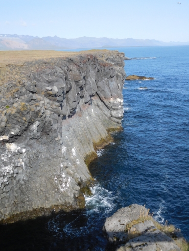 After Lóndrangar it does not take long before the road finally leaves the lava
field. I have finally rounded the peninsula and now I am cycling eastwards in the
direction of Borgarnes and Reykjavik. And of course Arnarstapi, the intended final
destination for today. Arnarstapi is a place where nobody really lives - almost no
one lives in the south of Snæfallsnes whatsoever - but there is a big tourist
complex where you can sleep for a few hundred euros a night in a refined log cabin.
Undoubtedly very romantic, but I prefer my own tent, especially when it comes to such
prices. The campsite also is not cheap. Twenty euros for a neglected lawn without
proper shelter against the wind and with the only facility an equally neglected
toilet room. Showers do not even exist, although when I suggest that I really have
to shower and I will otherwise will look for another place, there are showers suddenly,
but they cost ten (!) euros without warranty that the water will be hot. What to do?
I do not have to think long. It seems to me that it is a correct starting point not to
pay for a service that is not being offered. That the service is there, does not really
matter. Never have I saved so much money with a shower. That is why I really enjoy this
lovely hot shower for a long time.
After Lóndrangar it does not take long before the road finally leaves the lava
field. I have finally rounded the peninsula and now I am cycling eastwards in the
direction of Borgarnes and Reykjavik. And of course Arnarstapi, the intended final
destination for today. Arnarstapi is a place where nobody really lives - almost no
one lives in the south of Snæfallsnes whatsoever - but there is a big tourist
complex where you can sleep for a few hundred euros a night in a refined log cabin.
Undoubtedly very romantic, but I prefer my own tent, especially when it comes to such
prices. The campsite also is not cheap. Twenty euros for a neglected lawn without
proper shelter against the wind and with the only facility an equally neglected
toilet room. Showers do not even exist, although when I suggest that I really have
to shower and I will otherwise will look for another place, there are showers suddenly,
but they cost ten (!) euros without warranty that the water will be hot. What to do?
I do not have to think long. It seems to me that it is a correct starting point not to
pay for a service that is not being offered. That the service is there, does not really
matter. Never have I saved so much money with a shower. That is why I really enjoy this
lovely hot shower for a long time.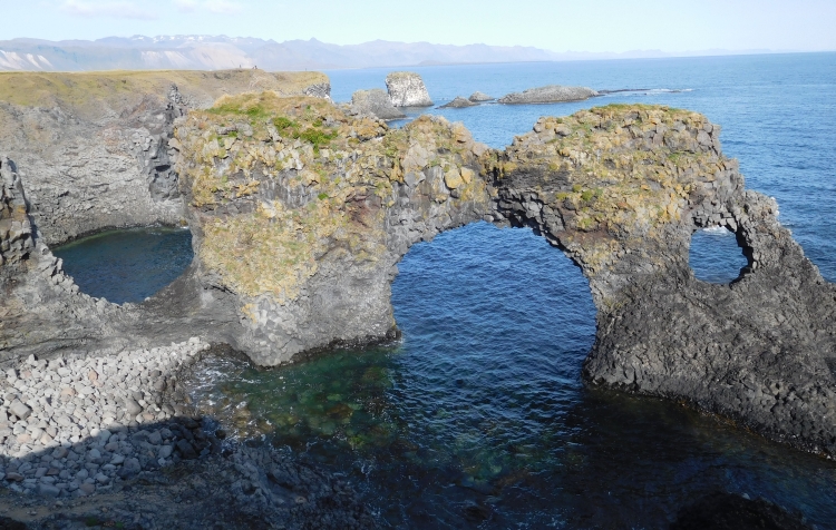
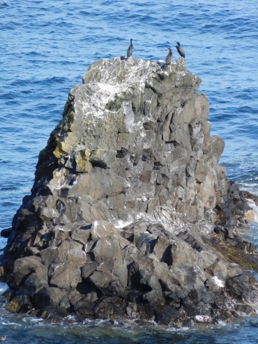
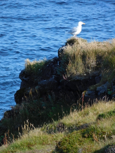
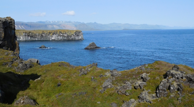
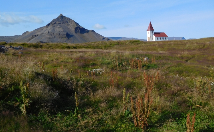
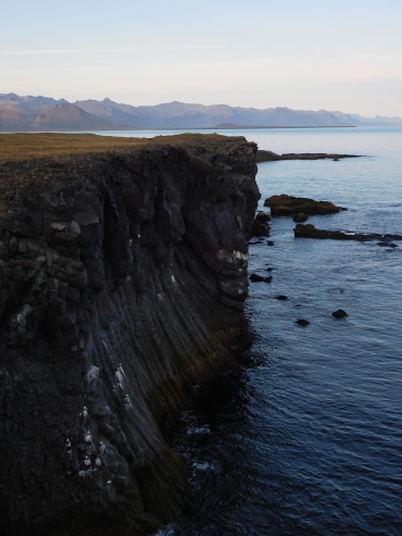
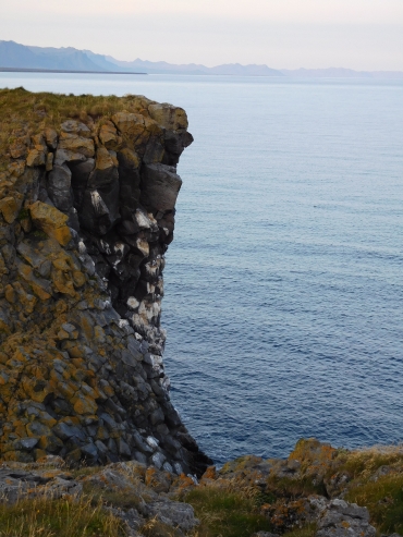
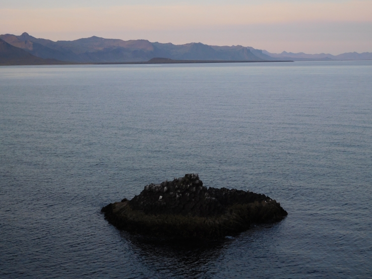
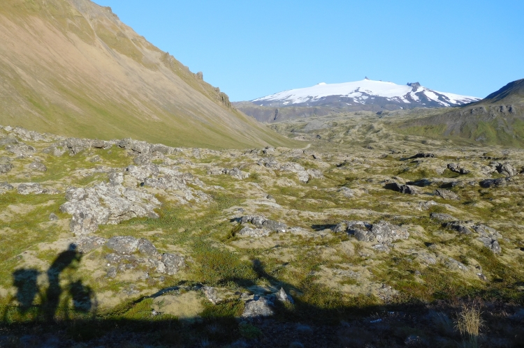
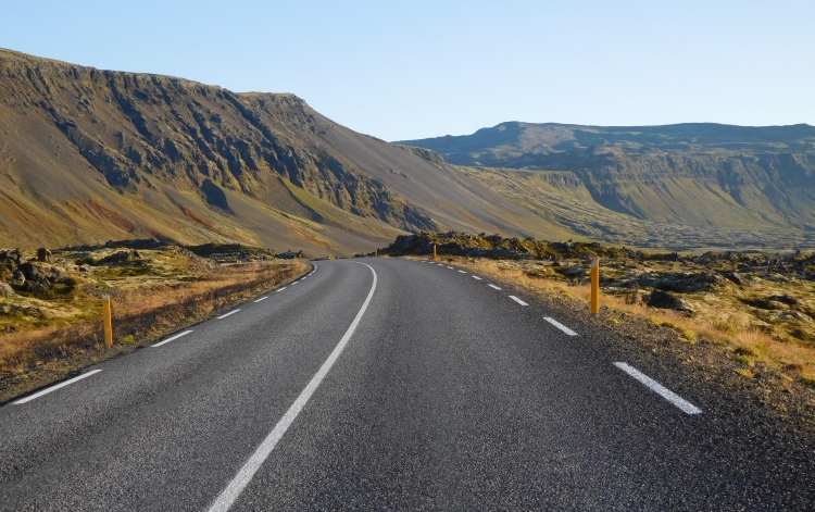
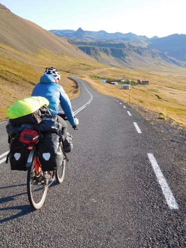 You can tell by his skinny appearance and by the way he cycles that Marco has spent many
an hour cycling in the mountains. He is especially strong as the road goes up. Today
there are not too many climbs, though. We are cycling between the high mountain ridge
of the peninsula and the sea. And although we have breathtaking views over the mountains
and volcanoes, we do not have to climb very much. It is not only rather flat today,
there is also no wind at all. We are therefore moving fast.
You can tell by his skinny appearance and by the way he cycles that Marco has spent many
an hour cycling in the mountains. He is especially strong as the road goes up. Today
there are not too many climbs, though. We are cycling between the high mountain ridge
of the peninsula and the sea. And although we have breathtaking views over the mountains
and volcanoes, we do not have to climb very much. It is not only rather flat today,
there is also no wind at all. We are therefore moving fast.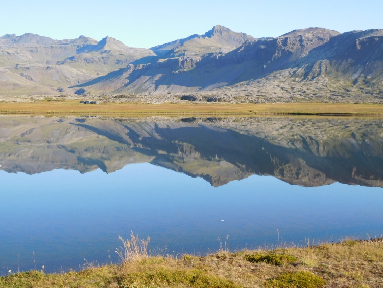
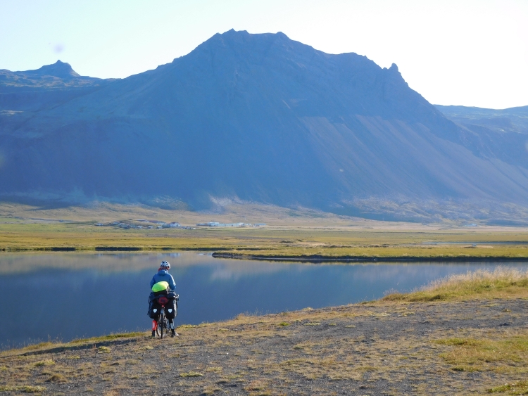
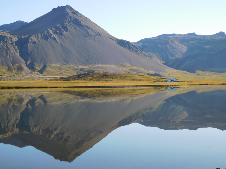
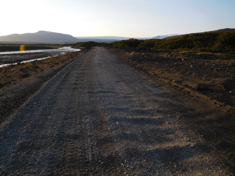

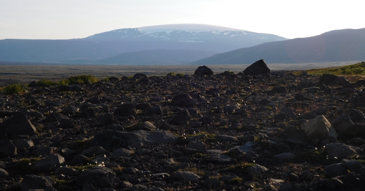
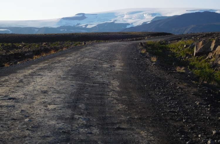
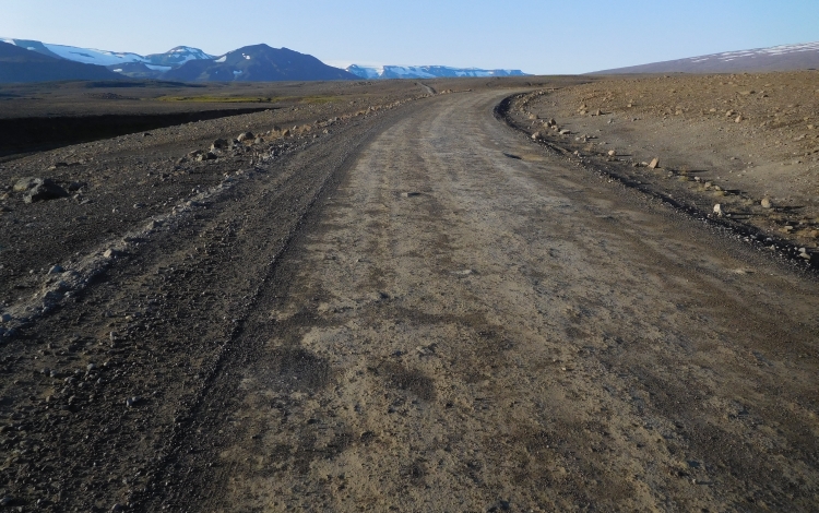
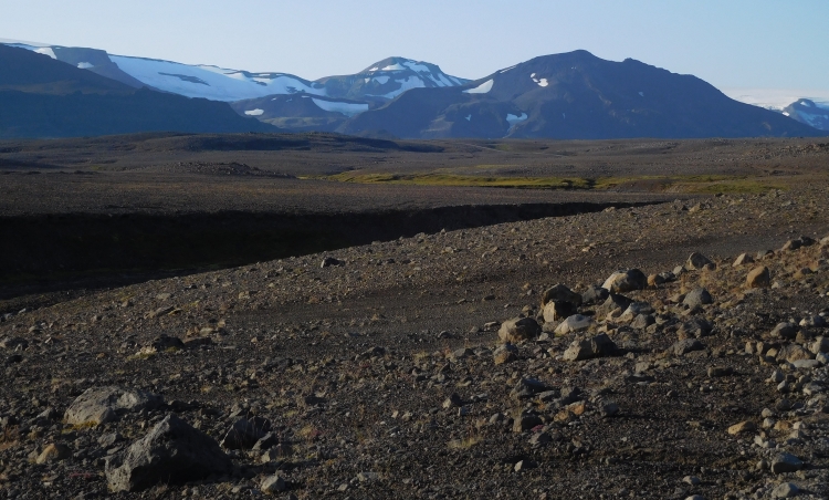
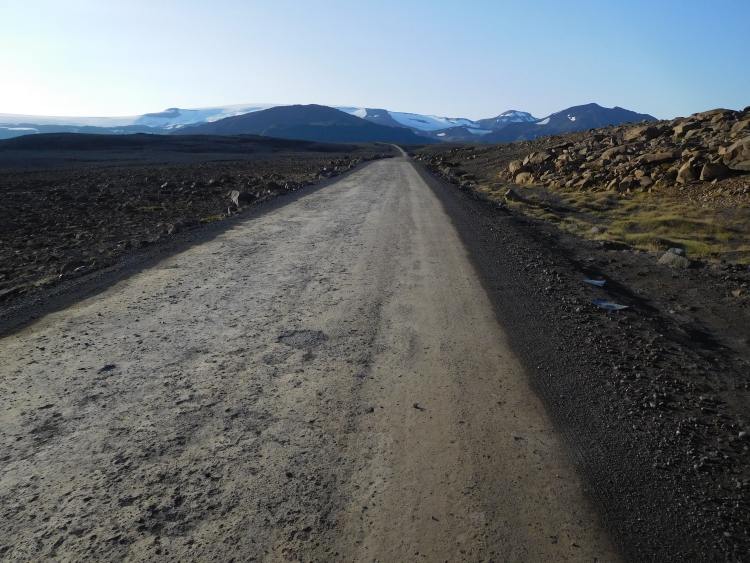
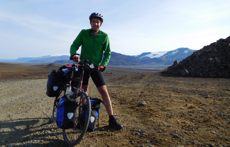
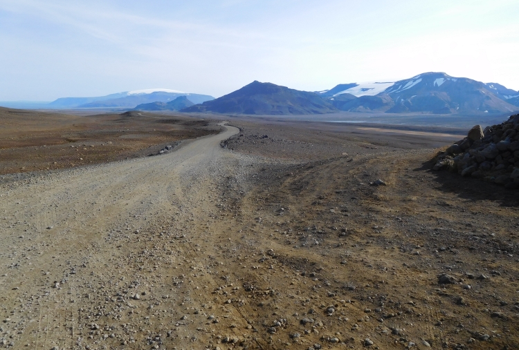
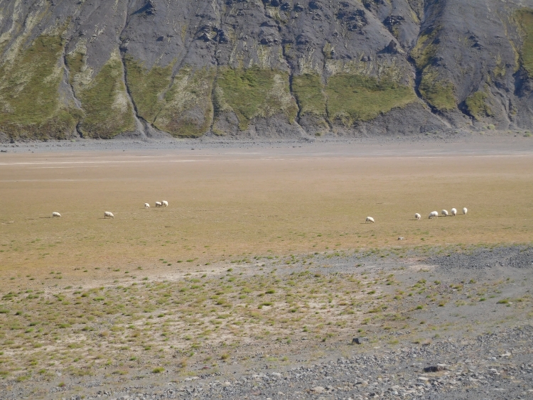
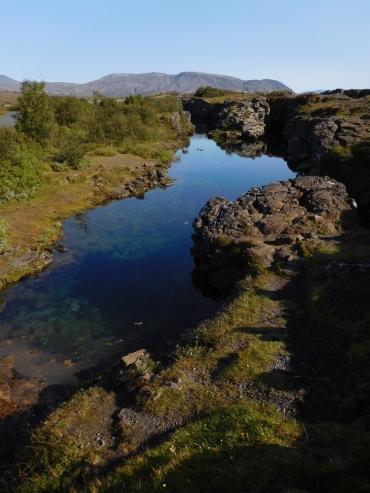 The first day of my trip I have also been passing through Þingvellir. At that time I
have not benefited fully from the special destination that is Þingvellir. That was
on the one hand because I had just started and I was filled with curiosity to the "larger"
landscapes of Geysir, Gullfoss and Landmannalaugar. And that was on the other hand because
I already had in my mind that I could pass Þingvellir again on the wy back. And so
it happened, because now I am here again. At the time I had fairly favorable conditions,
but it was partly cloudy. Now, however, it is a super day. And there is still a lot of
beauty that I had missed the first time, like the fissures filled with water pools, which
originated by the plates of America and Eurasia that are moving apart.
The first day of my trip I have also been passing through Þingvellir. At that time I
have not benefited fully from the special destination that is Þingvellir. That was
on the one hand because I had just started and I was filled with curiosity to the "larger"
landscapes of Geysir, Gullfoss and Landmannalaugar. And that was on the other hand because
I already had in my mind that I could pass Þingvellir again on the wy back. And so
it happened, because now I am here again. At the time I had fairly favorable conditions,
but it was partly cloudy. Now, however, it is a super day. And there is still a lot of
beauty that I had missed the first time, like the fissures filled with water pools, which
originated by the plates of America and Eurasia that are moving apart.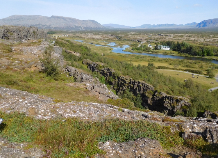
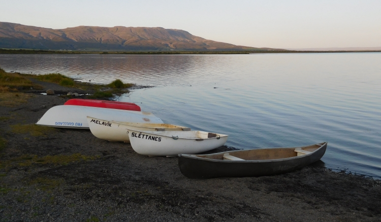
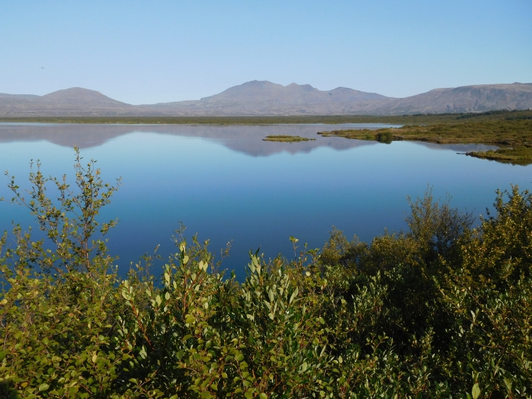
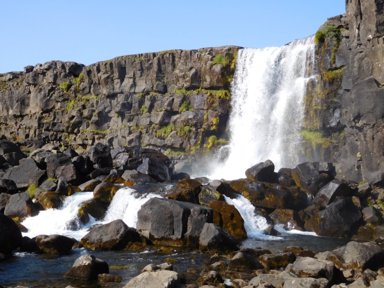
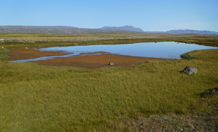
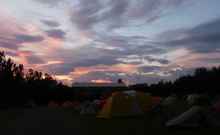
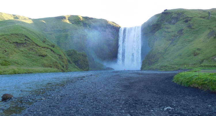
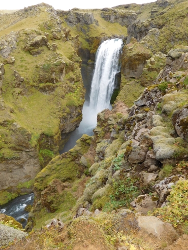 I am thinking quickly whether or not I want to take the risk of starting. I can still
decide to buy a ticket back again now. I do not have to think about this dilemma for a
long time. I will be taking the risk. And I will have to run like hell.
I am thinking quickly whether or not I want to take the risk of starting. I can still
decide to buy a ticket back again now. I do not have to think about this dilemma for a
long time. I will be taking the risk. And I will have to run like hell.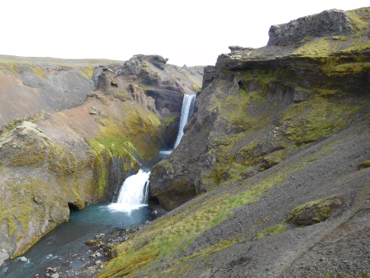
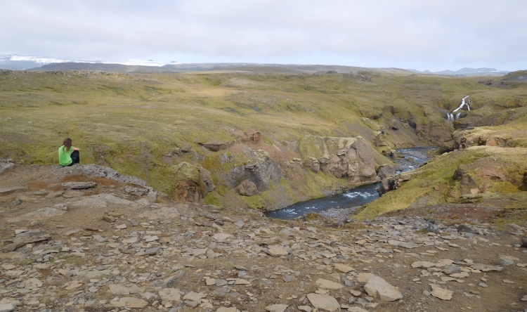
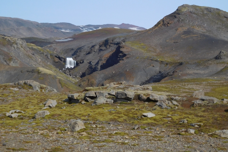
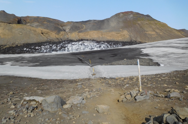
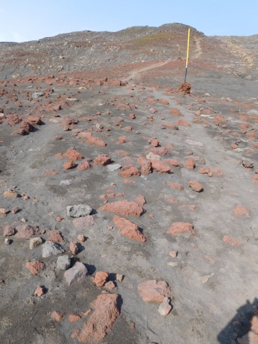
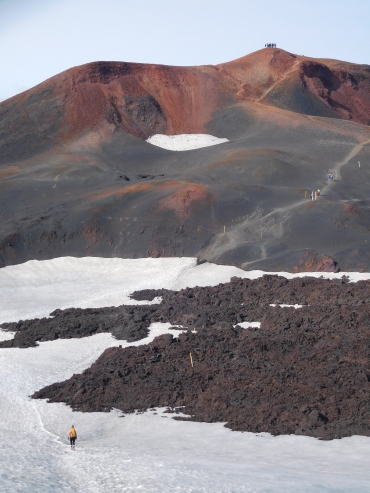
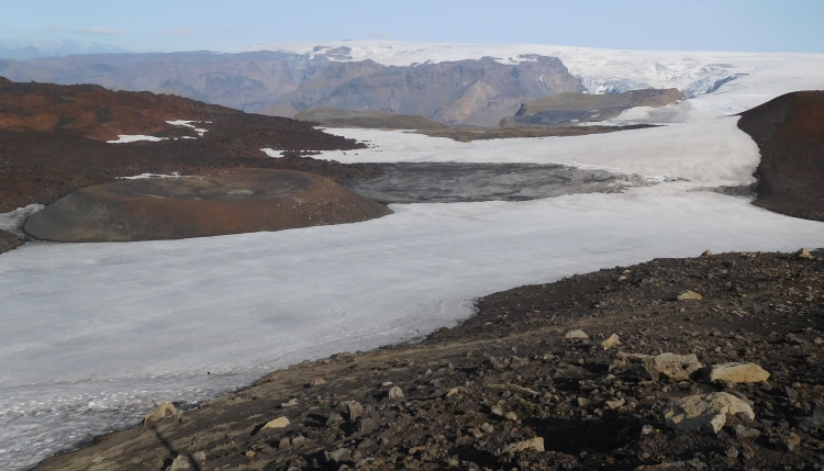
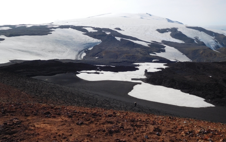
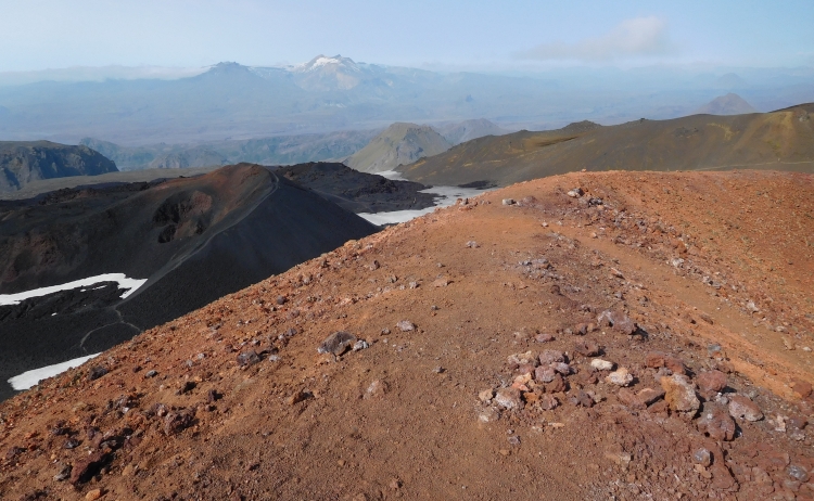
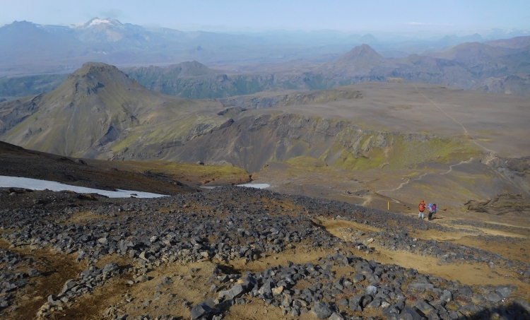
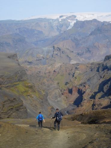 I am suddenly a lot farther than I had thought and suddenly I am in the position that I do
not really need to worry to catch the bus. Even better: possibly I will not need to take the last bus
and i might be able to catch an earlier bus. The descent leads over steep, loose debris. The terrain
is still not easy, especially not on my running shoes. I am between the people again. Because I am
lightly packed and because I was in a hurry, I have walked up considerably faster than most
of the others. And now I am going down, I still catch up a lot of people. Now I feel that it is
going to be okay, I have time for a chat here and there. It feels good to share the beauty of
this environment with others. And to stand together if there is a difficult passage to be overcome,
like a real climbing passage after my temporary group has taken a wrong route.
I am suddenly a lot farther than I had thought and suddenly I am in the position that I do
not really need to worry to catch the bus. Even better: possibly I will not need to take the last bus
and i might be able to catch an earlier bus. The descent leads over steep, loose debris. The terrain
is still not easy, especially not on my running shoes. I am between the people again. Because I am
lightly packed and because I was in a hurry, I have walked up considerably faster than most
of the others. And now I am going down, I still catch up a lot of people. Now I feel that it is
going to be okay, I have time for a chat here and there. It feels good to share the beauty of
this environment with others. And to stand together if there is a difficult passage to be overcome,
like a real climbing passage after my temporary group has taken a wrong route.