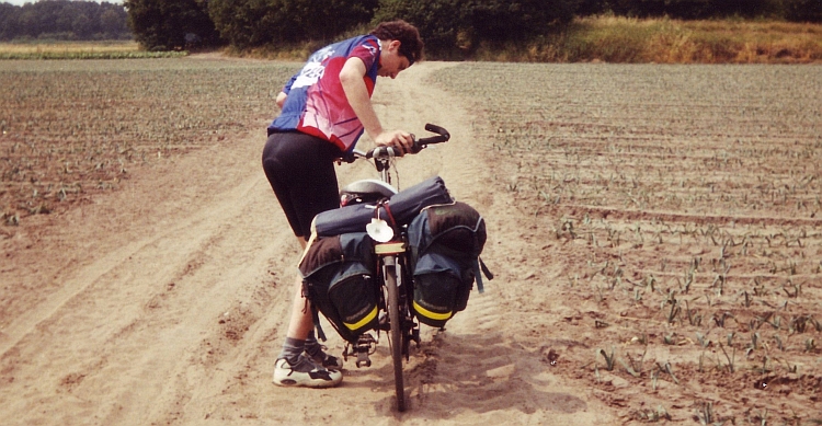
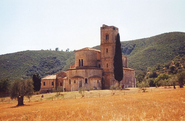
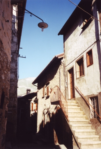
Day 1: Bunnik - Utrecht - Culemborg - Oisterwijk - Oirschot - Achel - Opglabbeek 180 km
Along the Kromme Rijn Valley I am cycling to Willems home in Utrecht. It is early in the morning.
This is already the third time that I am beginning a cycle journey. This time I will
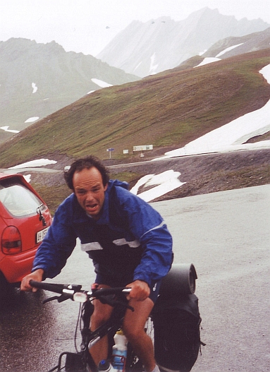
travel with Willem. Our destination is Rome. Jeroen will join us from Maastricht to the French Alps.
It is a beautiful day. As I arrive at Willems home, the sun has warmed the air to
pleasant temperatures.
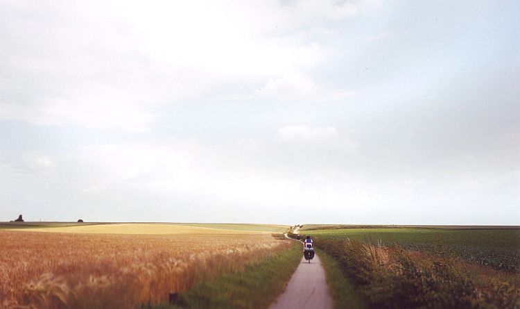
Willem and I have to ride far enough today to pick up Jeroen from the early train
in Maastricht tomorrow. Through the flat landscapes of Holland and
Belgium, we proceed in a good pace. Circumstances are good, there is not
much wind. After a long day we arrive in Opglabbeek in Belgium, less than 15
kilometres from Maastricht. Good enough for today.
Day 2: Opglabbeek - Maastricht - Slenaken - Limbourg - Jalhay - Botrange - Robertville 80 km
We wake up early in the morning to arrive on time in Maastricht. At 10 o'clock we arrive
at the station, right on time. Jeroen seems to have more problems. At 11 o'clock
he still is not there. At 12 o'clock neither. What has happened? Fifteen minutes
later he finally arrives. The Dutch railways are not famous for strict schedules.
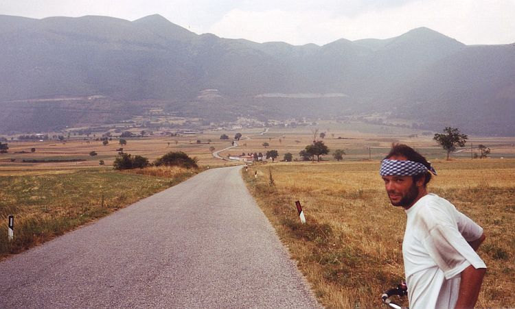
So now the journey can really begin. The first hill is only a ten minute ride away.
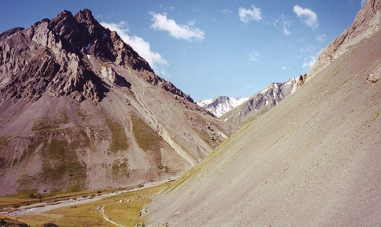
The Bemelerberg is a short ascent that brings us to the plateau of the Margraten.
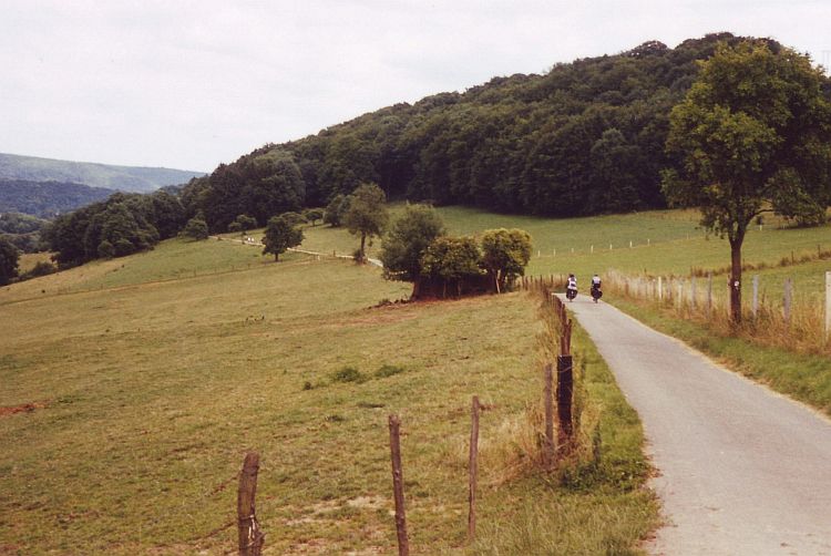
Southern Limburg is the only hilly part of the Netherlands. The landscape becomes
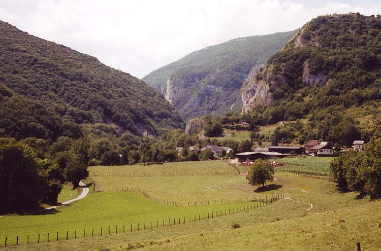
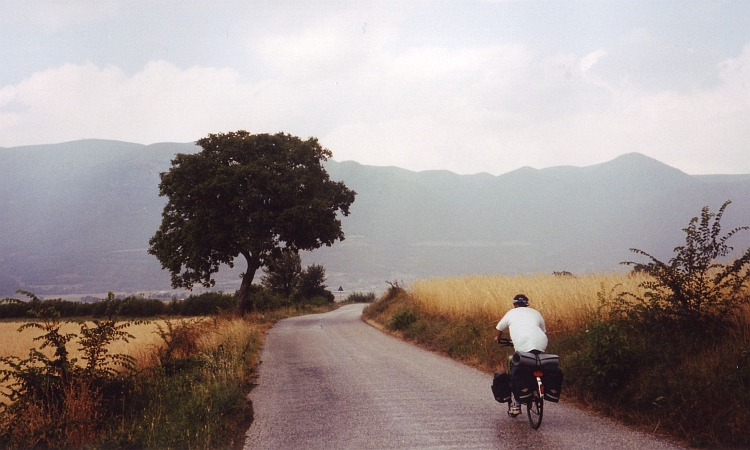
more hilly however when we have crossed the Belgian border. The Ardennes are not too
high also, but cycling in the Ardennes means climbing fifteen minutes, go down one minute,
then climb again for fifteen minutes. In fact we are climbing all the time without gaining
altitude in the end. The dullest climb of all is the ascent between Limbourg and
Jalhay. A very wide road with lots of traffic. The next ascent will never become
one of my favourites either. The ascent to the highest 'mountain' of Belgium, the
694 m Signal de Botrange, is a 7 kilometre long straight line with nothing to see
on the way.
Day 3: Robertville - St Vith - Ouren - Vianden - Bollendorf - Echternach - Rosport 130 km
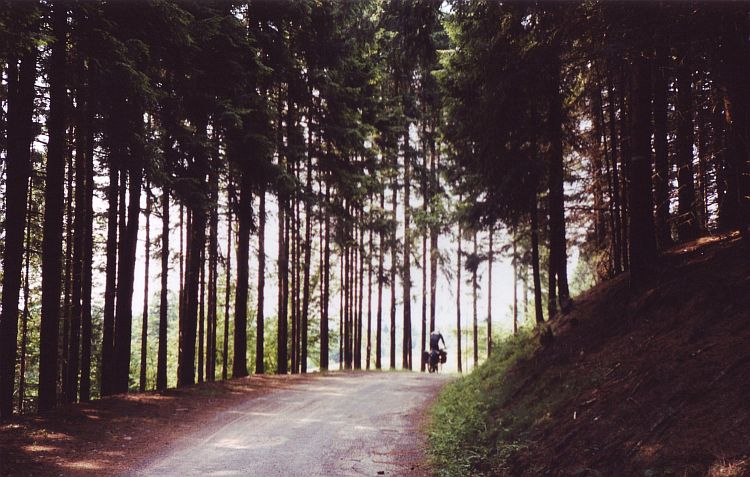
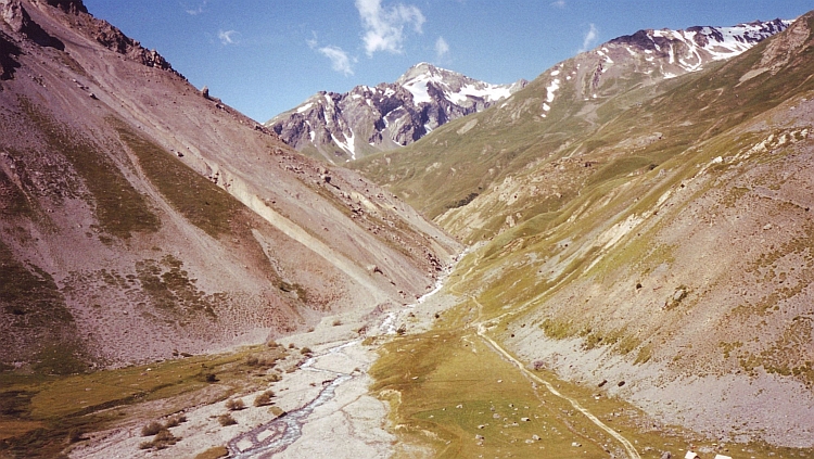
Another Ardennes day brings a lot of climbing too. This time on fine small roads in lovely
nature. The weather is grey which enhances the atmosphere. In Ouren we come at the border with
Luxemburg and Germany. The relatively deep valley of the Our is wonderful. We have to climb
out of the valley however. The road does not follow the valley any further. We have two possibilities:
the Luxemburg side of the valley or the German side. On my first cycling journey to
Spain I took the Luxemburg side which was quite a steep one. We decide to try the
other therefore.
Our decision was ill-deviced. This one is really steep. With a maximum gradient of around
20 % we need all our forces to just go on. Two kilometres and lots of sweat
later we arrive at the plateau, only to go down again a few kilometres later.
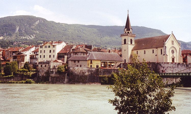
We follow the river again and pass lovely little towns like Vianden and Echternach.
We finish the day in the camping of Rosport.
Day 4: Rosport - Schengen - Sierck Les Bains - Bouzonville - St Avold 100 km
Fifty flat kilometres along the rivers Sauer and Moselle with the wind in our
backs bring us in two hours in Schengen. The weather is beautiful and so are the
vineyards on the hills along the river. At the border of France the flat kilometres come
to an end. The hills of Lorraine are no more than quiet, rolling hills but sometimes
there is a small, steep ascent. We sleep in the camping of St. Avold.
Day 5: St Avold - Fénétrange - Rauviller - Col du Donon - Schirmeck - Rothau 120 km
After a few kilometres we see a steep hill. The main road leads away from it just
before the hill. Our route however leaves the main road and goes in a stright line
right up against the wall. I see Jeroen 500 meter before me, a point on a straight line.
Not a moving point. He is slow enough to prevent seeing any movement. When I look a minute later
he is further up the hill though. When Willem and I start to climb, we find out that
this is indeed a very steep ascent in this further very gentle landscape.
There are no further surprises. We have luch break in the beautiful village of
Fénétrange. From now the landscape becomes more and more hilly. We see the
high wooded hills of the Vosges in the distance. We ride in a straight line towards
the line of hills. I am always very pleased to ride straight to a mountain range.
The Vosges are not that high though, but it will do for the moment. The first col
of the trip is the 718 meter high Col du Donon. The col is never steep but therefore
very long. My shape is not great, but good enough for today. We will see how tomorrow
will be, when we will have some steeper ascents.
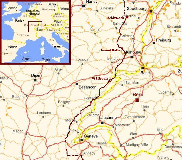
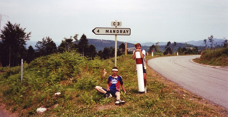
Day 6: Rothau - Saales - Col de Mandray - Le Valtin - Grand Ballon - Thann - Cernay 140 km
After some small cycle repairs we start a bit late. At ten o'clock we leave the
camping. A small road goes up to the Col de Saales. A long descent brings us in a
wide valley. We leave the valley for the ascent of the Col de Mandray. The Mandray is
again a comparatively easy ascent. The third ascent of the day is a bit longer.
And also a bit tougher. It is the first real col of this journey. From Le Valtin
a small road leads to the Col de La Schlucht. After a long mildly climbing stretch,
the road goes truly uphill at last. Further and further we climb above the valley.
All the time we see the little pass where the road joins the main road to the
Col de la Schlucht. From this prepass we will have to climb another two kilometres
further uphill to reach the col. All in all, the ascent is surprisingly long.
After more than an hour we finally reach the 'Prepass'.
The last two kilometres untill the Col de la Schlucht are not too difficult anymore.
After the col we have to ascend a bit more. We are on the 'Route des crêtes'
now. The Route des crêtes was built for army purposes after World War I and
is now a very touristic road that goes right over the crest of the Vosges hill
range and ends in the highest hills of the Vosges: the Ballon d'Alsace and the
Grand Ballon. The views are great. Because it is already late, the sun throws
ever deeper shadows over the hills. We end the Route des crêtes at the
highest point of the Vosges, the Grand Ballon at 1.400 meter elevation. The
descent to the nice wine village Thann is long and steep. We stay the night on
the camping of Cernay.
Day 7: Cernay - Delle - Rocourt - Montjoie - St Hyppolyte 100 km
There is some highly obscure rolling hill land between the Vosges and the Jura. At first,
we have some excellent views on the Ballons of the Vosges. As we proceed further
southward, we see the first range of the Jura in the distance.
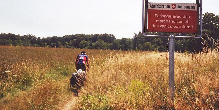
It takes us a few hours to cross the farmlands. Behind Delle, the first low hill
ranges of the Jura rise up. We ride straight toward the Swiss frontier. This
must be the most obscure border crossing of the world. An overgrown tractor trail
is our pathway into Switzerland.
We do not spend a long time in Switzerland. Only a few kilometres after our border
crossing, we are back in France again. We follow the course of the Doubs river,
our first highlight in the Jura. Massive limestone cliffs flank the river. The
Doubs owes its name to the 'dubious' twists and curves through the limestone plateau.
Much more dubious than the river is the weather. The temperature is extremely high
and the air is filthy humid. Indeed, just after we arrive at the camping of St Hippolyte,
the Jura is plagued by one of its frequent heavy rains. It is raining and thundering
all afternoon untill the evening. The thunder stops, but it keeps on raining the
whole night through...
Day 8: St Hyppolyte - Morteau - Pontarlier 100 km
... And it keeps on raining as we get up. The Jura lives up to its fame as a very
rainy area. From the beginning to the end of the day it is raining.
Despite the weather, it is lovely cycling in the Jura. The landcape is very green.
We follow the valley of the Dessoubre. Again the river is flanked by some splendid
vertical limestone cliffs.
It is climbing time again. Along the steep cliffs of the Cirque de Consolation we reach
the village of Fuans. We climb a few kilometres more. A long descent is our reward.
The wide valley of Pontarlier lies before us. With high speed we ride towards
the grasslands of the valley.
Day 9: Pontarlier - Chaux Neuve - St Claude 110 km
The day begins again with hard rains. The hills hang in thick clouds. There is nothing
to be seen. We cycle further, only because we are wet whatsoever, whether we stop or
we cycle on.
The afternoon brings improvement. The rains stop and a watery sun tries to break
through the clouds. The southside of the Jura brings higher and higher hills.
Willem nearly has an accident as he rides with full speed through a stop sign.
A truck nearly catches him. All human beings would have been in a shock. Not
Willem. Despite Willem is to blame for the situation, we see him screaming
and shouting at every car, cursing all the car drivers on the planet.
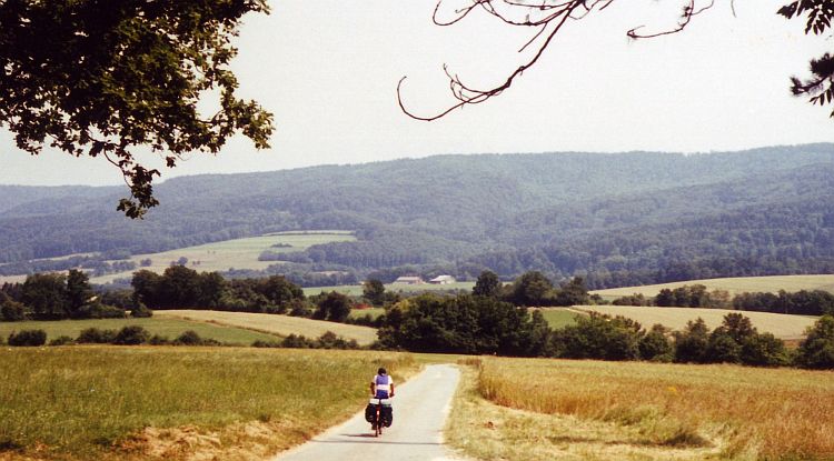
Day 10: St Claude - St Germain - Seyssel - Val du Fier - Annécy - Talloires 115 km
We begin the day with the ascent to the 1.049 meter Col de la Croix de la Serra.
After flexing the muscles of an ascent, there is always the moment that the legs have
rest at the descent on the other side. This descent is a long one that ends in the
Rhône Valley.
We climb again to a river terrace plateau a few hundred meters above the river.
We have panoramic views back over the high Jura and more important... the Alps. The
higher chains are not yet visible but we are on our way. The road goes down to the
Rhône again eventually. We cross the river at picturesque Seyssel. We enter the foothills
of the Alps in the narrow cliffs of the Val du Fier. After a lot of additional climbing
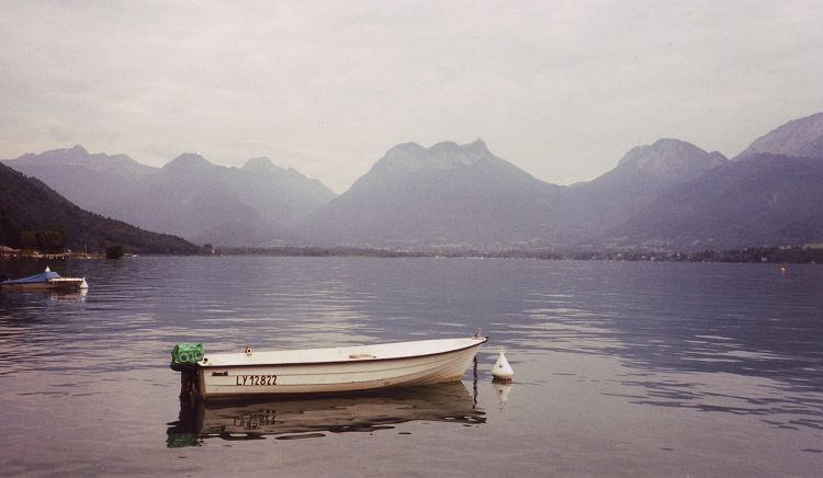
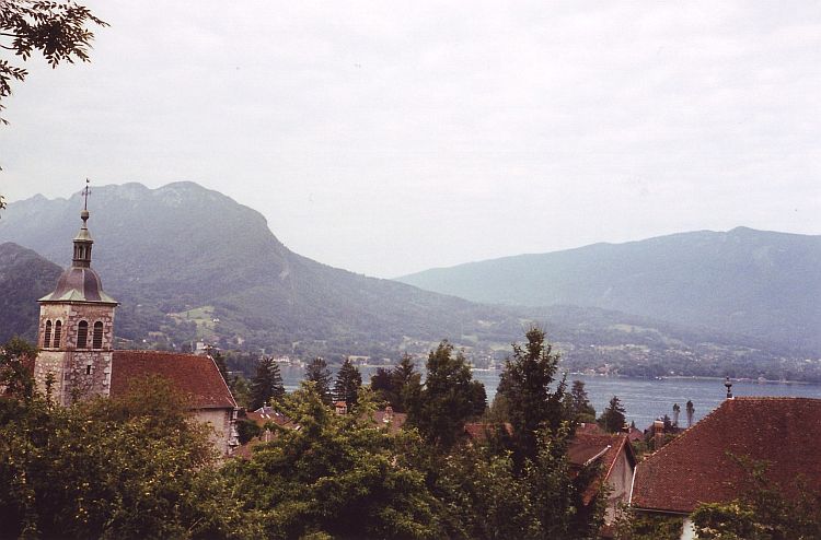
on the foothills of the Alps, we reach Annécy. Along the lake d'Annécy
we cycle untill Talloires. Tomorrow we will be cycling on the cols of the Alps...
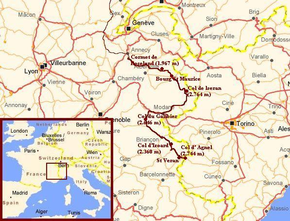
Day 11: Talloires - Ugine - Col de la Forclaz - Beaufort - Cormet de Roselend - Bourg St Maurice 95 km
There is a beautiful lightfall on the Annécy Lake in the early morning. A thin
cloud cover hangs above the lake. The light paints the lake in soft understated colours.
We leave the Lac d'Annécy behind after ten kilometres. Another ten kilometres through a
wide valley brings us to the first climb in the Alps. The Col de Forclaz is in fact
not a real col; we could traverse the col easily by riding around the ridge in the valley.
Instead we are climbing the short but steep col. In 5 kilometre we ascend 500 meter, only
to descend again on the other side, only to return a few kilometres further in the
valley where we came from.
The second col is a bit longer. The Cormet de Roselend is 1.967 meter high. It is the biggest
ascent untill now. I have a good rhythm but my back is hurting. Unfortunately the
high mountains are all wrapped in clouds. Otherwise we probably would have had
magnificent views over the Mont Blanc range. I must not complain. It does not rain
and the col iself is not covered in clouds so we still have good views. After the chapel
we see the end of the col before us. The last kilometres are not the most difficult.
We only have to descend to Bourg St. Maurice now.
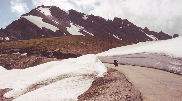
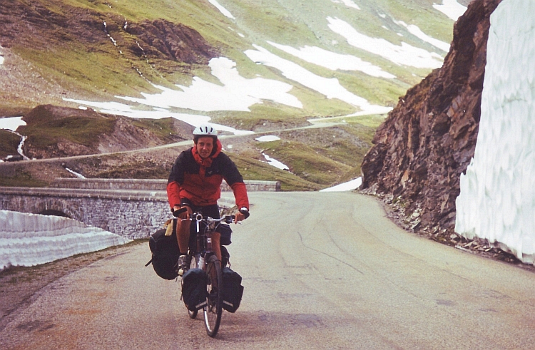
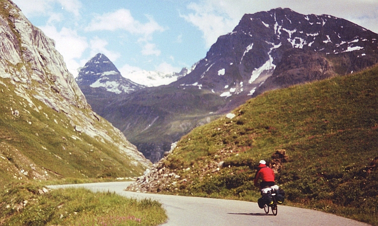
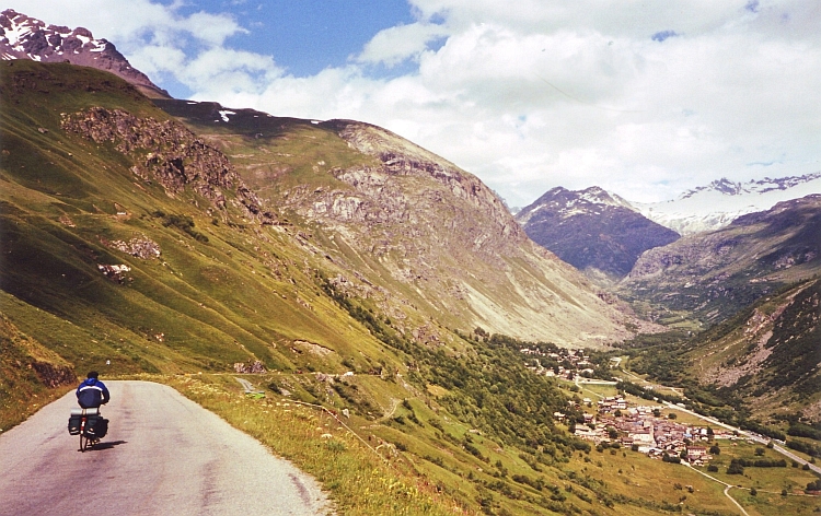
Day 12: Bourg St Maurice - Val d'Isère - Col de l'Iséran - Bonneval - Bessans - Modane 110 km
After the first Alps yesterday, todays stage will take it a little further.
We want to climb the 2.764 m Col de l'Iséran. That means that we have
to ascend more than 2.000 meter to reach the pass.
The 2.000 meter climb is nearly 50 kilometre long. This suggests that the average percentage
is not really high. Indeed, the road follows the river upstream at a reasonable
percentage. The weather is fine. Everything seems to go smoothly. The only minus is
that the road is a bit too busy to my taste. When we proceed, we get great views of the
Vanoise mountains, one of the six National Parks of France. We cannot enjoy the
views too long however. From the Lac du Chevril it is most tunnel work that
brings us in the subaesthetic winter sport resort Val d'Isère. The long, flat stretch
takes quite some time. From Val d'Isère we are back in nice landscapes again.
It is only straight up to the pass from here. The last kilometres are quite cold.
There are walls of snow along the road. Not all the winter snow has melted
yet. We finally reach the top where a strong and very cold wind give us an
unpleasant welcome.
The descent of the Col de l'Iséran is much more scenic than the ascent. We get
a good dose of classic alpine scenery: snowcapped mountains, steep cliffs and
grasslands filled with flowers. As we reach the valley floor in Bonneval-s-Arc, we
experience that the wind is not only blowing at the pass. There is storm in the
valley too. The head wind makes life difficult. Although the road is still
going down, it takes blood, sweat and tears to simply keep the bicycle moving.
Willem wants to stop for today but Jeroen is cycling way ahead of us. I see him
struggle against the wind two hundred meter before Willem and I. Nonetheless it
is impossible for him to hear us when we shout to him, nor is there a possibility
to catch up. It is a shame to see Jeroen passing some beautifully situated campings.
When we have finally caught up, we are in a narrow part of the valley, without
campings of course. Eventually we reach a camping much further, in Modane. This
was surely one of the heaviest cycling days I have experienced untill now. Not
so much because of 2.000 meter climbing, but because of 50 kilometre descending
with a severe smash-in-the-face storm.
Day 13: Modane - St Michel de Maurienne - Col du Télégraphe - Valloire 35 km
The camping of Modane is strategically situated along the railways. Modane is the last station
in France on the route to Torino and the last station before the tunnel under the Alps
as well, so all the night there is noise of whistling and riding trains. In the
middle of the night I wake up tense and nervous after dreaming that a train at
full speed ran over our tent.
When we wake up, Jeroen decides that it is time for him to return home. He wants to cycle
back to Holland as fast as possible. We say goodbye. Willem and I go on further
southward. Because we need a rest day, we only go up the Col du Télégraphe.
We stay the afternoon and the night in the camping of Valloire, on foot of another
big col, the Col du Galibier.
Day 14: Valloire - Col du Galibier - Briançon 55 km
With two Dutch colleagues we cycle up the Col du Galibier. The col is made famous in
the Tour de France. The climb is relatively steep all the way from the begin untill
the end but the last eight kilometres really make the difference. We are lucky
with the weather. There is a clear blue sky. None of the mountains is surrounded by
clouds. On my first cycling journey I passed the Galibier in a light drizzle. That time
I could not see anything of the surroundings.
Without any problems we reach the pass. We celebrate this moment together. The
colleagues will return to Valloire today. We will descend on the other side to
Briançon. We have great sights on the Ecrins mountains. The Barre des Ecrins is
the highest; its peak is more than 4.100 m high. The Meije is the most beautiful.
Its dark cliffs and ravines leave a grim impression but impressive as well.
The descent to Briançon is one of the most relaxed downhill experiences in France. After
a few steep downward kilometres with hairpins we reach the Col du Lautaret. From here
the road is wide without much traffic. The road goes down with a percentage of no more
than 4 or 5 %. Without having to pedal or use the brakes we go down with high
but fully controlled speeds. There are no curves so that we go on like this kilometre
after kilometre. Early in the afternoon we reach the mediaeval city of Briançon.
Day 15: Briançon - Col d'Izoard - Arvieux - St Véran 70 km
The Col d'Izoard is easily one of the most beautiful cyclable passes of the French Alps.
The pass is 2.360 m high. From both sides there are spectacular sceneries.
There are beautiful villages on both sides of the pass as well. Not unimportant, the
road to the pass is also extremely quiet. The weather is good and there is no
wind.
The ascent does not bring any difficulties. At the pass begins the Queyras,
a beautiful mountain area. We ride along infinite slopes with huge rocks, a
spectacular begin of the descent. After shooting lots of pictures, we descend fast
and comfortable further into the Queyras.
The Izoard is not the only ascent of the day. We will climb to the highest village of Europe
too. St. Véran is situated at more than 2.000 meter elevation. We have to hurry.
The weather is deteriorating rapidly. We see the clouds grow. A few kilometres before
St Véran we have to find refuge for an enormous cloudburst.
It takes quite some time before we can go on. We have not reached St Véran as yet another shower breaks loose.
This time there is some thunder and lightning as well. We hurry upward. We are having a
problem as there is no camping in the beautiful village. We proceed a few kilometres.
In a high alpine valley there is a camping, surely one of the most scenic campings in the Alps.
The atmosphere is grandiose. As we have pitched our tent, camping guests have made a surprise
dinner for us in the meantime, thinking we would have got problems as we had to cook
ourselves in this weather. We are very thankful because indeed, we would have got
problems to do so. I hope tomorrow the weather will be better, when we will cross
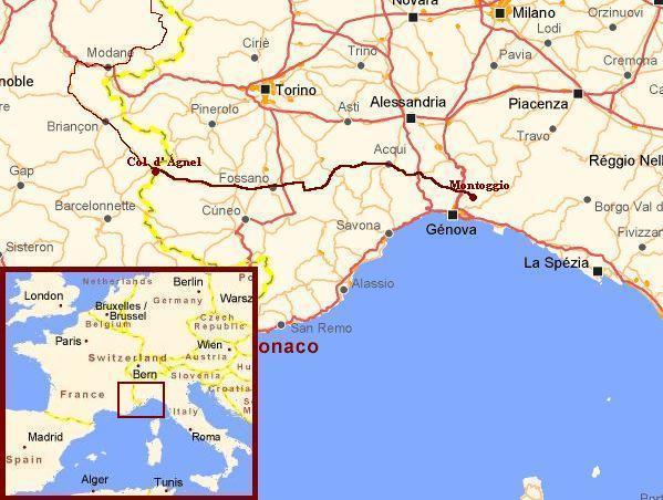
the 2.744 meter high Col d'Agnel into Italy.
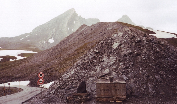
Day 16: St Véran - Col d'Agnel - Chianale - Casteldelfino - Frassino 60 km
The weather is still awful as we depart for our last kilometres in France. We have
to climb yet another 700 meter to the 2.744 Col d'Agnel. The higher we go, the harder
it rains and the colder it gets. A few kilometres before the pass we find a temporary
shelter in a mountain refuge. We wait thirty minutes, an hour, even longer. We
are waiting for ages but the weather does not show any sign of improvement. Staying here
is a miserable and cold experience, cycling in this weather is miserable and cold as well,
but maybe on the Italian side of the mountains a happy sunshine awaits us. Probably not,
but who knows. We decide to go on, we cannot wait forever. The last kilometres
the wind, the ice rains and the temperature just above zero make me feel terribly
cold. As I wait on the pass for Willem, I am really starving. Willem does not
look pretty as well as he arrives. We begin with the descent without having a
rest. It is definitely too cold for that.
The descent from the Col d'Agnel is one of the longest in Europe. From the pass
at 2.744 meter the road goes down all the time untill the Po Valley at 400 meter.
We do not complete the whole way down. When we have gone down far enough to replace
cold bad weather by warm bad weather we stop for today. In Frassino we experience how
Italians enjoy their holidays: with family and friends. The camping is one great
social, happy family. Unfortunately we experience the high quality of wining and dining
in Italy as well. Our banquet would set the tone for many a good Italian dish. After eating
pizza in Italy it takes a long time before appreciating non-Italian pizza again.
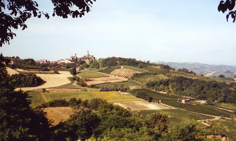
Day 17: Frassino - Fossano - Cissone - Canelli - Rocchetta 125 km
We leave the Alps behind soon after we start cycling. Along the foothills of the Alps,
we follow the course of the Varaita. Then the green hills are disappeared as well.
We are in the flat and fertile Po Valley. The farmers in the valley have a good life.
Immense houses, big cars, not the stereotype image of a farmer. Cycling on the
quiet backroads through the farmlands of the Po Valley is a nice thing to do after five
days of High Alps traverses.
We had counted on riding through flat lands the whole day. To our surprise the
landscape is becoming more and more hilly. Rolling hills are replaced by steep hills.
I must not complain. The landscape is extraordinary beautiful. The region we cross
is called the Langhe. A miniature mosaic of woods, vineyards and agricultural lands
is spread out over the hill landscape. The villages lie at strategic high places,
usually with the church as the highest point. The villages are usually devoid of people.
Maybe the inhabitants have a siesta, but probably these are semi ghost villages. We see only
elder people, most females. The camping in Rocchetta is also a ghost camping. The beautiful
sights from the camping across the Po Valley to the wide arch of the Alps is really special.
Day 18: Rocchetta - Acqui Terme - Monferrato - Voltaggio - Montoggio 115 km
The first day of good weather in Italy brings gorgeous sights from our tent over the
hills around and the Alps, more than hundred kilometres north and west. After descending
to the river valley we are heading towards Liguria. In Acqui Terme we observe that
the landscape is becoming somewhat flatter. We have left the hills of the Langhe.
Soon enough the hills return. After Lerma are some steep stretches. We pass
Mornese, the birth place of Fausto Coppi. Coppi did his daily training stages in
the hills around this little village.
We reach Liguria in the late afternoon. The hills are exuberantly green and surprisingly
steep. The hills are somtimes called the Ligurian Alps. For the cyclist some of these
roads are steeper than roads in the Alps that seldom exceed 12 %. The beautiful
landscape holds good promise for the coming days. Tomorrow we will reach the Mediterranean
Sea and the day after tomorrow we will cycle through the sea along the Cinque Terre, a
nature area with steep hills rising out of the sea, with five beautiful little
villages along or above the coast
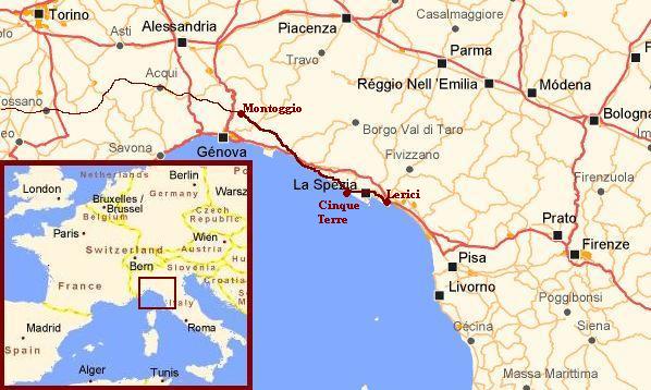
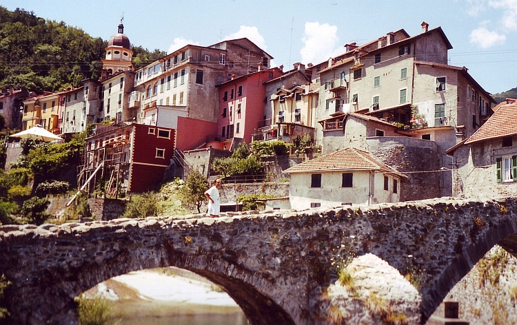
Day 19: Montoggio - Chiavari - Sestri Levante - Deiva Marina 85 km
There is only one pass that divides us from the sea. A short, steep ascent and a very, very
long descent bring us at the Mediterranean Sea in Chiavari. It is a nice moment when you reach
a goal like this. The views are not too good though, because of the bad weather. We hang
around for a few moments, before we decide to go on again. After Sestri Levante we have to do another ascent.
This time we climb into the clouds and into a pouring rain that never seems to cease.
A thick mist is clinging to the mountains. Views are no further than a few meters.
We decide to stop for the day in a big all Italian camping in Deiva Marina where the
programme shifts from the sportive to the gastronomic.
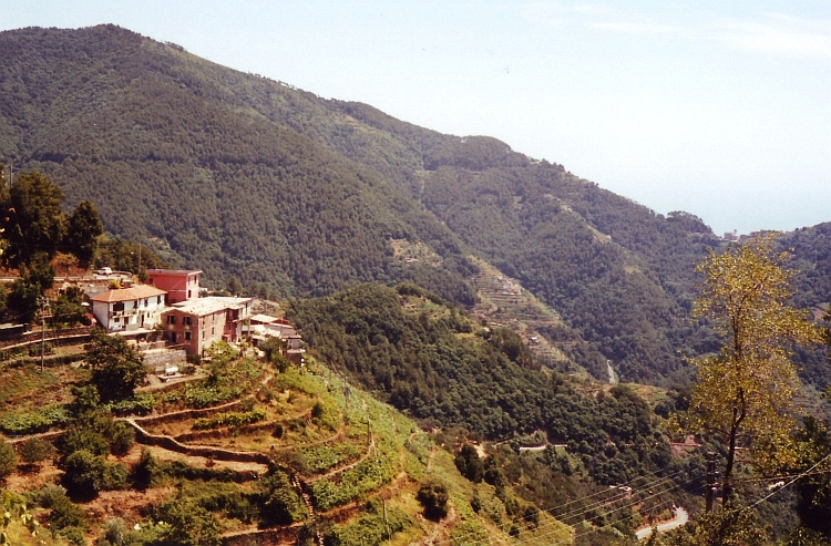
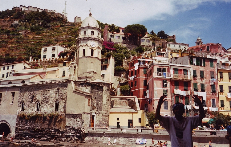
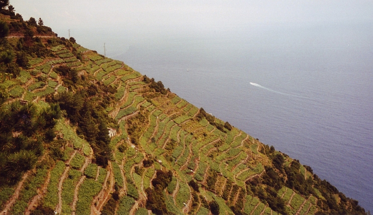
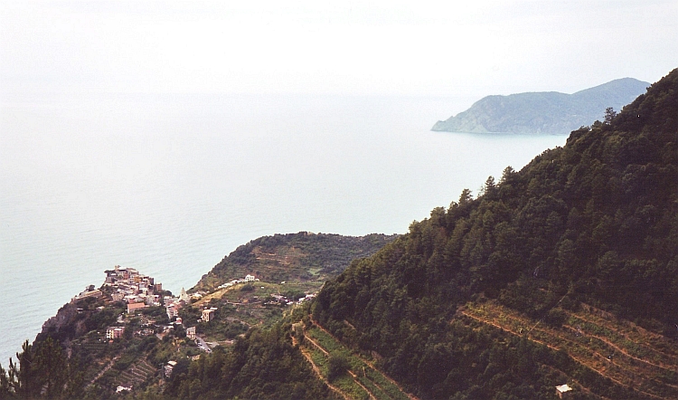
Day 20: Deiva Marina - Levanto - Cinque Terre - La Spezia - Lerici 90 km
The coastal ride of today would become one of the most mountainous day trips I have
made untill today. The most surprising part of this statement is the fact that this is
happening in a landscape with hills that do not exceed 1.000 meter elevation.
The first kilometres to Levanto are constantly steep up, steep down. In retrospect,
this would be only an overture of things to come. Levanto is an old-fashioned
luxury coastal resort, filled with big apartments and stately lanes with palm trees.
The place is not really my cup of tea but the beauty of the steep ascent to the
Cinque Terre brings back the great feeling of being in an extraordinary landscape.
The hills behind Levanto are very steep, the views over the hills into the sea are truly
fascinating. After a sort of pass we descend to the seaside town of Monterosso al Mare,
the first of the Cinque Terre. Monterosso is a first scenic highlight. The small village
has small backstreets, a lively market on a small square and, however difficult it
is to reach the place, loads of tourists.
The ascent that follows is even longer and steeper than the ascent to Monterosso.
A tiny little road, too steep for trucks, winds higher and higher up the hills. After an hour
we reach the 'main road', a small road high above the five villages of the Cinque Terre.
The road is relatively flat and offers great views again. The hills go down continuously
untill they meet the sea. On the higher places the hills become a bit flatter. Terraces with
vineries hang scenically above the steep lower slopes. However beautiful the sights
and scenes on the main road, we want to see the villages of the cinque Terre as well.
After a few kilometres we leave the comfortable road for a dangerously steep
descent to Vernazza. After going down more than 500 altitude meters, my fingers
ache from pulling the brakes constantly. We count ourselves lucky that we did not
have to climb this unusually steep road...
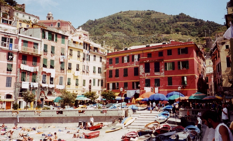
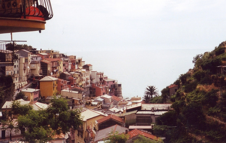
Vernazza is maybe the most beautiful of the villages with its square looking out over
the sea. Vernazza is beautiful enough to spend the rest of the day in a camping
but unfortunately there are no campings in the Cinque Terre. Hotels are way too
expensive for us. The ascent from Vernazza back to the main road is one of the
most extreme cycling experiences I have had. In three kilometre the road gains
600 meter altitude. That is a moyenne of 20 %. There are some flat stretches however,
so that in fact the road takes less than these three kilometres to gain the 600
meters altitude. The first kilometre is the worst. We have to zigzag to remain
on our bikes. We must not stop however. It will be extremely difficult to
set ourselves in motion on these steep gradients. Pushing a fully loaded bike up
the hill is also not a pleasure. After a little more than a kilometre, the steepest
part of the road is over. We can ride in a straight line again and eventually
we reach the main road.
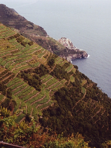
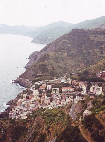
We decide to skip the third of the Cinque Terre, Corniglia. The place is situated
beautifully high and steep above the sea, but still more than three hundred meter
below us. The fourth of the Cinque Terre, Manarola, we do visit. The descent is not
as extreme as the Vernazza descent and so is the ascent back to the main road.
The fifth of the Cinque Terre we also have to skip because there is not enough
time to reach a camping otherwise. The road passes only a hundred meter above
Riomaggiore so we have a good view over the location whatsoever.
It is late in the evening as we leave the cinque Terre and reach the navy city La Spezia.
In the first quiet village after La Spezia, we find a camping in Lerici, just before
a mean thunderstorm breaks loose.
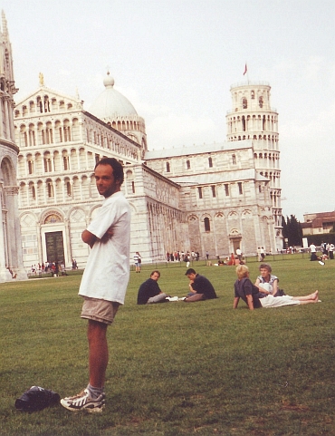
Day 21: Lerici - Viareggio - Pisa 80 km
After the beauty of scenery yesterday, the coastal ride to Pisa is less than
ecstatic. The coastal zone is flat, dusty and devoid of nature. The Apennines can
be seen in the distance but otherwise there is only ugliness. A string
of holiday resorts were built up decennia ago along the coastline. They do
not attract many visitors nowadays. The campings, hotels, casinos and
discotheques seem abandoned and forgotten. Fifty kilometres we pass through those
unlucky beach towns before we leave the seaside. We are in Tuscany now,
one of the worlds most touristic regions with its lofty countryside and famous
renaissance cities like Firenze and Siena. But first we visit Pisa. Just
before we ride into town, I get some problems with my wheel. A piece of my wheel has
just broken out from the inside, a strange and formerly unknown phenomenon. I
cannot cycle further any more. As the bicycle shops are closed the next two days
because of the weekend, we will have to enjoy ourselves in Pisa this weekend.
Day 22: Rest day, with train to Firenze and back
All day long we visit churches and famous renaissance buildings. It is
fascinating to see Michelango, Fra Lippo Lippi and Giotto sculptures, frescoes and
paintings but it is always good to leave an overcrowded city like Firenze as well.
Day 23: Rest day in Pisa
A second rest day is just a bit too much for me. We have to wait untill tomorrow however, untill
the bicycle shops open and I can buy a new wheel.
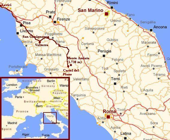
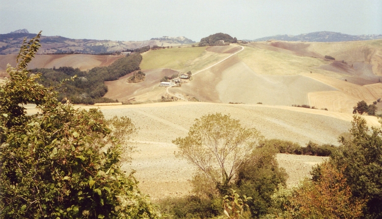
Day 24: Pisa - Volterra 70 km
It takes quite some time before we have found an appropriate wheel but at half past two
we can finally travel on. From the Pisa flatlands we ride towards the famous hillside
landscape of Tuscany. We find out that Tuscany is quite dry in the summer. Maybe it is
therefore that countryside Tuscany does not have the impact which I expected. The
surroundings of Volterra are quite nice, though. Drier and more desertlike than
I expected, this area has something unique in the way the dry hills are interspersed
by a few green river linings.
Day 25: Volterra - San Gimignano - Monteriggioni - Siena 80 km
We take an unpaved route from Volterra to San Gimignano through the hills. Tourists are
not to be found on this obscure route and for the first time in Tuscany we experience
the peaceful tranquillity that Tuscany is associated with. Because of the poor quality of the
road we proceed slowly. Around midday we ride into San Gimignano and into tourist
area. San Gimignano is one of the renaissance cities of Tuscany. This place is most
famous for its high square towers. It is a kind of mediaeval version of Manhattan.
From San Gimignano to Siena we are back on touristic roads. A bit of a downer after
the nice morning programme. We are glad we reach Siena, another renaissance Tuscany
highlight. We are lucky enough to be just in time for the last little space of the
camping where we can stay. In Siena we again indulge ourselves in the glories that
the Italian kitchen has to offer. The last days there have been more kitchen highlights
than extraordinary landscape sceneries.
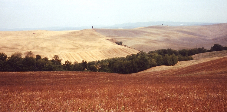
Day 26: Siena - Asciano - Montalcino - Castel del Piano 95 km
We begin the day in the classic Tuscany landscape of the Crete Senesi. Rolling hills,
cypresses, a lonely farmhouse on a lonely hilltop. The kind of landscape we like to associate
Tuscany with. Most important, the roads we travel are quiet this time. The only downer
is the greyish weather. We pass farmhouses, abbeys, little villages. At the end of
the day the landscape becomes more mountainous. The volcanic dome of the Monte Amiata
is dominating the scene now. Pastures are replaced by dense woods. We stay the night in
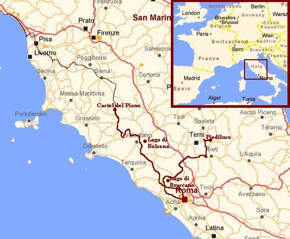
the camping of Castel del Piano on foot of the Monte Amiata.
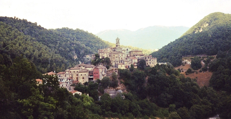
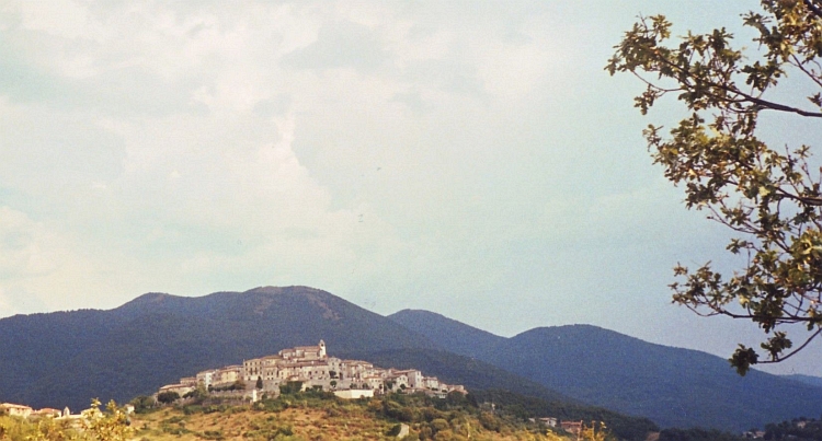
Day 27: Castel del Piano - Sovana - Pitigliano - Sorano - Capodimonte 110 km
The weather is splendid as we travel through the volcanic southern part of Tuscany in
the direction of Rome. The cone peak of the Monte Amiata still dominates the scene. Three small
picturesque towns of Sovana, Pitigliano and Sorano are built out of volcanic
stones and are every bit as scenic as their more famous counterparts of Central Tuscany.
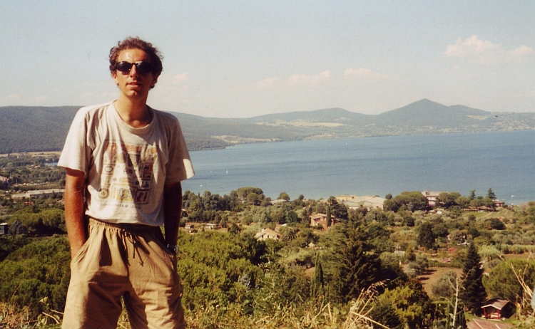
We end the day on a camping at the coast of a volcanic lake. The Lago di Bolsena
is a classic crater lake, surrounded by the crest of the volcano.
Day 28: Capodimonte - Tuscania - Vetralla - Bracciano 80 km
Already early in the morning it is clear that it is going to be a hot and humid day.
A highlight on the day is the early mediaeval town of Tuscania. Tuscania refuges two
old roman churches with some of the oldest frescoes in the world. Beautiful is too
small a word. The village has even more to offer than those fine churches. The small streets
of the old center have a nice, friendly atmosphere. Strangely, there are no tourists at all
in this remarkable old little town.
After Tuscania there are not too many highlights anymore. It is too hot and too
humid to enjoy a nice day trip. A bit of a routine day leads us to yet another crater
lake, the Lago Bracciano. From here we will cycle to Rome tomorrow in a day trip
without luggage.
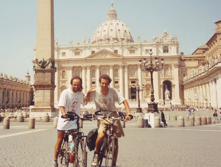
Day 29: Bracciano - Rome - Bracciano 100 km
Without luggage, the trip to Rome is not too demanding. Within two hours we
reach the old city and ride straight to the Vaticano. Unfortunately we miss
the Sixtan Chapel because it closes at 12 o'clock on saturday.Despite this
little tragedy we can still visit the most important church of the world that is
founded by the apostle and first pope Petrus. We put on our long trousers. This
is still the only way to visit the Basilica de San Pietro. Huge statues of old
popes show that spiritual power in the past had frequently gone hand in hand with
worldly power but there are islands of true beauty as well in the Basilica
such as the Pietá sculpture of Michelangelo.
The rest of the day we spend cycling along touristic highlights of Rome. In fact
it is too hot to really enjoy. Late in the afternoon we return to our camping
where we are just in time to see the beautiful sundown in the Lago di Bracciano.
Day 30: Bracciano - Borghetta - Montebuono - Cottanello - Marmore - Piediluco 140 km
It is again hot and humid as we ride along the coast of the Lago di Bracciano. We are heading
north now. The last days of our journey we want to spend in Umbria and maybe we will
cycle on to the Adriatic Sea. We are riding in a straight line to the hills and
mountains of the Apennines.
Within two hours we are in the mountains of the Apennines. We climb to a plateau
high above the valley. Finally the humid air is leading to clouds. There is a real
threat of rain now and in fact a bit of rain would be more than welcome. Everything
has turned up dusty the last days.
For a long time the clouds have been threatening but eventually the rain is coming
loose now, accompanied by a cracking thunderstorm. We have to find shelter.
The world looks different after the rain. The dense hot air has finally broken down in
favour of a cool, lucid atmosphere. The views over the valleys and mountains are
enriched by a newborn transparancy. A mysterious silence is accompanied by
strange lightfalls. Cycling here and now is extraordinary. We make maximum profit
of the situation and cycle the rest of the day through the mountains to end up in
Umbria in the camping of Piediluco.
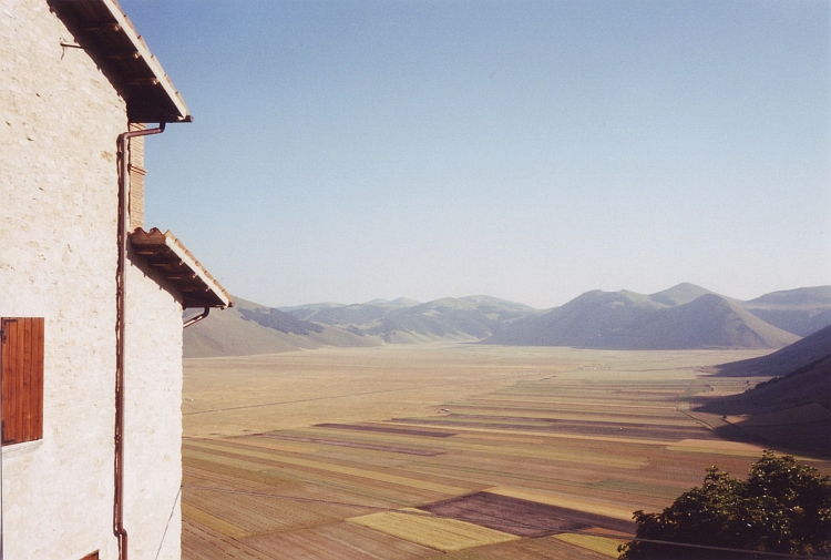
Day 31: Piediluco - Leonessa - San Pellegrino - Castelluccio 105 km
The weather is not good as we wake up and holds no promise for bright and shiny
times in the near future. It is raining dully and it is surprisingly cold after
the hot days untill yesterday. Now that the landscape is mountainous again after
more than a week, the weather does not bother me. In fact, the sometimes densely
wooded landscape only gains atmosphere in the greyish weather.
The first thing to do today is a climb to a small pass. Despite the frequent
rains the views are good. There is a strong wind which is getting stronger
by the minute. We proceed at a fairly good pace, though.
The road to a second pass climbs slowly to 1.200 meter elevation. The descent
into the valley brings us in the small village of San Pellegrino.
A massive mountain ridge lies before us. We have to cross the mountain range. This
ensures us that we have to climb again substantially. A severe rainstorm breaks
loose and causes wet clothes of course but also a magnificent view of the rainy
haze over the mountain range before us.
The ascent has got only one hairpin. Before the hairpin we have to cycle 4 kilometre
to the left. After the hairpin we have to cycle 4 kilometre to the right. Then it
is still a few kilometres upward before we reach the pass. At the time we are there,
the bad weather is just over. A hard wind is blowing away the last strings of clouds
from the mountains.
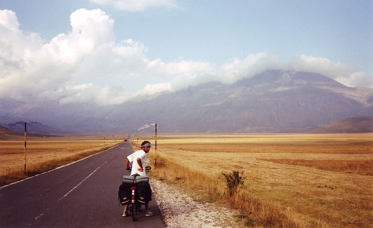
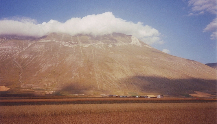
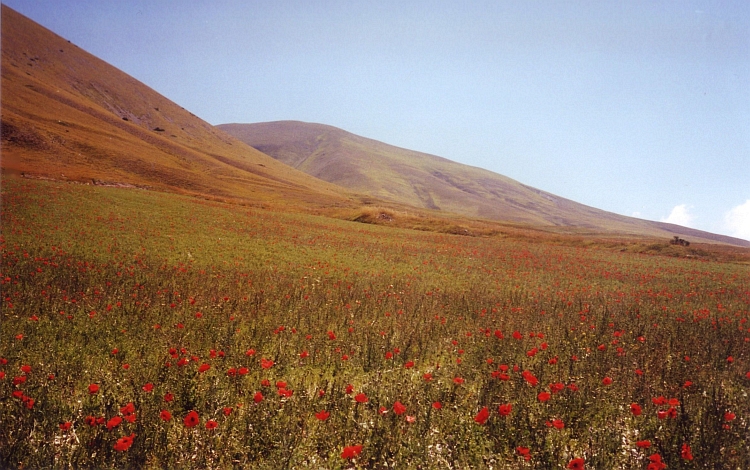
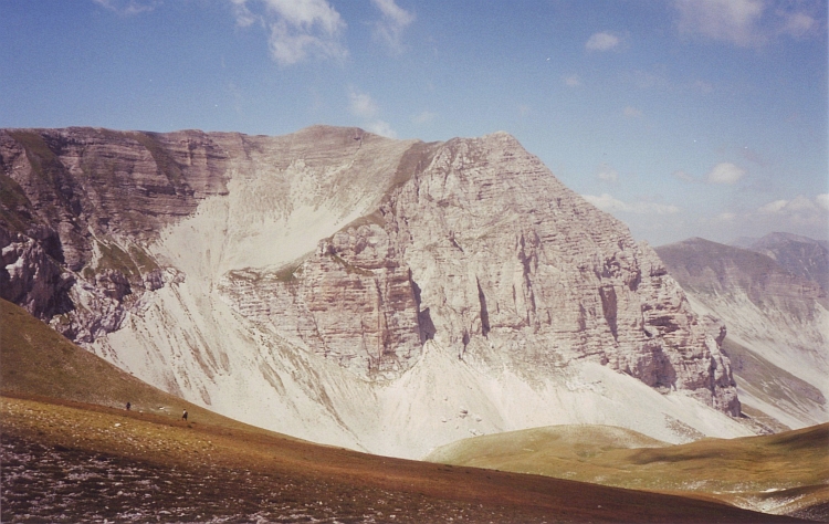
I do not believe my eyes. Before us lies a wide, completely flat valley. A late
evening sun shines over the valley below. The 2.400 meter high Monti Sibillini
rise majestically out of the plains. This is one of the most beautiful valleys
I have ever seen. The valley is called the Gran Piano. Because of the severe
winds it takes quite some time before we have crossed the plains. It is late
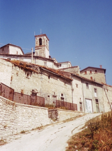
in the evening as we reach the only village in the valley. Castelluccio lies
scenically on a perfect cone in the middle of the valley.
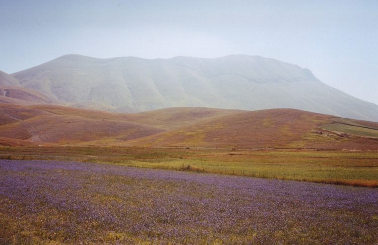
Day 32: Castelluccio and Monti Sibillini 20 km
The valley, the village and the mountains are so beautiful that we cannot decide but
to stay here today. Willem and I split up to do our own thing. I decide to cycle a bit.
Riding along the flanks of the Monti Sibillini I find out that I would rather explore
the mountains of the Monti Sibillini walking. I cycle on to the pass which is the
watershed between the Adriatic Sea and the Mediterranean Sea. From here I start
walking.
I hide my bicycle far from the road and walk upwards over the small mountain trail.
The lovely fields with flowers contrast sharply with the barren slopes of the
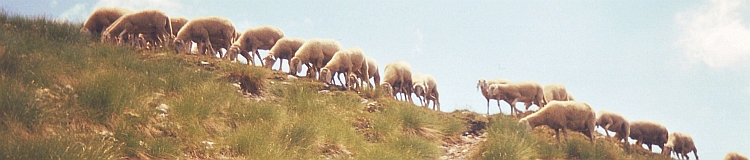
mountain. Along masses of sheep I am climbing high above the valley. In the end I
reach a high pass with a little mountain hut. The other side of the mountain
is one gigantic vertical rock slope. I have never known that the Apennines had
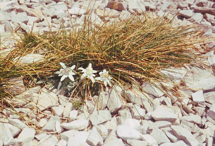
such rough landscapes. I walk to the highest top of the Monti Sibillini where I
find some Edelweiß flowers.
I lie down on the top for a long time, enjoying the day. We are really lucky to
have bright and sunny weather in this extraordinary place. I run down the mountain;
my bicycle is still there. Back in Castelluccio I meet Willem again. We have dinner
with a female pilgrim who wanders around a lot through these areas. She is going to
Assisi, a place which she frequently visits. We are told interesting stories
about her pilgrimage life. I feel a pilgrim myself today. We too are on our way
to Assisi. Tomorrow we will leave the magnificent valley and ride on to the
famous birthplace of San Francesco.
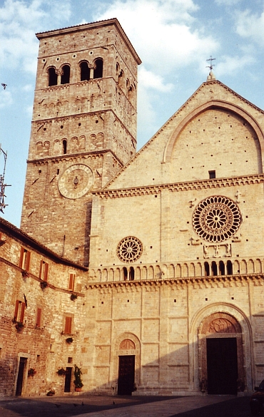
Day 33: Castelluccio - Visso - Foligno - Spello - Assisi 110 km
From Castelluccio it is not far to the pass any more. A long descent brings us back in the
woods, where we eventually end up in Visso.
From Viso we take a very quiet backroad through some high Umbrian
countryside. It takes a lot of climbing but the atmosphere is superb. The last stretch of the day
is a bit more strenuous. It is hot and there is not a slight breeze in the valleys
between Foligno and Assisi. The busy traffic is not easy to appreciate either. But after a short
climb we reach Assisi. We have a strange encounter as we meet our friend Jacco on the camping.
This means it is time for a rest day. Tomorrow we will visit the Basilica di San Francesco
together.
Day 34: Assisi
We are lost half of the day in the catacombs of the Basilica di San Francesco. There are
frescoes everywhere. The scenes of San Francesco's life by Giotto are world famous
but there is lots more to see. We indulge ourselves in profane art the whole
morning and part of the afternoon untill we are completely saturated with
Christian imagery. The rest of the day we spend in quiet conversation at the cafes
and terraces of Assisi.
Day 35: Assisi - Gubbio - Scheggia - Cagli - Urbino 115 km
Today we cycle on again. We take the high road through countryside Umbria to the nice
town of Gubbio where we have a lunch break. From Gubbio we have the last long ascent
over the Apennines. The road is not so steep however. The pass is the watershed with the
Adriatic Sea. We are in the province of Le Marche now, one of the least touristic regions of
Italy. From the pass we have a long, gradual descent along the Burano river. The
last kilometres we have to climb again, including a short steep ascent to the town of Urbino
which lies grandiose on top of a high hill.
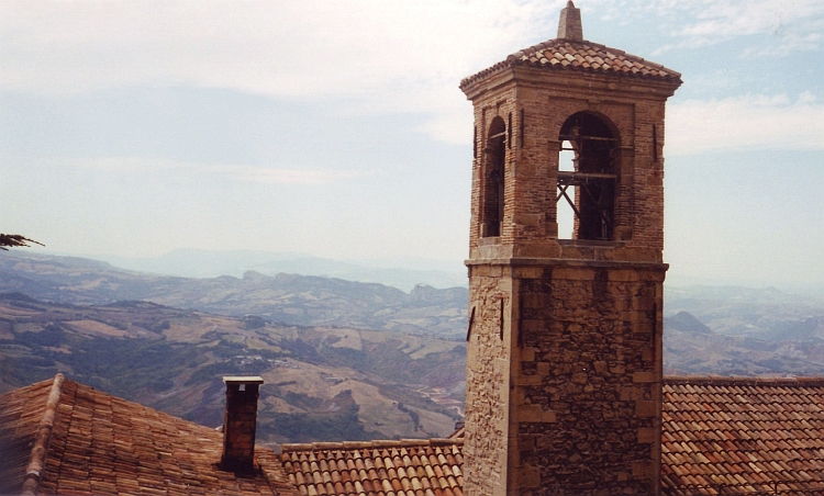
Day 36: Urbino - San Marino - Cesenatico 105 km
The hillside of Le Marche is pretty cycling landscape. Up and down we go. The ascents
are never longer than half an hour. Views are good nonetheless. The rock of San
Marino is the highest point and dominates the scene. We are heading straight
to the cliff of San Marino. The ascent to San Marino is by far the longest ascent of
the day. San Marino is a small independent country. Completely surrounded by Italy there
is not much added value of a ministate like San Marino. San Marino is famous
for its stamps. That is in fact all there is to be said about San Marino.
It is a long way down from San Marino to the Adriatic Sea. The landscape becomes
increasingly flat and eventually there is no hill to be seen. We reach the Adriatic
Sea after two hours. A string of ugly beach resorts stretches out infinitely before
us. We cycle to the camping of Cesenatico, 30 kilometre before Ravenna, the place
where we will end our journey. We indulge ourselves for the last time in Italian
food and in Italian style camping social life.
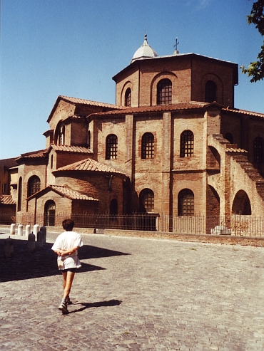
Day 37: Cesenatico - Ravenna 30 km
The last kilometres to Ravenna we have a strong wind against us. More than an hour
of hard work brings us in Ravenna, our final destination. Ravenna has some of the oldest churches
of the world. The San Vitale and the Apollinare Nuovo date from the 6th Century. Both
churches are not remarkable from the outside but there is a world of splendour
to be seen from the inside. The churches are filled with beautiful Byzantine
mosaic reliefs. An inspiring finale of our visit to grand old Italy.
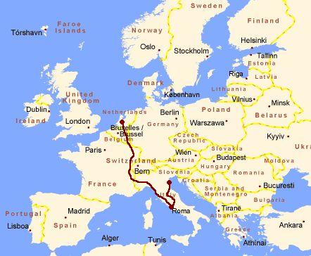
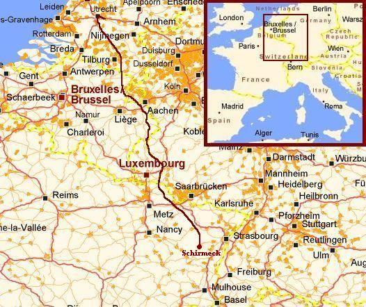
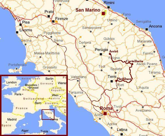
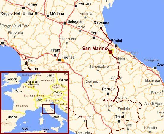
Detailed Maps
Via Roma - Cycling from Utrecht to Italy
Numbers and Facts
Facts of life
# Days
# Cycling days
Distance on bicycle
Distance / Days
Distance / Cycling days
Longest distance on a day
Highest altitude difference on a day: climbing
Highest altitude difference on a day: descending
Highest point on bicycle
Most difficult ascent
# historic monuments
# sweaty nights
# dinners of excellent quality
# dinners with excellent wine
# dinners higher than twice our budget
Numbers and Statistics
37
33
3.200 km
86 km
97 km
180 km
2.000 m (from Bourg St Maurice to Col de l'Iséran)
2.200 m (from Col d'Agnel to Frassino)
2.770 m (Col de l'Iséran)
The "Wall of Vernazza": from the beach in 3 kilometre to 600 m (!)
uncountable
every night in Italy
every Italian evening
every Italian evening
every Italian evening
Highlights of the Journey
Region
Vosges (France)
Alps (France)
Liguria (Italy)
Umbria (Italy)
Umbria (Italy)
Highlights
Cycling along the white cliffs and green flanks of the twisting and curving Doubs River
Forget about Tour de France history and cycle up the Queyras Cols Izoard and Agnel
Have first class views over the Mediterranean in the Cinque Terre and visit the magnificent villages
Spending a few days in Castelluccio and explore the Monti Sibillini and the wild flowered Gran Piano
Taking a break in the old village of Assisi and visit world famous Francis of Assisi Basilica

 After some small cycle repairs we start a bit late. At ten o'clock we leave the
camping. A small road goes up to the Col de Saales. A long descent brings us in a
wide valley. We leave the valley for the ascent of the Col de Mandray. The Mandray is
again a comparatively easy ascent. The third ascent of the day is a bit longer.
And also a bit tougher. It is the first real col of this journey. From Le Valtin
a small road leads to the Col de La Schlucht. After a long mildly climbing stretch,
the road goes truly uphill at last. Further and further we climb above the valley.
All the time we see the little pass where the road joins the main road to the
Col de la Schlucht. From this prepass we will have to climb another two kilometres
further uphill to reach the col. All in all, the ascent is surprisingly long.
After more than an hour we finally reach the 'Prepass'.
After some small cycle repairs we start a bit late. At ten o'clock we leave the
camping. A small road goes up to the Col de Saales. A long descent brings us in a
wide valley. We leave the valley for the ascent of the Col de Mandray. The Mandray is
again a comparatively easy ascent. The third ascent of the day is a bit longer.
And also a bit tougher. It is the first real col of this journey. From Le Valtin
a small road leads to the Col de La Schlucht. After a long mildly climbing stretch,
the road goes truly uphill at last. Further and further we climb above the valley.
All the time we see the little pass where the road joins the main road to the
Col de la Schlucht. From this prepass we will have to climb another two kilometres
further uphill to reach the col. All in all, the ascent is surprisingly long.
After more than an hour we finally reach the 'Prepass'.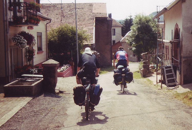
 The Col d'Izoard is easily one of the most beautiful cyclable passes of the French Alps.
The pass is 2.360 m high. From both sides there are spectacular sceneries.
There are beautiful villages on both sides of the pass as well. Not unimportant, the
road to the pass is also extremely quiet. The weather is good and there is no
wind.
The Col d'Izoard is easily one of the most beautiful cyclable passes of the French Alps.
The pass is 2.360 m high. From both sides there are spectacular sceneries.
There are beautiful villages on both sides of the pass as well. Not unimportant, the
road to the pass is also extremely quiet. The weather is good and there is no
wind.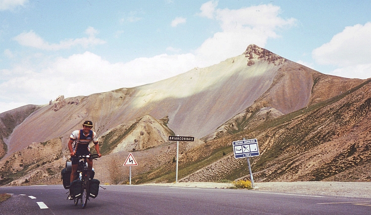
 The weather is still awful as we depart for our last kilometres in France. We have
to climb yet another 700 meter to the 2.744 Col d'Agnel. The higher we go, the harder
it rains and the colder it gets. A few kilometres before the pass we find a temporary
shelter in a mountain refuge. We wait thirty minutes, an hour, even longer. We
are waiting for ages but the weather does not show any sign of improvement. Staying here
is a miserable and cold experience, cycling in this weather is miserable and cold as well,
but maybe on the Italian side of the mountains a happy sunshine awaits us. Probably not,
but who knows. We decide to go on, we cannot wait forever. The last kilometres
the wind, the ice rains and the temperature just above zero make me feel terribly
cold. As I wait on the pass for Willem, I am really starving. Willem does not
look pretty as well as he arrives. We begin with the descent without having a
rest. It is definitely too cold for that.
The weather is still awful as we depart for our last kilometres in France. We have
to climb yet another 700 meter to the 2.744 Col d'Agnel. The higher we go, the harder
it rains and the colder it gets. A few kilometres before the pass we find a temporary
shelter in a mountain refuge. We wait thirty minutes, an hour, even longer. We
are waiting for ages but the weather does not show any sign of improvement. Staying here
is a miserable and cold experience, cycling in this weather is miserable and cold as well,
but maybe on the Italian side of the mountains a happy sunshine awaits us. Probably not,
but who knows. We decide to go on, we cannot wait forever. The last kilometres
the wind, the ice rains and the temperature just above zero make me feel terribly
cold. As I wait on the pass for Willem, I am really starving. Willem does not
look pretty as well as he arrives. We begin with the descent without having a
rest. It is definitely too cold for that.
 We leave the Alps behind soon after we start cycling. Along the foothills of the Alps,
we follow the course of the Varaita. Then the green hills are disappeared as well.
We are in the flat and fertile Po Valley. The farmers in the valley have a good life.
Immense houses, big cars, not the stereotype image of a farmer. Cycling on the
quiet backroads through the farmlands of the Po Valley is a nice thing to do after five
days of High Alps traverses.
We leave the Alps behind soon after we start cycling. Along the foothills of the Alps,
we follow the course of the Varaita. Then the green hills are disappeared as well.
We are in the flat and fertile Po Valley. The farmers in the valley have a good life.
Immense houses, big cars, not the stereotype image of a farmer. Cycling on the
quiet backroads through the farmlands of the Po Valley is a nice thing to do after five
days of High Alps traverses.
 After the beauty of scenery yesterday, the coastal ride to Pisa is less than
ecstatic. The coastal zone is flat, dusty and devoid of nature. The Apennines can
be seen in the distance but otherwise there is only ugliness. A string
of holiday resorts were built up decennia ago along the coastline. They do
not attract many visitors nowadays. The campings, hotels, casinos and
discotheques seem abandoned and forgotten. Fifty kilometres we pass through those
unlucky beach towns before we leave the seaside. We are in Tuscany now,
one of the worlds most touristic regions with its lofty countryside and famous
renaissance cities like Firenze and Siena. But first we visit Pisa. Just
before we ride into town, I get some problems with my wheel. A piece of my wheel has
just broken out from the inside, a strange and formerly unknown phenomenon. I
cannot cycle further any more. As the bicycle shops are closed the next two days
because of the weekend, we will have to enjoy ourselves in Pisa this weekend.
After the beauty of scenery yesterday, the coastal ride to Pisa is less than
ecstatic. The coastal zone is flat, dusty and devoid of nature. The Apennines can
be seen in the distance but otherwise there is only ugliness. A string
of holiday resorts were built up decennia ago along the coastline. They do
not attract many visitors nowadays. The campings, hotels, casinos and
discotheques seem abandoned and forgotten. Fifty kilometres we pass through those
unlucky beach towns before we leave the seaside. We are in Tuscany now,
one of the worlds most touristic regions with its lofty countryside and famous
renaissance cities like Firenze and Siena. But first we visit Pisa. Just
before we ride into town, I get some problems with my wheel. A piece of my wheel has
just broken out from the inside, a strange and formerly unknown phenomenon. I
cannot cycle further any more. As the bicycle shops are closed the next two days
because of the weekend, we will have to enjoy ourselves in Pisa this weekend.
 We take an unpaved route from Volterra to San Gimignano through the hills. Tourists are
not to be found on this obscure route and for the first time in Tuscany we experience
the peaceful tranquillity that Tuscany is associated with. Because of the poor quality of the
road we proceed slowly. Around midday we ride into San Gimignano and into tourist
area. San Gimignano is one of the renaissance cities of Tuscany. This place is most
famous for its high square towers. It is a kind of mediaeval version of Manhattan.
We take an unpaved route from Volterra to San Gimignano through the hills. Tourists are
not to be found on this obscure route and for the first time in Tuscany we experience
the peaceful tranquillity that Tuscany is associated with. Because of the poor quality of the
road we proceed slowly. Around midday we ride into San Gimignano and into tourist
area. San Gimignano is one of the renaissance cities of Tuscany. This place is most
famous for its high square towers. It is a kind of mediaeval version of Manhattan.
 The weather is splendid as we travel through the volcanic southern part of Tuscany in
the direction of Rome. The cone peak of the Monte Amiata still dominates the scene. Three small
picturesque towns of Sovana, Pitigliano and Sorano are built out of volcanic
stones and are every bit as scenic as their more famous counterparts of Central Tuscany.
The weather is splendid as we travel through the volcanic southern part of Tuscany in
the direction of Rome. The cone peak of the Monte Amiata still dominates the scene. Three small
picturesque towns of Sovana, Pitigliano and Sorano are built out of volcanic
stones and are every bit as scenic as their more famous counterparts of Central Tuscany. Already early in the morning it is clear that it is going to be a hot and humid day.
A highlight on the day is the early mediaeval town of Tuscania. Tuscania refuges two
old roman churches with some of the oldest frescoes in the world. Beautiful is too
small a word. The village has even more to offer than those fine churches. The small streets
of the old center have a nice, friendly atmosphere. Strangely, there are no tourists at all
in this remarkable old little town.
Already early in the morning it is clear that it is going to be a hot and humid day.
A highlight on the day is the early mediaeval town of Tuscania. Tuscania refuges two
old roman churches with some of the oldest frescoes in the world. Beautiful is too
small a word. The village has even more to offer than those fine churches. The small streets
of the old center have a nice, friendly atmosphere. Strangely, there are no tourists at all
in this remarkable old little town.
 From Castelluccio it is not far to the pass any more. A long descent brings us back in the
woods, where we eventually end up in Visso.
From Castelluccio it is not far to the pass any more. A long descent brings us back in the
woods, where we eventually end up in Visso.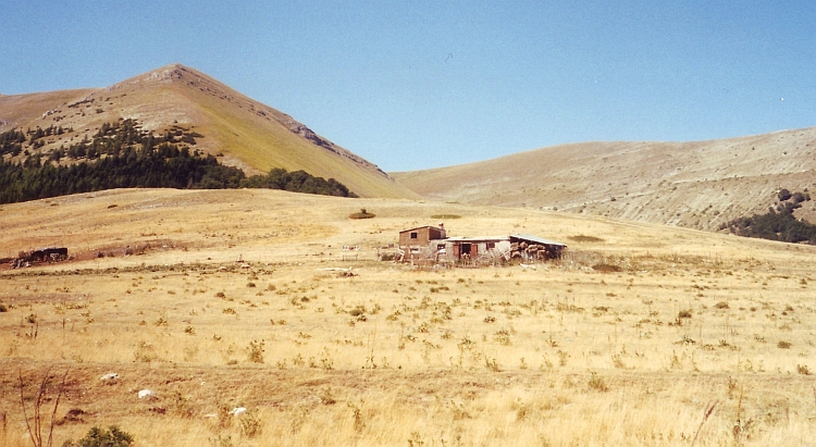
 The last kilometres to Ravenna we have a strong wind against us. More than an hour
of hard work brings us in Ravenna, our final destination. Ravenna has some of the oldest churches
of the world. The San Vitale and the Apollinare Nuovo date from the 6th Century. Both
churches are not remarkable from the outside but there is a world of splendour
to be seen from the inside. The churches are filled with beautiful Byzantine
mosaic reliefs. An inspiring finale of our visit to grand old Italy.
The last kilometres to Ravenna we have a strong wind against us. More than an hour
of hard work brings us in Ravenna, our final destination. Ravenna has some of the oldest churches
of the world. The San Vitale and the Apollinare Nuovo date from the 6th Century. Both
churches are not remarkable from the outside but there is a world of splendour
to be seen from the inside. The churches are filled with beautiful Byzantine
mosaic reliefs. An inspiring finale of our visit to grand old Italy.