After a flight of more than twenty hours via Istanbul and Mauritius we land in Ivato,
the international airport of Madagascar, near the capital Antananarivo. The airport
is small. There are two gates, a few or some small shops which are all closed and
there is a small combined reception and departure hall and there are two cash machines.
After preapring the bicycles we want to extract money from one of the cah machines,
but the machines do not accept regular bank cards. Luckily one of the machines accepts
Willems credit card and so we finally have money in the end.
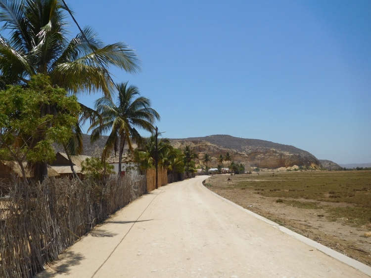
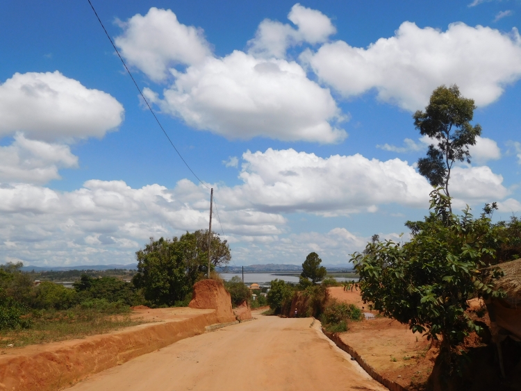
It is five o'clock in the afternoon now and the sun is low. We do not cycle to the
capital therefore, but instead we are riding to a small hotel in the center of Ivato.
It is located only a kilometer away from the airport, but it is still a challenge to
get there. I have to bring the huge bike box in the hotel. In the middle of the box is a
small hole that I am using as a grip. I am cycling with one hand on the steering wheel and
with the other hand carrying the bicycle box. Willem has a bicycle bag, which he has simply
put in a pannier together with other luggage. We arrive safely in the end. The hotel has
a beautiful, tropical garden and a good restaurant with views over the garden. Once in a while
a tropical bird is flying through the garden. The most eye-cathing is the scarlet-coloured
Red Fody, a kind of red variant of a starling. All in all, the first glimpses of Madagascar
suggest that the country has enough to offer to keep ourselves busy the coming four weeks.
Day 1: Ivato - Antananarivo - Manjakandriana - Mandraka 72 km
Today we can finally start our journey. It will be a short cycling day, as we have been sleeping
until quite late in the morning. In my case I needed it as I had not slept too much the night before
in the airplane.
The breakfast in the hotel is poor, epecially in comparison with the rich and varied evening
meal from yesterday. Perhaps the meager breakfast is a legacy of the French colonial rule
of yore. We leave with an empty stomach.
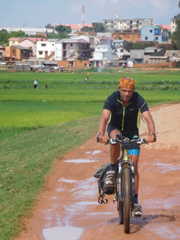
From Ivato we are heading towards the beginning of the Route Nationale 2 in Antananarivo.
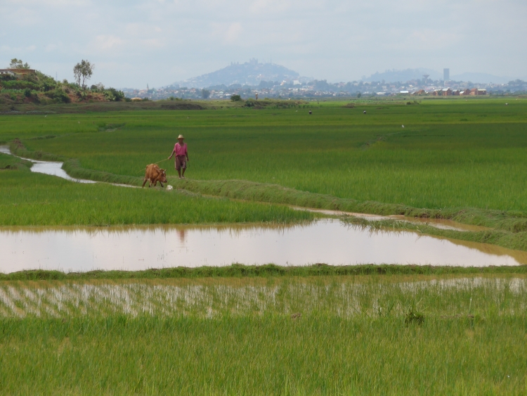
The capital of Madagascar is by far the largest city of the country with about two
million inhabitants. Visually the city differs strongly from other cities. Busy
neighborhoods alternate with vast rice fields, which reach deeply into the city.
The Malagasy people are rice eaters. Not China, not India, not Thailand but Madagascar
is the country that eats the most rice per head of the population. With the limited
infrastructure of the country it is necessary that the rice is produced close to the
people. Even in the city itself.
Willem and I both have got a GPS and it is easy to find the way therough the neighborhoods.
We reach the Route Nationale 2. Even in the capital the main road of the country is no more than
a one lane highway. It is a bit of a fight for the limited space, although it is Sunday now,
which is by far the quietest day of the week. Otherwise we were probably stuck in a roadblock.
After an hour and a half we have left behind Ivato and the biggest part of Antananarivo us.
It still takes another 45 minutes before we finally have crossed the last semi-urban suburbs.
We find ourselves in a hilly landscape that is pretty green without a high abundance of trees.
It is a landscape that in a lot of different ways holds a middle position. The landscape is neither
wet, nor is it dry. With a height between 1,000 and 1,500 meters the elevation is neither high nor
low, the climate is not hot and it is not cold either and the landscape is never flat but it is
also not mountainous. It is a bit natural, a bit rural and a bit urban.
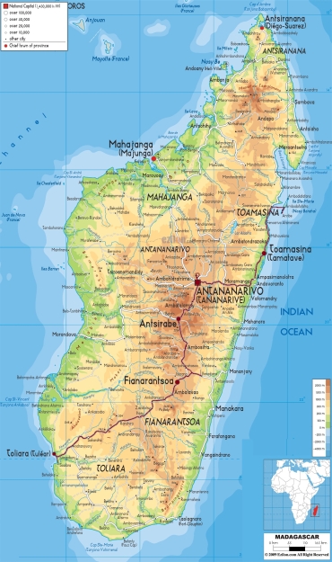
We plan to cycle on the Route Nationale 2 towards the east to the port city Toamasina,
which will take a few days. From there we want to cycle further north on the fabled Route
Nationale 5, a road which is known to be extremely bad. The road leads to the city Maroantsetra,
an interesting, isolated destination in the wettest part of Madagascar.
It is the first time after seven years that I am travelling with Willem again. We know each
other through and through and we have shared many adventures together. Because it has been
quite a while since we have been undertaking a bicycle trip together, we will probably have
to re-invent our friendship on this journey. Seven years is a long time in which both of us have
naturally changed a bit andwe have obviously also become a bit older along the way.
After a small break in a cafe, we find out that Willem has got a flat tire. Inspection shows
us that the little hole is close to the valve and therefore the tire cannot be repaired. Since
Willem has not got any other spare tires, we must look around from now on to purchase
a new flat tire as soon as we are able to.
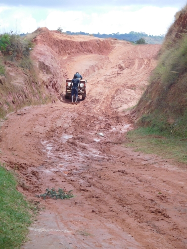
After a kilometer or forty we have the possibility to leave the asphalt of route 2
and change it for an unpaved road. That road is not on our maps but it is shoen on the GPS.
The route is considerably shorter than the tarmac road which makes a big detour here.
Of course there will be a reason for this detour, so I do not have the illusion
that the shortcut is practically the most convenient choice, but I do expect that it
will be an enjoyable intermezzo.
Already after a few hundred meters it appears that the choice pays off. We are cycling on
a muddy path which us luned with atmospheric mud houses with distinctive gable roofs.
It provides a new view in rural Madagascar. People seem to be living here from what the
natural environment produces. Despite the proximity of the main road from Madagascar.
The path is very narrow and at times very steep. A serious challenge with the bicycle
and with a normal car this would be a big gamble.
After a few minutes we pass the lst small houses and the road is not much more than a cart
track. A track that is being used maybe a few times in the year at the most. Occasionally
there are deep channels in the road. The steep gradients inside these channels are posing
a challenge for me. I have a trekking bike with rather thin tires and therefore I do
not have too much grip. Willem has got a mountain bike and he has a bit more grip on these kind
of surfaces. A little further on, the road is quite overgrown. At the moment that the road
is hardly recognizable as such, we reach the pass.
The descent is initially challenging, but soon the road becomes easier. Add the tracks
are coverging, the ground is getting more solid and the big stones are absent here. We reach
a traditional farming village and soon adter we reach the main road. We continue cycling
on the Route Nationale 2 to the east.
We reach Manjakandriana, the first city after Antananarivo. It is late in the afternoon
already and it would be nice if there were a place to stay in the small town. The only
hotel that is shown on the GPS, however, does not longer exist and it seems that there
are not ant other possibilities. There is not much else to do apart from cycling, though
there is no certainty that there will be overnight accommodation further on the road. If
we do not encounter any palces to sleep, we can take a side road in about twenty kilometers,
where we are hopefully able to pitch our rent any time soon.
We are cycling through ever greener landscapes. In the middle of the tropical hills lies a
beautiful village. We ask if there is a hotel here. That does not seem to be the case,
but a few kilometers further on in Mandraka we should have possibilities. Fifteen minutes
later we reach the nature reserve Mandraka, where we find a small hotel with restaurant
indeed. We can stay overnight in a simple room in the beautifully located complex.
Day 2: Mandraka - Moramanga - Andasibe 82 km
We are not leaving too early, but that is not necessary for today. It is about
eighty kilometers to Andasibe, which is not too far. We intend to stay in Andasibe
the next two nights, so that we have time to explore eponymous national park
tomorrow.
After Mandraka the landscape remains hilly and green. The road winds down through the tropical
forests. The landscape is reminiscent of the cloud forests between the Andes and the
Amazon basin, although the landscapes of the South American cloud forests are often steeper.
Anyway it is nice cycling here. Since the road is largely downhill we are covering
distance easily and soon enough we find ourselves on the broad valley bottom with
rice fields and a few villages.
In the first village I stop for an emergency repair. There is some play between
the fork crown and the steering wheel. I need two wrenches to turn them tight. I find
a simple workshop, where they are having two wrenches of the right size. A minute
later the bike is repaired and we can continue. We stop again a little further in
a real bike shop. Willem buys a new inner tube, so that he has got a spare one
again.
Through a rolling landscape we are riding in a new wide valley. We reach Moramanga,
the largest city since we have left Antananarivo. The city seems to be a big anthill.
People are crawling everywhere. The same applies to us. We also need to find ourselves
a way between the traffic. We are looking for a bank now. We have already found a few
ones, but none of the banks accept our bank cards or credit cards. In the end of the town
we finally find a bank that is accepting our bank cards. We are saved for now and we
have enough currency to be able to bridge the distance to Toamasina the coming days,
in case we cannot find a suitable bank in the smaller towns along the way.
After Moramanga the landscape becomes greener and hillier again. We reach the exit
road to Andasibe. We are in a wild tropical landscape with huge trees. We pass
the entrance of the national park and a few kilometers further we cycle into the
small town of Andasibe, an atmospheric place in a valley between the green hills.
We find a simple, cozy hotel for the next two nights.
Day 3: Andasibe 0 km
Today we are going to visit the national park. We are having breakfast early.
We hear the eerie cries of the indri indri. The call of the largest of the lemurs
reaches up to two kilometers and they can even be heard in the village.
After breakfast we walk to the entrance of the park. There are a number of guides at
the entrance waiting for groups. In all national parks of Madagascar it is compulsory
to hire a guide, so we also have to choose a guide. With the three of us we enter the
park.
After only fifty meters the guide stops and urges us to do the same. He holds his finger
against his lips, to make sure that we are absolutely not going to make a sound. Then he
points to a small brown bird, fifty meters away. I do not see anything special about the bird.
> What is going on?
>>> This is a very rare bird! You are very lucky that you are seeing this bird now!
> Yes, but... this looks like a very ordinary bird. A bit like our blackbird in Europe...
Then the bird flies away.
Oops, I think, will this be such an excursion? I am already bored after just one minute.
We are walking over a small trail that leads us ever deeper into the jungle. It is a beautiful
forest I must say, with many different types of trees and many species of ferns and other flora.
We do not encounter any special animals so far. We do, however, undeniably come closer to
the indri indris whose wailing cries are coming to us with an insane amount of decibels.
Then we see the first indri indri, about thirty meters above us. The indri indri is
about a meter long, and he has got a black and white face with teddy bear eyes. The
animal looks like it could never be able to hurt another species. A little later we
see more indri indris, all of them are in the highest regions of the trees now. Occasionally
an indri indri is jumping from the one to the other tree, sometimes a few times in a sequence.
This is clearly not without danger, but apparently they look well-equipped
for the task with their elastic legs and they have clearly practiced before.
After half an hour we have seen the ins and outs of the indri indri long enough and we are
leaving the scene. We scramble through the forest and not much later we see a group of
brown lemurs. These animals are considerably smaller than the indri indri. We are able
to come much closer to the brown lemurs, who are playing around at a height between five
and ten meters now. That offers the opportunity to take a closer look. The brown lemurs
are much busier than the indri indris and sometimes they jump as far as five meters from
tree to tree. They often cower together, just to fall apart by jumping each in different
directions. It is a breathtaking sight to see the animals play like this. Apparently there is
enough food in the forest that they can spend so much time without being busy collecting
or eating food all the time. Besides the indri indri and the brown lemur we also encounter
diademed sifakas, who are also playing, and later in the day we see a few bamboo lemurs,
who are eating bamboo.
On the basis of the experiences with the various lemurs, I could assume that life
in the jungle here is a paradise for the animals which are living here. That does
not seem to exacltly be the case. Many animals have very good protective colors and
that will not be for nothing. The two most amazing examples we see are the natural disguises
of the leaf-tail gecko and the nightjar. The leaf-tail gecko looks almost identical to the
branches of one of the local tree species. In the picture below is good to see (or not good
to see!) how the gecko seems to be a part of the branch. Even the lines and patterns of the
tree bark, as well as the moss species living on the branches, are represented on the skin
of the gecko. The nightjar has a similar survival strategy. Not being noticed is the motto.
During the day the bird sits still, even the eyes do not move. The wings appear to be
serrated, brown leaves. The guide is worth gold here, as we would never have been able to
spot both animals ourselves.
The guide once again shows his extraordinary skills by guiding us to a number of chameleons.
Although the chameleons here are sometimes extremely large, up to fifty centimeters long, they
are difficult to detect because of their protective colors. The most impressive chameleon
is the Parsons chameleon. The male and the female chameleons look radically different, but
both have a beautiful deep green colour. Where the male has alternating yellow and black
patterns on his skin, as if those were reflections of sunlight and shade, the female
is almost even green. The baby is brown.
After wandering around with the guide all morning and all afternoon, I feel that this
wildlife experience will no longer be surpassed anywhere within Madagascar. After the
hesitant start I have been mesmerized all day and after the rare bird of the first minute
there was not even a single boring moment. With two solo travelers in the hostel we discuss
each others experiences in Madagascar.
Day 4: Andasibe - Beforona - Ranomafana - Brickaville 116 km
Today we want to cycle to Brickaville, the first larger city with hotels after Andasibe.
That is still nearly 120 kilometers away, but those kilometers are mostly downhill.
A problem is that Willem is a little bit ill. He suffers from his intestines
and is sick, weak and nauseous. But he still wants to leave and so we are riding
towards Brickaville now.
The landscape is initially hilly to mountainous. The road climbs and descends continuously,
but in the end we are descending a bit more than we are climbing. Slowly but surely the
high hills are being replaced by medium-sized hills and after a few hours we are riding through
a landscape with hills that are no higher than a mere two hundred meters. We sre having lunch
in a simple restaurant, where I order the mysterious-sounding soupe chinoise. Willem
does not eat anything yet. The soup is served within fifteen minutes. The soup indeed has
a Chinese flavor and is incredibly tasty. I was already liking the Malagasy kitchen anyway,
but with these Chinese-tinted dishes, the food supply prvoes to be even more versatile
than I imagined yet.
The last fifty kilometers pass through the lowlands, but it is not flat. Willem
has hardly eaten all day and is running out of energy now. He is sick of the many, many
short slopes. Fifty meters of climbing, fifty meters downhill, fifty meters of climbing,
fifty meters downhill. The repetition is exhausting. The last kilometers are suddenly
flat and so we are suddenly in Brickaville, a small but extremely busy town on the bank
of a wide river near the east coast. A classic transit town, but one with a nice
atmosphere. We find a hotel and a bit later we are having dinner in a simple restaurant.
In Brickaville the kitchen is dominated by Chinese influences too. This time I do not order
the soupe chinoise but I opt for the riz cantonnais, the Malagasy variant of nasi.
Day 5: Brickaville - Toamasina 104 km
Today we want to reach Toamasina, the most important port city of Madagascar. We are having
breakfast in a restaurant along the road. This type of simple roadside restaurants is
confusingly called hotely in Madagascar. Whether you can eat well in a hotely is the
question, but surely you cannot sleep in a hotely. In this hotely the food is very good
and Willem also eats again. He seems to have recovered completely.
We are on our way now and soon we reach the big bridge. A great wide river winds
through the tropical landscape to end a little further downstream in the sea. Brickaville
lies along the river. From the bridge we have a beautiful view over the houses and boats
on the shore. On the other side of the river there are new green hills, where we will be
cycling up within a few minutes.
The Route Nationale 2 runs right along the coast, but beforehand I would say that it will
b a bit too far away to catch a glimpse of the sea. Now we have been climbing up against the
hill for quite some time and when we reach the highest point we do have the first view of
the Indian Ocean. The view on the other side is perhaps even more beautiful, though.
The slopes are covered with thousands of palm trees. Behind lies a broad valley against
the backdrop of the high hillranges of Madagascars interior.
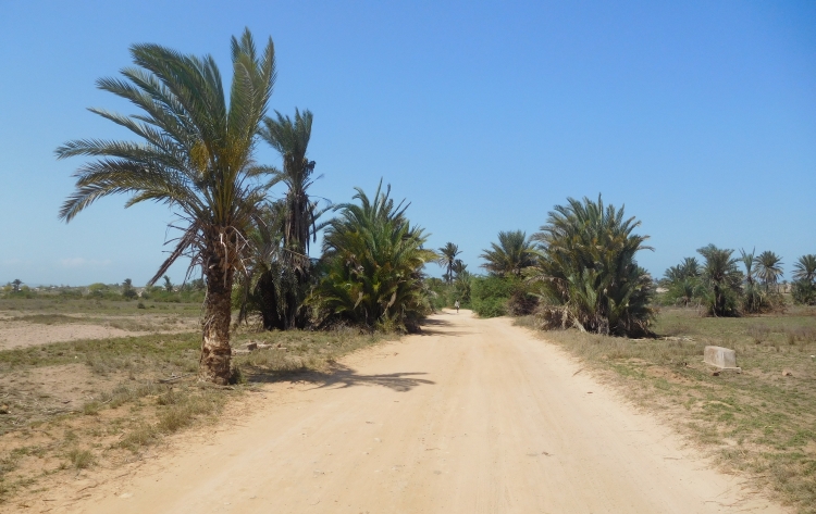
We descend to the valley. Thirty ultra-easy flat kilometers are awaiting us. Occasionally
we are passing a village. The houses are made of woods and sods. People do not bother to make
'real' houses here. On the one hand, people do not have the money, but maybe the
most important reason is that people are afraid that the houses will fall prey to the
many heavy cyclones that occur on the east coast of Madagascar. Then you better get buried
under a couple of sods than under a few concrete blocks. People do not really make much
progress in life this way, but apparently they do not mind too much. There is enough
food and water in the tropical landscape and that is the most important thing.
We are back in the hills again. It is time for lunch. We have cycled seventy kilometers
already. We have not found a suitable place to eat yet, however. In the last large village
before Toamasina there is also nothing. After the village Willem has a flat tire.
And the bad luck is not over yet. The spare tire, which willem has bought three days ago, appears
to be an 11 inches tire. A tire for a toddler bike. After half an hour we have repaired the leak
and we are on our way again. We think that we are lucky this time as we find a hotely along the
road. From the terrace there are nice vistas over the tropical landscape. The food that
the neighbors get served, does not look too good though. Poorly cooked meat with a slightly
decaying smell is mixed up with greyish black rice. Fortunately we have ordered something
else, but I do not have much trust in the kitchen here. After waiting for half an hour
we still have not received anything. When I inquire, it appears that the order has not
been taken up at all. We decide not to order anymore and to bridge the last thirty
kilometers with an empty stomach. Eventually we reach Toamasina. Just at the time we arrive
I feel weak because of not eating anything along the way.
Toamasina has an old center, but that does not mean that it is a beautiful city.
The center consists of wide avenues, lined palm trees. Weathered stately buildings flank
the avenues. All in all, the avenues and houses all look the same and there is nothing
really special to see and there is no really special atmosphere. The most interesting
is the coast with a nice beach and views over the big harbor. So Toamasina as a city
may not be very impressive, as a culinary city Toamasina is a top destination. We take a
late lunch at a popular cafe with an excellent seafood salad, and a few hours later
we are dining in a chic restaurant. We take it for granted, as from now on we will be
gonig to ever more peripheral areas. A final Bacchanal before the real adventure
is starting...
Day 6: Toamasina - Vohitsara - Foulpointe - Mahambo 91 km
In Toamasina begins the famous Route Nationale 5 to Maroantsetra. It is a legendary road,
actually beacause it can hardly be called a road at all. For a large part of the year it
is not possible to reach the isolated city with a four by four jeep. Only in the dry
season a four by four does make a chance. Whether it is possible to reach Maroantsetra
on a fully loaded bicycle, is still the question. We are just going to try it, then we
will see what happens.
We have taken our breakfast and we are packing our bicycles to take the road towards
Soanierana Ivongo. This is the easy part of the route, where the road is still paved
and where there are atill bridges over the rivers. But I am facing a problem. I am suddenly
having a nausea and I am having acute diarrhoea as well. I want to go whatsoever. And
so we are cycling over the remarkably busy exit road from Toamasina to Soanierana Ivongo.
Actually, the exit road is much nicer than the 'historic' center of Toamasina. All kinds of
vehicles with one, two, three, four or more or no wheels at all are rolling, bouncing,
sliding, wrenching or scraping over the road with vastly different speeds. in this
cheerful traffic jam we are cycling out of town and continuing our journey on the
Route Nationale 5.
The Route Nationale 5 is essentially a very ordinary road here, similar to the Route
Nationale 2. Occasionally we pass a village with turf huts, similar to the villages
between Brickaville and Toamasina. Just before Vohitsara we reach the Indian Ocean again.
Here the road gets a bit worse. Strips of asphalt are exchanged by strips without asphalt.
Because the strips without asphalt are much lower, all traffic loses a lot of speed at the
asphalt edges. Cars and jeeps can cover the passages by at most one kilometer per hour,
I myself must go back to ten kilometers per hour and Willem is the only one who does not need to
reduce speed at all with his mountain bike.
I do not feel well, but it is not too bad either. Over the course of the day I am even feeling
a bit better. Until we reach Foulpointe, a town with proper houses instead of sod huts.
There are several hotelys, where we are having lunch in one of those. I dare not eat
anything but a soup chinoise, but I am feeling sick after eating only a little bit of soup.
I cannot stand the strong smells and I am happy when we are done and we can continue
to cycle again, away from the smells that would be delicious in normal circumstances.
I start to feel better again while cycling. It is not so far anymore to Mahambo, where
we want to stay overnight. We could also cycle to the larger city Fenerive, but
Mahambo seems to be the nicent option. We have to leave the Route Nationale 5 for the
last kilometers to Mahambo. Over a sandy road we are riding to the low-key tourist
coastal village. We find a small bungalow near the sea. The coast is beautiful: a
wide bay with a beach of fine powder sand is flanked by tall coconut trees, all
against the background of emerald green hills.
After swimming in the ocean we are eating in a local restaurant and again my intestines
cannot cope well with the food. During the night I am spending just as much time
on the toilet as in my bed.
Day 7: Mahambo - Fenerive - Soanierana Ivongo 80 km
I am still feeling sick this morning, but Im still intending to start. I am not going to have
breakfast now, in the certainty that I will not keep it inside whatsoever. The plan for today
is to ride slow enough so that I will burn little energy in able to reach Soanierana Ivongo
without hunger. Perhaps my intestines will come to rest that way so that I can recover.
Today will be the last easy day with asphalt under the wheels. From tomorrow on we will
be confronted with 240 kilometers of unpaved roads with the highest difficulty level.
The first forty kilometers would consist of deep sand, where it may not be possible
to cycle with our heavily loaded bikes. As I see it now, it is best to go there with
a mountain bike with ultra-limited baggage. Then you can at least lift the bike and
this way you will always get there. I do not have a mountain bike and neither is my bike
ultra-lightly packed, so maybe we will find out tomorrow that we do not make a chance
with our bikes anyway, but it will surely help if we are both feeling healthy. That is why
I am not eating today, despite the fact that I am actually feeling hungry from the start.
We are cycling through similar landscapes as yesterday. A tropical, somewhat messed-up
landscape. The villages with wooden huts remain a pleasant experience. People are living
a simple life, devoid of any luxury, but there seems to be enough to eat. The sporadic
larger city has 'normal' houses made of stone and glass and concrete. Fenerive is also
a town with houses instead of huts. The traffic is an unprecedented chaos, especially for such
a small town.
After Fenerive we are back in the tropical landscape. We are passing a number of major
rivers. There are still bridges here to get ourselves over to the other side fast and easy.
That will be different in the coming days. After Sonierana Ivongo there will only be
ferries, where the question is whether or not they actually go and how long we have
to wait.
During the day I am feeling better, but I do not dare to eat until we are in Soanierana
Be Ivongo. Because the route with eighty kilometers is not too long and it is not
very strenuous either and so we reach Soanierana Ivongo early in the afternoon.
We find a hotel right in front of the ferry that will take us to the unpaved part
of the route tomorrow. On the other side of the kilometer wide river we see a beautiful
tropical landscape with emerald green hills. Together with Andasibe and the coastal area
around Mahambo this is the most beautiful landscape so far for me. It is very promising
for the days to come. The late lunch is also good. The food is tasty and I am not having
problems with my intestines anymore.
We are talking to a trader who sits nect to us. He is going to go to the other side of
the river for business, but he is waiting quite some time for the ferry now. He knows
the region well and he wonders whether it is actually possible for us to reach Maroantsetra
with our fully loaded bicycles. But he also concludes that if you have time enough and if
you have patience, you can always get there in the end. But there might be days that we
might do ten or twenty kilometers at the most. I must say that I am unsure whether I
have so much patience, then we would be busy to bridge these two hundred and forty kilometers
the entire rest of the trip and then we do not even know if we are able to travel
back to Antananarivo in time for the flight back home. There are only one or two flights a week
to the capital and they could already be full. The alternative with a jeep is also
painstakingly long and with a lot of uncertainties.
A little later the German development worker Ben joins the scene. He is married to
a Malagasy woman and he is living a little further in Foulpointe, which we passed
yesterday. He is on his way to a friend and he also must wait for a ferry. Eventually
it turns out that the ferry is too late for him and he will be staying in the same hotel
as we do. The trader is leaving us with the last ferry.
We are dining with Ben this evening. The food is excellent again. I am still feeling fine after the
lunch and I dare to drink beer again. After the dinner we drink a few more beers in a local cafe.
The atmosphere in the center is rough-edged and regularly a prostitute is passing by in search
of clients. Meanwhile I am suddenly feeling sick again, just as bad as yesterday or the day before
yesterday. Willem and I say goodbye to Ben and walk back to the hotel. There are a lot of
prostitutes on the streets and so Soniearana Ivongo is fully realizing its name and fame
as a brothel town.
Back at the hotel we find out that the doors are closed. There is no bell and so there is
nothing that we can do except for shouting to open the door. Nobody is coming. We call again
and finally a man is shuffling to the door. We walk back along the path to our small bungalow.
Then I suddenly lie on the ground, groaning with pain. In the complete darkness here I stood on
the edge of the path, where I sprained my ankle completely in the vacuum hole next to the path.
Nobody in Madagascar has a fridge, let alone that there is ice. There is nothing that I can do
to prevent the swelling and within fifteen minytes my ankle is as thick as a medium-sized
potato. From one moment to the next it is uncertain whether I will be able to continue this trip
any time soon and it is highly unlikely that I can start on the difficult part of the Route
Nationale 5 to Maroantsetra tomorrow or the day after tomorrow...
Day 8: Soanierana Ivongo - Ile Sainte Marie 1 km
The night was terrible. Stumbling to the toilet. Stumbling back again. Lying on bed. Pain.
Nausea. Having to go to the bathroom again. Stumbling to the toilet. Stumbling back.
I am actually happy as the sun comes up and we finally can get up. But I do not see an
attractive way forward for me this joutney. I am ill, I am injured and I can probably
do nothing else for the rest of our time in Madagascar. I say to Willem that he should
continue cycling to Maroantsetra if he wants to. It is completely clear now that this
will not be possible for me now. The first part of the road consists of loose sand, where
we will undoubtedly have to push our fully-loaded bikes over shorter or longer stretches.
Willem decides immediately that he is not going alone. Then the question remains: what could
we do now? Willem has already thought about this. From Soanierana Ivongo there is a
ferry connection across the river for the continuation of the Route Nationale 5
to Maroantsetra, but there is also a ferry connection to the tourist island of Ile
Sainte Marie. Willems sister has also been there before, so that is an interesting
destination for Willem. Then we can meanwhile wait and see how my injury develops.
If I recover fast enough, we could take the bus back to Antananarivo, and take an
easier route from there through the highlands in the direction of Toliara.
Day 9: Ile Sainte Marie - Ile Aux Nattes - Ile Sainte Marie 35 km
For the first time after four days I can keep food inside. That is a concern less in any
case. My ankle is still thick and that is my biggest concern of course. I still want to
try to cycle a bit today. Walking is still very difficult, but perhaps cycling goes
better. On Ile Sainte Marie I can test my ankle safely, as the landscape is flat and
we can ride without luggage. And so we are renting snorkel gear and a bit later we are
on our way to the north, to the island of Ile aux Nattes, a stone's throw away from the
considerably larger island of Ile Sainte Marie.
It turns out that I am able to cycle surprisingly well. I do not have to bend my ankle
while cycling and the pain is more or less the same as the ankle at rest. We are crossing a
large inland sea and we continue cycling to the northern end of the island. We can see the
Ile aux Nattes island on the other side of the sea channel. With a pirogue, a small boat that
is controlled by a boatman, we sail with bicycles and all to the other side. There we
are cycling around the island on the narrow single track paths. The snorkeling itself
is rather underwhelming. The reef is almost dead, the water is murky and there is few
fish. Moreover, I have considerably more problems with my ankle than with cycling.
Back on our bicycles I am trying to ride a bit faster and that works out. We decide
to go back to Antananarivo tomorrow with boat, bus and taxi. From there we will try
to cycle on mostly paved roads over the highlands to the south. Maybe we are able to
reach the southwestern coastal town of Toliara. The more challenging Route Nationale
5 to Maroantsetra will not work out now and we must leave that for another time.
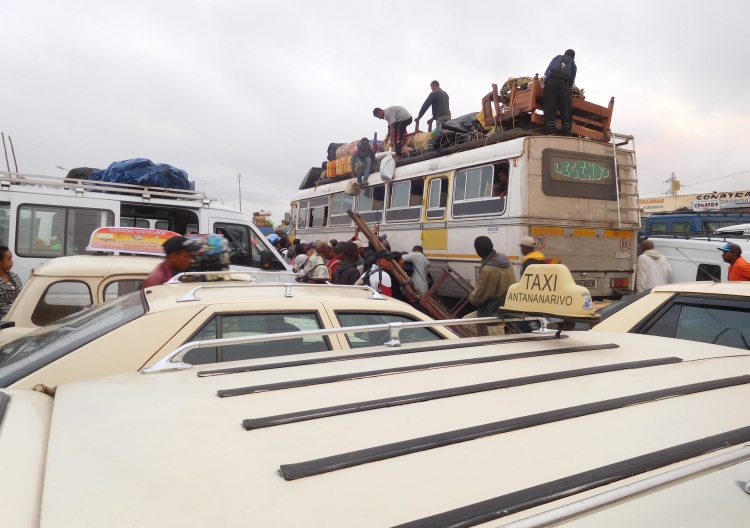
Day 10: Ile Sainte Marie - Antananarivo (bus) 0 km
A long boat trip back to Soanierana Ivongo, an equally long and slow bus trip to Toamasina
and an immensely long but neck-breaking fast hell of a journey in a van brings us back in
Antananarivo. At 5 o'clock in the morning we got up in Ile Sainte Marie and seventeen
hours later, at 10 o'clock in the evening, we arrive in the capital. The streets of
Antananarivo are empty, even in the center. I am surprised because I have not felt
unsafe anywhere in Madagascar, not even on the first day when we were rifing through
the suburbs of the capital.
I am glad that we have reached Antananarivo. Today was a day without a single
highlight, but tomorrow we can at least resume our bicycle trip.
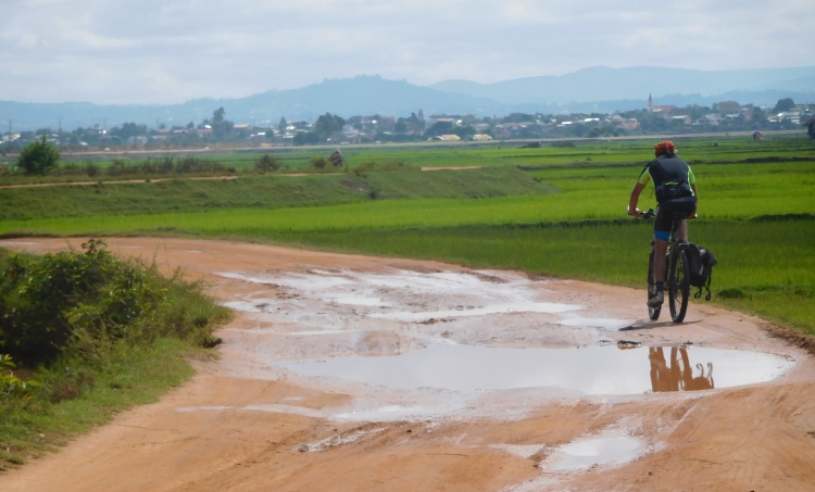
Day 11: Antananarivo - Behenjy - Ambatolampy 70 km
We wake up after a long sleep. We had a short night yesterday and the last nights
I have not slept well anyway because of my ankle. This night, however, I slept like a rose.
After breakfast we load our bikes and we are on the road again, finally. The hotel is close
to the center of Antananarivo and we immediately enter the bustle of the narrow, winding
streets. We descend to the low city, from where we have good views over the high city,
to the oldest part of Antananarivo with the old royal palace on top. We are not heading
for the high city, we will visit the capital properly on the last day before we
fly back.
We want to cycle to Ambatolampy today, the first city south of Antananarivo, at a
distance of seventy kilometers from the capital. Not too far, so that I am hopefully
able to tae positive instead of negative steps in my recovery. And we do not have too
much time to cycle far anyway, as we have started so late and there are not too many hours
left before it will be getting dark.
Initially, my ankle is painful while cycling. The pain is growing now. On the flat
terrain of Ile Sainte Marie everything went fine, but now my ankle reacts badly to
the exercise on the many climbs. Moreover, I am now carrying twenty extra kilograms
of luggage with me. Crazy enough it is getting better after a while and against all
logic, the ankle feels increasingly stable and less painful. After around thirty kilometers
we reach a village with a nice atmosphere, where we have a drink in a cafe. We already have a
number of climbs behind us. All in all, I am beginning to regain confidence in the
journey. Of course I have to make sure that I will not sprain my ankle again.
We are cycling through the central highlands of Madagascar, usually at an altitude
between one thousand and fifteen hundred meter. The climate is neither hot nor cold,
neither wet nor dry, a great climate for cycling. The landscape is also excellent,
hilly with lots of rice fields. Small settlements of ocher-red mud houses are spread
over the landscape. It is a landscape that is beautiful without being spectacular
and it is a landscape that is unique anywhere in the World except for Madagascar.
At one of the houses along the road the people are selling little statues of the Virgin Mary. Not those cute
little ones, but units of up to half a meter high. There are fifty of them, in three rows above each other,
as if they were posing for a picture of a soccer team. You would not immediately think great market
opportunities. I would not think about taking a unit like that in one of my panniers. Wrong! At
least, it looks like there are enough people who do see a market opportunity. We are passing more
Mary statues in the next ten houses along the road, always posing like a football team.
We are having a lunch in Behenjy. It is the village that enjoys nationwide recognition because
of the goose livers, a totally unnecessary tradition that has lingered here after the
French domination. Almost all the restaurants are advertising with the speciality. We do
not want to contribute to the senseless animal maltreatment and we go inside one of the few
hotely's that does not advertise with goose liver. The meals that Willem and I get served
are unfortunately not so good either. Willem gets a piece of chicken bone with some fat around it,
bathed in a pool of rancid fat. A kind of dirty intestines float in the fat pool and the smell
is impressively disgusting. The meal also turns out to be cold. My food is also bathing in fat
oil and is cold as well. So far we have eaten very well in Madagascar, but this hotely produces
a top ten position of bad personal food experiences. We pay the bill and we continue with empty
stomach. It is not that far anymore, so we will probably be fine.
After the bad meal we reach the most beautiful landscape of today. In fact, we are still cycling
through the rice fields and the hills, but here are just a few less houses in the landscape,
giving it a wonderfully harmonious atmosphere. Finally the day ends with a climb to Ambatolampy,
the highest city in Madagascar at 1,600 meter elevation. Here we find a nice hotel, where we
have to repair my bicycle. Apparently, one or more wires of my gear cable has been damaged during
yesterday's bus transport, so that today the other wires has been cut as well during cycling.
The last twenty kilometers I got increasingly more and more problems. Here in Ambatolampy a
single wire holds everything together. We replace the cable so that we will be able to
continue tomorrow.
Day 12: Ambatolampy - Ambohimandroso - Sambaina - Antsirabe 97 km
We leave Ambatolampy under an overcast cloud cover. Just like yesterday, we are cycling
through a hilly landscape with rice fields in the valleys. The valleys are wider than
yesterday and so it feelslike we were cycling through a hilly landscape yesterday while
today we are cycling across a high plateau. Today we are cycling mostly over flat
terrain. There is little wind and all in all it is an easy cycling day. Under these
easy conditions, I hardly ever suffer from my ankle, despite the fact that the ankle
is still thick and despite I still am suffering when I am walking. During my cycling
trip in Iceland three months ago I have been riding over a lot of straight, flat roads,
but then I usually had a stormy headwind. It feels good to have really easy conditions
now and I am tempted to treat the stage as a long time trial. WI persevere with the highest
possible speed that I can stand for a long time. However much fun I am having, the joy is
not shared. Willem asks himself, what this all is supposed to mean. You were injured,
weren't you?
The landscape is not spectacular but it is beautiful in a low-key manner, even under
the gray conditions of today. The muted colors have their own charm and are juxtaposed
beautifully with the exuberant colors of the tropical landscapes that we were undergoing
until today under persistently sunny conditions.
Terraces have been created in the valleys and low slopes. For the most part the terraces
are used to grow rice, but there are other crops as well. The characteristic mud houses
are scattered here and there in the landscape and are sometimes grouped together in
small settlements. The larger villages usually have more modern, cheaper houses.
These villages are less characteristic and less colorful, but are attractive in their
own right. The people are usually subdued and neither react excessively enthusiastic
nor with hostility to the strangers, which we actually are of course. I am in a village
where I am surrounded by children. They try to sell bananas, but even after we have
bought a few of them, they stay around me. I am giving my audience some entertainment,
so that the children are enthusiastic and if they are happy, I am happy too.
We move on through new fields. A relatively long, but not too steep road winds up
between the terraces. We arrive on a wide plateau, which is surrounded by low mountain
ridges, which we already see in the distance. After we have crossed the plateau,
we find out that we hardly have to climb again. On the contrary, from here we descend
most of the time and eventually we reach the city of Antsirabe, one of the larger
cities of Madagascar. The city itself does not overwhelm with beauty, but we find
a nice hotel, surrounded by a beautifully decorated garden with hundreds of trees
and plant species.
Day 13: Antsirabe - Lake Andraikiba - Lake Tritriva - Vinanikarena - Ilaka - Ambositra 123 km
This morning nothing reminds of the gray day of yesterday. A radiant sun is illuminating
the landscape in exuberant red, yellow, brown and green colors. The sky is deep blue,
as if we are in a desert. From Antsirabe it is about one hundred kilometers of cycling
to Ambositra, the next town with tourist facilities. In the vicinity of Antsirabe
there are also two lakes that can be reached with unpaved roads. The lakes seem to be worth
a detour and it is possible to cycle a circuit along them to end up on the Route Nationale
7 to Ambositra again. This is obviously a big detour, but we do not know exactly
how many extra kilometers we have to cycle. I also do not know whether it is already
possible for me to cycle on unpaved roads with my ankle. The cycling itself will be
okay, I am sure about that after yesterday, but the question is whether the ankle holds,
whenever my bike is slipping and I need to put a foot on the ground. I have decided
to take the risk for granted. And so we riding out of Antsirabe and after five kilometers
on tarmac we reach the first lake, Lake Andraikiba, the beginning of the dirt road.
We are cycling along the bright blue Lake Andraikiba. The road is slightly sandy, but the wheels
do not sink deeply. So far no problem at all. After the lake we are riding through undulating
terrain. We are riding in the direction of the next lake, the crater lake which is called Lake
Tritriva. In the distance we see a wide mountain range. Could this be the volcano with the
crater lake? The mountain does not look like a volcano. After crossing the plains we start
the climb against the mountain ridge.
We reach a sort of pass, from where we descend to a new broad plain. So the mountain range
was supposedly not the volcano with the crater lake. Only now we can see the volcano
beyond the second plain that is stretching out before us. Behind rises a new ridge
with a conical mountain top in the middle, which undoubtedly must be the volcano with
the crater lake. That is apparently quite a long climb.
First we descend to the plain. The road surface is somewhat more sandy here and once in a
while I am sinking deeply in the sand and suddenly I come to a standstill. At those
moments I need to bring a foot on the ground, in order not to fall. In the end everything
barely works out fine, but it is good enough.
We reach the village of Tritriva, from where we take the exit road to the volcano. We need to
take a guide because this is a nature reserve. Except for the guide, there are also a number
of children, who are essentially here for begging money. They are extremely refined
in the presentation of arguments why we should come over with money. They are born to be
politicians, who master the art of making their point regardless of the input of others.
They manage to get back to their agenda at all times during the conversation and they know
how to grab attention with a fast-paced alternation of rational, emotional and subliminal
arguments. One of the girls is so clever that she is able to overpower even the most shrewd
Dutch politicians. Nevertheless, she does not succeed in her plan. If I would give her
something, I should have to give something to all the children. Moreover, she does not
really need it. She will get there, with or without my help. If she does not succeed to the
left left, she will try to the right. And if that does not work, she will succeed above or
below.
Our guide is significantly less eloquent. He slumbers incomprehensibly. He is sympathetic
but I have no idea what he is talking about. There is not much to say about the landscape
anyway. We stand on the crater rim and look down into the crater lake. That is it
pretty much. It is a beautiful lake, but the road to the lake was even more beautiful.
Meanwhile the smart girl plays her last trump card:
>>> Buy this stone, as a souvenir to us children.
We say goodbye to the guide and the children, who can not keep up with us when we are
riding downhill. Then the girl shouts her very final trump card:
>>> Keep reminding us!
And it turns out that I do remind when I write down these words two months later.
Of all those many thousands of poor and begging children that we have seen, I have
more often not given any money than that I have given. But only with this girl I have
still feelings of guilt that I have not given anything. The psychological impact of
her arguments was so strong that I would almost take the plane back to Madagascar because
of the 'injustice' that she will have to continue in life without my financial support...
We cycle back to the valley, from where we take the exit road that leads back to the
Route Nationale 7. This is also a dirt road, more challenging than the road to Tritriva.
The road is clayey and gives good grip, but there are deep trenches and occasionally
the road steeply sinks down two meters to climb two meters just as steep. There are no
cars here. We only see carts with zebu's.
The clayey terrain is replaced by large stones. The terrain is more difficult now.
My relatively thin tires do not always have good grip, so my wheels are occasionally
slipping away. Every time that I have to put a foot on the ground, my ankle is pretty painful
now. On the steepest stretches the stones are encapsulated in a clay layer for better grip, but
that also means that I am being shaken up, especially on the descents. The blows on my wrists
are such, that I am facing more problems with my wrists now than with my ankle. Eventually
we reach the village Vinanikarena, where we reach the Route Natioanle 7, where we have
asphalt under the wheels again.
We have already cycled more than forty kilometers and it is almost twelve o'clock.
We still have more than eighty kilometers to go and less than six hours to do so before
it gets dark. There is a moderately heavy headwind, which may swell a bit further during
the afternoon. So we have already done a serious effort, but we certainly have a serious effort
ahead of us as well. That effort immediately starts with a climb. The descent that follows,
brings us into a beautiful, wide valley, filled with shimmering green rice fields.
I am enjoying the rice fields and I am taking one picture after another. In the meantime
Willem is cycling way ahead of me. I decide that I have wasted too much time.
I am riding in a fast pace now in order to keep up with Willem. Only after twenty
kilometers I reach Willem again. It is the place where a climb to a pass starts.
I am apparently in a good shape, as I am not having problems with the climb, although I
am tired before I begin. After hours of high effort I need a lunch now, but none
of the villages has something to offer. Eventually, after an hour or two, we find a
shop where we can buy some snacks. After the late lunch we still have to cover thirty
kilometers. The sun is already low, enhancing the already strong colors. We are in any case
in a beautiful landscape with narrow valleys and large, rocky mountain massifs with strange,
rounded shapes. We still have to go up to a last pass. It is a climb in several stages,
with alternating average steep climbs and flat sections or even small descents. Once
above we only have a small descent and subsequently it continues to climb and descend until
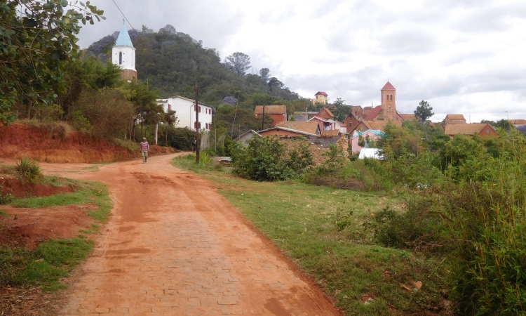
we eventually reach Ambositra under the last afternoon light. It is a beautiful city,
partially located on a hill in the middle of a wide valley, partially located against the
erratic flanks of the hill. There are quite some big churches, all of them on a local
increase or on other striking points. We find a nice hotel, where we enjoy the
sunset over the flanks of the historic city.
Day 14: Ambositra - Ambohimasoa - Ranomafana 137 km
After the long tour yesterday, it would be nice if we could take it easy today,
but that is not actually the case. The first big city on the Route Nationale 7 with
guaranteed facilities is Fianarantsoa, but that is too far for one day. Moreover,
we want to go to Ranomafana first, which lies to the east of the Route Nationale 7.
After about hundred kilometers is the exit road to Ranomafana and then it will be
about thirty kilometers to the village at the eponymous national park. According to
Willem, the road should be paved. I ask him if he is certain. Otherwise it will probably
take too long. Yes, he replies, he had checked it out on the internet.
It is nice weather today, but it is not exuberantly great. A bit boring actually. And
that also applies to the landscape. One unanimous ridge is followed by the next one.
After a day full of highlights like yesterday, I do not mind. It means that I am not
standing next to my bike making pictures all the time, but rather sitting on my
bike, bridging kilometers. For Willem it is the same. And thus we have cycled those
92 kilometers to Ambohimasoa surprisingly fast. We have a great lunch in a restaurant,
where we could also sleep. The restaurant is excellent and the owner and his son are
exceptionally sympathetic. They ask if we will stay asleep, but we will not do that.
We are heading on to Ranomafana.
Six kilometers after Ambohimasoa we reach the exit to Ranomafana. The road is unpaved from the
first meter.
> The road was unpaved you said, didn't you, Willem??
I ask, curious about what he will say about this.
>>> On the aerial photos though.
> But not in real life...
>>> No, supposedly not...
We wouls have had plenty of time if the road had been paved, but that is not the case.
Now the time is not on our side. The landscape is very beautiful and that is why it is a shame
that we have to push on. the rice fields are surrounded by emerald green tropical forests,
a landscape that is very different from the last days and which is more reminiscent of the region
around Andasibe. We pass a village with a special atmosphere, it feels far away from the
rest of the world. We buy some water in case we will not reach Ranomafana today and
we must camp somewhere along the way.
After the village the road leads up through the tropical rainforest. It is already five
o'clock and we only have one hour left before it will be completely dark. When we reach
the pass however, we are lucky. The road is suddenly paved. Another few kilometers
further the road joins the paved road from Fianarantsoa and then the landscape suddenly
falls down steeply. We are in a steep, intensely green world. A waterfall crashes
down next to us. The last ten kilometers to Ranomafana are a downhill paradise
with great curves. I am full of adrenalin and I am going through the curves like
crazy. Willem does the same. In no time we reach Ranomafana, a beautiful village
at the foot of the green mountains.
Day 15: Ranomafana - Fianarantsoa 64 km
We were actually planning to visit the national park of Ranomafana today, but Willem
explains that he does not really feel like going. It might be a bit of a repetition
after the great experience in Andasibe National Park. I think that he might be right
about that. In Andasibe we had maximum luck with our guide and we saw so many different
animals that we probably will not match or surpass the experience here. And so, suddenly
and unexpectedly, we are back on our bicycles again. Not for a long stage by the way.
We want to cycle to Fianarantsoa today, at around sixty or up to seventy kilometers
away from here.
We have to go back up again where we cycled down yesterday afternoon. So we know
what is coming: ten kilometers non-stop uphill with a medium steep gradient percentage.
So the climb is not too difficult, but it is initially warm since Ranomafana lies
much lower than the highlands where we stayed the last few days and where we will stay
again the coming days. We cycle up along the national park and after ten kilometers,
as expected, we reach the junction. We are not taking the unpaved variant to Ambohimasoa
this time, but we opt for the paved road to Fianarantsoa.
We reach the pass and we descend on the other side of the mountains. Eventually we reach
the Route Nationale 7 again. The road here is not too interesting and twenty-five kilometers
before Fianarantsoa we turn off to take an unpaved road that also leads to Fianarantsoa.
After a kilometer, however, we suddenly have a problem. The chain drags against the derailleur
and makes awkward noises. We find out that the derailleur is completely warped. We try to
bend the derailleur a bit, but it does not make much sense. Willem can ride in the middle speed
at least now. This is not a lasting solution, but we must be able to reach Fianarantsoa.
The dirt road leads through obscure villages, which are surprisingly busy. What are all
those people doing here, I wonder. But they obviously have a lot more reason to wonder
about what I am doing here.
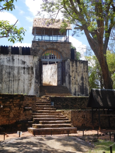
We reach Fianarantsoa. The city consists of two parts, the busy lower town and the historic
upper city, a few hundred meters above the lower city. We cycle past a bank in the lower town.
A crucial moment. We have to extract money for more than a week, since this might be our
last possibility to cash money until Toliara. We must take into account that we also need
money for two visits of national parks. And so we empty the entire bank and we are not only
millionaires now, we also have more than a million Ariary with us now.
We cycle up to the upper city. Strangely enough there is little life there. As busy as the lower
town is, so quiet is the upper city. Perhaps the hotels are a bit higher in the upper city.
We have to go there with long stairs. With the heavy bikes in our hands we climb upwards,
an unprecedented heavy job. And when we are fifteen minutes later, it is not only that
a heavy job but also a useless one. The only hotel is closed. And so we can go the same
way back. We are being chased by an ever growing crowd of beggars, who are standing in
the way. I am happy when we are standing down at the beginning of the stairs again
and we can continue cycling. We descend on another route and halfway between the upper
and lower city we find a small hotel. We have a fantastic dinner that night in the
local cookery school.
Day 16: Fianarantsoa - Ambalavao 55 km
Today we want to reach Ambalavo, the southernmost and last of the cities on the highlands.
It is not that far from Fianarantsoa to Ambalavao, so today is basically a piece of cake.
That is okay, because we can look at the derailleur of Willem that way. After a lot
of attempts we have reapaired the derailleur good enough, that the chain runs in both
the lightest and the middle speed. It should be good enough for the remainder of the trip.
We take an unpaved side road, which runs steeply up to a village. I can barely reach the top
without getting off. Up there the road is a little easier. We are cycling past a school,
where we are suddenly surrounded by dozens of screaming children, all of them running after
us. The descent starts right after the school and it gets ever steeper, with increasingly
deep trenches runnung through the narrow road. It is a pretty technical descent, a real
challenge with my bike, the more I prefer not to use a foot for balance purposes because
of my ankle. At the same time, all those children are running right behind us and it
would be nice if I could move a bit faster in the easier part at the top, to prevent
all those children standing in the way while riding the technical part of the descent
a little further. It all works perfectly. Whe we reach the difficult part, we are
ahead of them. Cautiously maneuvering I go down. The course is even more challenging
than it previously looked like. The last part is a bit easier again and so we reach
the Route Nationale 7 and the asphalt again.
A final climb leads up to a pass and then the road gently goes down to Ambalavao.
In the distance we already see the granite mountains of the national park
Andringitra and its surroundings. We will go there tomorrow. We reach Ambalavao,
a rather small town that almost entirely exists of traditional houses. It is as
far as I am concerned, the most beautiful city we have seen in Madagascar, together
with Ambositra.
We find a nice hotel, also a traditional house, where we have lunch in the garden.
The young cook is wearing a chef's hat. That naturally raises high expectations, and
those expectations are fully fulfilled. It is the best food in Madagascar until now.
In the afternoon we have plenty of time to visit the city, including the interesting
market.
Day 17: Ambalavao - Anja Park - Tsaranoro Valley - Camp Catta 58 km
Today we want to cycle to National Park Andringitra. This national park is not all about
special flora and fauna, but above all it is about landscapes. The granite mountains
reach to a height above two thousand meters. The highest mountain, the Pic Boby, is with
2,657 meter elevation the second highest mountain in Madagascar. We will go to one of the
camps in the Tsaranoro valley, on the dry side of the mountains.
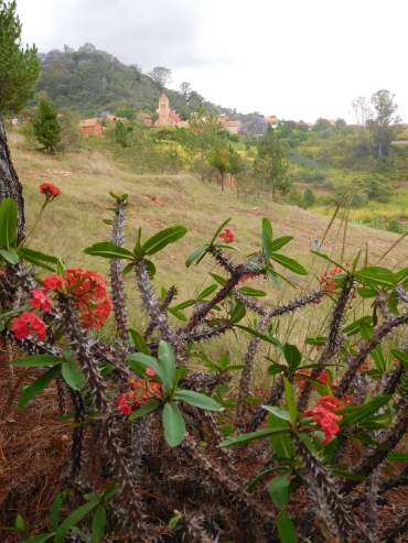
Immediately as we cycle out of Ambalavao, the first granite mountains emerge. The
landscape is the driest that we have seen so far. The flanks of the mountains are
largely treeless. Only the valleys are green. There are trees and in a few places
there is enough water for rice culture. The contrasts between the green valleys
and the dry mountain slopes are breathtaking. After an hour of cycling we reach Park Anja,
a regional park at the foot of spectacular granite mountains and one of the best places
in Madagascar to see ring-tailed lemurs.
As with all national parks, a guide is mandatory in Park Anja. In our case
we even have two guides. There is also a guide in training coming with us.
It is only a five minute walk before we see a group of ring-tailed lemurs. The lemurs
with the remarkably long black-and-white tails live in tight, social groups. The
animals are remarkably concerned with each other. They play and they frolic and like
other lemurs they jump from one tree to another, even if the trees are a few meters
apart. Even a mother with a young on her back can jump from one tree to another. Unlike
the other lemurs that I have seen, the ring=tailed lemurs can stand on two legs, just
like people.
After our visit to Park Anja we are riding on Route Nationale 7 again. We climb to
a pass and descend into a wide valley. Here is the exit to the Tsaranoro valley.
We take the exit on the dirt road to head for the camps at the national park, twenty
kilometers further. The road is pretty good and we are approaching the high mountains
quickly. There are fires raging everywhere on the hills. Because it has not rained
for a long time, there is nothing that can stop the fires. The wind blows the fire
in the direction of the end of the valley, which is why in theory we could be trapped,
were it not for the fact that fires will rise up the slope. As we will stay in the valley
I decide that nothing can happen to us, but it is still hard to see how half the
mountain slopes ablaze.
We reach a village where we buy some drinks. Soon there are a lot of children
around us. I introduce them to our Dutch carnival 'tradition'. The children must
get used to it a bit, but soon they raise the hands in the air at the right moments.
When we cycle away, they run after us. With the hands in the air.
After the village we cycle past more fires. At thr same time we are surrounded by a
phenomenal mountain landscape. It is a bit of the Malagasy version of the Yosemite
Valley, with perpendicular granite walls. It is true that the walls are roughly twice
as low as in Yosemite, but walls of 700 to 800 meters of elevation difference are
still extremely impressive. With the deep, warm, saturated colors of the rocks and
vegetation the Tsaranoro Valley is just as impressive to me as the Yosemite Valley.
We reach the first camp, Camp Tsaranoro. Willem and I are discussing whether we will
stay here or whether we will continue to Camp Catta, a mile away. The atmosphere is
not that special at Camp Tsaranoro and I opt for cycling on, which we do eventually.
And that proves to be the good decision, because Camp Catta is much more special.
It is beautiful at the foot of the Tsaranoro, the most impressive mountain wall of
the valley and there is a family of ring-tailed lemurs in the camp.
Day 18: Camp Catta - Bergtop van de Cameleon - Camp Catta (lopen) 0 km
Today we go with a guide to the top of the Caméleon, a striking mountain top nearby
the wall of the Tsaranoro. With the choice for this trip we actually do not reach the
national park at all, but the landscapes are similar to those of the granite mountains
which are within the boundaries of the national park.
Together with our guide Arcen we start early. The route initially runs through a
forest with many different trees, very different from the tropical forests we have
seen until now. After crossing the forest, we climb up between the big mountain walls of
the Tsaranoro and the Caméleon. The path winds up over the dry grass slope in
between. Just before the pass the trail goes left towards the top of the Caméleon.
We meet a group of women, who are walking from a village twenty kilometers away to
obtain rice and other food supplies. They have to walk back the same twenty kilometers
today, they tell. They are not tired, however. They cheerfully tell about the long
journey they have walked so many times.
We reach the top of the Caméleon. The last part has a few easy climbing passages.
And then we are at the top, where we have a great view over the valley.
We walk back over another route. On the climb I did not suffer too much from my ankle,
but on the descent the pain is pretty intense and the ankle is becoming wobbly.
Fortunately, the terrain is getting ever easier. We reach the valley floor and walk
back to the camp.
Day 19: Camp Catta - Ankaramena - Zazafotsy - Ihosy 127 km
The day does not start well. Willem has a flat tire. We replace the tire, but that one also
appears to be flat. And so we have to repair one of the tires. And then the bicycle pump
from Willem also appears to be broken. It did not function well during the whole trip,
but now the pump only extracts air instead of providing. My own pump is not suitable
for the mountain bike valves, so that is about it. Unless I have a spare pump with me.
I do not know whether or not I have a spare one with me. If I am riding on my own,
I always do, but now it would not be necessary. We are lucky. It proves that I have
taken a spare pump. We repair the tire and we can finally start the long way to Ihosy,
the first city with hotels.
For the first time during our trip we have to deal with boring weather. Not only is the sky
overcast, but the clouds are also formless and dreary. In fact, the route of today has
got very little added value. The first twenty kilometers back to the Route Nationale 7
are the same as the day before yesterday and are of course beautiful. Then we cycle more
than a hundred kilometers through a semi-desert landscape without noteworthy highlights.
We reach the city of Ihosy, the capital of the Bara tribe. The city is poor and
unappealing. We find a hotel that is clearly not frequented by many tourists. The staff
is giggling uncomfortably. Nevertheless everything proves to be fine in the end.
Our dinner is very nice too.
Day 20: Ihosy - Ankily - Ranohira 92 km
Today we want to reach Ranohira, the jumping-off point for the nearby Isalo National Park.
Tomorrow we want to explore the national park. We are cycling from Ihosy to the nearby
village of Ankily, on the other side of the river. That is the start of one of the longer
ascents of our route through Madagascar. The road climbs a little ten kilometers
up against a cuesta. The landscape at the foot of the climb is a kind of oasis, a
feast of green which contrasts sharply against the bare, vegetation-poor flanks of
the surrounding mountains. We climb out of the valley and soon we have beautiful
views over the green valley far below us.
After an hour of climbing we are up above and we have already had the most strenuous part
of the day. From now on the road is largely flat or a little downhill to Ranohira. At
the highest point is the exit road of the Route Nationale 13 to the far south of
Madagascar, an interesting and challenging unpaved route, which I would dare to do
now with my ankle, but we do not have time to do so. We continue on the paved Route
Nationale 7, but not before we have drunk something in the cafe at the crossroads.
Spacious, orderly, spotlessly clean, luxurious, relaxing, prosperous, these are the
adjectives that certainly do not apply to the 'interior design' of the café.
The little house which is barely standing, is a bewildering mess, in which every
little space is utilized. The whole house is full with scrap. The only thing that
seems to work is a cassette recorder, from where hazy, trippy dub music blasts from the
speakers. The fuzzy beat of the music is the tightest, most organized of everything
that we find here. After a little while, we succeed to get the waiter more or less
awake. He looks at us with a look of a steamed shrimp. We order two drinks, but we
have to repeat the order a little later when he seems to have lost track of it. We
cannot drink the cola at a table. The only table lacks one of its legs and sticks
into the air as a sinking Titanic with 45 degrees.
After the invigorating cola, we go down on the long road that lies ahead of us. What
initially looked like a piece of cake, turns out to be more difficult in reality.
There is a strong headwind, which means that we are not progressing very well.
The road does not go down steep enough to ever develop some speed. The landscape is a bare
plateau without vegetation and without something to look at. The sky cover is also extremely
boring. We have the same gray soup like we had yesterday, clouds without form or
substance. Willem already hates cycling with headwinds anyway, but such long, empty
landscapes in combination with the wind is disastrous. I have crossed these kinds of long,
empty landscapes before in my life, even in conditions that are more challenging, but
for Willem this is the first time. He does not like the prospect that we will to deal
with such landscapes more often until the end in Toliara at all and he experiences it
as a big anti-climax.
After a lunch in a village, the afternoon program brings more of the same. Wind, that
roars over the barren landscape. Only in the last hour we have views over the mountain range
from Isalo. We reach the village of Ranohira, the base for the mountains and the gorges.
We find a park with small bungalows, where we also arrange a guide for tomorrow.
We will be going with two Chilean and a French woman.
Day 21: Ranohira - Isalo National Park - Ranohira (walking) 0 km
The excursion was cheaper than expected because we are walking to the national park instead
of riding in a car. Now we are on the way, I wonder if this was such a good idea. The mountains
seem pretty far away. After an hour of walking over the plateau, we hardly seem to have
come any closer. Eventually we walk twelve kilometers before we arrive at the national
park.
We enter the national park and soon we find ourselves in a dense forest. Not much later
we walk into the first gorge, the Canyon des Makis. We clamber over the smooth boulders
along the river. The walls of the gorge rise straight up. The valley floor is intensely green.
There are flowers, ferns and trees all around. We bathe in a small lake.
After the Canyon des Makis we walk out of the national park for lunch. On the way the guide asks
to me what we are going to do with the way back. I ask what he means.
>>> Well, if we walk back, we do not have that much time in the second gorge, the Canyon
des Rats. Moreover, we will come home very late.
> You have to ask the whole group, not only me.
>>> But of course we can also go with a van...
> That sounds like a good idea then.
>>> Okay, that costs EUR 60,-.
> Well, the idea seems a lot less good to me. For that price we can go all go all the
way to Antananarivo, seven hundred kilometers away!
>>> Also good, but then we have to walk back. Think about it...
> You must thin about it yourself, I think. Just communicate with the group, I would say.
Meantime, the lunch is horribly bad. We have to divide the salad for two people with
three persons as the young French lady also orders lunch and the main course is
outright bad. Everything in the excursion is of low quality. But we have a nice
group, so I do noy bother. I tell the group abou the conversation that I had with
the guide. We all think the same thing about. Nobody likes to walk back and nobody
wants to pay extra. And certainly not so much extra. We decide not to decide. And
so we stroll inside the Canyon des Rats, the second and final gorges.
After a few hours of walking, climbing and swimming in the canyon, it is time to go back
again. It is almost 4 o'clock in the afternoon. The guide makes contact with me again.
>>> And, have you thought about it?
> About what?
I am playing the fool.
>>> Well, about the return journey...
> No, have you?
>>> Well ehh, you are the customer.
> One of the five customers, yes. Discuss this with the others or think of a way out yourself.
In the meantime we have already covered a kilometer of the way back and the decision has
made itself. I do not mind walking back and neither do the others. Only the guide is
dissatisfied. He has missed the lucrative return journey, he has to walk all the way
back and in place of half a day work he must work the whole day now and no one will give
a tip.
Day 22: Ranohira - National Park Isalo - Ilakaka - National Park Zombitse - Sakaraha 115 km
We cycle out of Ranohira and soon the road leads us through the Isalo National Park.
We are riding straight to a big rock wall. A bit later we are in the middle of the rocks.
Sometimes the rocks deviate for a while and there is a bare plain with at most some loose
trees, but the rock massifs are never far away.
Just before Ilakaka there is another special point in the national park, a hole in
a rock. A sandy road leads to the hole. I suffer from my ankle, especially on the
moments that I have to walk through the loose sand. I am tired of it, but a bit later
we are rewarded with beautiful views over the strange rock formations that rise up
from the desert. Here and there we see some Bismarckia palm trees. They have a black
trunk and wonderful silvery leaves, which reflect most of the sunlight. It is the most
special part of the national park. We reach the rock with the hole and cycle back to
Route Nationale 7 and further on to the mining town of Ilakaka.
We reach Ilakaka, a town where everything revolves around the sapphires. Around the turn
of the century the first sapphires have been found, and since that moment there is a
true sapphire rush going on, similar to the gold rush in the United States from a hundred
years earlier. The landscape is coincidentally more or less similar, a plateau with
large scale ridges with the climate of a semi-desert. Without the sapphires no one
would have lived here, but now it is a lively town. There are many people on the
street, but there are also many people in the river. They are sifting sand to isolate
sapphires or sapphire dust from the sand. There are many people together, but it is
not cozy. There is a wild-west capitalism going on here that is unprecedented. The
houses are largely poor, but the sapphire stores radiate prosperity and on the outskirts
of the village are some luxurious bungalows with large cars in front of the door.
After Ilakaka there is a climb to a wide plateau without trees. The road is a straight
line through an empty landscape. Only a few kilometers further a new crest rises. These
are not landscapes for Willem. He does not enjoy it and he does not feel like moving
forward in the large-scale landscape.
We descend to a small river, where we cycle through a new mining village. This is a more
recent sapphire city and here the difference between poor and rich is even greater than
in Ilakaka. One person has got everything and the rest has nothing at all. A few kilometers
further we reach a mining town where only one person is on the street. The rest of the
houses seem to have been abandoned for a couple of years now.
After the desolate mining town follows a long climb against the gently sloping plateau. We
are having headwind, so now the progress is even slower to Willem's displeasure. The
landscape is boring and monotonous, until we reach the pass. Now an open desert landscape
is stretching out ahead of us with wide valleys and lonely ridges. The landscape is
very large-scale and we can look at least forty kilometers ahead of us. We can descend
now. Not steep, but very long.
In twenty kilometers we descend a few hundred meters. In the valley we see our first baobab
about a kilometer far away. No matter how far the distance is, we are able to see well how
monumentally large this tree is, really majestic. With a little bit of luck, there will be
a lot more baobabs ahead of us, which we will hopefully see from a closer distance.
We are cycling up against a new hillside. It is the biggest climb today, but this climb
is more beautiful in its raw desolation than the last climb. Again we have headwind. I
think that we have had only headwinds in three weeks of cycling. However, this time
Willem does not seem to experience it as a problem. We reach the last pass, where a
new national park starts, the small but special National Park Zombitse-Vohibasia.
A few minutes ago we were cycling up through the desert, and now we are cycling down
through a forest. The National Park Zombitse-Vohibasia is the last dry forest of Madagascar.
Just before this forest would have fallen prey to one of the many fires of this region,
the area has been protected to proclaim it a national park. Well, protected? I hear
the harsh, grim sound of electric saws around me. I do not see anyone, however. Then
I see an ape-like white with black animal in a tree and a little later I see a few other
species. So these are producing the immense noise. They are Verreaux's sifakas.
We cycle out of the national park, but we are cycling in an equally special area now:
the forest of the baobabs. Well, forest, that is what it is called. It is actually
an open space with scattered babobabs. And there are very big baobabs. Wwe can reach
the baobabs easily on our bikes, an unforgettable experience. After visiting a lot of
those baobabs, we ride to the town of Sakaraha, where we find a hotel. From here it
is only one long day of cycling to reach Toliara on the west coast and the end of our trip.
Day 23: Sakaraha - Andranovory - Toliara 133 km
We start early on the long day to Toliara. The day starts gray, but for the time being
there is no wind. So we must benefit from the favorable conditions. Before this,
we can enjoy the last highlight of the route to Toliara. There are a few baobabs
on this stretch, including the biggest ones we have seen. The most spectacular baobab
is not one in one piece, but one with a complex of parallel stems. The tree looks
gigantic from a distance, but when I see Willem posing against the tree, it is really
revealed how thick and big the tree actually is.
After the visit to the giant tree we cycle further. Without the usual headwind
we are progessing very well, until we see a new big baobab. One minute later we are
standing against the tree. At that moment a boy comes running with a chameleon. It
is one of the most beautiful we have seen. We leave again and ontinue to the busy
village of Andranovory. After a few hours we are already halfway. Only some seventy
kilometers remain.
After Andranovory, the landscape is not too exciting anymore. The gray cloud cover is
boring and the villages are the poorest we have encountered so far. The wind has finally
come and we are confronted with the usual headwind again. It is good that we only have
to cycle the last forty kilometers against these headwinds, because I am already finished
with it after a few kilometers. We are also hungry and thirsty because in none
of the villages beyond Andranovory we have been able to obtain food or drink. Just
before we reach the coast we have a final climb to a withered limestone plateau.
After a few kilometers we have crossed the plateau and we descend to the coast.
Another ten flat kilometers further we reach Toliara, the big city on the west coast
of Madagascar and the end point of our journey.
Day 24: Toliara - Saint Augustin - Toliara 64 km
We have reached the end point of our journey, but that does not mean that I do not cycle anymore.
I decide to cycle without luggage along the coast to the village of Saint Augustin, an old
French colonial port village. Willem has no lust to go and stays in Toliara.
First I cycle ten kilometers back on the same road yesterday. There I take the exit to
Saint Augustin. A beautiful sandy road runs between the limestone plateau and the coast.
I am passing a few extraordinary poor villages. The people are living from fishing. With
tiny little boats with inimini sails they defy the waves and the wind of the ocean. I am
passing the Tropic of Capricorn. From there on the palm trees make way for the arid,
leafless trees of the limestone plateau. The only trees with little leaves are a kind of
small white baobab-like trees with a white bark.
After twenty kilometers of sandy road along the coast, the road suddenly goes up steeply. There
is a warning sign that the road is 28% steep. Fortunately I am cycling without luggage and after
a few minutes I am standing on top of the limestone plateau. With a temperature of far above
thirty degrees I am sweating heavily. I feel like a squeezed lemon when I reach the top.
A few kilometers later, I go down steeply. I have reached Saint Augustin, the nicely located
village at the mouth of the wide river Onilahy.
Over the same road I cycle back to Toliara, from where we will take the bus back
to Antananarivo. We want to leave tomorrow morning. After a few hours of hassle with middlemen
we have finally arranged two places in a van. In the meantime, I have eaten something wrong.
For the most part of the night I spend my time in the toilet. It seems like the 24-hour bus
trip of tomorrow is going to be a complete disaster.
Day 25: Toliara - Antananarivo (bus) 0 km
After a night of vomiting and other misery, my stomach seems completely empty and
nothing can possibly come out anymore. I hope it is good enough to pass the journey.
At six o 'clock in the morning the bus arrives. The driver asks if we want to pay
the million Ariary right away.
> One million Ariary??
I am bewildered. Yesterday we had arranged sixty thousand per seat.
>>> Yes, seventeen seats times sixty thousand.
> Well, just give us two seats. We only need one seat per person.
I lay down one hundred and twenty thousand Ariary.
>>> Well, then we will have to pick up other passengers...
> Okay, if that is necessary...
And so we are busy for three hours picking up other passengers before we finally
leave. The rest of the trip is terrible. I am stuck with my long legs in the very
small seats, but I am still lucky that everything remains inside.
Day 26: Antananarivo - Ambohimanga - Antananarivo 37 km
After a long, long, boring bus trip we reach Antananarivo around sunrise. With
a bus we go to Ivato, to the hotel of our first night in Madagascar, the place where I
I have stored my bicycle box for the return journey.
We have breakfast in the hotel. I am starting to feel better now. When Willem asks if
I want to make a small bike trip with him, I say yes to my own surprise. And so we are
cycling between the rice fields to the ancient palace of Ambohimanga, on a hill that
overlooks the surrounding plains, the lake of Ivato and the metropolis of Antananarivo.
On the other side there are views over new, even higher hills.
After a lunch in a small restaurant near Ambohimanga, Willem wants to continue
cycling a little further. I am going back again, for the simple reason that I almost
cannot keep my eyes open any more. The day before yesterday I hardly slept because
I was ill and the last night because I was crammed and folded on the narrow seat
in the bus. Via the Ivato lake I cycle back to our hotel, where I let myself drop
on my bed. I am lireally falling asleep.
Map of the route
Statistics
Facts and Figures
Facts and Figures
# Days
# Cycling days
Bike distance
Distance / Day
Biggest distance on ne day
Highest point by bike
Statistics
26
18
1.754 km
95 km
137 km
1.700 m
Dag voor Dag
Day
1
2
3
4
5
6
7
8
9
10
11
12
13
14
15
16
17
18
19
20
21
22
23
24
25
26
Route
Ivato - Antananarivo - Manjakandriana - Mandraka
Mandraka - Moramanga - Andasibe
Andasibe
Andasibe - Beforona - Ranomafana - Brickaville
Brickaville - Toamasina
Toamasina - Vohitsara - Foulpointe - Mahambo
Mahambo - Fenerive - Soanierana Ivongo
Soanierana Ivongo - Ile Sainte Marie
Ile Sainte Marie - Ile Aux Nattes - Ile Sainte Marie
Ile Sainte Marie - Antananarivo (bus)
Antananarivo - Behenjy - Ambatolampy
Ambatolampy - Sambaina - Antsirabe
Antsirabe - Vinanikarena - Ilaka - Ambositra
Ambositra - Ambohimasoa - Ranomafana
Ranomafana - Fianarantsoa
Fianarantsoa - Ambalavao
Ambalavao - Tsaranoro Valley - Camp Catta
Camp Catta - Le Caméleon - Camp Catta (walking)
Camp Catta - Ankaramena - Zazafotsy - Ihosy
Ihosy - Ankily - Ranohira
Ranohira - Isalo National Park - Ranohira (walking)
Ranohira - Ilakaka - Sakaraha
Sakaraha - Andranovory - Toliara
Toliara - Saint Augustin - Toliara
Toliara - Antananarivo (bus)
Antananarivo - Ambohimanga - Antananarivo
Km
72
82
-
116
104
91
80
1
35
-
70
97
123
137
64
55
58
-
127
92
-
115
133
64
-
37
Remarks
Highlands.
Tropical hills.
National park with tropical rain forest with special fauna.

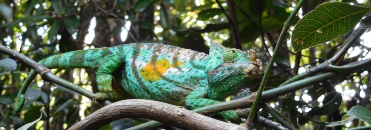
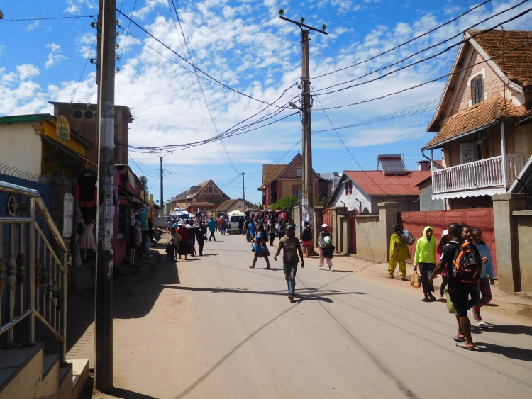
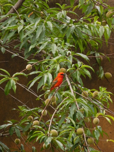

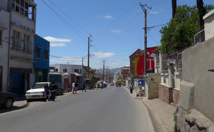
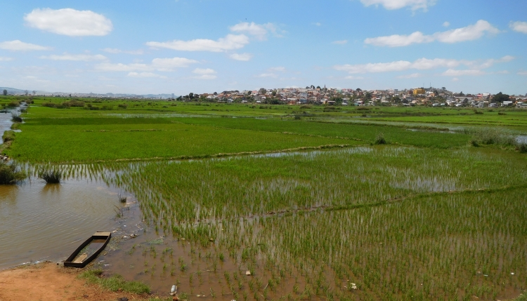
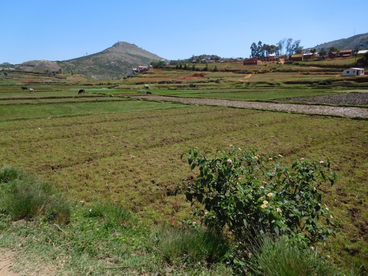
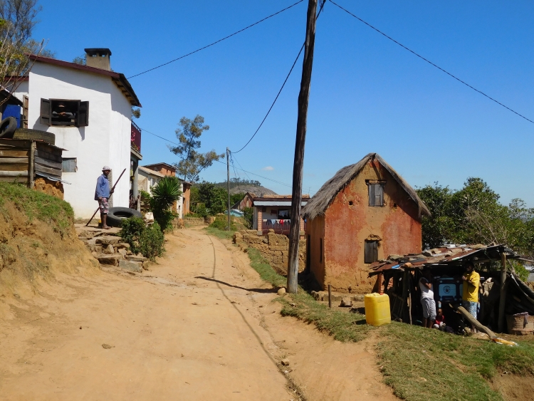
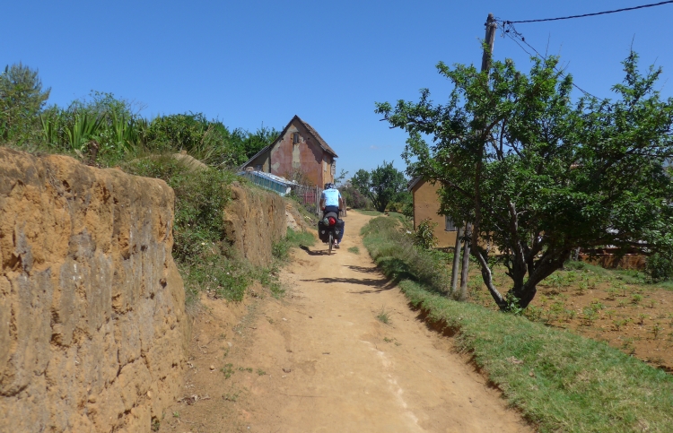
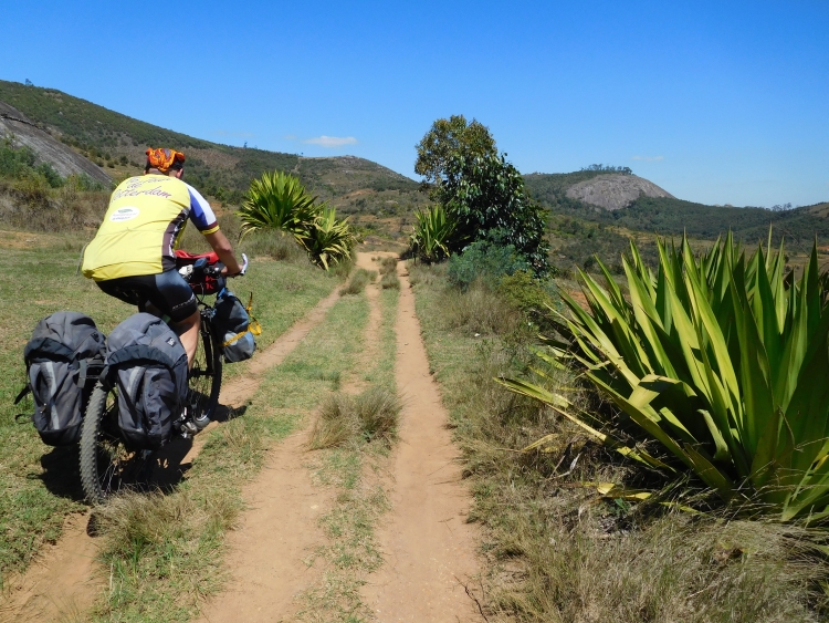
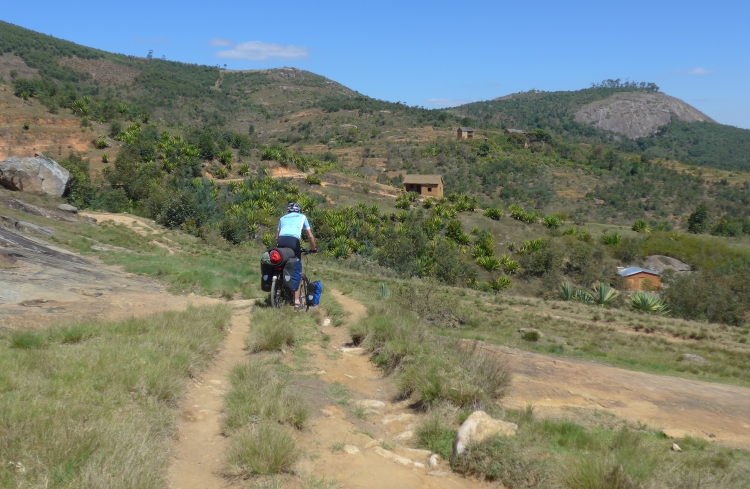
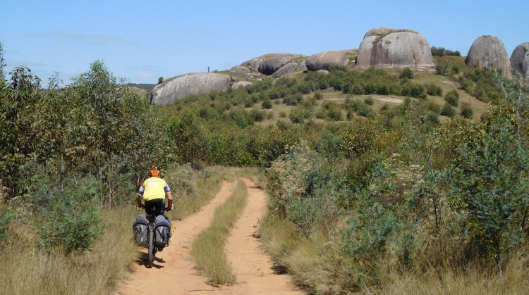
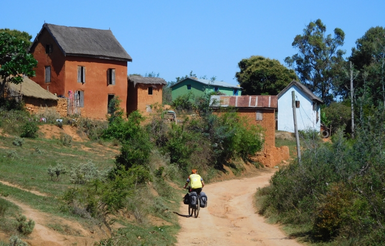
 We reach Manjakandriana, the first city after Antananarivo. It is late in the afternoon
already and it would be nice if there were a place to stay in the small town. The only
hotel that is shown on the GPS, however, does not longer exist and it seems that there
are not ant other possibilities. There is not much else to do apart from cycling, though
there is no certainty that there will be overnight accommodation further on the road. If
we do not encounter any palces to sleep, we can take a side road in about twenty kilometers,
where we are hopefully able to pitch our rent any time soon.
We reach Manjakandriana, the first city after Antananarivo. It is late in the afternoon
already and it would be nice if there were a place to stay in the small town. The only
hotel that is shown on the GPS, however, does not longer exist and it seems that there
are not ant other possibilities. There is not much else to do apart from cycling, though
there is no certainty that there will be overnight accommodation further on the road. If
we do not encounter any palces to sleep, we can take a side road in about twenty kilometers,
where we are hopefully able to pitch our rent any time soon.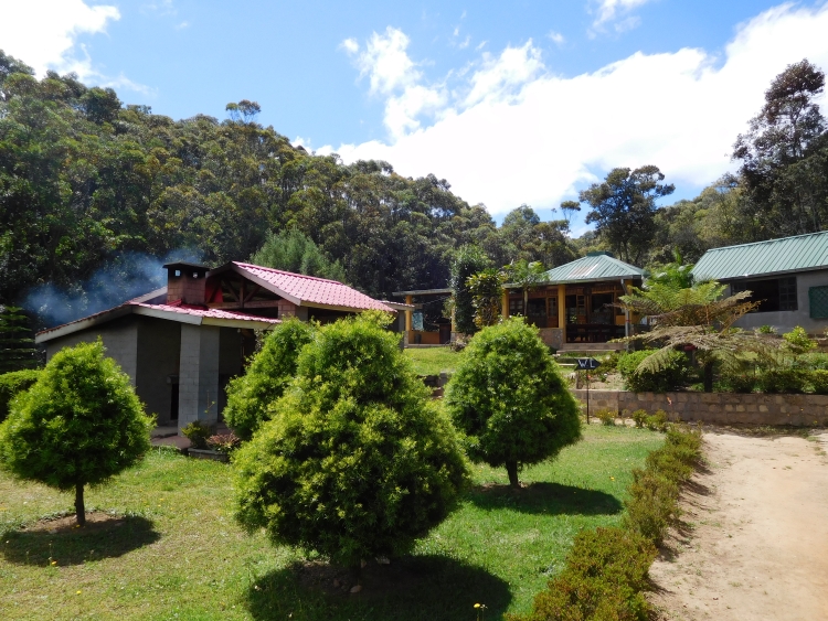
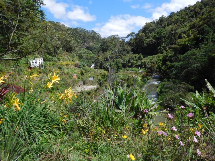
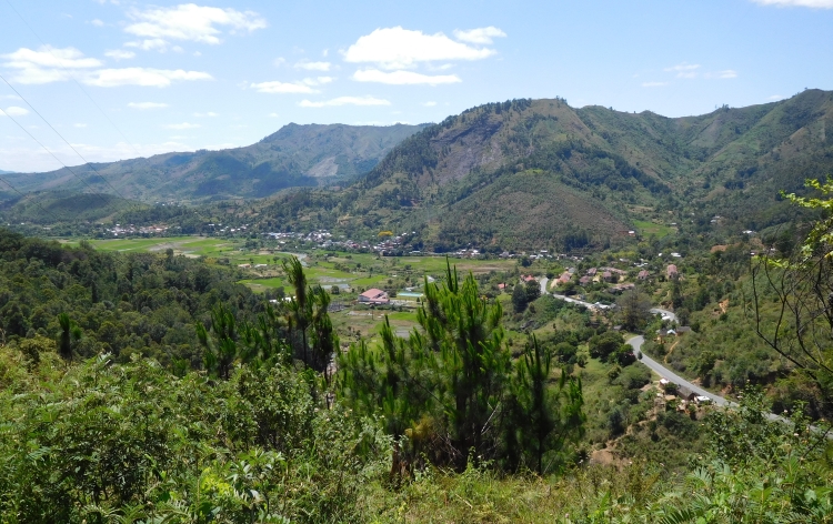
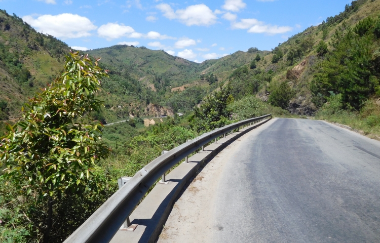
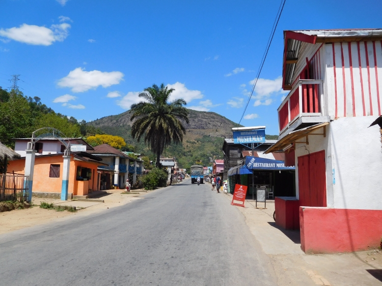
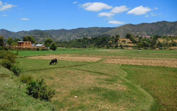
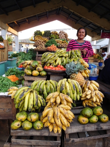
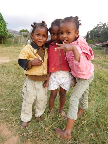
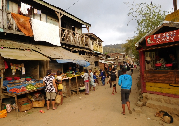
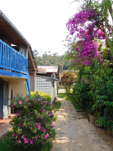
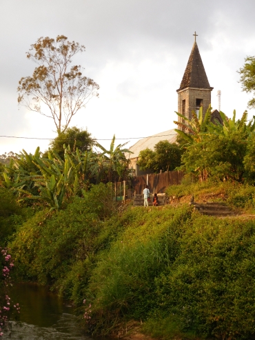
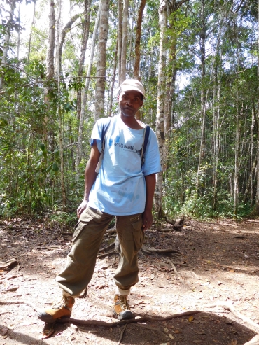
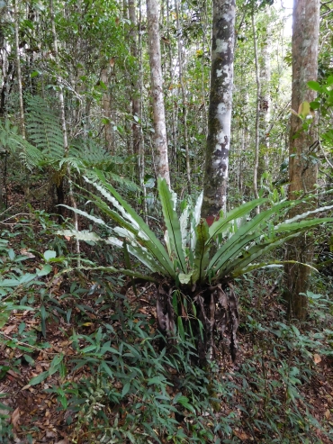
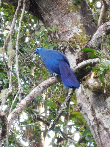 Oops, I think, will this be such an excursion? I am already bored after just one minute.
We are walking over a small trail that leads us ever deeper into the jungle. It is a beautiful
forest I must say, with many different types of trees and many species of ferns and other flora.
We do not encounter any special animals so far. We do, however, undeniably come closer to
the indri indris whose wailing cries are coming to us with an insane amount of decibels.
Then we see the first indri indri, about thirty meters above us. The indri indri is
about a meter long, and he has got a black and white face with teddy bear eyes. The
animal looks like it could never be able to hurt another species. A little later we
see more indri indris, all of them are in the highest regions of the trees now. Occasionally
an indri indri is jumping from the one to the other tree, sometimes a few times in a sequence.
This is clearly not without danger, but apparently they look well-equipped
for the task with their elastic legs and they have clearly practiced before.
Oops, I think, will this be such an excursion? I am already bored after just one minute.
We are walking over a small trail that leads us ever deeper into the jungle. It is a beautiful
forest I must say, with many different types of trees and many species of ferns and other flora.
We do not encounter any special animals so far. We do, however, undeniably come closer to
the indri indris whose wailing cries are coming to us with an insane amount of decibels.
Then we see the first indri indri, about thirty meters above us. The indri indri is
about a meter long, and he has got a black and white face with teddy bear eyes. The
animal looks like it could never be able to hurt another species. A little later we
see more indri indris, all of them are in the highest regions of the trees now. Occasionally
an indri indri is jumping from the one to the other tree, sometimes a few times in a sequence.
This is clearly not without danger, but apparently they look well-equipped
for the task with their elastic legs and they have clearly practiced before.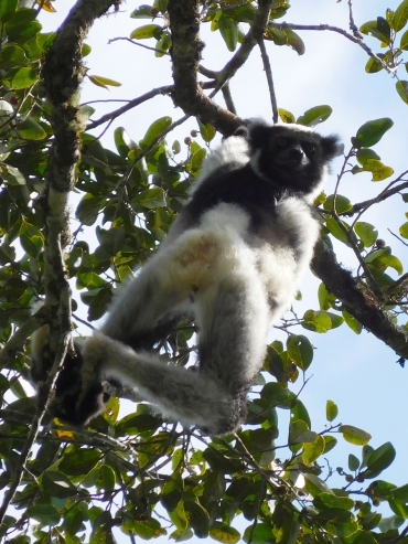
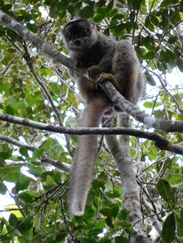
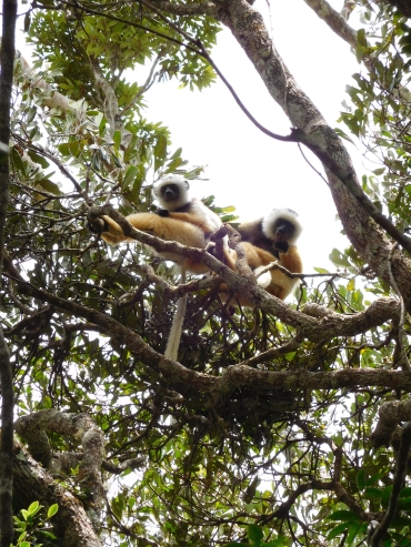
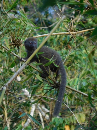
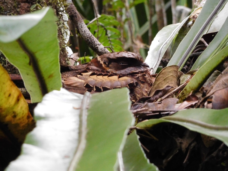
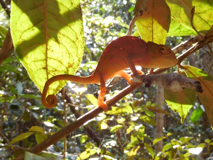
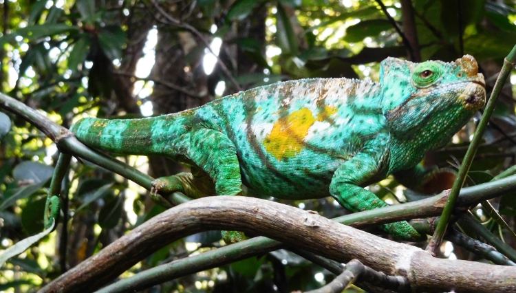
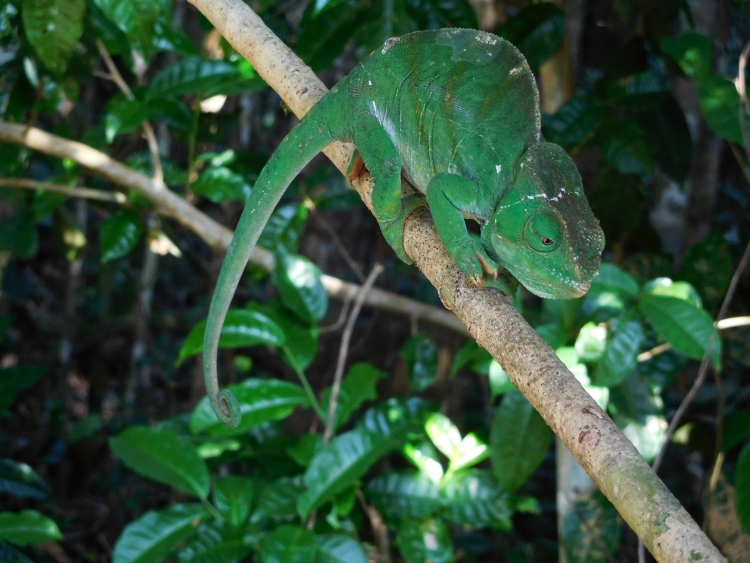
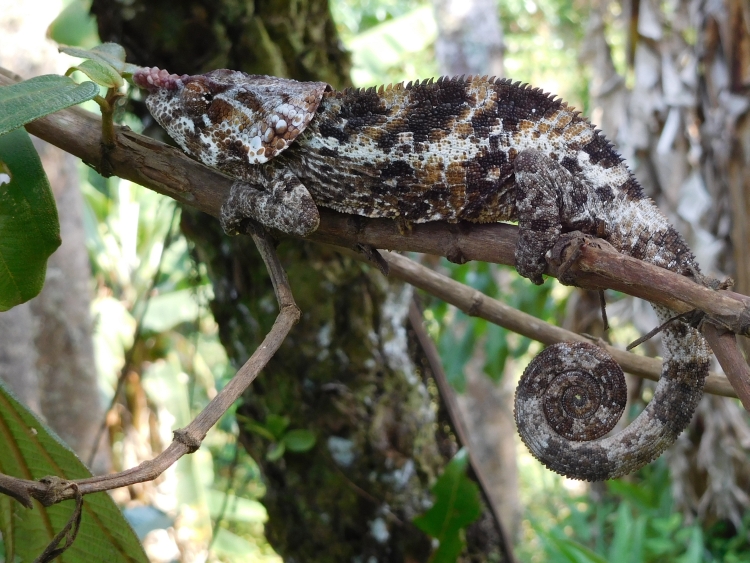
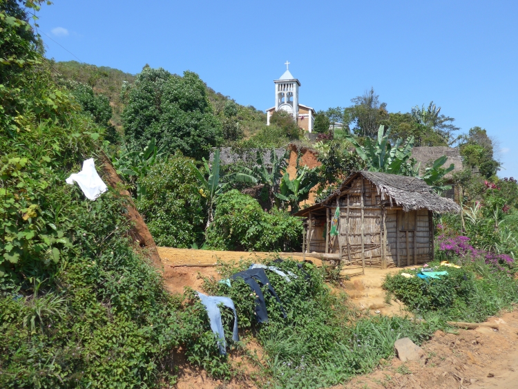
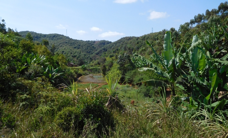
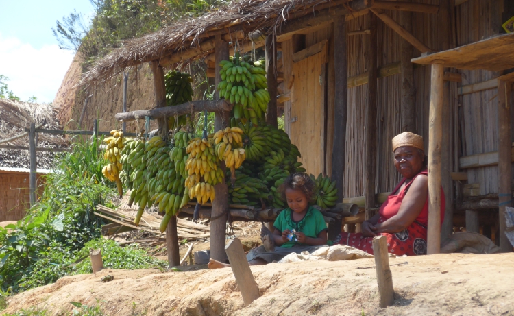
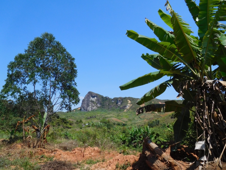
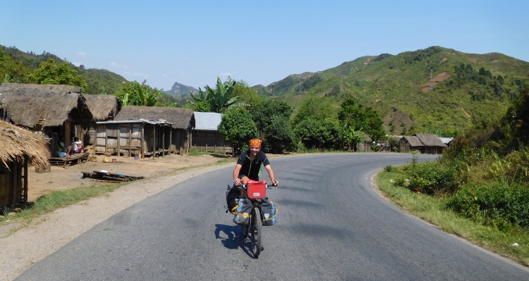
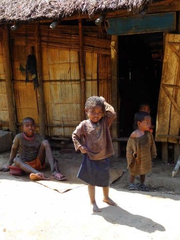
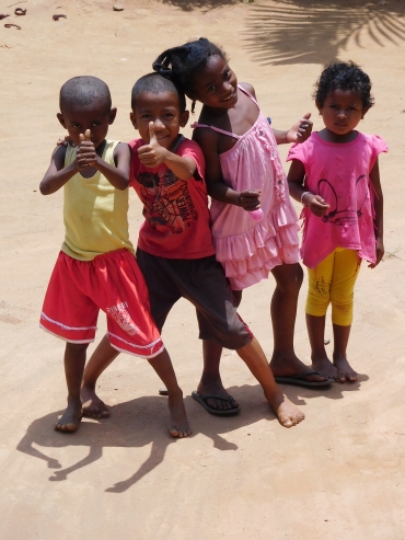
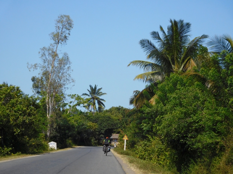
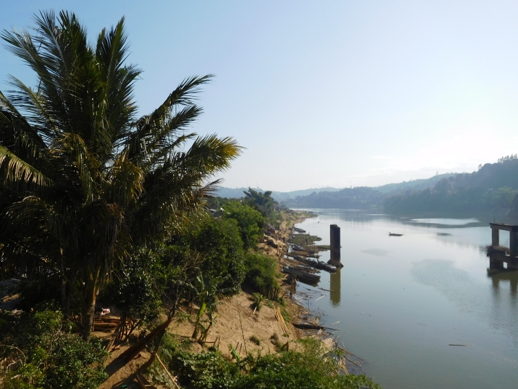
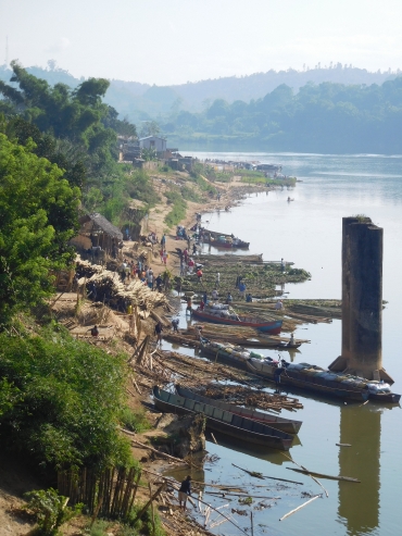
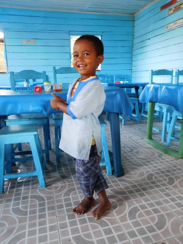
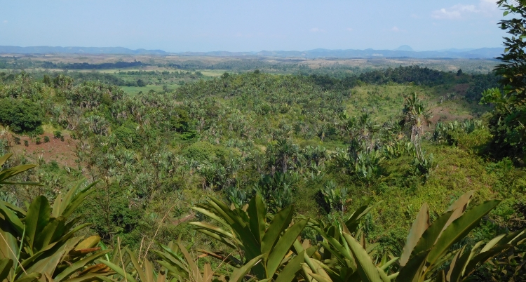
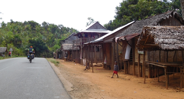
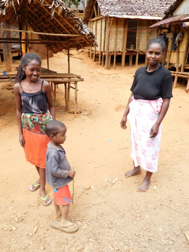
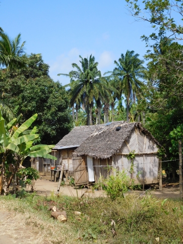
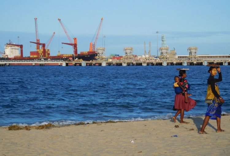
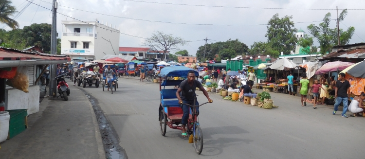
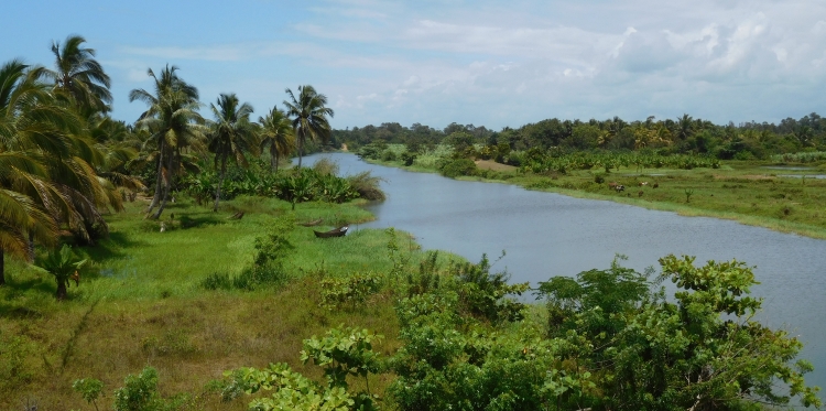
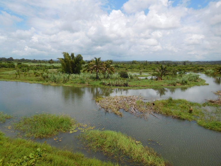
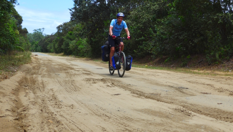
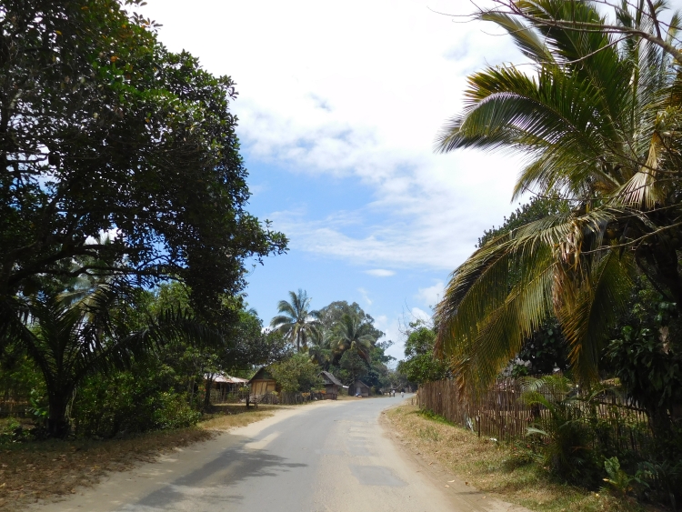
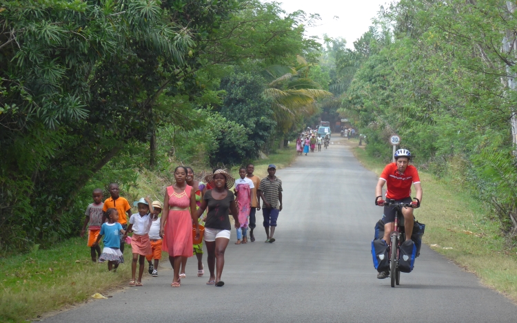
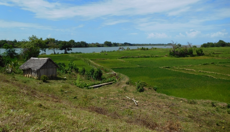
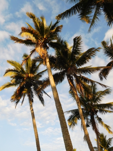 I start to feel better again while cycling. It is not so far anymore to Mahambo, where
we want to stay overnight. We could also cycle to the larger city Fenerive, but
Mahambo seems to be the nicent option. We have to leave the Route Nationale 5 for the
last kilometers to Mahambo. Over a sandy road we are riding to the low-key tourist
coastal village. We find a small bungalow near the sea. The coast is beautiful: a
wide bay with a beach of fine powder sand is flanked by tall coconut trees, all
against the background of emerald green hills.
I start to feel better again while cycling. It is not so far anymore to Mahambo, where
we want to stay overnight. We could also cycle to the larger city Fenerive, but
Mahambo seems to be the nicent option. We have to leave the Route Nationale 5 for the
last kilometers to Mahambo. Over a sandy road we are riding to the low-key tourist
coastal village. We find a small bungalow near the sea. The coast is beautiful: a
wide bay with a beach of fine powder sand is flanked by tall coconut trees, all
against the background of emerald green hills.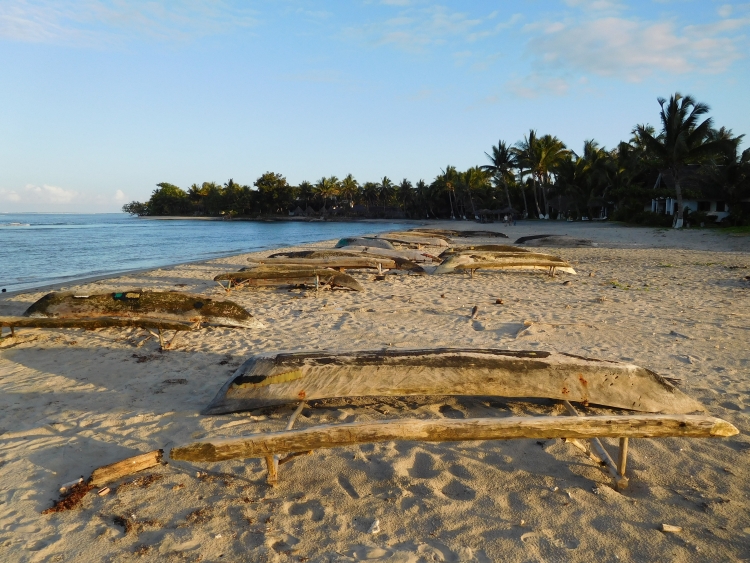
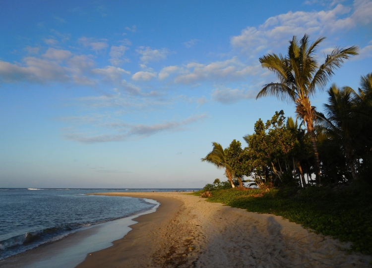
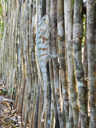 I am still feeling sick this morning, but Im still intending to start. I am not going to have
breakfast now, in the certainty that I will not keep it inside whatsoever. The plan for today
is to ride slow enough so that I will burn little energy in able to reach Soanierana Ivongo
without hunger. Perhaps my intestines will come to rest that way so that I can recover.
Today will be the last easy day with asphalt under the wheels. From tomorrow on we will
be confronted with 240 kilometers of unpaved roads with the highest difficulty level.
The first forty kilometers would consist of deep sand, where it may not be possible
to cycle with our heavily loaded bikes. As I see it now, it is best to go there with
a mountain bike with ultra-limited baggage. Then you can at least lift the bike and
this way you will always get there. I do not have a mountain bike and neither is my bike
ultra-lightly packed, so maybe we will find out tomorrow that we do not make a chance
with our bikes anyway, but it will surely help if we are both feeling healthy. That is why
I am not eating today, despite the fact that I am actually feeling hungry from the start.
I am still feeling sick this morning, but Im still intending to start. I am not going to have
breakfast now, in the certainty that I will not keep it inside whatsoever. The plan for today
is to ride slow enough so that I will burn little energy in able to reach Soanierana Ivongo
without hunger. Perhaps my intestines will come to rest that way so that I can recover.
Today will be the last easy day with asphalt under the wheels. From tomorrow on we will
be confronted with 240 kilometers of unpaved roads with the highest difficulty level.
The first forty kilometers would consist of deep sand, where it may not be possible
to cycle with our heavily loaded bikes. As I see it now, it is best to go there with
a mountain bike with ultra-limited baggage. Then you can at least lift the bike and
this way you will always get there. I do not have a mountain bike and neither is my bike
ultra-lightly packed, so maybe we will find out tomorrow that we do not make a chance
with our bikes anyway, but it will surely help if we are both feeling healthy. That is why
I am not eating today, despite the fact that I am actually feeling hungry from the start.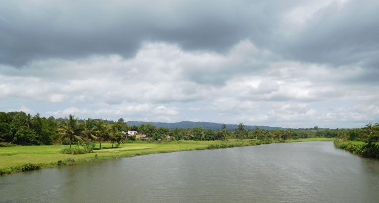
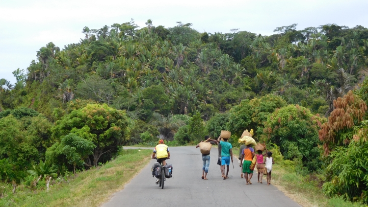
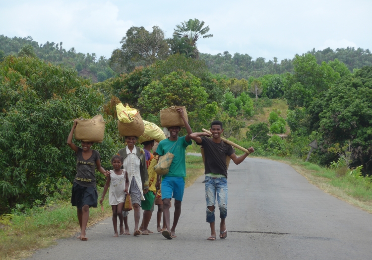
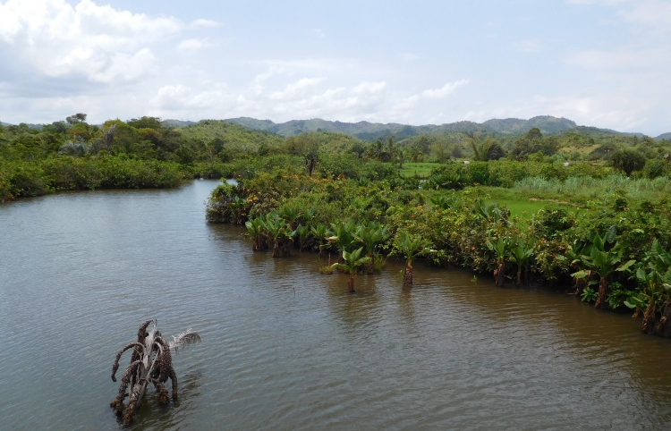
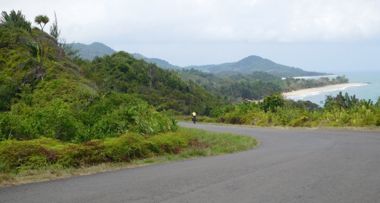
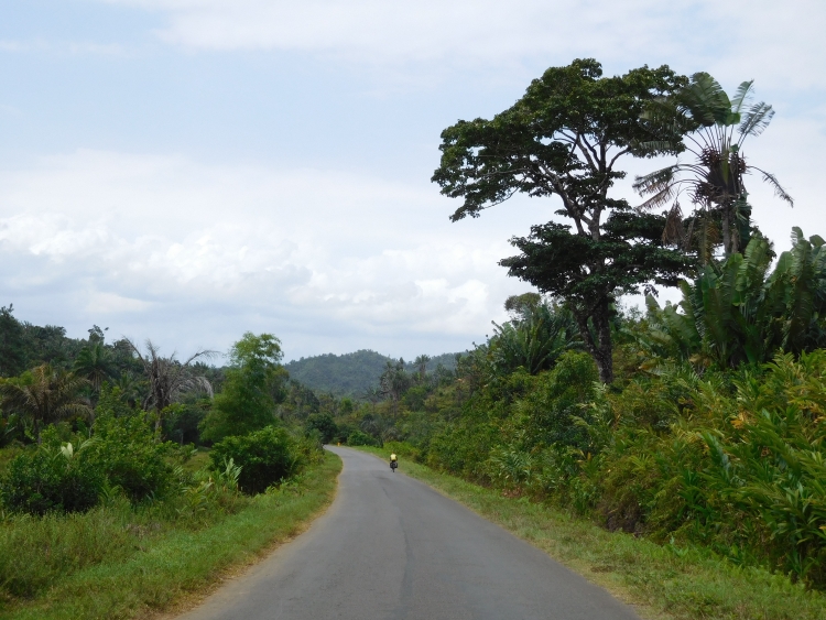
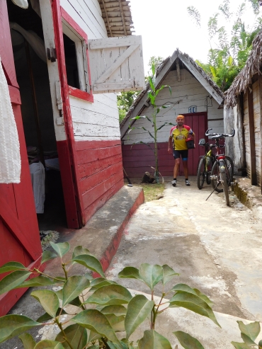
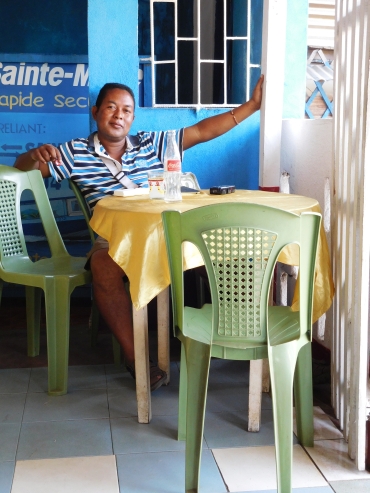
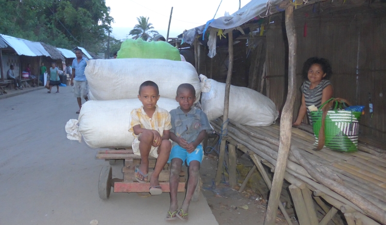
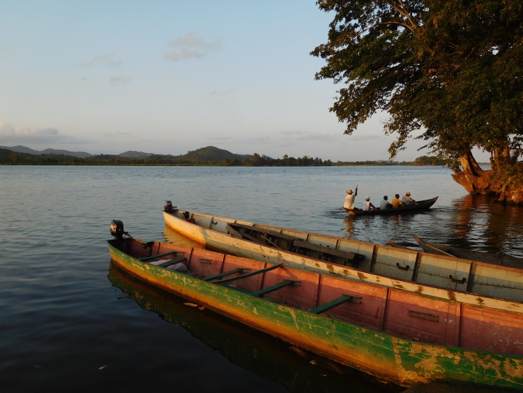
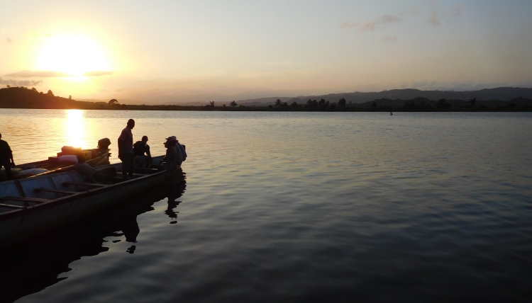
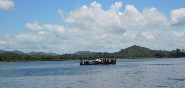
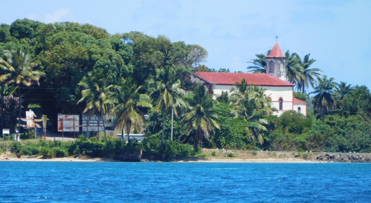
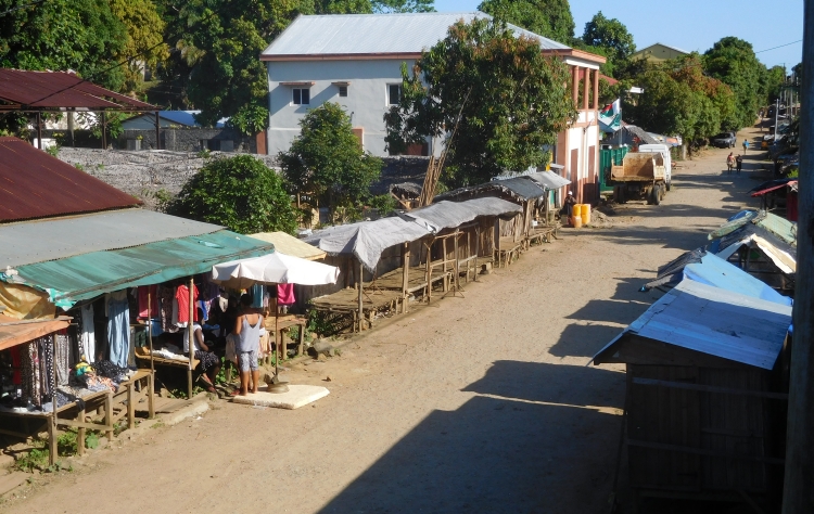
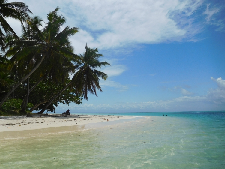
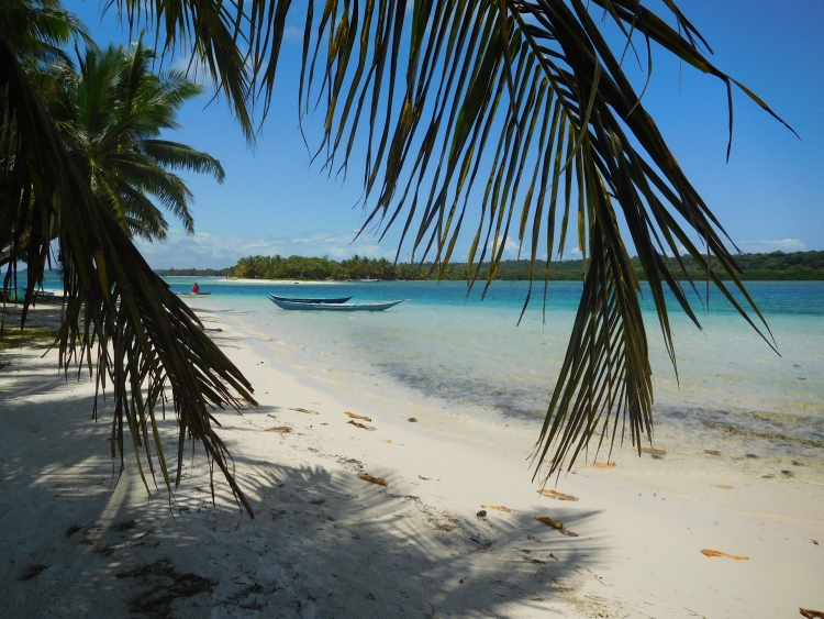
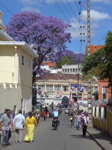 We wake up after a long sleep. We had a short night yesterday and the last nights
I have not slept well anyway because of my ankle. This night, however, I slept like a rose.
After breakfast we load our bikes and we are on the road again, finally. The hotel is close
to the center of Antananarivo and we immediately enter the bustle of the narrow, winding
streets. We descend to the low city, from where we have good views over the high city,
to the oldest part of Antananarivo with the old royal palace on top. We are not heading
for the high city, we will visit the capital properly on the last day before we
fly back.
We wake up after a long sleep. We had a short night yesterday and the last nights
I have not slept well anyway because of my ankle. This night, however, I slept like a rose.
After breakfast we load our bikes and we are on the road again, finally. The hotel is close
to the center of Antananarivo and we immediately enter the bustle of the narrow, winding
streets. We descend to the low city, from where we have good views over the high city,
to the oldest part of Antananarivo with the old royal palace on top. We are not heading
for the high city, we will visit the capital properly on the last day before we
fly back.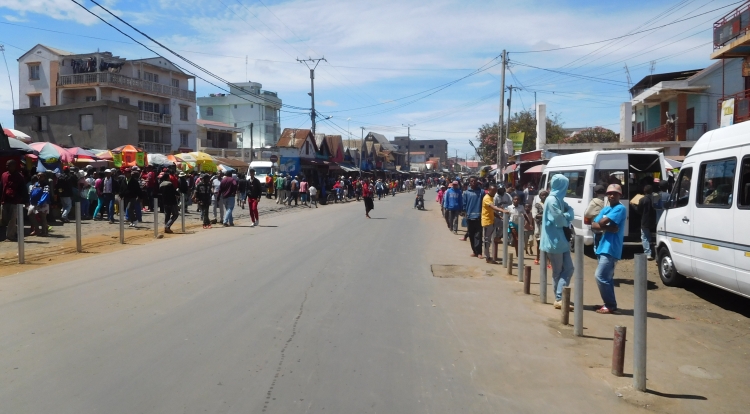
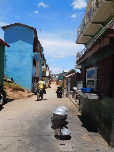
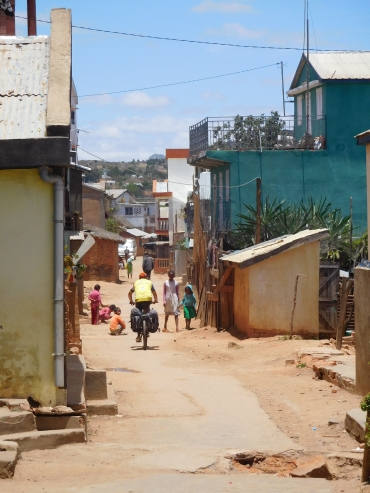
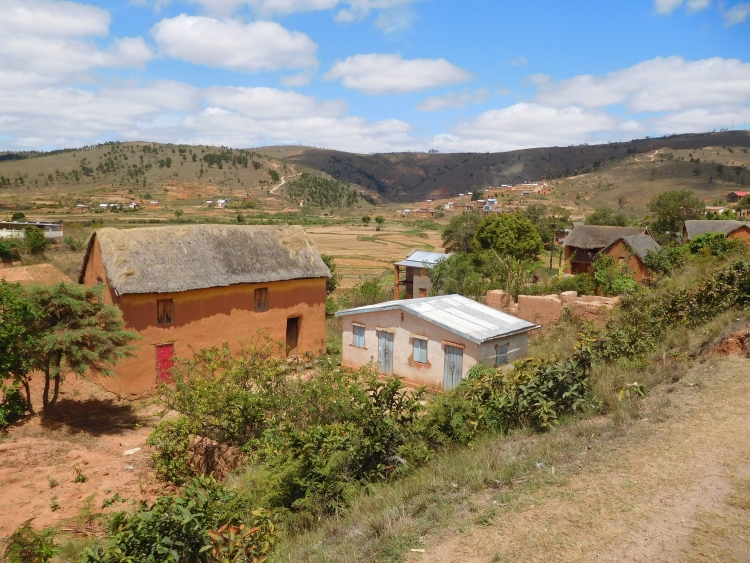
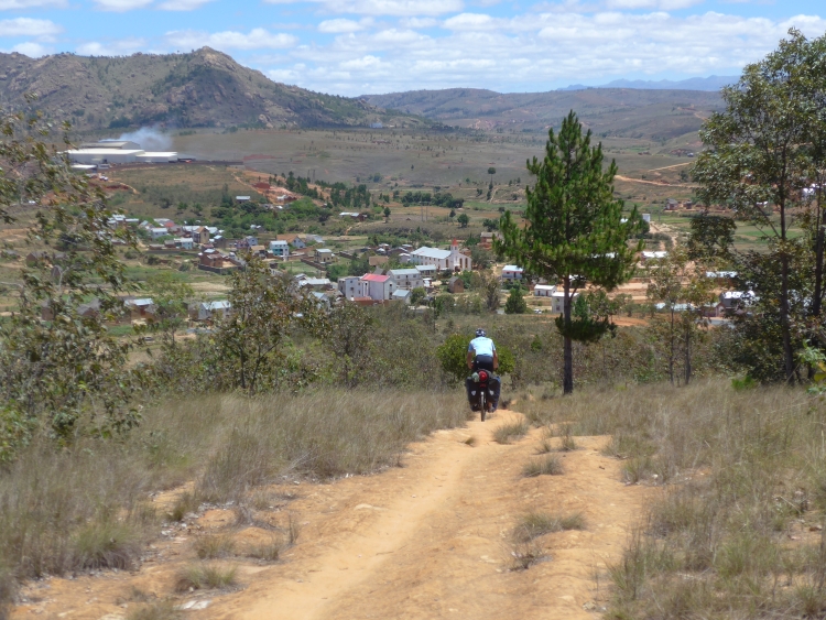
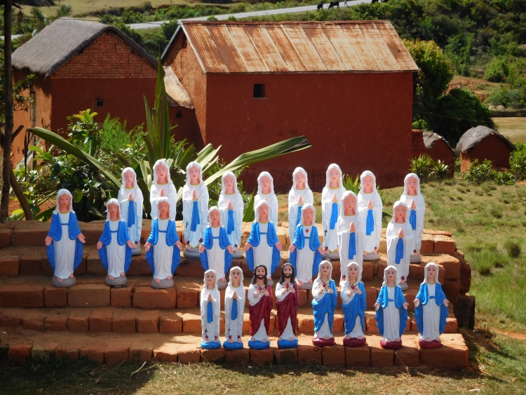
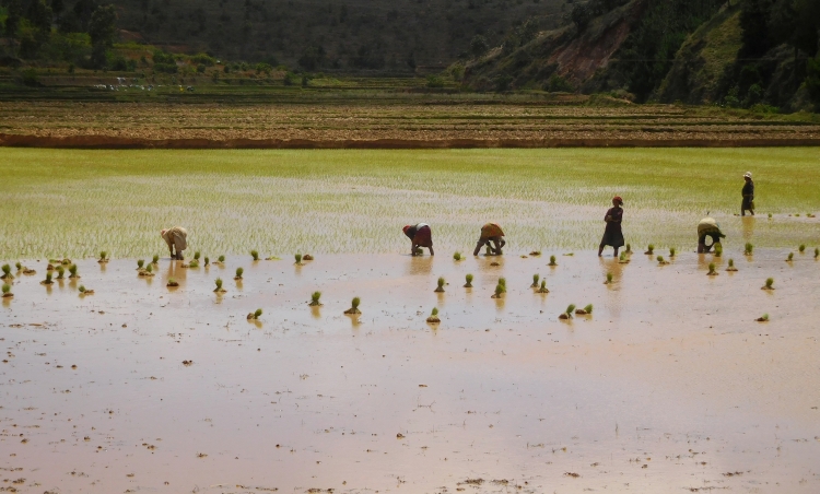
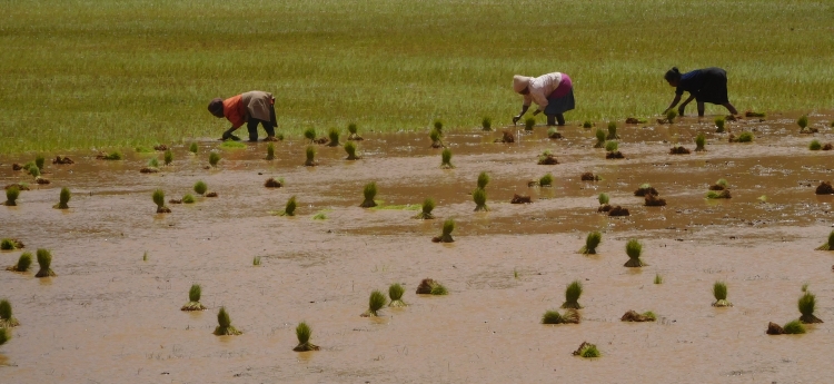
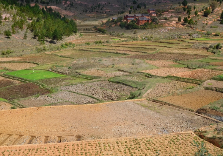
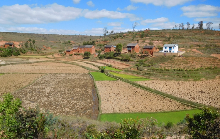
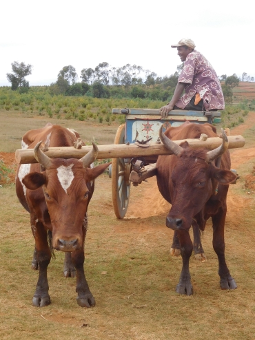 We leave Ambatolampy under an overcast cloud cover. Just like yesterday, we are cycling
through a hilly landscape with rice fields in the valleys. The valleys are wider than
yesterday and so it feelslike we were cycling through a hilly landscape yesterday while
today we are cycling across a high plateau. Today we are cycling mostly over flat
terrain. There is little wind and all in all it is an easy cycling day. Under these
easy conditions, I hardly ever suffer from my ankle, despite the fact that the ankle
is still thick and despite I still am suffering when I am walking. During my cycling
trip in Iceland three months ago I have been riding over a lot of straight, flat roads,
but then I usually had a stormy headwind. It feels good to have really easy conditions
now and I am tempted to treat the stage as a long time trial. WI persevere with the highest
possible speed that I can stand for a long time. However much fun I am having, the joy is
not shared. Willem asks himself, what this all is supposed to mean. You were injured,
weren't you?
We leave Ambatolampy under an overcast cloud cover. Just like yesterday, we are cycling
through a hilly landscape with rice fields in the valleys. The valleys are wider than
yesterday and so it feelslike we were cycling through a hilly landscape yesterday while
today we are cycling across a high plateau. Today we are cycling mostly over flat
terrain. There is little wind and all in all it is an easy cycling day. Under these
easy conditions, I hardly ever suffer from my ankle, despite the fact that the ankle
is still thick and despite I still am suffering when I am walking. During my cycling
trip in Iceland three months ago I have been riding over a lot of straight, flat roads,
but then I usually had a stormy headwind. It feels good to have really easy conditions
now and I am tempted to treat the stage as a long time trial. WI persevere with the highest
possible speed that I can stand for a long time. However much fun I am having, the joy is
not shared. Willem asks himself, what this all is supposed to mean. You were injured,
weren't you?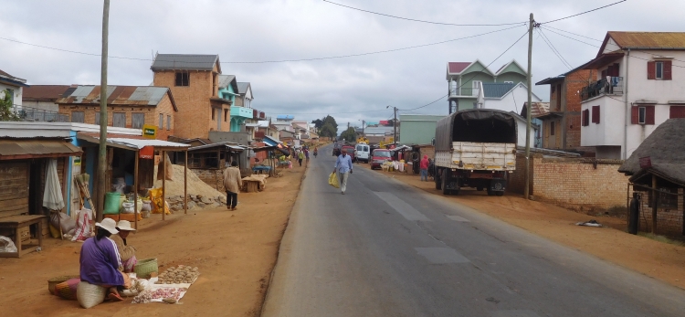
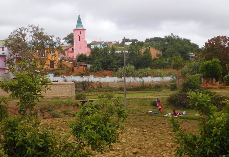
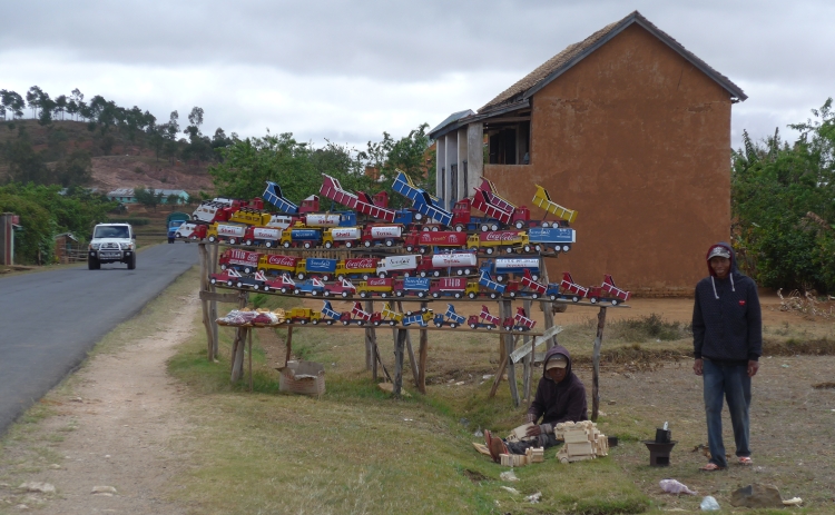
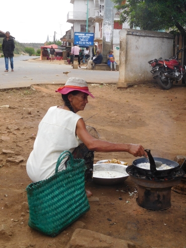
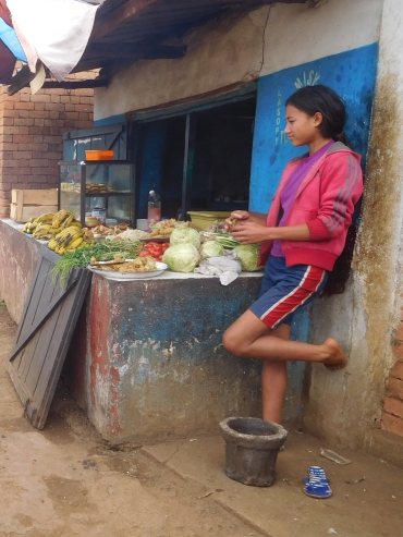
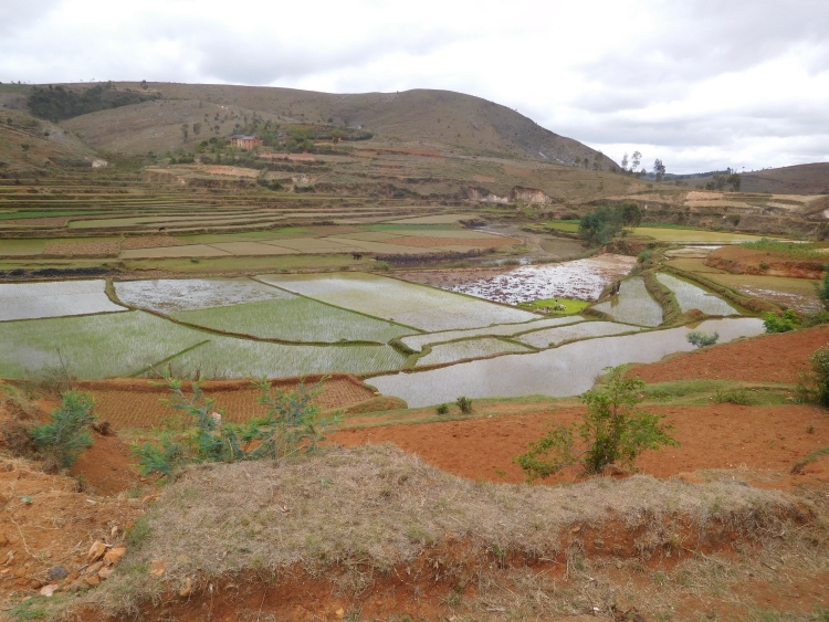
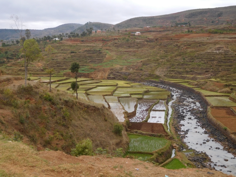
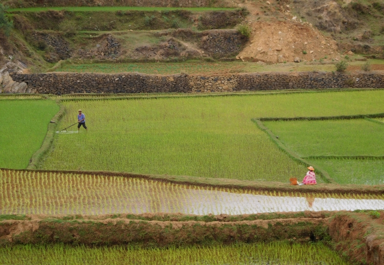
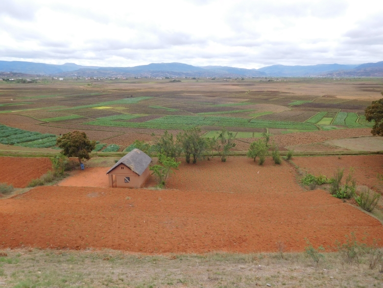
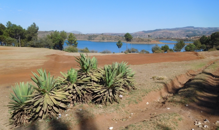
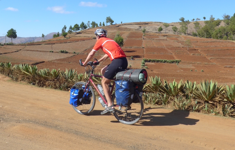
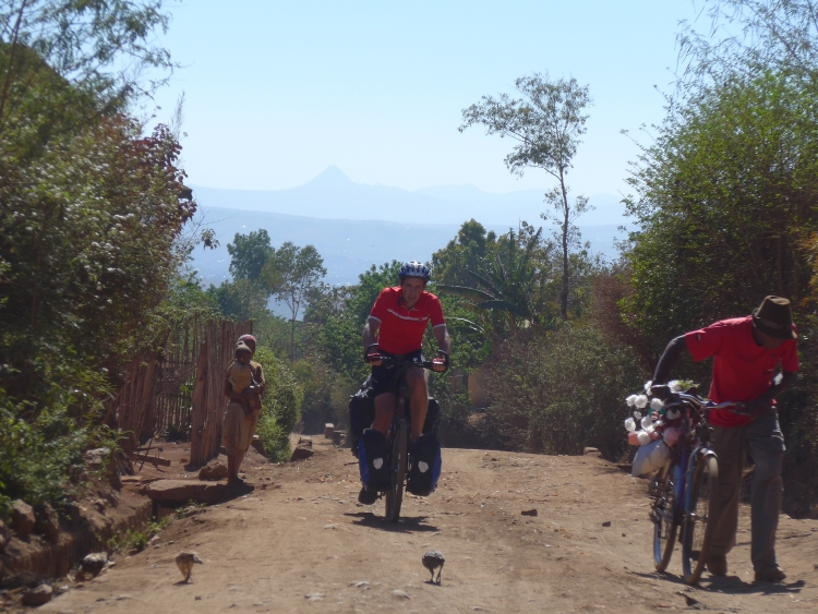
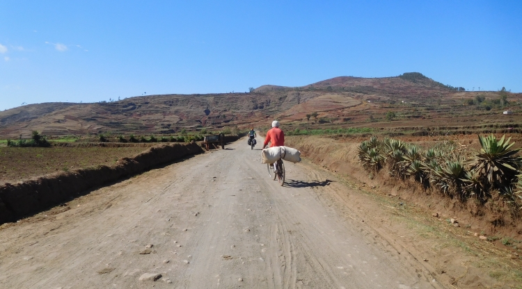
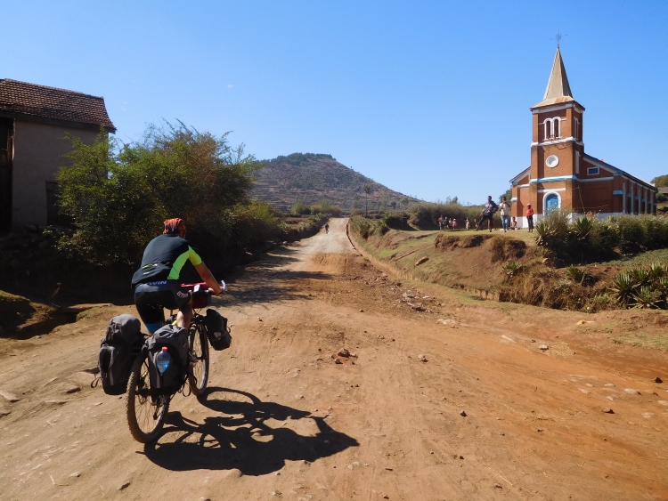
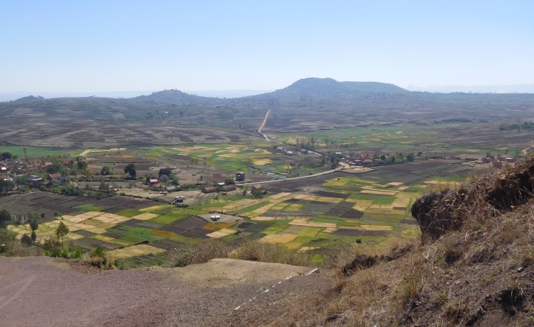
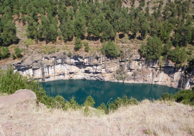
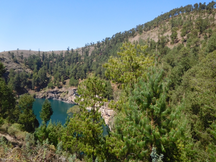
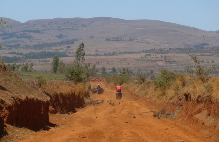
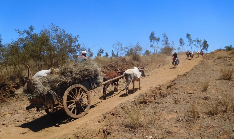
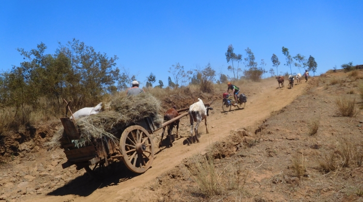
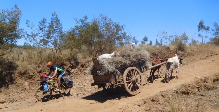
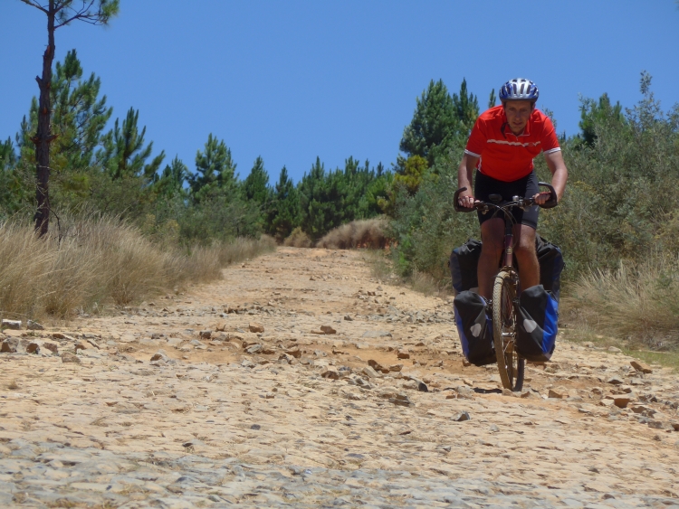
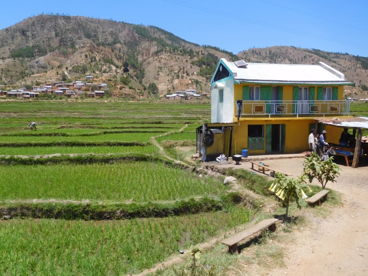
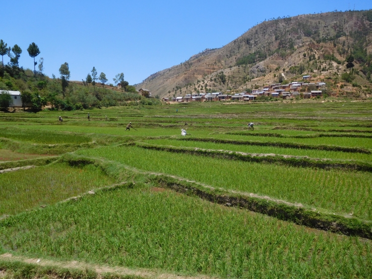
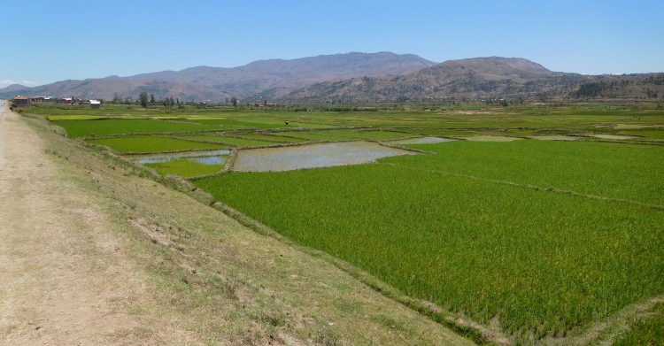
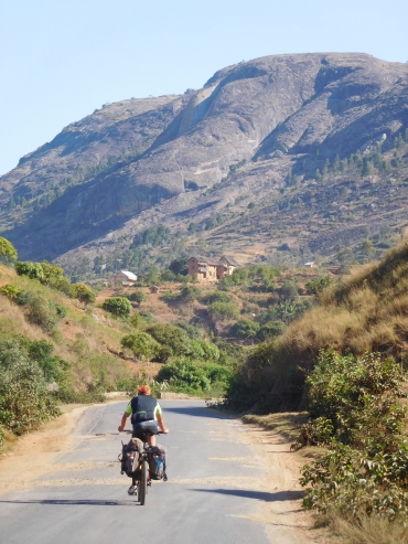 I am enjoying the rice fields and I am taking one picture after another. In the meantime
Willem is cycling way ahead of me. I decide that I have wasted too much time.
I am riding in a fast pace now in order to keep up with Willem. Only after twenty
kilometers I reach Willem again. It is the place where a climb to a pass starts.
I am apparently in a good shape, as I am not having problems with the climb, although I
am tired before I begin. After hours of high effort I need a lunch now, but none
of the villages has something to offer. Eventually, after an hour or two, we find a
shop where we can buy some snacks. After the late lunch we still have to cover thirty
kilometers. The sun is already low, enhancing the already strong colors. We are in any case
in a beautiful landscape with narrow valleys and large, rocky mountain massifs with strange,
rounded shapes. We still have to go up to a last pass. It is a climb in several stages,
with alternating average steep climbs and flat sections or even small descents. Once
above we only have a small descent and subsequently it continues to climb and descend until
we eventually reach Ambositra under the last afternoon light. It is a beautiful city,
partially located on a hill in the middle of a wide valley, partially located against the
erratic flanks of the hill. There are quite some big churches, all of them on a local
increase or on other striking points. We find a nice hotel, where we enjoy the
sunset over the flanks of the historic city.
I am enjoying the rice fields and I am taking one picture after another. In the meantime
Willem is cycling way ahead of me. I decide that I have wasted too much time.
I am riding in a fast pace now in order to keep up with Willem. Only after twenty
kilometers I reach Willem again. It is the place where a climb to a pass starts.
I am apparently in a good shape, as I am not having problems with the climb, although I
am tired before I begin. After hours of high effort I need a lunch now, but none
of the villages has something to offer. Eventually, after an hour or two, we find a
shop where we can buy some snacks. After the late lunch we still have to cover thirty
kilometers. The sun is already low, enhancing the already strong colors. We are in any case
in a beautiful landscape with narrow valleys and large, rocky mountain massifs with strange,
rounded shapes. We still have to go up to a last pass. It is a climb in several stages,
with alternating average steep climbs and flat sections or even small descents. Once
above we only have a small descent and subsequently it continues to climb and descend until
we eventually reach Ambositra under the last afternoon light. It is a beautiful city,
partially located on a hill in the middle of a wide valley, partially located against the
erratic flanks of the hill. There are quite some big churches, all of them on a local
increase or on other striking points. We find a nice hotel, where we enjoy the
sunset over the flanks of the historic city.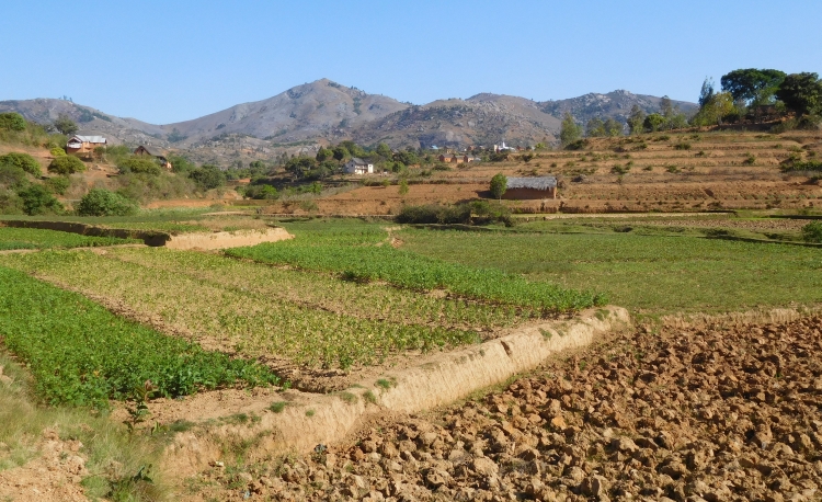
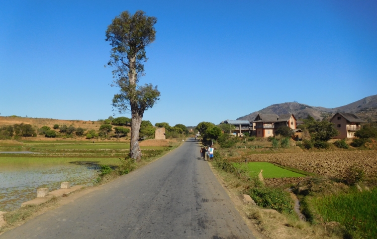
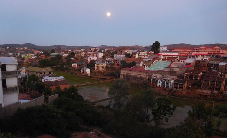
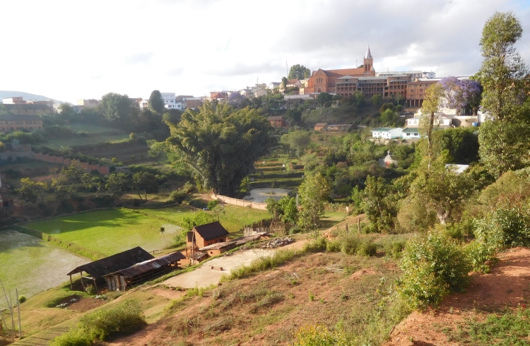
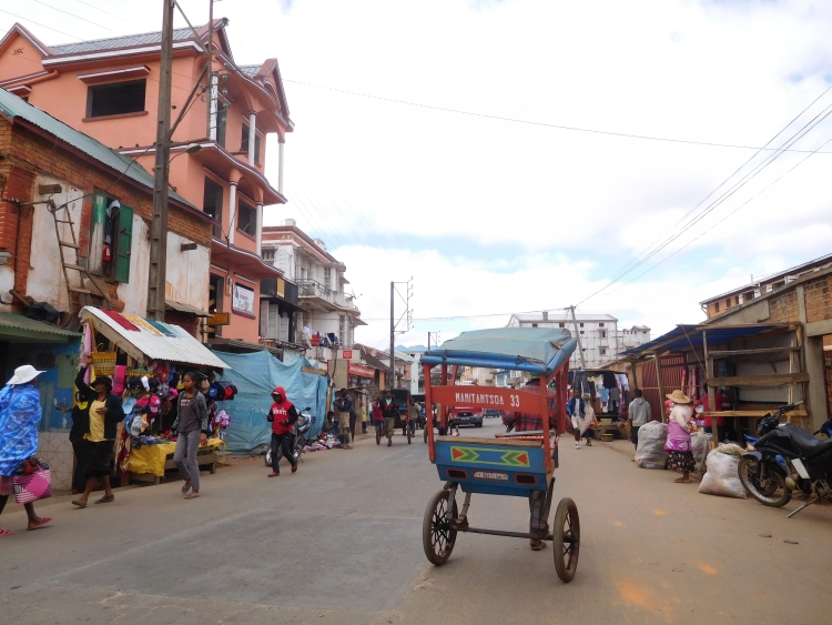
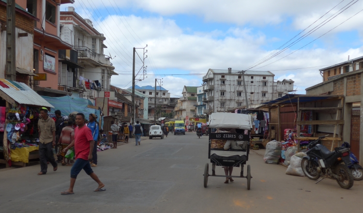
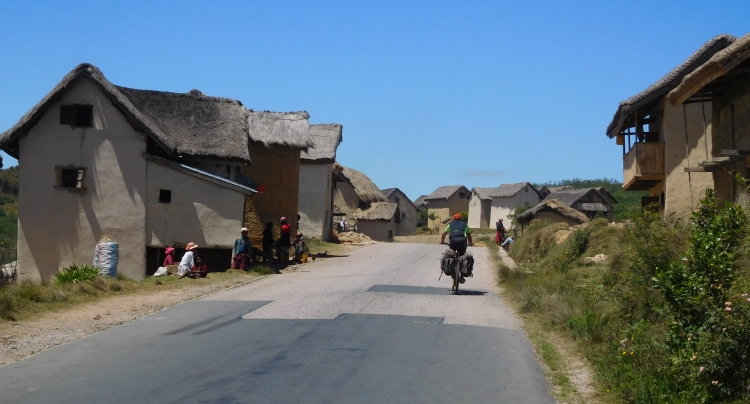
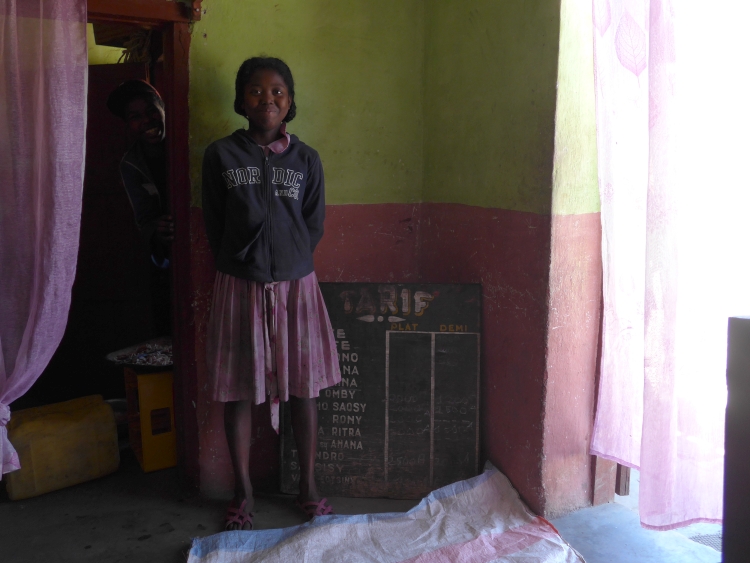
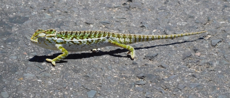
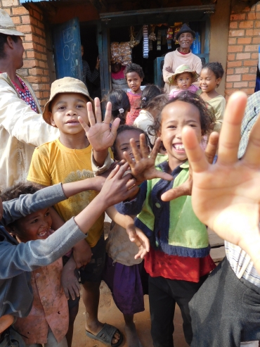 Six kilometers after Ambohimasoa we reach the exit to Ranomafana. The road is unpaved from the
first meter.
Six kilometers after Ambohimasoa we reach the exit to Ranomafana. The road is unpaved from the
first meter.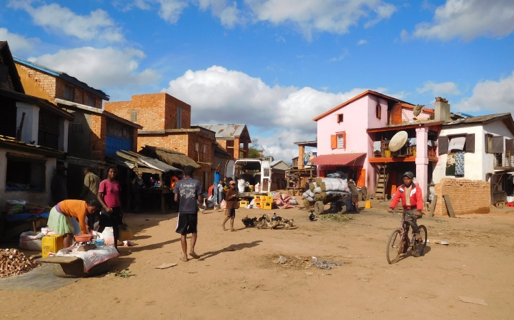
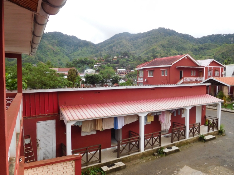
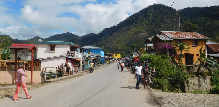
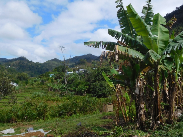
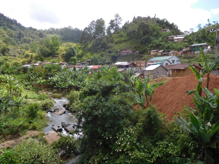
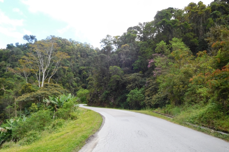
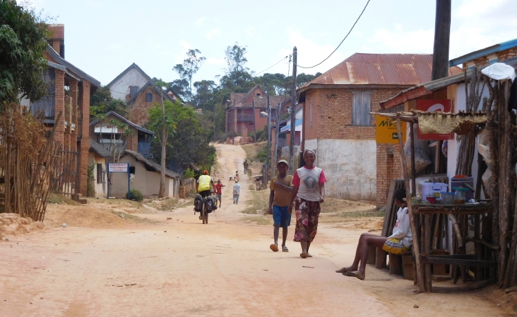
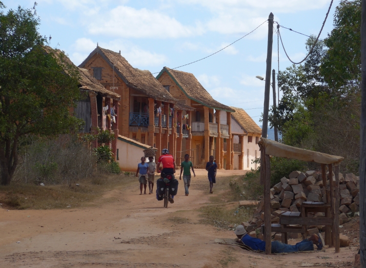
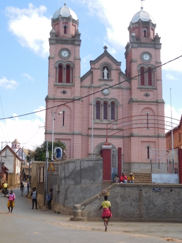 We reach Fianarantsoa. The city consists of two parts, the busy lower town and the historic
upper city, a few hundred meters above the lower city. We cycle past a bank in the lower town.
A crucial moment. We have to extract money for more than a week, since this might be our
last possibility to cash money until Toliara. We must take into account that we also need
money for two visits of national parks. And so we empty the entire bank and we are not only
millionaires now, we also have more than a million Ariary with us now.
We reach Fianarantsoa. The city consists of two parts, the busy lower town and the historic
upper city, a few hundred meters above the lower city. We cycle past a bank in the lower town.
A crucial moment. We have to extract money for more than a week, since this might be our
last possibility to cash money until Toliara. We must take into account that we also need
money for two visits of national parks. And so we empty the entire bank and we are not only
millionaires now, we also have more than a million Ariary with us now. 
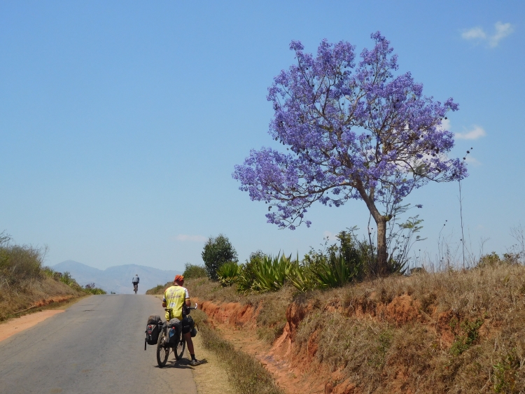
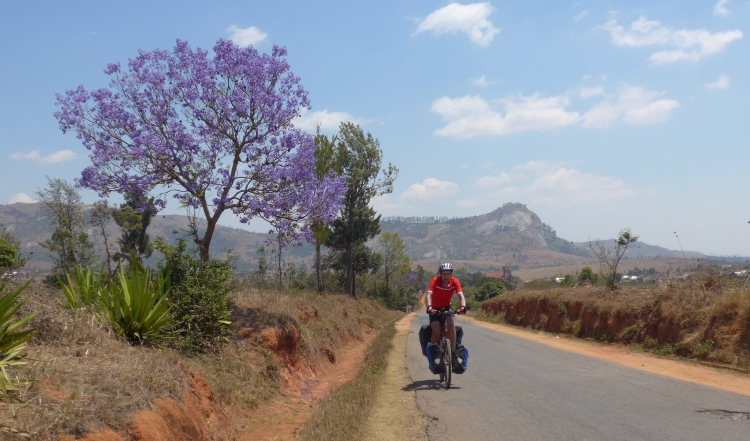
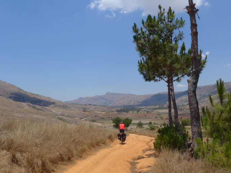
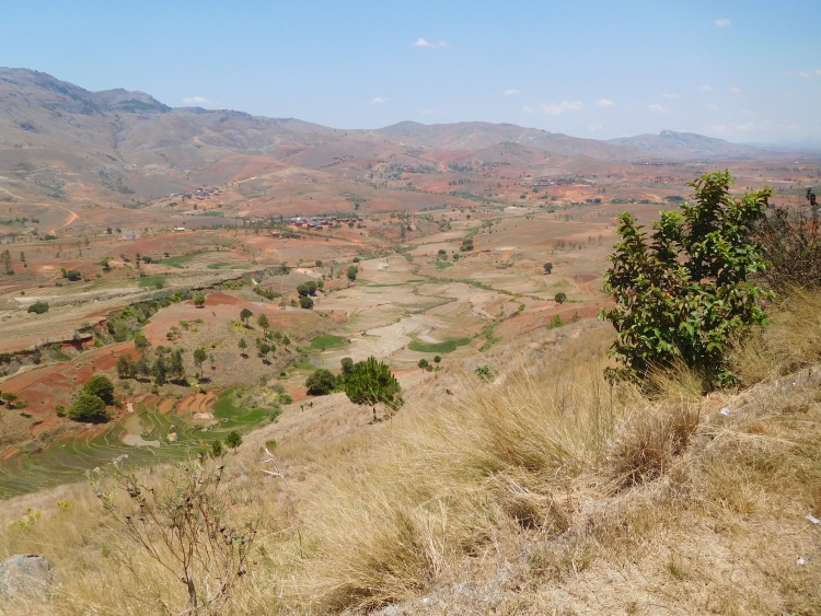
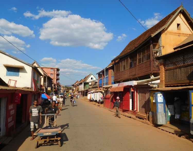
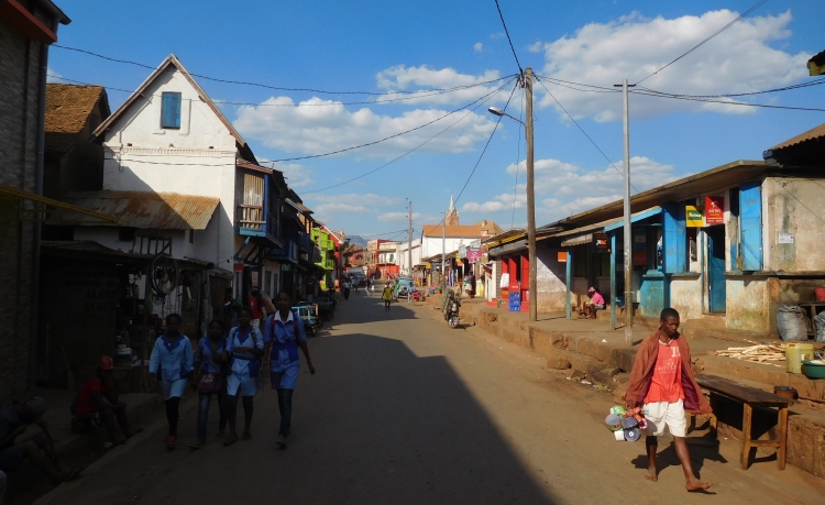
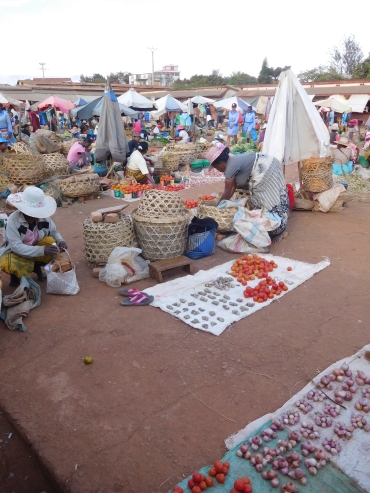
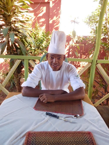
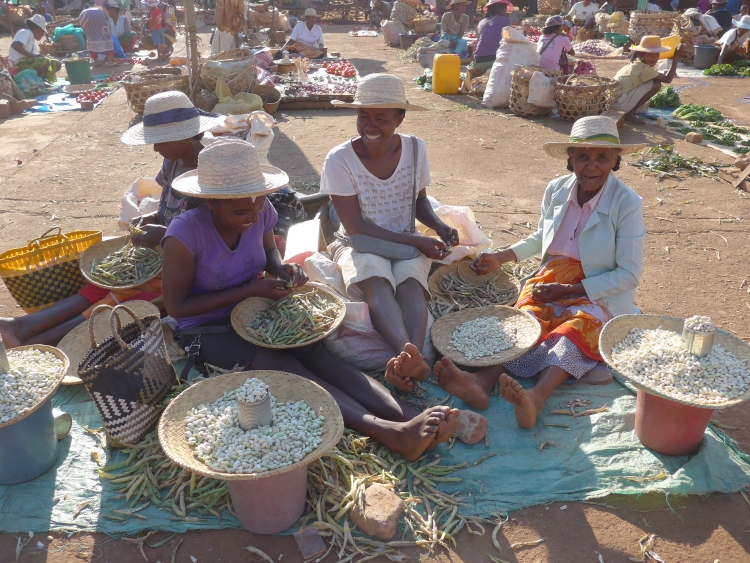
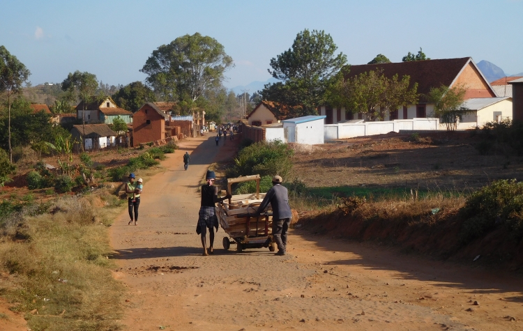
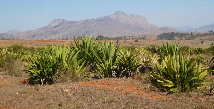
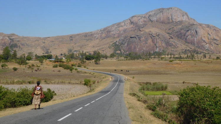
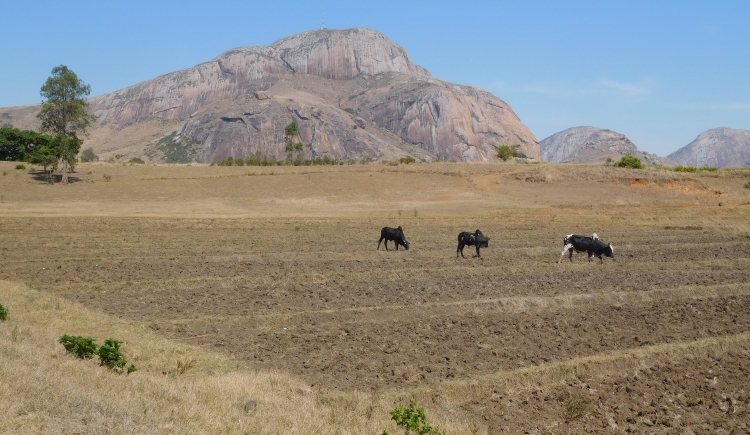
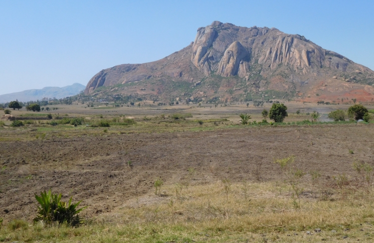
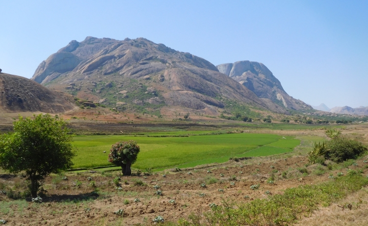
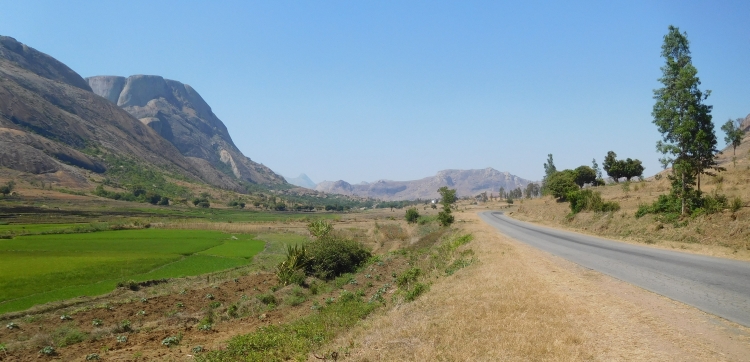
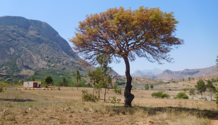
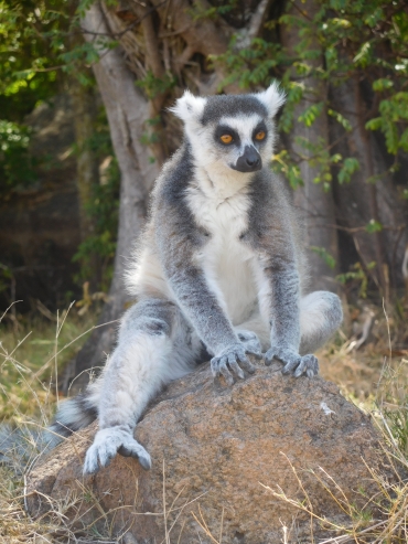
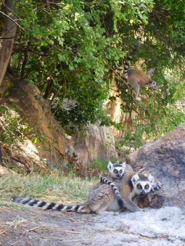
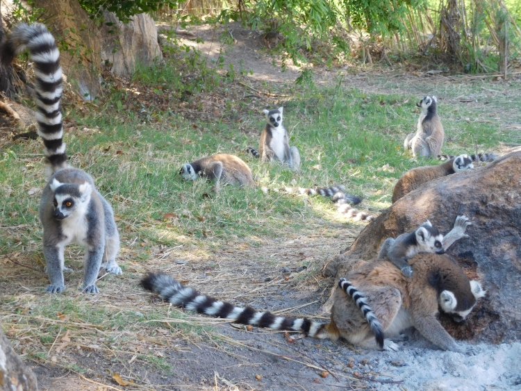
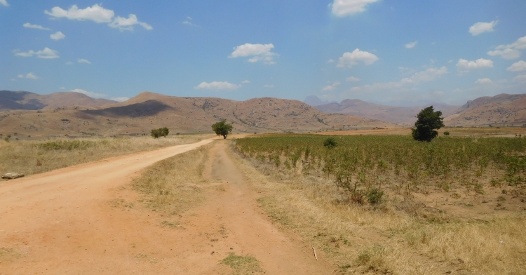
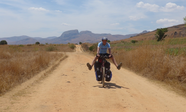
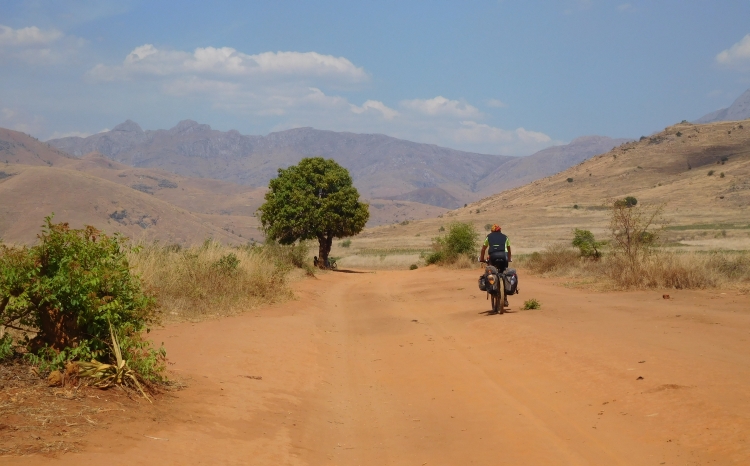
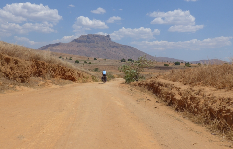
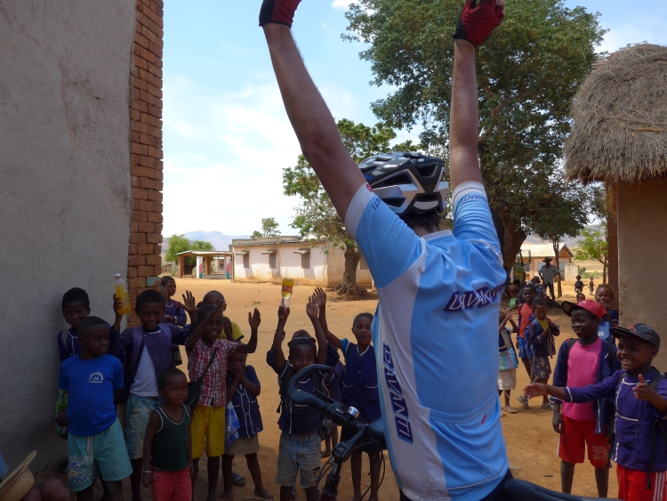
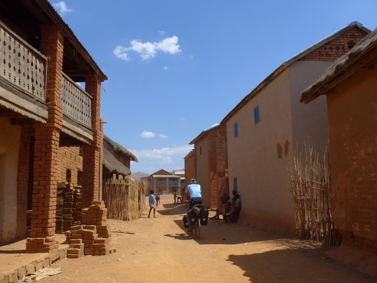
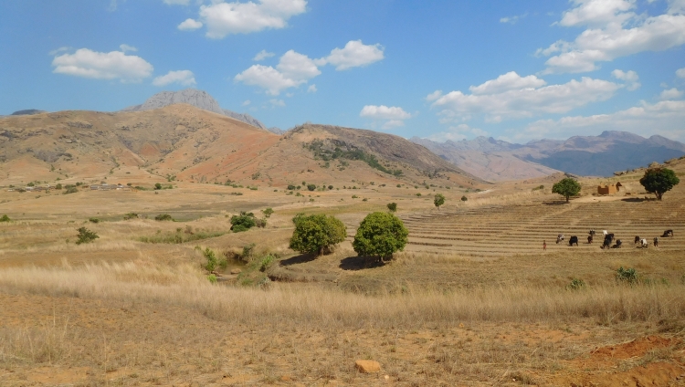
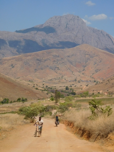
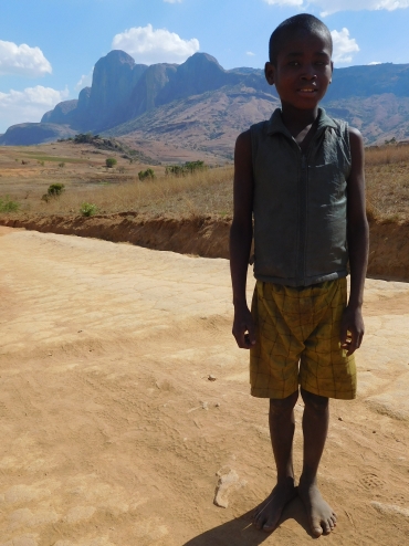
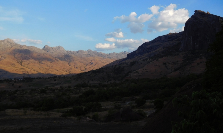
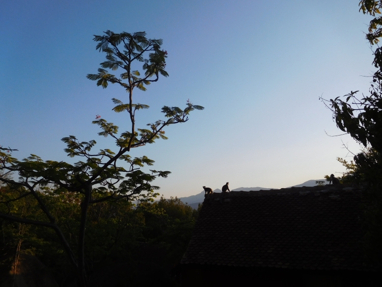
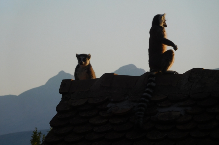
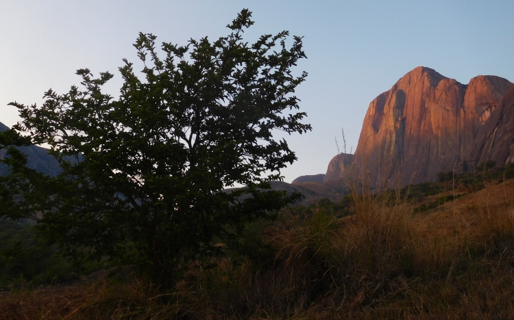
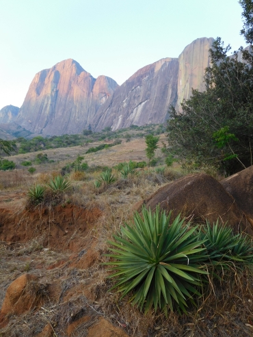
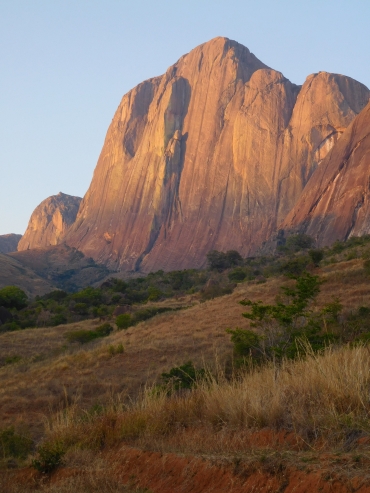
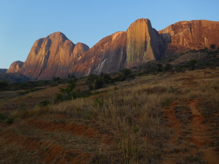
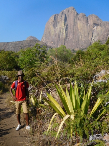 Together with our guide Arcen we start early. The route initially runs through a
forest with many different trees, very different from the tropical forests we have
seen until now. After crossing the forest, we climb up between the big mountain walls of
the Tsaranoro and the Caméleon. The path winds up over the dry grass slope in
between. Just before the pass the trail goes left towards the top of the Caméleon.
We meet a group of women, who are walking from a village twenty kilometers away to
obtain rice and other food supplies. They have to walk back the same twenty kilometers
today, they tell. They are not tired, however. They cheerfully tell about the long
journey they have walked so many times.
Together with our guide Arcen we start early. The route initially runs through a
forest with many different trees, very different from the tropical forests we have
seen until now. After crossing the forest, we climb up between the big mountain walls of
the Tsaranoro and the Caméleon. The path winds up over the dry grass slope in
between. Just before the pass the trail goes left towards the top of the Caméleon.
We meet a group of women, who are walking from a village twenty kilometers away to
obtain rice and other food supplies. They have to walk back the same twenty kilometers
today, they tell. They are not tired, however. They cheerfully tell about the long
journey they have walked so many times.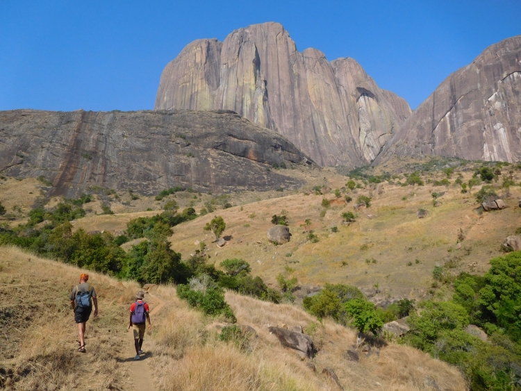
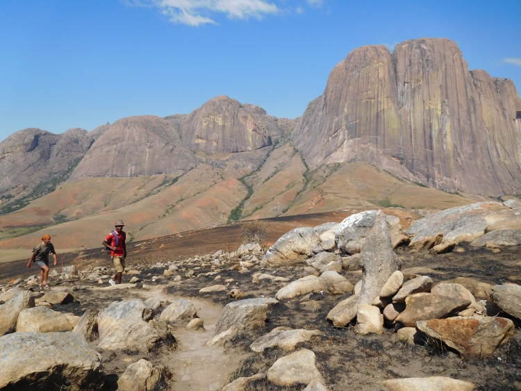

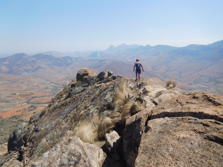
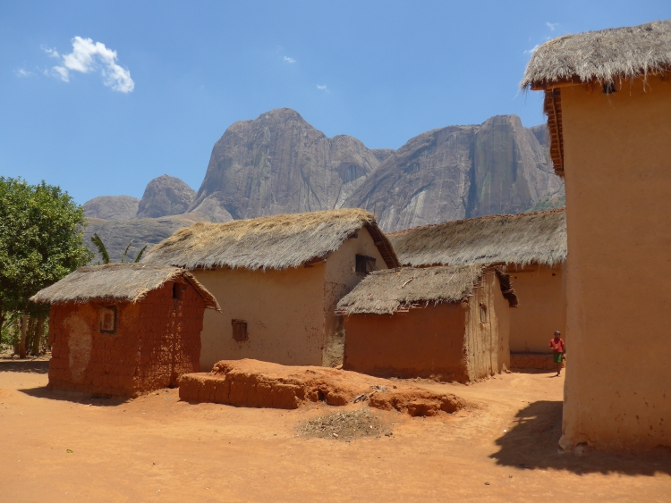
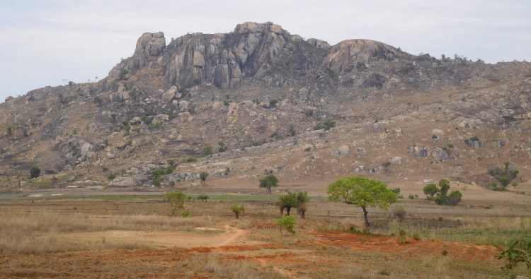
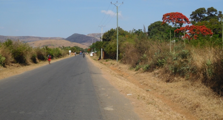
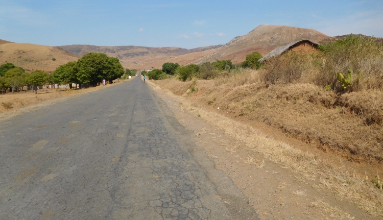
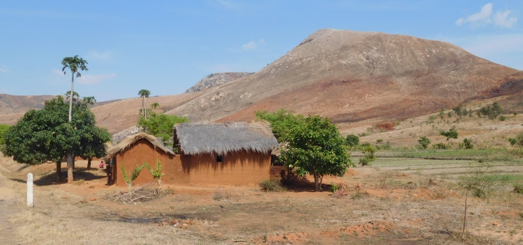
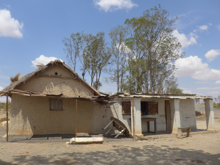
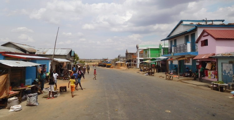
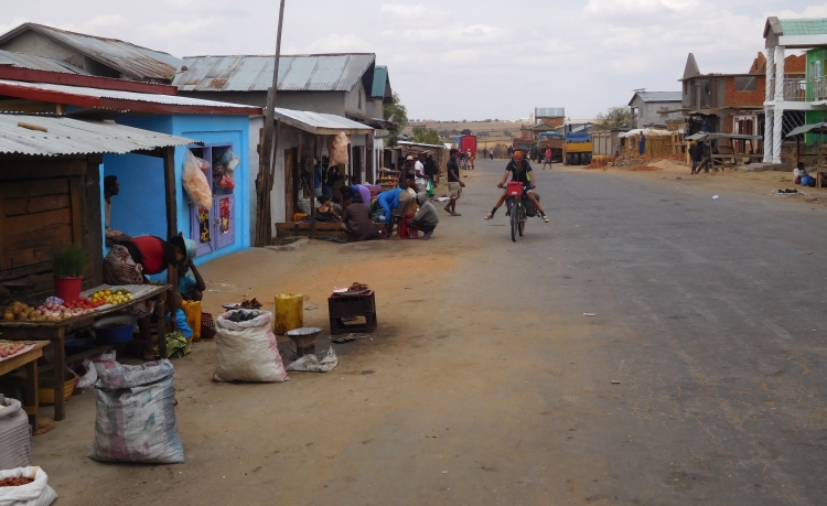
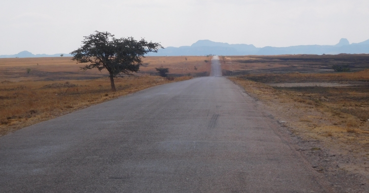
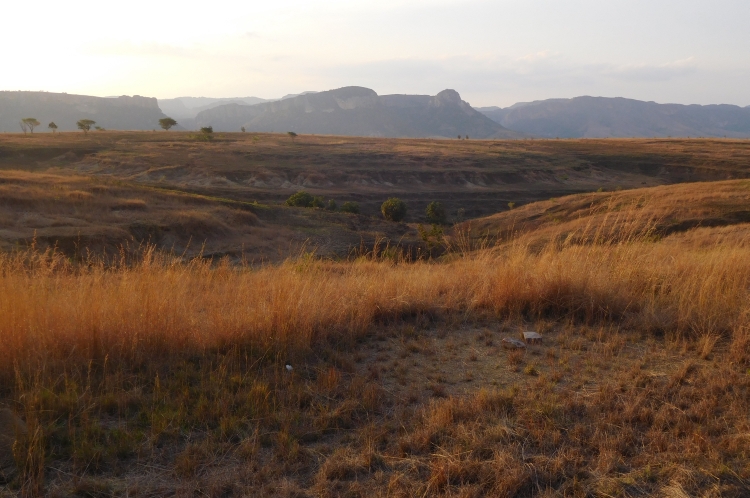
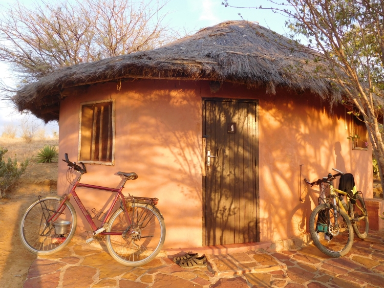
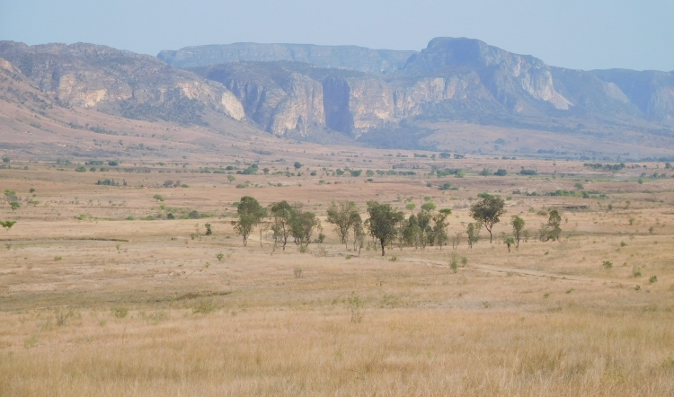
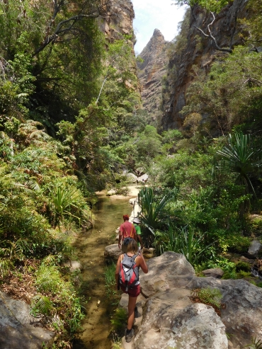
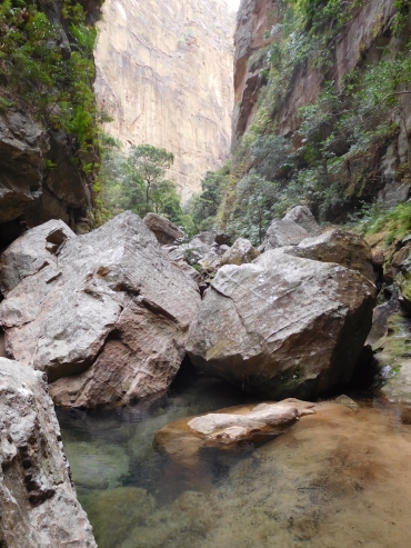
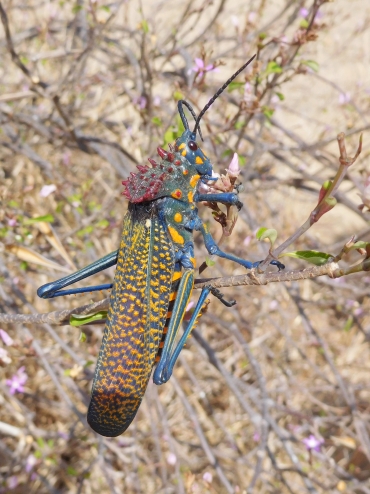 >>> Well, if we walk back, we do not have that much time in the second gorge, the Canyon
des Rats. Moreover, we will come home very late.
>>> Well, if we walk back, we do not have that much time in the second gorge, the Canyon
des Rats. Moreover, we will come home very late.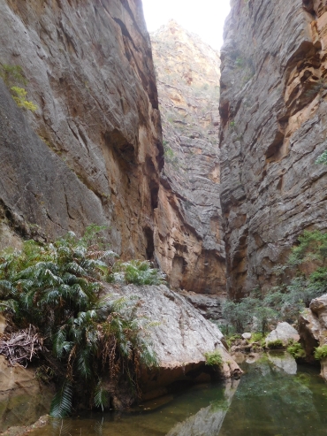
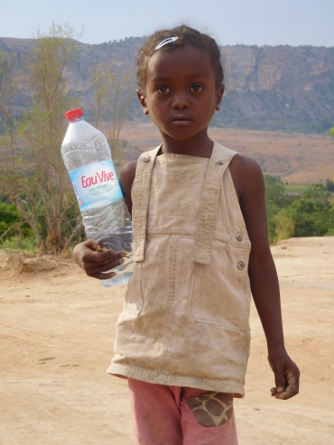
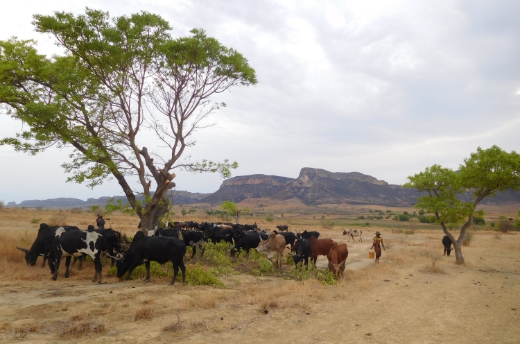
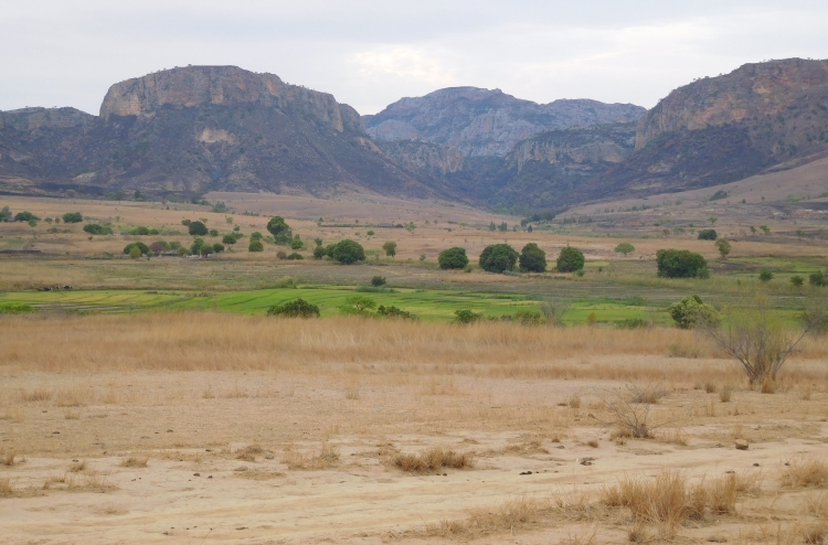
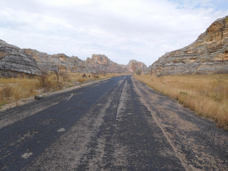
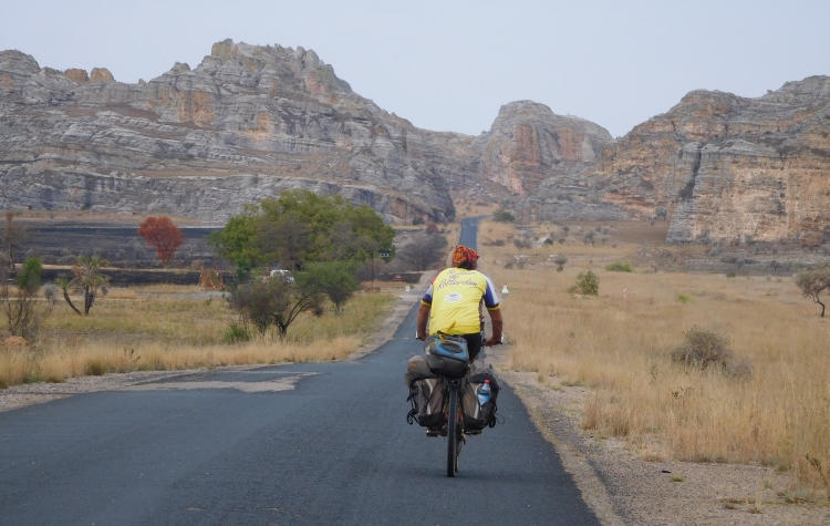
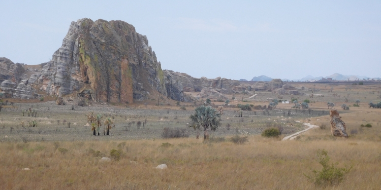
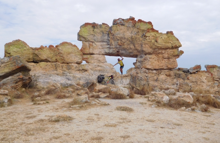
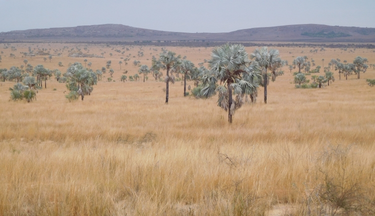
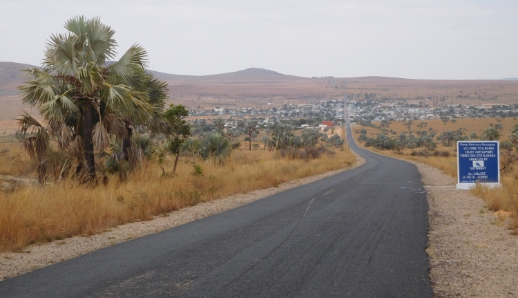
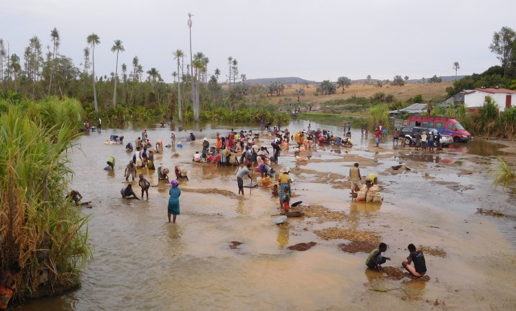
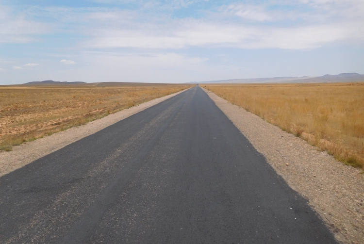
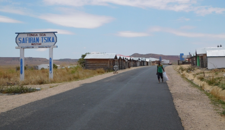

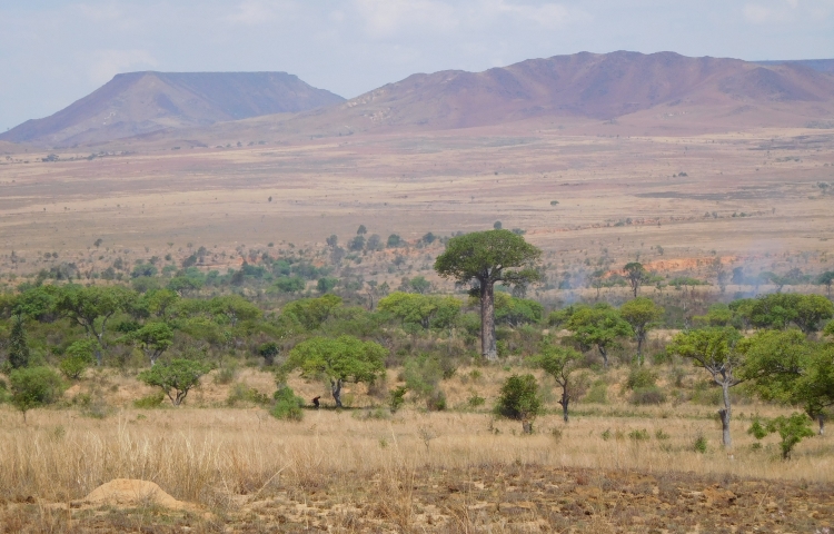
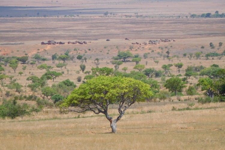
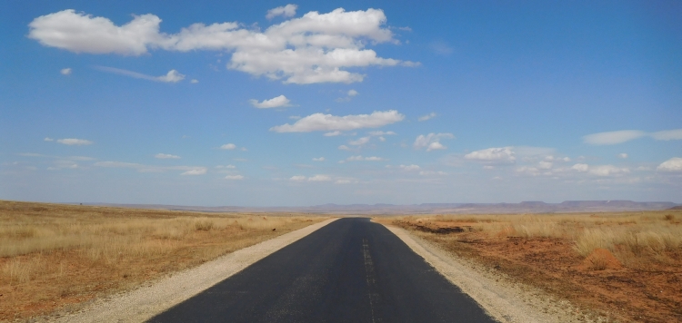
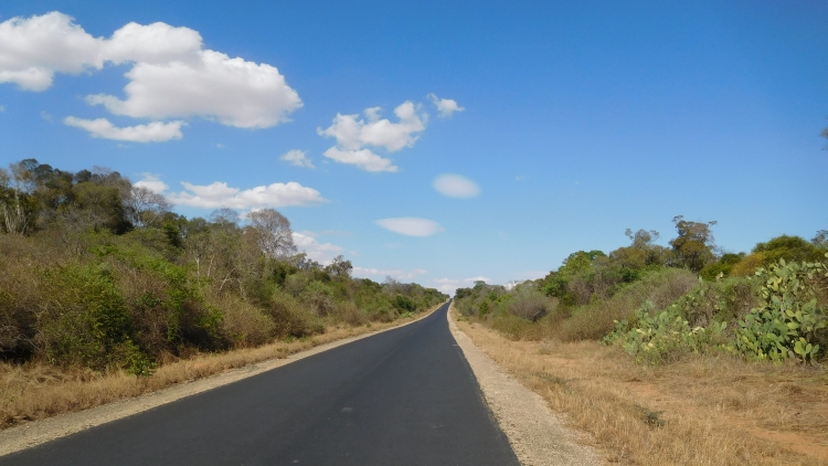
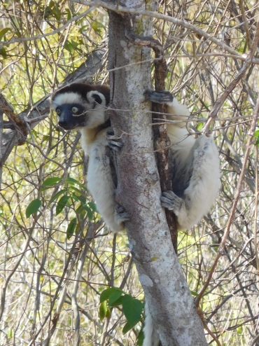
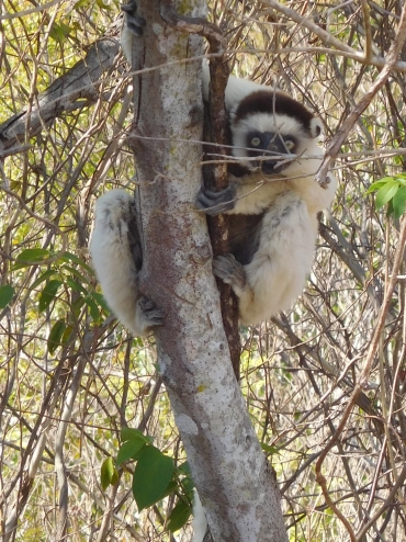
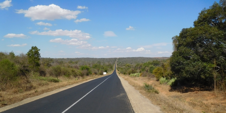
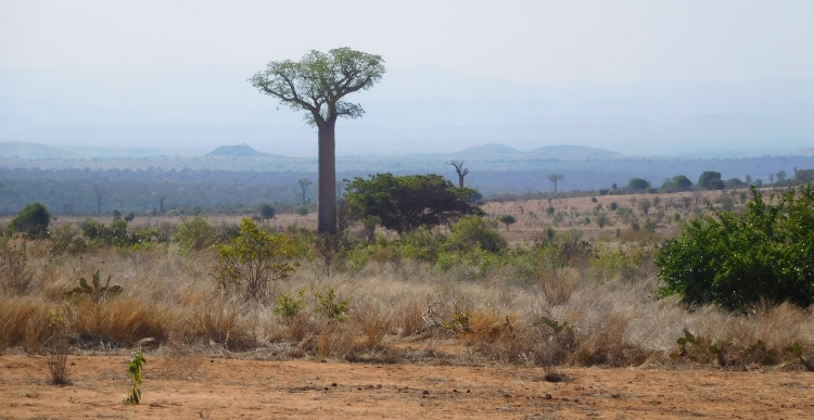
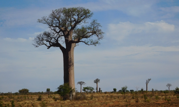
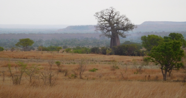
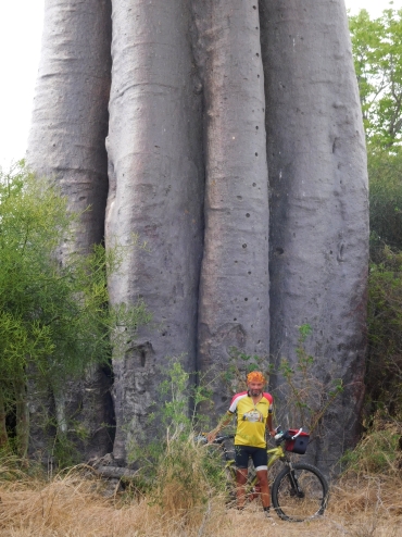
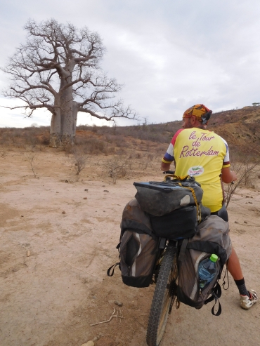
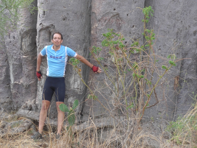
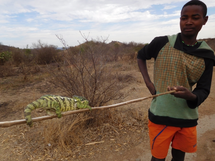
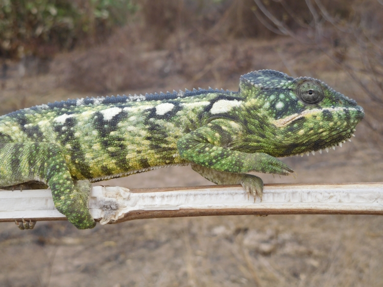
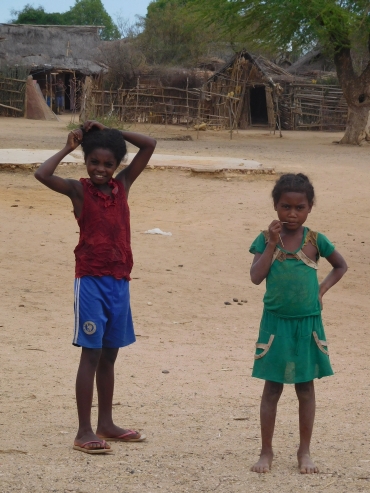 After Andranovory, the landscape is not too exciting anymore. The gray cloud cover is
boring and the villages are the poorest we have encountered so far. The wind has finally
come and we are confronted with the usual headwind again. It is good that we only have
to cycle the last forty kilometers against these headwinds, because I am already finished
with it after a few kilometers. We are also hungry and thirsty because in none
of the villages beyond Andranovory we have been able to obtain food or drink. Just
before we reach the coast we have a final climb to a withered limestone plateau.
After a few kilometers we have crossed the plateau and we descend to the coast.
Another ten flat kilometers further we reach Toliara, the big city on the west coast
of Madagascar and the end point of our journey.
After Andranovory, the landscape is not too exciting anymore. The gray cloud cover is
boring and the villages are the poorest we have encountered so far. The wind has finally
come and we are confronted with the usual headwind again. It is good that we only have
to cycle the last forty kilometers against these headwinds, because I am already finished
with it after a few kilometers. We are also hungry and thirsty because in none
of the villages beyond Andranovory we have been able to obtain food or drink. Just
before we reach the coast we have a final climb to a withered limestone plateau.
After a few kilometers we have crossed the plateau and we descend to the coast.
Another ten flat kilometers further we reach Toliara, the big city on the west coast
of Madagascar and the end point of our journey.
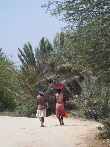 We have reached the end point of our journey, but that does not mean that I do not cycle anymore.
I decide to cycle without luggage along the coast to the village of Saint Augustin, an old
French colonial port village. Willem has no lust to go and stays in Toliara.
We have reached the end point of our journey, but that does not mean that I do not cycle anymore.
I decide to cycle without luggage along the coast to the village of Saint Augustin, an old
French colonial port village. Willem has no lust to go and stays in Toliara.