Shanti Shanti. Cycling and Trekking in India and Nepal
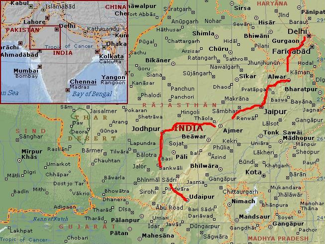
Day 1: Delhi - Tijara 102 km
The minute that you step outside the airplane in Delhi Airport, you feel that
you are in India. People are just standing, busy doing nothing. Even at midnight
this is quite a busy place. The air is thick with moisture and Indian smells. It is hot
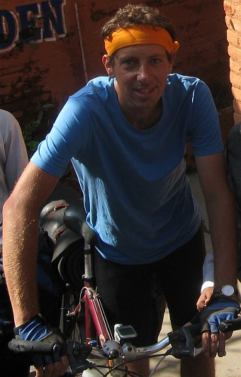
and humid, just as you might expect in the post-monsoon. As we prepare our bicycles
at the luggage take-off, I am sweating all over. After fixing the bicycle, we walk
towards the exit.
The airport looks much bigger than three years ago. Through a big crowd of people
we find our way and we are outside, in the night of Delhi. We have our cardboard
boxes with us, hoping to keep them for a few weeks at a hotel untill we come back for
our return flight. Unfortunately there is not a hotel on walking distance of the airport
and it is also not possible to cycle with those cardboard boxes in our hands on the highway to
Delhi. Within a minute we are surrounded by taxi drivers who offer to go to a 'very
good and very cheap hotel'. Of course this is the tourist trap where you pay a lot
for a short drive to a very expensive hotel. But after negotiating with the least agressive
driver we have a deal. He takes the cardboard in his little cab and goes off while we
are cycling behind. In the middle of the night we are riding straight into the
outskirts of Delhi for the first hotel below 500 Rupees.
Dogs lie down, scattered over the ramshackled narrow alleyways of the neighborhood. Only
few people are hanging around. There are a few simple hotels. We take one of them.
The hotel room is quite okay. And it has got a fan. All in all it did not take too much time and now we can have
a long rest. After a short midnight stroll we go to sleep. Soon I am drifting away
in a long deep sleep.
At nine o'clock we get up and leave. We will cycle two weeks in Rajasthan, then we
will go by bus and train to Varanasi from where we will cycle to Nepal and do some
trekking in the Himalayas. But first we will cycle in Rajasthan. We will head towards
Jaipur, the pink city and capital of Rajasthan.
The Old Jaipur Road is closed so we are forced to take the New Jaipur Road, which is
an extraordinary busy highway. Luckily there is a service road which is much quieter.
Cyclists, carriages with oxes and lots of walking people with loads of all kinds of
luggage on their backs or on their heads: it is the really slow traffic that makes
use of the two lane service road. In fact we are the fastest traffic on the service road.
The highway itself is used by cars, buses, trucks, motorcycles, scooters and taxis
and has got a minimum of six lanes on both sides. I have never seen so much traffic
in one view angle. Still the traffic does not look like a complete mess. There are no
dangerous situations.
We reach Gurgaon, a new mega suburb with luxury shopping malls for the fast growing
Delhi middle class. Gurgaon is a place which is spreading rapidly to all directions.
Everywhere there are new buidings being made. And Gurgaon is a place that is
attracting lots of people, also poor people. So all in all, Gurgaon already begins
to look like an ordinary Indian city with bazaars, holy cows on the streets and an
awful lot of people. It takes ages to cross the city. After thirty kilometre we have finally
crossed all the suburbs from Delhi. From the center of Old Delhi, it would have taken us
nearly sixty (!) kilometre to reach the end of the suburbs.
So finally we are cycling on a quiet road. We are cycling in the direction of Alwar
a medium-sized Indian city in Eastern Rajasthan. It is quite late already and we
will not be able to reach Alwar today. We will have to find out if there is a hotel
on the way, otherwise we will arrange a taxi to take us to Alwar. We have decided that
our cycling trip in Rajasthan will not be a cycling trip from A to B but more of a
random exploration of the 'heart' of Rajasthan. Willem has got a borrowed GPS system
in which he put way points of crucial places and crossroads from roads that are not
on maps but can only be seen on Google Earth.
Or in real life of course. And in real life we are crossing such a road. Unpaved
and obscure. We are certainly the first Europeans who cycle on this road. Immediately
we are in the 'wild west' of India, the heart of rural India. The disadvantage of
cycling on these way points without having an underlay of 'real' maps, is that we will
always be insecure about having the right road and we will also be insecure about how
much kilometre we have to cycle to reach 'civilization' with hotels and so forth.
We will certainly be sure whether we will find hotels on the way point roads. We will not.
So we will often have to rely on transport that we have to arrange in the villages.
But I do not have to think about whether the advantages weigh up to the disadvantages
of travelling this way. I simply have to look around me. We pass villages with
chickens on the streets, pigs in the houses. Oxes still do the hard work on the land.
There are lots of children on the road. Everywhere there are people, even in these remote
rural lands.
After more than an hour we find ourselves on pavement again but the road is
not busy. This is pleasant cycling country. After hundred kilometre we are quite
salty and sweaty. But this was an interesting first day, with huge contrasts between
Delhi and Gurgaon on the one hand and rural India on the other hand. In Tijara,
the biggest town on the way to Alwar, we do not find a hotel. We have got only
two hours of daylight. We have to take our first taxi.
Day 2: Alwar 0 km
After one day we have our first rest day. We still have to sleep because we have
had a very short night yesterday. The days are short and Alwar looks interesting
enough to spend a day.
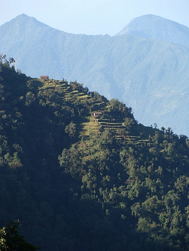
Alwar has got a very pleasant atmosphere. The city is surrounded by lush green
hills. The sky is gray. The last remnants of the monsoon are still lingering on.
Alwar has got 260.000 inhabitants but the city is compact. The old city has got a lovely array
of small alleys. Alwar has got a huge palace, the City Palace, a highly atmosheric
place. Especially the artificial deeply green lake with its temples around are really special.
Despite the pretty ambiance there are no tourists in Alwar. Maybe we will see even
prettier places the coming days but will they quite match the atmosphere of Alwar? We will
see the coming days...
Day 3: Alwar - Sariska - Bairat - Amber - Jaipur 148 km
It is raining cats and dogs, the kind of rain that never seems to end. We take our time for
the breakfast bur after we have eaten and we have loaded our bicycles, there is no improvement.
We decide to leave whatsoever. It is not cold so in fact it does not really matter that
it is raining.
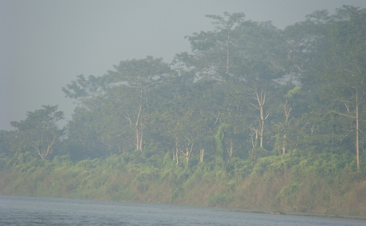
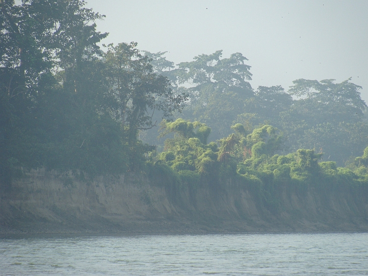
Despite the road is very bumpy, we soon reach the outer area of the Sariska Tiger
Reserve. The inner area cannot be visited by foot or on a bicycle. The outer area
is also very interesting and sometimes truly beautiful. We are passing green
flatlands that are surrounded by dark green hills. Rivers are wide and have
extremely high water levels. The levees are only a few centimeter higher than
the water level of the river. We see some parakeets and painted storks and lots of monkeys. There
are no tigers in the park any more. Or so it seems. I have heard that they there are tigers
again since a few months. Whatsoever, we will not see tigers in the outer area of the park.
We are lunching a few kilometre before Sariska. We order a few dry samosas. Or at least: they look
like samosas. But what is the teastall owner doing? He crumbles the samosas in his hand
and throws the pieces in a yellow sauce with lots of red streaks. Chilli. The sauce is burning spicy.
It is still good to eat though. But it takes some time before I am able to cycle
without feeling completely spiced up.
After Sariska we have to cross some hill ranges. In fact the hills are looking higher
than they actually are. It is not really hard climbing here. It is not raining any more
but we are just as wet because of the sweating. After a very bumpy descent the pavement improves
and we make progress easily. At 3 o'clock we reach the Delhi-Jaipur highway. The road does not look
busy so it is possible to cycle here. We have got only three hours of daylight left so we
must hurry a bit to reach Jaipur, which is still 64 kilometre away. We take a chai
for some mental preparation.
Cycling on the highway. It sounds ridiculous but in fact this is one of the quietest
roads we have had so far. And also one of the best roads. The road is smoother than
a Sam Cooke song and it seems that we are flying over the road. The sun is breaking through
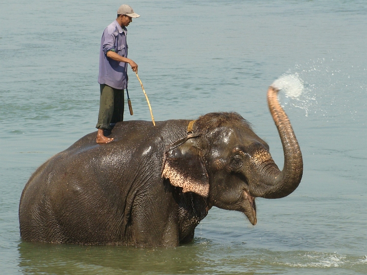
and red rays of sunlight give the hills a dreamy glow. Just a few kilometre before Amber
we pass a few elephants. Elephants on the highway? I try to picture myself what would happen if
people take an elephant ride on a highway in the Netherlands. I simply cannot grasp
the image. After a while we go further and reach Amber.
The palace of Alwar was big but how can I describe the palace of Amber? It has got a scale
beyond imagination. And it is simply extraordinary beautiful in the twilight. Behind
the palace is a big hill with a big wall that had to protect the palace against enemies. It must
have taken a heavy toll for the citizens of the region to pay the taxes for building such an
enormous work of art. But the people who built it and the Maharadja's who lived in
it have long been gone. The history has passes and now only the stones remain. And they are
wonderful.
It is getting late and it is getting dark. We proceed to Jaipur, only a few kilometres
from here. We descend to the capital of Rajasthan. On the way we pass another architectural
highlight, the floating palace. A palace in the middle of a huge artificial lake,
completely surrounded by water, an eerie effect. We get on and ride into Jaipur, the capital of
Rajasthan with over three million inhabitants. It is dark now as we have to cross the city to
the hotel area. On the way we pass the pink Palace of Winds, the most famous palace of Jaipur.
It takes quite some time before we have cycled from the one end of the town to
the other end. The last kilometre an old police officer on a scooter helps us by riding
the way with us. And the reward after a long and diverse cycling day is there.
We find a pretty hotel and we meet two nice women, a Swiss girl and a Belgian woman, Jasmine.
Jasmine will also stay one day in Jaipur before moving on to Pushkar, so we will be
able to meet again the coming days.
Day 4: Jaipur 0 km
Sightseeing Jaipur. After visiting the Pink City and the palaces I feel unwell. I
feel that I am having a fever. We return to our hotel. I go to bed. Despite a temperature
of 35 degrees Celsius in the shadow, I am freezing cold. We will have to see tomorrow
how seriously ill I am.
Day 5: Jaipur - Phulera - Naraina - Dada 98 km
I am not feeling too good but not too bad either. We decide to try, we will just see what will
happen. Whenever I feel ill, we can always take a taxi to a place with a hotel. The road
out of Jaipur is relatively quiet. From our hotel it is not far to the railway station.
A regional road leads us from the station out of town. Within ten kilometres we
are in rural areas. Another ten kilometre further the landscape is even scenically
interesting. We are passing villages but also nomadic tent camps. Everywhere we come,
the faces of the people have true character. Clothes are traditional. Women are
wrapped in long, colourful veils. The dress code of the females must reflect their
social and family status. Men often wear colourful turbans. Especially the older
men. The cycling is slow in these areas. The road is often unpaved and in villages
it is trial and error before we find the right road to the next village.
The teastalls are a special experience. These roads are not found on the maps so the people
are not used to tourists or travellers. Whenever we sit down in a teastall, children and men
tend to shyly look for contact. Sometimes the children are not shy at all. Quite
often we are surrounded by ten or more people. Only the women do not make contact. Women
tend to behave conservatively in contacts with men. Rajasthan has very traditional
views about relationships between men and women. In these areas it is the man who has fot
rights and the woman who has got the duties. For us, travellers, it is difficult to find
out how women feel about the inequality between man and wife. Is it really a problem?
Is the man able to handle the woman with love and respect as the woman has got a weak
social position in society? We will not find the answers from the women in this journey.
We are able to make contact with men and they are mostly quite open about their social
ideas. In general, they tend to find western women 'loose' and western men 'soft',
because they obviously are not able to have their women under 'control'. Most marriages
in India are arranged by the parents of the married couple. And still the majority of people
find that a better basis for a long and satisfying relationship than a 'blind' love
which is based on physical attraction or romantic dreams. The Indian people live out their
romantic dreams by looking at Hindi films, which are usually as sweet as syrup.
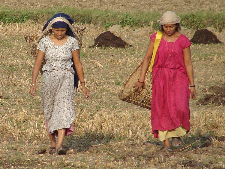
So the woman has got to take most of the social responsibilities and the woman has
to take care of the children. But the woman has also got to do most of the physical
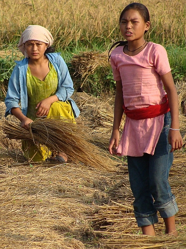
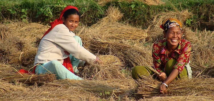
work. We see a group of thirty women, carrying stones on their heads for road
improvements. Even during this hard physical work they wear their most beautiful
colourful clothes. Only two people are sitting quietly on a chair in the shadow,
men. They look whether the women are working hard enough.
After one o'clock it is really hot. It must be around 37 degrees Celsius. The heavy
windless air does never give any refreshment. I am sweating all over. Everything is wet,
especially the contact places with my bicycle. The salt irritates the skin. I am still
feeling a bit ill. In fact I have a stomach problem, probably a parasite. The fever from yesterday
was probably a first response to that problem. I do not have any control about my thoughts.
I am more or less drifting on stream of conciousness. Or more appropriate: a stream
of dreamlike images. Still the overall feeling is not too bad, especially because this
was a very interesting day so far. But I feel that I must take it easy now. We decide to ride
to the Delhi - Jaipur - Udaipur highway. From there we will easily find a taxi to Pushkar where
are a lot of hotels. In Dada we reach the highway. We sit down in a tea house. After
a few minutes we are talking and discussing with a group of men and then we slowly come to
business. I drop the suggestion if there may be a possibility for local transport to
Pushkar. Ten minutes later there is a man with a car and ten minutes later we have a price
and we sit in a car on the highway to Pushkar.
In the atmospheric city of Pushkar we meet Ysmine again. We stay in Hotel Pink
Floyd, a nice gimmick. We have heard the bad news that Rick Wright has died a few
days ago, so we stay in the 'Atom Heart Mother' Room, the album which is most in
the vein of Rick. And it is a nice album whatsoever. But Pushkar has got lots more
to offer in the musical realms. In a square right before our hotel a group of people
are making music to the memory of an old lady who died exactly twenty years ago,
obviously a family member of some of the people. The people who are playing and
singing are really crafted musicians. There is a trancelike beat which slowly develops
in a more and more powerful way with ever more details. The intensity is further
enhanced by the powerful vocals of the two main singers. The power of the music is
that the complex structure of the rhythms and melodies is made accessible by
the steady rhythm and by the repeating 'yells' which are modulating all the time
to build up meaning and intensity. So this music is at the same time accessible and complex.
A hundred people are sitting down to listen. We too are asked to sit down and listen.
When we leave, my head feels empty and I feel upligted by a euphoric, catharsic energy. A
once in a lifetime experience.
Day 6: Pushkar 0 km
Another day of rest. Not that I need a rest day - I am feeling well now - but because Pushkar is
worth a visit. Pushkar lies idyllically between the green Aravalli Hills and has got a holy lake.
Pushkar is one of the holy cities for Hindus and attracts thousands of pilgrims each year. And
also thousands of tourists. The lake is very scenic. It is surrounded by white temples all
around. At sunrise we take a look in the ghats before the temples, where the pilgrims are
bathing to wash away their sins. We try to transcend our spiritual feelings in a musical way by doing
a percussion session with a local master. A way of giving back to the Earth and the people.
Willem and Yasmine are already on the roll as I join them. For Willem and Yasmine this
is not the first time to use percussion instruments. For me it seems like they are true masters
on the instrument, although it does not sound like that. But as I start to make noises,
it becomes crystal clear that they are way ahead of me. The master gives me an intense look.
>>> You must not be so concentrated. You must treat the drums as if they are a lady.
If you want to make love with a woman, are you tense then?
> To be honest... in those circumstances I am usually very tense.
>>> You must not think. Let the rhythm simply flow out of you.
> Just like making love???
>>> You have to be shanti shanti. You must feel one with yourself and your environment.
You must be on with the rhythm.
Despite we truly feel euphoric about our improvements on the local percussion instruments,
occasional passengers are looking rather compassionate than positively thrilled. But more and
more we get into the flow. Slowly we build up to a climax, the master makes improvisations
while we slowly build up the rhythm. We continue, a massive rhythm rolls out of our drums.
The inside world merges into the outside, or is it the other way around? The flow just takes
over. The rhythm reaches a climax, goes beyond, goes even further. There is no inside
world and there is no outside world, just one massive rhythm. And then suddenly everything is
shanti shanti...
Day 7: Pushkar - Kurki - Jaraintar 91 km
In two days we want to cycle to Jodhpur, the blue city and second city of Rajasthan.
After a cracking thunder storm yesterday night there is a strong headwind today.
A thick shapeless cloud mass is rolling in. We descend into a huge flat area,
a kind of savannah with sparse bushes and acacias. The flatlands before us look
spooky in the grey weather. The people are not too friendly. For the first time
the people along the road are begging, in a quite hostile way. Sometimes children try to
stop us by clinging to our bicycles, quite dangerous behaviour in fact. They are asking
for pens and Rupees but in fact they simply try to make problems.
After one and a half hour we leave the road for an unpaved road. From now on the
atmosphere on the road is much better. In fact the villages are poorer but now we
see smiling faces. Here we see people that want to talk instead of making trouble.
Our road however is more and more troublesome. In fact this is not a road any more.
At the best this is a sand track but sometimes we cycle on bare rock. Mostly flat, but still
difficult to cycle. The trails split up all the time, sometimes the tracks come together,
sometimes not. It will be increasingly difficult to find the way back, in case of need.
Then there lies a river before us. It is not a river with fast flowing water but it
is more like a lake. Still we have to cross it if we want to reach Jodhpur tomorrow.
So we try to wade through the river. After a while we find a place to cross the river.
The water level is above our knees for a long stretch but we reach the other side
of the river. From there it is very steep upward to climb up the river bank and then we
have to find a way through the bushes to reach a dirt track again. But we are able to continue
again. We are glad that we reach a village but it is a lot of hassle to find the proper way
out. The next village has a tea house, where we can finally drink something and have some
sweets to eat.
As we sit down, a thin man with a huge snake comes to us. He walks to me:
> Would you mind to hold my snake? I want to order some tea.
>>> Mmm... no, if you do not mind...
> Okay.
Indeed he does not seem to make a problem. He just asks a local gut but he also refuses.
The snake is more than a meter long. Of all the things that I could do, holding the
snake is one of the least likely. The atmosphere in the tea house is highly exotic.
There are only very characterful faces here. We are sitting here for more than an hour.
The people are interested in what we are doing. It is difficult to explain to these
people what is good or nice about leaving your work and your family to just cycle around.
But to be honest, in Europe that is also difficult to explain sometimes.
We say goodbye and continue on the sand road. I feel that I am still not hundred per cent okay.
Luckily the road is improving slowly. After every village, there are trails that join to
become a slightly improved road. Just before Kurki the road is even paved. The pavement
however is in such an awful state that the unpaved road before is less bumpy. On the worst
stretches I tend to cycle on the dirt along the road than rather on the road itself.
Sometimes that is not possible and I am literally shaking all over, a horrible experience
when having stomach problems like now. The villages are still big fun, though. When
the children see us, they come running towards us. They also try to stop us, like
the kids in the villages near Pushkar, but here they just want to have contact. They
are laughing shyly. Sometimes a father comes to talk to us. Every time we say goodbye,
we have a group of ten or twenty kids, running behind us to wave us goodbye. At the end of the day
we reach the small town of Jaraintar, a friendly place on the provincial road to Jodhpur.
We find a simple hotel with a nice atmosphere but poor facilities. And tomorrow: we
only have to follow the comfortable road to Jodhpur.
Day 8: Jaraintar - Jodhpur 104 km
I have had a terrible diarrhea this night. Most of the time I had to sit on my ankles
above the gap in the floor that is the toilet. The afwul smell in the toilet did not make
me feel better, but there was nowhere else that I can go to. It was terribly hot also,
there is not a fan in the toilet. So now it is morning, I am glad that we can leave, although I
do not know if I am actually strong enough to cycle. Luckily it is an easy, flat day over
comfortable pavement and at the end of the day we will have the luxury of a tourist
hotel in Jodhpur.
The cycling day is not too interesting. I am strong enough to cycle and weak enough
not to bother about the very boring road. Willem is completely bored and complains
about all the kilometres that divide us from Jodhpur. For me it does not really matter.
My stomach does not get any better by cycling, but it does not get any worse either. The last ten
kilometre I feel that I am getting weaker, though. It feels good when we finally
reach Jodhpur. The palace on the hill top is awe-inspiring. I feel that this could be a truly
interesting place. We find the hotel where we meet Jasmine.
Day 9: Jodhpur 0 km
In the twillight we walk with Jasmine up the hill to the palace. Jasmine is a professional
photographer; she has very interesting travel pictures on www.jadejade.be. It is nice to
see a professional photographer at work. It gives me an opportunity to see how she
organizes the processes to make pictures of local people and how she asks people
before her camera. After the sunrise we return to our hotel to have breakfast. A
few hours later we go back to the palace to come and look inside. It takes us hours to see
the whole gigantic palace. This is surely one of the most extraordinary buildings on
the planet. There are hundreds of rooms, full of Raj splendour. The building itself is
full of intricate details and the views over the blue city are breath-taking. The palace
lies majestically perched on a high cliff above the blue-painted houses of Jodhpur.
It is easy to forget the rudimentary taxes that must have been needed to build a structure
of this scale.
Day 10: Jodhpur, Osiyan, Jaisalmer 0 km
Today and tomorrow will again be rest days. We want to visit Jaisalmer in the thar Desert,
close to the border with Pakistan. Cycling from Jodhpur to Jaisalmer does not seem to
be too interesting. Three hundred kilometre flat area divides Jodhpur from the desert city
of Jaisalmer. Jasmine, Willem and I take a taxi to Jaisalmer, so that we are able to
visit the Jain temples of Osiyan. The temple complex is another extraordinary place in Rajasthan.
It is not the vast volume that impresses but the overload of fine details. There are small
sculptures everywhere, often these are erotic images. We are the only tourists during the two hours
that we spend on the complex. Then we continue to Jaisalmer, a long and boring ride.
But Jaisalmer itself looks very interesting. The old city lies on a hilltop is completely
surrounded by the walls of a citadel. This looks like an Arabic city of the Middle Ages.
We meet Akbar, a nice young man who lived for ten years in Australia and New Zealand and
is having holidays in his birthplace now. He offers us to guide us around tomorrow. Nice
things tomorrow!
Day 11: Jaisalmer, Jodhpur 0 km
So today we have a sightseeing tour in yet another big palace. But I find out that I have
seen a bit too much splendour the last days so I am passing all the rooms with Raj
extravagance to enjoy the views over the golden coloured city. Akbar proves to be
very nice company. After the visit of the palace we are walking through the alleys
of the old city, along the Jain temples and over the city walls and down to the
new city. We find a good tea house where we have a simple but very tasteful lunch.
The kind of place that only locals know, where we eat the things that most tourists
never find the opportunity to eat.
After the lunch we pass some interesting havelis, the ornamented
houses that rich businessmen have built in the nineteenth century. At two o' clock we
need to get the bus back to Jodhpur. So it is thanks to Akbar. And we have a long
and boring bus ride back to Jodhpur. In Jodhpur we have our last dinner with Jasmine.
She will head north to Amritsar and Dharamsala, places where we have been three years ago.
We will go further south to Udaipur, our last stop in Rajasthan before we will travel
by bus and train to Varanasi. From there we will cycle to Nepal. But that is all later.
Day 12: Jodhpur - Bassi - Bujinath 101 km
We get up early as we know that we have to cycle at least 140 kilometre to find a hotel
in Ranakpur. The area between Jodhpur and Ranakpur is a highly obscure area where we will
certainly not be able to find a hotel. An added difficulty is that we do not have a clue about
the distance. It could easily be two hundred kilometre as well. And the road could be
difficult to find. The road quality could be poor. So we get off on a mission impossible.
But we try to believe that we could be able to reach Ranakpur. As the road deteriorates
after fifteen kilometre we still believe. After the road gets unpaved after ten more kilometres
we still think we have a chance. Whenever we get lost another five kilometre later we say that
if from now on everything goes fine, we might still have a chance.
After we have to walk for half an hour through loose sand flats, and after we have to wade through a wide river
and after repairing a flat tyre we know that this is a hopeless affair. But still at times
it is interesting, especially if we ride through the villages. Sometimes there is a crowd of
children, but this time we have at least sixty school children around us. We are sitting an
hour with alle those kids around us. We try to entertain them and they give us fresh fruit. They have
two giant water melons and some strange but delicious sweet fruit. We cycle somewhat further, where
we again get lost. It is really difficult to find the way when you are cycling on roads
that cannot be found on maps.
So far every time we got lost, we found a way out out sooner or later but today is really hopeless.
We have cycled a hundred kilometre, it quite late already and we are only halfway.
We have to take a taxi in Bujinath. The landscape that we pass in the taxi is
sometimes really gorgeous. It is really a shame that we are not cycling this stretch
but what can we do? We arrive in Ranakpur as the evening falls. Tomorrow we will cross
the Aravalli Hills to Udaipur. We will not get lost tomorrow at least: tomorrow we will
ride on a major road, a road that is actually a road and one that can be found on a map.
Day 13: Ranakpur - Udaipur 100 km
This time it is Willem who has got stomach problems. Willem says he is still good
enough to cycle today. We decide to leave today, we can stop at any time and place
today. After only two kilometres we reach the Jain temples of Ranakpur.
The white temples are situated beautifully in the valley between the green Aravalli Hills.
Like the temples in Osiyan, the ornaments and details are stunning. We hang around for a
while and then we proceed in the direction of Udaipur.
First we have to climb to a pass over the first of the hill ranges. It feels good to climb, this is the first time
in the holidays that we are really climbing. Unfortunately Willem feels ill on this day.
But all in all we get on well. When we reach the pass, we find out that there is not
a descent on the other side, followed by a new ascent. There is a kind of flat area on
900 meter elevation. There are hills and valleys to the left and the right but the
road winds at more or less the same elevation. At times we have good views to the left,
at other times to the right and sometimes to both sides. This is a strange place.
the hills are all green as grass and the people are a little different from elsewhere in India.
It feels more like Africa than India.
After a few hours the road goes down finally. A new highway is being built here
and on the highway we go down to Udaipur. There is not much traffic now because
the road is still under construction. And maybe there is not a highway needed here.
The only city in the surroundings is Udaipur. To our surprise the highway is passing
by without a possibility to get off for Udaipur. There is no traffic at all right
now. We find an obscure track that finally leads to bigger roads and finally we
reach the firy-tale city of Udaipur, the palace capital of India. The Lake Pichola
has got two extraordinary floating palaces and is partly surrounded by a sheer wall
of palaces. Tomorrow we will do the sightseeing. Now it is time to have a good drink
to the end of our Rajasthan experiences. Tomorrow we will start the journey to Varanasi,
1.500 kilometre to the east. We will not cycle these flat kilometres, which will
take us two weeks at least. We will go to Varanasi by train and bus and from there
we will cycle to Nepal. It was nice to be in the hills today, now we like to see mountains...
Day 14: Udaipur 0 km
These days we have to get our bicycles and ourselves to Varanasi. First we do some sightseeing in
Udaipur. Our dinner at the Queen's restaurant was the best in have ever had in India. Or wherever.
In a pretty family atmosphere we can just sit down where the mother and child are just living.
The grandma is cooking. The mother sometimes goes to the kitchen to help, sometimes
she is sitting with us, explaining how they are cooking. They have 50 (!) different spices.
Everything we eat is just delicious. We promise to get the restaurant into the Lonely Planet,
although I do not quite know how. But we will try...
In the evening we cycle to the bus station where we wait for the bus but at the time
of leaving there is no bus. We are told that these buses do not leave actually at the
bus station but on an obscure street 500 meter further. We hurry in that direction, luckily we
are in time. The bus goes to Jaipur; at six o'clock in the morning we reach the pink city. We hope to
get a train ticket to Varanasi, but the trains are fully booked. So we have to get a bus.
We know the way here, so we easily find the (right) bus station. We hope to get a bus ticket
to Varanasi, but that also proves not to be possible. It takes a few hours before a bus
leaves to Agra. There we will have to find out further.
Day 16, 17: Agra, Varanasi 0 km
So at 5 o'clock in the afternoon we reach Agra. We get kicked off the bus in the outskirts
of Agra, the trick they use for getting tourists reliable on further local transport.
In that way tourists can be dropped at expensive hotels. But they cannot harm us
by these tricks. We simply ride with our bicycles into the center of Agra and we
find the central bus station as it gets dark. The bus station of Agra is a desolated
mess. And they cannot help us. There are no long distance buses running here. There
are supposed to be a lot of bus stations in Agra and we have to get one at ten kilometre
distance from here. But how to get there? We do not know where. And we cannot rely
on the taxi drivers either. They are just into commission rates. One man says he
can arrange train tickets. Also not a hundred per cent reliable of course, but
what can we do? We come to a ticket office. We will not be able to leave Agra this
evening. But tomorrow will be possible if we paynow. We have to trust these men,
we have to pay in advance and come back tomorrow morning.
So we have time to visit the Taj Mahal at sunrise. Three years ago we saw the Taj from the
riverside in the mid afternoon. This time I want to see the Taj from the 'official'
side, where I will be able to see the Taj turning pink as the suns comes up. Willem
does not want to go. Of course the Taj is a cliche but what can I say? It simply
is a very beautiful structure. And indeed the pink glow over the Taj is something
really special. A sight that will stick in my memory.
After a whole day of waiting, our train leaves at ten o'clock in the evening. I fall
asleep easily and the next morning we ride into the town of Varanasi...
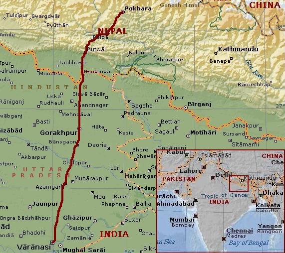
Day 18: Varanasi - Azamgarh 103 km
Varanasi is considered the holiest city by Hindus, situated along the holiest of rivers,
the Ganges. Every year millions of people come to Varanasi to bathe spiritually and
physically in the waters of the Ganges. Or to burn and throw the ashes of family
members who have passed away. There are some wild stories being told about pilgrims
drinking the holy river water while the dead bodies are floating by. Or about highly
corrupted people who are only interested in getting as much Rupees as possible
out of the tourists. This may all be true but our experience is much quieter. As
we reach the ghats, the bathing places, it is still quiet. We easily find boatman
where we arrange a tour. We see the pilgrims bathing but there are no dead bodies to
be seen. The burning ghats make a clean impression. We are told that the burning
continues for many hours, untill there is nothing but ash. That takes a lot of wood
and therefore a lot of money. It takes quite some fund raising and organisation to
keep the system accessible for the poor people, but they seem to manage. The ovens
are burning now for over over 4.000 years without a single pause.
So I cannot be sure that there is never a body that is not burned long enough. The people who
work for the ghats tell us about the difficulties of finding enough money to be
able to serve the poorer people. They tell about these problems as a kind of
fund raising but all in all the burning ghats make a reliable and well organized
impression. The burning ghats are downstream from the bathing ghats so that the
burning ghats do not provide risks for the bathing people upstream. So far the
facts as far as I am able to observe in the short time.
The impressions, the views, are stunning. First there is the beautiful sunrise, where the
sun is reflected magnificently in the river. The river Ganges has got a long line of ghats
with huge temples, an extraordinary sight. As the sun climbs above the horizon,
the pilgrims come and get into the river. Men only wear shorts, the women bathe
in their best saris. In fact it feels and looks like a beautiful, atmospheric
ritual. Some people are drinking the water of the Ganges, others do not.
It is already busy with swimnming and bathing people in the Ganges as we return to
the land. We will have breakfast and after four days we will cycle again, to the north,
in the direction of Nepal.
Northern India is flat and green and there are living an awful lot of people. Varanasi
itself has got two million inhabitants, one of six (!) cities of the province of
Uttar Pradesh with more than a million people. The rivers of the Sutlej, Ganges and
Brahmaputra make a broad plain area from Rajasthan in the far west of India to Assam
in the far east. Varanasi is in between; only three hundred kilometre northward are the first
hill ranges of the Himalayas. Our road out of Varanasi is comparatively quiet for a road in a
major city. The road is only two lanes wide and is certainly not the main road
between Varanasi and Nepal. After we have left the city of Varanasi behind us,
the road is still busy. We cycle through predominantly agricultural areas but there
is a long line of villages and small cities along the road, so that we actually
rather see houses and people than crops or nature.
There are no natural or cultural highlights and there is not much to be seen. But
it feels good to be here. We have seen a lot of huge palaces, temples and 'strange'
things. It feels good now to be cycling, nothing more and nothing less. And it is
still nice to have the ordinary contacts with the local people in the tea houses,
on the streets. And India is India: there are always little surprises. Positive
or negative, this is a special country - even in less interesting areas.
Day 19: Azamgarh - Dohrighat - Gorakhpur 110 km
It is hot and humid. At the beginning of October the monsoon usually still lingers
on in this region. Today it is not raining, it is even clearer than yesterday. But
within a short time there could be a rain shower like we had yesterday afternoon.
More than in Rajasthan, I am sweating so much that I am completely wet all of the time.
Even as we are cycling slowly on this flat terrain I have to drink all the time. Luckily
there are the teahouses, where we can buy new water. And the tea itself is also important.
The sugars are good in retaining the liquids. We would have drained completely without
the Indian masala tea! The masala tea is sweet, spicy and delicious. It gives energy
and it is good for stomach problems and other health problems. According to the Indians
at least. We have found out that the more shabby the teahouse, the better the tea. There
are no tourist areas, so that there are only local indian tea houses with high quality
strong taste chai. The nicest teahouse is run by a Nepali man who used to cycle in his home country.
He shows us a very old bicycle. 'This is a bad place', he excuses himself, 'but what can we do?'.
He does not have the financial means to make improvements. But according to me
this is not a bad place at all. Poor probably, but the people do whatever they can to
fight their way out of poverty.
In the morning the cycling stage is quite interesting with small lakes and with more
rural areas and less cities than yesterday. In the afternoon we cycle on the main road
between Varanasi and the Nepal border and the road is busier. And the road is worse.
It is full of gaps and is highly irregular. It is painful to be bumping and stumbling
over the 'multi layered' road after sweating heavily the whole day. My bottom,
which is already as red as a mandril and as salty as the Dead Sea, is constantly
irritating because of the bumping over the road.
At the end of the day we finally reach Gorakhpur, a city of around a million inhabitants and
the transport hub between the east west road from Kolkatta to Delhi and the north south road from
Nepal to Varanasi. Gorakhpur is just a normal Indian town, nothing more and nothing
less, no big palaces or temples, it is not a holy city. Today is a festival day
for the Hindus and on the main street there are some improvized neon lighted temples.
A feast of colour and kitsch. A bit like Christmans in Holland.
Day 20: Gorakhpur - Pharenda - Sunauli - Siddhartanagar 106 km
Another flat stage. We have good pavement this time but the surroundings are not
interesting. We hoped to see the Himalayas in the distance but even as we reach the Nepali
border in Sunauli, there are no mountains to be seen. Only twenty kilometre from the
Himalayas, the monsoon clouds effectively prevent any view. We are afraid that
the mountains have gone. We will have to see tomorrow if they actually exist.
The border is extremely busy but the procedures are being executed efficiently. We
are in Nepal now. A big roadblock of trucks can be circumvented by us by cycling
next to the road. After four kilometre we reach Siddhartanagar, the border town of Nepal,
where we find a hotel.
Day 21: Siddhartanagar - Butwal - Tansen 64 km
The weather is again monsoonal. It is already completely cloudy as we get up. We
are riding on the twenty kilometre road to Butwal, the last town before the Himalayas. Here
the Siddharta Highway will wind up the first hill ranges of the Himalayas to end in
Pokhara, on the foot of the real Himalayas. That is where we are heading for. Only
ten kilometre before Butwal we are finally distinguish the contour lines of the first
hill range. The highest hills are around two thousand meter high, a quite impressive
wall of hills as we are below hundred meter now.
When we ride out of Butwal the road starts climbing. One minute later we are completely
surrounded by a steep mountain landscape. The valley is dark, green and narrow. Because
of the ever darkening monsoonal clouds there is a strange atmosphere in the valley. We want to
climb to Tansen, a small mediaevil town on the first hill range. That is a long way up.
And it will be a wet day up as it finally starts raining. Raining? The sky is cracking open.
The valley is shaking with the rumble of thunder and the rain comes down with drops as
big as gravel. This is a serious monsoonal shower which will not be over soon. We wait
untill the first storm is over. Then we continue. Sometimes we look for shelter
in a teahouse and if the thunder is not too close, we continue. It takes quite
some time to climb up the hill this way but we have got the whole day.
Because we are still at low elevations, it is not cold. The way up is beautiful still, despite the
views are taken away by clouds and rain. A few kilometre before Tansen, after a few hours,
the rain suddenly stops and patches of blue sky become visible. The last kilometres up are
pleasant and we reach the small town of Tansen. Below us in the valley is a bed of
white clouds, surrounded by the hills. This is what the local people call the 'White Lake',
an apt name for this gorgeous view. The town itself is also nice and friendly. We climb to
the top of the hill range but there are no views, due to the clouds. We will have to wait
to see the snowcapped mountains.
Day 22: Tansen - Waling - Syangja - Pokhara 131 km
We descend through the steep streets of Tansen, back down to the Siddharta Highway.
The Siddharta Highway is named after Siddharta Gautama, who was born in nearby Lumbini.
The man that was born as a prince gave up his title and luxuries and became known
as the Buddha since he reached enlightenment in Bodh Gaya, India. The path to
enlightenment involves giving up any self-image or ego and involves the commitment
of becoming an instrument or medium for the benefit of whole mankind.Crucial in the
way is the realisation that there is actually not a self, there is only a choice for a self.
Enlightenment is reached by completely giving up the self, by loosing all ties to
worldly goods and personal ambitions. Loosing all ties to these personal aims is not the
same as giving them up. Giving up these personal aims can even have contraproductive
effect, for example becuase of feeling of jealousy against people who do not give up
personal erathly joys. Being enlighted is a state of continued love and happiness
and a complete freedom from the world of cause and effect, life and death and all
the dualities that we feel all the time.
You will never get anywhere without goals in your life but I am not anywhere close to
realizing a state of enlightenment. But we follow the path of Siddharta in name
as we find ourselves on the Siddharta Highway to Pokhara. And that road is actually
a beautiful one. The weather is splendid today, although we do not have views over
the high Himalayas on the first pass. A long and spectacular way down brings us a
thousand meter lower at the Kali Gandaki River.
Another ascent brings us in a new valley. There are a lot of Children in Nepal.
That is a well known fact - the average age is below twenty - and clearly visible
in the villages or along the road. The children are nice, friendly and sometimes they
have surprisingly good social skills. I am surprised how good the Nepali people look. Nepal is
supposed to be one of the poorest nations in the world but I cannot see any poverty
along the Siddharta Road. I do not see fat people and I do not see any undernourished people
either. There are beautiful women all around, the men look strong and healthy and
so do the kids.
The landscape is also special. Everywhere we see steep rice terraces. In between
are wooded areas. There is a nice atmosphere in the villages and the road is not
too busy. Everything is good in fact. The best thing however is the contact with the
people, especially the kids who are fighting their way to our bicycles and before our
cameras with a huge enthusiasm. The Siddharta Highway really has an apt name and is one
of the great fun roads of Asia to cycle. We cycle the whole day and reach Pokhara as the evening
falls. It is completely dark as we are searching the Dal Lake where most of the hotels
are. It is important to be close to the tourist activity because tomorrow we will arrange
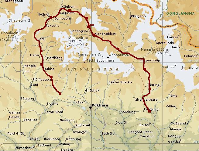
everything that is needed for the trekking. We want to walk the Annapurna Circuit, one
of the most popular trekkings of Asia. It does not take a long time before we are surrounded
by the 'real' Himalayas...
Day 1: Besisahar - Khudi - Bhulbhule -Ngadi - Bahundanda 17 km
All the groups are having breakfast at the same time. Apart from us there is a French group
and a Spanish group in our hotel. It is surprising that there are other groups at all. Yesterday
was a festival day and the tourist buses did not run. Willem and I still tried to reach
Besisahar, the beginning of the Annapurna Circuit. That turned out wonderfully well.
There proved to be a lot of local buses which moved a lot of people to their families
and close relatives. And that means really a lot. Tens of buses were out there, all
with loads of people in the buses and on the roofs. The last thirty kilometre through
the mountains we also sat on the roof. It was great fun with the locals and we had
awesome great views; it was a grand entrance to the Annapurna region, the playground
for the next two weeks or more.
The Annapurna Circuit is in fact not a complete circuit, but it is kind of semicircle.
It starts in Besisahar, on the southside of the Himalayas at only 800 meter
elevation. From there it follows the Marsyangdi River, passes through the complete
Himalaya range and subsequently turns westward, where the trail parallels the Himalaya
Range and climbing ever more up along the Marsyangdi river to finally reach the
Thorang La, the 5.417 meter high pass that divides the Marsyangdi Valley from the
Kali Gandaki Valley. After a long way down, the trail reaches the Kali Gandaki Valley and
turns southwards. From there the trek passes again through the Himalayas in the deepest
gorges of the world and makes one more big ascent to Poon Hill, a viewpoint mountain.
From there the trail goes down south and reaches the final destination of Nayapul.
At half past eight we start walking. Besisahar proves to be a big village. It takes
half an hour before we finally pass the last houses.
The pavement turns into a dust road. The world around us is green. The valley is still
quite wide and is full of trees. At these low altitudes there is tropical rain forest.
The hill slopes on both sides rise up spectacularly but we donot see the very high Himalayas
yet. Every time it could be possible to finally see a seven thousand meter mountain.
Or maybe even the 8.163 meter high Manaslu, one of fourteen mountains in the world
that rise up over eight thousand meters of elevation. But we do not see the high
mountains. Not Yet.
In Khudi we sit in a tea house after a cup of Nepali tea. We have views of a huge swing
which is close to us, right above the road. A construction of four bamboo sticks
in a rectangle, knotted together ten meter right above the road. Cars and even trucks
can pass down under. We see those constructions everywhere in the Pokhara region
but this is the biggest so far. This time there are no children playing but it is
an uprising of men that has been gathering at the swing. A very angry man is having a speech
and gets ever angrier during his speech. I do not understand as I do not speak
more than a few words Nepali. Still we can see that he has got an effect on a part
of the surrounding men. The atmosphere is getting agressive. I see the women take
their children and leave the place. That tells me that this is serious business now.
We pay our tea and leave the place too.
In Khudi the jeep track ends. From now on we will walk over a footpath. The next village
Bhulbhule is the entry point for the Annapurna Circuit. The paperwork is done within a minute
and we walk on. After a few minutes we can look into a side valley and we see the Himal
Chuli towering seven thousand vertical meters above our heads. The mountain is 7.893 meter high.
I have never seen a mountain this high in full view (In fact, I have seen higher mountains once but
that was from a distance of 150 kilometre). I am awestruck. I did not expect to see these
high mountains at this stage because we are on the southside, the wet side, of the mountains.
We are passing through excellent scenery. A huge waterfall is the most impressive highlight.
In Ngadi we sit down for lunch. A young man comes and sits down next to us. We are a
group of three now.
After Ngadi the trail ascends for the first time. We are passing through lush green rice fields
and atmospheric villages with wooden houses, adobe houses and stone houses. The temperature
has risen to about thirty degrees so we are sweating a lot during the ascent. But
after a few weeks of India this is a normal experience. The climb to Bahundanda is
really nice. A lot of children are playing and the people make contact easily and freely.
Bahundanda itself is a pretty village, sitting atop a shoulder a few hundred meter above the
Marsyangdi River. There are views in both directions. We decide to stay here today;
this is a beautiful place to spend the rest of the afternoon.
The whole evening we are playing
cards. I learn to know the shithead game. We play the game a lot this evening. Gary
proves to be good company with his Manchester accent, his strange humour and the
virtual absence of good manners. So this is a great start. I am really looking forward
to all the landscapes, villages and people that we will meet.
Day 2: Bahundanda - Ghermu - Jagat - Chamche - Tal 17 km
We had a good night in Bahundanda. The guesthouse is run efficiently and the personnel is very
friendly. A girl of about eighteen years old speaks english very well and is in fact leading
the lodge at her young age. But she is doing a very good job and she is doing it with a smile.
From Bahundanda we go down to river. The river valley is getting narrower and steeper. The
rice fields cling in small terraces to the steep slopes. We are approaching the
Main Himalayan Range now. The river valley is very narrow and immensely steep. It
is too steep now for terraces. The river is passing through the hard rocks of the Himalayan range.
It does not take too much time before the river valley is a series of gorges.
It is a strange idea that we are walking through the high Himalayas now, as we are at an
elevation just above thousand meter elevation and as we do not see any snowcapped mountains.
The steep valley simply does not leave any room for great views. Any possible view is blocked
by the clouds whatsoever.
The sheer cliffs on both sides of the river give a claustrophobic feel but also
impressive sights. Huge waterfalls come down on both sides and the Marsyangdi
River itself cuts mercilessly through the rocks. A big series of avalanches accompany
the river on both sides. Sometimes our trail has to circumvent these by high detours,
sometimes a swinging bridge leads the trail to the other side of the river where
are no landslides. Just before Tal we pass the Spanish group. There are some interesting
men and women in that group. My Spanish is not too good anymore but I am still able to
have some discussions. Then we have Dan and Danny, two Americans from New York,
who seem to be experienced trekkers. They are walking the same pace as we do. It is the
meeting of people on the way which makes a trekking such a special experience.
The last kilometres to Tal are very interesting. The gorges are nearly vertical and the trail has
to climb a hundred meter vertical above the river to finally descend to a lonesome
sand bank in the river between the vertical walls of the Himalayas. This is really a
special place. We find a nice guesthouse. Again the guesthouse is run efficiently.
This time we have three beautiful young women who organize our stay. Life is really
not too bad...
Day 3: Tal - Karte - Bagarchhap - Danaqyu - Thanchok 16 km
Like always, I have got up very early to see the sunrise. This time I am extremely lucky.
The gorges are still black as night while the early sunlight reveals high Himalaya
peaks at the end of the black gorges. An extraordinary sight. I am really feeling that I am actually in
the high Himalayas now, although we are still relatively low at 1.700 meter elevation.
It is surprisingly cold here at the early dawn.
After half an hour I return to our lodge. The others are waking up now and together we are having
breakfast. At the time that we are leaving, the sun still has not touched the cliffs around us.
We pass some Mani walls, a row of boulders that are made as somebody dies at that spot. It is a
Tibetan or Himalayan Buddhist tradition like the use of prayer flags that are also abundant
here. The red, yellow, blue and green flags are inscribed by prayers that are believed to be
spread by the wind. Then we have the prayer wheels. By turning the wheels the inscribed
prayers are spread. And there are the stupas or chorten, the white or earthlike structures
that represent all the worldly to spiritual levels of existence of (human) life.
The whole morning we walk through the gorges. It is a splendid day with deep blue skies.
In Bagarchhap we have more or less passed the gorges. We have the first views of big
Himalayan peaks after the Himal Chuli, 50 hours before. After a while, The 8.163 meter high
Manaslu is revealed, one of fourteen peaks that rise over 8.000 meter. Only seven mountains
in the world are higher. On the other side, the Annapurna II shows her dangerous white
dress of pure ice, which falls four thousand meter vertically. Majestically and proud
she towers above all that surrounds her. Only the Manaslu is higher. But it is not
only the vastness and immensity of the landscape that has got a deep impact. It is
also the much more subtle microworld of colourful flowers that takes my breath away.
Once in a while we are passing truly nice villages with friendly, smiling people. Small monasteries and
all kinds of stupas and lines of prayer wheels and prayer flags all over the place.
And then there are the fellow trekkers on the way. We meet Dan and Danny again, two
very nice men with great spirit. After Danaqyu the trail climbs steeply through dark and
and mysterious forest with strange dark trees. It seems to be a sort of cloud forest
as it looks like the cloud forest that I have seen in the Amazonian regions of the Andes in
South America. Indeed the forest is veiled in mists and clouds, so maybe this is some kind
of cloud forest indeed. It is quite chilly as we reach Thanchok at the end of the ascent
at 2.700 meter altitude.
We find a lodge in Thanchok. A short time later Dan and Danny arrive and soon after two other
trekkers that we have seen regularly the last two days. It is a nice bunch of
people here and now. We have an outerworldly sunset where the Manaslu is turning
from yellow to orange to a fiery red and a subtle hazy pink. This is certainly one
of the very most beautiful sunsets that I have seen, only rivalled by some Chilean
sunsets. The great atmosphere in the trekkers group in the evening is a perfect
end of a perfect day. We have walked fifty kilometres now in three days and we are not even
halfway the ascent. It feels good to know that it is still a long way to go.
Day 4: Thanchok - Koto - Chame - Bhratang - Lower Pisang - Upper Pisang 21 km
A new day. Again I am up early for sunrise views. So yesterday it was the Manaslu in the east that
got the eerie sunset, now it is the Annapurna II that gets the first sunrise.
The air is as blue as can be and the Annapurna II shines in a powerful white light.
A black hill on the foreground is still wrapped in the shadow. My early morning sunrise stroll
is a perfect prelude of what is to come. When I walk back, I meet Willem who has also got
up early for the sunrise this time.
When we come back, Gary is also up. We are having breakfast. After we have finished,
we pay and I see how we are leaving. It is a shame that we leave the others but
it is just happening; I do not know if it is right or wrong but as I have still
not made my mind up, we have simply gone.
We are walking through the villages of Koto and Chame that have a profoundly Tibetan atmosphere.
After Chame the Marsyangdi Valley becomes narrow again. Steep cliffs surround us but
also block good views. This is not the most interesting part of the trek. We walk on
efficiently and after two and a half hours we reach a huge glacial moraine. A little further
we walk around a rock cliff and at once we have a view over a completely smooth rock surface of
1.500 meter high, eroded in one huge amphitheater of rock. This is yet another true
natural highlight of unimaginable scale. We cross the Marsyangdi River and walk to
up the moraine wall. Through a dense pine forest we walk further towards Lower Pisang.
Sometimes we see glimpses of the smoothly carved rock wall.
We are passing a few small idyllic lakes before we eventually reach the wide valley in which
the village of Lower pisang lies. More scenically however is Upper Pisang that lies a
hundred meter above the valley with commanding views over the Annapurna II. So that
is where we are heading to spend the night. I visit the monastery of Upper Pisang
with its beautiful murals and walk through the village. This time we do not have
an efficiently run guesthouse but we have an owner that forgets everything. It takes
one and a half hour before I get a bucket of water to wash myself it also takes one
and a half hour and ten times of asking what we have ordered before his wife comes.
Day 5: Upper Pisang - Ghyaru - Ngawal - Bhraga - Manang 20 km
I wake up with my stomach tilted upside down. At least it feels like that. I have not slept the
whole night and after our breakfast I need a long visit to the toilet. I am feeling horrible still
but I am able to walk. We will just see what happens, there are lodges enough on this trek.
So it is a triumphant return of the giardia parasites that is troubling me now. We take
the high trail over Ghyaru and Ngawal. There is also a low trail but the low trail
does not seem interesting. We climb to the Tibetan style village of Ghyaru at 3.730 meter,
the highest point so far. The village of Ghyaru is situated 400 meter above the valley.
There are great views over the Marsyangdi Valley and the complete Himalaya range of
Annapurna II, Annapurna IV, Annapurna III, Gangapurna and Tilicho Peak, all mountains
between 7.000 and 8.000 meter high. Best views are over the Annapurna III, which is
on the opposite side of the Marsyangdi River. On our side of the river there are lower
mountains but still above 6.000 meter.
As we reach Ghyaru, I need to find a toilet. I find one, although I do not know
whether this may be called a toilet. There is not even a gap in the floor. The
only thing that reminds me of a toilet is the smell and - in this case - it is a
very strong reminder. I nearly have to give up and I have a horrifying experience in
the toilet.
We sit down in the village to drink a cup of tea. We start walking again. I am still
feeling bad, although the extraordinary landscapes really uplift me at the same time.
I am walking efficiently now, not trying to loose energy. The trail is keeping the
same altitude. Endlessly it keeps going on untill we reach another Tibetan style
village, Ngawal. Just before the village we are having lunch. I do not have any
appetite but I try to eat a little as I need something at least as we will try to
reach Manang today.
After a long break we walk towards Ngawal. There is a beautiful stupa. Then the
trail goes down into the valley again. I am feeling a little better as we reach
the valley bottom. We sit down for a while to eat a chocolate bar. At the moment
that I stand up, a young woman passes us. It proves to be Shannon from California,
who likes to do all kinds of sports like swimming and cycling. And hiking of course.
We are talking busily and slow down so much that another young woman passes along.
That is Ruth from England, an equally sweet, nice young woman who is into tae kwondo
and hiking and has got a PHD title in nanotechnology.
After another short break the women rush along further. I have never seen women that are
walking that fast. There also proves to be a guide, shiv, who is following and does not seem
to hurry at all. And so do I. I am feeling better now, but physically far from great.
But I am feeling happy now in the beautiful valley. The sun is throwing sidelight
in low angles into the valley and everything is bathing in an eerie, pure yellow
light. There are some lonesome trees in the valley in tender autumnal colours. In
Bhraga we see the first yaks of Nepal. In the last kilometres to Manang we pass
some strangely eroded bare sedimentary rocks. Then we climb up to Manang that lies
fifty meter above the valley. It takes us half an hour before we find a lodge. Untill
now it was not quite busy because we entered the Circuit the day after a festival day. Now
we have walked quite long distances for five days, we have caught up with the people
wgo walk this stretch in six days, like most people do. So from now on, it will not be so
quiet any more. But today we find a lodge eventually, where we meet Shiv and the ladies.
And so the day ends by playing Shithead all evening.
Day 6: Manang - viewpoint - Manang 5 km
I still have not completely recovered but I am not feeling too bad either. We have to stay
another night in Manang whatsoever to be able to acclimatize. After Manang we will
climb in a few days to the pass at 5.416 meter elevation. It is always wise sleep low;
in the daytime it is good to climb up to prepare the body for having less oxygen
to keep the body processes running. That is in fact what we did yesterday by taking
the high road over Ghyaru. Today it would have been nice to walk to the much higher
Ice Lake at 4.600 meter but I am feeling not good enough and the others also do not
feel like going there. Shiv and the Ladies are already on the way to a viewpoint
nearby and that is what we also intend to do now. We pass a beautiful turquoise coloured
lake and climb above to the viewpoint. It is not so far. On the way we meet Shannon
who is already returning. Ruth and Shiv are going to another viewpoint, a little higher.
We stick to the lower viewpoint. There are good views to the Gangapurna and we can buy some
yak cheese, delicious. We hang around more than an hour before we return to Manang, where we have
a Shithead marathon half of the afternoon and the whole of the evening. The ladies have other
rules and the constant struggle about the 'proper' rules and the ongoing confusion about the exact
set of rules that is applying, is what really sets the Shithead game at a higher level
than all the other card games.
Day 7: Manang - Yak Kharka - viewpoint - Yak Kharka 17 km
Shiv and the ladies are already on the way. According to Shiv there will be a run on
the few facilities of Yak Kharka. Yak Kharka lies on 4.050 meter altitude, that is 550 meter
higher than Manang. Getting on to the next place Letdar on 4.200 meter would be unwise. So
it is necessary to get on early. We have agreed that the first group will arrange rooms for
all of us. We leave fifteen minutes later, thinking that we will catch up whatsoever.
We walk high above the valley and pass the last true villages of the Marsyangsi Valley.
The skies are bright and blue again and the sight over the valley are great, although
we have seen these same views for two days already.
After the last village the trail winds around the corner of the mountains and we
walk in a nortward direction, into a small sidevalley of the Marsyangdi Valley.
By doing so, we walk further and further from the main Himalayan range in the south.
We are walking in the direction of Tibet, which is actually not too far from here. The
landscape becomes spacier, wider. The peaks that surround us here are a bit lower but still
over 6.000 meter elevation. We ourselves steadily climb higher. The only trees here are
found in the river bed. Shrubs and bushes are still living in the mountains around us.
They have deep autumnal colours, a beautiful sight. It is a feast of colour whatsoever
with the rocks themselves that are painted in soft grey and salmon pink with a dot of white
snow on top.
Willem and I are making lots of pictures and enjoy the day. It is not good to spoil
the day by hurrying on or by laying too much pressure on yourself. The worst that can
happen is that there are no beds and then we have to sleep on the dinner table maybe. Or perhaps
we have to go on to Letdar. On the other hand: we walk fast enough and soon we have taken
over all the groups. All the groups except for Shiv and the ladies. They are incredibly fast!
When I have reached Yak Kharka I see the ladies sunbathing. They have arranged the rooms already.
So there we are at 9 o'clock in the morning and we have done our job already. After a
little sunbathing we go inside, it is just a bit too cold outside. So we start to play
Shithead again. Willem is the first one who has seen enough cards the last days.
At twelve o'clock I am done too. I want to walk a little up the hills, maybe there is
a nice viewpoint. Shannon and Shiv go with me. I cannot find Willem and so we decide to
go with the three of us.
We just go up the mountain that is beside the lodges of Yak Kharka. Shannon walks
ahead, discussing with me how to go on. Shiv walks behind. He has never been here
before, so for Shiv this is also a new experience. Shannon walks incredibly fast.
Sometimes I feel obliged to say that she must slow down a bit; she has never
been on these altitudes before. On the other hand: she just looks fine, so I am
not really worried. Every time we get higher, we see a spot above us that inspires
us to walk a little further. The bushes are sparse here but grasses are still
abundant. Sometimes we find dry Edelweiß flowers.The view is getting better
and better and we have climbed impressively high above the valley by now. We reach
a shoulder in the landscape, from where we are able to see the top of our viewpoint
mountain, two or three hundred meter above us. The viewpoint mountain is composed
of loose rock and hard rock. It will involve some climbing to reach the top.
As we are discussing, we see that Willem has followed us. It is in fact a coincidence
that he was going up at more or less the same time as we did. So now we are four.
We decide to go on. The slope of loose rock is a bit more difficult than we hoped;
the stones are really loose and have a size and shape that seem ideal for slipping
and sliding. Sometimes there are some bushes or grasses which make the slope a little
more stable, mostly not. The last part is easier to climb on the hard rock beside.
Then we are standing on the ridge. The view down on the other side of the mountain
makes sure that we have to be careful here. It is just a few steps to the top and there we
are. It is really a good viewpoint at about 4.800 meter elevation. The pass is still 600
meter higher than here but I feel really high in every possible way. Willem and I take a
lot of pictures. Willem wants to make a picture with the self-timer while we are
all standing on the top. After arranging the camera he starts running to us. Willem does not
come further than the second step. He slips away completely and falls over. We are all
struck by the thought that this could end up awfully wrong, if he would fall on the
wrong side of the mountain. Not Willem. He explains that he had everything under
control. Whatsoever, the very most important thing is that everything is okay.
We try another scree slope on the way down; this time the loose rock is a bit smaller
and much easier to handle. Like deep snow we sink into the stones, so that we are
really stable and we run down easily. Within a few minutes we are down on the shoulder in
the landscape again. From now on it is straightforward down over the grassy slopes. Shiv tells
me this has been a special experience for him. I think this was a special day for all of us. The sun
is sinking behind the mountains and it is starting to freeze a little. So we continue to go
down and we reach Yak Kharka just before it gets dark. We walk into our lodge where we pick
up Gary and Ruth. A little stroll in the hills proves to be very helpful in gaining
appetite for a game of Shithead.
Day 8: Yak Kharka - Thorang Phedi 7 km
This day we will have to reach the lodge even earlier than yesterday according to Shiv.
Gary, Willem and I are slower in preparing so Shiv and the ladies leave the hostal
while we are still busy organizing.
At six o'clock we are also ready to start walking. It is bitterly cold. And it
will take a long time before the sunlight will touch the valley. So there is
nothing much to do but walking on. We are not the first ones to leave, as we take
over quite a few groups. Just after Letdar we find Shiv. He is looking really weird.
He says he does not feel fine. Is it the altitude? He says not but you cannot be sure.
I am calculating. If Shiv has got problems by sleeping at Yak Kharka on 4.050 meter,
it will not be better at Thorang Phedi at 4.450 meter. And the day after we have to
cross the pass at over 5.400 meter.
We have to discuss the issue with all six of us. The ladies have pushed on, so we
first have to catch up with them. I am walking as fast as I can but that is not fast
enough. I reach Thorang Phedi and the ladies are already sunbathing. They have arranged the rooms
so that is a good start. So we are at our destination at eight o'clock in the morning. We could still have
been sleeping now. It takes a long time before Shiv arrives. He does not look fine.
We decide to look what is happening. Shiv seems to be very sure that it is not the
altitude.
As the day progresses and I become ever more bored by the many Shithead games, I
see the energy flowing outside the group. The altitude finally takes its toll. And after
the many highlights of the last days this is really a dull day. The only one who is gaining
energy is Shiv. Luckily. He is making jokes again. "Things happening in the mountains",
he uses to explain his sickness. It is the explanation for everything in fact that is
happening. Loosing a Shithead game, seeing a vulture, a fart of Gary, all are "things
happening in the mountains". So maybe everything will be all right. We will see tomorrow what will
be happening in the mountains...
Day 9: Thorang Phedi - Thorang La (5.416 m) - Muktinath 17 km
We get up at half past three. It is completely dark still. Of course it is freezing
but there is no wind. All in all the cold could be worse. At four o'clock we are ready to go.
Willem has forgotten something. While I am waiting, the others are leaving. At least that
is what Shiv says. A minute later Willem and I are leaving too. It takes ten minutes at least
before we catch up with Ruth. But I do not see Shiv. Ruth says that Shiv must be behind us.
But if Shiv is behind Ruth, we should have seen him. I decide to return. Maybe he is waiting
for Willem and me. I pass many groups who climb up. I reach Thorang Phedi. I am searching
everywhere for Shiv but he does not seem to be here. After ten minutes I decide that I have
not found him and he must have been leaving.
So I hurry up to the high camp at 4.850 meter. The others should wait there at least.
So I am actually running up, passing all the same groups again. The tempo helps
against the cold as well. After twenty minutes I am ahead of most of the groups.
Now it is only porters ahead of me. And the complete Shithead Group, I hope. Another
fifteen minutes later I have made it to the High Camp. It is still completely dark
as I see Shiv before the entrance. It is good to see that guy again. He was ahead
of us all the time, he explains. We decide that from now on we will always leave
together to prevent these kind of complications.
One thing is certain: Shiv does not suffer from any symptoms of altitude sickness.
After a breakfast in the High Camp it is not completely dark any more. We carry on along
snow fields. A world in white is surrounding us. Or at least, it is supposed to be white
around here. Everybody is taking loads of pictures. Fun in the snow. Just like school kids
snow is all we need to be happy. At the time the sun comes up, we have nearly reached
the pass. There are mountains of around 6.500 meter that stand as proud gatekeepers
on both sides of the pass. The last kilometres are quite flat and further than it looks like. The sun
is up now and the whole world around is shining and white. I am walking fast now to be
the first at the pass and to be able to make pictures of everybody arriving at the pass.
I succeed and I see everybody arriving. Everybody is full of joy. Especially Gary and the
ladies who have never been this high.
We are staying nearly an hour at the pass. It is getting busier and busier. We are taking pictures
of the prayer flags, of each other. Then we go down on the other side of the pass. We look
into the Kali Gandaki Valley, nearly three thousand meter below. Today we will go down
1.600 meter to Muktinath at an elevation of 3.800 meter. Through a landscape of screeslopes
we walk. Snowfields are still around us but after a while we have left all the snow fields
behind us. The sun is warming us up efficiently as we go down. Soon the temperature is above zero
degrees and not much later it is nice and warm. As we reach the valley bottom we are able to walk in our
shirts. It is 11 o'clock as we reach Muktinath. We have a whole day behind us but also a whole day ahead
of us.
The rest of the day we are sunbathing untill clouds come rolling in. It is getting cold and it
is starting to snow. Only a few snow flakes but it proves that we are still in high mountain
areas. We visit the Hindu and Buddhist temples of Muktinath. Muktinath is a holy
place because of a spring and because of a fire (gas) that comes out of the mountain.
Muktinath is a nice place to stay and the first village of significance after Manang. From now
on we will not stay at really high altitudes any more. Maybe this will be the last cold night.
Hopefully the weather will be fine tomorrow as it could be an interesting day as we
will reach the Kali Gandaki Valley with the village of Kagbeni, the only place of the
mysterious Mustang Kingdom that can be visited by tourists.
Day 10: Muktinath - Jharkot - Kagbeni - Jomsom - Marpha 26 km
We are leaving early again this morning. To my surprise the weather is beautiful.
Bright blue skies, not a single cloud is visible. Still there is a little problem. Shannon
does not feel well. Still she insists that we start walking, despite we see that she is ill.
Today we will first descend a thousand meter to reach the valley of the Kali Gandaki. We will reach
Kagbeni up there, the only place of the Mustang Kingdom that can be visited on the Annapurna Circuit.
The mountain slopes are bare. The colours of the mountains range from red, purple and
yellow to brown and grey.The soft light comes in under low angles and throws interesting
light and shadow patterns on the landscape. The area around Muktinath and Jharkot
has got some trees that are in full autumnal glory now; the delicate light gives
the whole scene an outerworldly feel.
Among the many highlights so far on this trek, this is still a standout. The desertlike scenery
is probably quite similar as the Tibetan landscapes a little more upstram the Kali Gandaki.
The more we descend, the more we are able to look into the Upper Mustang Valley.
We reach Kagbeni while it is still early in the morning. So actually we walk inside
the Tibetan Buddhist Mustang kingdom, which is geographically a part of Nepal like
the other Tibetan Buddhist kingdom of Dolpo. Both kingdoms cannot easily be visited
by tourists. The village of Kagbeni is actually the only place that can be visited
without paying an entry permit for thousands of Dollars.
Kagbeni proves to be a very nice village. Maybe not as interesting as the villages
without the stream of tourists further north in Upper Mustang, but still
beautiful and interesting. We pass a huge stupa at the entrance of the village and visit
a small monastery. A funny place is the Yac Donalds, complete with a yellow M (from
Mustang Valley). There are great views over the wide valley of the Kali Gandaki over
the barren hills and mountains of Upper Mustang. Even better views are to the south
where the Kali Gandaki Valley breaks through the Main Himalaya Range. From here
the views are dominated by the Nilgiri North of 7.061 meter altitude. Not the highest
mountain so far but still very impressive.
After Kagbeni we walk through the river bed of the Kali Gandaki. Kali means black
and that is an apt description of the river. The Kali Gandaki is actually black
from the sediments that are being transported by the river. The valley is quite wide.
Therefore the landscape is not changing all the time any more. We are looking to the Nilgiri
North all the time. Shannon is still doing fine, although she is still feeling ill.
Her eyes are not good. It is strange to see how fast she is walking still. In fact she is
walking ahead all the time. She explains that is easier now than going slowly.
After an hour of walking over the river bed we get a full view of the Dhaulagiri.
With 8.167 meter altitude the Dhaulagiri is the highest mountain that is visible on
the Annapurna Circuit. There are only six mountains that are higher than the Dhaulagiri.
Eventually we reach Jomsom, the administrative headquarters of the Kali Gandaki and
Mustang regions. Jomsom even has got airport services which are used by people that do
the Jomsom trek from Nayapul to Jomsom. I am thinking that these people therefore miss
everything that we have done so far. The only part of the trek that I would like to
have missed are the last kilometres in Jomsom. Jomsom is a dull place after all the
highlights that we have had.
Shannon still wants to continue so after our lunch we are walking further south over
the river bed. An incredible headwind is blowing through the valley now. Sand and dust are
being blown up. I am using sunglasses to protect my eyes and I put a headband before
my mouth to protect my lungs. This is really extraordinary. It is even difficult to
put one foot before the other. This is like a psychedelic experience. Everything is whirling
up and around us. Nothing is normal now. I cannot see normally, I cannot breathe normally, I cannot
walk normally. Even talking is difficult. I am walking with Ruth now and we have to shout to each
other. Sometimes I just cannot hear what Ruth is saying. Incredibly, Shannon is again walking
ahead. She must have some tremendous physical and mental resources! I am confident that everything
will be okay with her and I stick with Ruth.
Then we finally have the village of Marpha within view. Marpha is sheltered from the
winds by surrounding mountains and unexpectedly a silence is overwhelming us. The last
kilometre is easy and relieved we walk in the nice village of Marpha. Marpha is surrounded
by woods and has got pretty whitewashed houses. A red monastery is towering above the white houses.
Ruth and I reach the lodge where we had decided to stay. Shannon is already there and she
is doing well. She is looking a bit better. Not bad after a 26 kilometre walking day with such a
bizarre finale.
Day 11: Marpha - Tukuche - Kalopani - Lete - Ghasa 24 km
Shannon is feeling well. That means that there are no problems to be expected today.
It will be an easy day along the river. First flat through the river bed and in the afternoon we
will descend. It is a cloudy morning. The peaks of the Dhaulagiri and other mountains
are not visible. It is not bad weather either but we have had better views the last days.
The scenery was so good and I have made so many pictures the last days that I do not
miss the mountain views. Today is a day of just walking. Walking over wide trails.
Sometimes we even walk over jeep roads. Walking and talking. The atmosphere
in the group is special and everybody seems to feel happy and comfy. I am happy to be here now
and to be part of this group. I know that these are the days to look back upon with
melancholy.
We reach Ghasa early in the afternoon but there is no point in going further. Tomorrow
we will have a short day to Tatopani. It is possible to reach Tatopani today but
it is no fun to rush to Tatopani today.
Day 12: Ghasa - Dana - Tatopani 13 km
Today is an easy day again. Only thirteen kilometres divide us from Tatopani. There
are hot springs in Tatopani, which is an added bonus. We walk along the narrow valley of
the Kali Gandaki. The landscape is extraordinarily green, quite a contrast with the surroundings
of Kagbeni. The trail is narrow, which is causing a little trouble when we meet groups of horses.
There are coming up ever more horses. We try to make little detours but sometimes I
end up before a steep ravine. There are huge waterfalls coming from the steep mountains
on both sides of the Kali Gandaki. As we reach Dana, the valley is a bit wider again,
so that there are possibilities for growing different kinds of crops. There are
small villages with friendly wooden houses. And there are beautiful exotic flowers
in the valley; some are deeply red, others purple, yellow or pink. And there are
great sights of the Nilgiri South, one of the most impressive mountains of the trek.
We have descended to 1.200 meter altitude now. The surroundings are tropically green and
the temperature is above thirty degrees. Only the view to the Nilgiri South reminds
us that we are really in the Himalayas still. We reach the village of Tatopani which
means hot water. And that is what we get. We are sitting in the hot springs for
hours, untill our hands are sore. Especially the hands of Gary look like they are
two hundred years old. They are awfully wrinkled. But our muscles are nicely
relaxed.
After our long bathing experience, we have another bonus as the last rays of
sunshine light up the peak of the Nilgiri South from orange to red to purple.
Day 13: Tatopani - Chitre - Ghorepani 17 km
From Tatopani we have to climb 1.700 meter to Ghorepani at 2.870 meter elevation.
Ghorepani will be our last stop at this trek. Tomorrow we will walk up to Poon Hill
and decend to Nayapul, the end of the Annapurna Circuit.
So today we are just going up the mountain. We are so much used to climbing at
high altitudes that today is not very difficult. At least untill we reach Chitre at
2.350 meter elevation. We reach the village so early that we are having a very long break.
We have just been lazing in the sun for two hours as we get on for one more hour.
So far so good. I am walking with Shannon who is having problems with her knees.
We have to walk slower and slower and we have many breaks. Still the others are
behind.
Eventually we reach Ghorepani, where I wait for the others. Ruth is coming
up after quite a while. I have a little shock. She is looking very pale. The meal
was quite oily and Ruth's stomach was not able to cope with that. I am having problems
with the skin of my leg that is painfully red where the sweat at my trousers erode
the skin of the upper inner part of my legs.
So the day ends with unexpected problems but we are in Ghorepani. After two hours Ruth
is looking much better. I am also better after a good shower and Shannon is positive about
tomorrow. After the dinner there is music and we start dancing. All kinds of Nepali people
come and join us and soon the restaurant has become a dancefloor. The Nepali disco becomes
really vivid when the Nepalis do a very machismo act on a fast Nepali dance song. The Nepalis
seduce me to join in the act. For a short time I ask myself whether I am too old for this or
whether this could be a ridiculous sight. Then I go through my knees and join the Nepalis.
Day 14: Ghorepani - Poon Hill - Ghorepani - Nayapul 17 km
We get up early for the last time. We have to climb 300 meter to reach Poon Hill. We hope to arrive
there just before sunrise so that we have the best possible views of the mountains around us.
Everybody gets up early for the same reasons, so we know that it will be very busy on the
way to the viewpoint mountain. Willem is traditionally the slowest and so he is this time.
Ruth is asking me why men are always so slow. So we start to go up as one of the latest groups.
It is a true roadblock on the way up. Luckily we are just in time before the sunrise.
The Dhaulagiri is receiving the first rays of sunshine and soon the Annapurna I, Tukuche Peak
and Macchapuchhare are following. More than a hundred men and women, tourists and porters
are together on Poon Hill to see the sunrise. In fact this is not the best sunrise from the holidays,
the circumstances are not extraordinary, but still the views are stunning with some of the more
spectacular mountains of the world around us.
We go down to our lodge for a breakfast. Then it is a long way down to Nayapul, 2.100 meter
lower than Poon Hill. This is the last time that we will see the high mountains. One
time I look behind to see them in full glory, then I go down. From now on I will have to do with
the memories. Through a dense forest we go down. It is slippery on the trail because of
splashing water from the fast running river beside us. Eventually we reach the shoulder
of a huge ridge far above the valley. A steep trail leads down. The trail is not wet here any more
and it is possible to go down fast. And that is what we are doing. It is still morning as
we reach the valley floor. We need a lunch right now, which takes a long time. Then it is only a flat walk
to Nayapul, the finish of the Annapurna Circuit. The last two hours do not have any highlights any more,
I am in a reflective mood and see all kinds of scenes of the past two weeks flow by.
Then we reach Nayapul and it is ready. We step inside the bus, which takes us back to Pokhara.
Day 40: Pokhara - Khairani - Damauli - Bandipur 77 km
After our Annapurna Circuit we have partied and rested one day with the Shithead Team.
Now everybody picks up his or her own things. We have already said goodbye to everybody, except for
Ruth. We will meet her in Kathmandu. We think that we will be able to ride in three days to
Kathmandu. We will do some little detours to take in some highlights but it is still
possible to reach Kathmandu in three days.
So here we are again, riding on pavement. Busy roads instead of villages without cars.
Concrete buildings around us instead wooden houses or adobe houses. But what is worrying
me most is Willems bicycle. Every time he uses a little force, the chain slips from the
rings. We go awfully slow and Willem is surely not having a great time. We do not find
out what the problem is. We are adjusting all the time without any results.
The scenery is improving after thirty kilometre. We are still very slow. We are having a lunch
and after that we climb to a little pass. Then we descend a long time. A nice hill ridge
lies before us. We will have to climb up that ridge on a small 8 kilometre road.
That means that the road must be very steep. The climb is not necessary but on the
hill ridge is a small town, Bandipur, which is supposed to be very beautiful. Further,
there are supposed to be good sights on the Himalayas. The road is indeed steep on places. I have
a steady rhythm. Every two kilometre I wait for Willem who is not able to cycle up properly.
The views improve every meter. Between these hills and the Himalayas is nothing but a wide,
green valley. From here the Himalayas look like a massive wall. We reach Bandipur just in time
for sunset. We walk to a viewpoint hilltop for great views over the complete Annapurna,
Dhaulagiri and Manaslu ranges.
Day 41: Bandipur - Dumre - Mugling - Malekhu - Devighat 115 km
We get up early again to walk up to the viewpoint. This time the views are even better than yesterday
evening. The valley is filled up with mists and above rise the Himalayas.
We walk back to Bandipur which is the most beautiful city of Nepal so far. It is a compartively old
city and it breathes the air of melancholy of long gone times. There are some tourists,
but it is is still a kind of a gem. The vast majority of tourists simply pass by
through the valley below from Pokhara to Kathmandu or vice versa.
After breakfast we descend to the Pokhara - Kathmandu road. The road is good quality
and not too busy. We get along well. We have found out what the problem was with Willems
bicycle. The hotel owners in Pokhara have been 'repairing' Willems chain without asking or even
informing us. They screwed it up and did not fix the links properly, reason why it did
not get along the chain rings well. Fortunately everything is okay now.
The road to Kathmandu is not too interesting. We follow the road for nearly a hundred
kilometre. Then we are able to leave the road for an interesting detour over an unpaved
road to Devighat. The unpaved road is quite a special one. It is the worst road since Rajasthan.
Slippery, dusty, sandy and bumpy. Lots of fun but also a little problem as we are riding
very slow now. It will be dark within one and a half hour and we do not know how far it will be.
A bus is riding a hundred meter before us and is riding only a little bit faster. But the
bus has to stop all the time for passengers getting in or out. Or up or doen because there
are a lot of people on the bus. So every time we come across and then the bus comes to take over,
leaving choking amounts of dust in the air. The villages are busy places. This is true off-the-beaten-track
country, a true wild west adventure dream. The beautiful hillside scenery adds a
little extra to the mix. This is probably the most interesting road for cycling so far
in Nepal. But it is getting dark now. We ride into a bigger village and ask whether it is possible to
sleep here. Luckily that is possible. We have a small room with three beds. People come
walking in and out all the time. To our surprise one of the men lies down in one of the beds
and goes to sleep. Whatever, as long as there are two beds where we can sleep, it is okay!
Soon I drift away in a long deep sleep.
Day 42: Devighat - Kathmandu 65 km
It is not too far to Kathmandu but it will involve some climbing. We do not know how far we will
have to climb but Kathmandu is 900 meter higher than where we are now so we will have to climb
at least that. We say goodbye to our friendly guesthouse family and we are on our way again.
After hundred meter we reach pavement. That is kind of a surprise. The road starts to climb and
continues to do so. Now I am having problems with my chains. I hear a rattling noise and then the
chain snaps in two. As we try to repair, we do not seem to be able to get the chains linked.
This is a huge problem. I do not understand. Then Willem suggests to try one of his seven speed
links (I have a nine speed bicycle). To my surprise we get it fixed that way. But after a short time
the chain lies broken on the ground for a second time. Now we find out that there is a short piece
of seven speed chain put between the nine speed chain. So the hotel owners in Pokhara
have also 'repaired' my bicycle. So we put the seven inch piece out and now finally my bike is running
okay.
We have to climb a little further, though, before we reach the pass at 1.800 meter. From now
on it is only down to Kathmandu but the road is very bad. In fact this is one of the more unpleasant
downhills of my life. Because I had not been able to wash last night, I am very unclean and the
excessive amounts of sweat of two days is causing a lot of trouble now on the extremely bumpy downhill.
My bottom must look like a mandril as we ride into Kathmandu. The city is busy and chaotic and it takes
a while before we find the hotel area. We find a nice hotel off the crowds.
Day 43: Kathmandu 0 km
Kathmandu is a lot nicer if you learn to know the place. We stroll around the town the whole morning,
visit market places, see a lot of temples. The Durbar Square has got a lot of temples.
It is festival day so there are a lot of people out there. A lot of of market salesmen
are selling fresh fruits or chains of marigold flowers.
In the afternoon we meet Ruth and say our last goodbyes in Nepal. In the late
afternoon we cycle to the Swayambunath Stupa, a huge stupa on a viewpoint hill.
A lot of monkeys stroll around the site. We visit the stupa and the nearby monastery.
Then we return to Kathmandu for dinner. Tomorrow we will cycle through the Kathmandu
Valley to Nagarkot in the hills. Maybe we will have views to the Everest...
Day 44: Kathmandu - Pashupathinath - Bodhnath - Sankho - Nagarkot 35 km
Today we will cycle to Nagarkot on the hill range at the north eastern end of the Kathmandu Valley.
That is supposed to be the best viewpoint on the Mount Everest and the complete Himalaya Range.
But first we are doing a sightseeing trip through outer Kathmandu. We cycle to the Hindu Temple complex
of Pashupathinath and after that we visit the famous Tibetan Bodhnath Stupa. It is festival
day again and it is Nepali New Year. A procession of motor cyclists is trying to make as
much noise as possible; they do a perfect job. Then there is a procession of vehicles with some kind
of Tibetan rap music; at least that is my association. It is quite late as we actually start to
cycle in the direction of Nagarkot. After a few kilometre I have another chain fracture.
I am beginning to be worried. I do not have very much chain links left.
In Sankho we meet a Dutch man that we had talked to during the Annapurna Circuit.
Together we have lunch. Then we go ahead to Nagarkot. The paved road ends and is replaced
by a steep dust road. Loose sand is followed by big round stones. This is not the easiest
cycling path in Nepal but it is very quiet here and the views over the countryside are
very nice. It takes some effort but in the end we reach the hill ridge. From there
the road up is a bit steeper but the quality is better. Soon we reach Nagarkot. Great
views we will not have this evening. There are too many clouds. But we get another highlight.
After dinner there is Nepali disco with live music.
Day 45: Nagarkot - Bhaktapur - Patan 34 km
We get up early to get the best views of the Mount Everest. But there are too many clouds.
We wait untill the mists are evaporated but at the same time clouds are forming from above.
I know that we will not see the Everest. We decide to leave Nagarkot. We will cycle to
Bhaktapur and Patan, the two most beautiful towns from the Kathmandu Valley as we
might believe stories of fellow travellers. The road to Bhaktapur is paved and is
downhill. Within an hour we are in Bhaktapur. The old city of Bhaktapur is filled
with temples. In the narrow streets there is a lot of grain and corn that is being
dried. We hang around some three hours in beautiful Bhaktapur and then we are
heading to Patan.
The road to Patan is very busy and I do not have a great time. Every time I am pushed off the
road by trucks and buses. I am glad as we leave Patan. It is not eay to find a hotel though. It
is yet another festival day and nearly all the hotels are closed. Luckily there is one hotel where
we are able to sleep. We have to eat at four o'clock because the majority of restaurants is closed
and the minority that is not closed at Four o'clock will close at five o'clock. I believe that there
has not been a day that there is not a festival going on in Nepal. And they are organizing
more and more of them! For everything is a festival. A brother and Sister day, a day of the pigs,
a day of the machines. I would be happy if we finally arrive back in India, a place where
people are actually working!
Day 46: Patan - Naubise - Daman 81 km
We are riding to the west, in the direction of Pokhara. Actually we will follow the
Pokhara road untill Naubise where the junction to Hetauda is. From there we have to climb up
to Daman at 2.322 meter altitude, our last chance to see the Mount Everest.
From Patan the road goes up to a small pass. Then we have a nice descent to
Naubise at 550 meter elevation. From there we have to climb in two stages to Daman.
First we go up to a pass of 2.000 meter, then we go down a few hundred meter and then
there is a last ascent of five or six hundred meter. All in all a long day of climbing.
But the road is quite good quality pavement, there is not much traffic and the weather
conditions are easy. It is not so hot and it is not cold either. It is a half clouded day.
At the time we reach Daman the sun is low and it is rapidly cooling down. We find a basic hotel.
The shower is outside, just a bucket of cold water. But we do not actually need more than
that. We visit the view tower but there are no views of the Himalayas. We only have
one more chance to see the Everest, tomorrow.
Day 47: Daman - Hetauda - Lothar - Bachauli - Sarauha 126 km
For the last time we get up early for mountain views. At six o'clock we walk to the view tower.
I do not actually believe that we will have good views. As we reach the top of the tower,
I am surprised and delighted. The Himalayas can be seen! It is a hazy sight and it is clear
that the Himalayas are very far away. We only have one problem. We see a hundred mountains,
all tiny triangles at the horizon and one of them is the Mount Everest. But which one? After
inspecting the maps, we find out. We say to each other that it really has got the right shape.
But I must be honest, this is not a spectacular Everest view. But the refracting light
still makes a nice colour play. One thing is clear: this is it, we will not get
anything better.
After breakfast there is a small ascent to the pass at 2.500 meter. Then it is a long way
down to the Terai, the low plains of Nepal. The descent brings beautiful landscapes, a
green blanket of trees covers the mountains. Small houses are found on lonely hill tops. And the
road is winding like a big crawling snake, down to the ground, nearly two and a half
thousand meter below.
We reach Hetauda around noon. We have descended all the way. From here it is seventy
kilometre to Sarauha near the Chiwan National Park. That will be our final destination.
We have to travel back to Delhi for our return flight. We will travel the long way back
by bus and train, not really a highlight but we have to deal with it.
The road to Chitwan is actually nice cycling. The road is not too busy and the hills
of the Himalayas are alwas close. Sometimes there are tropical rain forests, sometimes
there is agricultural lands around us. Sometimes we ride along huge river beds, deserted
plains of round stones. We reach Chitwan with the last sunlight. A lot of people are working
on the land. There is a peaceful feel in the valley, everybody is smiling despite the hard work on
the land.
Our last cycling kilometres are the last highlight. Tomorrow we have one more
true holiday when we will be visiting the Chitwan National Park with its tigers and rhinos
and lots of birds. We will probably not see tigers as they are night animals, but rhinos we
will surely see. And a lot of birds. And then we will begin the long way back to Delhi and
back home...
Map of our cycling route in Rajasthan, India
Map of our cycling route from Varanasi, India to Pokhara, Nepal

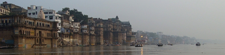
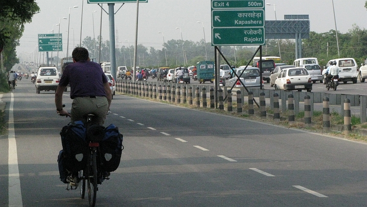
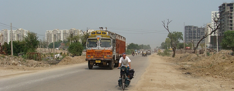
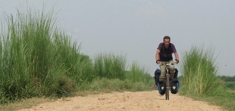
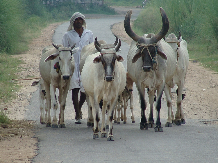
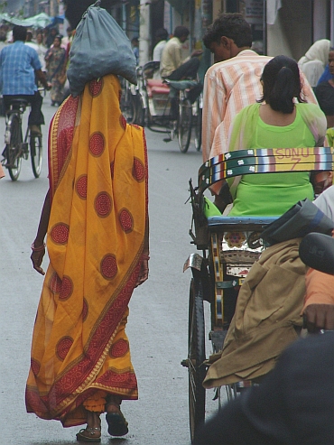 After one day we have our first rest day. We still have to sleep because we have
had a very short night yesterday. The days are short and Alwar looks interesting
enough to spend a day.
After one day we have our first rest day. We still have to sleep because we have
had a very short night yesterday. The days are short and Alwar looks interesting
enough to spend a day.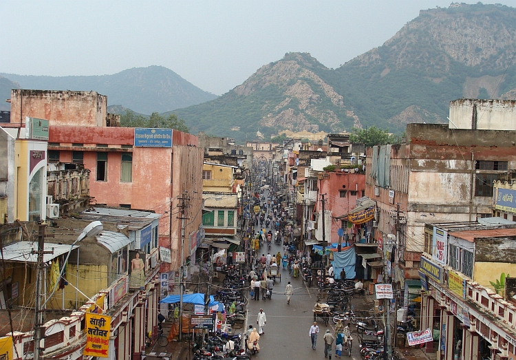
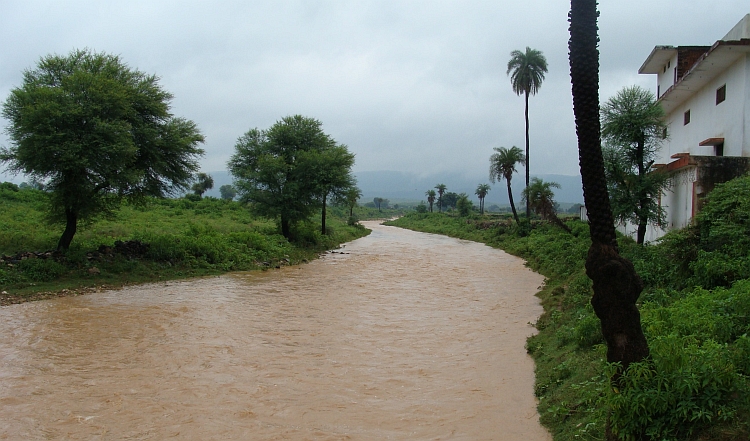
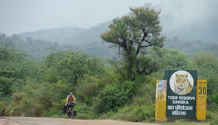
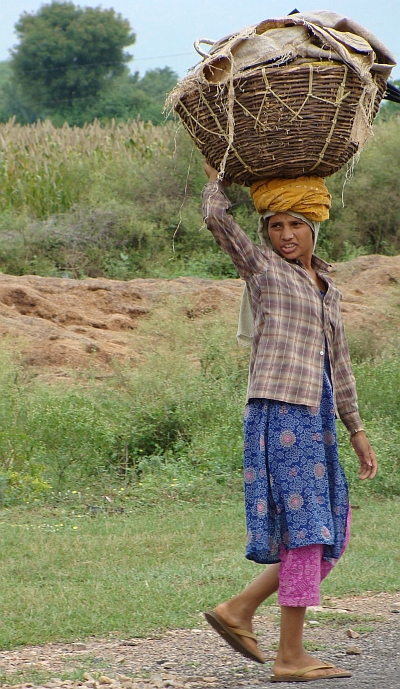 We are lunching a few kilometre before Sariska. We order a few dry samosas. Or at least: they look
like samosas. But what is the teastall owner doing? He crumbles the samosas in his hand
and throws the pieces in a yellow sauce with lots of red streaks. Chilli. The sauce is burning spicy.
It is still good to eat though. But it takes some time before I am able to cycle
without feeling completely spiced up.
We are lunching a few kilometre before Sariska. We order a few dry samosas. Or at least: they look
like samosas. But what is the teastall owner doing? He crumbles the samosas in his hand
and throws the pieces in a yellow sauce with lots of red streaks. Chilli. The sauce is burning spicy.
It is still good to eat though. But it takes some time before I am able to cycle
without feeling completely spiced up.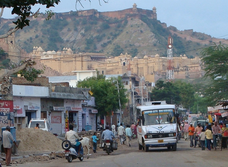
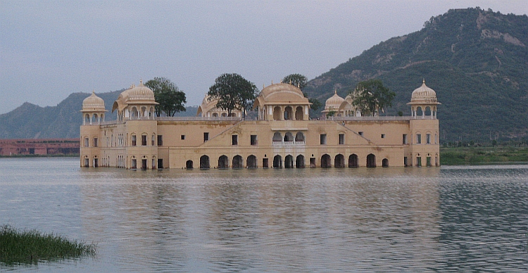
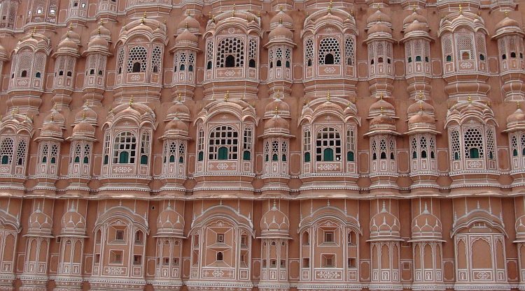
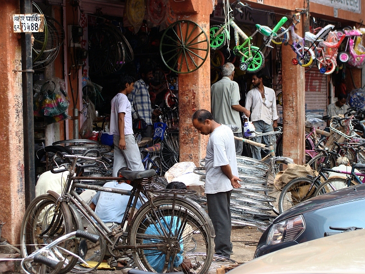
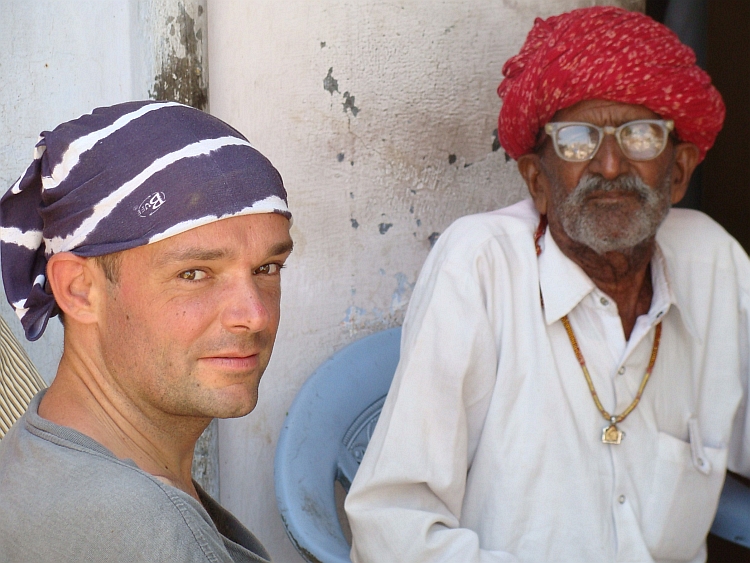
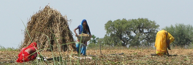
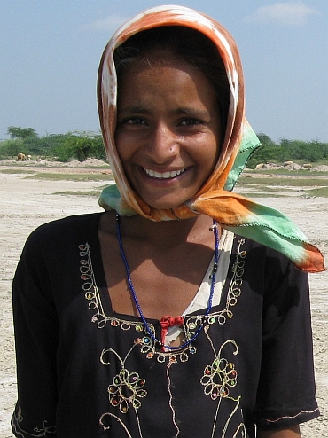
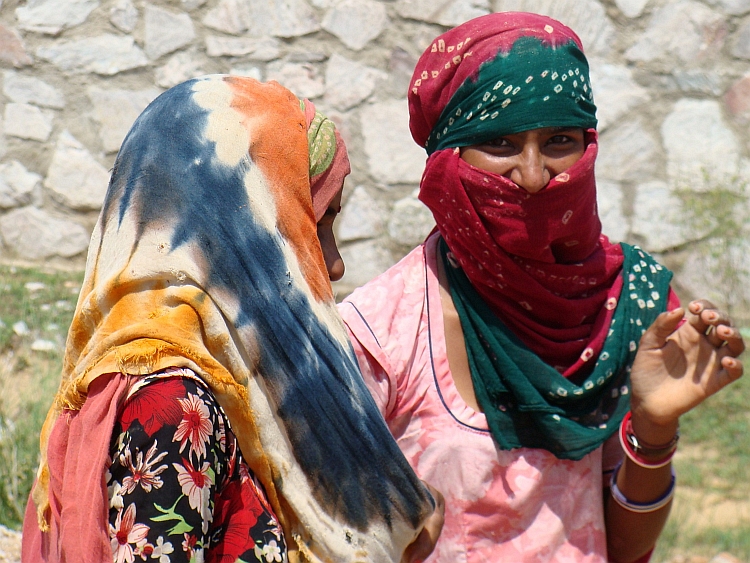
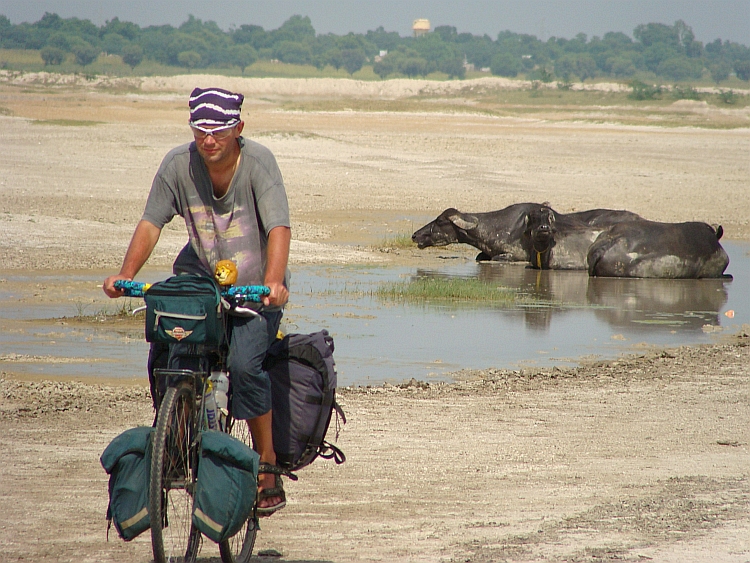 In the atmospheric city of Pushkar we meet Ysmine again. We stay in Hotel Pink
Floyd, a nice gimmick. We have heard the bad news that Rick Wright has died a few
days ago, so we stay in the 'Atom Heart Mother' Room, the album which is most in
the vein of Rick. And it is a nice album whatsoever. But Pushkar has got lots more
to offer in the musical realms. In a square right before our hotel a group of people
are making music to the memory of an old lady who died exactly twenty years ago,
obviously a family member of some of the people. The people who are playing and
singing are really crafted musicians. There is a trancelike beat which slowly develops
in a more and more powerful way with ever more details. The intensity is further
enhanced by the powerful vocals of the two main singers. The power of the music is
that the complex structure of the rhythms and melodies is made accessible by
the steady rhythm and by the repeating 'yells' which are modulating all the time
to build up meaning and intensity. So this music is at the same time accessible and complex.
A hundred people are sitting down to listen. We too are asked to sit down and listen.
When we leave, my head feels empty and I feel upligted by a euphoric, catharsic energy. A
once in a lifetime experience.
In the atmospheric city of Pushkar we meet Ysmine again. We stay in Hotel Pink
Floyd, a nice gimmick. We have heard the bad news that Rick Wright has died a few
days ago, so we stay in the 'Atom Heart Mother' Room, the album which is most in
the vein of Rick. And it is a nice album whatsoever. But Pushkar has got lots more
to offer in the musical realms. In a square right before our hotel a group of people
are making music to the memory of an old lady who died exactly twenty years ago,
obviously a family member of some of the people. The people who are playing and
singing are really crafted musicians. There is a trancelike beat which slowly develops
in a more and more powerful way with ever more details. The intensity is further
enhanced by the powerful vocals of the two main singers. The power of the music is
that the complex structure of the rhythms and melodies is made accessible by
the steady rhythm and by the repeating 'yells' which are modulating all the time
to build up meaning and intensity. So this music is at the same time accessible and complex.
A hundred people are sitting down to listen. We too are asked to sit down and listen.
When we leave, my head feels empty and I feel upligted by a euphoric, catharsic energy. A
once in a lifetime experience.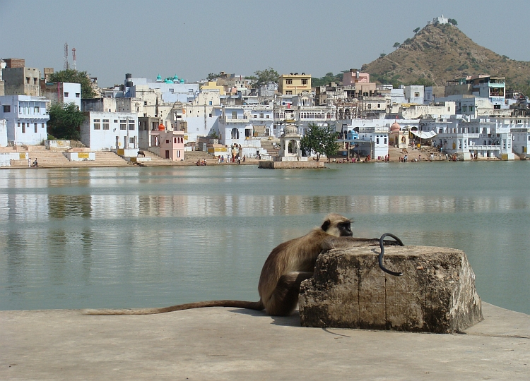

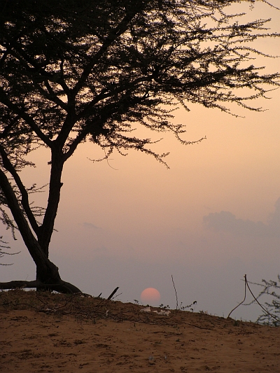 If you want to make love with a woman, are you tense then?
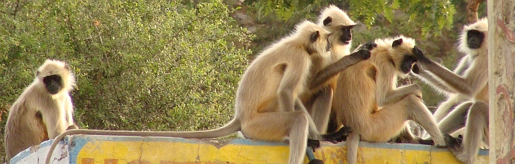
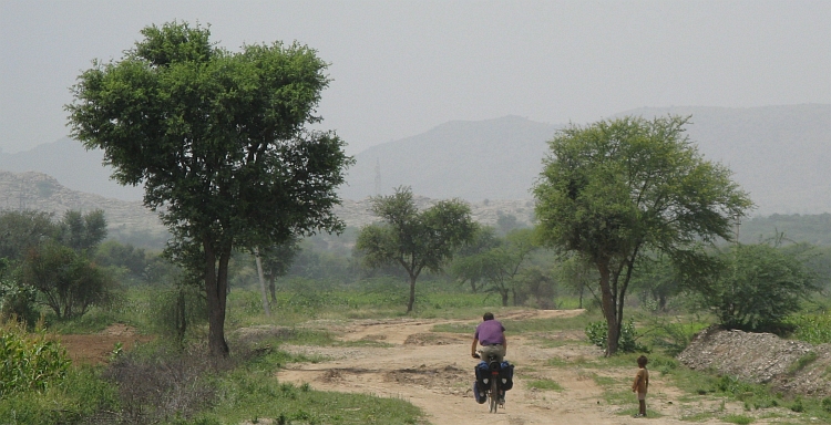

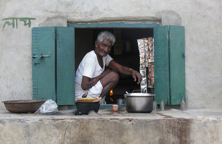 As we sit down, a thin man with a huge snake comes to us. He walks to me:
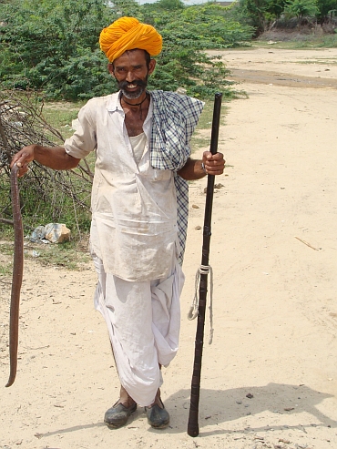
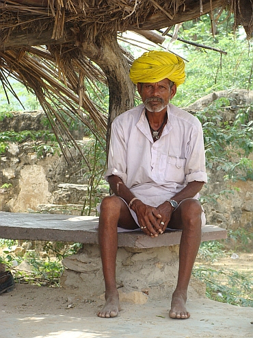
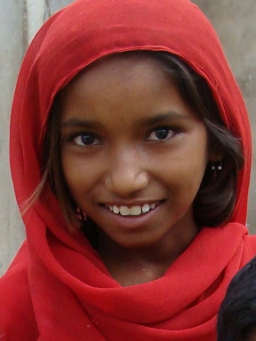
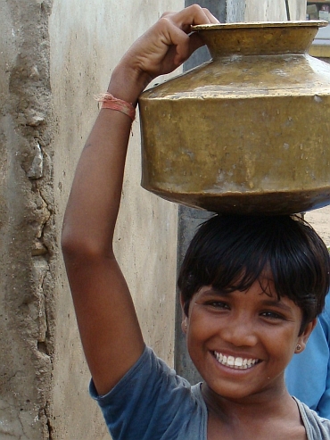
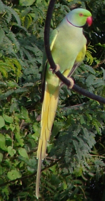 I have had a terrible diarrhea this night. Most of the time I had to sit on my ankles
above the gap in the floor that is the toilet. The afwul smell in the toilet did not make
me feel better, but there was nowhere else that I can go to. It was terribly hot also,
there is not a fan in the toilet. So now it is morning, I am glad that we can leave, although I
do not know if I am actually strong enough to cycle. Luckily it is an easy, flat day over
comfortable pavement and at the end of the day we will have the luxury of a tourist
hotel in Jodhpur.
I have had a terrible diarrhea this night. Most of the time I had to sit on my ankles
above the gap in the floor that is the toilet. The afwul smell in the toilet did not make
me feel better, but there was nowhere else that I can go to. It was terribly hot also,
there is not a fan in the toilet. So now it is morning, I am glad that we can leave, although I
do not know if I am actually strong enough to cycle. Luckily it is an easy, flat day over
comfortable pavement and at the end of the day we will have the luxury of a tourist
hotel in Jodhpur.
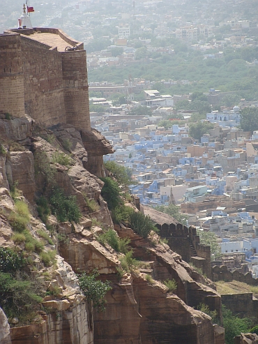 In the twillight we walk with Jasmine up the hill to the palace. Jasmine is a professional
photographer; she has very interesting travel pictures on www.jadejade.be. It is nice to
see a professional photographer at work. It gives me an opportunity to see how she
organizes the processes to make pictures of local people and how she asks people
before her camera. After the sunrise we return to our hotel to have breakfast. A
few hours later we go back to the palace to come and look inside. It takes us hours to see
the whole gigantic palace. This is surely one of the most extraordinary buildings on
the planet. There are hundreds of rooms, full of Raj splendour. The building itself is
full of intricate details and the views over the blue city are breath-taking. The palace
lies majestically perched on a high cliff above the blue-painted houses of Jodhpur.
It is easy to forget the rudimentary taxes that must have been needed to build a structure
of this scale.
In the twillight we walk with Jasmine up the hill to the palace. Jasmine is a professional
photographer; she has very interesting travel pictures on www.jadejade.be. It is nice to
see a professional photographer at work. It gives me an opportunity to see how she
organizes the processes to make pictures of local people and how she asks people
before her camera. After the sunrise we return to our hotel to have breakfast. A
few hours later we go back to the palace to come and look inside. It takes us hours to see
the whole gigantic palace. This is surely one of the most extraordinary buildings on
the planet. There are hundreds of rooms, full of Raj splendour. The building itself is
full of intricate details and the views over the blue city are breath-taking. The palace
lies majestically perched on a high cliff above the blue-painted houses of Jodhpur.
It is easy to forget the rudimentary taxes that must have been needed to build a structure
of this scale.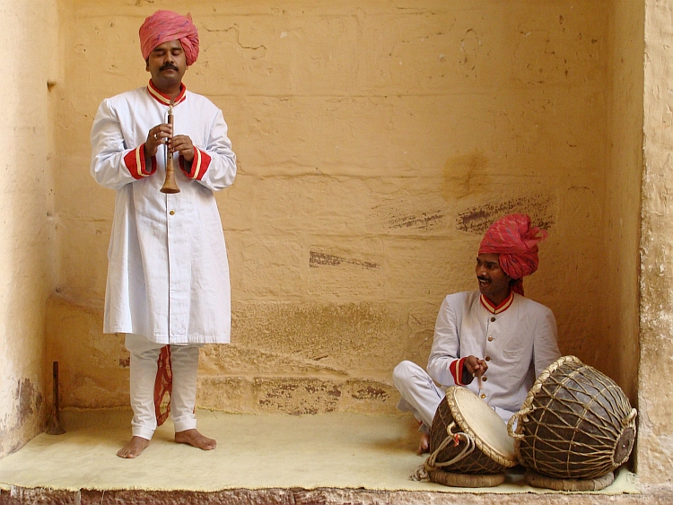
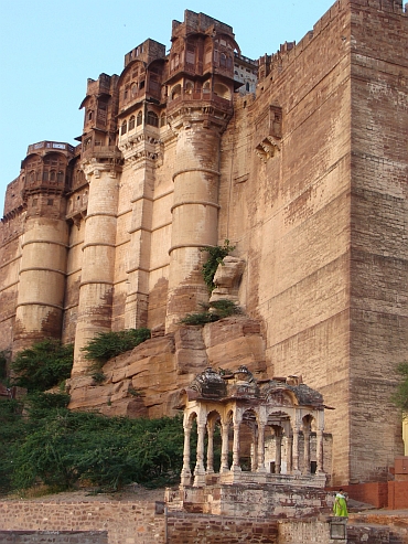
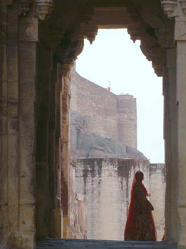
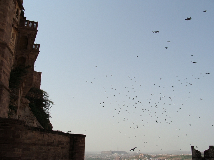
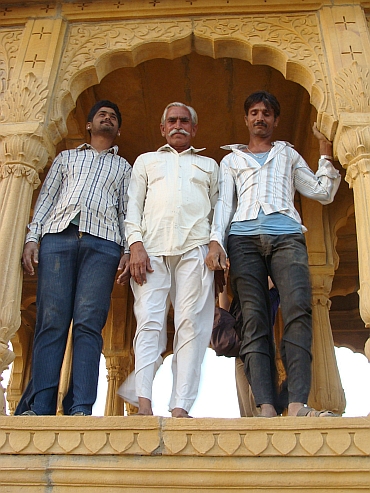 Today and tomorrow will again be rest days. We want to visit Jaisalmer in the thar Desert,
close to the border with Pakistan. Cycling from Jodhpur to Jaisalmer does not seem to
be too interesting. Three hundred kilometre flat area divides Jodhpur from the desert city
of Jaisalmer. Jasmine, Willem and I take a taxi to Jaisalmer, so that we are able to
visit the Jain temples of Osiyan. The temple complex is another extraordinary place in Rajasthan.
It is not the vast volume that impresses but the overload of fine details. There are small
sculptures everywhere, often these are erotic images. We are the only tourists during the two hours
that we spend on the complex. Then we continue to Jaisalmer, a long and boring ride.
But Jaisalmer itself looks very interesting. The old city lies on a hilltop is completely
surrounded by the walls of a citadel. This looks like an Arabic city of the Middle Ages.
We meet Akbar, a nice young man who lived for ten years in Australia and New Zealand and
is having holidays in his birthplace now. He offers us to guide us around tomorrow. Nice
things tomorrow!
Today and tomorrow will again be rest days. We want to visit Jaisalmer in the thar Desert,
close to the border with Pakistan. Cycling from Jodhpur to Jaisalmer does not seem to
be too interesting. Three hundred kilometre flat area divides Jodhpur from the desert city
of Jaisalmer. Jasmine, Willem and I take a taxi to Jaisalmer, so that we are able to
visit the Jain temples of Osiyan. The temple complex is another extraordinary place in Rajasthan.
It is not the vast volume that impresses but the overload of fine details. There are small
sculptures everywhere, often these are erotic images. We are the only tourists during the two hours
that we spend on the complex. Then we continue to Jaisalmer, a long and boring ride.
But Jaisalmer itself looks very interesting. The old city lies on a hilltop is completely
surrounded by the walls of a citadel. This looks like an Arabic city of the Middle Ages.
We meet Akbar, a nice young man who lived for ten years in Australia and New Zealand and
is having holidays in his birthplace now. He offers us to guide us around tomorrow. Nice
things tomorrow!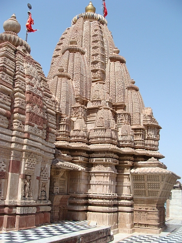
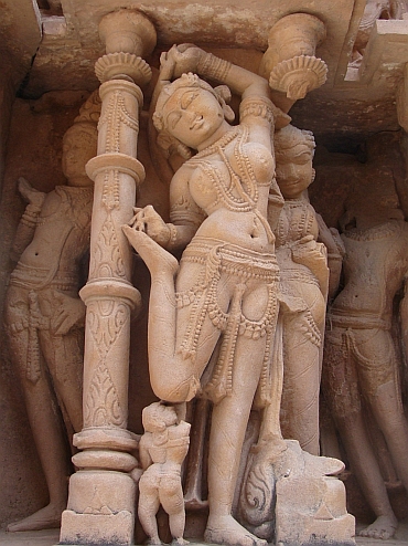
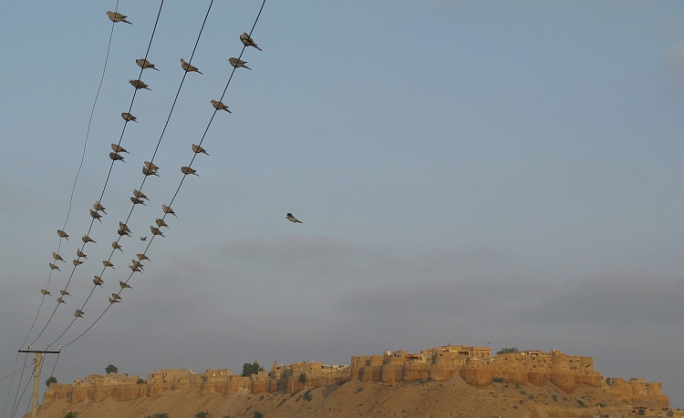
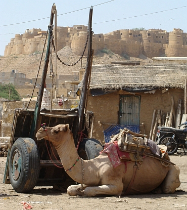 So today we have a sightseeing tour in yet another big palace. But I find out that I have
seen a bit too much splendour the last days so I am passing all the rooms with Raj
extravagance to enjoy the views over the golden coloured city. Akbar proves to be
very nice company. After the visit of the palace we are walking through the alleys
of the old city, along the Jain temples and over the city walls and down to the
new city. We find a good tea house where we have a simple but very tasteful lunch.
The kind of place that only locals know, where we eat the things that most tourists
never find the opportunity to eat.
So today we have a sightseeing tour in yet another big palace. But I find out that I have
seen a bit too much splendour the last days so I am passing all the rooms with Raj
extravagance to enjoy the views over the golden coloured city. Akbar proves to be
very nice company. After the visit of the palace we are walking through the alleys
of the old city, along the Jain temples and over the city walls and down to the
new city. We find a good tea house where we have a simple but very tasteful lunch.
The kind of place that only locals know, where we eat the things that most tourists
never find the opportunity to eat.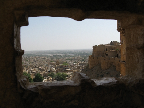
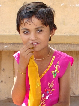
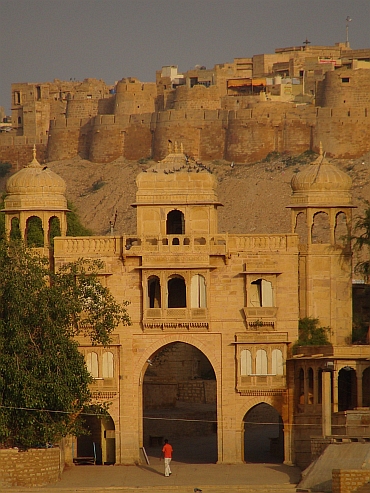
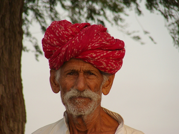
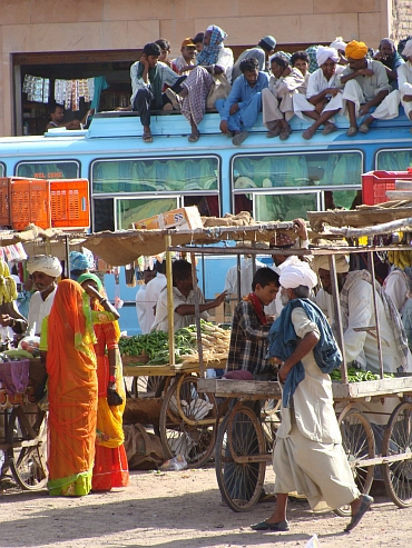
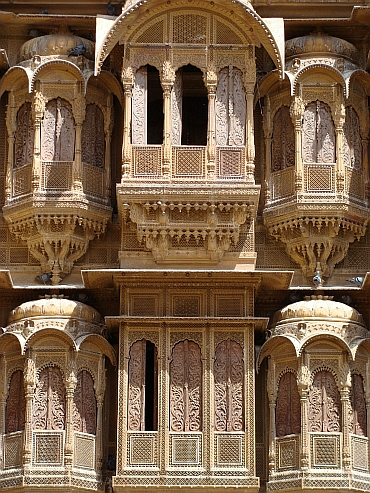
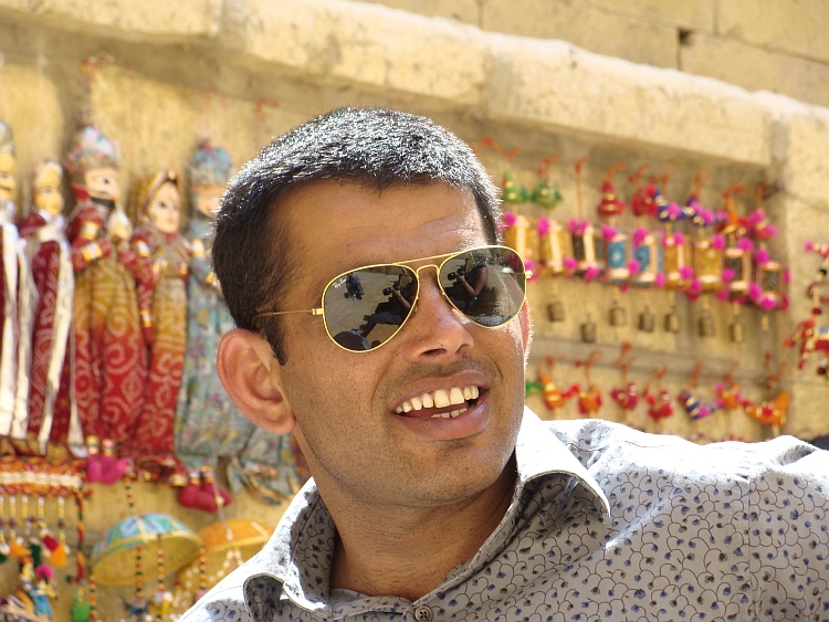
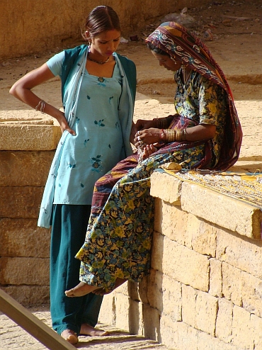
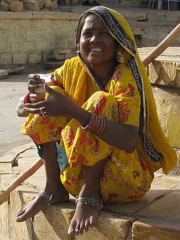
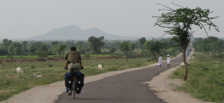
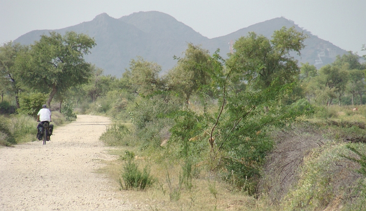
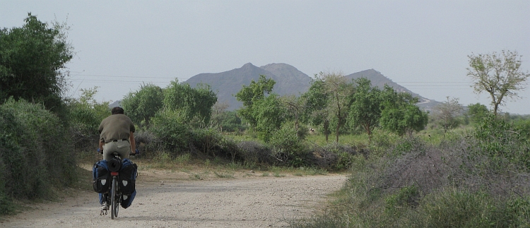
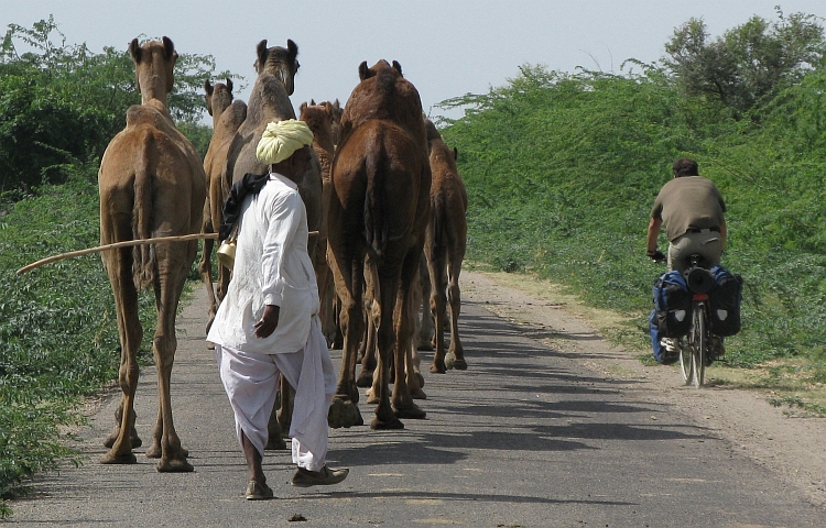
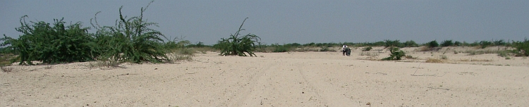
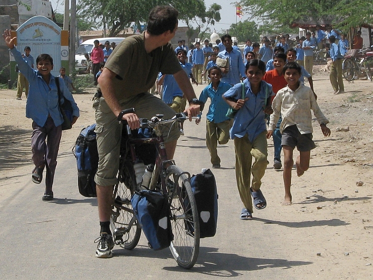
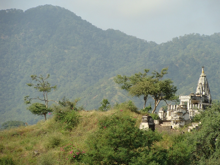
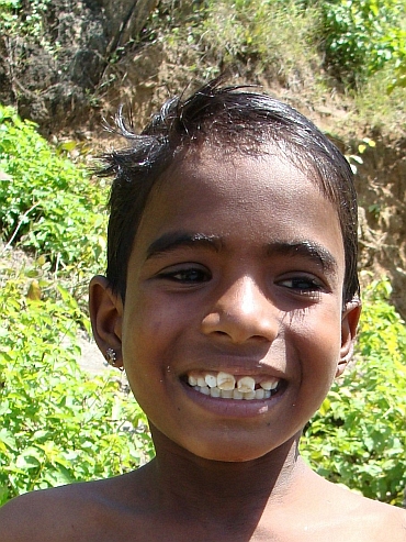 First we have to climb to a pass over the first of the hill ranges. It feels good to climb, this is the first time
in the holidays that we are really climbing. Unfortunately Willem feels ill on this day.
But all in all we get on well. When we reach the pass, we find out that there is not
a descent on the other side, followed by a new ascent. There is a kind of flat area on
900 meter elevation. There are hills and valleys to the left and the right but the
road winds at more or less the same elevation. At times we have good views to the left,
at other times to the right and sometimes to both sides. This is a strange place.
the hills are all green as grass and the people are a little different from elsewhere in India.
It feels more like Africa than India.
First we have to climb to a pass over the first of the hill ranges. It feels good to climb, this is the first time
in the holidays that we are really climbing. Unfortunately Willem feels ill on this day.
But all in all we get on well. When we reach the pass, we find out that there is not
a descent on the other side, followed by a new ascent. There is a kind of flat area on
900 meter elevation. There are hills and valleys to the left and the right but the
road winds at more or less the same elevation. At times we have good views to the left,
at other times to the right and sometimes to both sides. This is a strange place.
the hills are all green as grass and the people are a little different from elsewhere in India.
It feels more like Africa than India.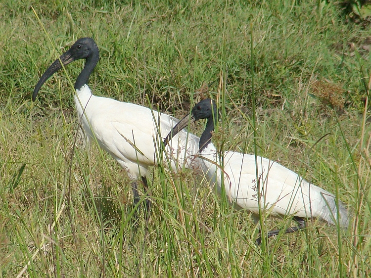
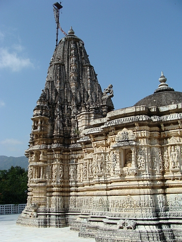
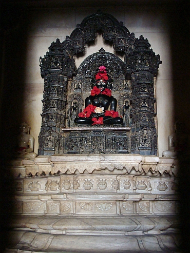
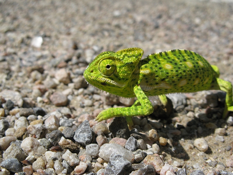
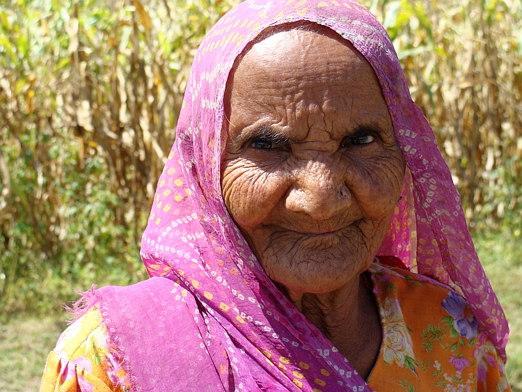
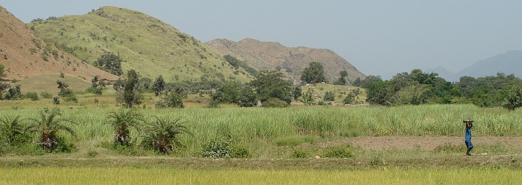
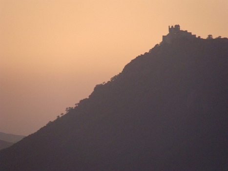 After a few hours the road goes down finally. A new highway is being built here
and on the highway we go down to Udaipur. There is not much traffic now because
the road is still under construction. And maybe there is not a highway needed here.
The only city in the surroundings is Udaipur. To our surprise the highway is passing
by without a possibility to get off for Udaipur. There is no traffic at all right
now. We find an obscure track that finally leads to bigger roads and finally we
reach the firy-tale city of Udaipur, the palace capital of India. The Lake Pichola
has got two extraordinary floating palaces and is partly surrounded by a sheer wall
of palaces. Tomorrow we will do the sightseeing. Now it is time to have a good drink
to the end of our Rajasthan experiences. Tomorrow we will start the journey to Varanasi,
1.500 kilometre to the east. We will not cycle these flat kilometres, which will
take us two weeks at least. We will go to Varanasi by train and bus and from there
we will cycle to Nepal. It was nice to be in the hills today, now we like to see mountains...
After a few hours the road goes down finally. A new highway is being built here
and on the highway we go down to Udaipur. There is not much traffic now because
the road is still under construction. And maybe there is not a highway needed here.
The only city in the surroundings is Udaipur. To our surprise the highway is passing
by without a possibility to get off for Udaipur. There is no traffic at all right
now. We find an obscure track that finally leads to bigger roads and finally we
reach the firy-tale city of Udaipur, the palace capital of India. The Lake Pichola
has got two extraordinary floating palaces and is partly surrounded by a sheer wall
of palaces. Tomorrow we will do the sightseeing. Now it is time to have a good drink
to the end of our Rajasthan experiences. Tomorrow we will start the journey to Varanasi,
1.500 kilometre to the east. We will not cycle these flat kilometres, which will
take us two weeks at least. We will go to Varanasi by train and bus and from there
we will cycle to Nepal. It was nice to be in the hills today, now we like to see mountains...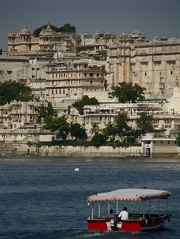
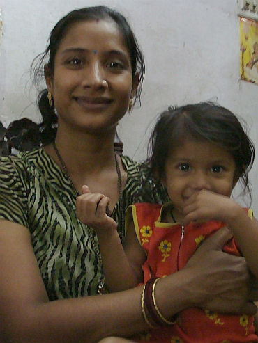
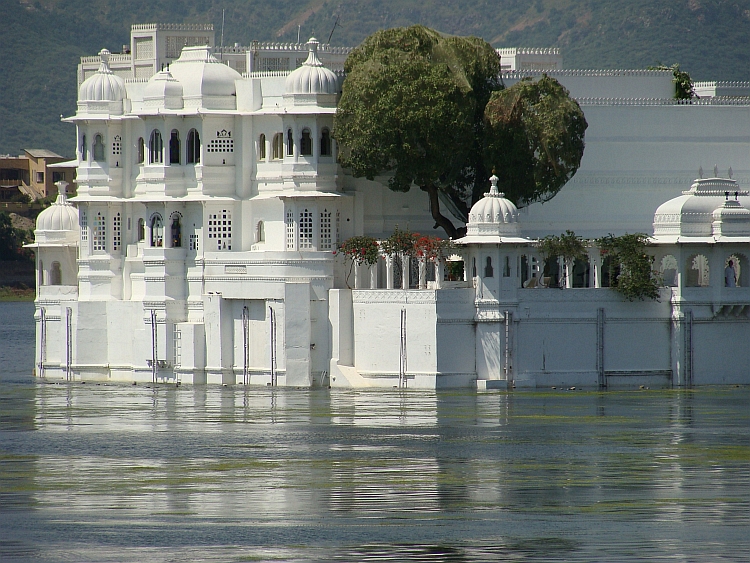
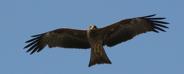
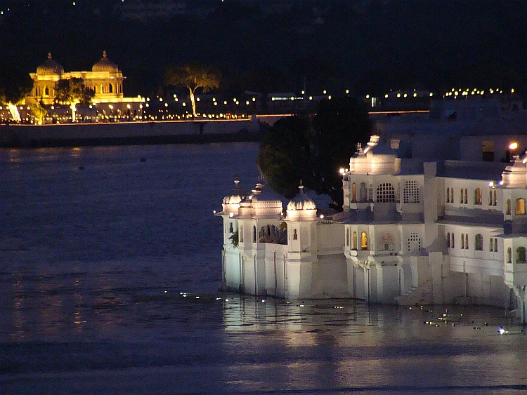
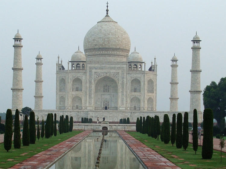
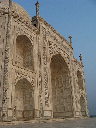
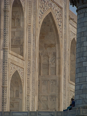
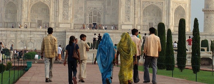
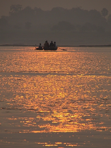
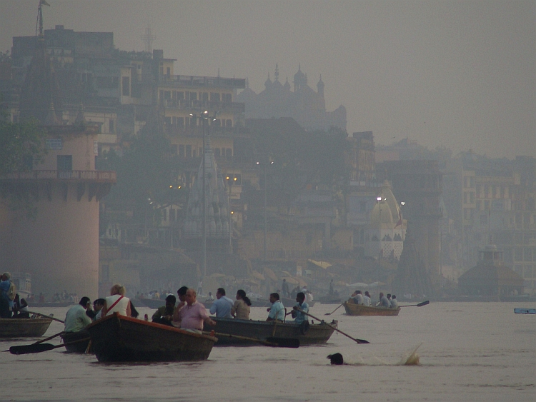
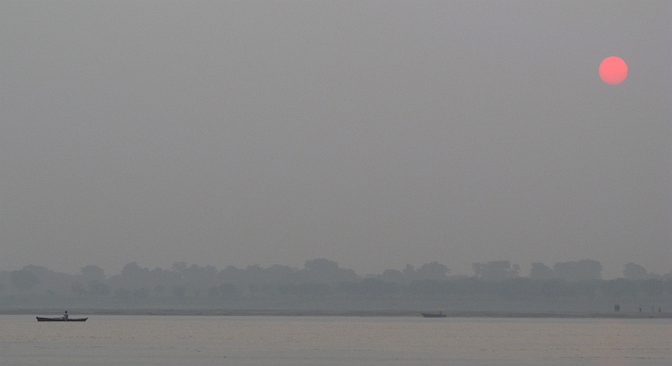
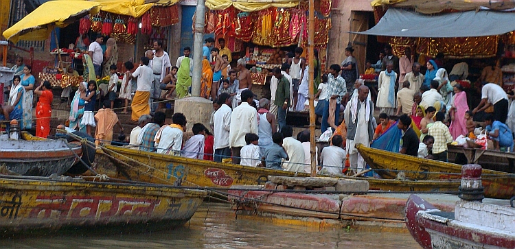
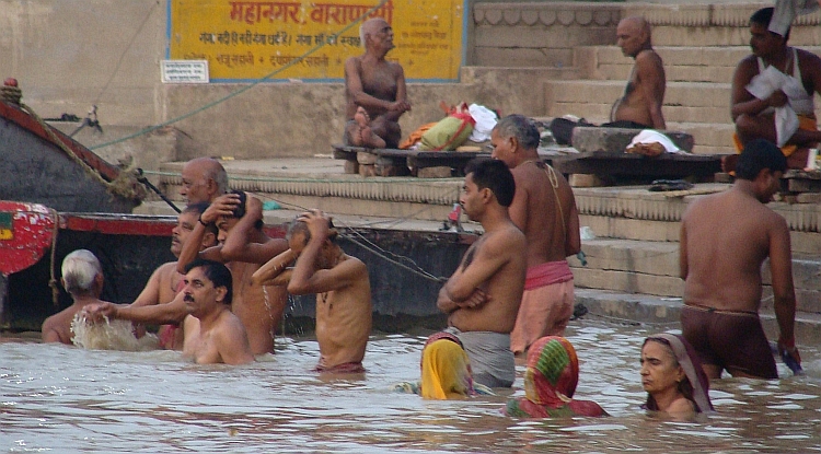
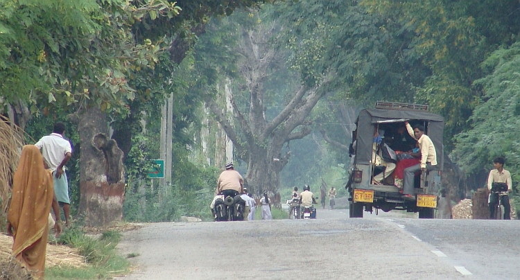
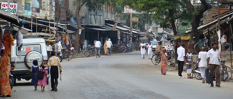
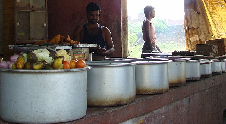
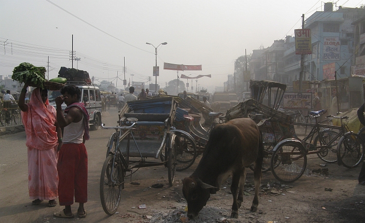
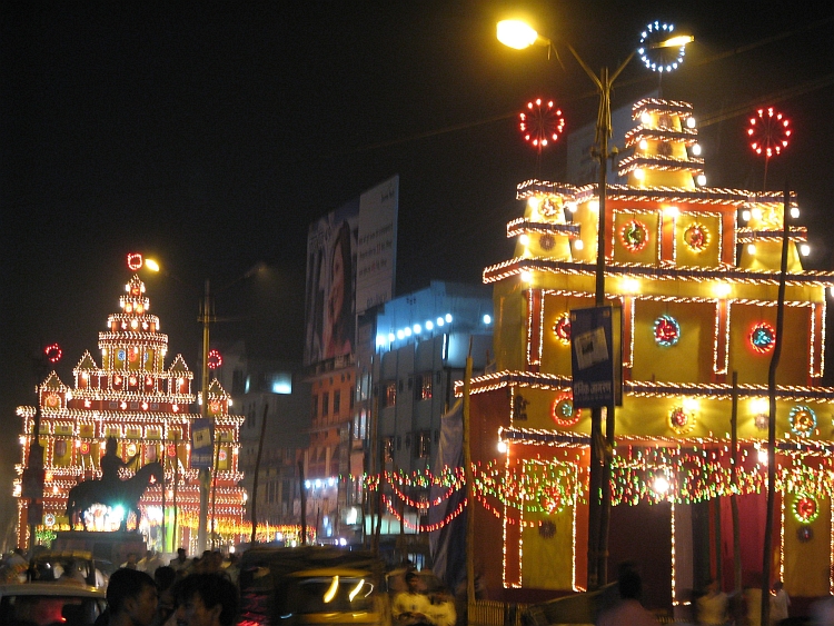
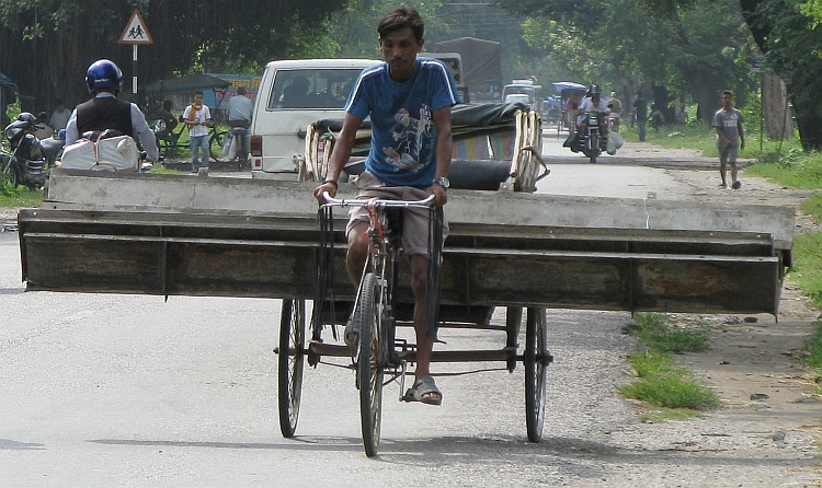
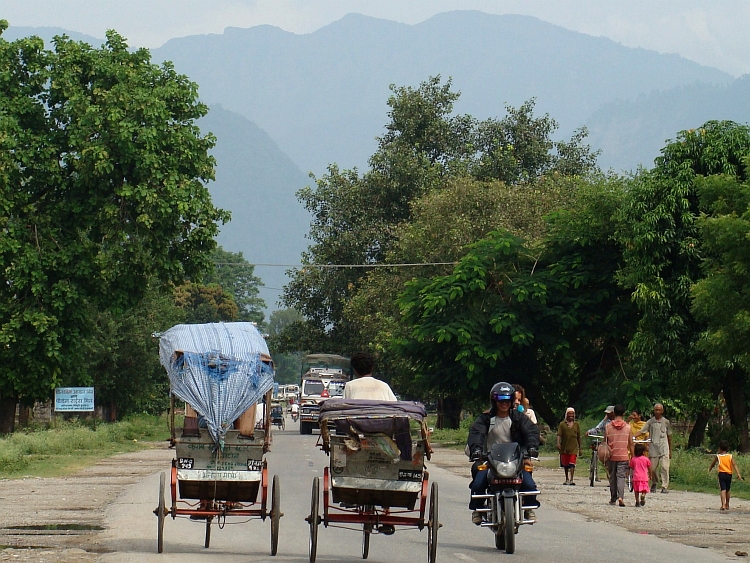
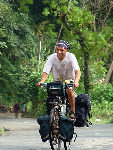 When we ride out of Butwal the road starts climbing. One minute later we are completely
surrounded by a steep mountain landscape. The valley is dark, green and narrow. Because
of the ever darkening monsoonal clouds there is a strange atmosphere in the valley. We want to
climb to Tansen, a small mediaevil town on the first hill range. That is a long way up.
And it will be a wet day up as it finally starts raining. Raining? The sky is cracking open.
The valley is shaking with the rumble of thunder and the rain comes down with drops as
big as gravel. This is a serious monsoonal shower which will not be over soon. We wait
untill the first storm is over. Then we continue. Sometimes we look for shelter
in a teahouse and if the thunder is not too close, we continue. It takes quite
some time to climb up the hill this way but we have got the whole day.
When we ride out of Butwal the road starts climbing. One minute later we are completely
surrounded by a steep mountain landscape. The valley is dark, green and narrow. Because
of the ever darkening monsoonal clouds there is a strange atmosphere in the valley. We want to
climb to Tansen, a small mediaevil town on the first hill range. That is a long way up.
And it will be a wet day up as it finally starts raining. Raining? The sky is cracking open.
The valley is shaking with the rumble of thunder and the rain comes down with drops as
big as gravel. This is a serious monsoonal shower which will not be over soon. We wait
untill the first storm is over. Then we continue. Sometimes we look for shelter
in a teahouse and if the thunder is not too close, we continue. It takes quite
some time to climb up the hill this way but we have got the whole day.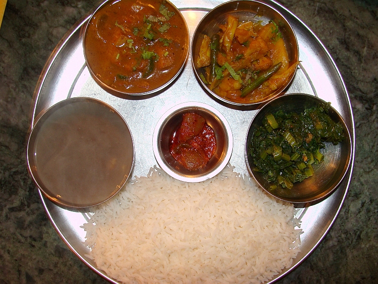
 We descend through the steep streets of Tansen, back down to the Siddharta Highway.
The Siddharta Highway is named after Siddharta Gautama, who was born in nearby Lumbini.
The man that was born as a prince gave up his title and luxuries and became known
as the Buddha since he reached enlightenment in Bodh Gaya, India. The path to
enlightenment involves giving up any self-image or ego and involves the commitment
of becoming an instrument or medium for the benefit of whole mankind.Crucial in the
way is the realisation that there is actually not a self, there is only a choice for a self.
Enlightenment is reached by completely giving up the self, by loosing all ties to
worldly goods and personal ambitions. Loosing all ties to these personal aims is not the
same as giving them up. Giving up these personal aims can even have contraproductive
effect, for example becuase of feeling of jealousy against people who do not give up
personal erathly joys. Being enlighted is a state of continued love and happiness
and a complete freedom from the world of cause and effect, life and death and all
the dualities that we feel all the time.
We descend through the steep streets of Tansen, back down to the Siddharta Highway.
The Siddharta Highway is named after Siddharta Gautama, who was born in nearby Lumbini.
The man that was born as a prince gave up his title and luxuries and became known
as the Buddha since he reached enlightenment in Bodh Gaya, India. The path to
enlightenment involves giving up any self-image or ego and involves the commitment
of becoming an instrument or medium for the benefit of whole mankind.Crucial in the
way is the realisation that there is actually not a self, there is only a choice for a self.
Enlightenment is reached by completely giving up the self, by loosing all ties to
worldly goods and personal ambitions. Loosing all ties to these personal aims is not the
same as giving them up. Giving up these personal aims can even have contraproductive
effect, for example becuase of feeling of jealousy against people who do not give up
personal erathly joys. Being enlighted is a state of continued love and happiness
and a complete freedom from the world of cause and effect, life and death and all
the dualities that we feel all the time.
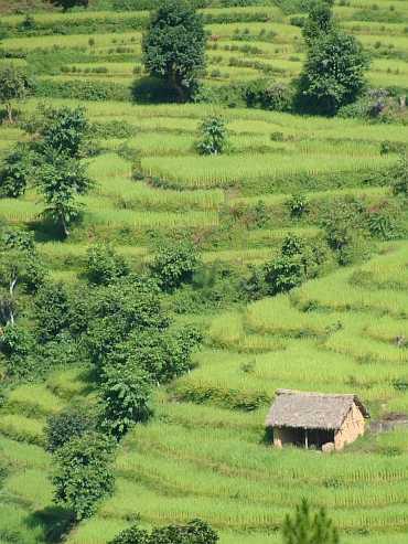
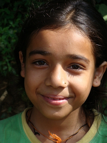
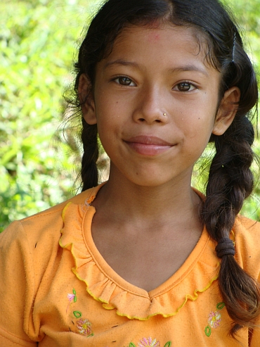

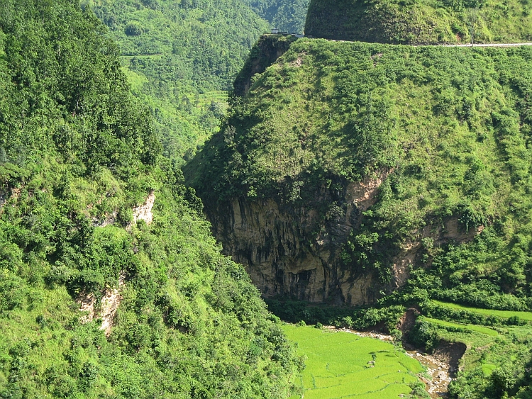
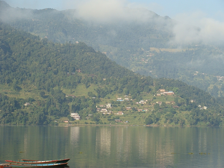
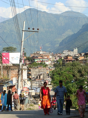
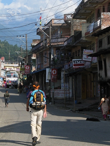
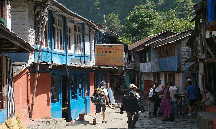
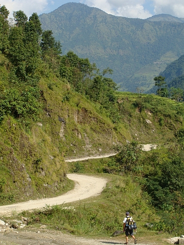 In Khudi we sit in a tea house after a cup of Nepali tea. We have views of a huge swing
which is close to us, right above the road. A construction of four bamboo sticks
in a rectangle, knotted together ten meter right above the road. Cars and even trucks
can pass down under. We see those constructions everywhere in the Pokhara region
but this is the biggest so far. This time there are no children playing but it is
an uprising of men that has been gathering at the swing. A very angry man is having a speech
and gets ever angrier during his speech. I do not understand as I do not speak
more than a few words Nepali. Still we can see that he has got an effect on a part
of the surrounding men. The atmosphere is getting agressive. I see the women take
their children and leave the place. That tells me that this is serious business now.
We pay our tea and leave the place too.
In Khudi we sit in a tea house after a cup of Nepali tea. We have views of a huge swing
which is close to us, right above the road. A construction of four bamboo sticks
in a rectangle, knotted together ten meter right above the road. Cars and even trucks
can pass down under. We see those constructions everywhere in the Pokhara region
but this is the biggest so far. This time there are no children playing but it is
an uprising of men that has been gathering at the swing. A very angry man is having a speech
and gets ever angrier during his speech. I do not understand as I do not speak
more than a few words Nepali. Still we can see that he has got an effect on a part
of the surrounding men. The atmosphere is getting agressive. I see the women take
their children and leave the place. That tells me that this is serious business now.
We pay our tea and leave the place too.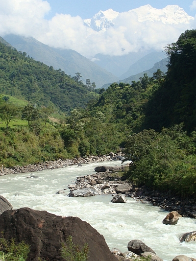 In Khudi the jeep track ends. From now on we will walk over a footpath. The next village
Bhulbhule is the entry point for the Annapurna Circuit. The paperwork is done within a minute
and we walk on. After a few minutes we can look into a side valley and we see the Himal
Chuli towering seven thousand vertical meters above our heads. The mountain is 7.893 meter high.
I have never seen a mountain this high in full view (In fact, I have seen higher mountains once but
that was from a distance of 150 kilometre). I am awestruck. I did not expect to see these
high mountains at this stage because we are on the southside, the wet side, of the mountains.
In Khudi the jeep track ends. From now on we will walk over a footpath. The next village
Bhulbhule is the entry point for the Annapurna Circuit. The paperwork is done within a minute
and we walk on. After a few minutes we can look into a side valley and we see the Himal
Chuli towering seven thousand vertical meters above our heads. The mountain is 7.893 meter high.
I have never seen a mountain this high in full view (In fact, I have seen higher mountains once but
that was from a distance of 150 kilometre). I am awestruck. I did not expect to see these
high mountains at this stage because we are on the southside, the wet side, of the mountains.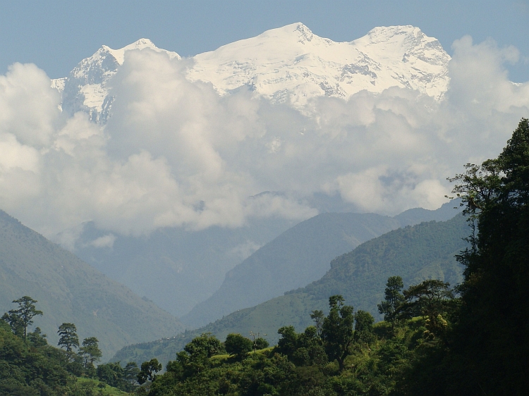
 After Ngadi the trail ascends for the first time. We are passing through lush green rice fields
and atmospheric villages with wooden houses, adobe houses and stone houses. The temperature
has risen to about thirty degrees so we are sweating a lot during the ascent. But
after a few weeks of India this is a normal experience. The climb to Bahundanda is
really nice. A lot of children are playing and the people make contact easily and freely.
Bahundanda itself is a pretty village, sitting atop a shoulder a few hundred meter above the
Marsyangdi River. There are views in both directions. We decide to stay here today;
this is a beautiful place to spend the rest of the afternoon.
After Ngadi the trail ascends for the first time. We are passing through lush green rice fields
and atmospheric villages with wooden houses, adobe houses and stone houses. The temperature
has risen to about thirty degrees so we are sweating a lot during the ascent. But
after a few weeks of India this is a normal experience. The climb to Bahundanda is
really nice. A lot of children are playing and the people make contact easily and freely.
Bahundanda itself is a pretty village, sitting atop a shoulder a few hundred meter above the
Marsyangdi River. There are views in both directions. We decide to stay here today;
this is a beautiful place to spend the rest of the afternoon.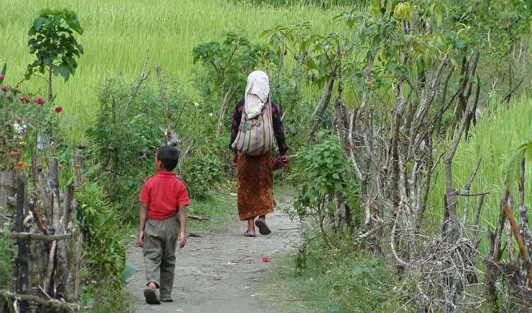
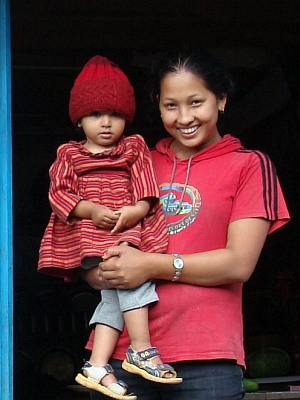 We had a good night in Bahundanda. The guesthouse is run efficiently and the personnel is very
friendly. A girl of about eighteen years old speaks english very well and is in fact leading
the lodge at her young age. But she is doing a very good job and she is doing it with a smile.
We had a good night in Bahundanda. The guesthouse is run efficiently and the personnel is very
friendly. A girl of about eighteen years old speaks english very well and is in fact leading
the lodge at her young age. But she is doing a very good job and she is doing it with a smile.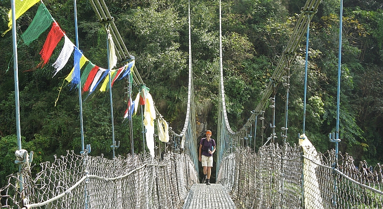
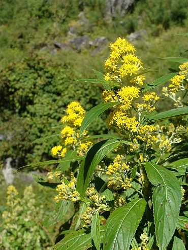 The sheer cliffs on both sides of the river give a claustrophobic feel but also
impressive sights. Huge waterfalls come down on both sides and the Marsyangdi
River itself cuts mercilessly through the rocks. A big series of avalanches accompany
the river on both sides. Sometimes our trail has to circumvent these by high detours,
sometimes a swinging bridge leads the trail to the other side of the river where
are no landslides. Just before Tal we pass the Spanish group. There are some interesting
men and women in that group. My Spanish is not too good anymore but I am still able to
have some discussions. Then we have Dan and Danny, two Americans from New York,
who seem to be experienced trekkers. They are walking the same pace as we do. It is the
meeting of people on the way which makes a trekking such a special experience.
The sheer cliffs on both sides of the river give a claustrophobic feel but also
impressive sights. Huge waterfalls come down on both sides and the Marsyangdi
River itself cuts mercilessly through the rocks. A big series of avalanches accompany
the river on both sides. Sometimes our trail has to circumvent these by high detours,
sometimes a swinging bridge leads the trail to the other side of the river where
are no landslides. Just before Tal we pass the Spanish group. There are some interesting
men and women in that group. My Spanish is not too good anymore but I am still able to
have some discussions. Then we have Dan and Danny, two Americans from New York,
who seem to be experienced trekkers. They are walking the same pace as we do. It is the
meeting of people on the way which makes a trekking such a special experience.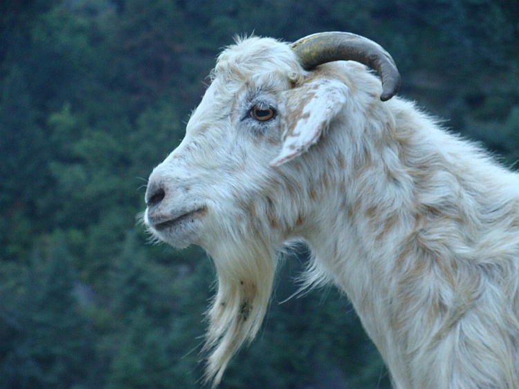
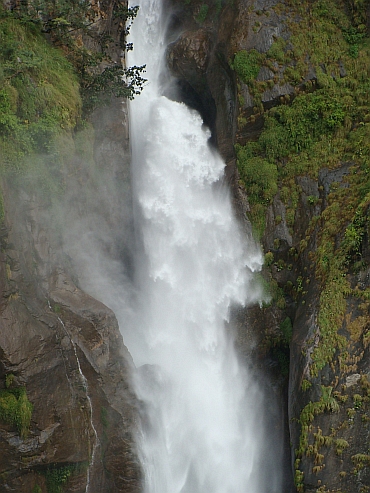
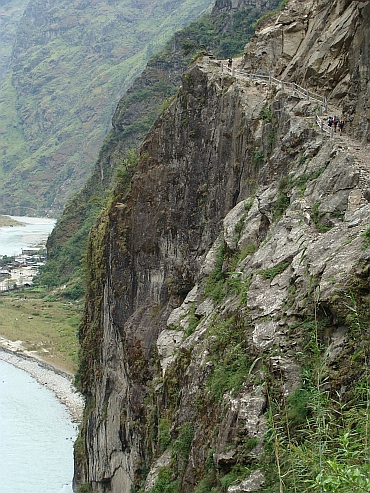
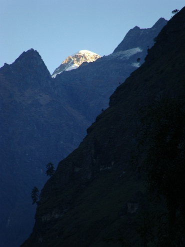
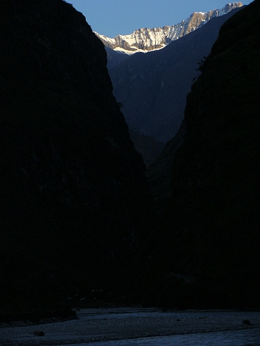
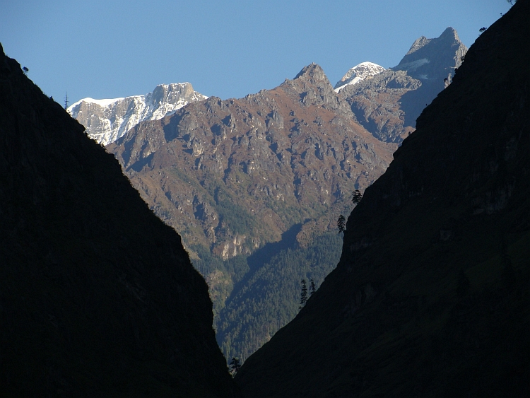
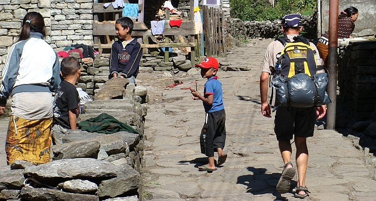
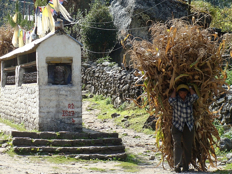
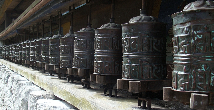
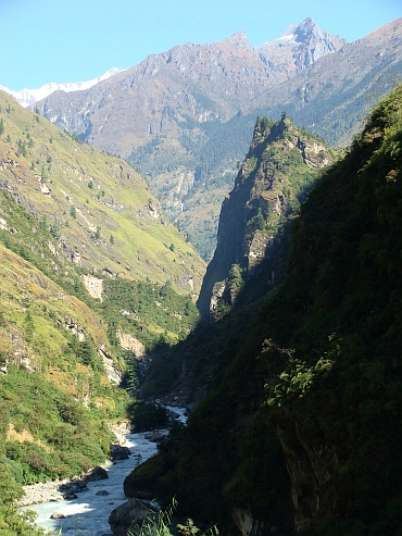
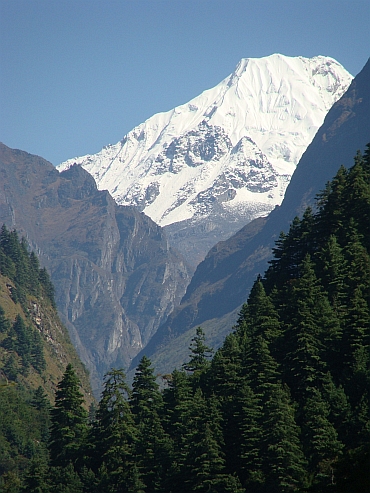
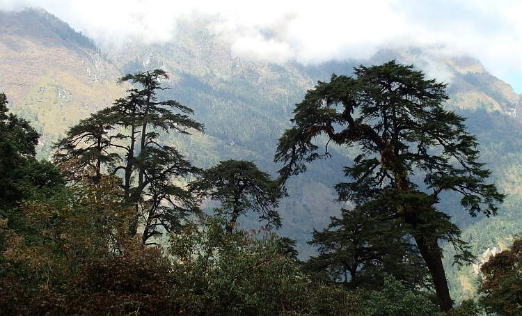
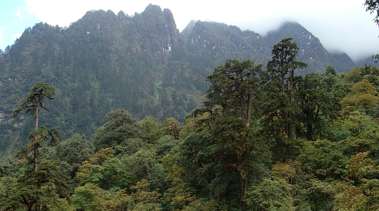
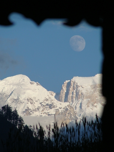
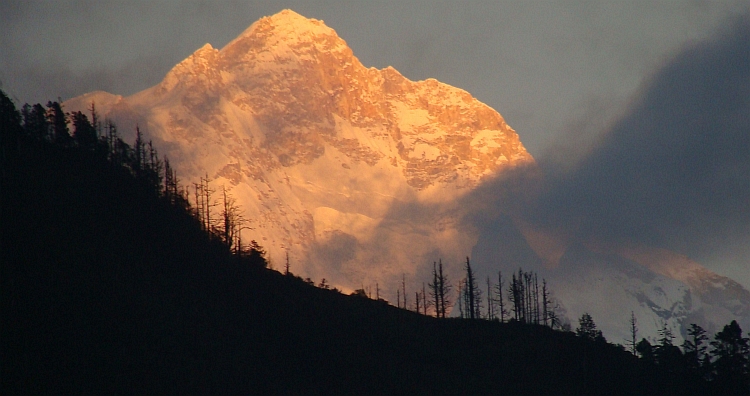
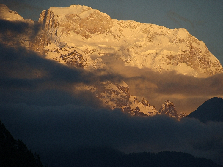
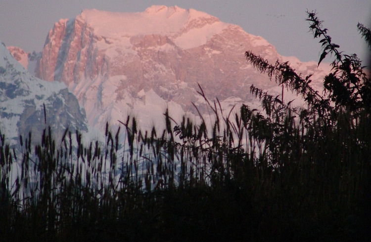
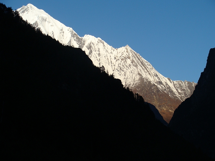
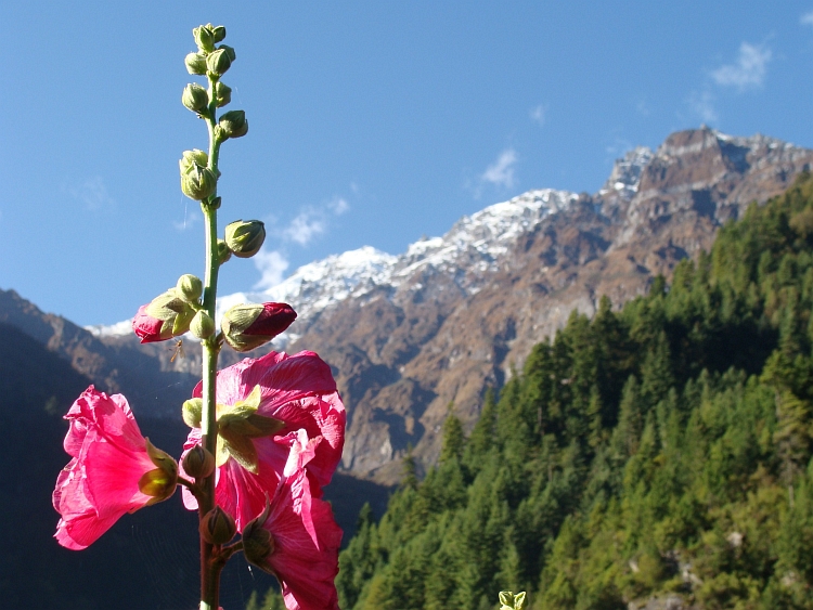
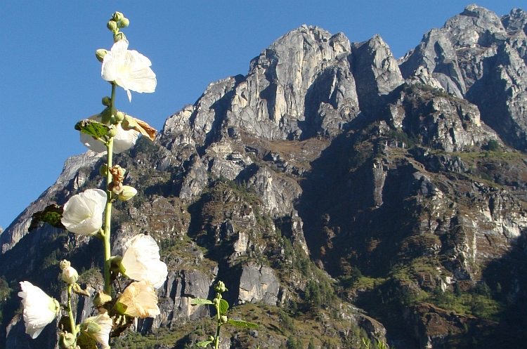
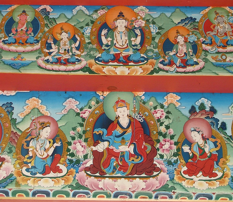
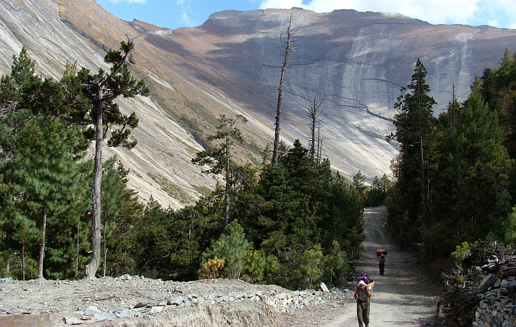
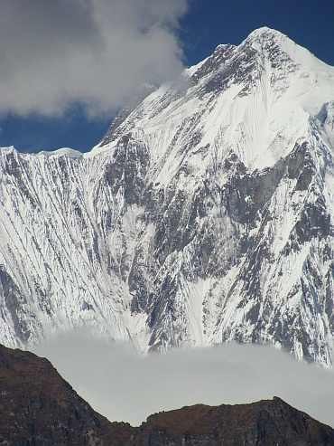 We are passing a few small idyllic lakes before we eventually reach the wide valley in which
the village of Lower pisang lies. More scenically however is Upper Pisang that lies a
hundred meter above the valley with commanding views over the Annapurna II. So that
is where we are heading to spend the night. I visit the monastery of Upper Pisang
with its beautiful murals and walk through the village. This time we do not have
an efficiently run guesthouse but we have an owner that forgets everything. It takes
one and a half hour before I get a bucket of water to wash myself it also takes one
and a half hour and ten times of asking what we have ordered before his wife comes.
We are passing a few small idyllic lakes before we eventually reach the wide valley in which
the village of Lower pisang lies. More scenically however is Upper Pisang that lies a
hundred meter above the valley with commanding views over the Annapurna II. So that
is where we are heading to spend the night. I visit the monastery of Upper Pisang
with its beautiful murals and walk through the village. This time we do not have
an efficiently run guesthouse but we have an owner that forgets everything. It takes
one and a half hour before I get a bucket of water to wash myself it also takes one
and a half hour and ten times of asking what we have ordered before his wife comes.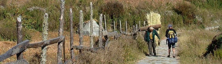

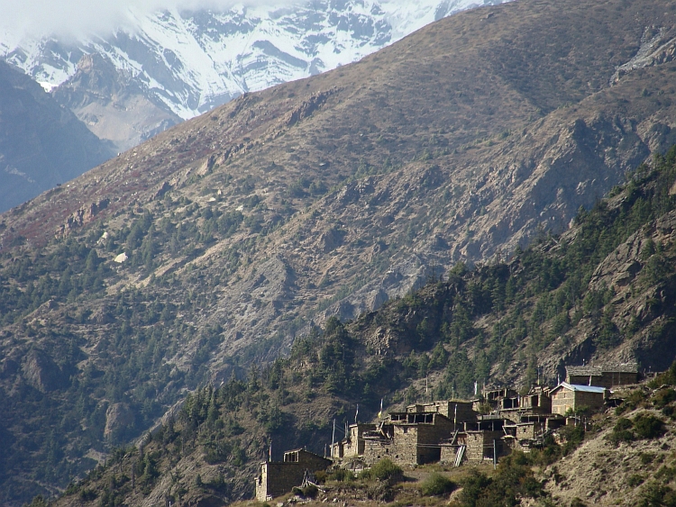
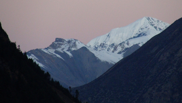
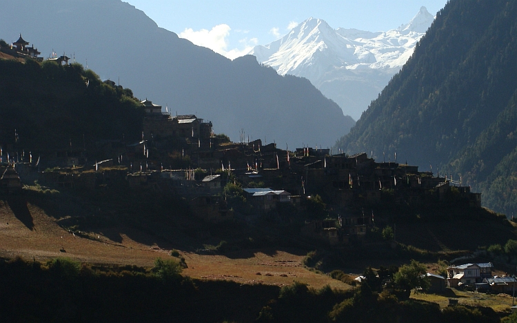
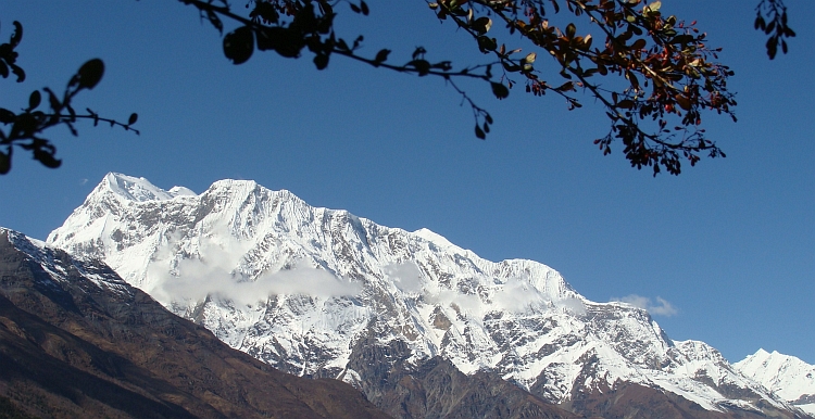
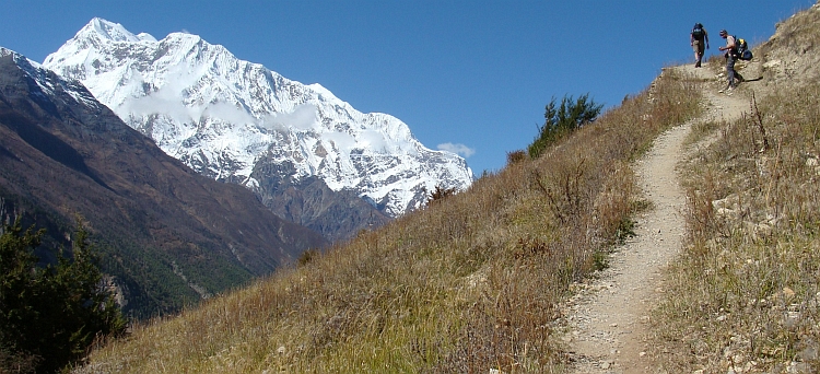
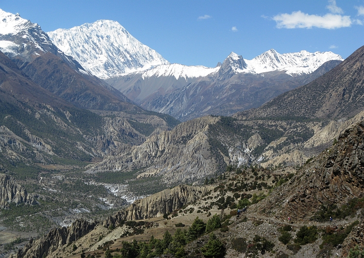
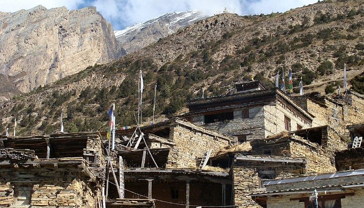
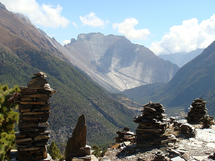
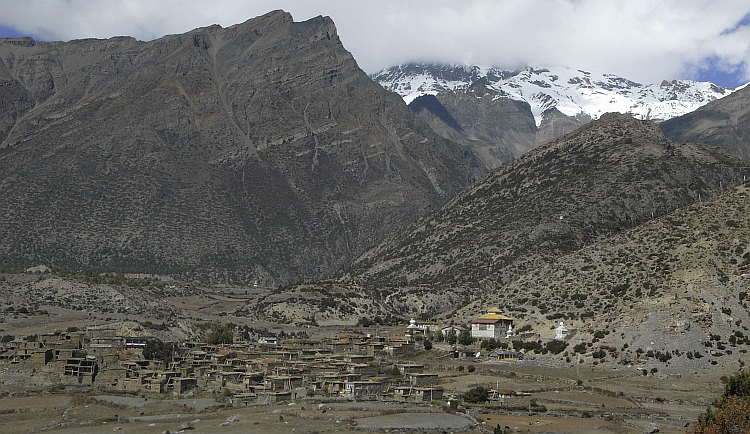
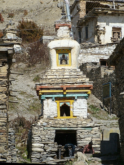 After another short break the women rush along further. I have never seen women that are
walking that fast. There also proves to be a guide, shiv, who is following and does not seem
to hurry at all. And so do I. I am feeling better now, but physically far from great.
But I am feeling happy now in the beautiful valley. The sun is throwing sidelight
in low angles into the valley and everything is bathing in an eerie, pure yellow
light. There are some lonesome trees in the valley in tender autumnal colours. In
Bhraga we see the first yaks of Nepal. In the last kilometres to Manang we pass
some strangely eroded bare sedimentary rocks. Then we climb up to Manang that lies
fifty meter above the valley. It takes us half an hour before we find a lodge. Untill
now it was not quite busy because we entered the Circuit the day after a festival day. Now
we have walked quite long distances for five days, we have caught up with the people
wgo walk this stretch in six days, like most people do. So from now on, it will not be so
quiet any more. But today we find a lodge eventually, where we meet Shiv and the ladies.
And so the day ends by playing Shithead all evening.
After another short break the women rush along further. I have never seen women that are
walking that fast. There also proves to be a guide, shiv, who is following and does not seem
to hurry at all. And so do I. I am feeling better now, but physically far from great.
But I am feeling happy now in the beautiful valley. The sun is throwing sidelight
in low angles into the valley and everything is bathing in an eerie, pure yellow
light. There are some lonesome trees in the valley in tender autumnal colours. In
Bhraga we see the first yaks of Nepal. In the last kilometres to Manang we pass
some strangely eroded bare sedimentary rocks. Then we climb up to Manang that lies
fifty meter above the valley. It takes us half an hour before we find a lodge. Untill
now it was not quite busy because we entered the Circuit the day after a festival day. Now
we have walked quite long distances for five days, we have caught up with the people
wgo walk this stretch in six days, like most people do. So from now on, it will not be so
quiet any more. But today we find a lodge eventually, where we meet Shiv and the ladies.
And so the day ends by playing Shithead all evening.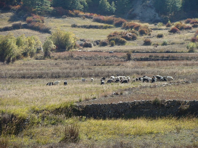
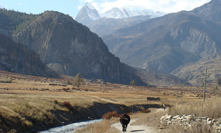
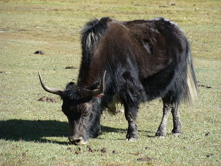
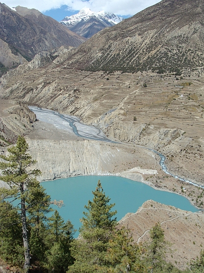 I still have not completely recovered but I am not feeling too bad either. We have to stay
another night in Manang whatsoever to be able to acclimatize. After Manang we will
climb in a few days to the pass at 5.416 meter elevation. It is always wise sleep low;
in the daytime it is good to climb up to prepare the body for having less oxygen
to keep the body processes running. That is in fact what we did yesterday by taking
the high road over Ghyaru. Today it would have been nice to walk to the much higher
Ice Lake at 4.600 meter but I am feeling not good enough and the others also do not
feel like going there. Shiv and the Ladies are already on the way to a viewpoint
nearby and that is what we also intend to do now. We pass a beautiful turquoise coloured
lake and climb above to the viewpoint. It is not so far. On the way we meet Shannon
who is already returning. Ruth and Shiv are going to another viewpoint, a little higher.
We stick to the lower viewpoint. There are good views to the Gangapurna and we can buy some
yak cheese, delicious. We hang around more than an hour before we return to Manang, where we have
a Shithead marathon half of the afternoon and the whole of the evening. The ladies have other
rules and the constant struggle about the 'proper' rules and the ongoing confusion about the exact
set of rules that is applying, is what really sets the Shithead game at a higher level
than all the other card games.
I still have not completely recovered but I am not feeling too bad either. We have to stay
another night in Manang whatsoever to be able to acclimatize. After Manang we will
climb in a few days to the pass at 5.416 meter elevation. It is always wise sleep low;
in the daytime it is good to climb up to prepare the body for having less oxygen
to keep the body processes running. That is in fact what we did yesterday by taking
the high road over Ghyaru. Today it would have been nice to walk to the much higher
Ice Lake at 4.600 meter but I am feeling not good enough and the others also do not
feel like going there. Shiv and the Ladies are already on the way to a viewpoint
nearby and that is what we also intend to do now. We pass a beautiful turquoise coloured
lake and climb above to the viewpoint. It is not so far. On the way we meet Shannon
who is already returning. Ruth and Shiv are going to another viewpoint, a little higher.
We stick to the lower viewpoint. There are good views to the Gangapurna and we can buy some
yak cheese, delicious. We hang around more than an hour before we return to Manang, where we have
a Shithead marathon half of the afternoon and the whole of the evening. The ladies have other
rules and the constant struggle about the 'proper' rules and the ongoing confusion about the exact
set of rules that is applying, is what really sets the Shithead game at a higher level
than all the other card games.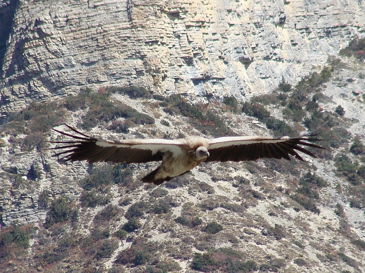
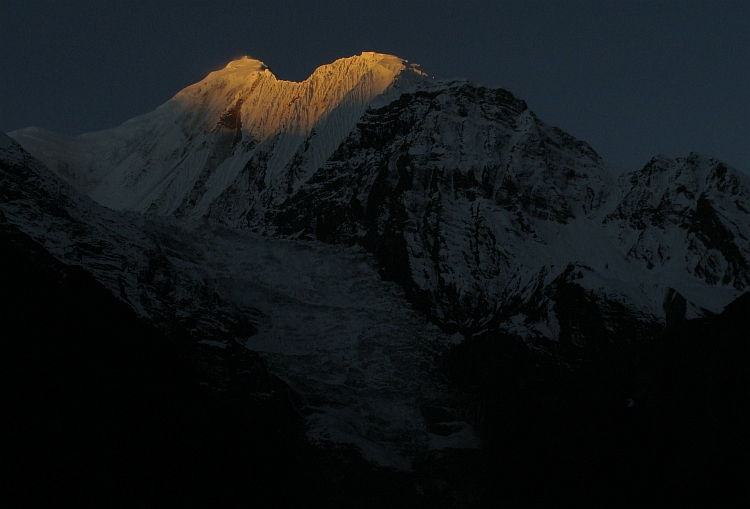
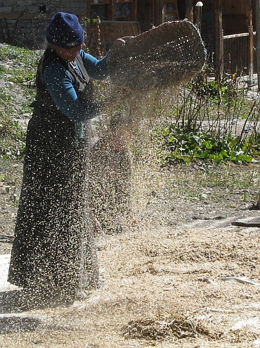
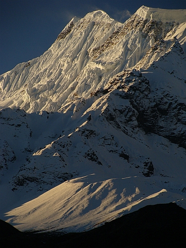
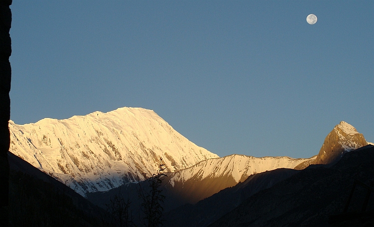
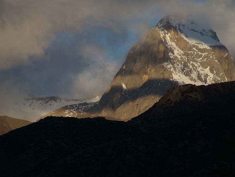
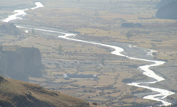
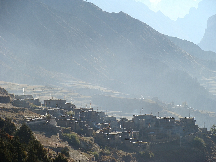
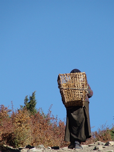
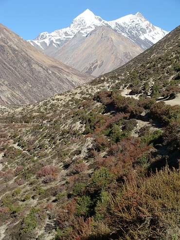
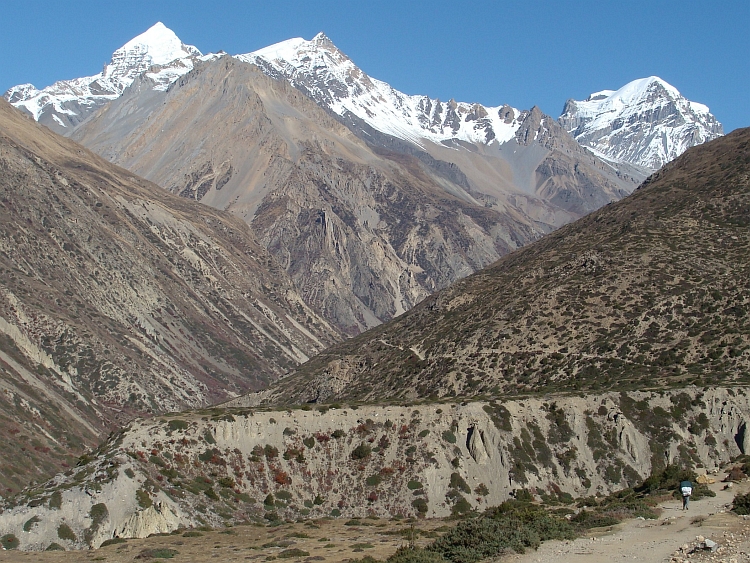
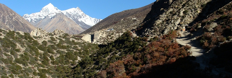
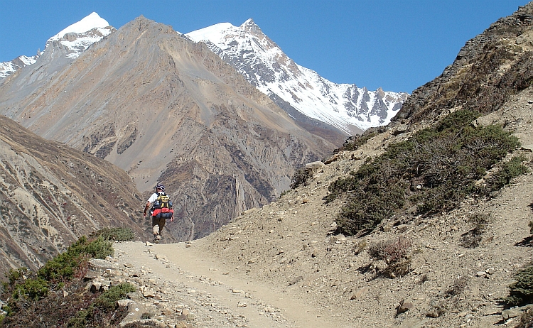
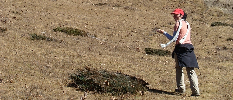
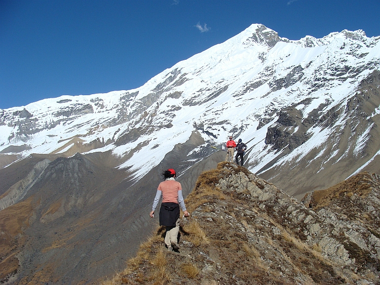
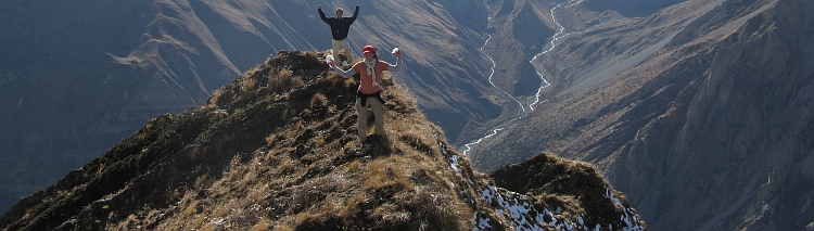
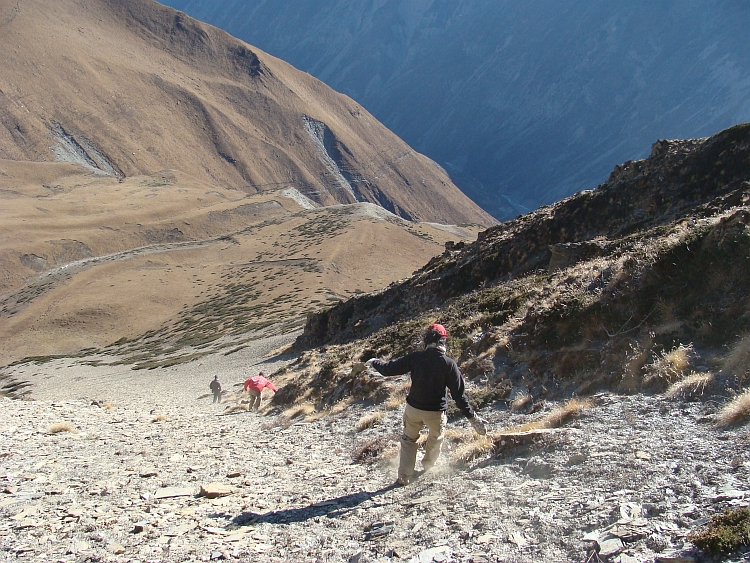
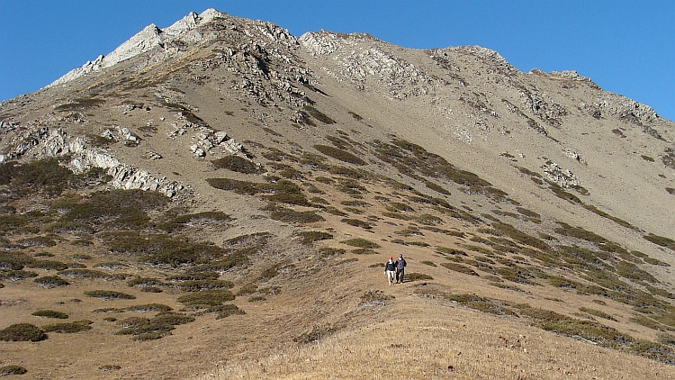
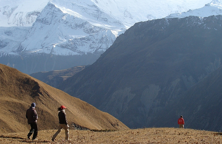
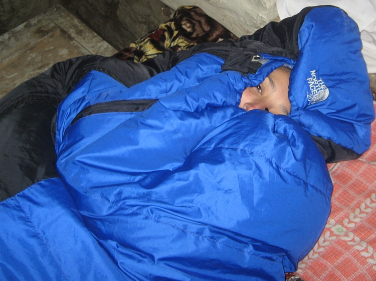
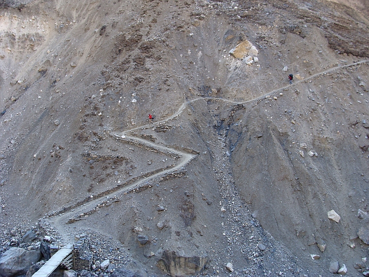
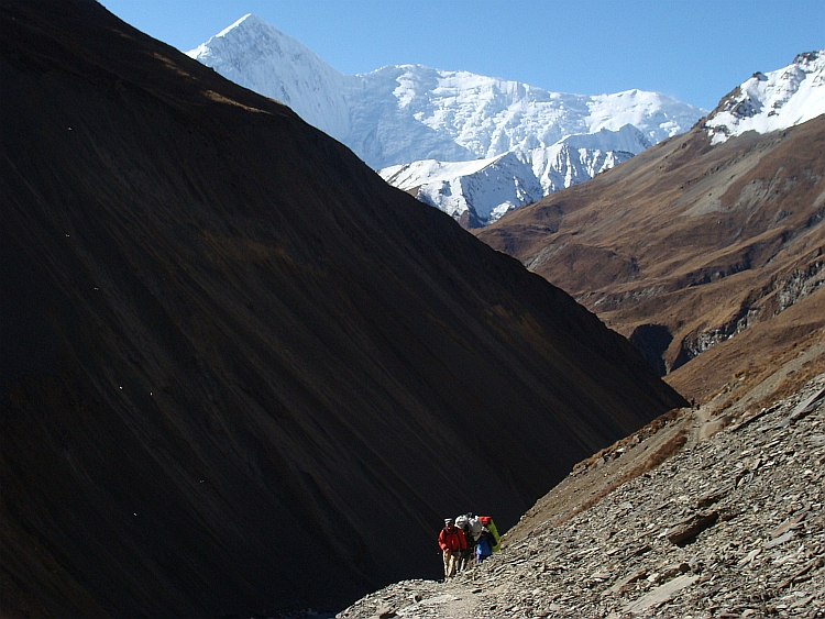
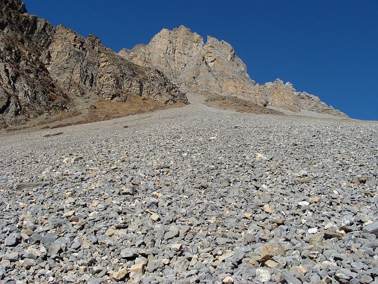
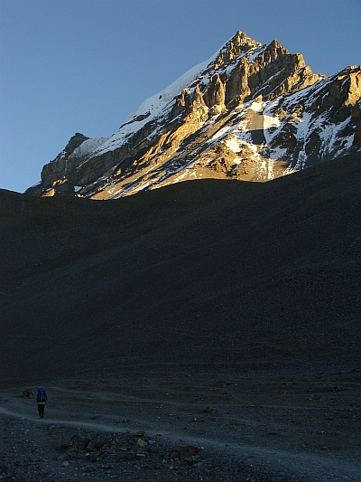 We get up at half past three. It is completely dark still. Of course it is freezing
but there is no wind. All in all the cold could be worse. At four o'clock we are ready to go.
Willem has forgotten something. While I am waiting, the others are leaving. At least that
is what Shiv says. A minute later Willem and I are leaving too. It takes ten minutes at least
before we catch up with Ruth. But I do not see Shiv. Ruth says that Shiv must be behind us.
But if Shiv is behind Ruth, we should have seen him. I decide to return. Maybe he is waiting
for Willem and me. I pass many groups who climb up. I reach Thorang Phedi. I am searching
everywhere for Shiv but he does not seem to be here. After ten minutes I decide that I have
not found him and he must have been leaving.
We get up at half past three. It is completely dark still. Of course it is freezing
but there is no wind. All in all the cold could be worse. At four o'clock we are ready to go.
Willem has forgotten something. While I am waiting, the others are leaving. At least that
is what Shiv says. A minute later Willem and I are leaving too. It takes ten minutes at least
before we catch up with Ruth. But I do not see Shiv. Ruth says that Shiv must be behind us.
But if Shiv is behind Ruth, we should have seen him. I decide to return. Maybe he is waiting
for Willem and me. I pass many groups who climb up. I reach Thorang Phedi. I am searching
everywhere for Shiv but he does not seem to be here. After ten minutes I decide that I have
not found him and he must have been leaving.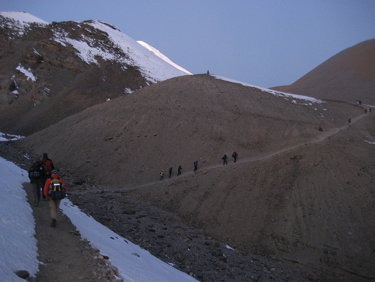
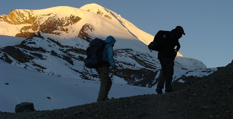
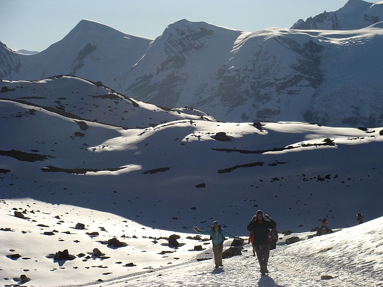
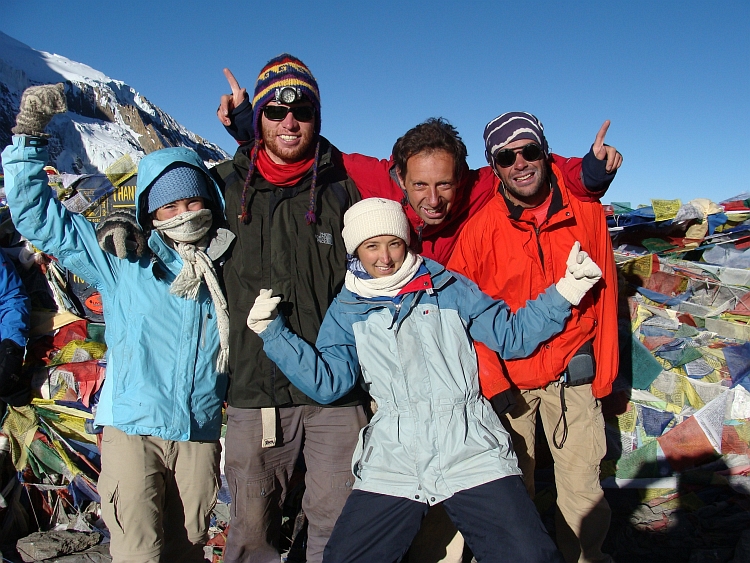
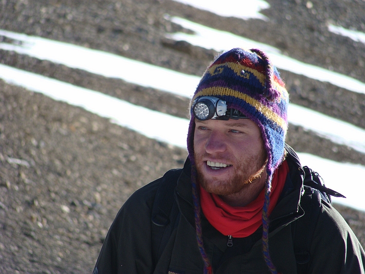
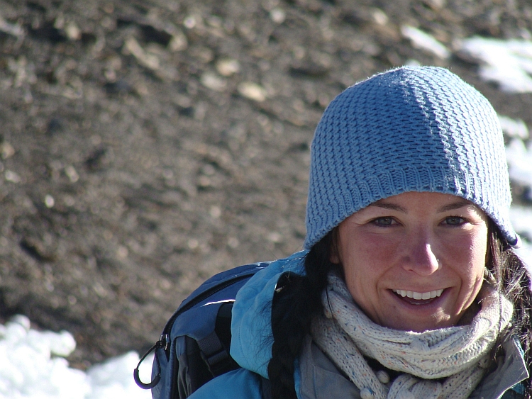

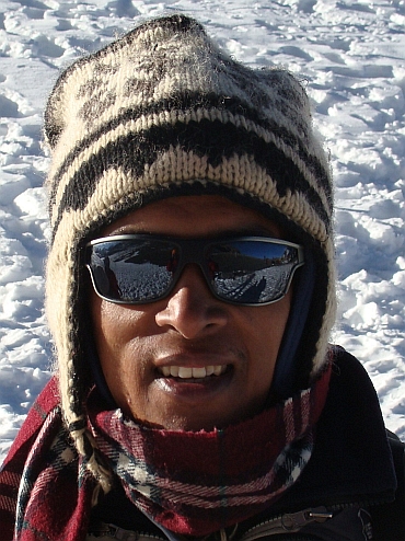 We are staying nearly an hour at the pass. It is getting busier and busier. We are taking pictures
of the prayer flags, of each other. Then we go down on the other side of the pass. We look
into the Kali Gandaki Valley, nearly three thousand meter below. Today we will go down
1.600 meter to Muktinath at an elevation of 3.800 meter. Through a landscape of screeslopes
we walk. Snowfields are still around us but after a while we have left all the snow fields
behind us. The sun is warming us up efficiently as we go down. Soon the temperature is above zero
degrees and not much later it is nice and warm. As we reach the valley bottom we are able to walk in our
shirts. It is 11 o'clock as we reach Muktinath. We have a whole day behind us but also a whole day ahead
of us.
We are staying nearly an hour at the pass. It is getting busier and busier. We are taking pictures
of the prayer flags, of each other. Then we go down on the other side of the pass. We look
into the Kali Gandaki Valley, nearly three thousand meter below. Today we will go down
1.600 meter to Muktinath at an elevation of 3.800 meter. Through a landscape of screeslopes
we walk. Snowfields are still around us but after a while we have left all the snow fields
behind us. The sun is warming us up efficiently as we go down. Soon the temperature is above zero
degrees and not much later it is nice and warm. As we reach the valley bottom we are able to walk in our
shirts. It is 11 o'clock as we reach Muktinath. We have a whole day behind us but also a whole day ahead
of us.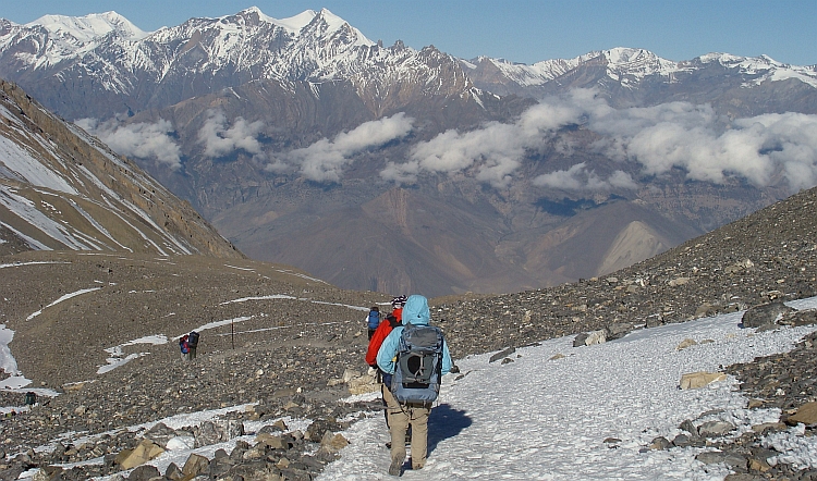
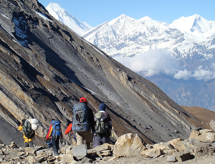
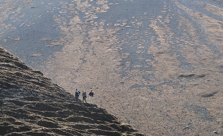
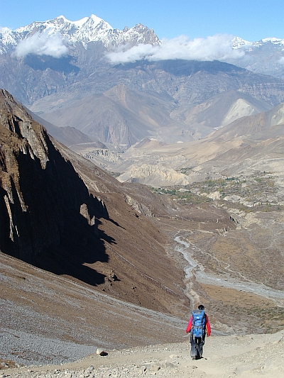 The rest of the day we are sunbathing untill clouds come rolling in. It is getting cold and it
is starting to snow. Only a few snow flakes but it proves that we are still in high mountain
areas. We visit the Hindu and Buddhist temples of Muktinath. Muktinath is a holy
place because of a spring and because of a fire (gas) that comes out of the mountain.
Muktinath is a nice place to stay and the first village of significance after Manang. From now
on we will not stay at really high altitudes any more. Maybe this will be the last cold night.
Hopefully the weather will be fine tomorrow as it could be an interesting day as we
will reach the Kali Gandaki Valley with the village of Kagbeni, the only place of the
mysterious Mustang Kingdom that can be visited by tourists.
The rest of the day we are sunbathing untill clouds come rolling in. It is getting cold and it
is starting to snow. Only a few snow flakes but it proves that we are still in high mountain
areas. We visit the Hindu and Buddhist temples of Muktinath. Muktinath is a holy
place because of a spring and because of a fire (gas) that comes out of the mountain.
Muktinath is a nice place to stay and the first village of significance after Manang. From now
on we will not stay at really high altitudes any more. Maybe this will be the last cold night.
Hopefully the weather will be fine tomorrow as it could be an interesting day as we
will reach the Kali Gandaki Valley with the village of Kagbeni, the only place of the
mysterious Mustang Kingdom that can be visited by tourists.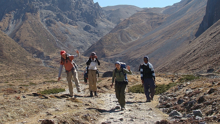
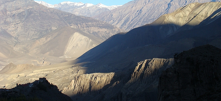
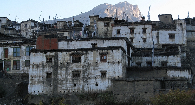
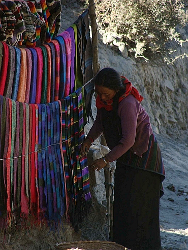
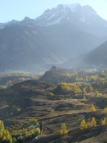
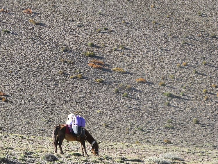
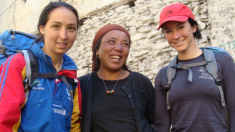
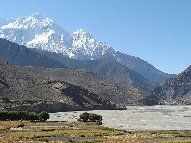
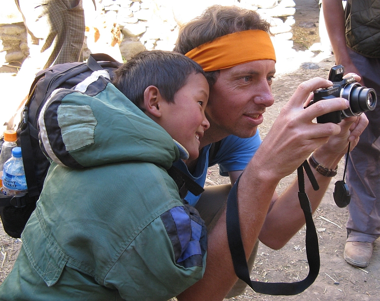
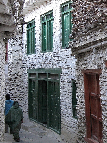 Shannon still wants to continue so after our lunch we are walking further south over
the river bed. An incredible headwind is blowing through the valley now. Sand and dust are
being blown up. I am using sunglasses to protect my eyes and I put a headband before
my mouth to protect my lungs. This is really extraordinary. It is even difficult to
put one foot before the other. This is like a psychedelic experience. Everything is whirling
up and around us. Nothing is normal now. I cannot see normally, I cannot breathe normally, I cannot
walk normally. Even talking is difficult. I am walking with Ruth now and we have to shout to each
other. Sometimes I just cannot hear what Ruth is saying. Incredibly, Shannon is again walking
ahead. She must have some tremendous physical and mental resources! I am confident that everything
will be okay with her and I stick with Ruth.
Shannon still wants to continue so after our lunch we are walking further south over
the river bed. An incredible headwind is blowing through the valley now. Sand and dust are
being blown up. I am using sunglasses to protect my eyes and I put a headband before
my mouth to protect my lungs. This is really extraordinary. It is even difficult to
put one foot before the other. This is like a psychedelic experience. Everything is whirling
up and around us. Nothing is normal now. I cannot see normally, I cannot breathe normally, I cannot
walk normally. Even talking is difficult. I am walking with Ruth now and we have to shout to each
other. Sometimes I just cannot hear what Ruth is saying. Incredibly, Shannon is again walking
ahead. She must have some tremendous physical and mental resources! I am confident that everything
will be okay with her and I stick with Ruth.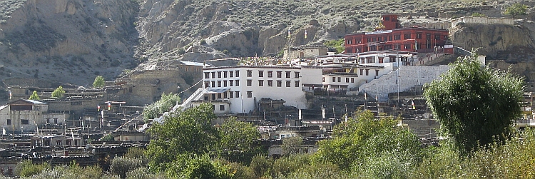
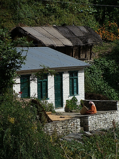 Shannon is feeling well. That means that there are no problems to be expected today.
It will be an easy day along the river. First flat through the river bed and in the afternoon we
will descend. It is a cloudy morning. The peaks of the Dhaulagiri and other mountains
are not visible. It is not bad weather either but we have had better views the last days.
The scenery was so good and I have made so many pictures the last days that I do not
miss the mountain views. Today is a day of just walking. Walking over wide trails.
Sometimes we even walk over jeep roads. Walking and talking. The atmosphere
in the group is special and everybody seems to feel happy and comfy. I am happy to be here now
and to be part of this group. I know that these are the days to look back upon with
melancholy.
Shannon is feeling well. That means that there are no problems to be expected today.
It will be an easy day along the river. First flat through the river bed and in the afternoon we
will descend. It is a cloudy morning. The peaks of the Dhaulagiri and other mountains
are not visible. It is not bad weather either but we have had better views the last days.
The scenery was so good and I have made so many pictures the last days that I do not
miss the mountain views. Today is a day of just walking. Walking over wide trails.
Sometimes we even walk over jeep roads. Walking and talking. The atmosphere
in the group is special and everybody seems to feel happy and comfy. I am happy to be here now
and to be part of this group. I know that these are the days to look back upon with
melancholy.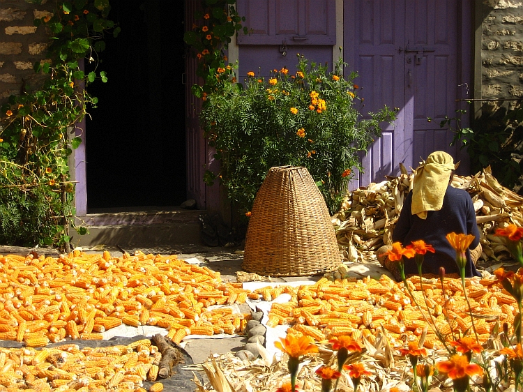
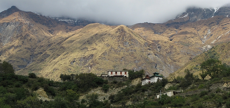
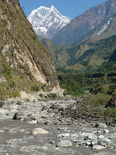 Today is an easy day again. Only thirteen kilometres divide us from Tatopani. There
are hot springs in Tatopani, which is an added bonus. We walk along the narrow valley of
the Kali Gandaki. The landscape is extraordinarily green, quite a contrast with the surroundings
of Kagbeni. The trail is narrow, which is causing a little trouble when we meet groups of horses.
There are coming up ever more horses. We try to make little detours but sometimes I
end up before a steep ravine. There are huge waterfalls coming from the steep mountains
on both sides of the Kali Gandaki. As we reach Dana, the valley is a bit wider again,
so that there are possibilities for growing different kinds of crops. There are
small villages with friendly wooden houses. And there are beautiful exotic flowers
in the valley; some are deeply red, others purple, yellow or pink. And there are
great sights of the Nilgiri South, one of the most impressive mountains of the trek.
Today is an easy day again. Only thirteen kilometres divide us from Tatopani. There
are hot springs in Tatopani, which is an added bonus. We walk along the narrow valley of
the Kali Gandaki. The landscape is extraordinarily green, quite a contrast with the surroundings
of Kagbeni. The trail is narrow, which is causing a little trouble when we meet groups of horses.
There are coming up ever more horses. We try to make little detours but sometimes I
end up before a steep ravine. There are huge waterfalls coming from the steep mountains
on both sides of the Kali Gandaki. As we reach Dana, the valley is a bit wider again,
so that there are possibilities for growing different kinds of crops. There are
small villages with friendly wooden houses. And there are beautiful exotic flowers
in the valley; some are deeply red, others purple, yellow or pink. And there are
great sights of the Nilgiri South, one of the most impressive mountains of the trek.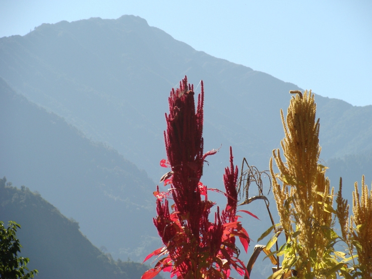
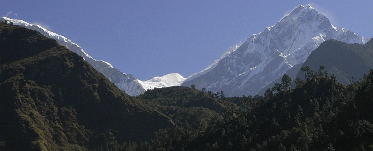
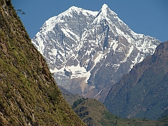
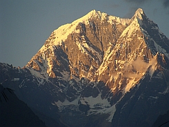
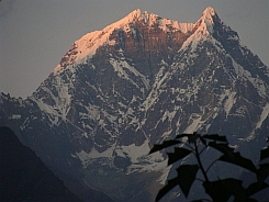
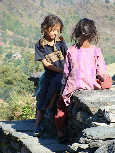
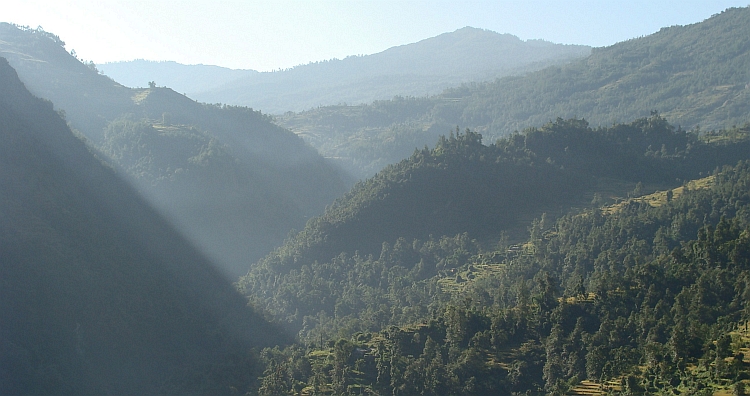
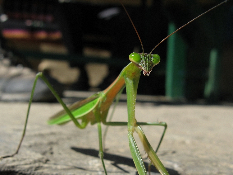
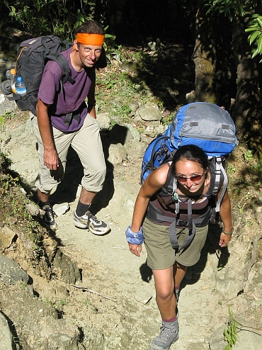 Eventually we reach Ghorepani, where I wait for the others. Ruth is coming
up after quite a while. I have a little shock. She is looking very pale. The meal
was quite oily and Ruth's stomach was not able to cope with that. I am having problems
with the skin of my leg that is painfully red where the sweat at my trousers erode
the skin of the upper inner part of my legs.
Eventually we reach Ghorepani, where I wait for the others. Ruth is coming
up after quite a while. I have a little shock. She is looking very pale. The meal
was quite oily and Ruth's stomach was not able to cope with that. I am having problems
with the skin of my leg that is painfully red where the sweat at my trousers erode
the skin of the upper inner part of my legs.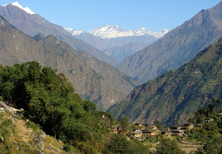
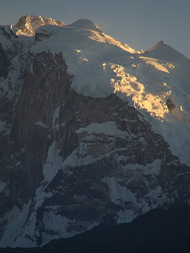
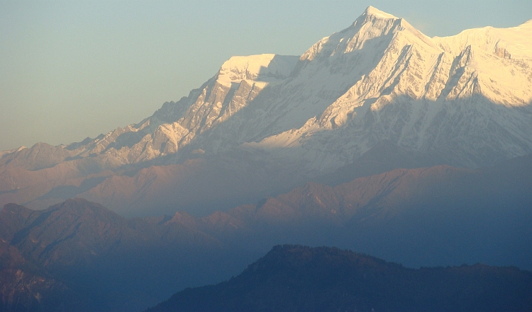
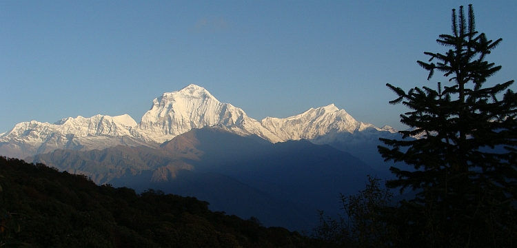
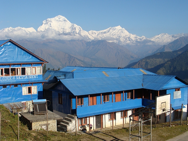

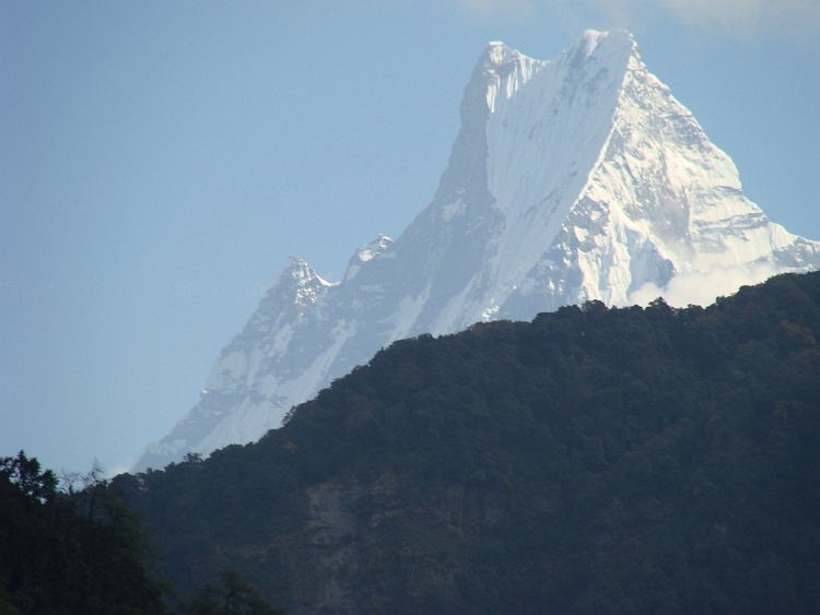
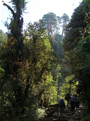
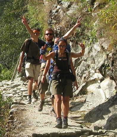
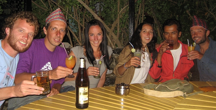
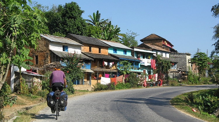
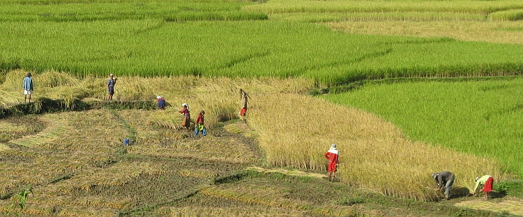
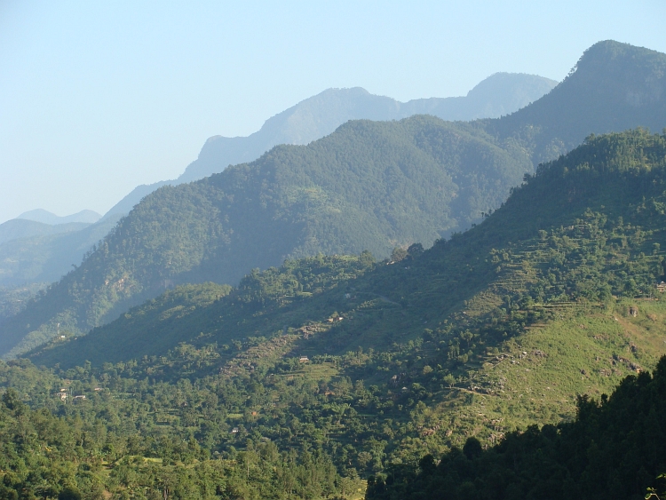
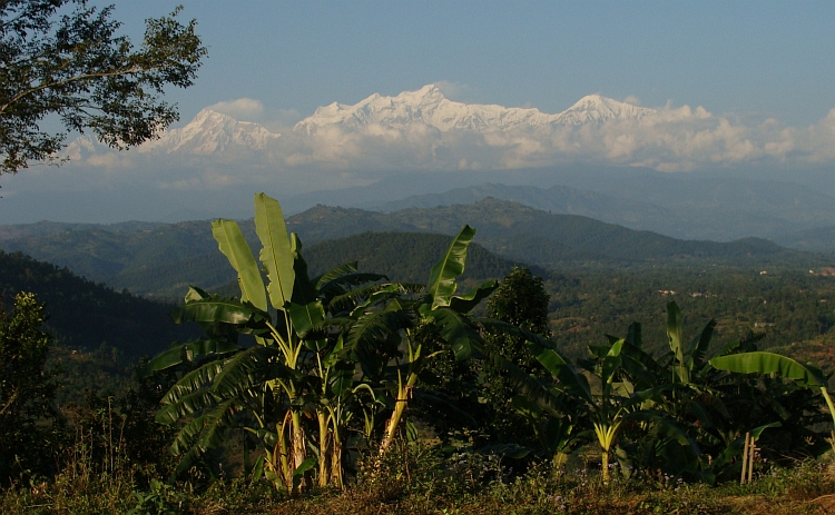
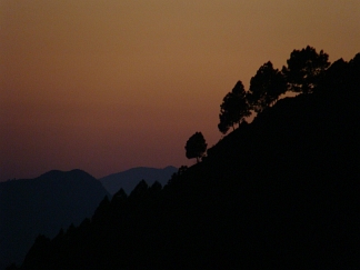
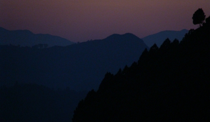
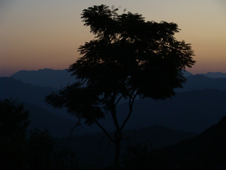
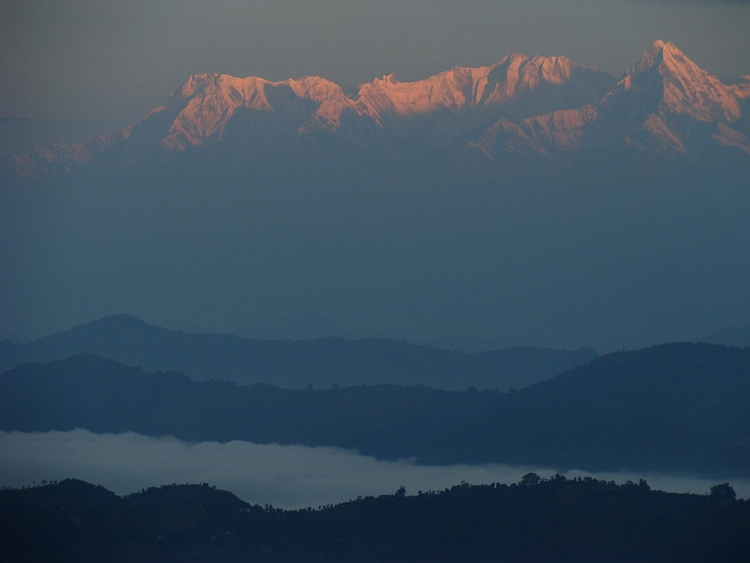
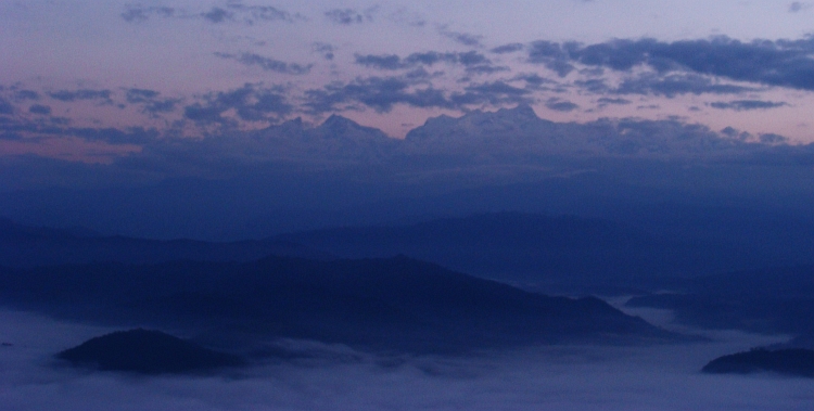
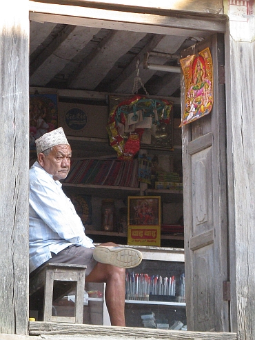
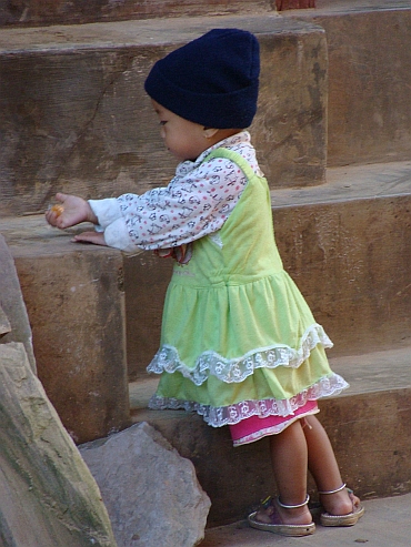
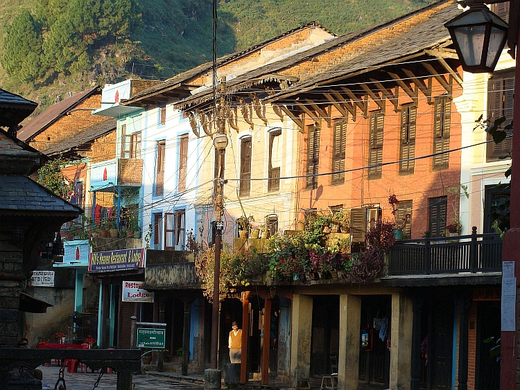
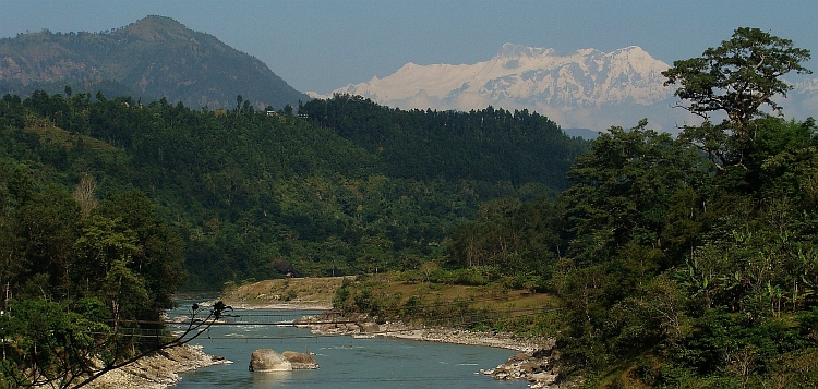
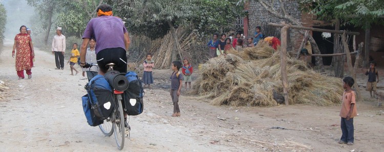
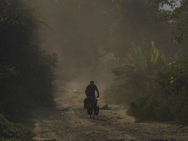
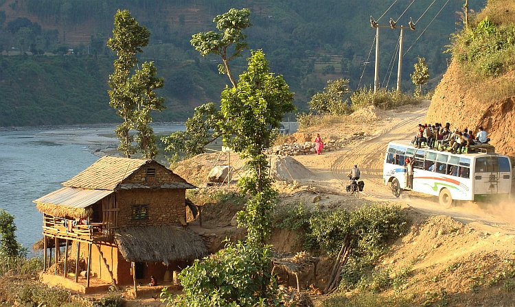
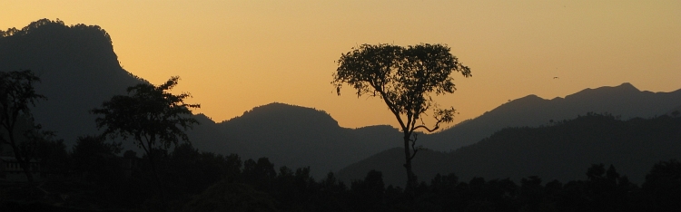
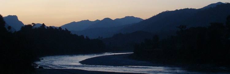

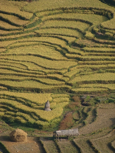 It is not too far to Kathmandu but it will involve some climbing. We do not know how far we will
have to climb but Kathmandu is 900 meter higher than where we are now so we will have to climb
at least that. We say goodbye to our friendly guesthouse family and we are on our way again.
After hundred meter we reach pavement. That is kind of a surprise. The road starts to climb and
continues to do so. Now I am having problems with my chains. I hear a rattling noise and then the
chain snaps in two. As we try to repair, we do not seem to be able to get the chains linked.
This is a huge problem. I do not understand. Then Willem suggests to try one of his seven speed
links (I have a nine speed bicycle). To my surprise we get it fixed that way. But after a short time
the chain lies broken on the ground for a second time. Now we find out that there is a short piece
of seven speed chain put between the nine speed chain. So the hotel owners in Pokhara
have also 'repaired' my bicycle. So we put the seven inch piece out and now finally my bike is running
okay.
It is not too far to Kathmandu but it will involve some climbing. We do not know how far we will
have to climb but Kathmandu is 900 meter higher than where we are now so we will have to climb
at least that. We say goodbye to our friendly guesthouse family and we are on our way again.
After hundred meter we reach pavement. That is kind of a surprise. The road starts to climb and
continues to do so. Now I am having problems with my chains. I hear a rattling noise and then the
chain snaps in two. As we try to repair, we do not seem to be able to get the chains linked.
This is a huge problem. I do not understand. Then Willem suggests to try one of his seven speed
links (I have a nine speed bicycle). To my surprise we get it fixed that way. But after a short time
the chain lies broken on the ground for a second time. Now we find out that there is a short piece
of seven speed chain put between the nine speed chain. So the hotel owners in Pokhara
have also 'repaired' my bicycle. So we put the seven inch piece out and now finally my bike is running
okay.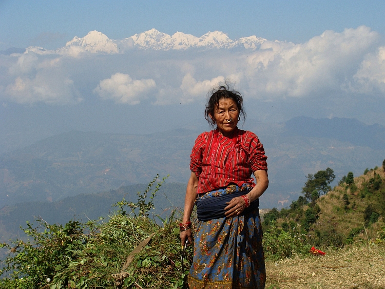
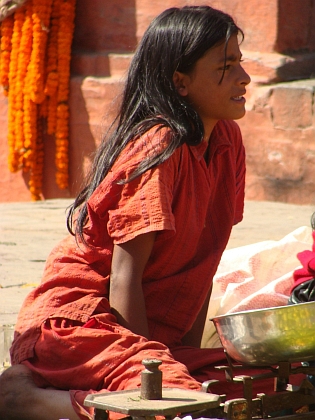
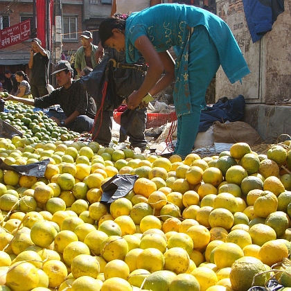
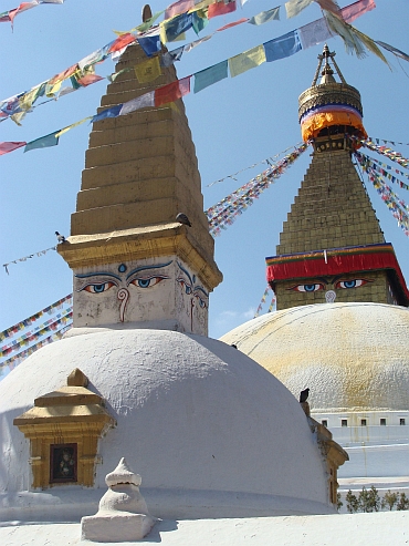
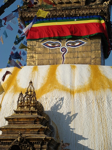
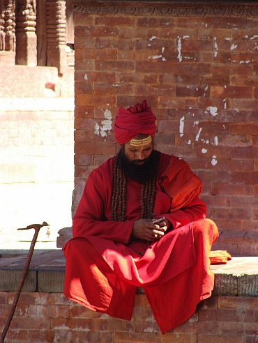
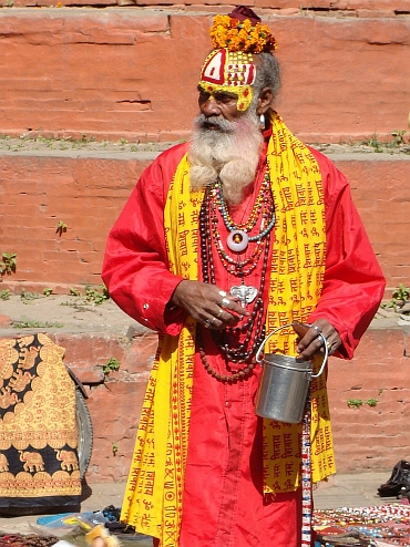
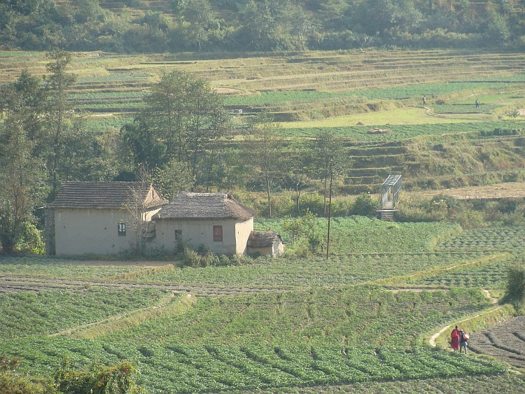 In Sankho we meet a Dutch man that we had talked to during the Annapurna Circuit.
Together we have lunch. Then we go ahead to Nagarkot. The paved road ends and is replaced
by a steep dust road. Loose sand is followed by big round stones. This is not the easiest
cycling path in Nepal but it is very quiet here and the views over the countryside are
very nice. It takes some effort but in the end we reach the hill ridge. From there
the road up is a bit steeper but the quality is better. Soon we reach Nagarkot. Great
views we will not have this evening. There are too many clouds. But we get another highlight.
After dinner there is Nepali disco with live music.
In Sankho we meet a Dutch man that we had talked to during the Annapurna Circuit.
Together we have lunch. Then we go ahead to Nagarkot. The paved road ends and is replaced
by a steep dust road. Loose sand is followed by big round stones. This is not the easiest
cycling path in Nepal but it is very quiet here and the views over the countryside are
very nice. It takes some effort but in the end we reach the hill ridge. From there
the road up is a bit steeper but the quality is better. Soon we reach Nagarkot. Great
views we will not have this evening. There are too many clouds. But we get another highlight.
After dinner there is Nepali disco with live music.