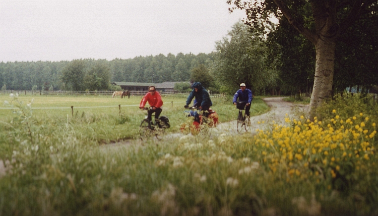
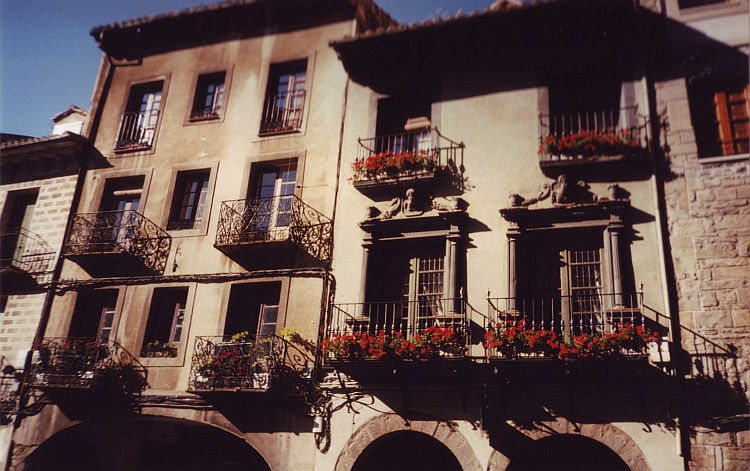
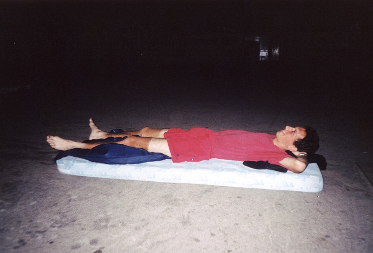
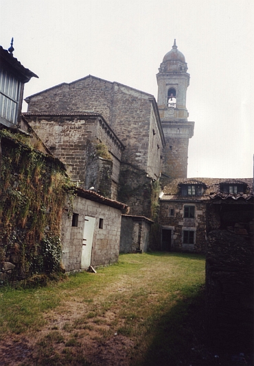
Day 1: Bunnik - Den Bosch - Vught - Oisterwijk 88 km
Less than a year after my first big tour, I am on a bicycle trip once again now. In 1999
I have reached as far south as Catalonia, Northern Spain. This time I will have a little
bit more time, money and motivation to travel a little further south. In 1999 I have explored
the little backroads of France, this time I have planned to focus on Spain. And this time
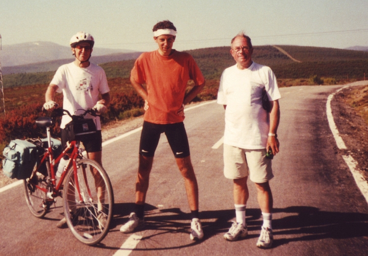
I will be used to being alone. The first two weeks I will not be alone, however. Menno will
accompany me through France. And today we cycle with five friends: Klaartje, Willem, Peter,
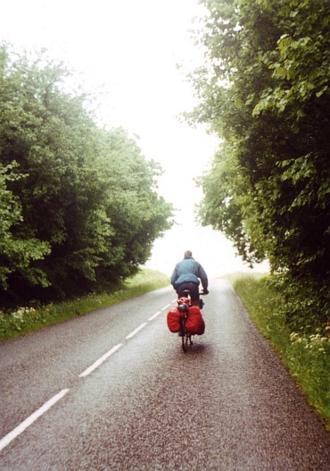
Olaf and Marco. We are not lucky with the weather. It is raining the whole day. Ten kilometre
after Vught everyone has quit the wet journey. Menno and I go on alone to quit
a little further in Oisterwijk.
Day 2: Oisterwijk - Olmen (Belgium) - Sint Truiden 103 km
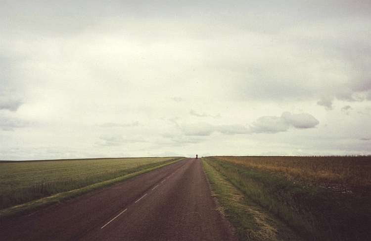
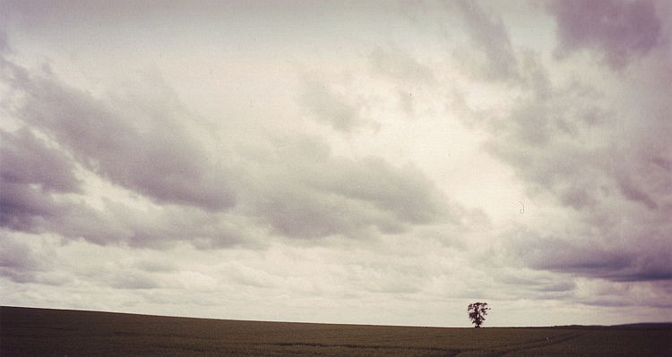
The sky is a dull shade of 990000, but at least it is not raining now. The road cuts through the woods
of Kempen. A dispassionate, straight line. Right to an unknown target, without detours. A straight
line through the endless forest without beginning and without end.
If we are out of the woods, it starts to rain again. It is raining less hard than yesterday but
the wind from the south has increased. I am not very talkative today. It is not exactly
the most scintillating day of my life yet.
We end up in the hostel of St Truiden. We are the only guests. After hanging our wet clothes
and tent on a long clothesline, we walk to the market, the social heart of the trading town. No
man out there. I notice that quite dark clouds are moving in. Menno affirms that it is
a special sight that it is this dark but that it is not raining. Slowly we begin to realize that
we have to hurry back to the youth hostel if we wish to avoid any more wet clothes.
We have started to run back too late. Shivering we sit in our wet clothes in the hostel. Our survival
instinct is not sharp as a knife yet.
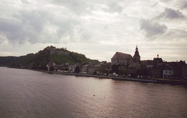
Day 3: Sint Truiden - Namur - Onhaye - Givet (France) 120 km
"Lost?" Menno has been waiting for me and frees me from my lonely thoughts.
"A real geographer, eh?" I reply, "A real Geographer can get lost on a straight
road." Menno will accompany me the first days. Then I will go further alone. Me and my bike.
Without purpose , without goal. I wonder where this trip will bring me.
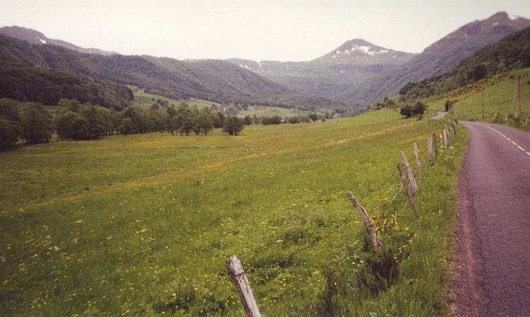
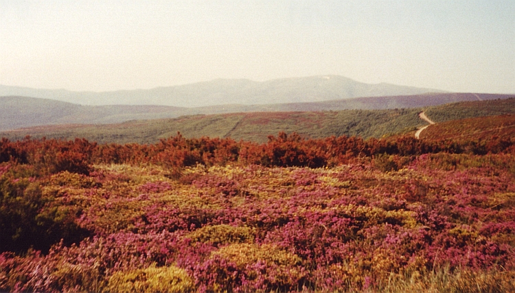
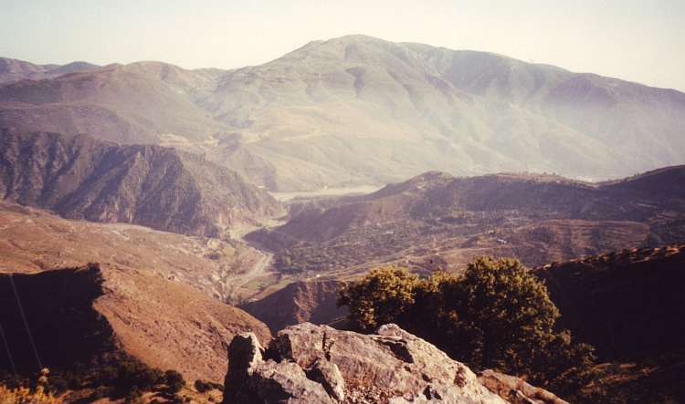
The landscape between the Meuse and Sint Truiden is hillier than I expected. The first
climbs are emerging. On the slopes is small millet and wheat cultivation. We descend
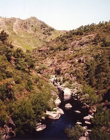
into the valley of the Meuse; we follow the river upstream. On either side of the Meuse
River are the famous Meuse Rocks, which attract many climbers on days when the weather is
better than today. We cross the French border near Givet and reach a camping.
Day 4: Givet - Hargnies - Monthermé - Aiglemont - Sédan - Boutoncourt - Le Chesne 100 km
The rain is ticking on our tent as we get up. We pack our luggage in a hurry
before everything gets wet. It is raining harder and harder. We find shelter
under the bridge over the Meuse in Givet. Silently we eat our breakfast. What shall we do?
Cycling another day through cold rain showers is not a pleasant option. On the
other hand: we are wet already.
After the breakfast under the bridge we find ourselves back again on our saddles. We are
already wet, so we might just as well continue the bike trip. We climb up from the Meuse Valley
to the undulating plateau of the Ardennes. We come in a thick forest with a layer consisting
of a dense network of bright green ferns. Deciduous Trees alternate with
conifers. Silently we move on through the lonesome landscape of the Ardennes.
Uphill, downhill. There is only the rhythm of the rain and the climbs and the
descents. Menno also retreats into his own world. We continue without saying anything.
We are all alone with the trees and the birds. The only sound is the sound of raindrops
splashing on the plastic rainwear. The forest seems to thrive well under the steady
flow of raindrops falling from the sky. It breathes in, takes in the elixir of life,
breathes out. The forest seems reborn, clean and full of new vitality. The pine trees leave
a deep intense smell. A fragrance that refreshes and energizes. I am in an increasingly
deepening trance. I feel the restless mind of the last day slowly dissolve into a
powerful flow. No way, no guiding insights, only a feeling of comfort. If the trance
increasingly takes hold of me, we suddenly find ourselves on the edge of the Ardennes plateau.
Far below we see the place where the Semois and Meuse gather and become one. The rivers
have sculpted large meander arcs in the landscape. Even the millions of years old
rock layers are eventually dissolved in the water of the Meuse.
The Meuse between Sédan and Charleville-Mézieres is not very
attractive. Where we have just cycled through a landscape of pine trees and ferns,
now we move through a large, abandoned industrial landscape of concrete and asphalt.
kilometres of industrial wasteland. In Flize we finally leave the 990000 industrial
landscape. Just outside the town small wooden houses are built along the river. The houses
rise steeply from the water, which reminds me of the ghats of Varanasi in India, where
Hindus burn the dead and give them back to the holy river Ganges. The river as a metaphor
for human life or maybe even a series of lives. The past four days we have crossed the river
Meuse seven times. Once as a mature river near Den Bosch, heading towards its end. We have seen
the Meuse searching the space between the Meuse Rocks in Belgium. The meandering Meuse at Givet,
where we had breakfast under the bridge of the motorway. The Meuse who has blazed a path through
the rocks of the Ardennes. The Meuse at Charleville-Mézieres, surrounded by industry. ANd the Meuse
at Flize with its wooden "ghats".
Day 5: Le Chesne - Vouziers - Binarville - Revigny sur Ornain - Bar le Duc 146 km
Packing our bicycles in the rain is becoming a routine now. Within fifteen minutes we are
on our bicycle, struggling against a southwestern storm. Cold arrows of rain hit
our faces. After twenty kilometre we reach Vouziers where we find shelter in a cafe.
We have to wait for better times to carry on. After two hours it is better. It is
dry now at least. We take off once again after the false start this morning. This
proves to be another wet affair. After ten minutes we have to flee for another rain shower. We are
nearly freezing under the roof of a petrol station. As the rain is calming down,
we start off for the third time.
We are riding through the lovely hill landscape of the Champagne. Sometimes it
is raining, sometimes it is dry. We follow the course of the Aisne, reach the forests
of Argonne. The weather is surely improving now. As the evening falls, the sun is
shining carefully. We profit of this sudden change in our favour. Through the lovely
Saulx Valley we ride, cross another hill ridge and end up in the nice renaissance
town of Bar-Le-Duc.
Day 6: Bar le Duc - Sommancourt - Valleret - Bar sur Aube 95 km
We leave Bar-Le-Duc in clear blue skies. Through the hills of the Champagne we are riding
into the sun. South we go! For the first time we have nice temperatures. As the hours pass,
the air feels more and more humid. It feels like monsoon. We are not in Thailand but in
Northern France however. As I look up, I see that the sky above has turned into a
dark grey soup. Southwest of us, the sky is as black as ink, rolling with an immense
speed over the hills of the Champagne towards us. We have reached the camping
of Bar sur Aube just in time before a tremendous hail storm breaks loose.
Day 7: Bar sur Aube - Bagneux la Fosse - Beauvoir sur Arce - Channes 71 km
In a dark brown cafe in Bar sur Aube, I am sipping my last cup of coffee as the last
remnants of the cold front are chasing over.
It is half clouded but there is a stormy southwestern wind again. Menno has problems
with one of his knees. It looks like he cannot continue. Things are not turning
in our favour. We quit early in the afternoon and stay in a gîte d'étape.
We deserve a little rest and hang our tent, clothes and sleeping bags to dry.
Day 8: Channes - Arthonnay - Ancy le Franc - Noyers - Epoisses 77 km
Water, water, everywhere is water. With five kilometre per hour we struggle against
the gigantic storm. The rain chases horizontally through the air, taking our breath
away. I cannot look forward, I can only look down. Why on Earth are we doing this?
Yesterday we decided to leave early, but why as the weather is this awful? It takes nearly two
hours to reach a cafe.
While we sit down in the cafe, dry and warm, we hear the wind raging outside. It seems
that our decision to leave had more implications. Mennos knee has deteriorated badly.
Menno has not mentioned giving up but I know he is seriously thinking it over now.
After two hours, the weather has improved significantly. The rain is over now. The sky
is still grey but the wind has slowed down a little. It is at least possible to go on now.
Slowly we progress against the fierce wind and we reach the beautiful village of Noyers
around noon. Menno has crossed the Rubicon. He will break off the journey. It
has no use to go on he says. He does not want to risk lasting knee problems again.
Strangely, having made this difficult decision must have felt like a liberation. Menno is in a
triumphant mood at once, maybe because he now has the opportunity to meet with
his girlfriend Klaartje in the house of Klaartjes parents in nearby Morvan.
Day 9: Epoisses - Avallon 35 km
It is good weather finally. Today we will not profit too much because we will not
go further than nearby Avallon, where Menno will meet Klaartje. Tomorrow I will
try to cross the hills of the Morvan to reach Menno and Klaartje once again in
the house of Klaartjes parents. We reach the nice mediaevil town of Avallon around
noon and spend the afternoon well, exploring the town and doing a bit of rock
climbing along the river near the camping.
Day 10: Avallon - Vézélay - Lormes - Château Chinon - Villapourçon 106 km
So now I will try to reach the house of Klaartjes parents in Villapourçon today.
Despite the heavy rain, Menno wants to cycle the first ten kilometres to the mediaevil
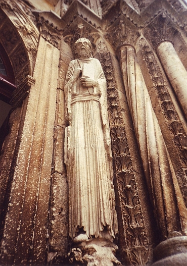
village of Vézélay. Vézélay is one of the starting points of
the pilgrim route to Santiago de Compostela. We cycle slowly over the cobbled street
up to the cathedral. There is nobody to be seen on the streets. The cathedral is
opened, though. I am touched by the serene atmosphere of the village. Menno and
I say goodbye. From now on I will be alone. Hopefully I will be able to reach
Villapourçon today. Unless the cold, wet and gloomy weather, I have picked
up a kind of angelic feel in Vézélay. The landscape seems to breathe
a rich spiritual past and the rain seems to have an odour of incense. Everything
seems to have some unknown purpose and direction.
In the long and winding road up the first hill range of the Morvan I see two cyclists before me. After a few
minutes I reach them. They are on the way to Santiago. They will try to reach Nevers, an important
halting place on the way to Compostela. As we reach the top of the hill, the two
pilgrims take the right way to Compostela. I take the left way to Lormes.
There are road constructions just before Lormes. In the confusing circumstances
I take the wrong way and after a long descent I find out that I have gone down
all the way from the massif of the Morvan to the flat lands around. I have to
cycle back again to Lormes, another hour upward, only to descend on the other side
of the village and to begin another long ascent. Because of all the climbing I am
completely warmed up but on the same time my skin is cold because of the rain.
My body is thermally unstable; as I am eating some chocolate under the roof of
a bus stop, I see that I have an aura of steam around me.
I am having a long rest in Château Chinon. There is only one more ascent on the programme.
After reaching the summit, I only have to go down to Villapourçon. As I
reach the village of Villapourçon, it is finally dry. It is good to meet
Menno and Klaartje.
Day 11: Villapourçon - Sanglier - Luzy - Toulon sur Arroux - Anzy le Duc - Marcigny - Chambilly 114 km
It is raining once again as I am descending the Morvan. After heartily saying farewell
to Menno and Klaartje, I have to face the elements again. This time not for long
however. After two hours it is dry and after another hour the sun breaks through.
A quiet day of cycling through the rolling hills of Burgundy brings me at the meadows
of a farmer where I can have a campsite.
Day 12: Chambilly - Ambierle - Col de la Rivière Noire - Col de la Planade - St Rémy sur Durolle 95 km
A feeling of excitement goes through my veins as I am cycling closer and closer to the first
hill range of the Massif Central. A 1.000 meter climbing brings me up to the mediaevil
town of Ambierle and further up to the Col de la Rivière Noire. The landscape
is intensely green. It must rain a lot here and after the last two weeks that must not
be a surprise. Today is a very sunny day however. For the first time I reach a
camping with tourists in St Rémy sur Durolle.
Day 13: St Rémy sur Durolle - Thiers - Sallèdes - Vic le Comte - Champeix - St Flore - Col de la Chaumoune - Condat 138 km
Today feels like poetry. First I reach the nearly vertical city of Thiers, perched
against the cliffs of the Durolle. Thiers seems to have grown organically out of the green
and fertile earth. Then, after a short climb, I am on a river terrace, a few hundred meter
above the wide valleys of the Dore on the one hand and the Allier on the other hand.
The weathered landscape of the Auvergne is magnificent. As I reach the Allier valley and
leave the valley for the long climb up to the Col de la Chaumoune, I meet a Dutch couple.
I sit two hours with them along the mountain stream, cheerfully chatting and joking
together. then I go on again, I reach the Col de la Chaumoune early in the evening
and descend to Condat, where I find a camping for tonight.
Day 14: Condat - Riom es Montagnes - Puy Mary - Salers 68 km
"Beaujolais?", The waiter asks teasingly. "Après le vélo," I reply in broken French.
It is not my habit to consume alcoholic drinks before 11 o'clock in the morning. Everyone at
the bar is involved in my doubt if I should cross the Cantal at its highest over the
Puy Mary or whether I should follow the Dordogne, which is a much quicker and easier way.
The waiter, a drunken young man and an old man with twinkling eyes, all agree that
The Dordogne region is an overrated tourist trap and the Puy Mary a miracle of Gods
natural beauty. If I question why millions of people spend several weeks in the Dordogne and not the
slopes of the Puy Mary, I only meet pitying glances. I will have to find the answer to
the question myself.
The landscape of the Cantal breathes the atmosphere of a symphony of a Brückner. Wild flower meadows
provide an idyllic secondary theme to the massive volcanic peak which soar majestically
above the old, weathered landscape. The Puy Mary is the highest point of the
impressive volcanic complex. The mountain ha the appearance of a supreme high alpine
landscape because of the abundance of numerous large snowfields so early in the season.
The way to the Puy Mary is an absolute highlight, more impressive than most high passes in the Alps.
Where in the climb in the Alps can you find a serene atmosphere like this?
The climb to the pass is long but only the last eight kilometres are steep. At three kilometres
before the pass I reach a crater rim. The road leads to the crater rim and goes further
up steeply one more kilometre, then I stand on the pass. A long descent, only
interrupted by a short climb, brings me to the Templar town of Salers. The houses are
made of dark 990000 lava rock. The original facades and bell towers and give the Renaissance
town a fairytale atmosphere. I am happy that I am not here in the high season. I do not want
to know what impact the crowds couls make on the fairytale atmosphere.
Day 15: Salers - St Julien aux Bois - Bretenoux - Carennac - Rocamadour 120 km
After Salers, there are forty kilometers downhill and flat terrain before I reach
the Dordogne region. Now it is only up and down through lush, green landscapes.
The highlands of the Corrèze region are intersected by numerous rivers
that have cut themselves deeply in the terrain. The landscape is most
attractive in these steep valleys. Because of the stifling heat it is a tough job
to climb our of these valleys.
The weather is as hot and humid as possible without brewing a thunder storm.
At the end of the day that is what I get eventually. I reach the camping of
Rocamadour just in time before hell breaks loose.
Day 16: Rocamadour - Luzech - St Maurin - Valence d'Agen 142 km
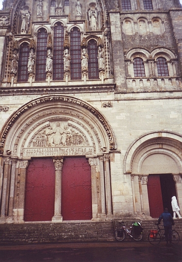
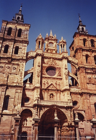
In Rocamadour I have kept up with the St Jacques route to Compostela again. Rocamadour
is perched against a cliff. The city has three levels. Above the cliff is a 12th
century old church. The second level has lots of chapels and is actually built against
the cliff. The third level is the actual mediaevil town.
It is raining again. Not too hard, but this is the kind of bad weather that will stick
around for a long time. There is not too much to be seen in the hills south of Rocamadour.
Around noon I have reached the River Lot in Luzech. Strange enough all the shops and
restaurants are closed. I have no water and food any more so hopefully I will find
a restaurant soon.
I have bad luck. There is nothing on the way in the hills between the
River Lot and the River Garonne. This time I am happy that it is raining. Despite the
rain, the thirst is growing steadily. Sixty hungry and thirsty kilometres further,
I reach St Maurin. I have not drunk for five hours and I have not eaten for eight hours
but now I can finally buy water and something to eat.
Ten kilometres further is a camping. It is the ugliest one I have ever seen. In
the middle of an industrial area, under the smoke of a nuclear energy complex
and in the rainy, grey weather, this is the worst place I have ever stayed. I
eat a takeaway pizza in the desolated town. The only noises are the sound of rain
and the sound of an alarm that is already going on for an hour as I return after
my dinner.
Day 17: Valence d'Agen - Lavardens - Mirande - Tarbes - Lourdes 180 km
As I awake, I feel the urge to leave as soon as possible and to cycle as far as I can
go from this unfriendly, industrial place. The whole day I go on and on. The last few
hours I see the mountains of the Pyrenees ahead. The sight encourages me to go on
untill I reach Lourdes. Here I find a small camping in the middle of the town.
A woman tells me that she once had walked from her house all the way to Compostela.
She is very enthusiastic; she urges me to ask for the credencial and to follow the caravan
of pilgrims to Santiago. I ask myself if that is possible for cyclists also, but
she is sure.
In the evening I go to the cave where St Bernadette was said to have seen Maria hundred
years ago. Nowadays there are thousands of sick and injured people per day who are
coming to the cave to taste the healing waters. And there are thousands of people who
help them. This place is full of love and faith but also of hopelessness and fear.
I do not know what to think. I have to rejudge on what pillars humanity should
be built upon. That is my spiritual homework for the coming days.
Day 18: Lourdes - Bielle - Laruns - Col du Pourtalet - Sabiñanigo (Spain)-Jaca 149 km
After a long sleep and after drinking coffee with nearly all the camping guests,
I am finally on my way around noon. Along the foothills of the Pyrenees I go westward
And after some uphill and downhill cycling I reach Bielle.
From here I go southward and reach Laruns at nearly 4 o'clock. Here is the beginning of the ascent to the Col du
Pourtalet and the Spanish border. It is too late to start climbing today, especially
because it is very cloudy and there is a heavy southwind. But then a cyclist,
coming from Spain, tells me that the weather in Spain is excellent. After a little
thought I decide to start climbing today whatsoever. And indeed, after ten kilometres
there is not a cloud to be seen.
The col du Pourtalet is not a difficult ascent. It has a percentage of 5 to 7
all the time. Eventually, I reach the pass and the Spanish border at seven o'clock.
An eagle is flying above my head. It is beautiful to see the sun going down, being
high in the mountains. I enjoy the idea of exploring new territory in Spain. I nearly
cannot wait and let myself roll down into the promised land, into new worlds.
Day 19: Jaca - Monasterio de San Juan de la Peña - Javier - Sanguësa 100 km
So things are finally going my way. I am in Spain, suddenly. Despite the early morning hour,
the temperature is pleasant. A magnificent blue sky does not give chance to clouds.
After nearly three weeks of stormy weather it feels estranging that there is no
wind at all in the streets of Jaca. I am hanging around the Cathedral for two hours,
just to see the people passing by. Half of the passengers are locals, the others are pilgrims
for Santiago. The pilgrims are full of stories about physical endurance, injuries,
loneliness, spirituality, will power, faith, love and hope. A young girl thinks of giving
up. An old man tells that he has slept on a churchyard because there were no
normal facilities anymore. A special experience is meeting an old man who has a
tremendous charisma; the man is constantly radiating from a seemingly enormous
reservoir of stimulating energy. If it is actually possible to reach enlightenment
in the way Buddhists describe, then this man must have reached that stage.
I have made my mind up. I am determined to go to Santiago too, more than thousand
kilometres to the west.
But my first goal is much closer. Six hundred meter above the valley lies the
Monasterio de San Juan de la Peña under an overhanging rock. A small paved road is
leading up the monastery. I am sweating all over during the climb. I am not used
to these temperatures any more. But it is great to cycle in a shirt, finally. As
I reach the monastery, there are pilgrims, again. It seems like there are as much pilgrims
as there are stones. I am welcomed heartily by two cyclists. They have come from
Santiago and do the Camino in the "wrong" direction. They say it is hard labour to
visit the beautiful monasteries. They are always far above the valleys, so that you
always have to climb a lot.
After visiting the monastery I descend to the main road and go on to the west. All the
time I have beautiful views of the Pyrenees on my right hand. Through long wide
valleys I go, once in a while passing a lonely mountain range. There is quite some
wind now and for the first time I have wind in the back. I fly across the plains.
Without any effort I cycle a hundred kilometres before I stop in the camping of
Sanguësa.
Day 20: Sanguësa - Lumbier - Pamplona 63 km
I have breakfast with very friendly German cyclists who make a tour around the
Pyrenees. Again I have wind in my back during cycling, but this time the wind is frighteningly
strong. I decide to stop in Pamplona. I do not trust the weather. After asking the
Credencial in Pamplona I am an officially registered pilgrim. With the Credencial
it is possible to sleep in the alberguos for the pilgrims. Tonight I sleep in the
camping of Pamplona however. A very unwise decision because the expected bad weather
is even worse than I expected. A storm is raging so hard that I am afraid that my tent will blow
away. Even as I am sleeping inside the tent, I have the feeling that me and my tent
could take off any second.
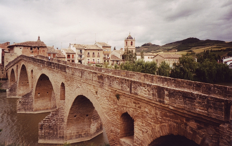
Day 21: Pamplona - Puente La Reina 46 km
The whole night the storm keeps me awake. As soon as the night is over, I pack my bicycle,
happy that my tent has survived the night. And happy too that I myself have survived.
The few other guests on the camping do the same, all looking awfully tired after
a frightening night. It is still storming, although the wind velocities seem to
decrease a little. It is raining still and it is at least twentyfive degrees colder than
yesterday before the storm. Now that I have packed my luggage, I have to go because
there is no shelter on the camping for these horizontal rains. I pass through Pamplona
again. Through small valleys I head for Puente la Reina. Luckily the storm is
weakening. As I reach Puente la Reina, the weather has improved significantly. I
have done enough for today whatsoever. I take my first alberguo credit.
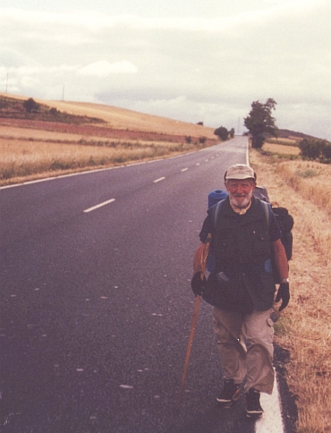
Day 22: Puente La Reina - Lizarra - Los Arcos - Logroño - Nájèra - Azofra 114 km
I am leaving early but the walkers are even earlier. There is lots of cheering and
shouting when cyclists pass walkers. The walkers have often shared the same experiences;
most of the walkers do twenty to twenty-five kilometres per day and sleep in the same
alberguos.
Today I share experiences with a Belgian group of cyclists. With this group of
veterans I reach Logroño, the capital of the Rioja. We go on for Nájèra
where we meet André, another Belgian veteran, who I met before in Pamplona and Lizarra.
The alberguo has not enough room for all of us any more. André and I decide to go on.
In the nice village of Azofra we can stay. We have dinner in a fine restaurant and meet
some interesting people in the alberguo. One woman writes beautiful poems, another one makes
beautiful Tibetan Mandala paintings. A Brazilian girl can barely walk after two days
camino but she can still swing the samba. A czech woman tells me that everything is
love and that you should not have any thoughts. Only then you can communicate truly
with the animals, the flowers, the rivers and the light beings...
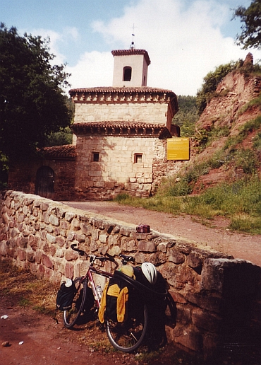
Day 23: Azofra - Monasterio de Yuso & Suso - Santo Domingo de la Calzada 57 km
Today I want to visit the Monasterio de Yuso and the Monasterio de Suso, two monasteries
in the mountains of the Sierra de la Demanda. This sidetrip off the main road will
provide some extra climbing, but that is no problem.
The landscape of the Sierra de la Demanda is lovely green; there are dense woods on the hills and grasslands
in the valleys. The Monasterio de Yuso lies in the Cardenas valley and has a
natural grace. The quirky pink-red monastery is built in an elegant renaissance
style but does not look like any other building that I know about in fact. The Monasterio de Suso
is much older and dates back to the tenth century. The serene Suso monastery
looks more like a Tibetan Monastery than like a Christian but has in fact
Moorish influences. After exploring some of the dirt tracks in the mountains,
I return to the main road. I end up in Santo Domingo de la Calzada.
Day 24: Santo Domingo de la Calzada - Ezcaray - Fresnedal - Burgos 99 km
Today I want to go off the beaten track once more. Another day I spend in the
Sierra de la Demanda by taking the road to Ezcaray, a nice village. From Ezcaray
an obscure backroad leads over the Sierra de la Demanda. The mountains are veiled in
mysterious mist clouds as I reach the pass. The pass is the frontier between the Rioja
region and Castilla. The Castilla villages look decidely poorer than their Rioja
counterparts but have a certain quality of their own. The landscape is much wider than
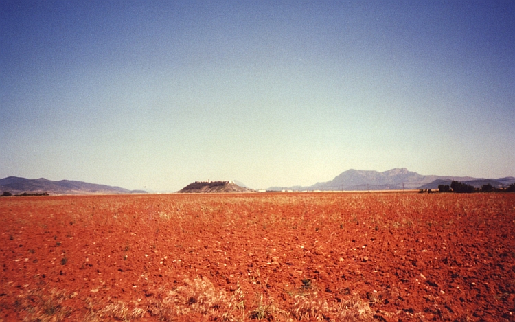
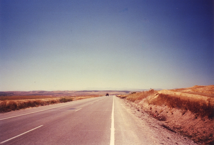
in the Rioja. Every kilometre that I ride further to the west, the landcape becomes drier. Then
I am on the Meseta again, the dry and barren highlands which form the core of
(Central) Spain. After a whole day on obscure backroads it is nice to ride into the
flamboyant city of Burgos and it is double party as I meet again with André.
We have one more dinner together in downtown Burgos.
Day 25: Burgos - Mansilla - Humada - Aguilar de Campoó 100 km
I leave the pilgrim route for a while for a detour around the Picos de Europa. I
have to cross more than a hundred kilometre Meseta before I will reach the mountains.
It is the first really hot day. The high temperature is not a problem because the air
is very dry. The Meseta landscape is not dull at all. The plains seem endless but
there are small rivers that lie hundred meter deep, so once in a while I have
a short descent and a fair decent climb. Even more surprising are the table mountains
near Humada. The landscape could well be used as a background for a western movie.
In Aguilar de Campoó I find a camping, not too far from the Picos any more.
Day 26: Aguilar de Campoó - Piedrasluengas - Col de Piedrasluengas - Potes 95 km
Nice riding through green hill landscapes brings me higher and higher. After a few hours
up and down and up again I reach the Col de Piedrasluengas. On the Col are grand views of
the limestone cliffs of the Picos de Europa. From here I have a descent of more than
thirty kilometre and more than 1.000 altitude meters to Potes. I seem to descend into
an oven.
The Cantabria region is statistically much colder than the rest of Spain.
But not today. It is thirty seven degrees and quite humid. Even while descending
I only seem to feel warmer. At the end of the day I reach Potes in the middle of the Picos de Europa,
where I find a small camping.
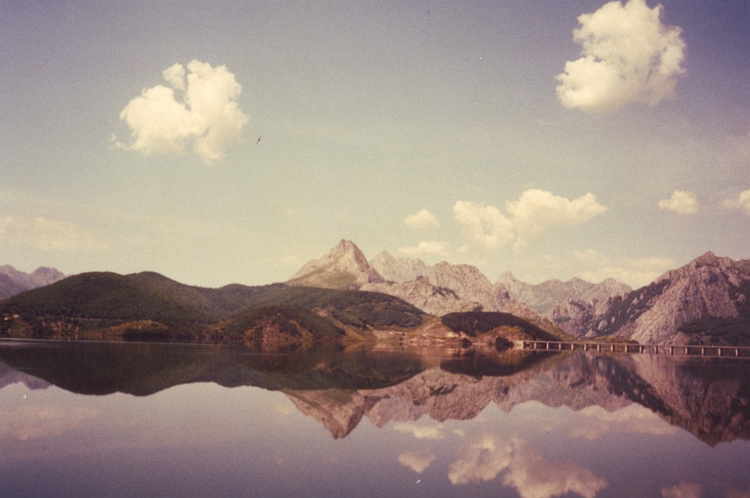
Day 27: Potes - Pto. de San Glorio - Riaño - Cistierna - Melianzos - Valdefuente - León 156 km
In 24 kilometre the road goes up to the 1.609 meter high Puerto de San Glorio. The weather
is beautiful so that I have superb views on the limestone cliffs of the Picos de
Europa once again. When I reach the pass, I reach a different world. I am in dry
and deserted Castilla again. Because of the strong wind I do not profit from the
descent. When I reach Riaño, it is still early in the afternoon, though. In
the tourist information office I hear that the camping of Riaño is still closed,
maybe the camping of Cistierna is opened.
In Cistierna I cannot find the camping. Only after lots of help from local people
I find the camping after an hour, only to find it closed. What to do now? I
decide to try to reach León before it gets dark. That is still sixty flat
kilometres from here. The road along the Rio Esla is not too interesting. Despite
the wind I make good progress. I pass an interesting village of adobe houses
before I reach the National Road to León. The last kilometres I ride in
the dirty smoke of trucks, a complete contrast with the small local roads.
As I reach León at half past six, it is still 37 degrees. I am on the main
route from the Camino to Santiago once again. I can sleep in the alberguo from
the nunnery, right in the center of the city.
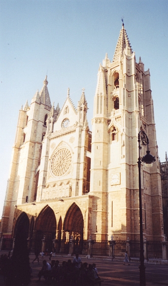
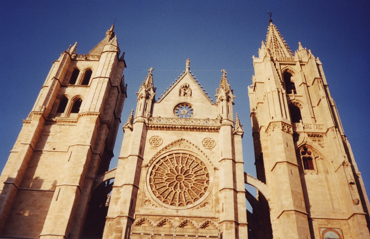
Day 28: León - Hospital de Orbigo - Astorga 90 km
I start the day with sighseeing in the old center. The cathedral is bathing in the golden
morning light. I am impressed by the stained glass windows. Not only the gothic cathedral,
also the humble, atmospheric Basilica de San isidoro is a stunning monument in the
friendly city of León. Less friendly is the National road between León and
Astorga with lots of heavy traffic, glass on the road and polluted air. In Hospital
de Orbigo it is possible to leave the busy road for a while. I am sitting in
the alberguo which is run by a Dutch man and a Venezolan woman. While I am there,
an 86 year old woman on Meindl shoes walks into the room. She has walked from her home
in Germany to here. She must be very fit for her age as she does not show any signs of
fatigue. She cannot stand the heat, that is the only reason why she stops quite early.
On the other hand, she begins at six o'clock every day, she tells, so she must
have been walking for four to five hours.
I ride the last fifteen kilometre to Astorga, where I take a lunch break. As I
visit the cathedral, I meet an old friend: it is André again! As I want to take
a picture of our meeting, I realize that I have forgotten my camera in Hospital de Orbigo.
I have to cycle between the broken glass over the National Road back and forth again.
When I return again in Astorga, it is dinner time. André has lots to tell as he
reflects about his working life, his family life, a peace that he has found during the
last years. He wants to do the Camino now, while he is 64 years old. He tells that
maybe he cannot permit to wait another year.
Day 29: Astorga - Puerto de Cruz de Fer - Molinaseca - Ponferrada - Villafranca del Bierzo - O Cebreiro 116 km
From Astorga a small road winds up the Montes de León. It is perfect sunny, windless
weather. The temperature is not too high yet. The higher parts of the Montes de
León are quite flat. The treeless plains are in full blossom. The whole world
is coloured purple.
I meet André another time. Together we descend to the nice village Molinaseca.
In Ponferrada we say farewell. André does not want to slow me down. That is
not a problem with me, but I cannot change his view and in the end I have to respect
his choice. The last ascent of the day brings me in the most western region of Spain:
Galicia. In the age-old village of O Cebreiro I finish. The village has nice
views back from where I came from but also across Galicia on the other hand of the pass.
The village itself has nice Asterix-style houses and an Asterix-style church from the
9th Century.
Day 30: O Cebreiro - Triacastela - Samos - Sarria - Portomarín - Palas de Rei - Melide 112 km
For a long time the road remains high above the valley. I have great views in constantly
changing angles. After a last short climb, I have a long descent.
The hilly landscape is very green compared with the desertlike landscapes of Castilla.
The villages are silent and introverted compared with the lively, cheerful
atmosphere of the rest of Spain. A grey mist is hanging over the land so that it is
even more silent here. There are a lot of short but steep ascents in the Galician
part of the Camino. But Santiago is defintively not too far any more. As I reach
Melide, Santiago is only fifty kilometre far, fifty comparitively flat kilometres.
There is place for me in the alberguo. Only a short morning ride divides me from
Santiago...
Day 31: Melide - Santiago de Compostela 50 km
Only four kilometres to go. On my righthand I see a big hotel with a big pink neon
"love" sign. A girl in a short skirt asks if I want some lovin'. I guess that this
is not the kind of love that brought me to Santiago. Now it is only one curve before
I am on the top of the last hill. I turn to the right, only hundred meter
and I will be able to see Santiago below. I see four cyclists coming in my
direction from Santiago... As I look better, I recognize the four veterans from
the Rioja! They have reached Santiago, they shout... no time... have to
hurry to catch the airplane back to Belgium. And then they are out of sight. I
am looking forward again and there it is, below... Santiago... I let myself go down.
Within a minute I am down in Santiago, ride into the old city. I start walking. It
is too crowded to cycle now. I feel being part of the age-old stream of pilgrims. I am
on the Pórtico de Gloria now, the road twists and turns, one last turn and there
it is right before me: the cathedral. The cathedral with the bones of St Jacques.
Fulfilment.
Day 32: Santiago de Compostela - Negreira - Corneira - Corcubión - Cabo Finisterra 102 km
So this is it. I have made it to Compostela. But what now? Is this the end? I am
not sure. I decide to think things over. I will cycle to Cape Finisterra in the
meantime, the western spot of Spain.
It is 11 o'clock as I leave Santiago in grey, misty weather. When I am outside Santiago,
I am in silent and introverted Galicia once again. The region west of Santiago is
even more desolate. The landscape is desolate and so are the villages. Nobody seems
to say anything. On the Camino I am used to greet every passenger and every passenger
says hello to me. In the villages of Galicia my greetings seem to dissolve into the
air. The landscape becomes more and more deserted. The villages are not pleasant. The
houses are built out of dark grey stones. The churches have a sort of Roman style, very basic
and in the same dark grey colour, sombre as well as atmospheric. A strange mystic
hangs in the air. The roads become more and more obscure. Every sound is damped in
the thick grey mists that hang over the hills and the valleys. Sometimes I get dogs
running after me, barking out loud and showing their teeth. They do not seem to like
strangers too much here.
After a few hours I finally reach the Atlantic Ocean. In Céa I find a bakery
where I can buy something to eat at last. I am happy that the girl from the bakery is
sweet and laughing. That feels as a relief after the desolate moors I have crossed.
It is not too far to Cape Finisterra anymore. I reach the end of the world where
I find another alberguo.
Lots of pilgrims make an additional tour to Cape Finisterra
after reaching Santiago.There are a few guests in the alberguo. An exceptionally good
walker from Barcelona, who has walked fifty to sixty kilometre every day, a Danish girl
who had once walked to the Mount Kailash in Tibet and Machu Picchu in Peru, a sweet, loving
Austrian girl and a heartily Brazilian guy. All in all, enough for an outstanding
evening.
Day 33: Cabo Finisterra - Corcubión - Carnota - Muros - Noía - Padrón 120 km
I have been thinking about what to do the last days. Should I end here or should I continue?
And where should I go? I have made up my mind. I will travel further to the south of Spain. After having
breakfast together, I say farewell to the guests of the alberguo. I am on my way
again. After three grey days, it is perfectly sunny again today. The whole day I
am riding along the Atlantic coast over a small, winding road that leads me
through old fishermen villages and along rocky cliffs.
It is great cycling country here. The road follows the coast, but id not so easy.
The road goes up and down. In the end of the day I have a serious hill range to
cross. After a nic descent I end up in the small town of Padrón.
Day 34: Padrón - A Estrada - Soutelo - Orense 117 km
Quite a tough day with lots of wind and lots of climbing brings me in Orense. An
unfriendly atmosphere is hanging over the town. I do not feel welcome here. I am
going to bed early, hope to leave this place soon.
Day 35: Orense - Celanova - Trasmiras - Verín - Chaves (Portugal) 128 km
I am leaving Orense as soon as I can. A big road is leading out of the city. I feel
relieved as I reach Celanova, a small, friendly town between the hills. There is a
special moment when I see the wide river valley of the Rio Támega a few hundred
meter below. From the river valley it is not too far to the Portugese border any more.
I find a camping outside the nice town Chaves.
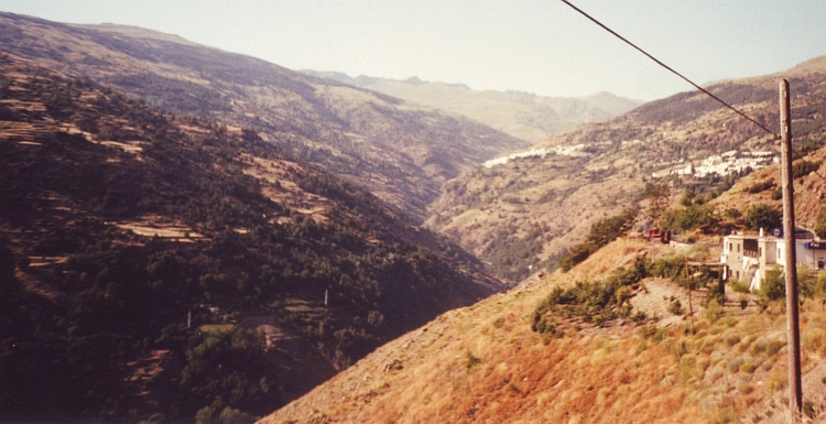
Day 36: Chaves - Rebordelo - Vinhaís - Bragança 115 km
Trás Os Montes is a beautiful, yet very poor, region. The road from Chaves to
Bragança is leading through mountain terrain. On the steep flanks of small river
valleys are terraces. Villages are often situated far above the valley. Sometimes
the road goes through a narrow valley, sometimes the road follows a ridge hundred
meters above the valleys.
There is not too much life in the villages. As I step inside
a cafe in on of the villages, I finally see where the village life takes place.
A crowd of men - there is not a single woman in the cafe - looks in bewilderment.
Have they never seen a foreigner in these surroundings? When I ask something to
eat in Spanish, the people are relieved. Oh, he is Spanish, they whisper to each
other. The gorgeous views on the route to Bragança are even better when I
reach the Parque Natural de Montesinho where the mountains are a little bit
higher. There is the deep odour of mimosa everywhere. Only therefore this region
is worth the detour. It takes a long time to reach Bragança. I am quite
tired when I reach the friendly camping.
Day 37: Bragança - Milhão - Vimioso - Miranda do Douro 108 km
Today is again leading through the mountains of Trás Os Montes. As I ride
in a southward direction, the landscape becomes drier. The higher areas between the
rivers become wider; the few villages all lie on the flat areas above the river valleys.
Life in the villages looks more traditional than I was used to see in Spain. Lots of
donkeys and mules are still used for transport. It seems like there are only widows
in black clothes in the villages. I hardly see any men on the deserted streets. Maybe
the absence of life is caused by the heat. It is hot and humid. The sky is grey
but I can see (and feel!) the sun still shining through. I am tired again as I reach
the camping of Miranda do Douro. In the beautiful city with the white houses
I can see Spain on the other side of the Douro River, one of the most important rivers
of the Iberian peninsula.
Day 38: Miranda do Douro - Almeida (Spain) - Ledesma - Salamanca 98 km
The Douro River has cut a deep gorge in the landscape. The one highlight of today is climbing
from the Douro River up to the Spanish Meseta. Ninety nearly flat kilometres
bring me in the beautiful old city of Salamanca. I have the whole afternoon and evening
to explore the city, but it is too hot to fully enjoy. In the evening the city comes to
life and the temperature makes it possible to see more than air-conditioned terraces.
Day 39: Salamanca - Las Veguillas - Linares de Riofrio - Béjar - Candelario 112 km
It is the second half of July now and I am heading straight southward. I have to get up
very early from now on to benefit from the relatively cool morning temperatures.
After twelve o'clock the temperatures do not drop significantly untill the sun is down.
Over the flat Meseta I am riding in a straight line to the Sierra de la Peña
de Francia which I want to cross today. After fifty kilometre the road starts to wind
up. It only takes fifteen minutes before I see that I have already reached the pass.
How could that be so easy? I do not understand. I go down and only now I am beginning to understand. The descent to
the Alagón River takes me nearly half an hour. On the other side of the river
the road starts winding up. I have to climb all the lost altitude meters back and even
more. The plateau on the south side of the river is much higher than where I came from.
I have a hard job to do in the heat of the day. It takes a long time to reach the nice
city of Béjar. The city lies on top of a huge rock cliff. I take a few hours rest to
enjoy the place. In the early evening I climb to the camping of Candelario, one
of the prettiest villages of Spain with whitewashed houses in the middle of a beautiful
mountain landscape.
Day 40: Candelario - El Barco de Avila - Parador de Gredos - Mombeltrán 111 km
There are a few mountain ranges in Central Spain. Today I will pass two of them: The
Sierra de Candelario and the Sierra de Gredos. The Sierra de Candelario does not
cost too many sweat. In fact the road is circumventing the mountains instead of climbing
to a pass. My route across Sierra de Gredos is not too difficult either. The first
pass is reached only after fifty kilometre upward but is not steep, the second
is a little steeper but only a few kilometres long. So I am much earlier on the other side of
the mountains than expected. Because the southside of The Sierra de Gredos has spectacular
rock cliffs, I do not ride further than Mombeltrán to enjoy the mountains a bit longer.
The next days will be flat...
Day 41: Mombeltrán - Talavera de la Reina - Cebolla - Toledo 132 km
After an easy, flat morning ride, the afternoon programme offers quite the same.
the only difference is that the sun has warmed Mother Earth significantly in the meanwhile.
The plains around me are completely yellow and brown. Only a lonesome olive tree
once in a while breaks the monotony of the landscape. This is the ultimate meditation
on nothingness. At home I never succeed in breaking off the constant stream of thoughts
but in the heat of the Valley of the Tajo River I have difficulty to form a single
coherent thought. The sun is burning mercilessly and fills my whole world. There
is nothing but the heat now. Although I have reached a mental state that has cut me
loose from my ego and my thoughts, I do not feel like an enlightened Buddha or
Franciscus of Assisi. On the other hand I am not dissatisfied with my emptiness.
Suddenly I have the physical sensation to be cooking in an oven. Before me I see
jagged towers, churches and walled fortresses against the background of the deep
blue sky. I am seeing fata morganas now. A minute later I am seeing the mediaevil city
still. I have reached Toledo! I find a camping with the ultimate reward: a
swimming pool.
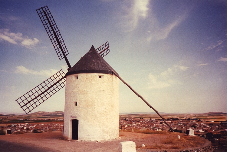
Day 43: Toledo - Mora - Consuegra - Manzanares - Valdepeñas 177 km
Today I get up very early. The first camping southward is nearly 180 kilometre far
from Toledo and of course I want to ride as far as I can before the heat will be
unbearable. The route is not hard at all. The Meseta is nearly flat. Once in a
while I see a lonely hill range, which effectively breaks the monotony. On a hill
range in Consuegra there are lots of windmills to be seen, the so-called Molinos.
Don Quijote fought against these windmills more than four hundred years ago and so I
am doing in a way. After Consuegra the landscape becomes dull. Especially around
Manzanares there is nothing to be seen. The landscape is just empty. The last
twenty kilometres I must suffer from a salt shortage. I drink 9 liter water
without ever getting rid of extreme thirst. But eventually I reach the camping of
Valdepeñas.
Day 44: Valdepeñas - Almuradiel - La Carolina - Linares - Baeza - Ubeda 133 km
The big highway that is leading me into Andalucía will probably not be the
very best introduction to the land of flamingo's, white houses, olive trees, flamenco
music, beautiful women and the sun. From all these characteristics only the olive
trees and the sun are present. The streets are silent after noon, it is too hot to
be outside. The absence of white houses, flamenco music and beautiful women
is a bit overcomposed by the other two characteristics. Between the villages I am
riding through huge fields of olive trees. And they do not give anything that is
even close to a shadow. Even more present than the olive trees is the yellow terrorist.
From noon untill the evening falls, everybody flees inside their houses for the sun. I am the only
Don Quijote who is still out there, fighting the heat. Especially on the way up to Baeza
I am fighting a lost cause. I seem to be sweating from the inside, is that possible?
Not only my skin is double salted, as I swallow, I seem to swallow sea water. My
insides seem to dissolve. At the time I reach beautiful Baeza, I do not feel very
fresh. Maybe I have never been so dirty in my life. There is not a camping in Baeza
so I ride on to nearby Ubeda. There is also no camping there. I decide to take a hotel
this time. I am surprised that a completely dirty cyclist - me - is welcomed so
heartily in the prestigious three star hotel.
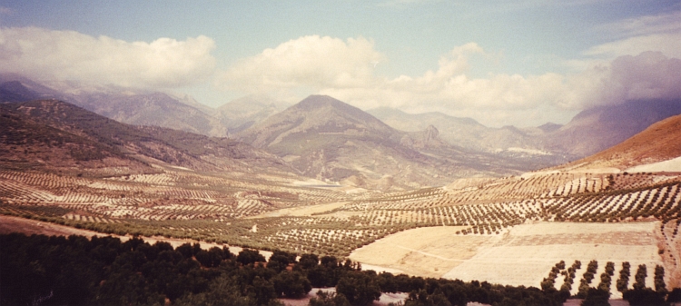
Day 45: Ubeda - Jòdar - Guadahortuna - Iznalloz - Albolete - Granada 130 km
I get up early to avoid the afternoon heat as much as possible. From Ubeda I descend
a few hundred meter to the Guadalquivir river and ascend more or less the same on the
other side of the river. A wild mountain landscape unfolds before me. Between the towering
rock cliffs are wide valleys with olive trees. After Jòdar the road goes up some
more. Because I am relatively high, the temperatures are more humane than yesterday.
For a long time I remain on more or less the same altitude. The landscape becomes
flat and very dry. The long, fine day with some highly unpredictable changes in
landscape ends on the highway to Granada. I have heard before that there are no
good possibilities to cycle into Granada on nice secondary roads so I do not waste
any time searching for the perfect way. So I am leaving the highway on a very
busy road into the suburbs. On a bus stop I ask for the direction to the camping
of Granada. Thirty men and woman are telling me at the same time how to go and
everyone is saying something else. A blind girl comes to me and points quietly
the exact direction so that I ride straight to the camping.
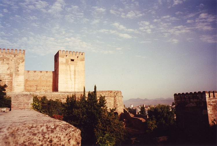
Day 46: Granada
I fill the day with sightseeing and visiting the Alhambra. In the evening I
explore the interesting Albaicín neighborhood. And take some rest for tomorrow
because tomorrow I want to cycle up to 3.400 meter Pico Veleta in The Sierra Nevada,
the highest road of Europe.
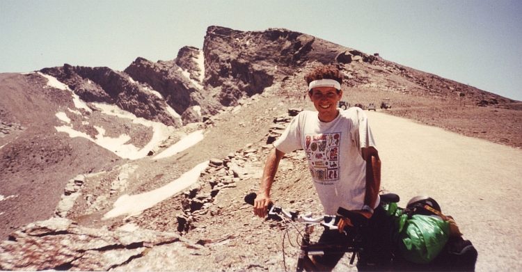
Day 47: Granada - Pico Veleta (3.400 m) - Mulhacén(3.482 m) - Capileira - Pitres 106 km
It is completely dark as I pack my luggage for the longest day of the journey. From Granada
at 700 meter elevation it is a very long way up to the 3.400 meter of the Pico Veleta.
At six o'clock I am ready and cycle through the deserted streets of Granada, straight
to the mountains of the Sierra Nevada. After forty minutes I reach the road to Sierra
Nevada. After a few kilometres the road starts to go up. It is a fair climb, not too
difficult.
After two hours I reach Sierra Nevada village, a mundane ski resort. Even
now there are guests in the hotels. Above the village the serious work begins. The
road becomes steeper. With a few nice hairpins the road twists to a saddle with
beautiful views down the valleys and mountain ranges of Andalucía. I take some rest
in a mountain hut. There is a serious storm now. The chairs at the terrace are
constantly blown away. Every now and then a chair flies left or right my ears,
which makes eating a sandwich a devillish frightening experience. After the hut the
road is closed for cars. The road becomes more challenging. The wind cries and howls,
I can barely keep sitting on my bicycle. When I reach a new saddle I expect even
more wind, but, strange enough, the wind has calmed down sudddenly. I have beautiful sights
of the Pico Veleta and the Mulhacén. The latter is the highest mountain of Spain.
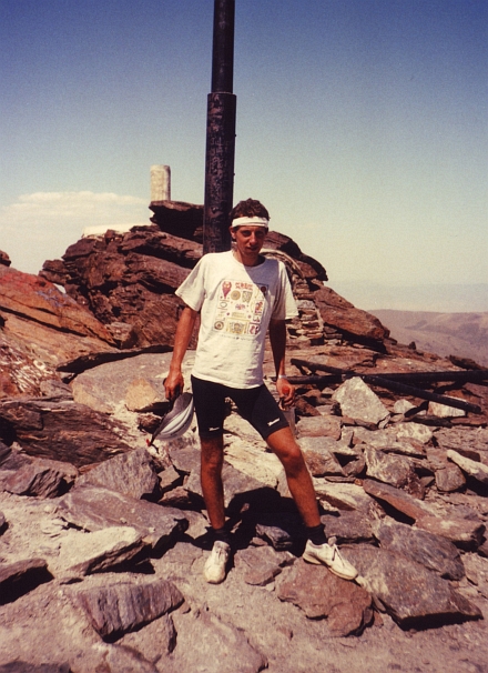
The Pico Veleta is not far any more. I reach the top at two o'clock in the afternoon.
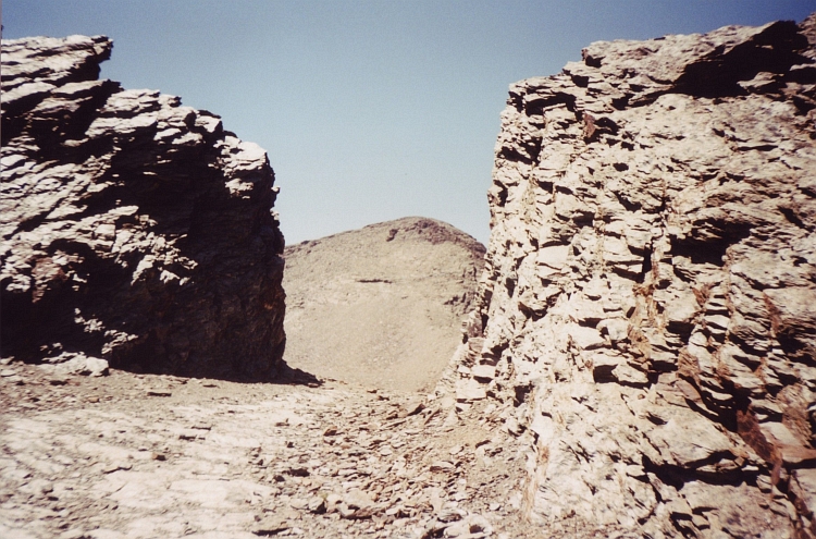
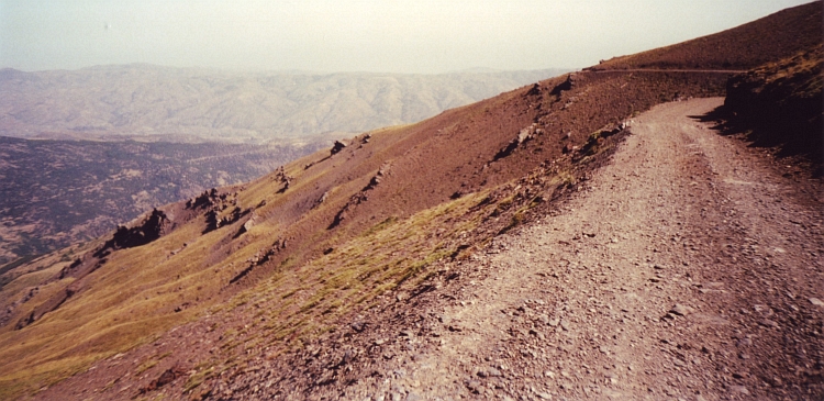
There are a lot of stones in the Sierra Nevada. Not only the mountains are built
out of big stones, the road down to the Alpujarras is also built out of these stones.
The road is deteriorated rapidly after it is closed for cars. The way down to the
Alpujarras is one huge highlight. First the road remains right under the mountain
tops of the Sierra Nevada. Then it passes the Mulhacén and only after that, the
road starts to go down. On the bad road it takes ages before I reach the foot of the Mulhacén.
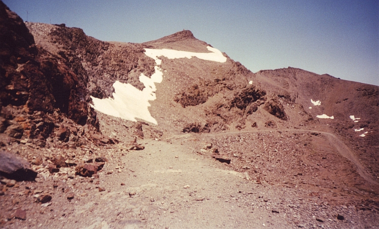
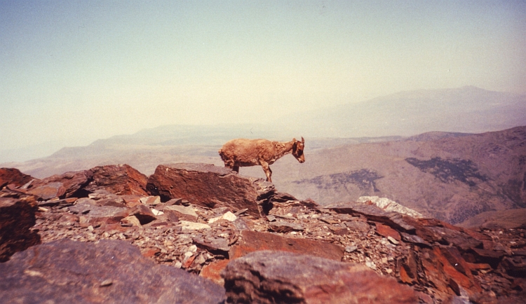
Right before the Mulhacén I have a flat tyre. I have pushed myself and my bicycle a bit too hard on
these stones. Standing under the highest mountain of Spain, I decide to walk
up the mountain. I reach the top where there is a very old capricorn that is too
old to flee. I have all the time to make some nice pictures of the animal.
The road down is a long one, but bit by bit the road becomes better. It is late
already when I reach the first village of the Alpujarras, Capileira. I descend a
little further. Then I see a sign of a camping. Unfortunately I have to climb again but after
twenty minutes I have finally reached the camping at 8 o'clock. Right in time for dinner
because I am hungry like a wolf.
Day 48: Pitres - Pampaneira - Orgiva - Motril - Almuñécar - Nerja 95 km
I meet Allison, a nice English girl. After teatime we take a second teatime in Orgiva,
this time with her mom. I go by bike, the females go by car. Because it is only downhill,
I am earlier than the girls. After a whole morning of chatting, I go on my way again.
So what to do now? I decide to reach Gibraltar to "complete" the North-South traverse of Spain.
Then I will go home. Probably I will go to Sevilla after reaching the rock of the apes
and try to fly back from there.
I reach the Mediterranean Sea in Motril. From here the road is very, very busy.
I go through some very scary, dark tunnels, which I cannot recommend. I do not
want to go back anymore, but if I knew beforehand, I would surely avoid these
tunnels. The route along the Costa del Sol is further okay. Busy of course, but
the steep mountains along the coast offer spectacular sights as well. I stay
in a camping in Nerja.
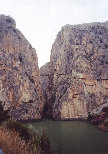
Day 49: Nerja - Torre del Mar - Málaga - Alora - El Chorro 118 km
Along the Costa del Sol I ride in the direction of Málaga. The road is flat.
There are no mountains rising up from the coast like on the Motril to Nerja stage. In
Málaga I am lucky to find the road that is leading me into the Valle del Sol.
I am riding upstream along the river. The name of the Ruta del Sol seems well chosen.
It is nearly forty degrees and sweat is flowing down my face and my arms and my legs.
The mountains inland become more and more impressive. The day ends
in a giant gorges landscape. The Garganta del Chorro is very impressive. There are great rock
climbing possibilities in the limestone cliffs. I have the possibility to do some
climbing with an Irish family. After the rock climbing interlude I stay in the camping
along the lake.
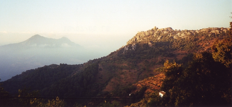
Day 50: El Chorro - Ardales - El Burgo - Ronda - Algotacín 99 km
It is a misty morning. I leave the Garganta del Chorro. It is relatively cool
because of the mist. Through the Parque Natural de Barbastro I climb through surprisingly
green, forested landscapes up to high plains. As I reach the plains, the mists have gone
and it is sunny again. There are great views over the plains and the beautiful lake.
Over a superbly obscure unpaved road I go southward from Ardales in the direction of Ronda. After fifteen kilometres I
have asphalt under my wheels again. The landscape is much drier here. Two minor
cols further I reach Ronda, a town of white houses.
From Ronda there is another minor pass to climb. After the col the road remains
at high elevations. There are spectacular sights as the road is really high above
the valley. The landscape on this side of the mountains has changed again to very green.
White villages lie as eagle nests on the best viewpoints. In one of them I stay
in a camping. I am far enough south to reach Gibraltar tomorrow and to return to
the camping the same day.
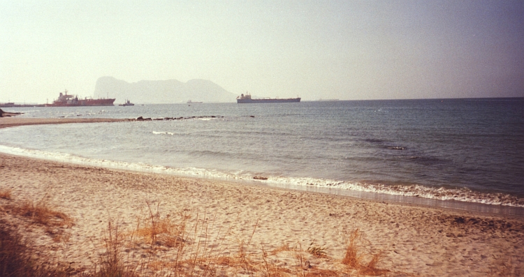
Day 51: Algotacín - Gaucín - Gibraltar - Gaucín - Algotacín 167 km
Because I have planned to go back to the camping today, I am able to keep my tent
and luggage at the camping. For the first time this journey I cycle the "light" way.
It feels as a great luxury to cycle without luggage. I seem to fly up the mountains.
This is great fun. I am still riding high above the valley. The sunrise enlightens
the higher areas of the mountains and reflects on the mists that climb up out of
the valley. Gaucín is the last of the white villages high above the valley.
From here the road goes a long way down. In fact it feels like a very long way down because
I have a very strong backwind as I am down on the ground. The last fifty kilometre to
Gibraltar I fly over the asphalt. San Roque, 10 kilometre before Gibraltar, must be
one of the most deserted places of Spain. Trains, nor buses, nor taxis go further south
than San Roque. Gibraltar is completely ignored by the Spanish. The stranded travellers
hang around in lousy bars and expansive shops. San Roque is a place that is best ignored
by the tourist.
The same can be said about the British pride on the Iberian peninsula. Gibraltar is
more British than Britain itself, the best self-parody possible. The cars drive left.
Red double deck buses are chasing over the lanes and avenues. The police wear shorts.
Add to all this the huge ugly hotels and hurried traffic and I know that I have to leave this
place as soon as possible. I want to be on the Ape rock however, just to have a picture with
a monkey on my knee. As I reach the entrance of the Ape Rock, I have to pay nearly
20 dollars for entrance by car. People by foot have free entrance. Despite I have
no car, I have to pay. I try to explain that this is a bike and not a car but the
employee does not listen. Prize negotiations do not work either. I decide that I
will have to go back without seeing the beloved monkeys.
The way back is no more triumphant than my visit to Gibraltar. Despite I have no
luggage, I have great difficulty to stand the wind. As the road goes up for a 1.000
meter climb, I have really had it. I have an awfully weak day. It seems like
ages but finally I have wrestled myself up the mountain. In the beautiful village
of Gaucín I take a long rest, enjoy the sights over the valley. After the long
rest I do not feel stronger but there are no further difficulties anymore; I return
to the camping where I have a long, long sleep.
Day 52: Algotacín - Cortes de la Frontera - Ubrique - Villamartín - Dos Hermanas - Sevilla 140 km
I am recovered surprisingly well from the exhaustion yesterday. The morning sun
radiates golden waves of light over the mountains. A strong spirit is radiating
in the inside as well. I am really enjoying the day. This could well be the last day
of the journey. If I am in good shape I will reach Sevilla from where I will try to fly
back. I am thinking back. The nature, the villages, the good people I have met.
André, Allison, the Austrian girl from Cape Finisterra. I pass through the landscapes,
the landscapes pass through me, always taking new shapes, always forming new
compositions. An everlasting dance of changing light. Mountains become hills, hills
become plains. The land metamorphoses from green to yellow to ochre. I am riding to Sevilla,
all alone with burned sunflowers all around. Enjoying the dance of light and shadow,
of life and death.
Map of the route
Statistics
Fast Facts
Fast Facts
# Days
# Cycling days
Distance on bicycle
Distance / Days
Distance / Cycling days
Longest distance on a day
Highest altitude difference on a day: climbing
Highest altitude difference on a day: descending
Highest point on bicycle
Highest point walking
# cold & wet days
# hot & dry days
Numbers and Statistics
52
50
5.600 km
108 km
112 km
180 km
2.720 m (from Granada to Pico Veleta)
2.300 m (from Pico Veleta to Pitres)
3.398 m (Pico Veleta)
3.482 m (Mulhacén)
too much
too much
Highlights
Region
France, Spain
France, Spain
Aragón
Rioja
Galicia
Portugal
La Mancha
Andalucía
Andalucía
Highlights
Becoming part of the stream of pilgrims to Santiago
The Col du Pourtalet is a perfect way to cross the Pyrenees with great landscapes on both sides
Enjoying great looks over the wide plains and lonely mountain ranges along the Río Aragón
Taking the quiet sideroad to the Sierra de la Demanda and its perfect monasteries of Yuso & Suso
Feeling the spirit of a pilgrim reaching his destination by reaching Santiago or Cape Finisterra
Getting high on mimosa between Chaves and Bragança and step back in time a few decennia
Feel like a Don Quijote on the dry and deserted plains of La Mancha
Riding the highest cycling route of Europe to the Pico Veleta and descend into the Alpujarras
Dwelling in the highlands near Ronda and see as much white villages as you can absorb


 The sky is a dull shade of 990000, but at least it is not raining now. The road cuts through the woods
of Kempen. A dispassionate, straight line. Right to an unknown target, without detours. A straight
line through the endless forest without beginning and without end.
The sky is a dull shade of 990000, but at least it is not raining now. The road cuts through the woods
of Kempen. A dispassionate, straight line. Right to an unknown target, without detours. A straight
line through the endless forest without beginning and without end.
 The rain is ticking on our tent as we get up. We pack our luggage in a hurry
before everything gets wet. It is raining harder and harder. We find shelter
under the bridge over the Meuse in Givet. Silently we eat our breakfast. What shall we do?
Cycling another day through cold rain showers is not a pleasant option. On the
other hand: we are wet already.
The rain is ticking on our tent as we get up. We pack our luggage in a hurry
before everything gets wet. It is raining harder and harder. We find shelter
under the bridge over the Meuse in Givet. Silently we eat our breakfast. What shall we do?
Cycling another day through cold rain showers is not a pleasant option. On the
other hand: we are wet already.
 In a dark brown cafe in Bar sur Aube, I am sipping my last cup of coffee as the last
remnants of the cold front are chasing over.
In a dark brown cafe in Bar sur Aube, I am sipping my last cup of coffee as the last
remnants of the cold front are chasing over.
 There are road constructions just before Lormes. In the confusing circumstances
I take the wrong way and after a long descent I find out that I have gone down
all the way from the massif of the Morvan to the flat lands around. I have to
cycle back again to Lormes, another hour upward, only to descend on the other side
of the village and to begin another long ascent. Because of all the climbing I am
completely warmed up but on the same time my skin is cold because of the rain.
My body is thermally unstable; as I am eating some chocolate under the roof of
a bus stop, I see that I have an aura of steam around me.
There are road constructions just before Lormes. In the confusing circumstances
I take the wrong way and after a long descent I find out that I have gone down
all the way from the massif of the Morvan to the flat lands around. I have to
cycle back again to Lormes, another hour upward, only to descend on the other side
of the village and to begin another long ascent. Because of all the climbing I am
completely warmed up but on the same time my skin is cold because of the rain.
My body is thermally unstable; as I am eating some chocolate under the roof of
a bus stop, I see that I have an aura of steam around me.

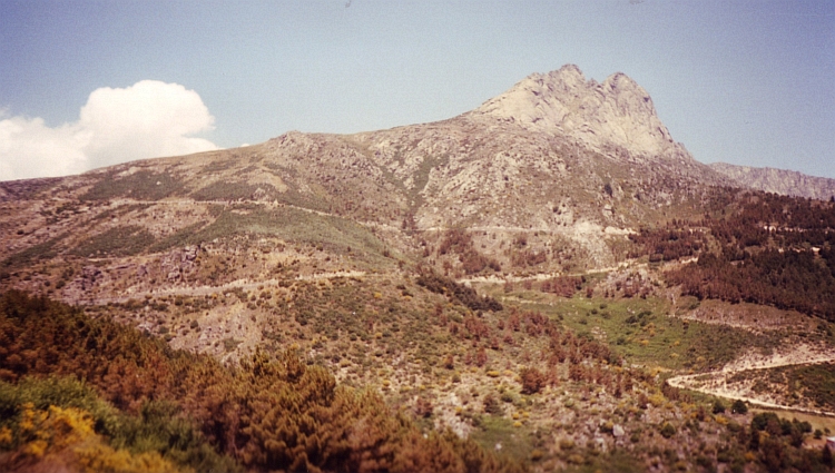
 The climb to the pass is long but only the last eight kilometres are steep. At three kilometres
before the pass I reach a crater rim. The road leads to the crater rim and goes further
up steeply one more kilometre, then I stand on the pass. A long descent, only
interrupted by a short climb, brings me to the Templar town of Salers. The houses are
made of dark 990000 lava rock. The original facades and bell towers and give the Renaissance
town a fairytale atmosphere. I am happy that I am not here in the high season. I do not want
to know what impact the crowds couls make on the fairytale atmosphere.
The climb to the pass is long but only the last eight kilometres are steep. At three kilometres
before the pass I reach a crater rim. The road leads to the crater rim and goes further
up steeply one more kilometre, then I stand on the pass. A long descent, only
interrupted by a short climb, brings me to the Templar town of Salers. The houses are
made of dark 990000 lava rock. The original facades and bell towers and give the Renaissance
town a fairytale atmosphere. I am happy that I am not here in the high season. I do not want
to know what impact the crowds couls make on the fairytale atmosphere.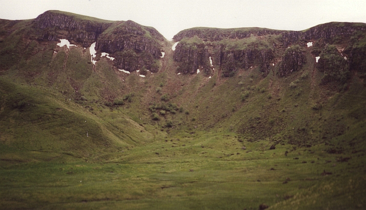
 After Salers, there are forty kilometers downhill and flat terrain before I reach
the Dordogne region. Now it is only up and down through lush, green landscapes.
The highlands of the Corrèze region are intersected by numerous rivers
that have cut themselves deeply in the terrain. The landscape is most
attractive in these steep valleys. Because of the stifling heat it is a tough job
to climb our of these valleys.
After Salers, there are forty kilometers downhill and flat terrain before I reach
the Dordogne region. Now it is only up and down through lush, green landscapes.
The highlands of the Corrèze region are intersected by numerous rivers
that have cut themselves deeply in the terrain. The landscape is most
attractive in these steep valleys. Because of the stifling heat it is a tough job
to climb our of these valleys.
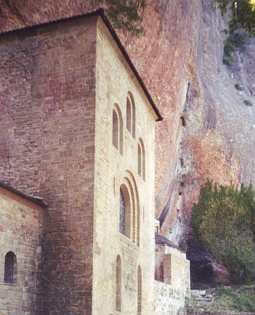
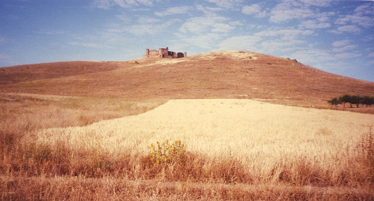
 In Rocamadour I have kept up with the St Jacques route to Compostela again. Rocamadour
is perched against a cliff. The city has three levels. Above the cliff is a 12th
century old church. The second level has lots of chapels and is actually built against
the cliff. The third level is the actual mediaevil town.
In Rocamadour I have kept up with the St Jacques route to Compostela again. Rocamadour
is perched against a cliff. The city has three levels. Above the cliff is a 12th
century old church. The second level has lots of chapels and is actually built against
the cliff. The third level is the actual mediaevil town.

 But my first goal is much closer. Six hundred meter above the valley lies the
Monasterio de San Juan de la Peña under an overhanging rock. A small paved road is
leading up the monastery. I am sweating all over during the climb. I am not used
to these temperatures any more. But it is great to cycle in a shirt, finally. As
I reach the monastery, there are pilgrims, again. It seems like there are as much pilgrims
as there are stones. I am welcomed heartily by two cyclists. They have come from
Santiago and do the Camino in the "wrong" direction. They say it is hard labour to
visit the beautiful monasteries. They are always far above the valleys, so that you
always have to climb a lot.
But my first goal is much closer. Six hundred meter above the valley lies the
Monasterio de San Juan de la Peña under an overhanging rock. A small paved road is
leading up the monastery. I am sweating all over during the climb. I am not used
to these temperatures any more. But it is great to cycle in a shirt, finally. As
I reach the monastery, there are pilgrims, again. It seems like there are as much pilgrims
as there are stones. I am welcomed heartily by two cyclists. They have come from
Santiago and do the Camino in the "wrong" direction. They say it is hard labour to
visit the beautiful monasteries. They are always far above the valleys, so that you
always have to climb a lot.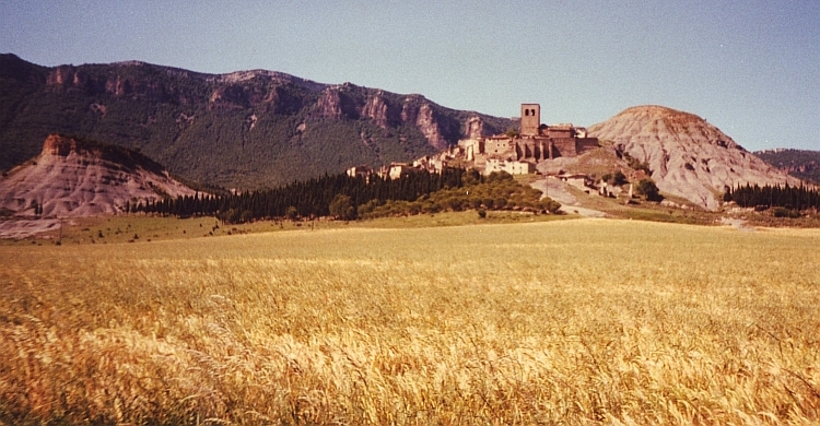

 Today I want to visit the Monasterio de Yuso and the Monasterio de Suso, two monasteries
in the mountains of the Sierra de la Demanda. This sidetrip off the main road will
provide some extra climbing, but that is no problem.
Today I want to visit the Monasterio de Yuso and the Monasterio de Suso, two monasteries
in the mountains of the Sierra de la Demanda. This sidetrip off the main road will
provide some extra climbing, but that is no problem.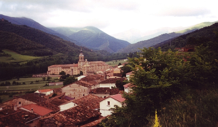
 Nice riding through green hill landscapes brings me higher and higher. After a few hours
up and down and up again I reach the Col de Piedrasluengas. On the Col are grand views of
the limestone cliffs of the Picos de Europa. From here I have a descent of more than
thirty kilometre and more than 1.000 altitude meters to Potes. I seem to descend into
an oven.
Nice riding through green hill landscapes brings me higher and higher. After a few hours
up and down and up again I reach the Col de Piedrasluengas. On the Col are grand views of
the limestone cliffs of the Picos de Europa. From here I have a descent of more than
thirty kilometre and more than 1.000 altitude meters to Potes. I seem to descend into
an oven.
 For a long time the road remains high above the valley. I have great views in constantly
changing angles. After a last short climb, I have a long descent.
For a long time the road remains high above the valley. I have great views in constantly
changing angles. After a last short climb, I have a long descent. Only four kilometres to go. On my righthand I see a big hotel with a big pink neon
"love" sign. A girl in a short skirt asks if I want some lovin'. I guess that this
is not the kind of love that brought me to Santiago. Now it is only one curve before
I am on the top of the last hill. I turn to the right, only hundred meter
and I will be able to see Santiago below. I see four cyclists coming in my
direction from Santiago... As I look better, I recognize the four veterans from
the Rioja! They have reached Santiago, they shout... no time... have to
hurry to catch the airplane back to Belgium. And then they are out of sight. I
am looking forward again and there it is, below... Santiago... I let myself go down.
Within a minute I am down in Santiago, ride into the old city. I start walking. It
is too crowded to cycle now. I feel being part of the age-old stream of pilgrims. I am
on the Pórtico de Gloria now, the road twists and turns, one last turn and there
it is right before me: the cathedral. The cathedral with the bones of St Jacques.
Only four kilometres to go. On my righthand I see a big hotel with a big pink neon
"love" sign. A girl in a short skirt asks if I want some lovin'. I guess that this
is not the kind of love that brought me to Santiago. Now it is only one curve before
I am on the top of the last hill. I turn to the right, only hundred meter
and I will be able to see Santiago below. I see four cyclists coming in my
direction from Santiago... As I look better, I recognize the four veterans from
the Rioja! They have reached Santiago, they shout... no time... have to
hurry to catch the airplane back to Belgium. And then they are out of sight. I
am looking forward again and there it is, below... Santiago... I let myself go down.
Within a minute I am down in Santiago, ride into the old city. I start walking. It
is too crowded to cycle now. I feel being part of the age-old stream of pilgrims. I am
on the Pórtico de Gloria now, the road twists and turns, one last turn and there
it is right before me: the cathedral. The cathedral with the bones of St Jacques.


 Trás Os Montes is a beautiful, yet very poor, region. The road from Chaves to
Bragança is leading through mountain terrain. On the steep flanks of small river
valleys are terraces. Villages are often situated far above the valley. Sometimes
the road goes through a narrow valley, sometimes the road follows a ridge hundred
meters above the valleys.
Trás Os Montes is a beautiful, yet very poor, region. The road from Chaves to
Bragança is leading through mountain terrain. On the steep flanks of small river
valleys are terraces. Villages are often situated far above the valley. Sometimes
the road goes through a narrow valley, sometimes the road follows a ridge hundred
meters above the valleys.


 Along the Costa del Sol I ride in the direction of Málaga. The road is flat.
There are no mountains rising up from the coast like on the Motril to Nerja stage. In
Málaga I am lucky to find the road that is leading me into the Valle del Sol.
Along the Costa del Sol I ride in the direction of Málaga. The road is flat.
There are no mountains rising up from the coast like on the Motril to Nerja stage. In
Málaga I am lucky to find the road that is leading me into the Valle del Sol.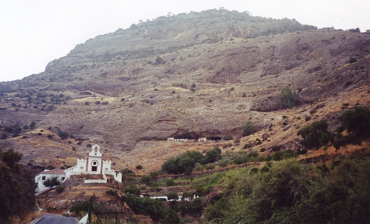
 Over a superbly obscure unpaved road I go southward from Ardales in the direction of Ronda. After fifteen kilometres I
have asphalt under my wheels again. The landscape is much drier here. Two minor
cols further I reach Ronda, a town of white houses.
Over a superbly obscure unpaved road I go southward from Ardales in the direction of Ronda. After fifteen kilometres I
have asphalt under my wheels again. The landscape is much drier here. Two minor
cols further I reach Ronda, a town of white houses.