| Start Page | 1) Ecuador | 2) Peru | 3) Bolivia | 4) Chile & Argentina | 5) Colombia | 6) Central America | 7) Mexico | 8) U.S.A. | 9) Canada |  |
| Start Page | 1) Ecuador | 2) Peru | 3) Bolivia | 4) Chile & Argentina | 5) Colombia | 6) Central America | 7) Mexico | 8) U.S.A. | 9) Canada | |
|
The long Road. Part 4 of 9: Argentina and Chile
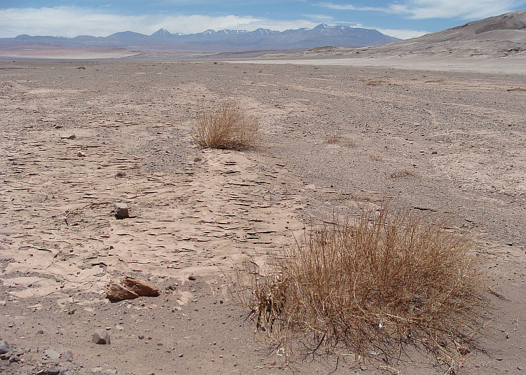
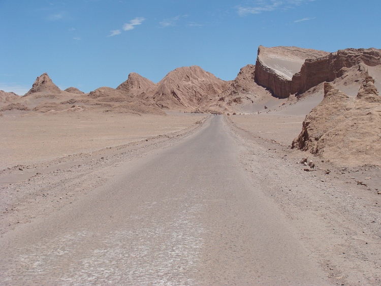
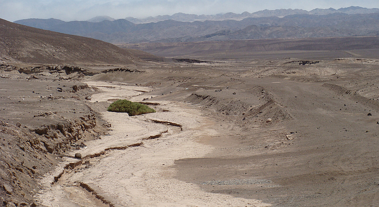
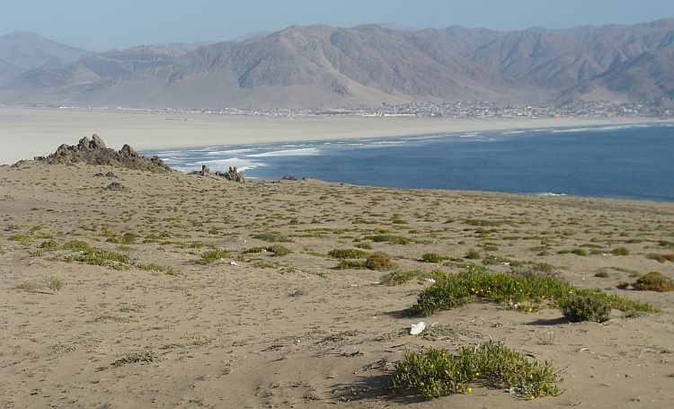
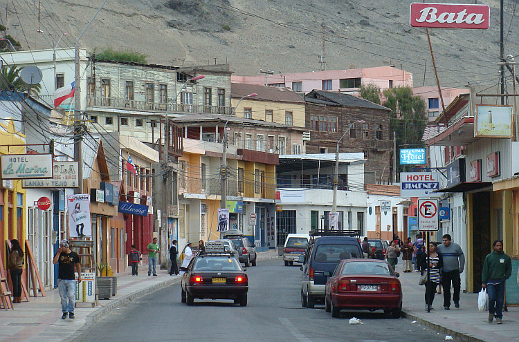
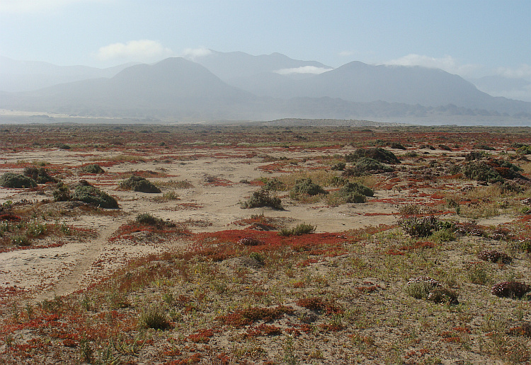
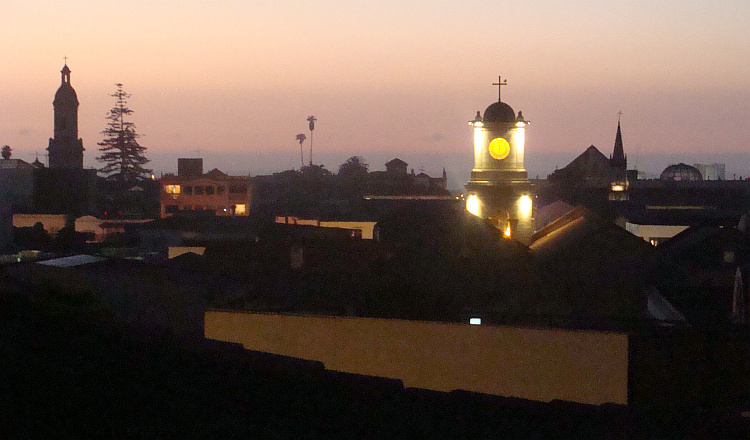
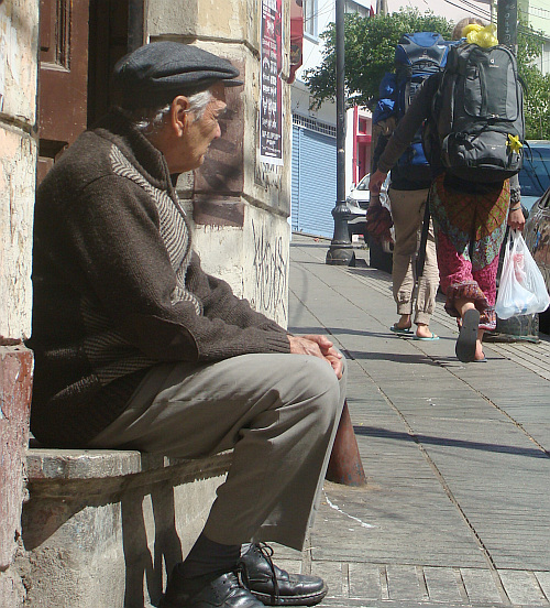
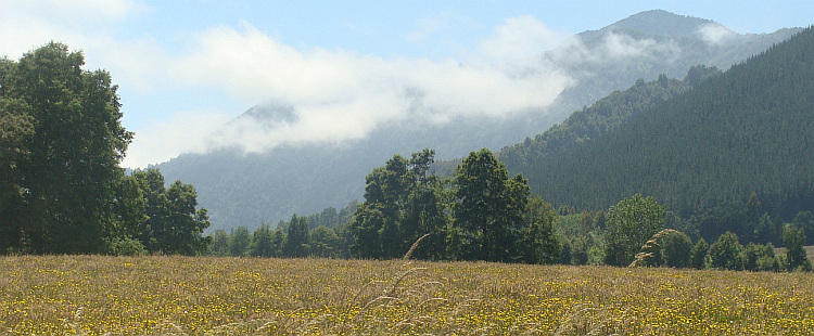
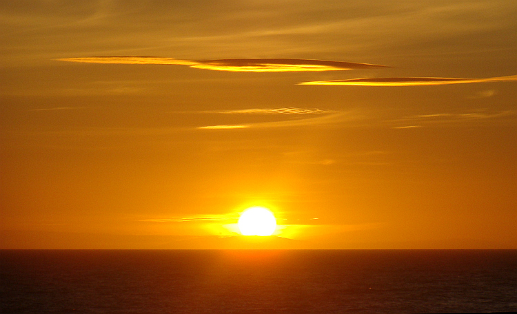
 In Antofagasta I reached the ocean. The port town had quite some casinos and
brothels. The desert is not a romantic place, and there are only the raw, primary
feelings. And we are therefore once again confirmed in the clichéd
image that money and sex are indeed the primary human motivations. Lately the
supply in Antofagasta has been expanded with giant shopping malls for
a more socially accepted form of entertainment. While I was making a picture
at the boulevard of the gray apartment blocks with the gray fog in the
background and the gray ocean on the foreground, a cyclist passed by. The
Russian Boris traveled on a road bike through Latin America and had only two
panniers with him. He did not camp and he traveled light. And he explained that
he covered very big distances. He had cycled in 43 days from Mexico City to
Antofagasta. That is an average of at least 250 to 300 kilometers per day. His
calves and thighs were at least four times as thick as that of other mortals.
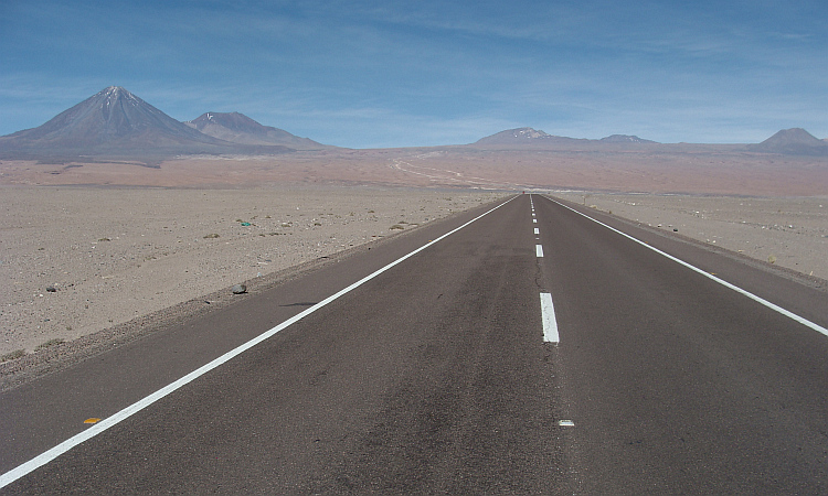
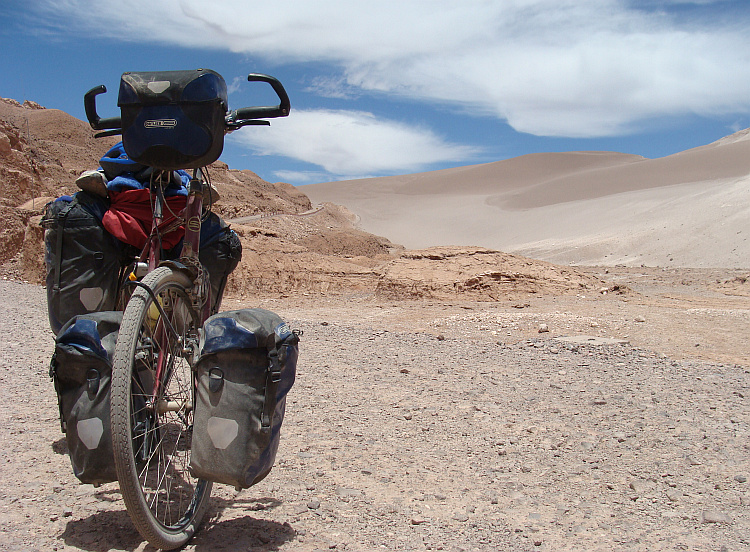
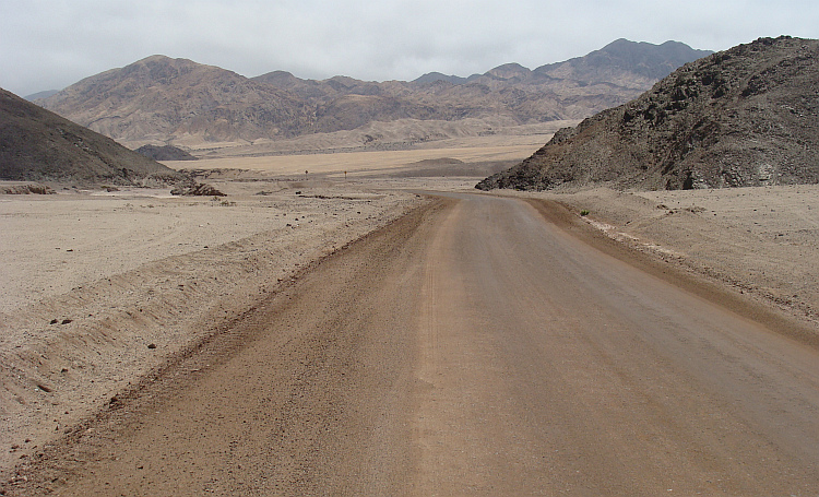
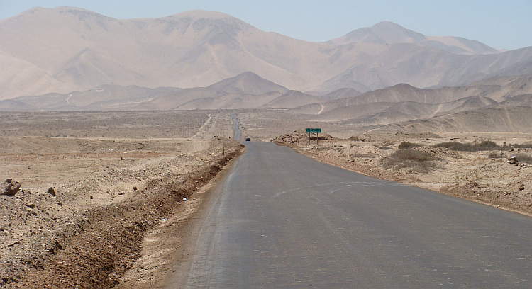
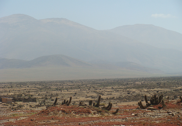
On the climb to the Panamericana I was just able to keep the pace of the man
with the concrete muscles, but once on the Panamericana we reached the terrain
of Boris. The road was more or less flat again. Before I realized that I was
too slow, the iron man cycled two hundred meter ahead of me. He passed a coffee
stall, probably the only tavern in the next four hundred kilometers. From
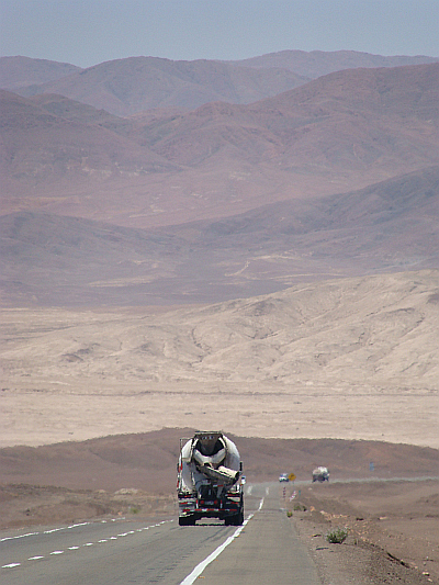
Antofagasta it is more than four hundred kilometers on the Panamericana to
the first settlement. I actually wanted some caffeine doping, but I passed the
coffee stall to reach Boris. It turned out to be a hopeless mission. I saw Boris
ever further ahead of me. Fifty kilometers further, at the exit where I would
leave the Panamericana for a more attractive route along the coast, he had not
waited. He was only fixed by cycling. In hindsight I could just as well drink my
cup of tea.
In Antofagasta I reached the ocean. The port town had quite some casinos and
brothels. The desert is not a romantic place, and there are only the raw, primary
feelings. And we are therefore once again confirmed in the clichéd
image that money and sex are indeed the primary human motivations. Lately the
supply in Antofagasta has been expanded with giant shopping malls for
a more socially accepted form of entertainment. While I was making a picture
at the boulevard of the gray apartment blocks with the gray fog in the
background and the gray ocean on the foreground, a cyclist passed by. The
Russian Boris traveled on a road bike through Latin America and had only two
panniers with him. He did not camp and he traveled light. And he explained that
he covered very big distances. He had cycled in 43 days from Mexico City to
Antofagasta. That is an average of at least 250 to 300 kilometers per day. His
calves and thighs were at least four times as thick as that of other mortals.
On the climb to the Panamericana I was just able to keep the pace of the man
with the concrete muscles, but once on the Panamericana we reached the terrain
of Boris. The road was more or less flat again. Before I realized that I was
too slow, the iron man cycled two hundred meter ahead of me. He passed a coffee
stall, probably the only tavern in the next four hundred kilometers. From
Antofagasta it is more than four hundred kilometers on the Panamericana to
the first settlement. I actually wanted some caffeine doping, but I passed the
coffee stall to reach Boris. It turned out to be a hopeless mission. I saw Boris
ever further ahead of me. Fifty kilometers further, at the exit where I would
leave the Panamericana for a more attractive route along the coast, he had not
waited. He was only fixed by cycling. In hindsight I could just as well drink my
cup of tea.
 "If you ride through the world o your own, you need a lot of help."
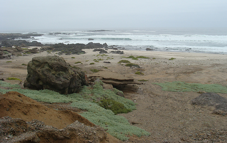
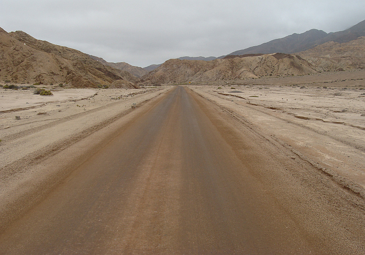
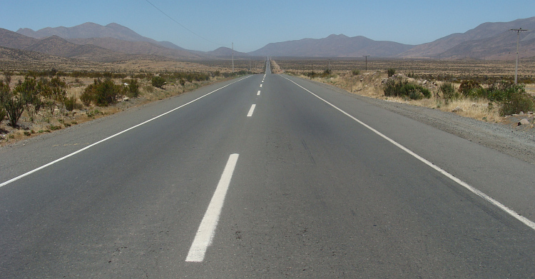
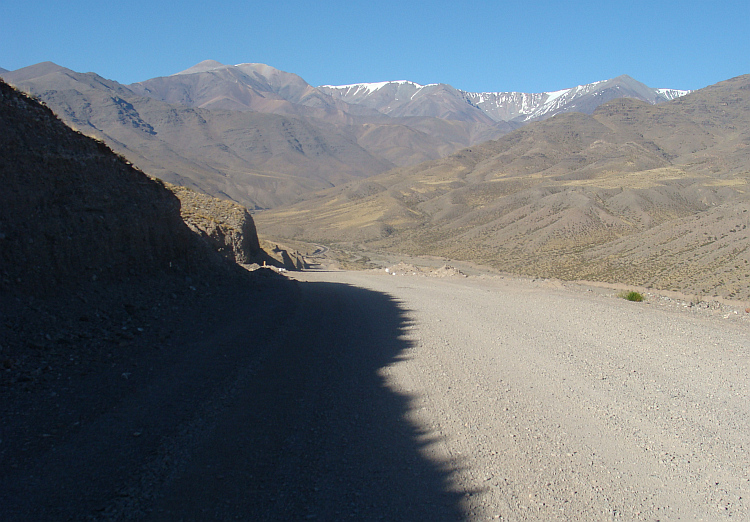
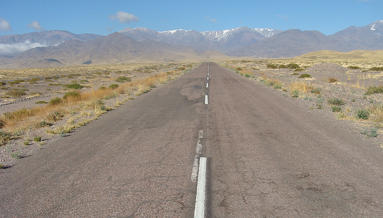
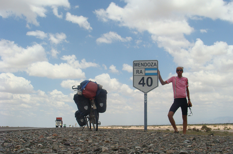
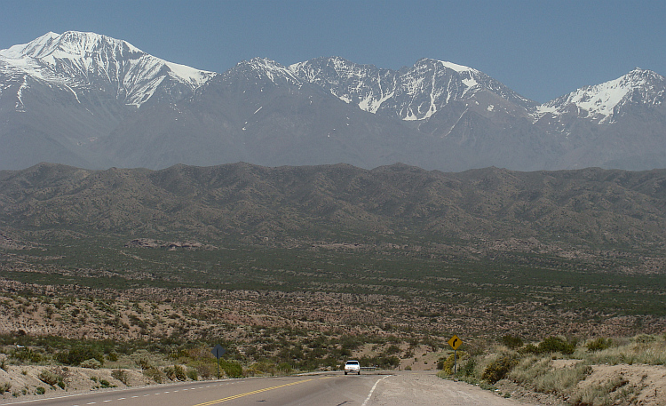
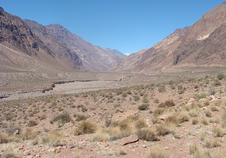
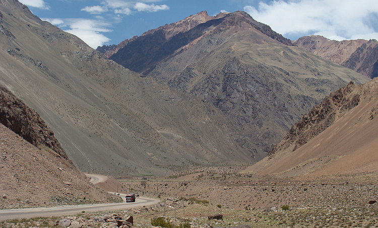
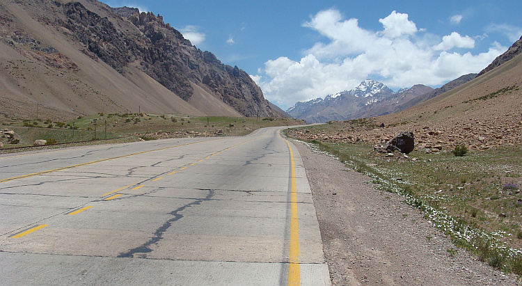
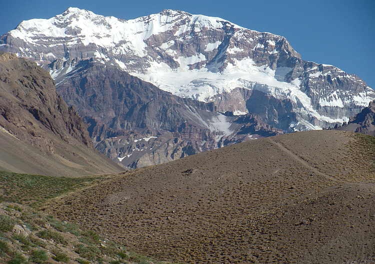
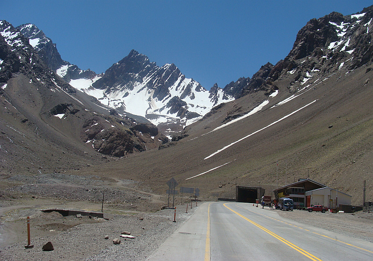
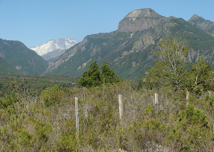
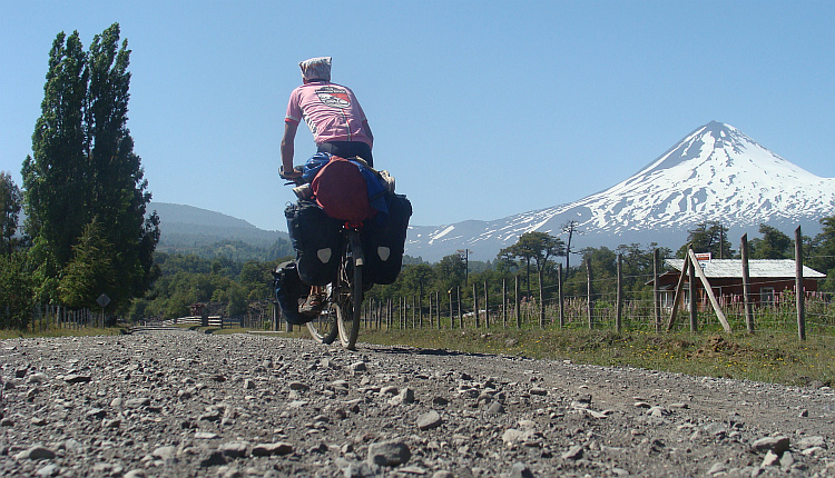
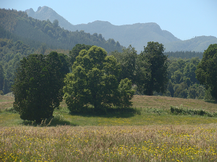
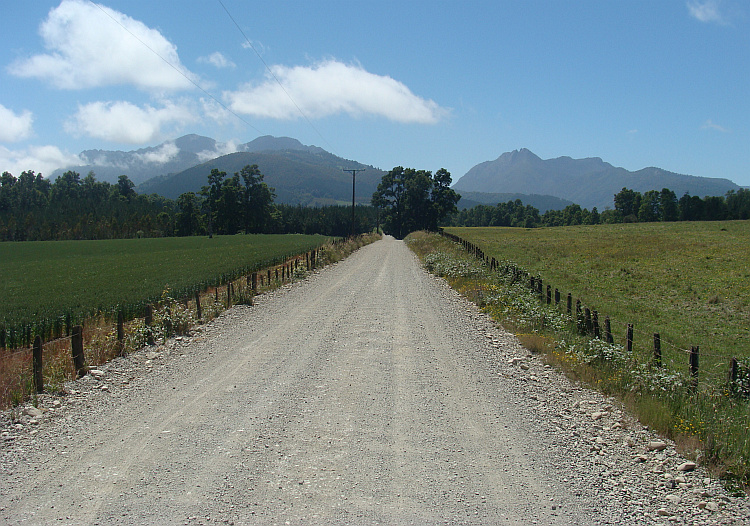
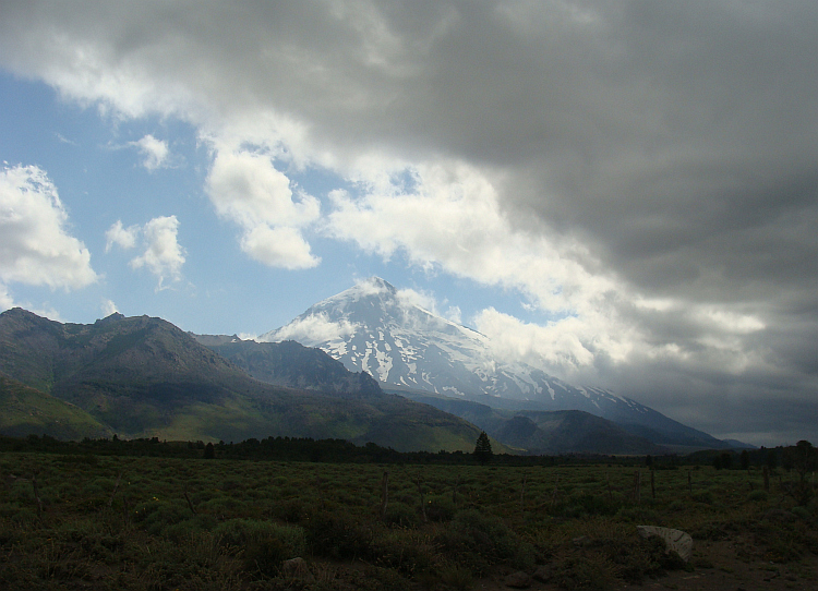
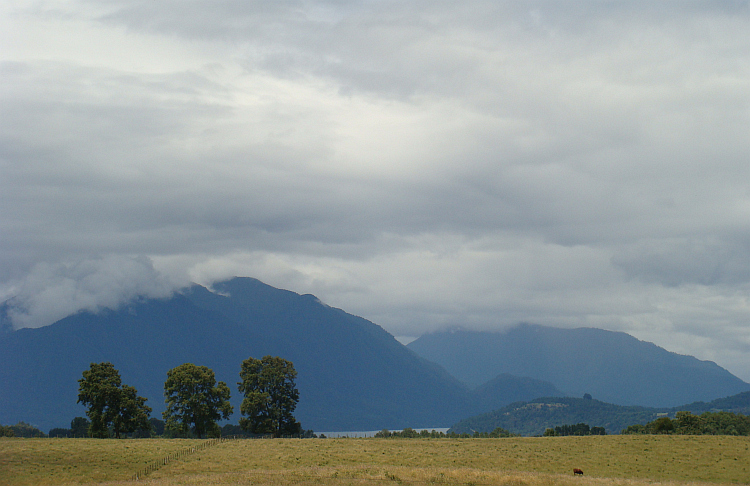
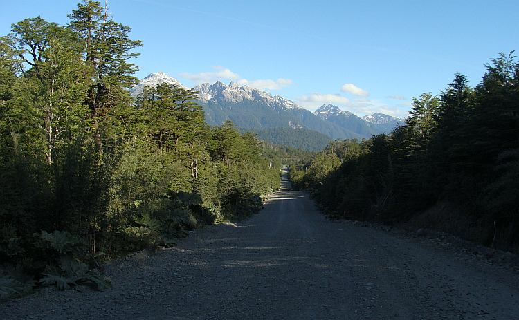
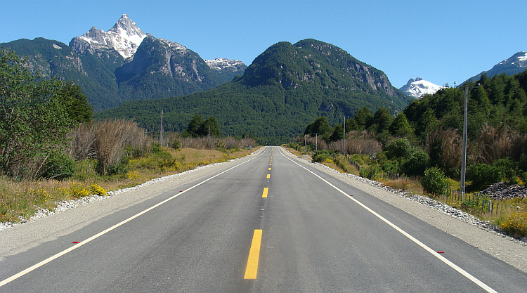
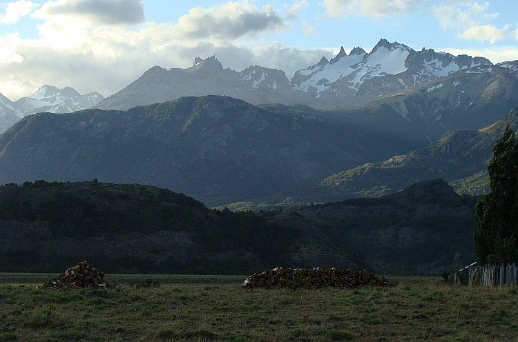
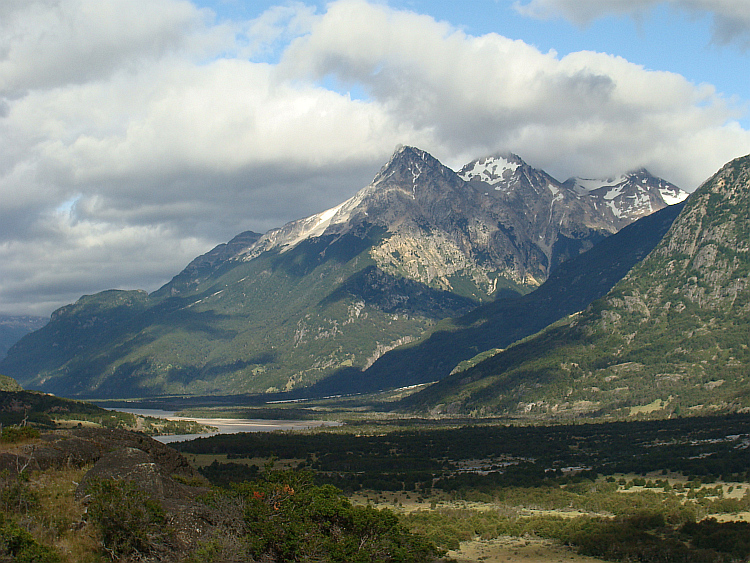
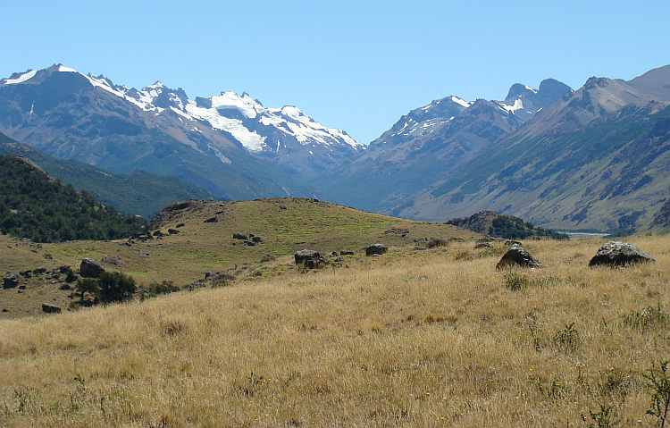
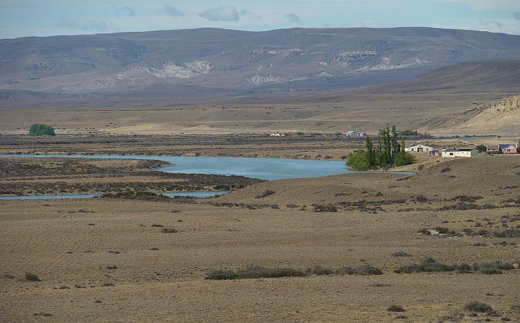
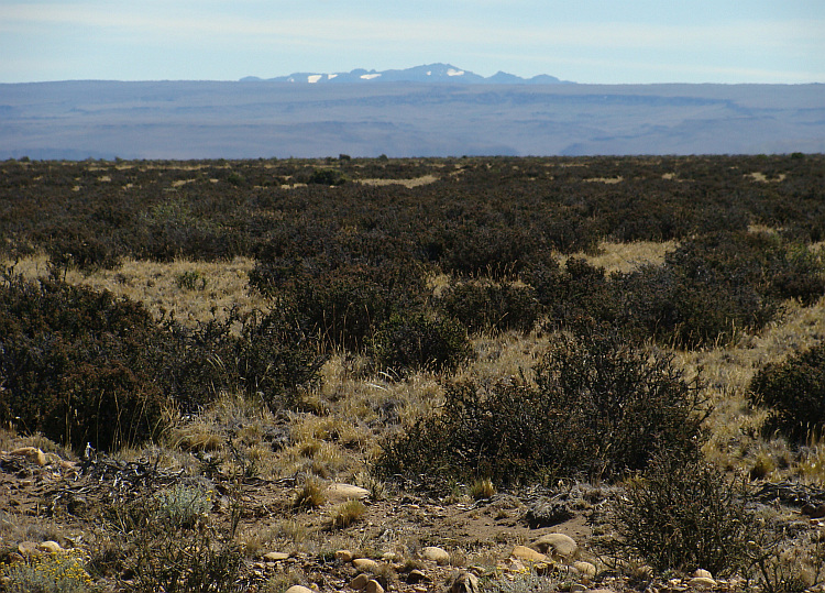
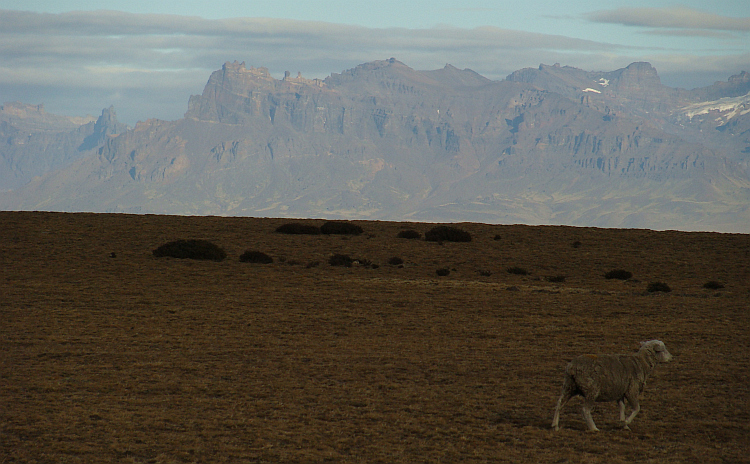
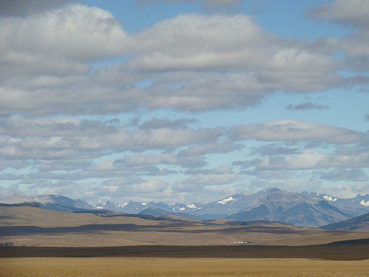
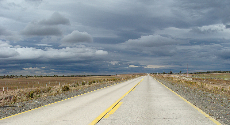
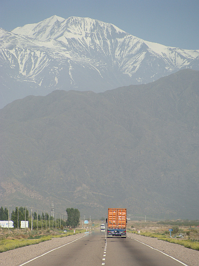 After two days it was time to leave the Ruta 40 and the hot lowlands. I rode
straight to the snowy mountain range from the Andes, a solid wall which rose
up six thousand meter from the plains. The road was good. I cycled on the main
link between Argentina and Chile, from Buenos Aires to Santiago de Chile.
A problem were the heavy trucks, which swooped by recklessly close on the road
without shoulder. Another problem was the stormy headwind. The conditions gave
the opportunity for a perfect wind tunnel test: a narrow valley with slopes of
hundreds to thousands of meters high and a storm against, which had ample
opportunity in the narrow valley to to swell and accelerate. I fought the
elements and the elements won.
After two days it was time to leave the Ruta 40 and the hot lowlands. I rode
straight to the snowy mountain range from the Andes, a solid wall which rose
up six thousand meter from the plains. The road was good. I cycled on the main
link between Argentina and Chile, from Buenos Aires to Santiago de Chile.
A problem were the heavy trucks, which swooped by recklessly close on the road
without shoulder. Another problem was the stormy headwind. The conditions gave
the opportunity for a perfect wind tunnel test: a narrow valley with slopes of
hundreds to thousands of meters high and a storm against, which had ample
opportunity in the narrow valley to to swell and accelerate. I fought the
elements and the elements won.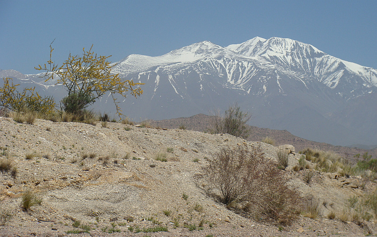
 I reached the Chilean coast in the fashionable resort of Viña del Mar. On the
boulevard I saw men with big reflective sunglasses and women with a plaster of
makeup that would envy Tutankhamun. Arms, legs, neck, everything rattled with
bling. Among the many apartments was a lot of green. The trees were different
from what I was used to in the Andes. As some men cut or trim their facial hair,
so were the trees and plants. Some trees were cut globular, others had the
shape of an equilateral triangle. Nature was apparently too sloppy, and
therefore the people have made an artificial remake of the created universe. Even
better than the original. Viña del Mar was not only a mecca for hair,
makeup and other stylists, the city was also a motorist paradise. There were no
speed limits and they were basically allowed to do whatever they want. There
was no need to take account of cyclists, they were prohibited. I had to get away
here anyway and I ignored the warning signs. With some difficulty I managed
to cross Viña del Mar. I reached the next big town, neighboring Valparaíso.
I reached the Chilean coast in the fashionable resort of Viña del Mar. On the
boulevard I saw men with big reflective sunglasses and women with a plaster of
makeup that would envy Tutankhamun. Arms, legs, neck, everything rattled with
bling. Among the many apartments was a lot of green. The trees were different
from what I was used to in the Andes. As some men cut or trim their facial hair,
so were the trees and plants. Some trees were cut globular, others had the
shape of an equilateral triangle. Nature was apparently too sloppy, and
therefore the people have made an artificial remake of the created universe. Even
better than the original. Viña del Mar was not only a mecca for hair,
makeup and other stylists, the city was also a motorist paradise. There were no
speed limits and they were basically allowed to do whatever they want. There
was no need to take account of cyclists, they were prohibited. I had to get away
here anyway and I ignored the warning signs. With some difficulty I managed
to cross Viña del Mar. I reached the next big town, neighboring Valparaíso.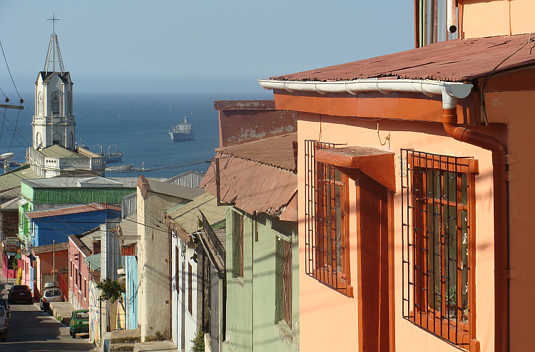
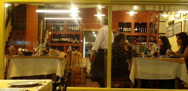
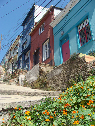
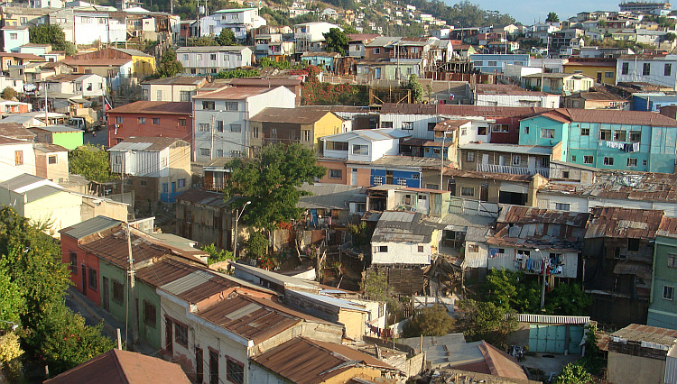
 The hills of Valparaíso rose steeply from the sea. Houses in all colors
clung to these so-called Cerros. These were so steep that the houses seemed
to be stacked on top of each other. Impossibly steep roads meandered between
the houses to the many stunning viewpoints. Valparaíso was a fascinating,
chaotic, three-dimensional world of steep, green hills, the deep blue sea and
houses in all possible colors. Many of these houses were painted with frescoes
and murals. Or with graffiti, the frescoes of the modern era. Valparaíso
was the artistic city of Chile. Everybody was an artist. Or pretended to be.
And of course those are the real artists.
The hills of Valparaíso rose steeply from the sea. Houses in all colors
clung to these so-called Cerros. These were so steep that the houses seemed
to be stacked on top of each other. Impossibly steep roads meandered between
the houses to the many stunning viewpoints. Valparaíso was a fascinating,
chaotic, three-dimensional world of steep, green hills, the deep blue sea and
houses in all possible colors. Many of these houses were painted with frescoes
and murals. Or with graffiti, the frescoes of the modern era. Valparaíso
was the artistic city of Chile. Everybody was an artist. Or pretended to be.
And of course those are the real artists.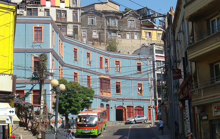
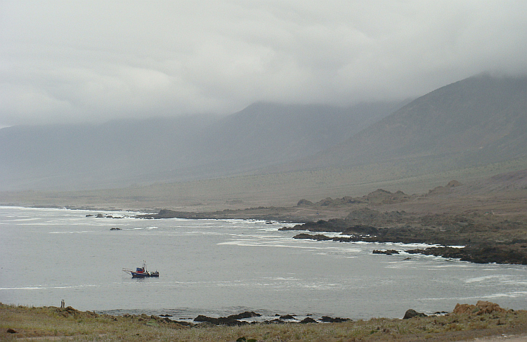
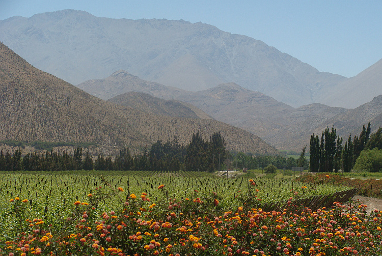
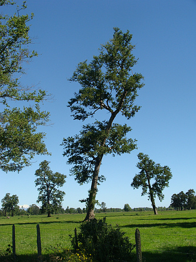
 Along the Chilean coast and through the hills and valleys of the Coastal Mountains
and the Central Valley I moved south. I cycled through one of the world's best
wine regions, the Colchagua Valley. A German winemaker explained that good wine,
just like great art, thrives under suffering. Because of the dry climate, the many
sun-hours and with the cooling influence of the ocean on the one hand and the
Andes on the other hand, there are plenty of stress factors for the grapes. The
daily battle against the conditions resulted in characterful wines.
All internationally appealing grape varieties were represented in Chile:
Merlot, Pinot Noir, Cabernet Sauvignon Shyraz and above. But the big star of the
Chilean wines is the Carmenère, the grape that has become extinct in Europe.
A good Carmenère guarantees a triple explosion of flavor. The first
sensation is full and fruity, berry-like. After that a dry, spicy taste world
manifests itself, which is catapulted to the final stage. The intense
bitter sour aftertaste of the third and final taste explosion is in turn the
perfect prelude to a new sip of fruity Carmenère.
Along the Chilean coast and through the hills and valleys of the Coastal Mountains
and the Central Valley I moved south. I cycled through one of the world's best
wine regions, the Colchagua Valley. A German winemaker explained that good wine,
just like great art, thrives under suffering. Because of the dry climate, the many
sun-hours and with the cooling influence of the ocean on the one hand and the
Andes on the other hand, there are plenty of stress factors for the grapes. The
daily battle against the conditions resulted in characterful wines.
All internationally appealing grape varieties were represented in Chile:
Merlot, Pinot Noir, Cabernet Sauvignon Shyraz and above. But the big star of the
Chilean wines is the Carmenère, the grape that has become extinct in Europe.
A good Carmenère guarantees a triple explosion of flavor. The first
sensation is full and fruity, berry-like. After that a dry, spicy taste world
manifests itself, which is catapulted to the final stage. The intense
bitter sour aftertaste of the third and final taste explosion is in turn the
perfect prelude to a new sip of fruity Carmenère. 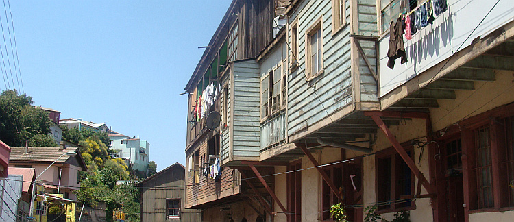
 Chile was the first of the former Spanish colonies that gained democracy, in 1886,
two years after the end of the Pacific War. President Balmaceda tried to reform
the country and to change the extremely unequal distribution of wealth. The
oligarchy of Chile consisted of traditional landowners and a small group of
people that got rich from the nitrate mines. When Balmaceda wanted to nationalize
the nitrate mines, the military made a coup. Balmaceda committed suicide
and the status quo was restored in favor of the landowners and the industrial
elite. The second democratic and progressive period of Chile was not permanent
either. In 1970, Salvador Allende won the election. He wanted to nationalize
the copper mines and the banks and insurance and he wanted a redistribution
of the land. Salvador Allendes policies provoked the landowners and the
industrial elite. And the Americans, who were de facto expoliting the copper
mining operations and with Richard Nixon they had a president that whatsoever
was not into socialist experiments in their 'backyard', such as South America
was considered at the time. When Allende was reelected in 1973, the Chilean
army staged a coup once again, with the help of the United States of America.
Allende was killed and Augusto Pinochet came to power with the military junta
until 1990. During this period, at least three thousand people killed and
many people disappeared without a trace. One of them was the popular
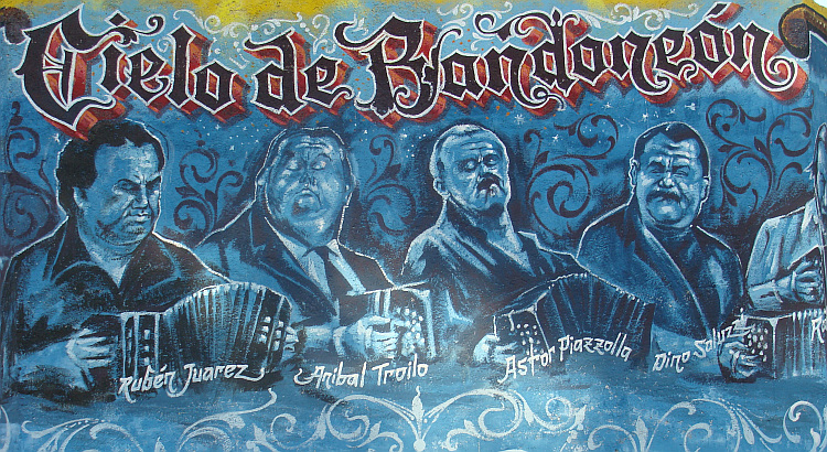
protest singer Victor Jara, whose poignant song 'Te recuerdo Amanda'
was a dramatic statement against the regime. It is a love song about Manuel
and Amanda. Manuel goes to the factory every day, until one day he does not
come back because of an 'accident'. Amanda since then waits in despair and
in vain for his return. The life of Victor Jara would lead to a similar fate as
that of his character Manuel. He wrote his last song at the age of 35 at the
stadium of Santiago, the place where many criticizers of the junta 'disappeared'.
Chile was the first of the former Spanish colonies that gained democracy, in 1886,
two years after the end of the Pacific War. President Balmaceda tried to reform
the country and to change the extremely unequal distribution of wealth. The
oligarchy of Chile consisted of traditional landowners and a small group of
people that got rich from the nitrate mines. When Balmaceda wanted to nationalize
the nitrate mines, the military made a coup. Balmaceda committed suicide
and the status quo was restored in favor of the landowners and the industrial
elite. The second democratic and progressive period of Chile was not permanent
either. In 1970, Salvador Allende won the election. He wanted to nationalize
the copper mines and the banks and insurance and he wanted a redistribution
of the land. Salvador Allendes policies provoked the landowners and the
industrial elite. And the Americans, who were de facto expoliting the copper
mining operations and with Richard Nixon they had a president that whatsoever
was not into socialist experiments in their 'backyard', such as South America
was considered at the time. When Allende was reelected in 1973, the Chilean
army staged a coup once again, with the help of the United States of America.
Allende was killed and Augusto Pinochet came to power with the military junta
until 1990. During this period, at least three thousand people killed and
many people disappeared without a trace. One of them was the popular
protest singer Victor Jara, whose poignant song 'Te recuerdo Amanda'
was a dramatic statement against the regime. It is a love song about Manuel
and Amanda. Manuel goes to the factory every day, until one day he does not
come back because of an 'accident'. Amanda since then waits in despair and
in vain for his return. The life of Victor Jara would lead to a similar fate as
that of his character Manuel. He wrote his last song at the age of 35 at the
stadium of Santiago, the place where many criticizers of the junta 'disappeared'. 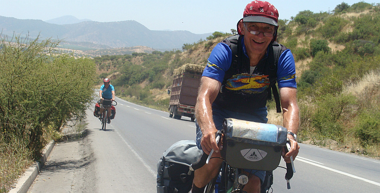
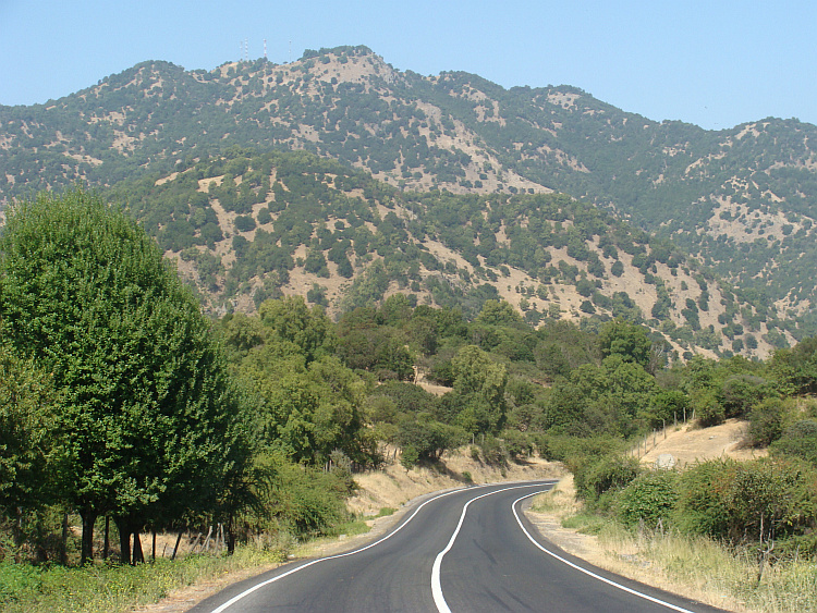
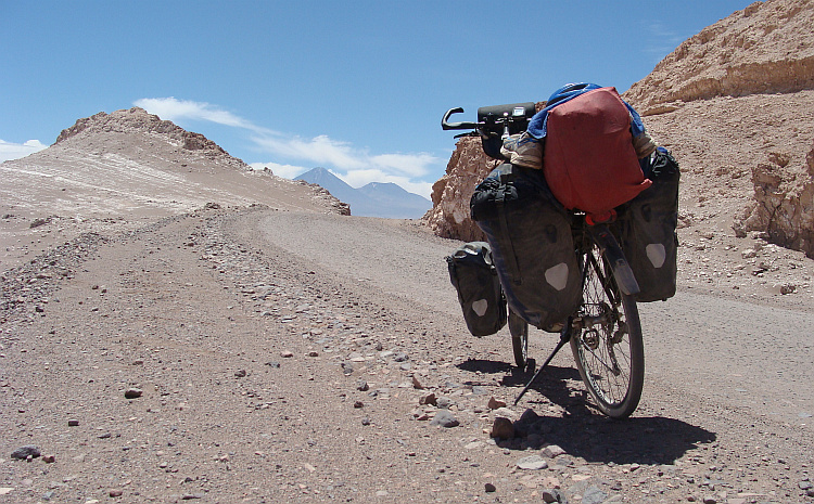
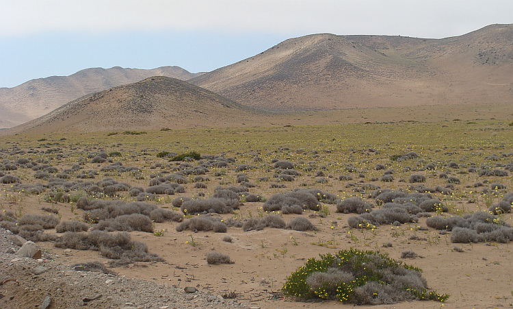
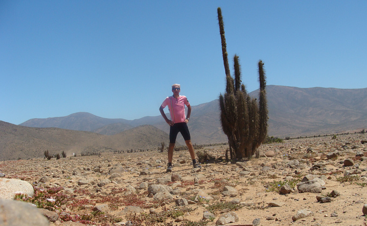
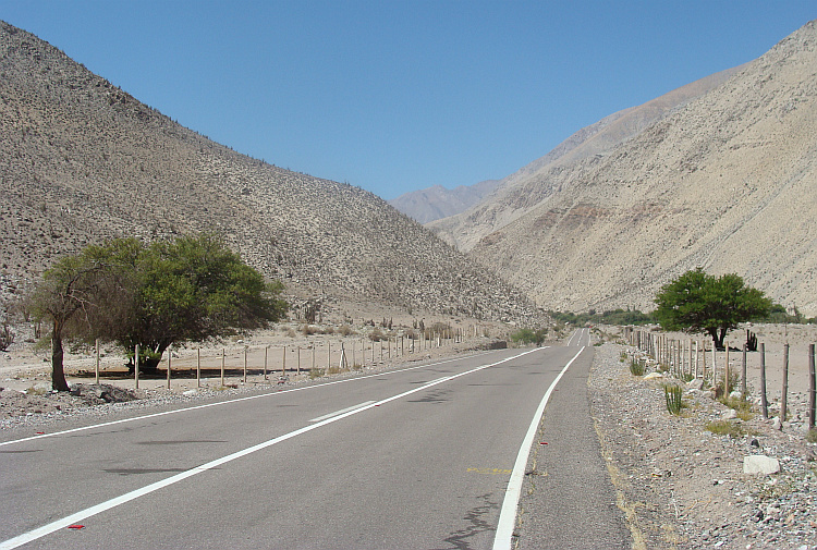
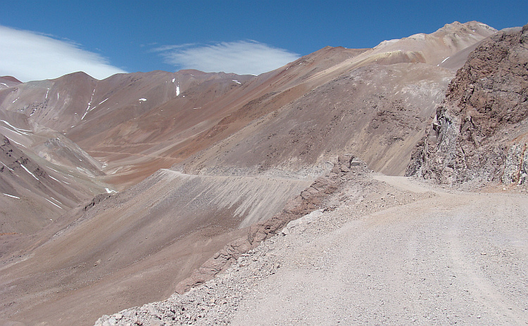
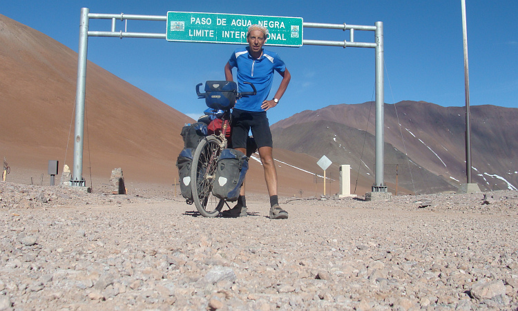
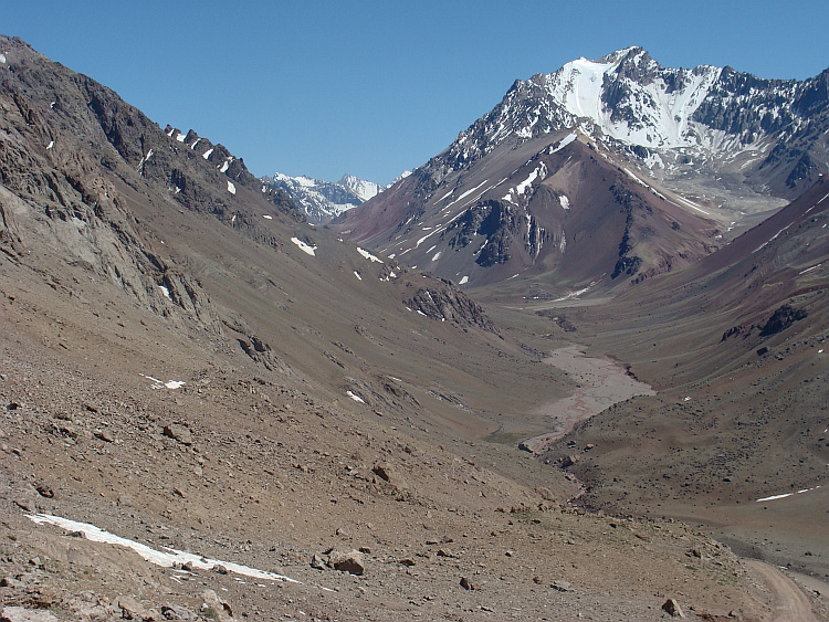
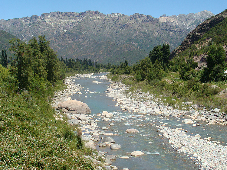
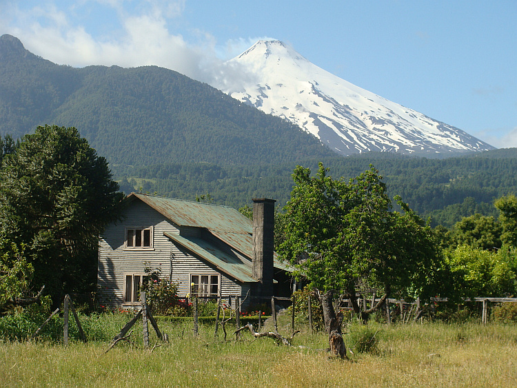
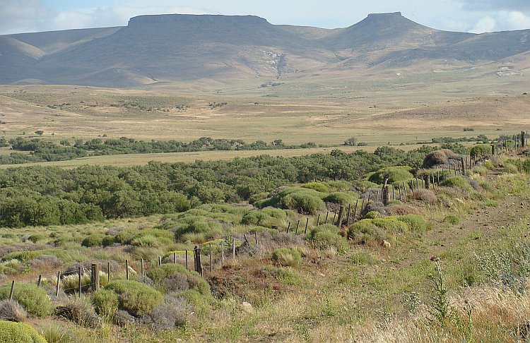
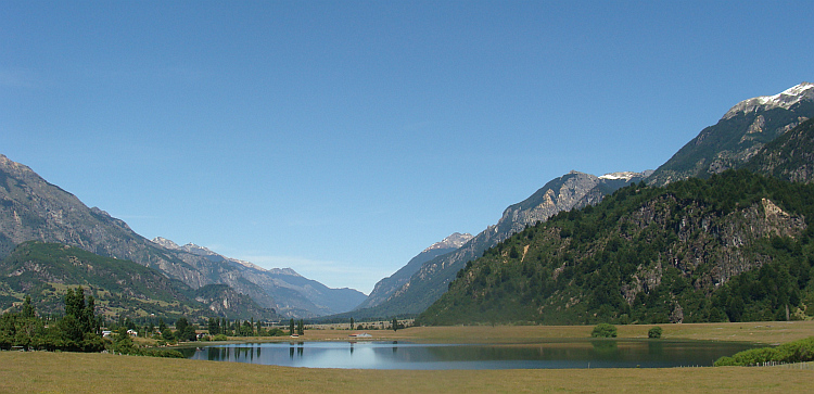
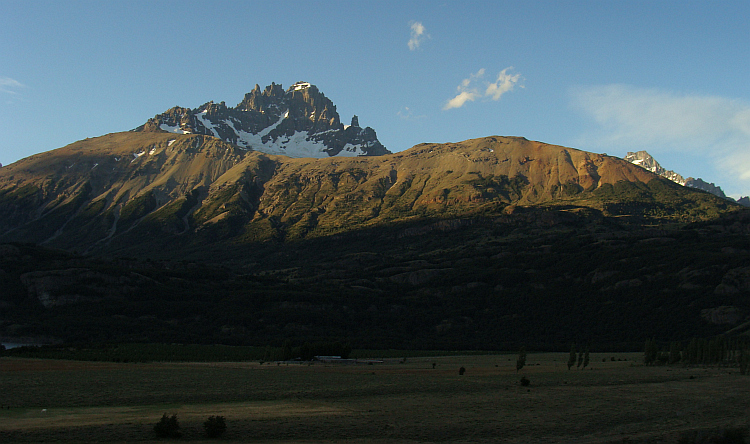
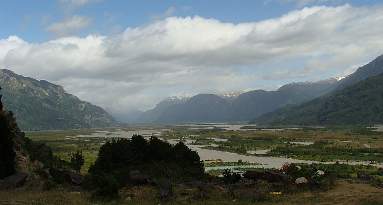
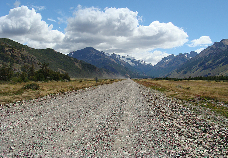
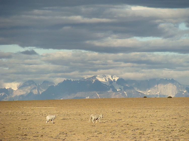
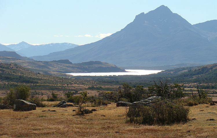
 I wanted to cross the Andes back to Argentina. The first reliable option
to cross the mountain range was the Paso Pehuenche. I had traveled far enough
south, to leave the extremely dry landscapes behind me for good.
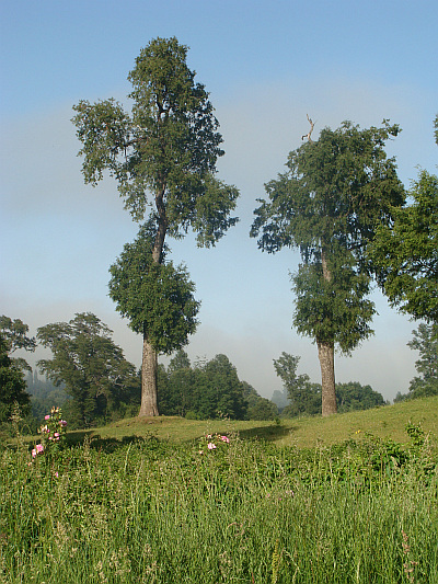
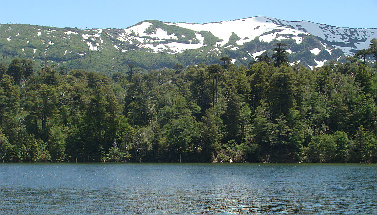
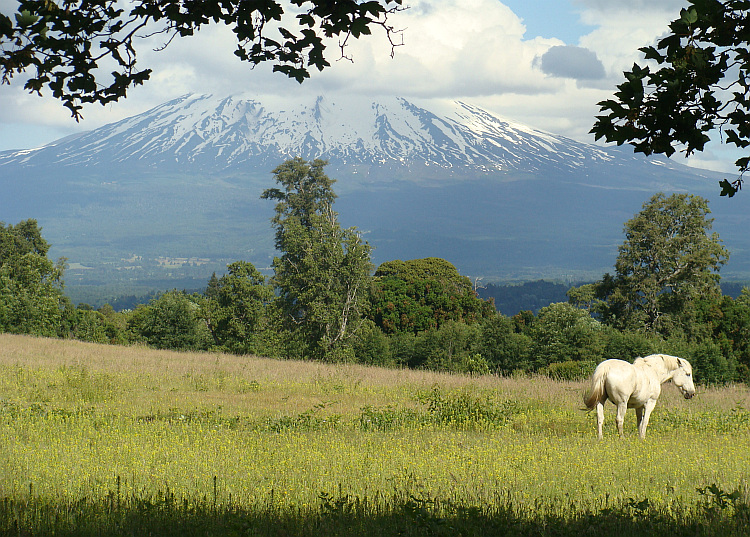
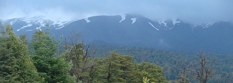
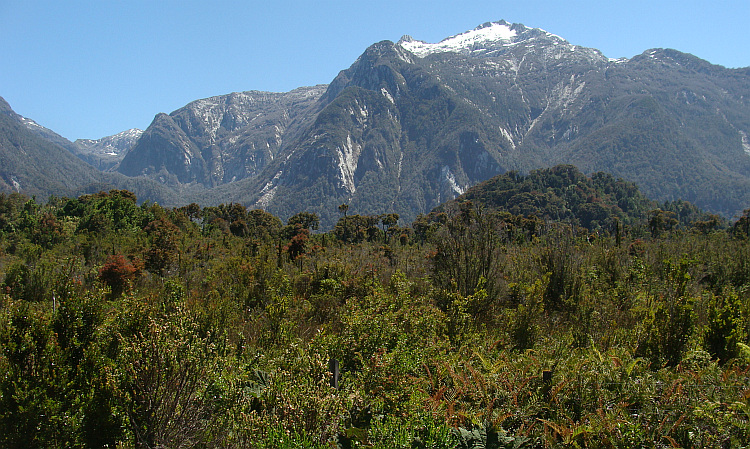
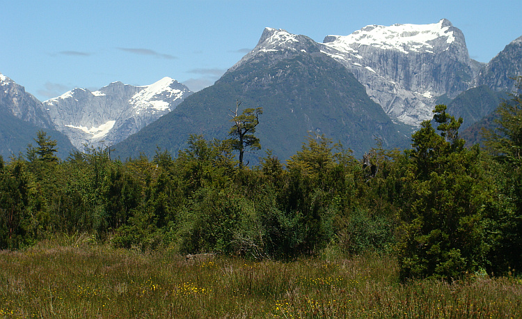
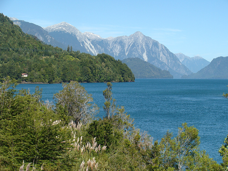
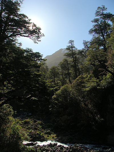
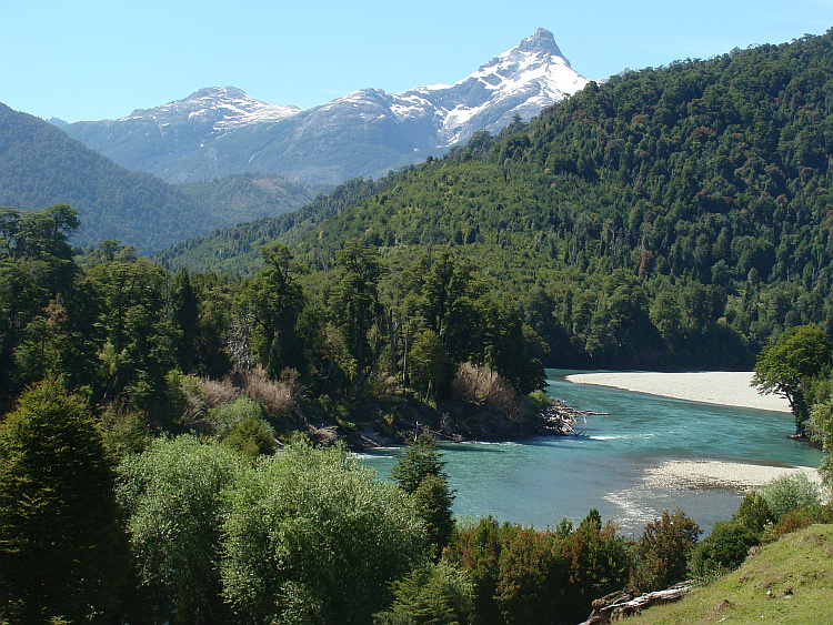
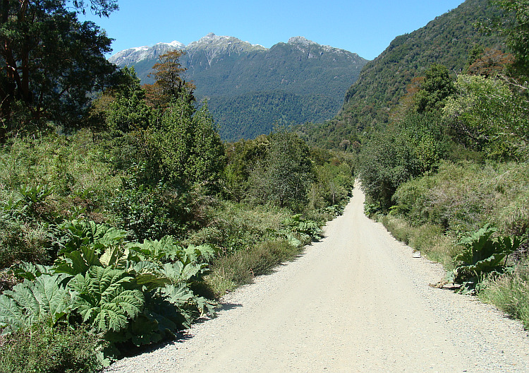
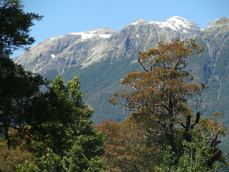
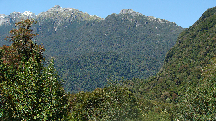
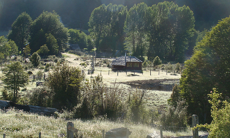
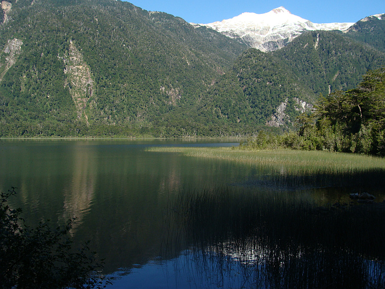
Through vast forests I cycled up through the Andes and I passed deep blue lakes.
Occasionally a snowy white volcano towered above the green landscape. To my
surprise I spotted some parrots. Great macaws with blue wings were fluttering
through the air.
I wanted to cross the Andes back to Argentina. The first reliable option
to cross the mountain range was the Paso Pehuenche. I had traveled far enough
south, to leave the extremely dry landscapes behind me for good.
Through vast forests I cycled up through the Andes and I passed deep blue lakes.
Occasionally a snowy white volcano towered above the green landscape. To my
surprise I spotted some parrots. Great macaws with blue wings were fluttering
through the air. 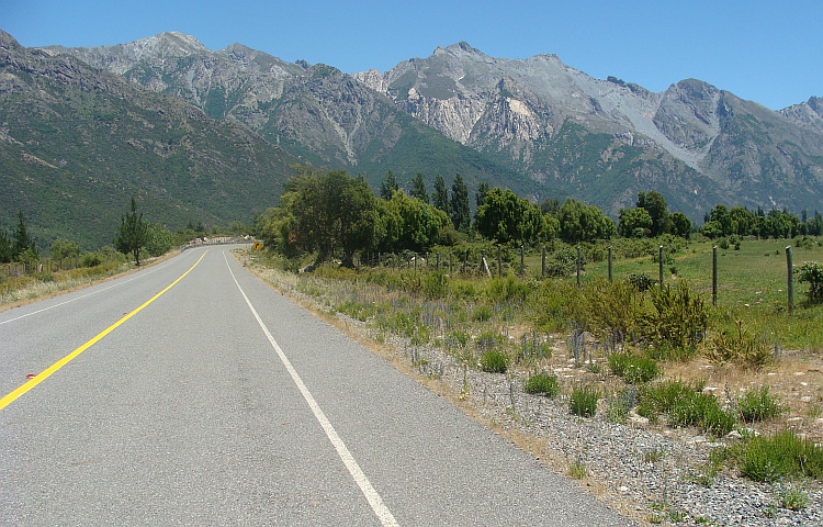
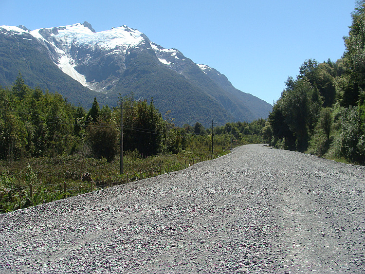
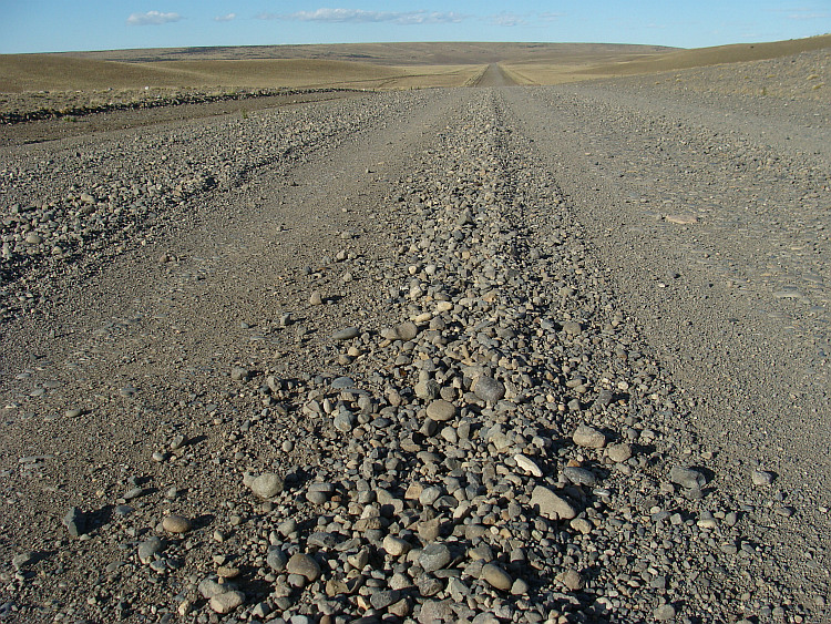
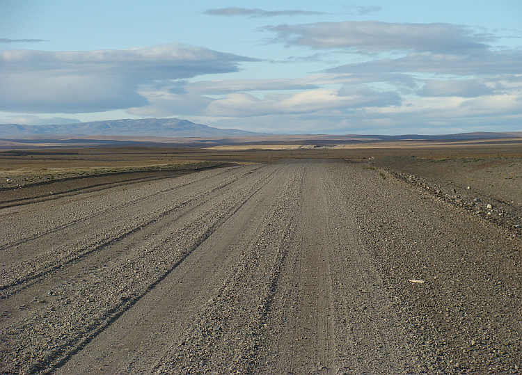
 I started the morning for the way back. After twenty kilometers on the road, I
reached an unmanned roadblock. The company COBUN, which generates electricity from the
reservoir and the supplying rivers, had closed the road. They apparatly owned
the road and wer allowed to close it. There was no way to get through. A
passionate curse escaped my mouth. After backtracking twenty kilometers on
the same road and ten kilometers cycling further down I had a third and final
possibility to avoid a detour of four hundred kilometers. I enetered a new
secondary road. This one was of unusually poor quality, but in any case I cycled
in the right direction again, to the south. After twenty kilometers over the
abominable gravel road waited another surprise: a roadblock with fencing of
three meters high. Behind the fence an asphalt road leaded to civilization. Once
again it was a little surprise from the company COBUN. There was an emergency
telephone and desperately I tried to contact COBUN.
I started the morning for the way back. After twenty kilometers on the road, I
reached an unmanned roadblock. The company COBUN, which generates electricity from the
reservoir and the supplying rivers, had closed the road. They apparatly owned
the road and wer allowed to close it. There was no way to get through. A
passionate curse escaped my mouth. After backtracking twenty kilometers on
the same road and ten kilometers cycling further down I had a third and final
possibility to avoid a detour of four hundred kilometers. I enetered a new
secondary road. This one was of unusually poor quality, but in any case I cycled
in the right direction again, to the south. After twenty kilometers over the
abominable gravel road waited another surprise: a roadblock with fencing of
three meters high. Behind the fence an asphalt road leaded to civilization. Once
again it was a little surprise from the company COBUN. There was an emergency
telephone and desperately I tried to contact COBUN. 
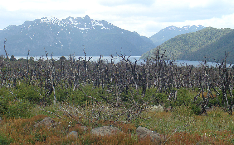
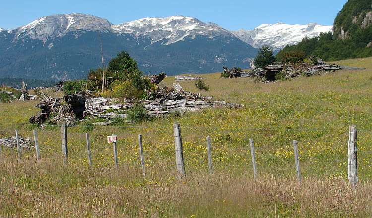
 The trifle with my friends of the company COBUN fit into a broader framework.
Pehuenche Indians were forced to leave their territory for the benefit of
reservoirs COBUN. Not only the Indian population was victim. The reservoirs
also have replaced thousands of acres of rare temperate rainforests.
The trifle with my friends of the company COBUN fit into a broader framework.
Pehuenche Indians were forced to leave their territory for the benefit of
reservoirs COBUN. Not only the Indian population was victim. The reservoirs
also have replaced thousands of acres of rare temperate rainforests.
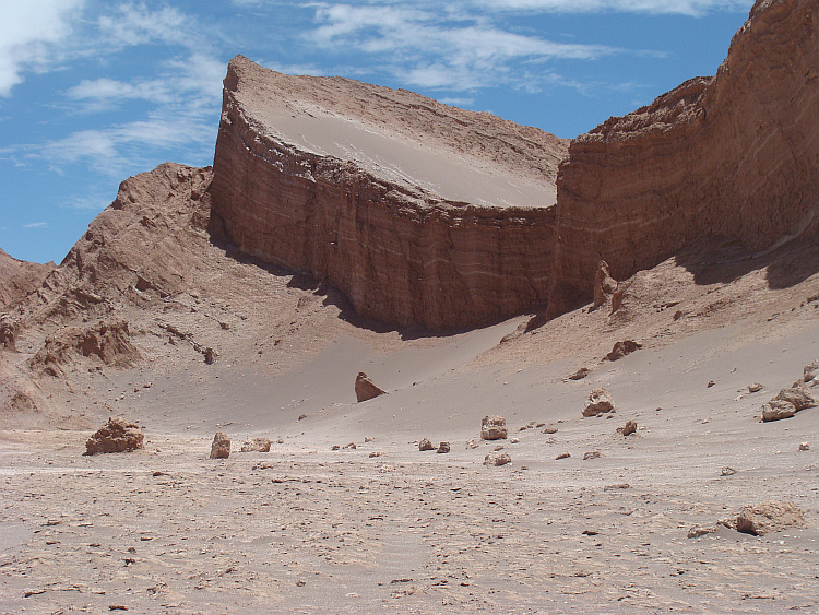
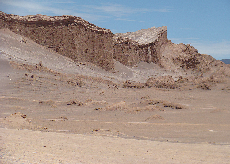
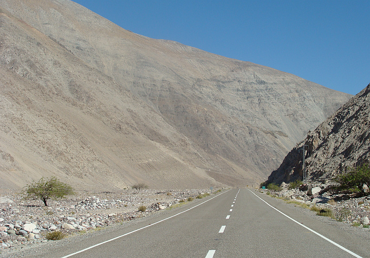
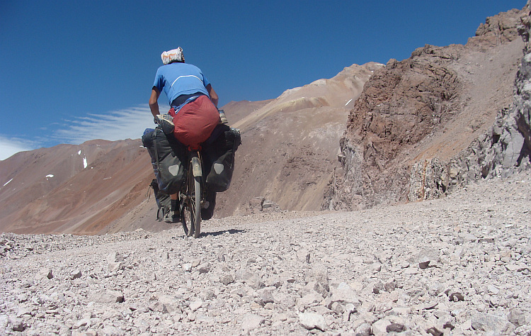
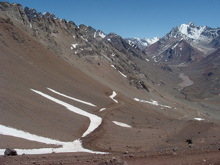
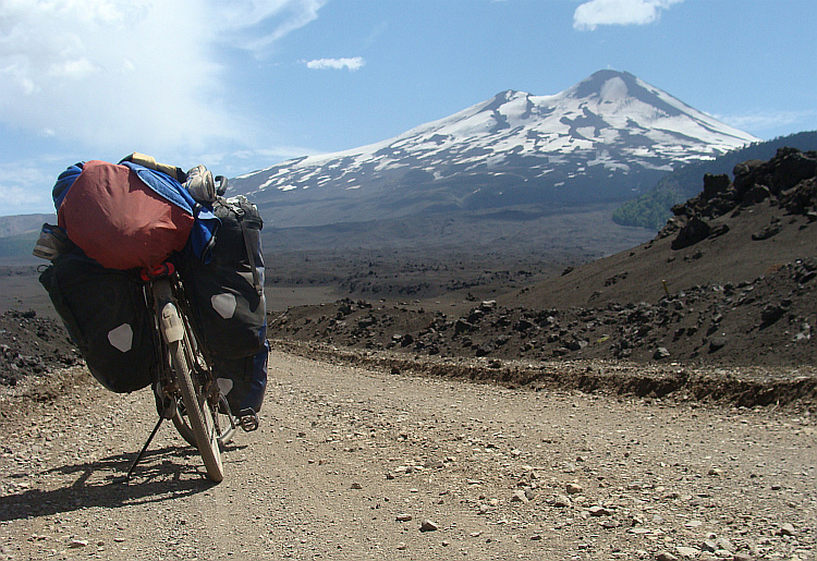
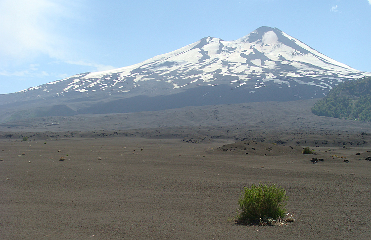
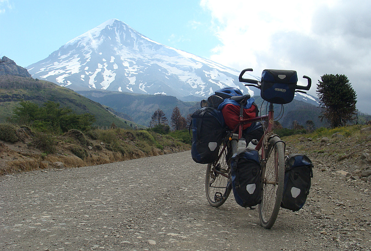
 I reached the first large lava field. The volcanic grit gave little
grip and I was forced to walk with the bike. That was just a foretaste of
what awaited me on the other side of the lava field. The road was cruelly and
severely beaten, as if a giant mole had churned up the mess. Cycling was
impossible; my bike sank deep into the loose stones. I could barely push my bike
through the loosened stones mush. Only a hundred meter before me I saw the
excavator at work. So that was the culprit. If I could pass over the monster,
I might again be able to continue my way on a 'normal' road. The reality was
that I did not have a chance to ever catch the excavator, because it made the
road impassable. I saw the accursed excavator ever further before me. Bitterly I
realized that I was just a minute too late to prevent this tragedy. Meanwhile,
the sun had come out of its hibernation. I thought that I had arrived cooler climates
by now, but it was even hotter here than in the Atacama Desert. While I pushed
forth my bike through the loose stones, the sweat was pouring down my face.
I was looking for a small river to cool down a bit.
I reached the first large lava field. The volcanic grit gave little
grip and I was forced to walk with the bike. That was just a foretaste of
what awaited me on the other side of the lava field. The road was cruelly and
severely beaten, as if a giant mole had churned up the mess. Cycling was
impossible; my bike sank deep into the loose stones. I could barely push my bike
through the loosened stones mush. Only a hundred meter before me I saw the
excavator at work. So that was the culprit. If I could pass over the monster,
I might again be able to continue my way on a 'normal' road. The reality was
that I did not have a chance to ever catch the excavator, because it made the
road impassable. I saw the accursed excavator ever further before me. Bitterly I
realized that I was just a minute too late to prevent this tragedy. Meanwhile,
the sun had come out of its hibernation. I thought that I had arrived cooler climates
by now, but it was even hotter here than in the Atacama Desert. While I pushed
forth my bike through the loose stones, the sweat was pouring down my face.
I was looking for a small river to cool down a bit. 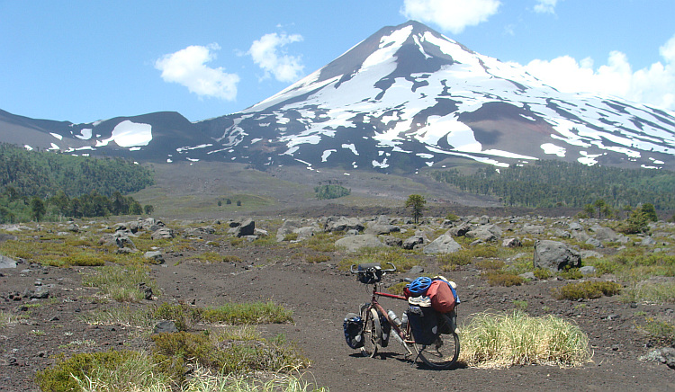
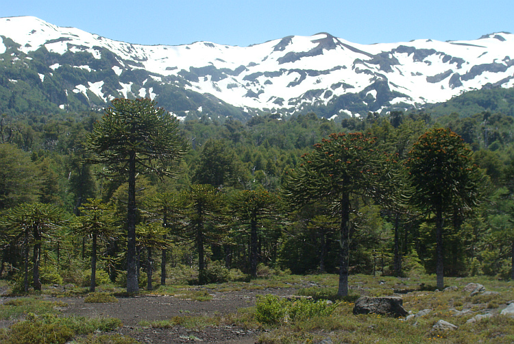
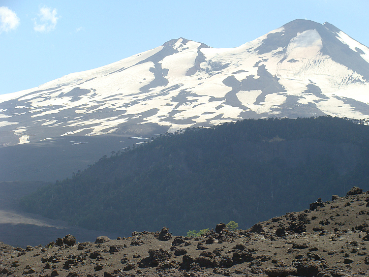
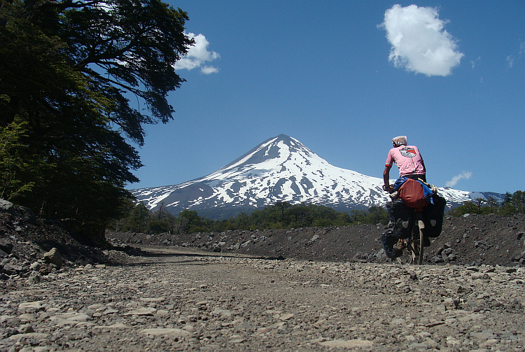
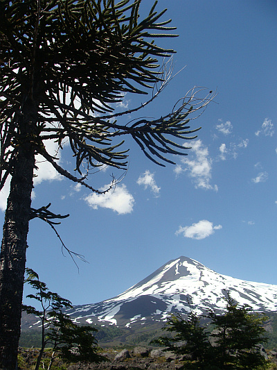
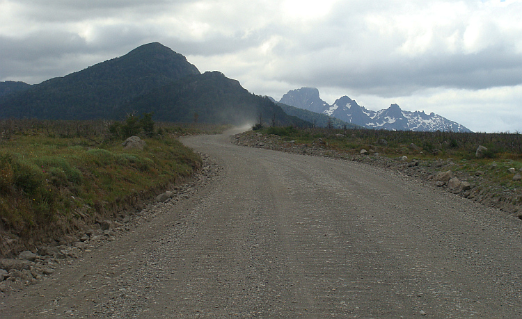
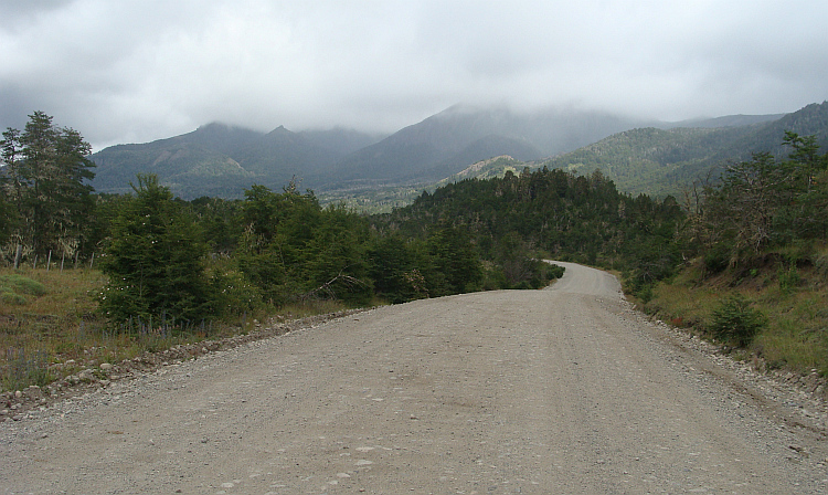
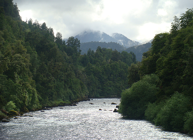
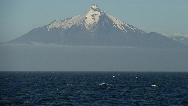
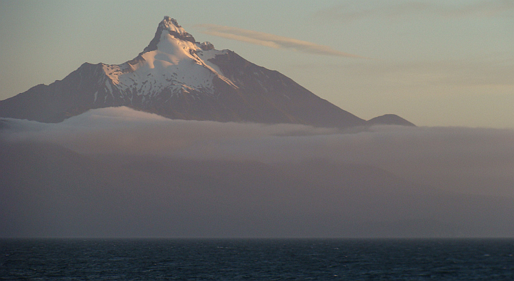
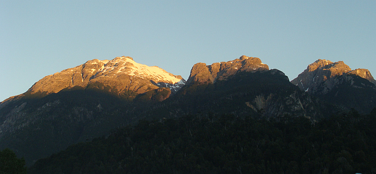
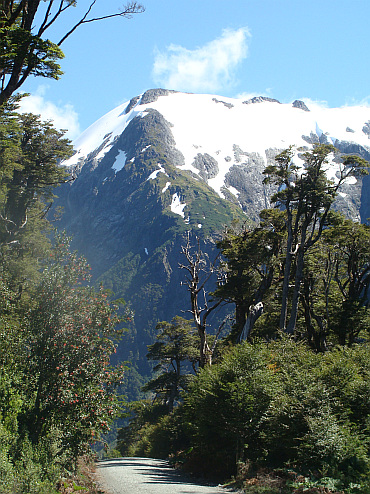
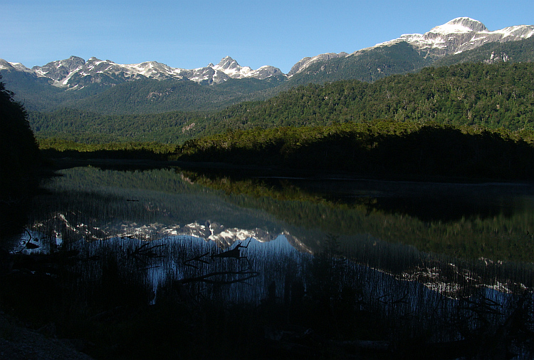
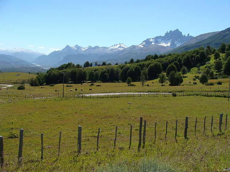
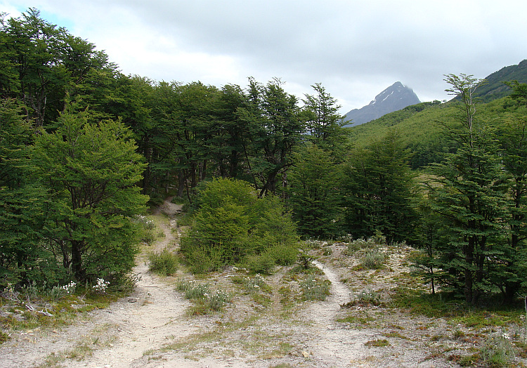
 After Currarrehue the way up led up in the mountains through dense forests and
along many cascading waterfalls. After the climb I reached a plateau, flanked
by snow-capped mountain ranges. The volcano Lanín towered above the
plateau. After many hours I reached the pass and the border. The lush green,
temperate rainforests of Chile had made way for the vast pampas of Argentina.
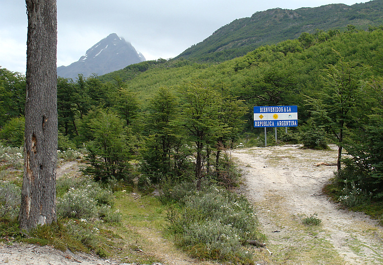
After Currarrehue the way up led up in the mountains through dense forests and
along many cascading waterfalls. After the climb I reached a plateau, flanked
by snow-capped mountain ranges. The volcano Lanín towered above the
plateau. After many hours I reached the pass and the border. The lush green,
temperate rainforests of Chile had made way for the vast pampas of Argentina.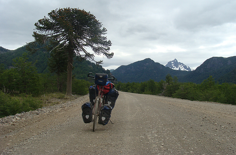

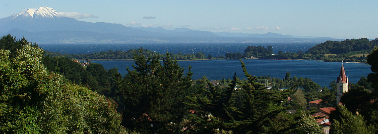
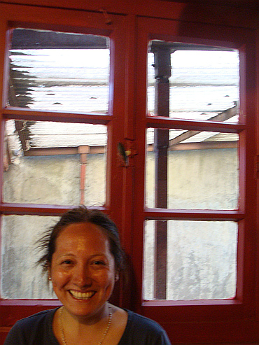
 I dined with the Chilean señorita Katharine, who had dived deeply in the
mythological and spiritual world of the Mapuche Indians. It is generally
known how the Spaniards in current Peru and Bolivia had subdued the Incas and other
Indian groups, but the fate of the Mapuche of Chile was even more brutal. Like
the tribes in North America, they had undergone a nearly complete genocide.
Today the Mapuche live mostly in isolated reserves. Partly because people like
Katharine nowadays we learn more about their living and thinking. Katharine wore
the Mapuche name 'llanka' or pearl. And also the Lonely Cyclist had meanwhile
got a Mapuche name: 'Alen'. That means literally 'the man who looks bright in
the night.' Like all Indian languages the mapuche language is one of metaphors.
The words can be read like someone who has deep contact with his inner dreams
and thus looks far ahead. As someone who can see in the night. Of course I was
fond of my mapuche name and I also had a new Mapuche name for my cheerful Chilean
señorita: Puyehue, to the volcano that still produced tonnes of smoke
above the Chilean-Argentinian border. Puyehue supposedly smoked a giant peace
pipe for the fraternization of the world at large and that of the old enemies
Argentina and Chile in particular.
I dined with the Chilean señorita Katharine, who had dived deeply in the
mythological and spiritual world of the Mapuche Indians. It is generally
known how the Spaniards in current Peru and Bolivia had subdued the Incas and other
Indian groups, but the fate of the Mapuche of Chile was even more brutal. Like
the tribes in North America, they had undergone a nearly complete genocide.
Today the Mapuche live mostly in isolated reserves. Partly because people like
Katharine nowadays we learn more about their living and thinking. Katharine wore
the Mapuche name 'llanka' or pearl. And also the Lonely Cyclist had meanwhile
got a Mapuche name: 'Alen'. That means literally 'the man who looks bright in
the night.' Like all Indian languages the mapuche language is one of metaphors.
The words can be read like someone who has deep contact with his inner dreams
and thus looks far ahead. As someone who can see in the night. Of course I was
fond of my mapuche name and I also had a new Mapuche name for my cheerful Chilean
señorita: Puyehue, to the volcano that still produced tonnes of smoke
above the Chilean-Argentinian border. Puyehue supposedly smoked a giant peace
pipe for the fraternization of the world at large and that of the old enemies
Argentina and Chile in particular. 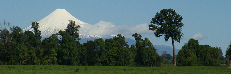
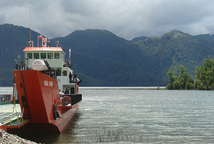
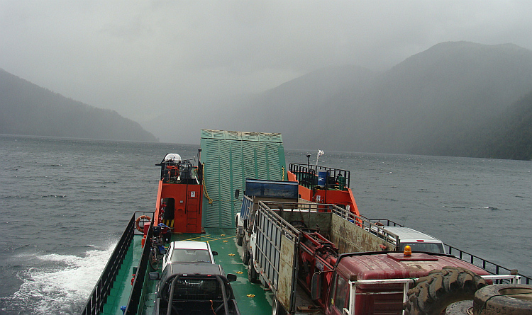
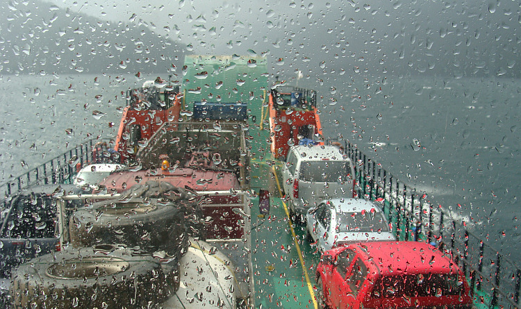
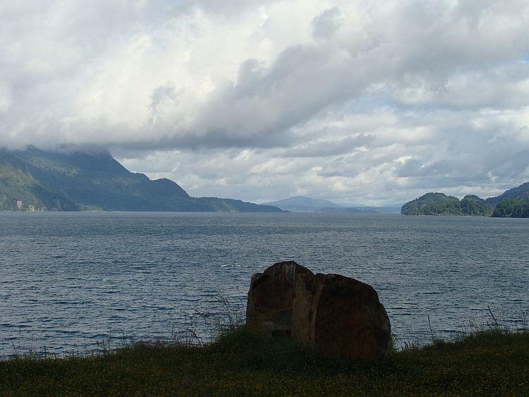
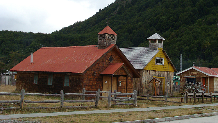
 A ferry brought me to the island of Chiloé, an island that is almost as big
as the Netherlands. At the far southern tip of the island, I had a ferry to
catch. Only once a week the ferry was running between the island and the village
of Chaitén in Chilean Patagonia. I did my Mapuche name little honor. I
did not look further than my own nose. The route through Chiloé was much larger
than I thought. A day before I would reach the ferry I heard that I had to be at
the ferry two hours before the actual departure. I had a hard headwind that day
and I had to race the last hundred kilometers to possibly reach the ferry in time.
Chiloé is known for its wooden churches that had become part of the UNESCO
World Heritage, but the Lonely Cyclist raced rapidly along the churches to be
in time for the ferry. Afterwards I had plenty of time. It turned out to be
completely untrue that I must be present two hours in advance. Moreover, the boat was
four hours too late.
A ferry brought me to the island of Chiloé, an island that is almost as big
as the Netherlands. At the far southern tip of the island, I had a ferry to
catch. Only once a week the ferry was running between the island and the village
of Chaitén in Chilean Patagonia. I did my Mapuche name little honor. I
did not look further than my own nose. The route through Chiloé was much larger
than I thought. A day before I would reach the ferry I heard that I had to be at
the ferry two hours before the actual departure. I had a hard headwind that day
and I had to race the last hundred kilometers to possibly reach the ferry in time.
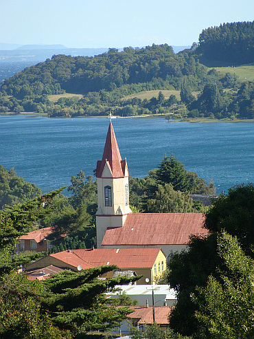
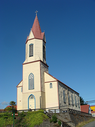
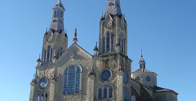
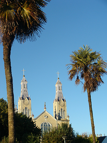
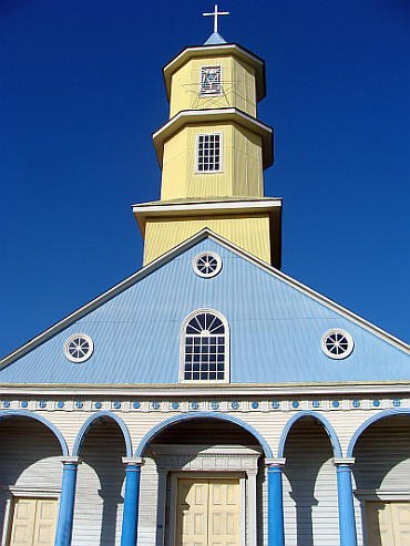
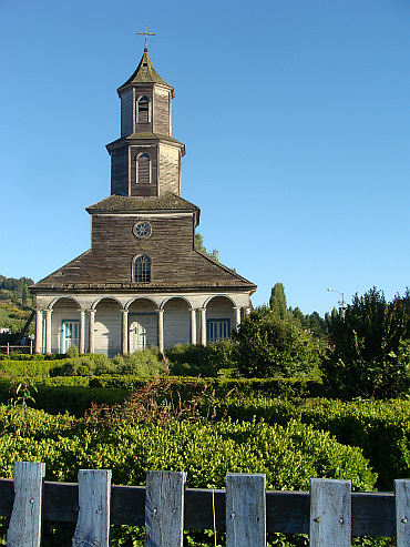
Chiloé is known for its wooden churches that had become part of the UNESCO
World Heritage, but the Lonely Cyclist raced rapidly along the churches to be
in time for the ferry. Afterwards I had plenty of time. It turned out to be
completely untrue that I must be present two hours in advance. Moreover, the boat was
four hours too late. 
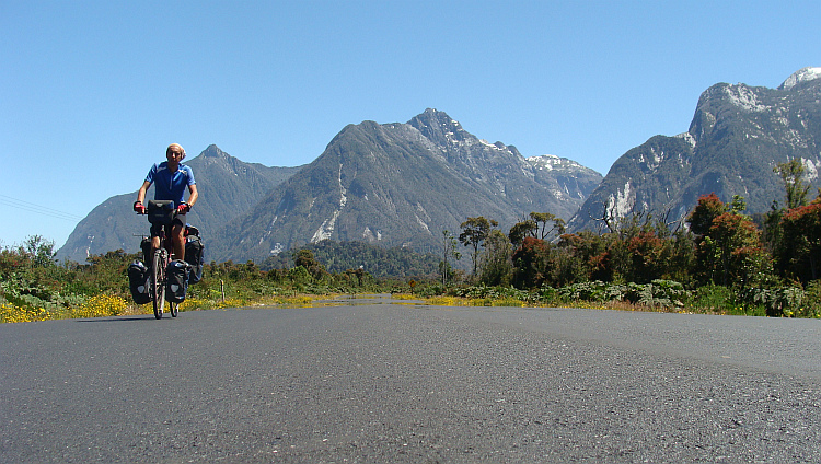
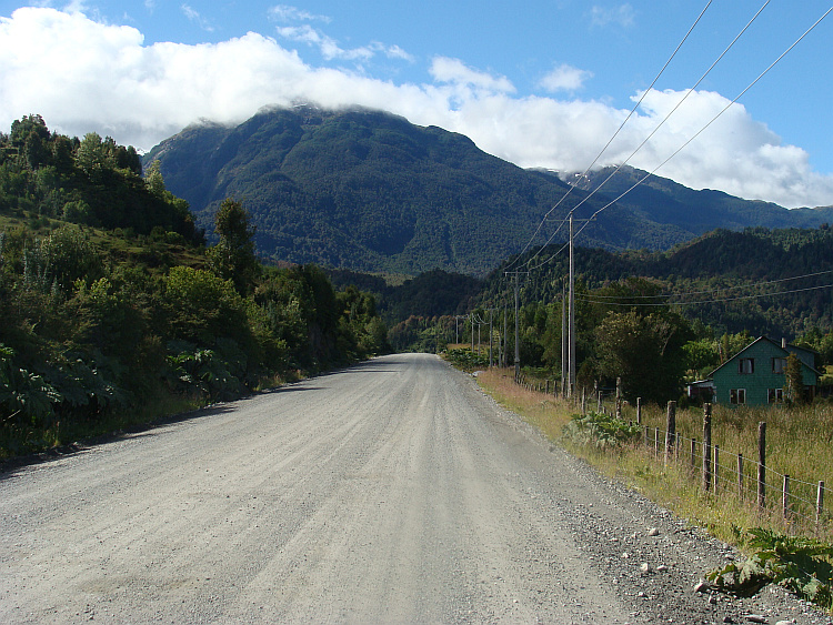
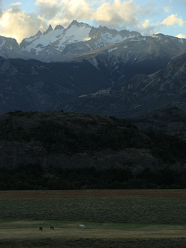
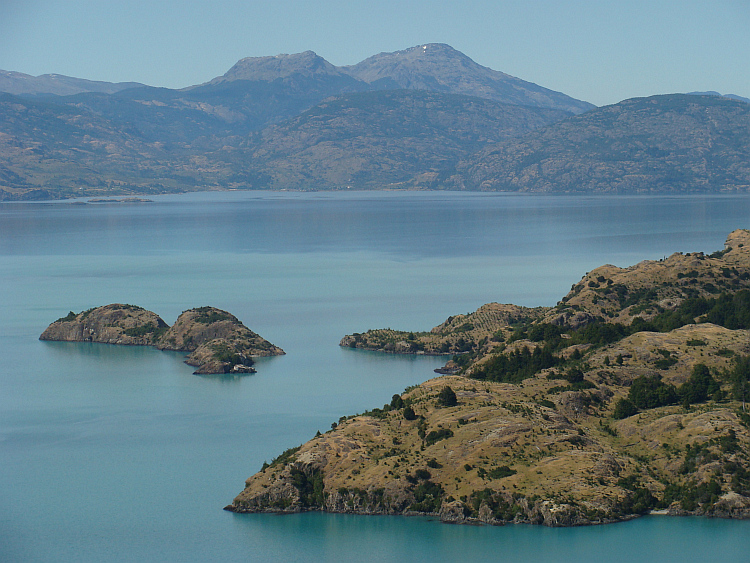
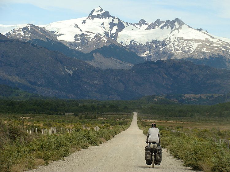
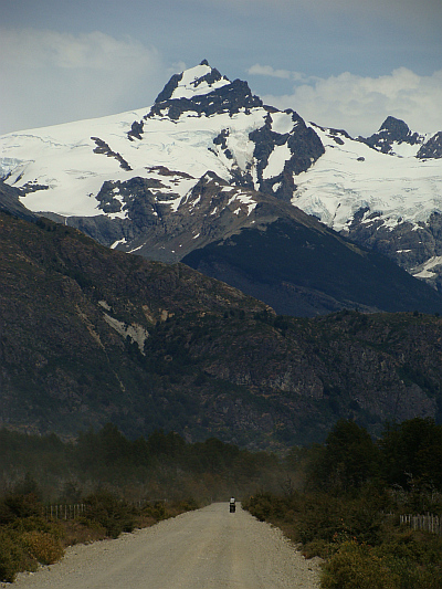
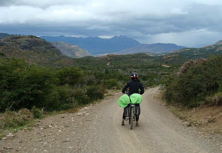
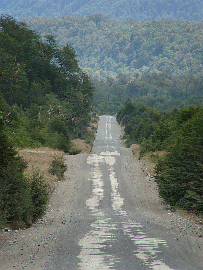
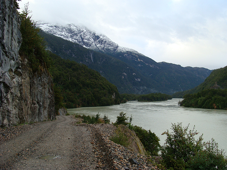
 The northern half of Chilean Patagonia is more or less isolated from the rest
of Chile and Argentina by mountains, ice caps and the ocean. The Carretera
Austral connects the villages and settlements of the sparsely populated area
with one another. The road is one of the classic routes for bicycle travelers
in South America. She starts in Chaitén and ends 1,400 kilometers south in
Villa O'Higgins. Chaitén was a disaster area. The small town was buried
under several meters thick layers of ash as a result of a burst of a previously
existing volcano in 2008. The community tried to scramble out of the misery.
During my presence an ATM was ceremonially opened. A happy event, since the
residents had to rely on an ATM five hundred kilometers away the last three
years.
The northern half of Chilean Patagonia is more or less isolated from the rest
of Chile and Argentina by mountains, ice caps and the ocean. The Carretera
Austral connects the villages and settlements of the sparsely populated area
with one another. The road is one of the classic routes for bicycle travelers
in South America. She starts in Chaitén and ends 1,400 kilometers south in
Villa O'Higgins. Chaitén was a disaster area. The small town was buried
under several meters thick layers of ash as a result of a burst of a previously
existing volcano in 2008. The community tried to scramble out of the misery.
During my presence an ATM was ceremonially opened. A happy event, since the
residents had to rely on an ATM five hundred kilometers away the last three
years.
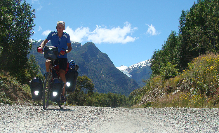
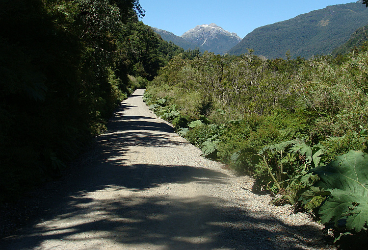
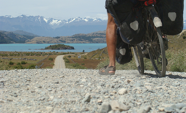
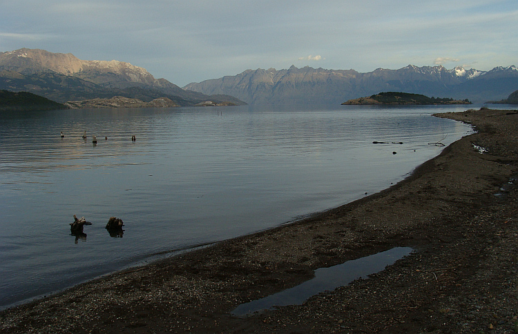
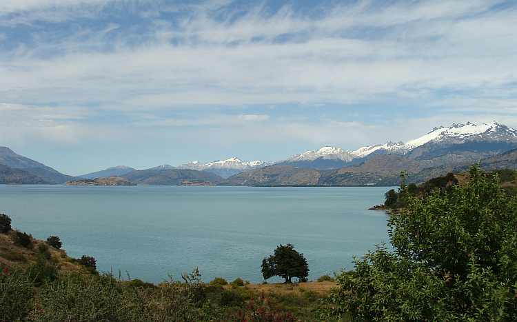
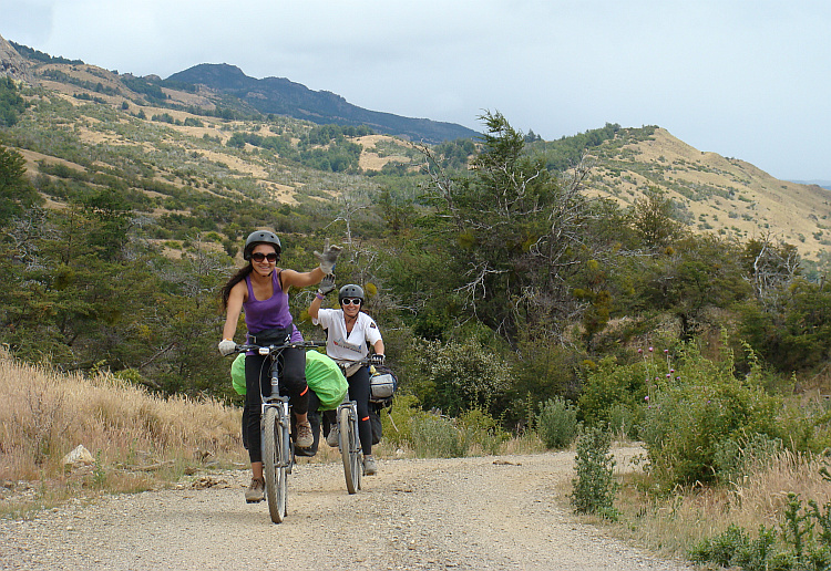
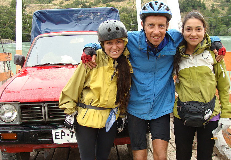
 I was not the only cyclist in the ever changing landscapes of Chilean Patagonia.
Nowhere in the world I met so many bike travelers as on the Carretera Austral.
On the whole route I camped only one night on my own. All other nights I had
company. I camped once with a couple who had biked a lot in Mongolia. I spent
another night with a Venezuelan cyclist. Another night my tent was next to
the tent of two handsome Chilean sisters. The following day we rode together on
an alternative route parallel to the Carretera Austral. The road surface was
composed of large stones and there were some very steep climbs, but the sisters
were extremely sporty and could perform very well in the difficult terrain.
Except cyclists there were other travelers too. For transport they had to rely
on the good will of the local population. In this sparsely populated part of
the world there was hardly any organized public transportation available.
I was not the only cyclist in the ever changing landscapes of Chilean Patagonia.
Nowhere in the world I met so many bike travelers as on the Carretera Austral.
On the whole route I camped only one night on my own. All other nights I had
company. I camped once with a couple who had biked a lot in Mongolia. I spent
another night with a Venezuelan cyclist. Another night my tent was next to
the tent of two handsome Chilean sisters. The following day we rode together on
an alternative route parallel to the Carretera Austral. The road surface was
composed of large stones and there were some very steep climbs, but the sisters
were extremely sporty and could perform very well in the difficult terrain.
Except cyclists there were other travelers too. For transport they had to rely
on the good will of the local population. In this sparsely populated part of
the world there was hardly any organized public transportation available.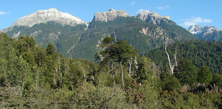
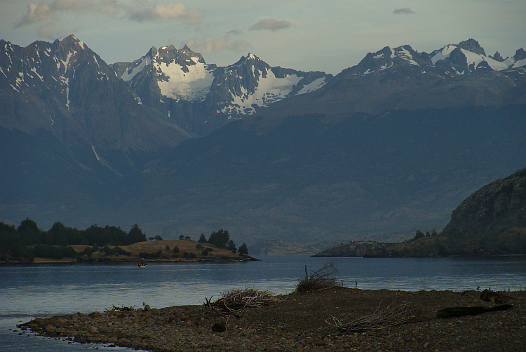
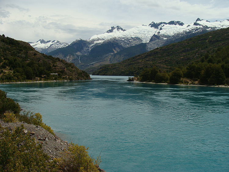
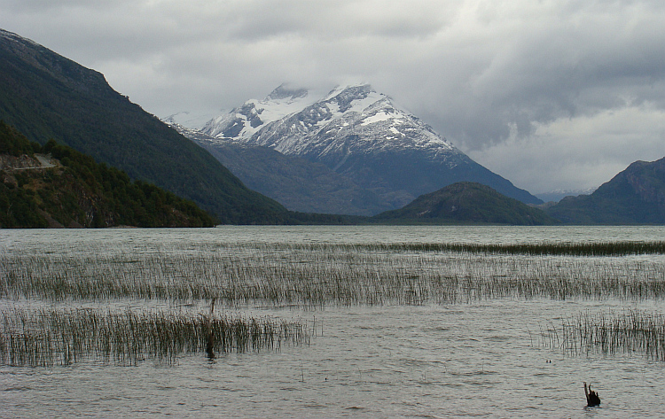
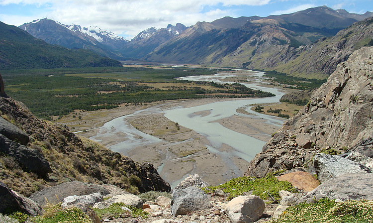
 The next morning it was still raining cats and dogs. I grabbed all my wet stuff
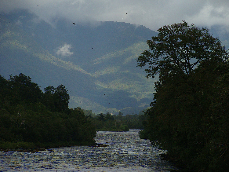
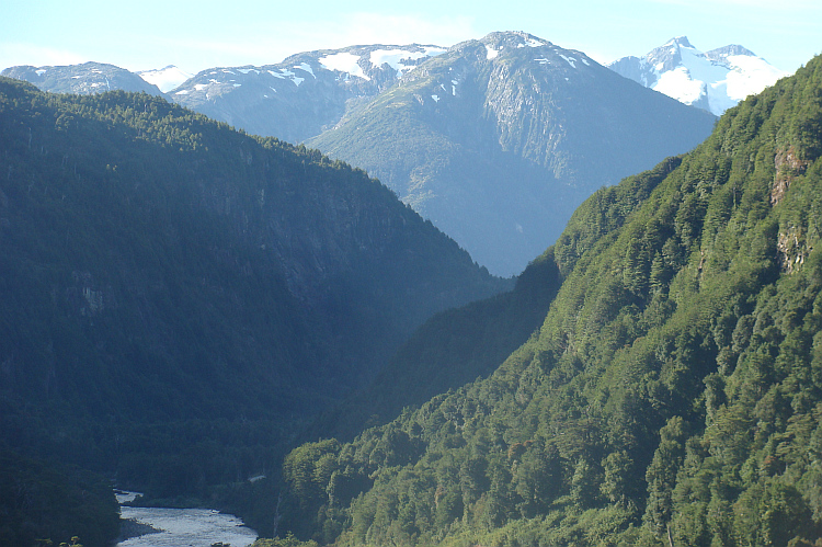
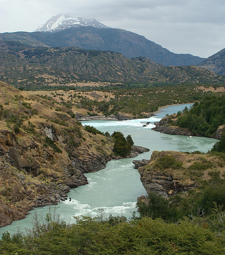
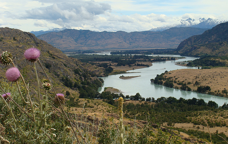
together and cycled further towards Villa O'Higgins. I reached the mouth of the
Rio Baker. The river worked its way in mighty meanders between the steep
mountainside in its rush down to the Pacific. The landscape was even greener
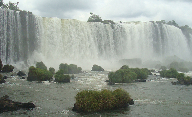
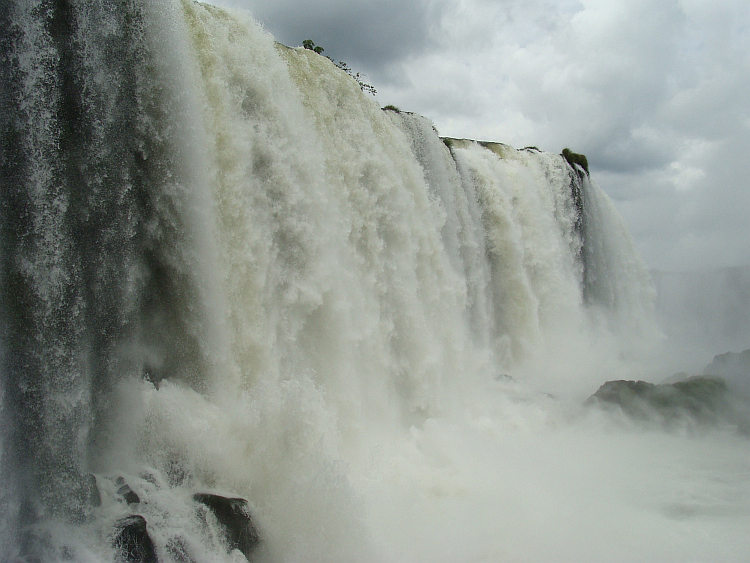
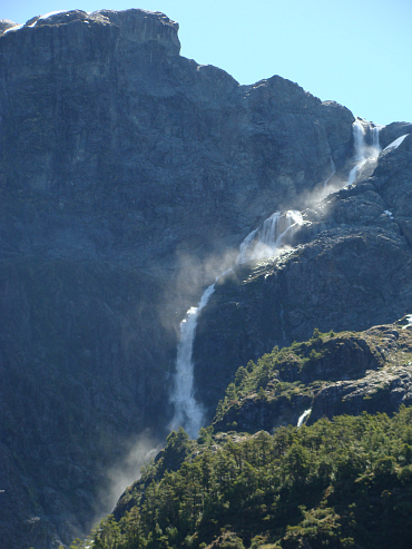
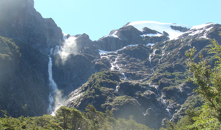
than the rainforests of Ecuador. Everywhere water clashed down from waterfalls,
coming from the mist-shrouded mountain slopes above. Not only the rivers and
waterfalls carried massive quantities of water downwards, also many a torrential
shower delivered a big contribution on the already wet landscape. In the icy
cold downpours I climbed steeply to a small pass between the basins of the Rio
Baker and the Rio Bravo. A beautiful but also an intensely cold and horriby
wet experience. I descended to the mouth of the Rio Bravo, where a ferry had to
take me to the other side. The ferry would only go once or twice a day on a
rather flexible and utterly unknown schedule.
The next morning it was still raining cats and dogs. I grabbed all my wet stuff
together and cycled further towards Villa O'Higgins. I reached the mouth of the
Rio Baker. The river worked its way in mighty meanders between the steep
mountainside in its rush down to the Pacific. The landscape was even greener
than the rainforests of Ecuador. Everywhere water clashed down from waterfalls,
coming from the mist-shrouded mountain slopes above. Not only the rivers and
waterfalls carried massive quantities of water downwards, also many a torrential
shower delivered a big contribution on the already wet landscape. In the icy
cold downpours I climbed steeply to a small pass between the basins of the Rio
Baker and the Rio Bravo. A beautiful but also an intensely cold and horriby
wet experience. I descended to the mouth of the Rio Bravo, where a ferry had to
take me to the other side. The ferry would only go once or twice a day on a
rather flexible and utterly unknown schedule.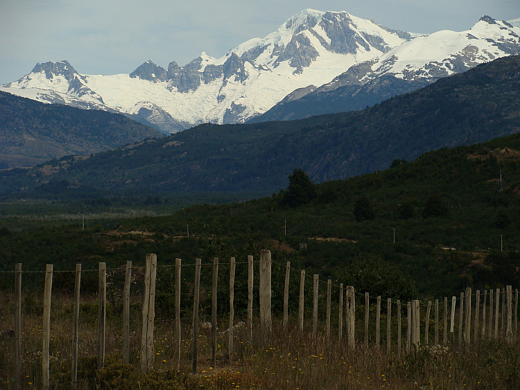
 So I had to wait for an unknown time to cross the river. I had heard of fellow
bike travelers that there was a cafe where they could serve very nice Kuchens
with equally tasty empanadas and great coffee. To my relief the cafe turned to
be open. I only had to replace a freshly broken nut of my carrier. I was just
busy when I had to remove the whole repair stuff, because the owner of the cafe
thought that it was in the way for customers who wanted to go inside - customers
that were non-existing. I was all alone, let alone a group of construction
workers. The men of the construction were busy building a concrete quay for the
ferries. Despite my intense numb hands I had reapaired my bike after fifteen
minutes. I could finally go warm up in the cafe. To my surprise the door appeared
to be locked. I looked through the window to see what was going on. I could not
discern any sign of life anymore. The manager apparently found no reason
to keep his business open. Too bad for the manager because I would be a very
good customer for him. But far worse for me, because this cafe would probably
be the only place in three days where I had an opportunity to warm and dry
myself and my luggage.
So I had to wait for an unknown time to cross the river. I had heard of fellow
bike travelers that there was a cafe where they could serve very nice Kuchens
with equally tasty empanadas and great coffee. To my relief the cafe turned to
be open. I only had to replace a freshly broken nut of my carrier. I was just
busy when I had to remove the whole repair stuff, because the owner of the cafe
thought that it was in the way for customers who wanted to go inside - customers
that were non-existing. I was all alone, let alone a group of construction
workers. The men of the construction were busy building a concrete quay for the
ferries. Despite my intense numb hands I had reapaired my bike after fifteen
minutes. I could finally go warm up in the cafe. To my surprise the door appeared
to be locked. I looked through the window to see what was going on. I could not
discern any sign of life anymore. The manager apparently found no reason
to keep his business open. Too bad for the manager because I would be a very
good customer for him. But far worse for me, because this cafe would probably
be the only place in three days where I had an opportunity to warm and dry
myself and my luggage. 
 Who did not mourn for this little personal drama were the construction workers.
They did not work in the rain and they were sheltering under a roof in a closed
and for me unreachable place. To the amusement of the men they did have a
dry place where I absolutely did not have a place to shelter. The five centimeter
wide overhang of the cafe was totally inadequate for the icy rain drops that
floated with high horizontal speed. While the Lonely Cyclist tried to defy the
raging storm and the successive and mercilessly cold, heavy rainstorms, the
construction workers had the time of their lives. It may be spiritually inferior
to distract pleasure from the suffering of your fellow man, but that surely
did not spoil the party by any means. They were laughing continuously, seeing
how the Lonely Cyclist suffered from the cold rain. And even funnier was that
they did not do anything to help the Lonely Cyclist in his ordeal.
Who did not mourn for this little personal drama were the construction workers.
They did not work in the rain and they were sheltering under a roof in a closed
and for me unreachable place. To the amusement of the men they did have a
dry place where I absolutely did not have a place to shelter. The five centimeter
wide overhang of the cafe was totally inadequate for the icy rain drops that
floated with high horizontal speed. While the Lonely Cyclist tried to defy the
raging storm and the successive and mercilessly cold, heavy rainstorms, the
construction workers had the time of their lives. It may be spiritually inferior
to distract pleasure from the suffering of your fellow man, but that surely
did not spoil the party by any means. They were laughing continuously, seeing
how the Lonely Cyclist suffered from the cold rain. And even funnier was that
they did not do anything to help the Lonely Cyclist in his ordeal.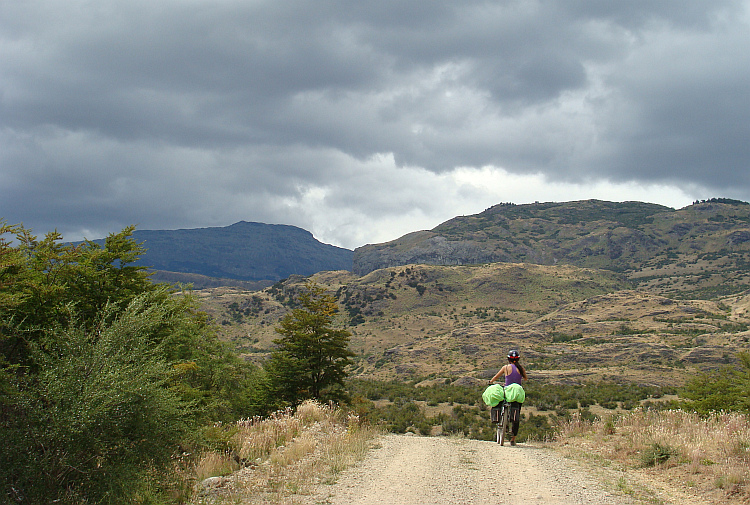
 The malicious pleasure proved an endless source of joy. When after three hours
the ferry finally arrived, it was the signal for the final joke of the
construction workers. On their ease they came from their shelter and walked
to the cafe. To my surprise, the doors were opened for the workers. Long will
the construction workers tell to audiences at parties about this precious day
in their lives. The day that they saw the Lonely Cyclist suffering in the little
harbor. "Never had such a laugh ..." If the audience would ask, what is so funny
about that, they would reply that they saw the dire need of the Lonely Cyclist,
but did not offer him shelter. If the people, despite new laughter, would still look
with glassy eyes, the construction workers would confess that they had waited
deliberately to go to the cafe until the ferry came to make sure that the cafe
would remain closed for the Lonely Cyclist until he was on board, so that he
could not be able to warm up and moreover, he would not be able to eat too.
Probably, at this point of the story, they could not keep their eyes dry from
laughter and tears of joy wouldd be rolling down their cheeks. If they would
still meet incomprehension from the audience, they would say: "You should have
seen his flabbergasted face, when the cafe opened... ", rolling
on the ground out of sheer fun.
The malicious pleasure proved an endless source of joy. When after three hours
the ferry finally arrived, it was the signal for the final joke of the
construction workers. On their ease they came from their shelter and walked
to the cafe. To my surprise, the doors were opened for the workers. Long will
the construction workers tell to audiences at parties about this precious day
in their lives. The day that they saw the Lonely Cyclist suffering in the little
harbor. "Never had such a laugh ..." If the audience would ask, what is so funny
about that, they would reply that they saw the dire need of the Lonely Cyclist,
but did not offer him shelter. If the people, despite new laughter, would still look
with glassy eyes, the construction workers would confess that they had waited
deliberately to go to the cafe until the ferry came to make sure that the cafe
would remain closed for the Lonely Cyclist until he was on board, so that he
could not be able to warm up and moreover, he would not be able to eat too.
Probably, at this point of the story, they could not keep their eyes dry from
laughter and tears of joy wouldd be rolling down their cheeks. If they would
still meet incomprehension from the audience, they would say: "You should have
seen his flabbergasted face, when the cafe opened... ", rolling
on the ground out of sheer fun.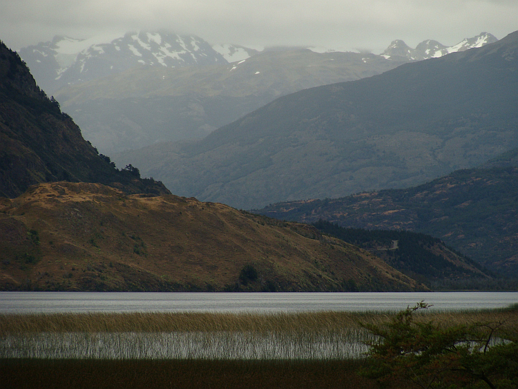

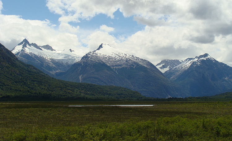
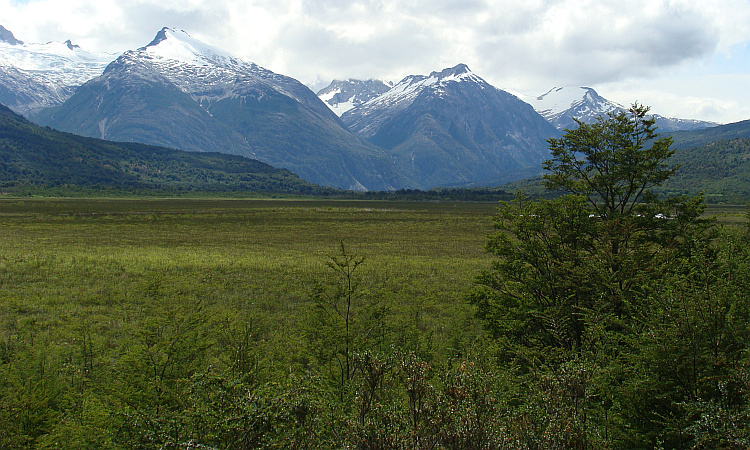

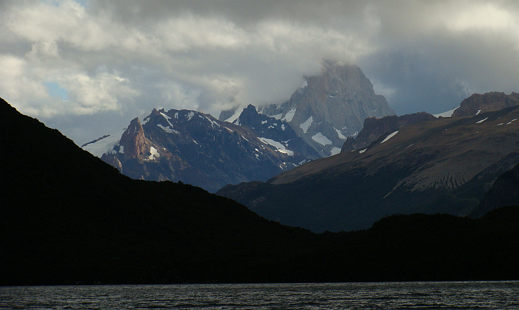
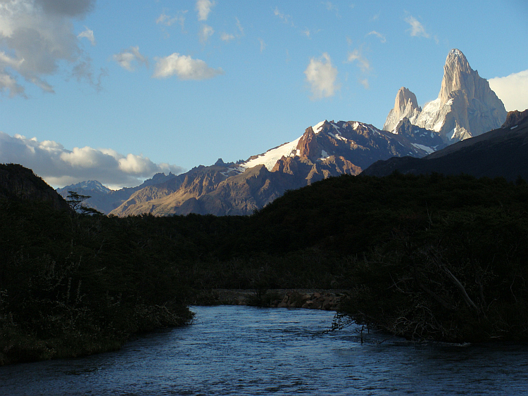
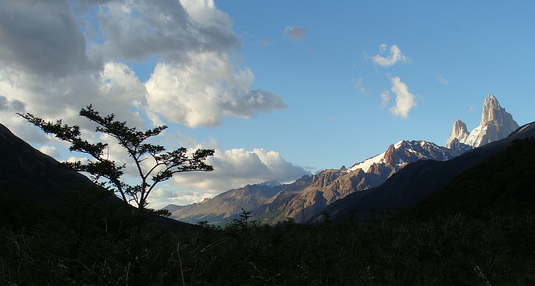
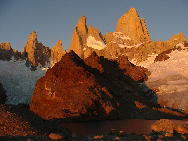
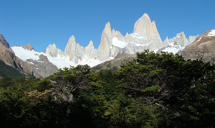
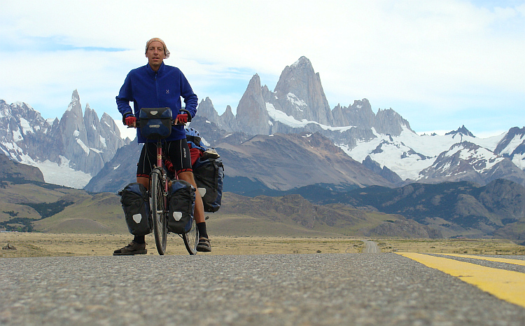
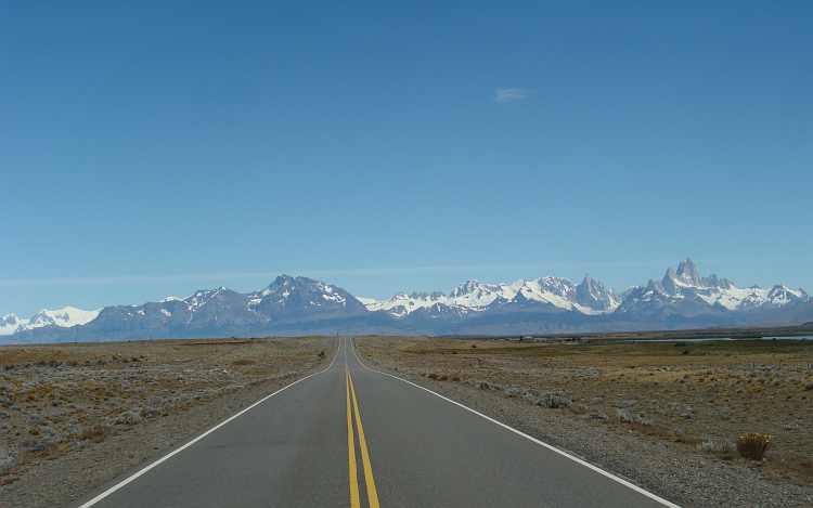
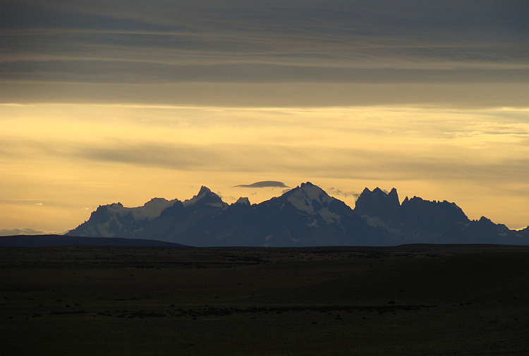
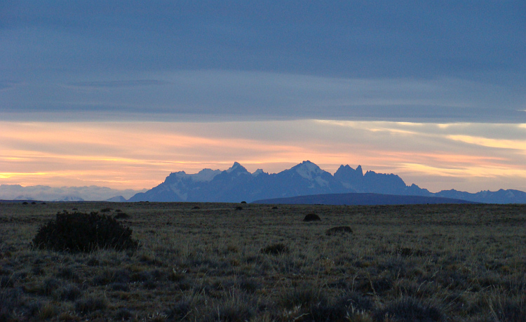
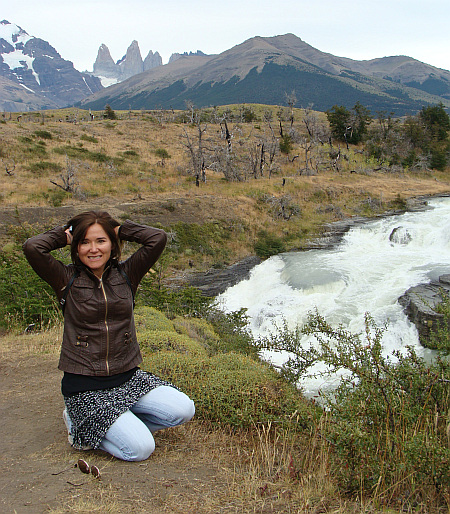
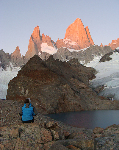 In El Chaltén I began a two-day trek through the mountains. The
weather was gorgeous. I met some comrades whom I knew from my route through
Chile on the Carretera Austral. Together we camped at the foot of the Fitz Roy,
a famous mountaing in the history of alpinism and one of the most impressive
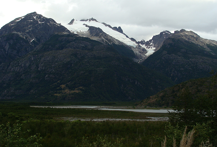
mountains of the world. The next morning we got up early. With my Israeli
friends and an Austrian woman I experienced the sunrise over the mythical
mountain. The granite obelisk of the Fitz Roy reflected in the calm water of the
glacial lake. The rock towers and mountain lake colored from pink to orange
to red. For several minutes the world around us was bathing in a fiery orange-red
light. Everything had the same unearthly color, as if the world was in a kind
of celestial harmony for a brief moment. Thankful we underwent the poetic
beauty of the moment.
In El Chaltén I began a two-day trek through the mountains. The
weather was gorgeous. I met some comrades whom I knew from my route through
Chile on the Carretera Austral. Together we camped at the foot of the Fitz Roy,
a famous mountaing in the history of alpinism and one of the most impressive
mountains of the world. The next morning we got up early. With my Israeli
friends and an Austrian woman I experienced the sunrise over the mythical
mountain. The granite obelisk of the Fitz Roy reflected in the calm water of the
glacial lake. The rock towers and mountain lake colored from pink to orange
to red. For several minutes the world around us was bathing in a fiery orange-red
light. Everything had the same unearthly color, as if the world was in a kind
of celestial harmony for a brief moment. Thankful we underwent the poetic
beauty of the moment. 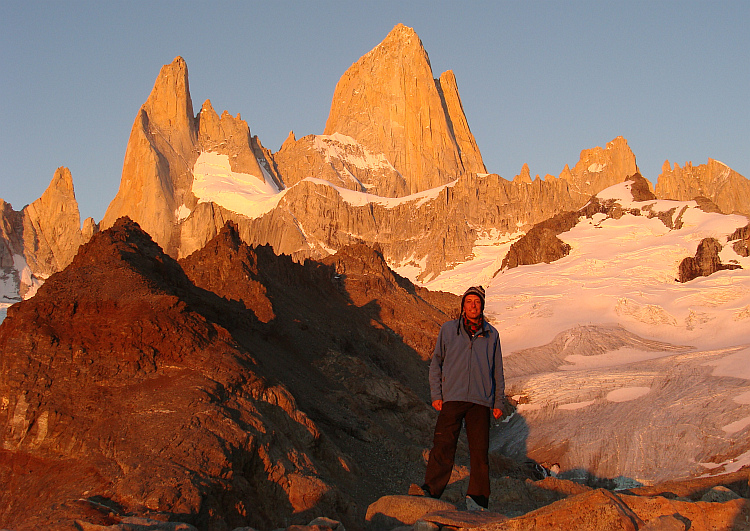
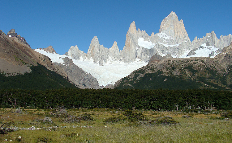
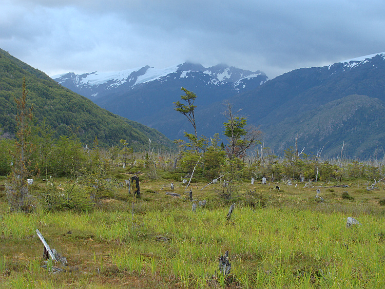
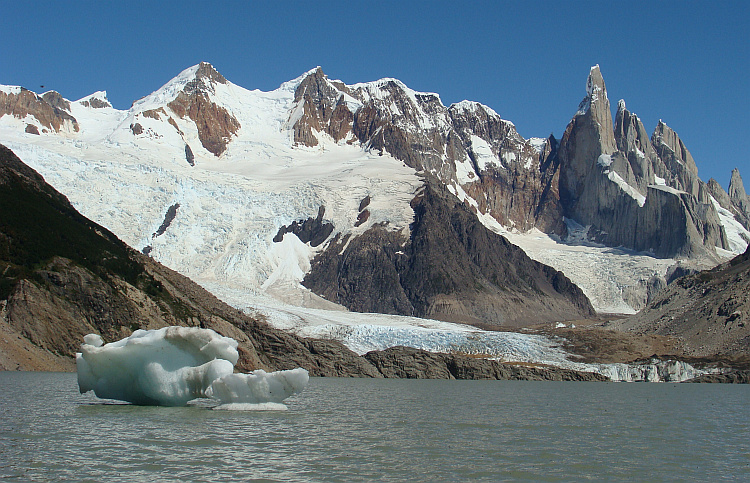
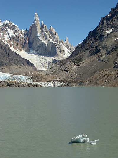 We descended to the campsite, where we parted. Through forests of Coigue trees
and the in all directions growing Lenga trees I walked in a few hours to
another glacial lake at the foot of Cerro Torre. The lonely rock tower of the
Cerro Torre stuck out like a pool cue more than thousand meters up from the
surrounding glacier landscape. The tip of the cue consisted of gleaming ice,
caused by the frigid jet winds that blow around the peak. I climbed to the
glacial lake at the foot of the granite rock tower. A few icebergs were floating
in the glacial lake, coming from the glacier that ends in the lake. It was
the second moment of iconic beauty that I experienced this morning.
We descended to the campsite, where we parted. Through forests of Coigue trees
and the in all directions growing Lenga trees I walked in a few hours to
another glacial lake at the foot of Cerro Torre. The lonely rock tower of the
Cerro Torre stuck out like a pool cue more than thousand meters up from the
surrounding glacier landscape. The tip of the cue consisted of gleaming ice,
caused by the frigid jet winds that blow around the peak. I climbed to the
glacial lake at the foot of the granite rock tower. A few icebergs were floating
in the glacial lake, coming from the glacier that ends in the lake. It was
the second moment of iconic beauty that I experienced this morning.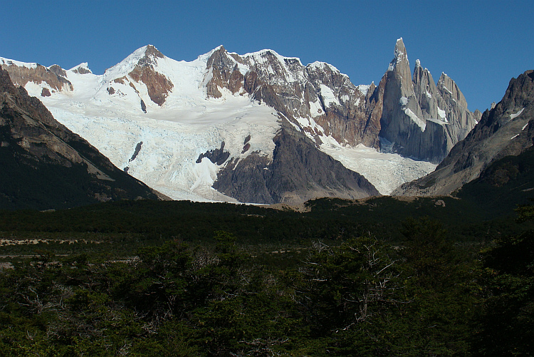
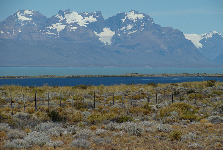
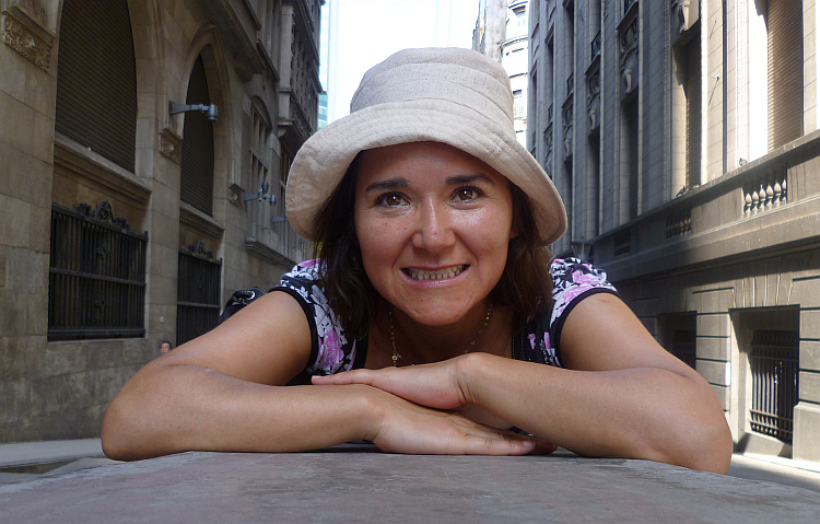
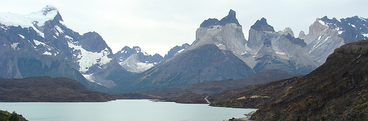
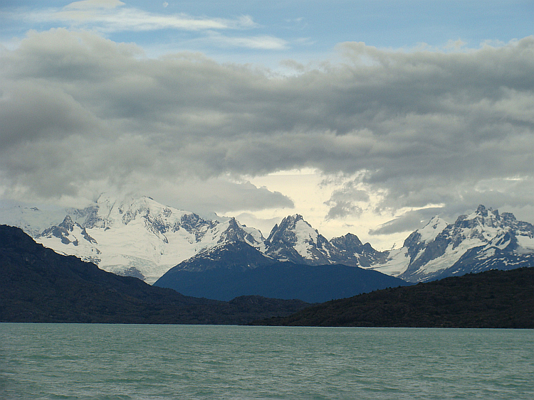
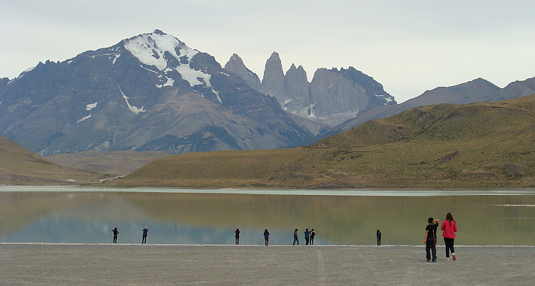
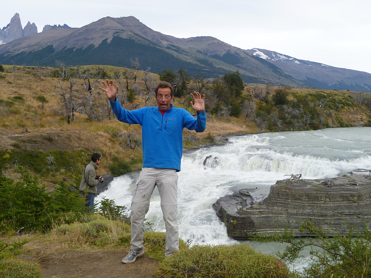
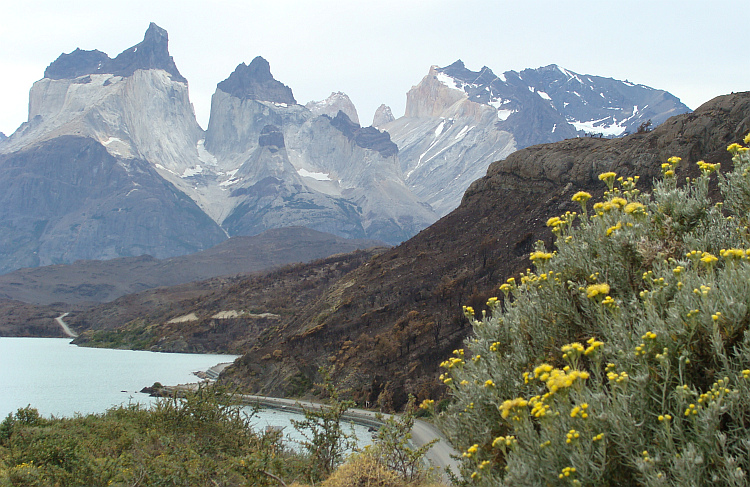
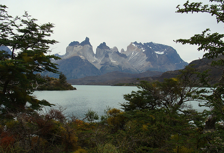
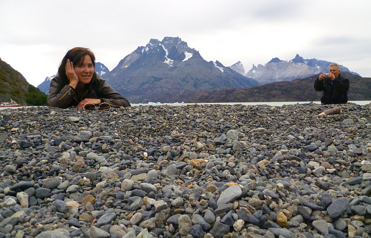
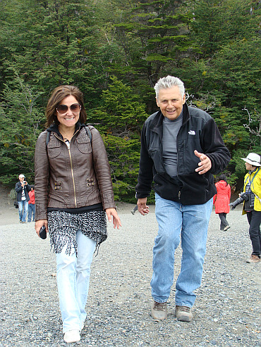
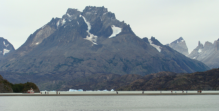
 In Puerto Natales I booked a day trip to the Torres del Paine, Chile's most
well-known national park. Since recently, a large fire had destroyed half of
the nature so a multi-day trek seemed a bit too much. Besides, a few days ago
I had done a beautiful trek through similar landscapes in El Chaltén
with much better weather. I was richly rewarded for my laziness. On the tour I
met the fifty year old American motorcycle traveler Robert and the Chilean
painter and saleswoman Margarita. Together we were the Tres Amigos, The Three
Friends, to the movie with Steve Martin. Margarita mastered the art of
temptation to perfection and flirted with delight. The two men let it all
happen. So it happened that I was in one of the most beautiful places of the
Earth, but that I had very little eye for it. After the long day we were neatly
brough back from the National Park to Puerto Natales, where the Tres Amigos dined.
In Puerto Natales I booked a day trip to the Torres del Paine, Chile's most
well-known national park. Since recently, a large fire had destroyed half of
the nature so a multi-day trek seemed a bit too much. Besides, a few days ago
I had done a beautiful trek through similar landscapes in El Chaltén
with much better weather. I was richly rewarded for my laziness. On the tour I
met the fifty year old American motorcycle traveler Robert and the Chilean
painter and saleswoman Margarita. Together we were the Tres Amigos, The Three
Friends, to the movie with Steve Martin. Margarita mastered the art of
temptation to perfection and flirted with delight. The two men let it all
happen. So it happened that I was in one of the most beautiful places of the
Earth, but that I had very little eye for it. After the long day we were neatly
brough back from the National Park to Puerto Natales, where the Tres Amigos dined.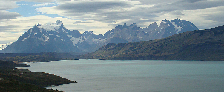
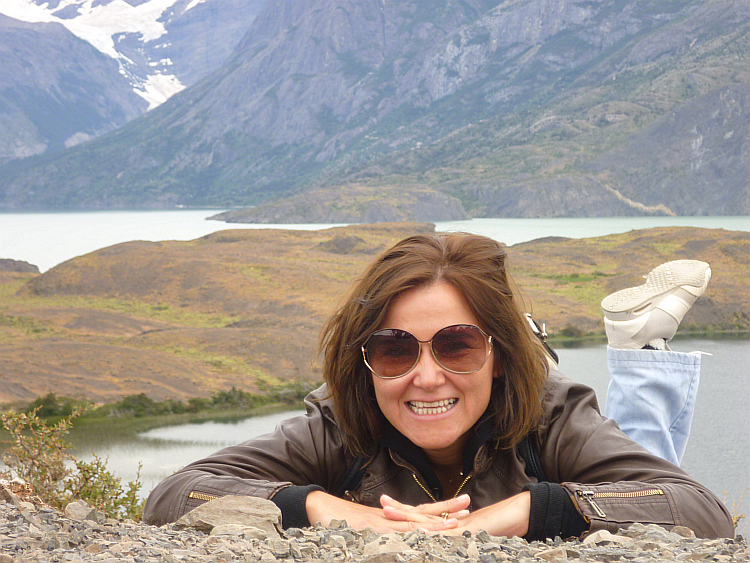
 "What a passion !!" Margarita commented ironically.
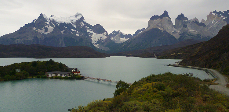

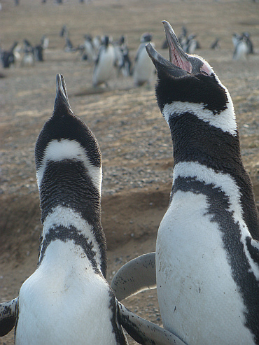
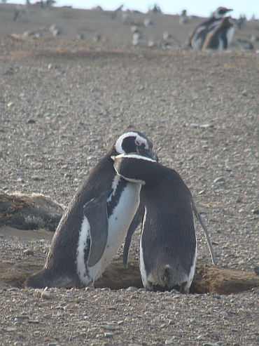
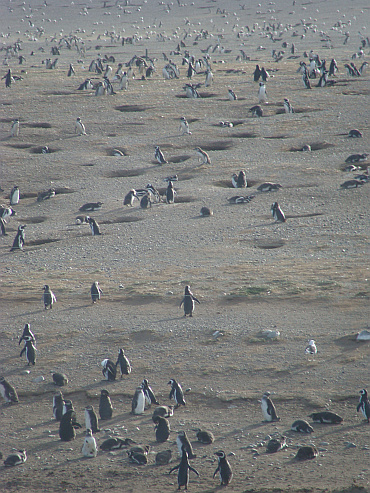
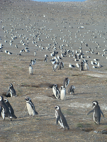
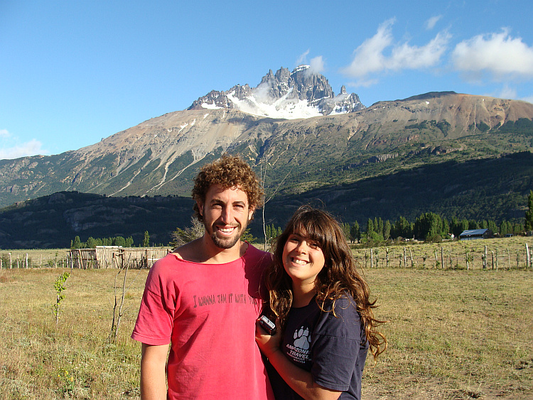
 In Punta Arenas I emailed Margarita. I asked if she wanted to come to me. I
attached a photo of two kissing penguins. One day later she had traveled to me
and we were together at the end of the world. She was my Pinguinita Magallanes,
named after the little penguins in the Strait of Magellan. I was her Pinguino
Rey, to the great King Penguins in Patagonia. Most Latinas are emotionally and
direct from nature, but with her extroverted character and artistic temperament
these properties were reinforced in Margarita. Suddenly other South American
women seemed timid and shy creatures.
In Punta Arenas I emailed Margarita. I asked if she wanted to come to me. I
attached a photo of two kissing penguins. One day later she had traveled to me
and we were together at the end of the world. She was my Pinguinita Magallanes,
named after the little penguins in the Strait of Magellan. I was her Pinguino
Rey, to the great King Penguins in Patagonia. Most Latinas are emotionally and
direct from nature, but with her extroverted character and artistic temperament
these properties were reinforced in Margarita. Suddenly other South American
women seemed timid and shy creatures.